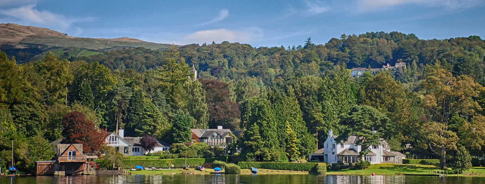
The Lake District National Park is at the heart of English countryside and was officially created on the 13th August 1951. The dramatic scenery of the Lake District is credited with inspiring writers and poets such as Wordsworth, Coleridge and Keats.
The size and location of the Lake District National Park means there are a huge number of activities available to visitors both on and off the lakes. On this page all about the Lake District National Park you will find our collection of inspiring articles from our Ordnance Survey Champions and industry experts along with a huge archive of hiking, cycling, running and walking routes to try in the Lakes.

Where are the Lakes?
The Lake District National park is situated in North West England, it lies close to the towns of Kendal and Keswick, with Carlisle and Lancaster nearby. It’s known for its mountainous terrain and scenic lakes, including England’s highest peak, Scafell Pike.
Top Lake District National Park articles
Best Autumn Walks in the Lake District
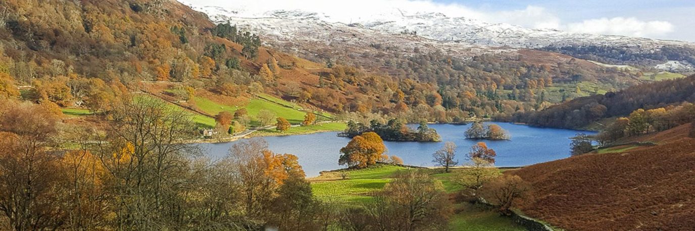
Autumn in the Lake District is a feast for the eyes. An array of reds, yellows and oranges span the horizon and cover the ground. Here are some of the best autumn walks to be enjoyed in the Lake District this season.
A Guide to Scafell Pike
Scafell Pike Routes & FAQ’s: Find out more about hiking up Scafell Pike in the Lake District, England’s highest mountain
3 Winter Wainwright Hikes: Lake District North Western Fells
Lake District North Western Fells Walks – a short walk, a medium walk and a long walk – great ideas for a hiking weekend in the Lakes!
Lake District National Park FAQ’s
The Lake District is also known as the Lakes or Lakeland. It is a mountainous region in Cumbria, in the North West of England.
The Lake District National Park is England’s largest and covers 2362 square kilometres (912 square miles)
Well you could say there’s just 1! That’s because only Bassenthwaite Lake is officially named a lake and the rest are all called ‘waters’ or ‘meres’. There are 16 major lakes, waters and meres in the Lake District and many more smaller ‘tarns’. Windermere is the longest at 10.5m long and Wastwater is the deepest at 74m deep.
There are 4 mountains in the Lake District over 3000 feet high and 114 classed as Hewitts over 2000ft. Mountains or fells in the Lake District are also famously classified as ‘Wainwrights’. Alfred Wainwright detailed 214 fells in his famous seven-volume Pictorial Guide to the Lakeland Fells (1955-66). Many walkers and hikers have completed or ‘bagged’ all 214 fells, a badge of honour within the hiking community.
Scafell Pike, 978 m (3209 ft) is the highest mountain in the Lake District.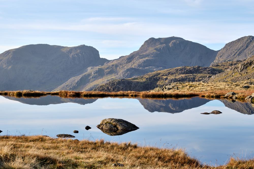
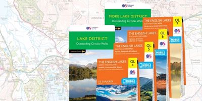
It’s a large area so there are a number of Ordnance Survey maps available for the Lake District National Park. The best way to ensure you have the correct Lake District map for your needs is to pop in your key locations into our Ordnance Survey Map Finder portal. The map finder will help you decide which map type and map area is best for you. You can also print a personalised map centred for any UK location – perfect for planning your lake District Holiday once you know where you’ll be based and can save you having to buy 2 maps.
Lake District National Park Routes
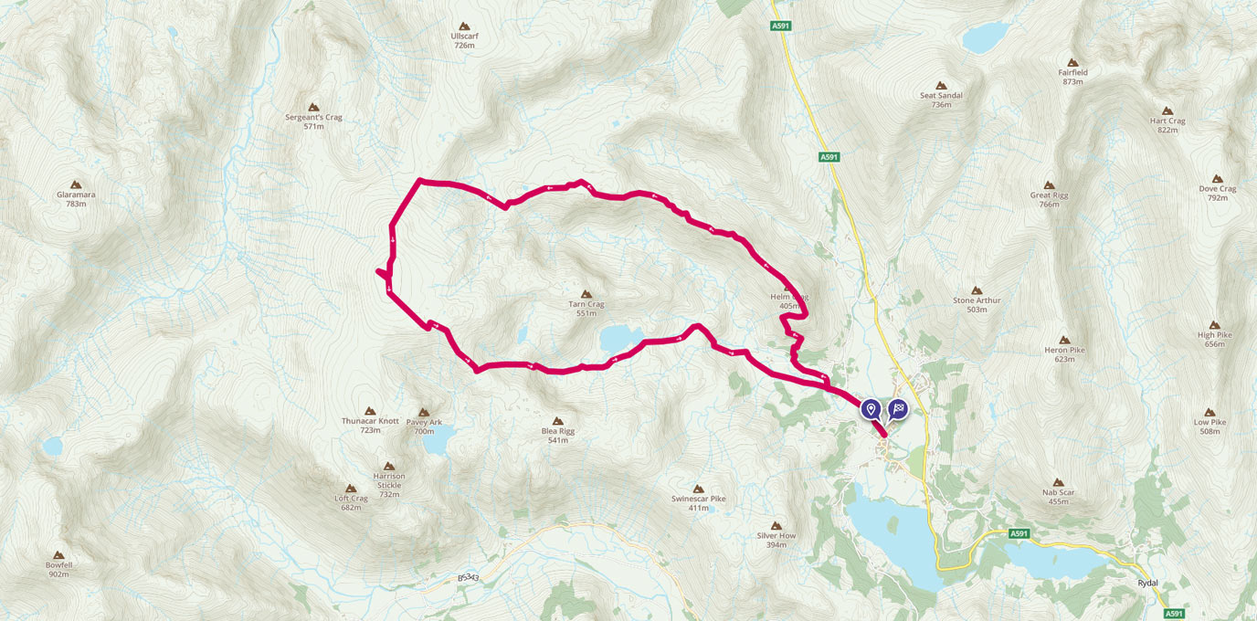
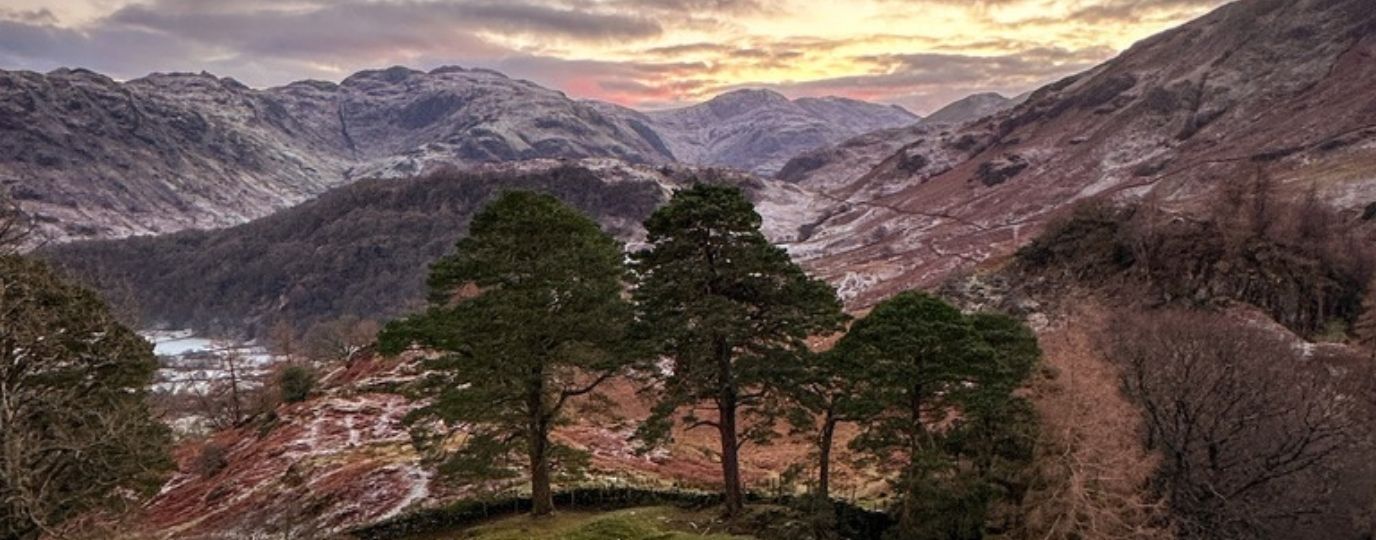
A High Raise round from Grasmere
A walk from Grasmere up to the High Raise summit and trig pillar, the highest point in the Central Fells with commanding views of the whole Lake District.
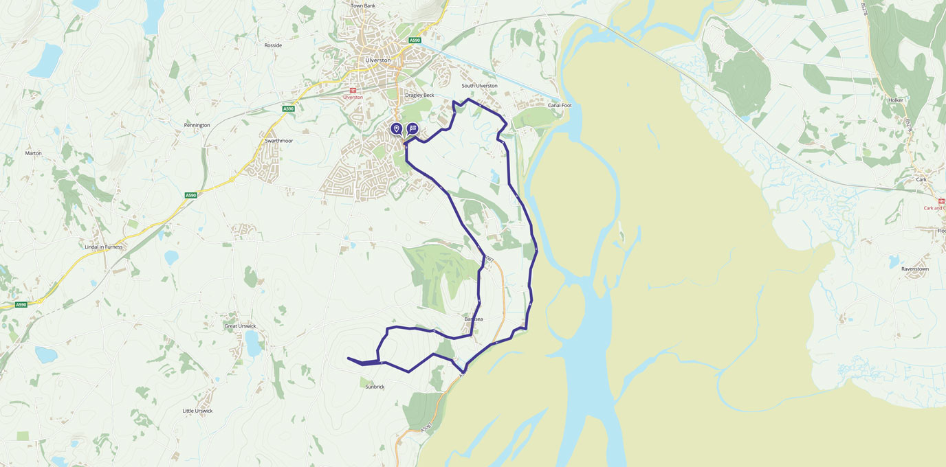
A coastal loop of Ulverston with stunning views
This walk has a little of everything, from country lanes, beautiful views across Morecambe Bay, and a gradual climb to Brigg Common for a 360 degree view of the sea and the Lake District.
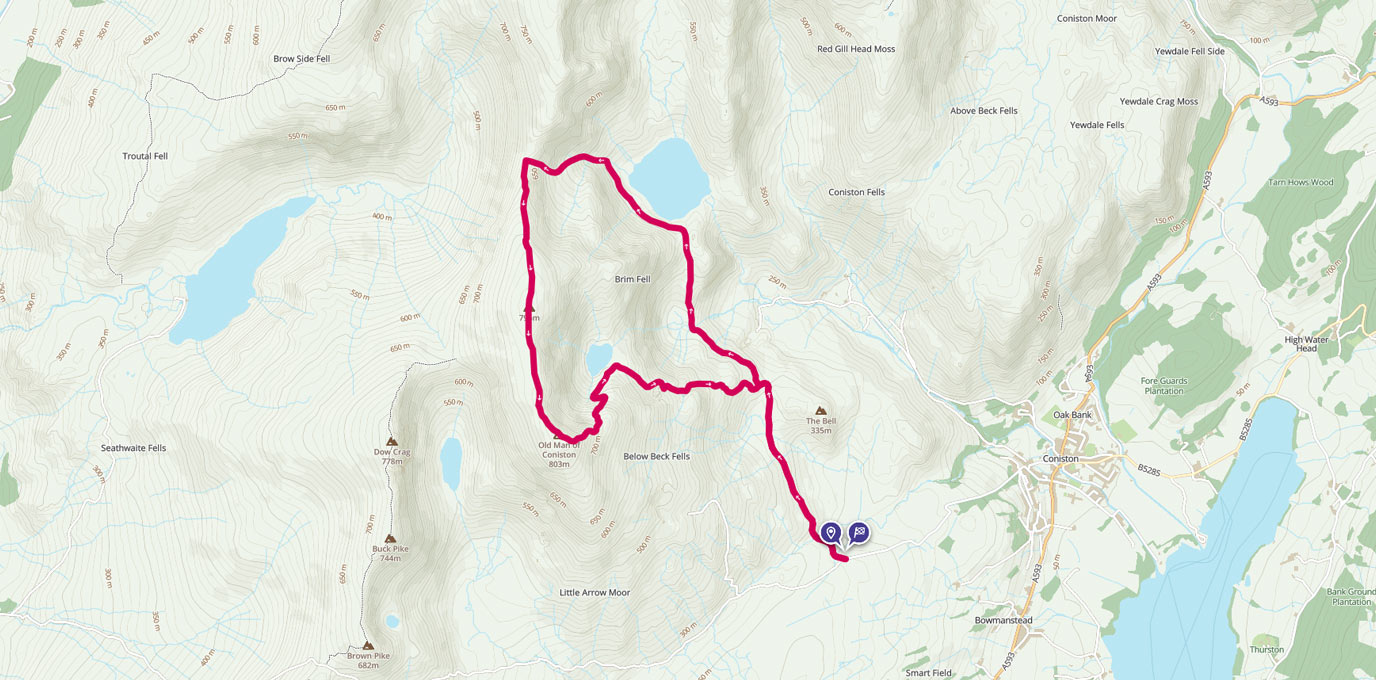
Old Man of Coniston and Levers Water Circular
The Old Man of Coniston is part of the Furness Fells in the Lake District standing 803m high, and lies to the west of the village of Coniston, and Coniston Water. OS GetOutside Champion duo, TwoTravlrs, take us across this underrated beauty of the Lakes.
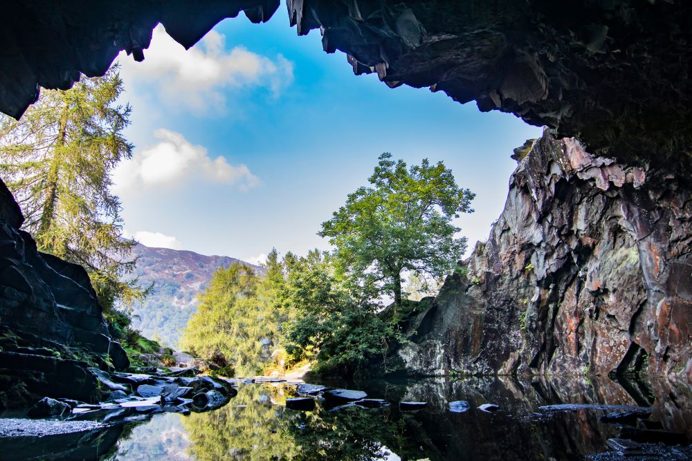
Rydal Caves
A must visit! Sat between Ambleside and Grasmere, Rydal is home to the extensively photographed Rydal Cave
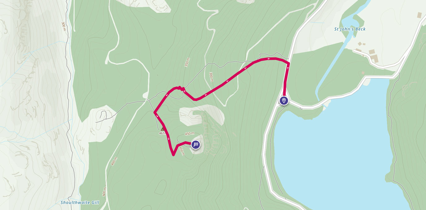
Raven Crag – Thirlmere
OS GetOutside Champion, Jack Anstey, takes us on a short, steep walk with some of the most rewarding and spectacular views the Lake District has to offer.
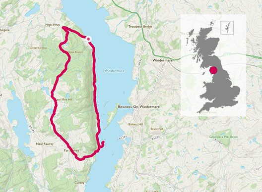
Mountain Biking around Claife Heights
The Lake District is a hub for adventure, whether you’re looking for multi-day hikes or just escaping for a few hours. It’s also home to some amazing gravel tracks and quiet lanes that are perfect for getting out on the mountain bike.
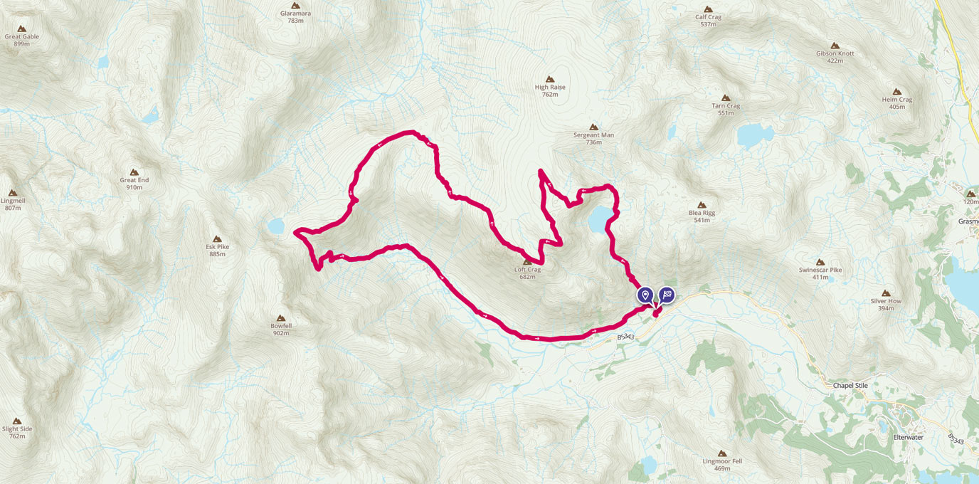
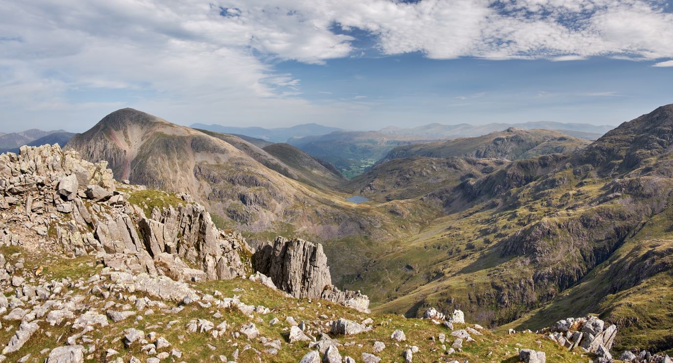
The very best of the Langdale Pikes
James Forrest explores the very best of the Langdale Pikes in a long – but glorious – day of hiking.
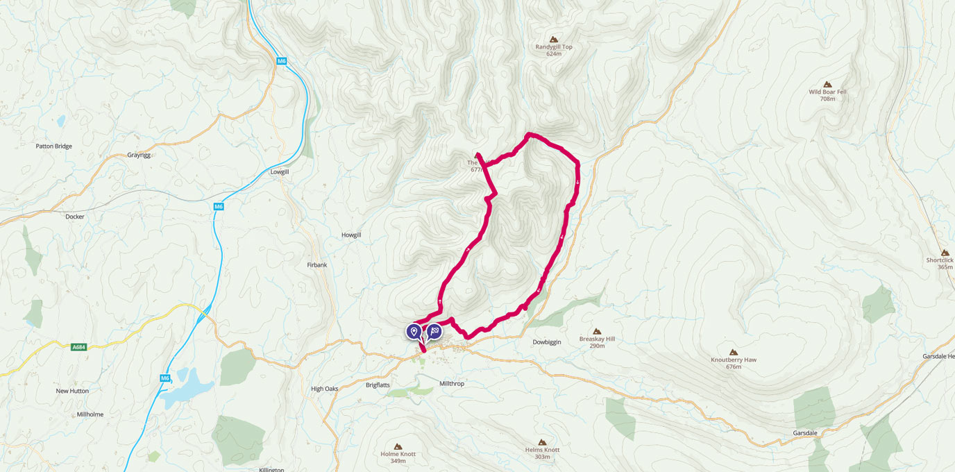
The Howgill Fells
Drive along the M6 motorway between Carlisle and Lancaster and a magnificent mountain range will rise before you. Fells such as Great Gable, Helvellyn, The Langdale Pikes and Scafell Pike will entice you in with their rugged charm.
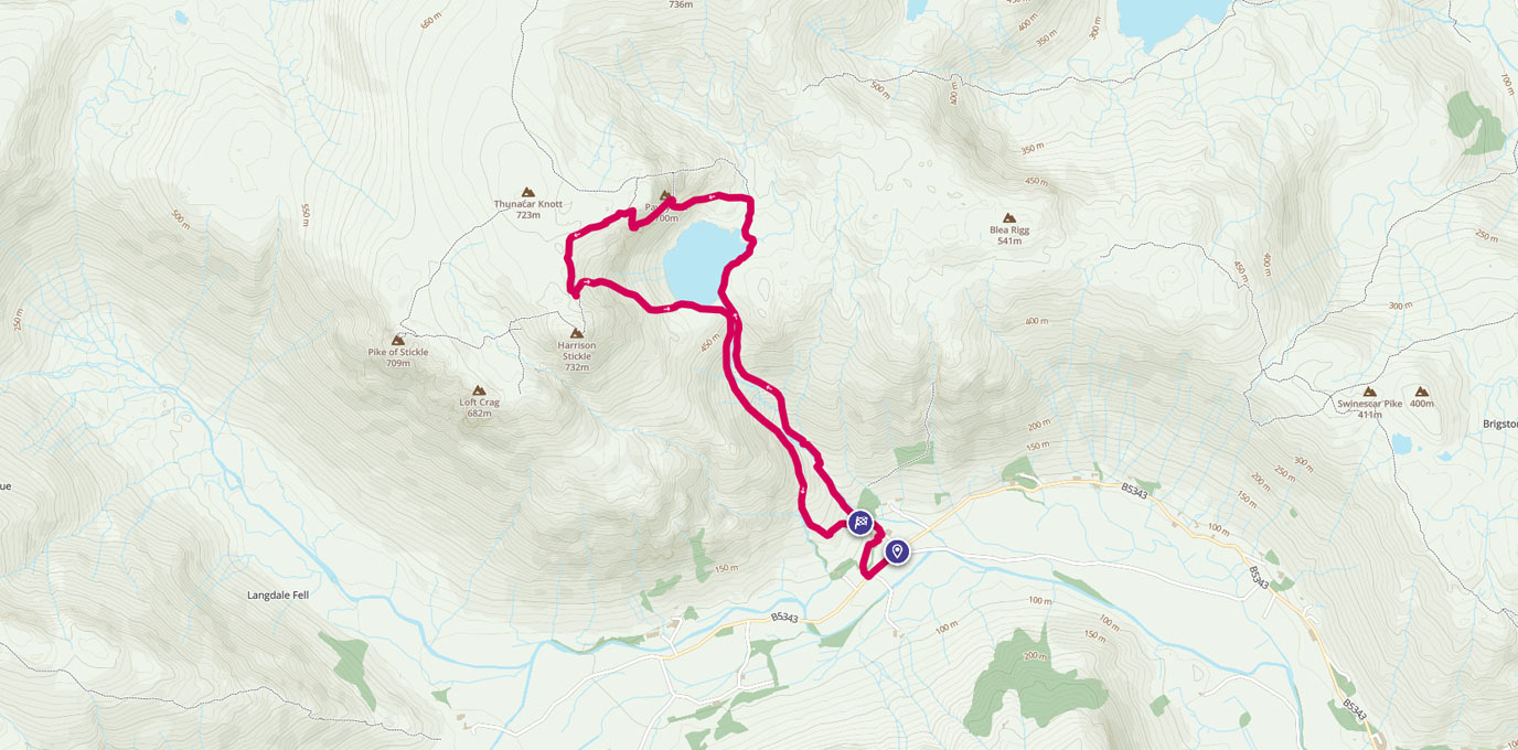
Jack’s Rake Scramble
Jack’s Rake is a brilliant grade 1 scramble in the stunning Langdale area of the Lake District, with potential for something more for those looking for a bit of a bigger thrill or an extended adventure.

EXPLORE THE
OS Shop
We are with you every step of the way. Shop our trusted walking and hiking maps and guidebooks so you can explore the outdoors with confidence.
Go to the shop