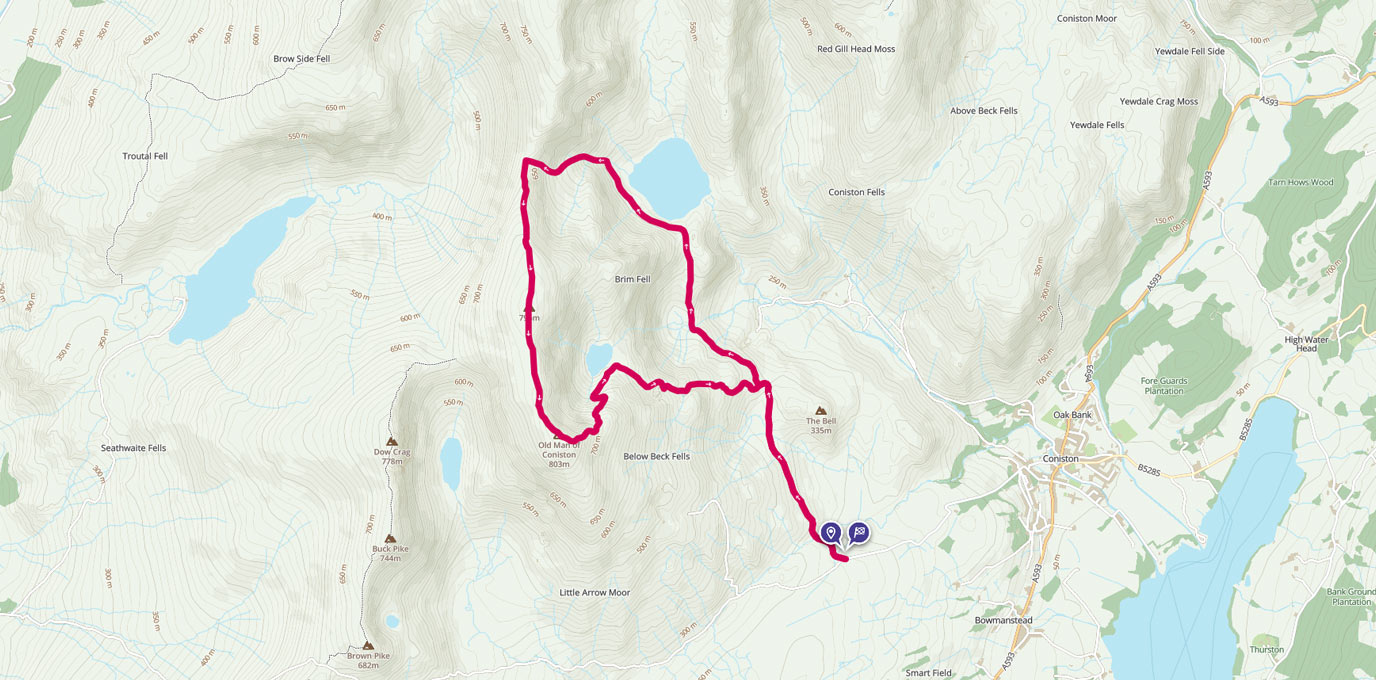
The Old Man of Coniston is part of the Furness Fells in the Lake District, standing 803m high, and lies to the west of the village of Coniston, and Coniston Water. OS GetOutside Champion duo, TwoTravlrs, take us across this underrated beauty of the Lakes.
Also known as Coniston Old Man, or simply The Old Man, the mountain is popular with tourists and fell-walkers with a number of well-marked paths to the summit, and is one of our favourite places to bivvy or wildcamp in the southern part of the Lake District.
The mountain has seen extensive slate mining activity for approximately 800 years, and the remains of abandoned mines and spoil tips are a significant feature of the north-east slopes, along with the countless crags for climbers to explore.
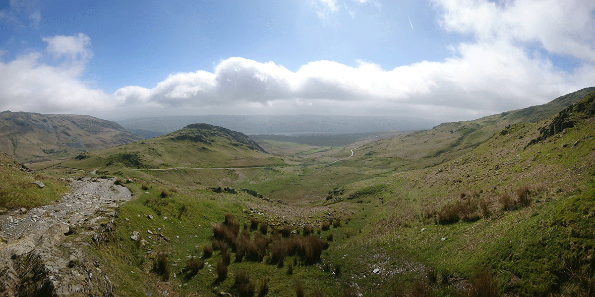
Easily accessible with plenty of parking, Coniston to us seems like one of the underrated beauties of the Lakes.
SD 289 970
Darkness fell on a Friday evening after work, and we started by walking up the gravel and rock track, heading approximately north west.
As we entered the car-park through a gate from the tarmac of Walna Scar Road, we began to bear right.
SD 2843 9808
Gentle for the first kilometre or so before a sharp left turn in the track where is steepens and becomes rough (waypoint 1), we navigated by the light of our head torches and the glow from the village below.
Source: Ben Freke
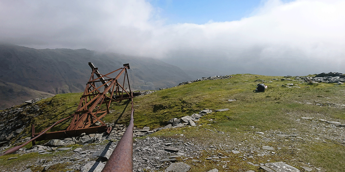
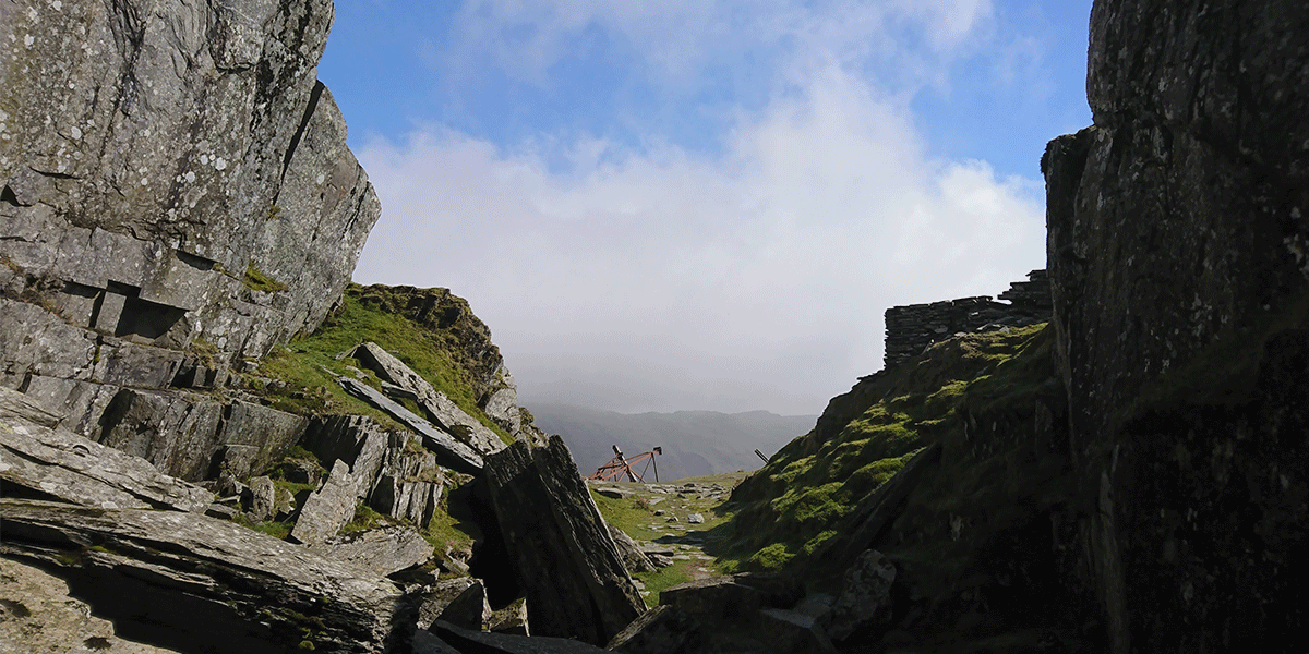
Ahead of us the path turned into zig-zags, leading to a level with old, ruined buildings and the remnants of quarry workings from long ago. This area is interesting to explore, looking at the old markings and dates on the machinery, imagining the conditions and toil that the workers here would have endured.
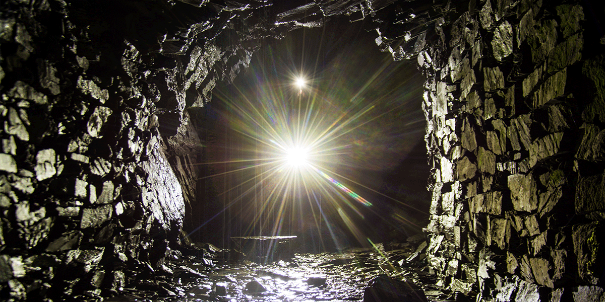
Continuing on the track up to the left and under or over the rusting steel cables from the old aerial tramway, leads you past a series of tunnels left over from the mines.
Source: Ben Freke
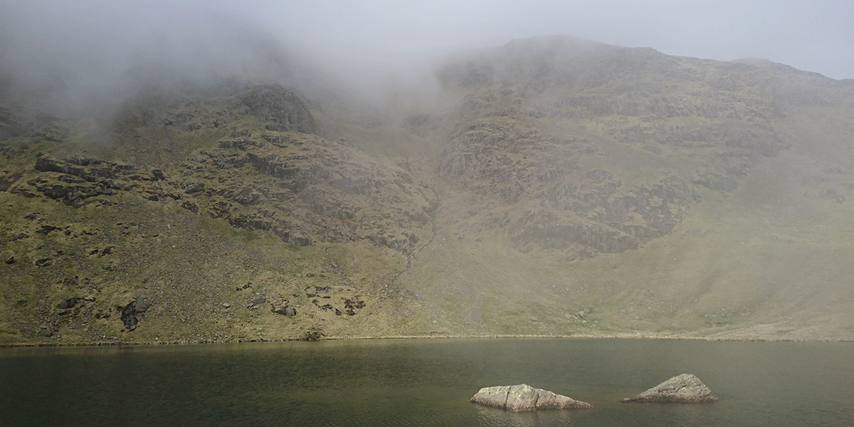
Eventually, we reached the fallen tower and had a break for a bit of food and water in front of the beautiful view, the path then heads up to the right, with Low Water finally coming into view.
After enjoying the water’s edge and perhaps a cold swim, the path continues up the hillside to the left, zig-zagging again in a general southerly direction.
There are a few steep steps and some loose ground, but for the most part the path is solid and easy-going, so remember to look behind you at the views!
SD 2745 9783
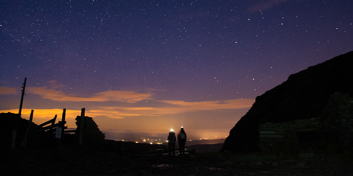
We continued straight at the cairn, where the path zig-zagged right, towards the cairn and trig point at the summit of the Old Man (waypoint 2).
Here, we took a well deserved rest and enjoyed the lovely views of the surrounding fells, all the way through until morning.
At daybreak, we headed north on the path which crosses the ridge line (sticking to the right hand side the whole way), with the eastern slope falling away steeply to Low Water, and west slope at a slightly gentler gradient.
SD 2706 9943
We continued on the ridge, turning right at Levers Hawse (waypoint 3) and following the track down towards Levers Water itself, where it was time for another rest stop by the water. It’s easy to let time get away from you here, enjoying the peace and quiet and the beauty that nature provides.
From here, it was a pleasant and easy-going walk to rejoin the original path at waypoint 1, and re-tracing our steps from the previous night back to where we left our vehicle in Walna Scar car park.
A stunning walk which isn’t particularly challenging, and in a beautiful area of the country with a lot of history. Can’t go wrong with that!
8.4 km SD 289 970
8.4 km / 5 miles