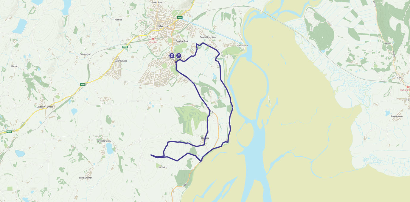
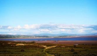
This walk has a little of everything, from country lanes, beautiful views across Morecambe Bay, and a gradual climb to Brigg Common for a 360 degree view of the sea and the Lake District.
SD 291 771
To start the walk you can park near Ulverston Sports Centre which is located on the coast road. With a Co-Op near by you can easily buy refreshments for the walk.
Take west end lane and follow down the country lane taking the first right which will take you towards a large White house. The first part of the walk gives you views of the Hoad which towers over Ulverston and surrounding fields.
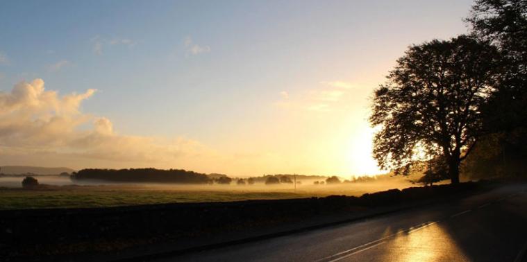
Following the road for a few mile you will soon come to the coast which gives you beautiful views over the bay with the cross-bay railway bridge to your left.
SD 305 775
Taking the right, walk through the wooded area, before reaching Conishead Priory and Buddhist Temple – beautiful grounds and coffee shop, great photo opportunities and you can relax before continuing your walk.
Follow the signs for ‘The coast’ the path takes your through beautiful wood land, with a range of flowers (depending on the season) you then reach the bay again, a great place to sit. The views really are spectacular.
Head west following the coastal path for a few miles until you reach the coast road, where you can get an ice cream from ‘Roy’s Quality Ices’ or Chill and Grill cafe. Plenty of benches to sit enjoy your ice cream and day dream out across the bay. There are also toilets available here.
If you prefer to do short trip with no climbling, from this point you can walk along the roadside path back to the carpark. Alternatively continue up to Birkrigg Common.
SD 299 740
Continue west from Roys, take a right shortly after Olde Mill (a white old looking pub) there is a fairly steep incline to the common, you may need stop a few times, but its worth it at the top!
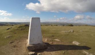
From Birkrigg Common trig point you realise what an incredible place this is there is a panoramic view over Morecambe Bay and spinning around you get an equally impressive view of the Hoad at Ulverston and the mountains on the Lake District National Park
Continuing downhill by any of the criss-crossed fern lined paths, you follow the road back towards Ulverston and loop back down to the carpark.
I chose this walk because anyone can do it with such variety in landscapes and places to stop and rest its the perfect way to spend an afternoon.
13 km SD 291 771
13 km / 8 miles