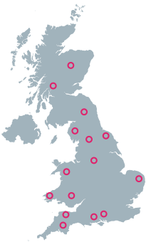
UK Route Guides – Get Inspired & Get Outside
Discover great outdoor activity ideas and detailed uk route guides from OS Maps to follow. Inspiration for finding new UK hiking routes, running trails, cycling routes and even your next paddle adventure.
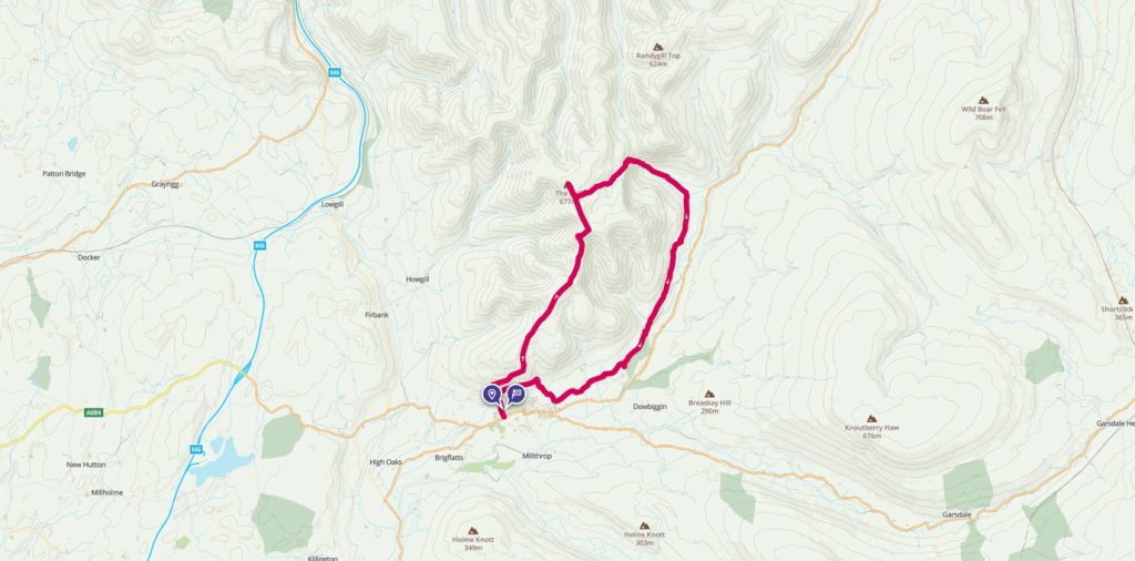
The Howgill Fells
Drive along the M6 motorway between Carlisle and Lancaster and a magnificent mountain range will rise before you. Fells such as Great Gable, Helvellyn, The Langdale Pikes and Scafell Pike will entice you in with their rugged charm.
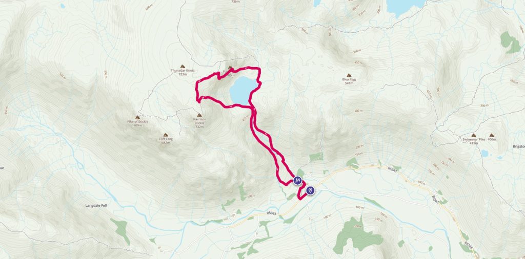
Jack’s Rake Scramble
Jack’s Rake is a brilliant grade 1 scramble in the stunning Langdale area of the Lake District, with potential for something more for those looking for a bit of a bigger thrill or an extended adventure.
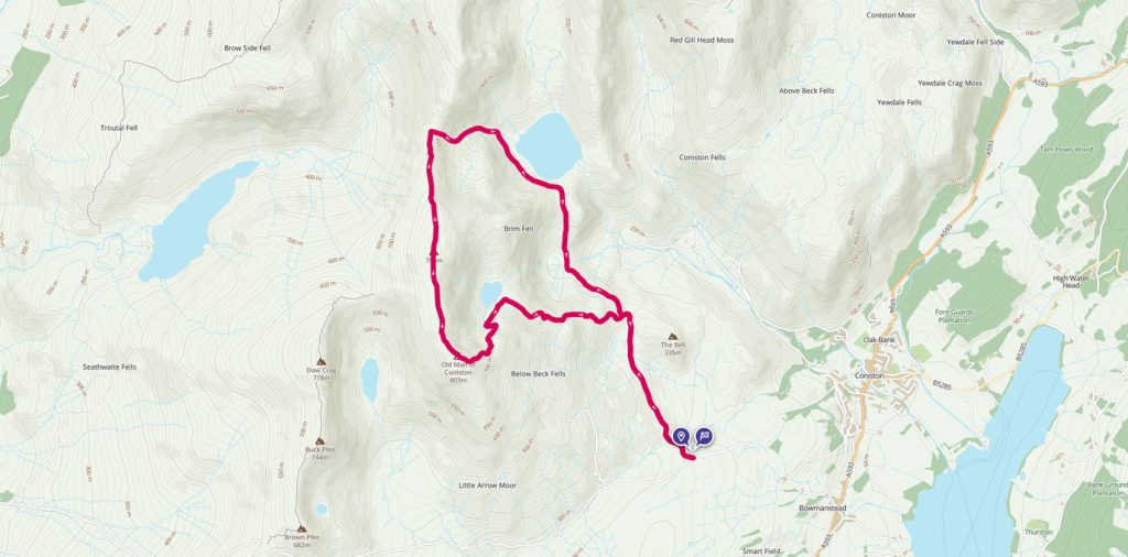
Old Man of Coniston and Levers Water Circular
The Old Man of Coniston is part of the Furness Fells in the Lake District standing 803m high, and lies to the west of the village of Coniston, and Coniston Water. OS GetOutside Champion duo, TwoTravlrs, take us across this underrated beauty of the Lakes.
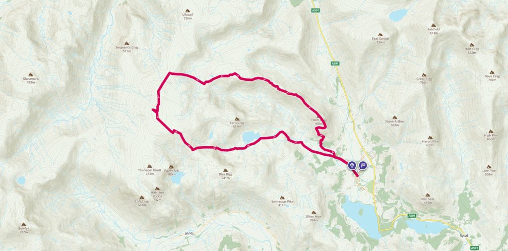
The very best of the Langdale Pikes
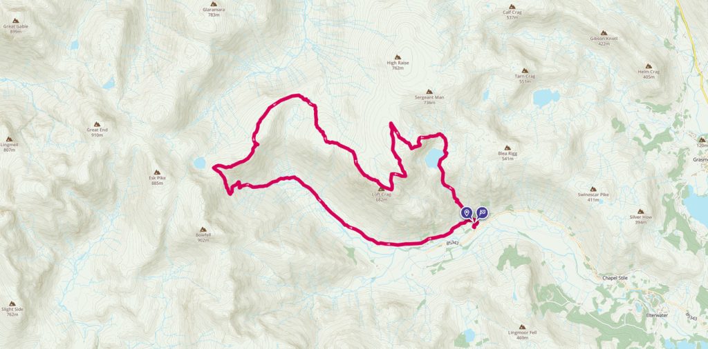
James Forrest explores the very best of the Langdale Pikes in a long – but glorious – day of hiking.
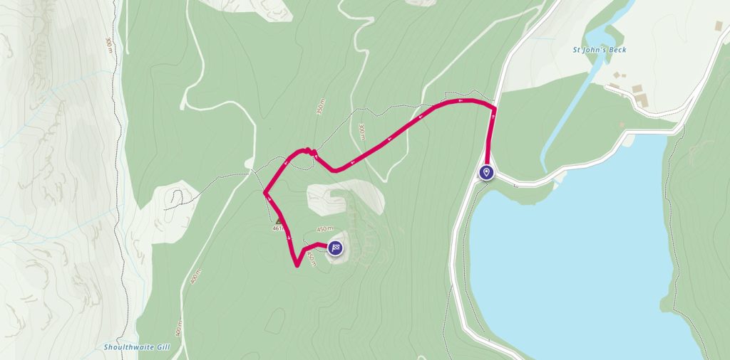
Raven Crag – Thirlmere
OS GetOutside Champion, Jack Anstey, takes us on a short, steep walk with some of the most rewarding and spectacular views the Lake District has to offer.
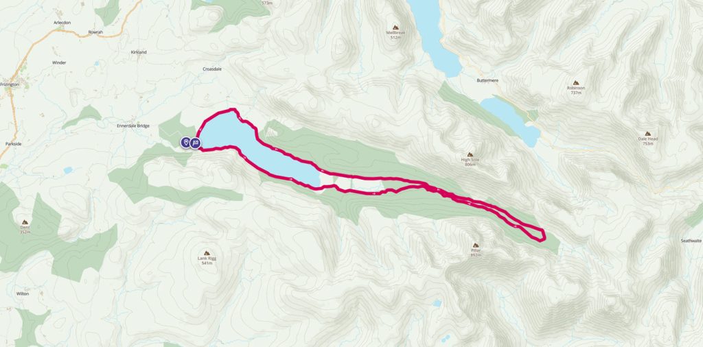
Ennerdale Forest walk
The English Lake District is blessed with some of the finest scenery in the United Kingdom. Instead of going for the peaks, for this walk we’ve chosen to explore the Ennerdale Valley
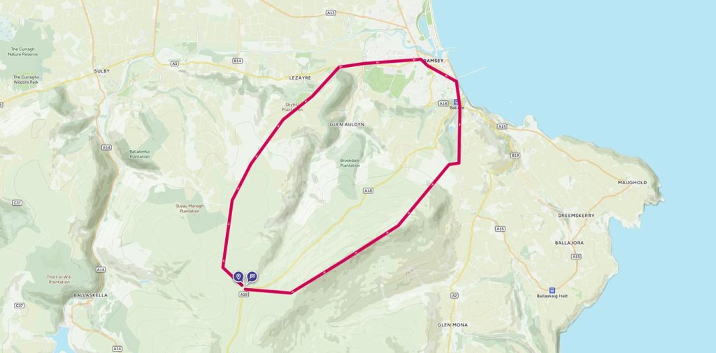
Trig bagging on the Isle of Man
The North Barrule trig pillar is on the Isle of Man and is at the end of a lovely ridge with many false summits.
A High Raise round from Grasmere
A walk from Grasmere up to the High Raise summit and trig pillar, the highest point in the Central Fells with commanding views of the whole Lake District.
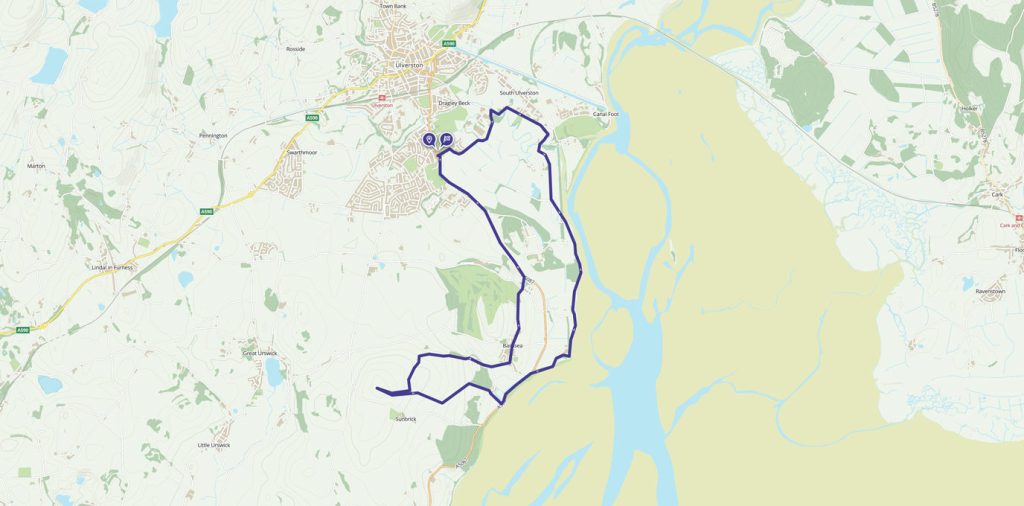
A coastal loop of Ulverston with stunning views
This walk has a little of everything, from country lanes, beautiful views across Morecambe Bay, and a gradual climb to Brigg Common for a 360 degree view of the sea and the Lake District.