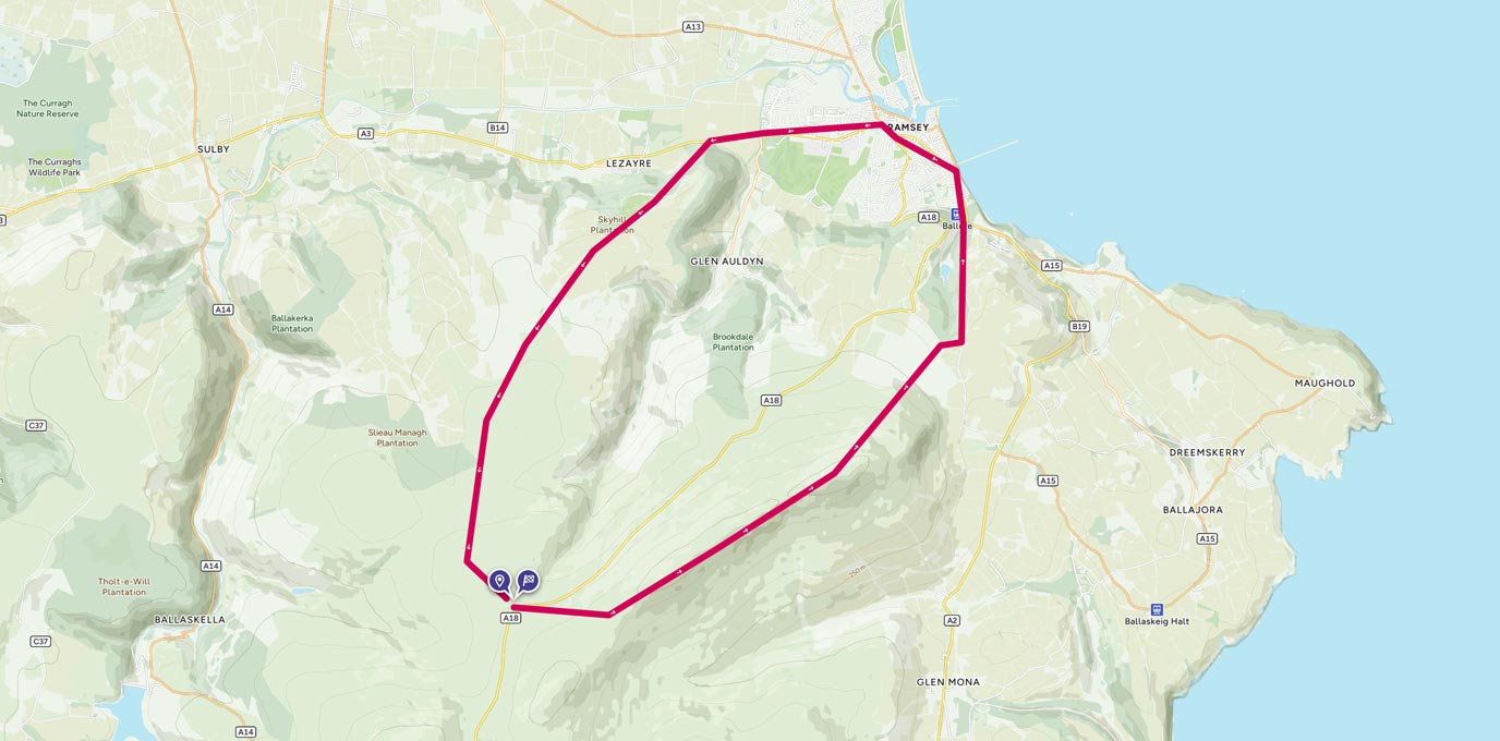
The North Barrule trig pillar is on the Isle of Man and is at the end of a lovely ridge with many false summits.
SC 410 897
The walk begins at the Mountain Box parking area on the A18. This is the TT track and care should be taken when crossing it. Even when it’s not TT season there are usually some fast vehicles and speed limits may not be what you expect from the mainland! Incidentally the drive along the TT track, especially this section, is well worth it.
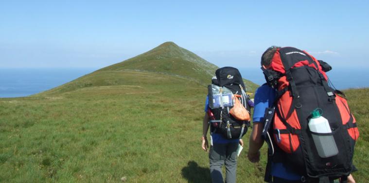
Leaving the car and carefully crossing the road, take a bearing of 115° and head South East uphill. You can make an extra little detour and head more South to take in the cairn at Clagh Ouyr. This cairn stands at 551m. It’s a steep climb (150m higher than your car) but worth it. Once you reach the summit of the ridge you can follow the well-trodden path North East on a bearing 059°.
2 km
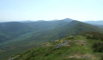
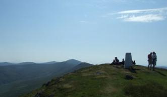
This ridge is very well known for its false summits … there are many. Part way up every peak you think that this one will be the last but it seems like every time another one appears just as you get to the top. Some sections of this track are boggy but the lovely man in charge of path furniture has very kindly laid some duckboards. When we walked this ridge even the sheep were taking advantage of the duckboards! The 565m summit is worth every boggy step. You are rewarded, at the trig, with views down to the town of Ramsey, across the sea, and back over the open moorland with Snaefell in the distance. The Gold DofE group that were to follow in our footsteps a few hours later would be on their last checkpoint in what had been the most amazing expedition from start to finish. Our journey from Torbay was quite a task but worth the effort. The team loved the island and its people. We knew that in a few hours’ time the expedition that had taken months and months of planning would be over. The trig point, looking down to Queen’s Pier, brought a mix of emotions for us all. Our jubilation at a successful trip was slightly tinged with sadness that it would soon be all over.
3.6 km
At this point we returned to the bus parked on the A18 but for a circular route you need to use your compass to get a bearing of 037° and head steeply downhill towards Ballure Plantation. Although this section is steep the terrain is quite good. Follow the minor road East until you meet the track that heads North. Skirt the plantation and head towards the town.
7 km
After a little mooch around Ramsey and perhaps a quick stop for an ice cream, make your way to the edge of town to pick up the A3 Lezayre Road. (Incidentally there is an excellent bookshop in Ramsey that sells a few antique books. I have ever since regretted not purchasing a little antique book of Isle of Man maps and geographical detail.)
9.8 km
Follow this road past the turning for Glen Auldyn to the edge of the Sky Hill Plantation. This is where you meet the Millennium Way track. Take this track through the plantation. A steep climb will take you along the very well maintained track to open moorland. You are rewarded for your efforts with fine views. At grid ref 406 909 you have a choice to extend the route further. A quick trip South West for 500m will take you to the monument at 402 905. Return to the original path and head South East back towards the road. Time now for a well deserved coffee and cake!
15.4 km SC 409 898
15 km / 9 miles