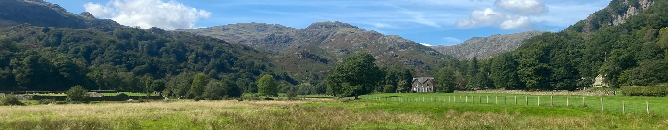
The Lake District National Park is home to some of the most stunning bodies of water in the UK. While only one is officially named a “lake” (Bassenthwaite Lake), the region boasts 16 major lakes, each with its own charm, history, and natural beauty.
Which lakes are the most popular?
In this guide, we rank them by 2025 monthly UK search volume (using Dragon Metrics). This shows the approximate number of people in the UK searching for the name of each lake every month (on average across the year). This will give you a great indication of which of the lakes in the Lake District are the busiest with tourists and which are the more quiet and less popular of the lakes.
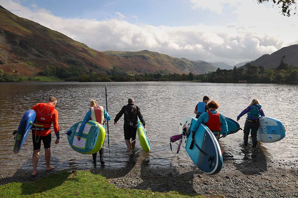
We also share details of the nearest peaks for each of the lakes, an OS Maps Link to help you explore hiking routes in the area, and a few interesting facts about each lake. If you’re looking to paddle in any of the lakes read our Paddleboarding in the Lake District Guide where you’ll find 15 of the best places to paddle in the lakes.
Find out more about the lakes of the Lake District National Park
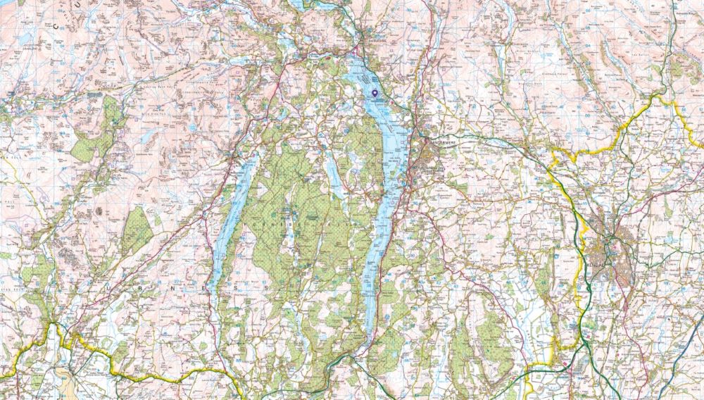
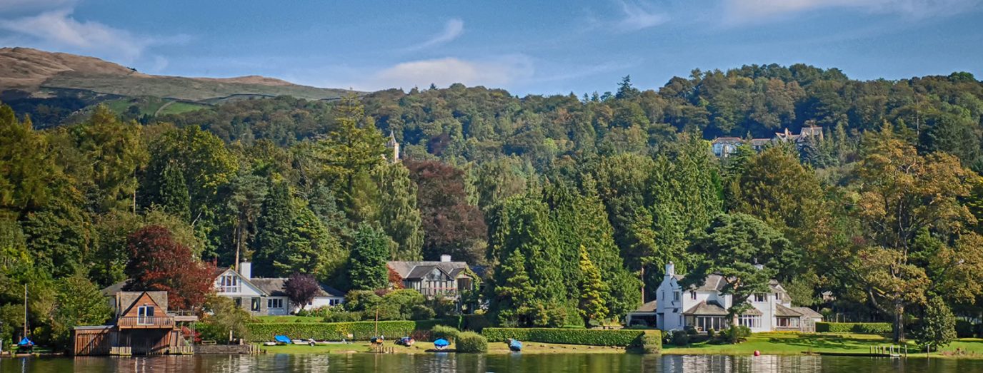
Windermere – The largest and most famous lake in the Lake District
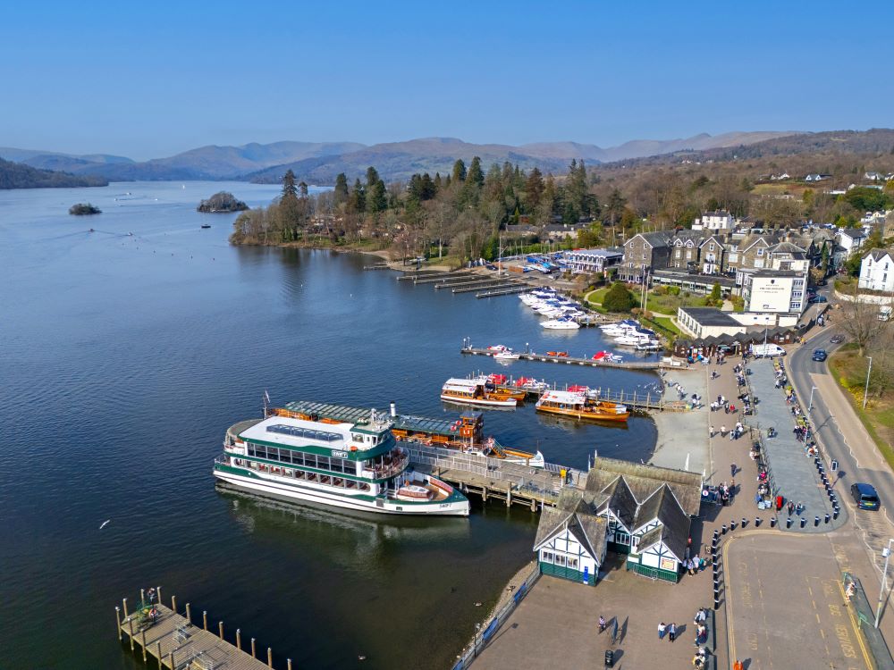
Search Volume: 165,000 per month
Size: 16.8 km²
Max Depth: 64 m
OS Maps: Explore Windermere
Paper Map: Buy a Map of Windermere
Nearest Peaks:
- Orrest Head is a classic viewpoint with easy access and stunning views.
- School Knott offers a gentle climb with panoramic views of the lake.
- Brant Fell overlooks Bowness and provides a peaceful walking route.
Interesting Facts about Windermere:
- Windermere is the largest natural lake in England, stretching over 10.5 miles.
- It was formed during the last Ice Age and holds over 300 billion litres of water.
- The Windermere Ferry has been operating since the 15th century.
- Windermere has over 7 million visitors per year!
Swimming, canoes, kayaks and paddleboards are all permitted on Windermere
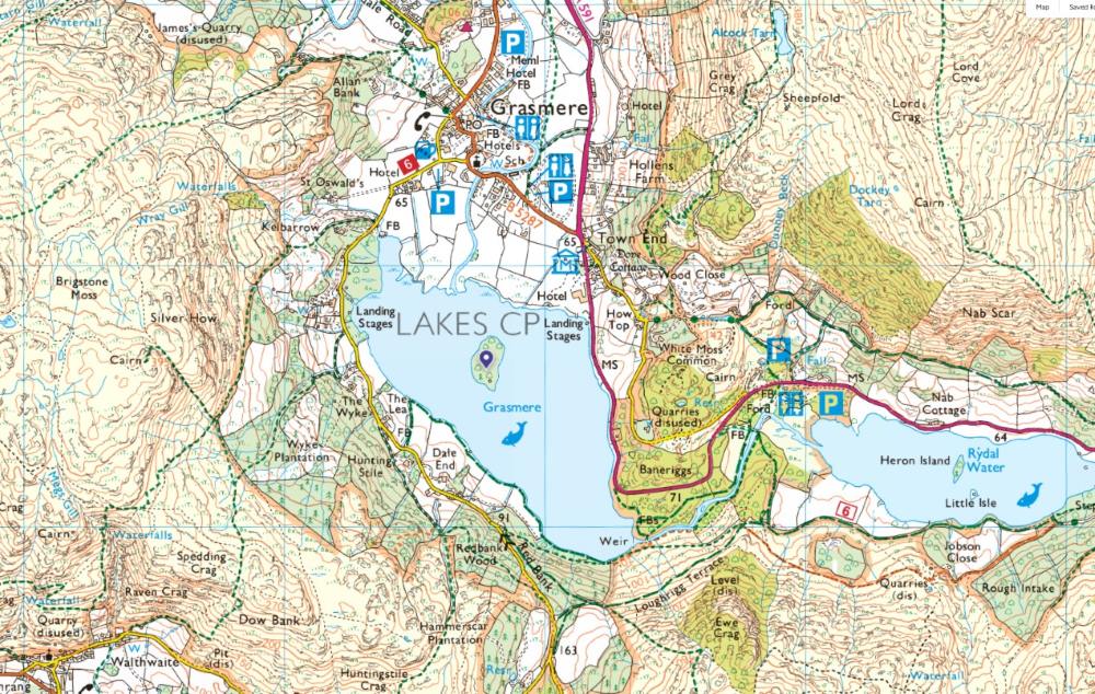
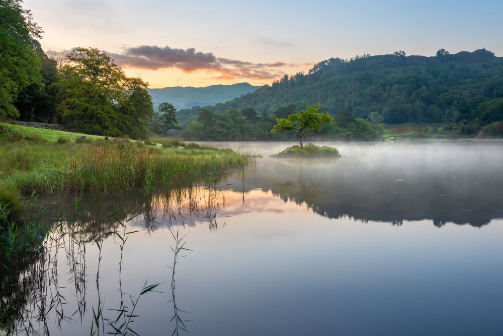
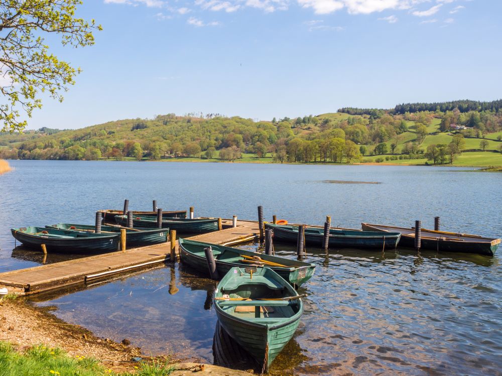
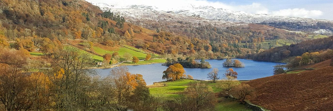
Grasmere – Described by William Wordsworth as “the loveliest spot that man hath ever found”
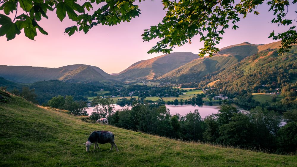
Search Volume: 60,500 per month
Size: 0.6 km²
Max Depth: 21.5 m
OS Maps: Explore Grasmere
OS Paper Map: Buy a Map of Grasmere
Nearest Peaks:
- Helm Crag is known for its distinctive summit rocks called the “Lion and the Lamb.”
- Stone Arthur is a short but steep climb with great views.
- Seat Sandal is a higher fell offering panoramic vistas.
Interesting Facts about Grasmere:
- Grasmere was described by William Wordsworth as “the loveliest spot that man hath ever found.”
- It is famous for Grasmere Gingerbread, invented by Sarah Nelson in 1854.
- The lake has a central island and is surrounded by lush meadows.
Swimming, canoes, kayaks and paddleboards are all permitted in Grasmere
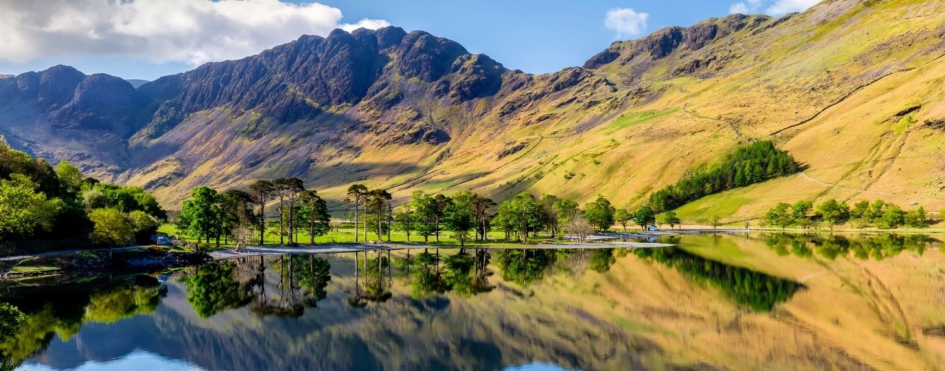
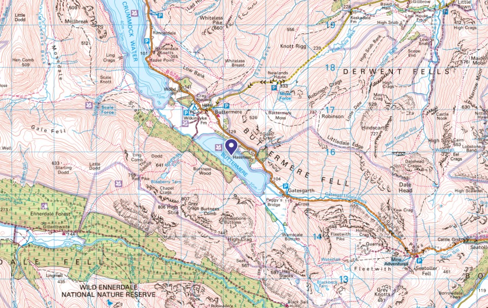
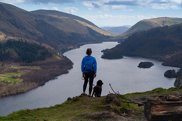
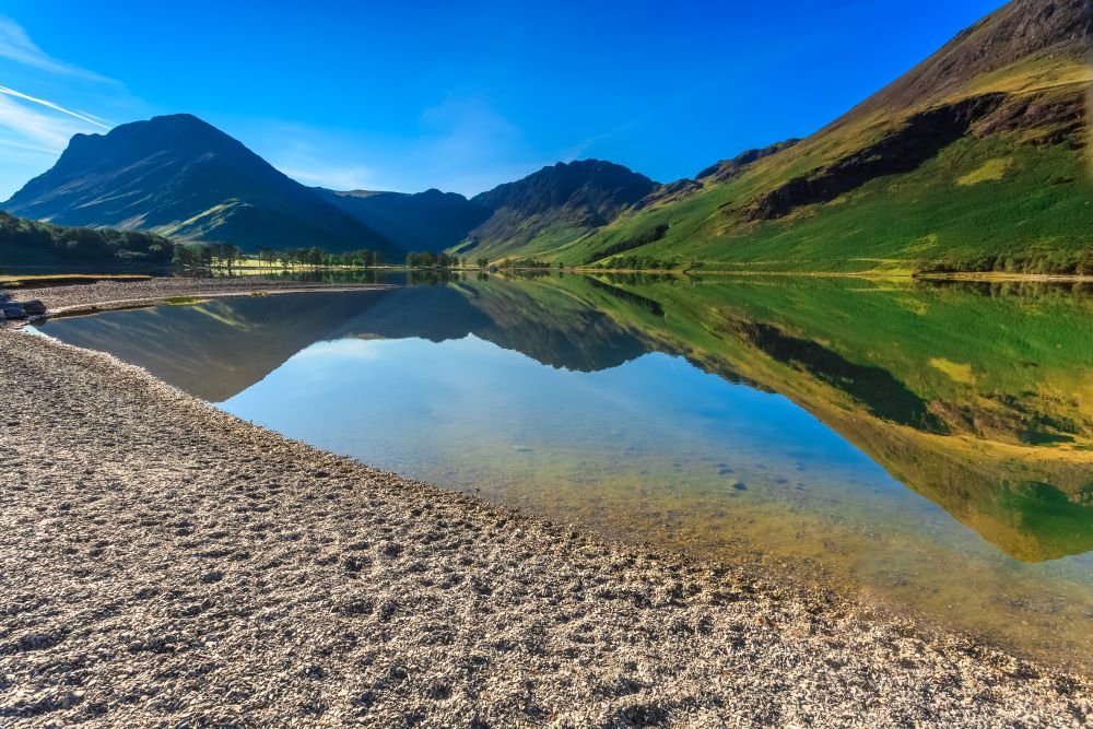
Buttermere – Named after the famous Viking Chieftan ‘Jarl Buthar’
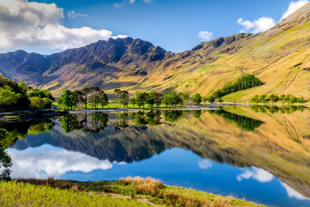
Search Volume: 49,500 per month
Size: 0.9 km²
Max Depth: 28.6 m
OS Maps: Explore Buttermere
OS paper map: Buy a Map of Buttermere
Nearest Peaks:
- Haystacks was Alfred Wainwright’s favourite fell and is a classic walk.
- Fleetwith Pike offers a steep ascent with dramatic views.
- High Crag is part of the Buttermere Ridge and connects to other peaks.
Interesting Facts about Buttermere:
- Buttermere is surrounded by dramatic peaks and offers one of the most scenic low-level walks.
- The nearby Honister Slate Mine is one of the last working slate mines in England.
- The lake was once joined with Crummock Water before glacial retreat separated them.
- Buttermere is said to have been the base of Jarl Buthar, a Norse chieftain who led a guerrilla resistance against the Norman invaders for nearly 50 years after the Conquest of 1066.
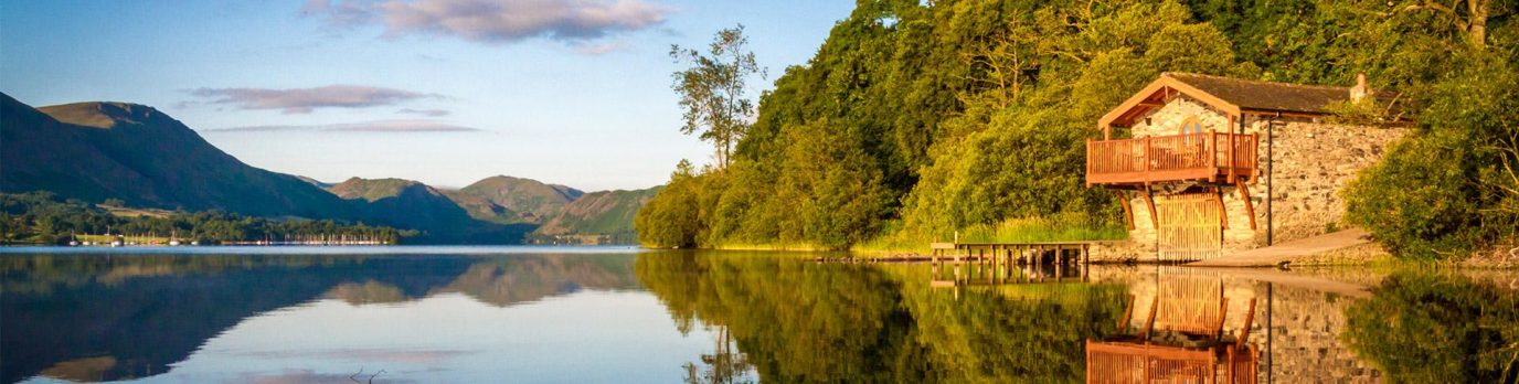
Ullswater – Where Wordsworth was inspired to write ‘Daffodils’
Search Volume: 40,500 per month
Size: 8.9 km²
Max Depth: 63 m
OS Maps: Explore Ullswater
Paper Map: Buy a Map of Ullswater
Nearest Peaks:
- Helvellyn is one of England’s highest peaks and offers the famous Striding Edge route.
- Place Fell provides panoramic views over Ullswater and is a rewarding climb.
- Hallin Fell is a short, family-friendly summit with excellent views.
- William Wordsworth was inspired by the daffodils near its shores and wrote his iconic poem.
Interesting Facts about Ullswater:
- Ullswater inspired the creation of Sticky Toffee Pudding at Sharrow Bay.
- It is popular for steamer cruises and sailing, with several jetties along its shore.
- The lake is surrounded by dramatic fells and is a favourite among photographers.
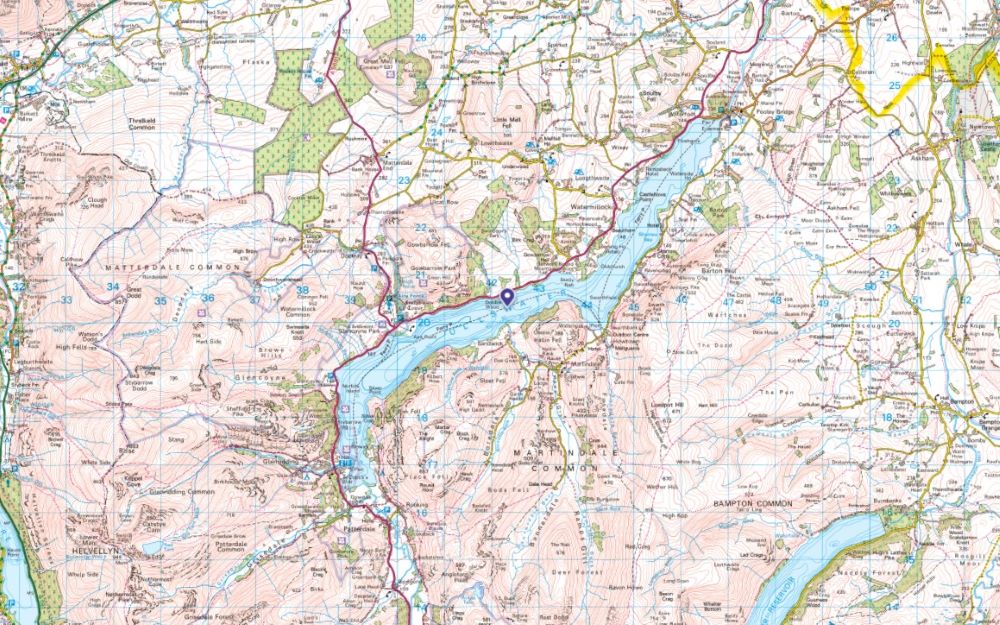
Swimming, canoes, kayaks and paddleboards are all permitted in Ullswater

EXPLORE THE
OS Shop
We are with you every step of the way. Shop our trusted walking and hiking maps and guidebooks so you can explore the outdoors with confidence.
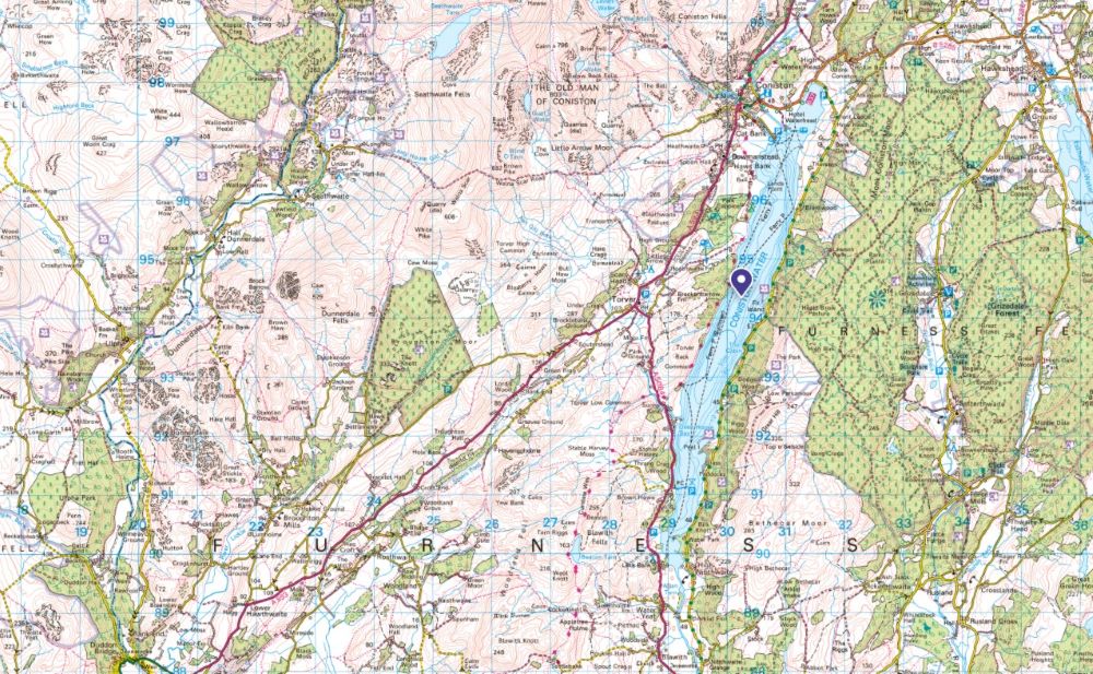
Go to the shopConiston Water – The inspiration for Swallows & Amazons
Search Volume: 40,500 per month
Size: 4.9 km²
Max Depth: 56 m
OS Maps: Explore Coniston
OS Paper Map: Buy a Map of Coniston
Nearest Peaks:
- The Old Man of Coniston dominates the skyline and is a classic Lake District hike.
- Dow Crag is rugged and dramatic, ideal for experienced walkers.
- Swirl How is part of the Coniston Fells circuit and offers expansive views.
Interesting Facts about Coniston Water:
- Coniston Water was the site of Donald Campbell’s water speed record attempts.
- It inspired Arthur Ransome’s Swallows and Amazons.
- The historic Steam Yacht Gondola, operated by the National Trust, cruises the lake.
Swimming, canoes, kayaks and paddleboards are all permitted in Coniston Water
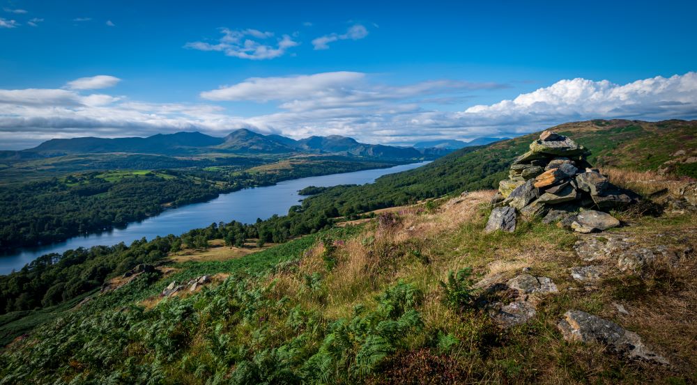
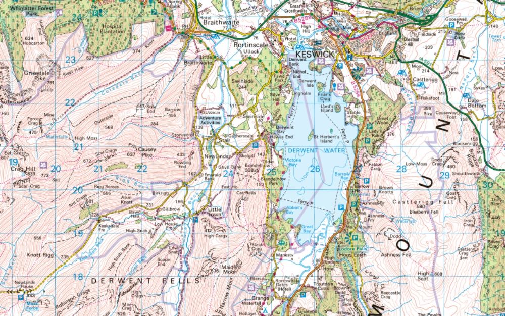
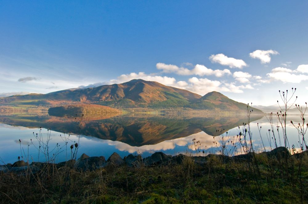
Derwentwater – The ideal lake for island hoppers
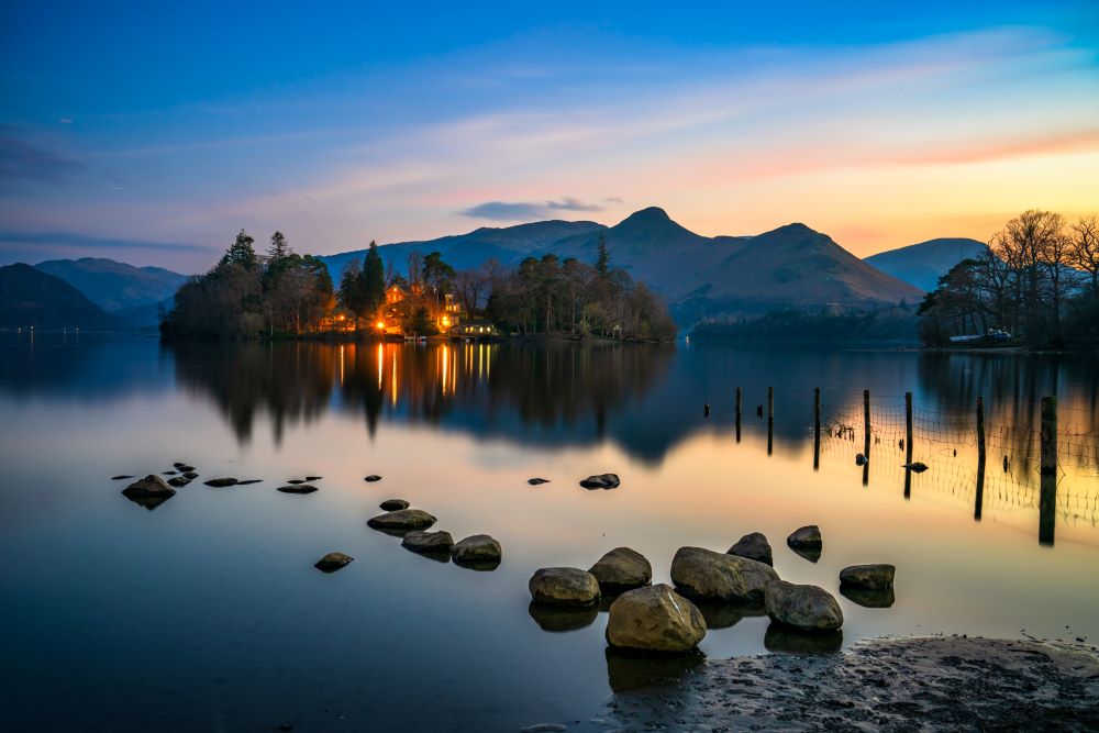
Search Volume: 12,100 per month
Size: 5.5 km²
Max Depth: 22 m
OS Maps: Explore Derwentwater
OS Paper Map: Buy a Map of Derwentwater
Nearest Peaks:
- Catbells is a popular and accessible fell with stunning views over the lake.
- Walla Crag overlooks Derwentwater and Keswick and is ideal for a short hike.
- Latrigg offers an easy walk with a rewarding panorama of the surrounding area.
Interesting Facts about Derwent Water:
- Derwentwater is known for its four scenic islands, including St Herbert’s Island, Lord’s Island, Ramsholme Island and Derwent Island. Great fun for paddlers.
- It is close to Keswick, a vibrant hub for walkers and outdoor enthusiasts and start of the super challenging Bob Graham Round.
- Rowing boats and launches are available for visitors to explore the lake.
Swimming, canoes, kayaks and paddleboards are all permitted in Derwentwater
Bassenthwaite Lake – The only official ‘LAKE’ in the Lake District!
Search Volume: 12,100 per month
Size: 5.3 km²
Max Depth: 19 m
OS Maps: Explore Bassenthwaite
OS Paper Maps: Buy a Map of Bassenthwaite
Nearest Peaks:
- Skiddaw is one of the highest peaks in the Lake District and offers panoramic views.
- Dodd Fell is a woodland walk with a summit viewpoint ideal for wildlife spotting.
- Barf is a steep climb with scenic rewards and local legend.
Interesting Facts about Bassenthwaite Lake:
- Bassenthwaite Lake is the only body of water in the Lake District officially named a “lake.”
- It is an important habitat for ospreys, with viewing points at Whinlatter Forest.
- The lake is shallow and tranquil, making it ideal for wildlife watching.
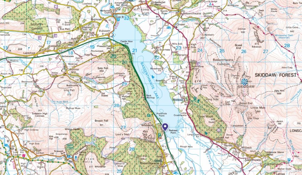
Swimming, canoes, kayaks and paddleboards are all permitted in Bassenthwaite Lake
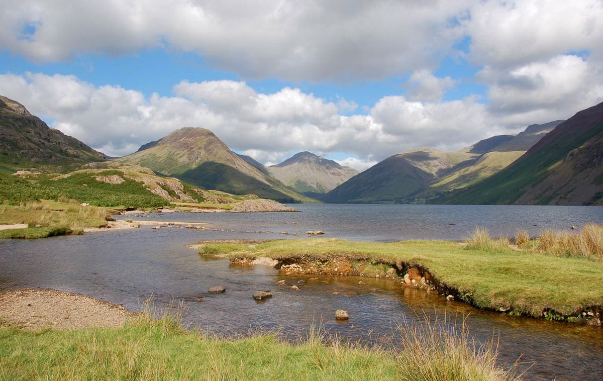
Wastwater – The deepest lake in the Lake District
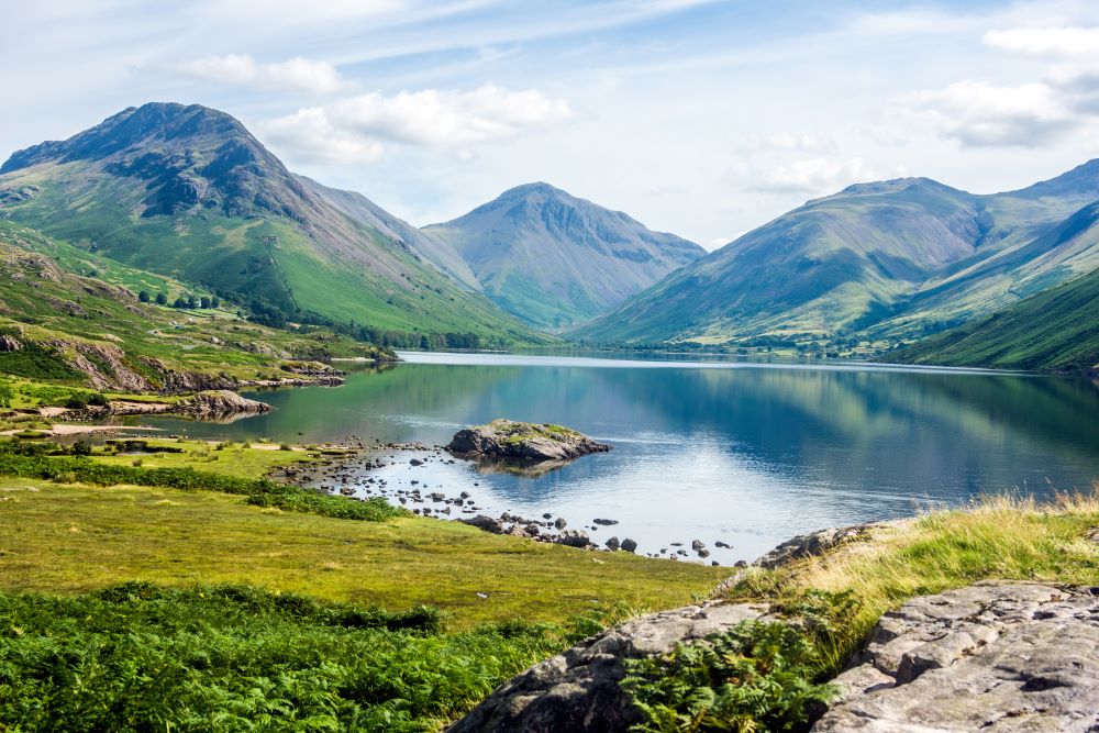
Search Volume: 12,100 per month
Size: 2.9 km²
Max Depth: 76 m
OS Maps: Explore Wastwater
OS Paper Map: Buy a Map of Wastwater
Nearest Peaks:
- Scafell Pike is England’s highest mountain and towers above Wastwater.
- Great Gable offers dramatic views and is a favourite among seasoned hikers.
- Yewbarrow is steep and rugged, providing a thrilling ascent.
Interesting Facts about Wastwater:
- Wastwater is the deepest lake in England at 76 metres.
- It was voted Britain’s Favourite View in 2007 (easy to see why!)
- The lake is flanked by the famous Wastwater Screes, a dramatic geological feature.
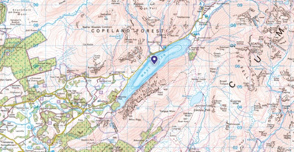
Swimming on Wastwater is permitted, canoes, kayaks and paddleboards need a permit
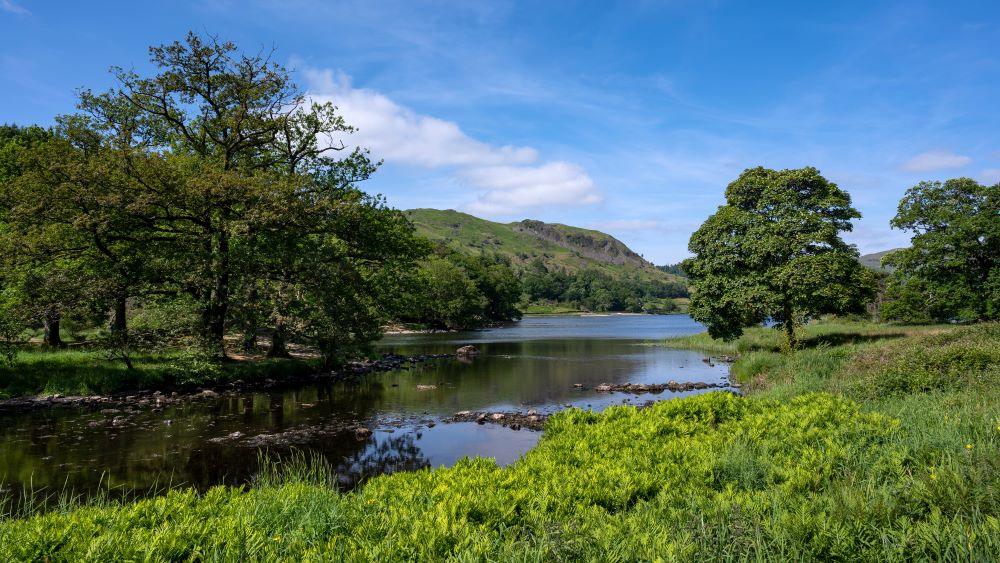
Elter Water – From the Norse for Swan – this is literally ‘Swan Lake’
Search Volume: 9,900 per month
Size: 0.16 km²
Max Depth: 7 m
OS Maps: Explore Elter Water
OS Paper Map: Buy a Map of Elter Water
Nearest Peaks:
- Loughrigg Fell is easily accessible and offers stunning views.
- Lingmoor Fell overlooks Great Langdale and is a quieter alternative.
- Silver How provides views of Grasmere and the surrounding area.
Interesting Facts about Elter Water:
- Elter Water is known for its three-part basin with varied water quality.
- It offers stunning views of the Langdale Pikes.
- The lake is peaceful and ideal for photography and sketching.
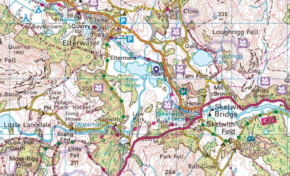
Swimming is permitted on Elter Water, paddleboarding and canooing require a permit
Thirlmere – It’s controversial dam sparked one of the first organised environmental campaigns!
Search Volume: 8,100 per month
Size: 3.3 km²
Max Depth: 46 m
OS Maps: Explore Thirlmere
OS Paper Map: Buy a Map of Thirlmere
Nearest Peaks:
- Helvellyn is easily accessed from the eastern shore and offers one of the most iconic ridge walks in the UK.
- Raven Crag is a short but steep climb with rewarding views over the reservoir.
- High Rigg provides a rolling ridge walk with panoramic views.
Interesting Facts about Thirlmere:
- Thirlmere was created by damming two smaller lakes to supply water to Manchester, causing controversy and leading to one of the first organised environmental campaigns. Ultimately these campaigns inspired the creation of the National Trust!
- The surrounding area is rich in ancient woodland and wildlife habitats.
- It’s a peaceful spot with scenic walking routes and views of Helvellyn.
- Thirlmere also holds literary significance, being a famous meeting place for Wordsworth and Coleridge
Swimming & paddleboarding are not permitted on Thirlmere, canoes & kayaks are permitted.
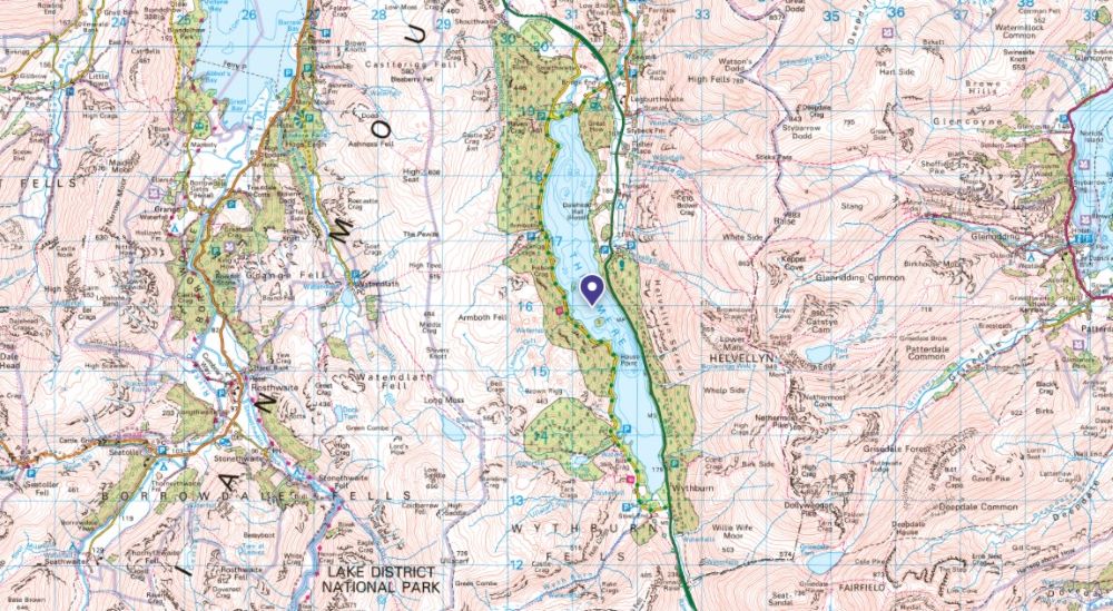
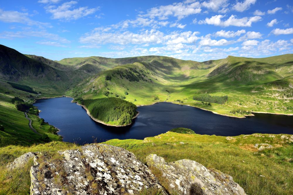
Haweswater – Two villages were flooded to create this reservoir
Search Volume: 5,400 per month
Size: 3.9 km²
Max Depth: 57 m
OS Maps: Explore Haweswater
OS Paper Maps: Buy a Map of Haweswater
Nearest Peaks:
- Harter Fell rises above the reservoir and offers a quiet, scenic climb.
- High Street is a Roman road summit with expansive views.
- Kidsty Pike is part of the Coast to Coast route and offers dramatic scenery.
Interesting Facts about Haweswater:
- Two villages—Mardale Green and Measand—were flooded to create the reservoir.
- During droughts, ruins of the old villages can sometimes be seen.
- Haweswater is home to rare species including the golden eagle.
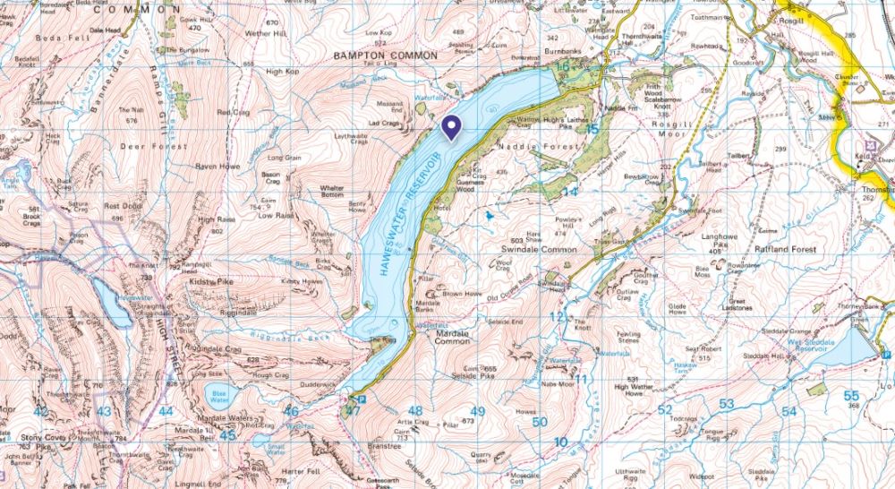
No swimming or paddling is permitted in Esthwaite Water
Crummock Water – Home to Scale Force, the tallest waterfall in the Lake District
Search Volume: 4,400 per month
Size: 2.5 km²
Max Depth: 43.9 m
OS Maps: Explore Crummock Water
OS Paper Maps: Buy a Map of Crummock Water
Nearest Peaks:
- Grasmoor rises steeply above the lake and is the highest in the area.
- Rannerdale Knotts is a short but scenic climb, especially in bluebell season.
- Mellbreak offers views of both Crummock Water and Loweswater.
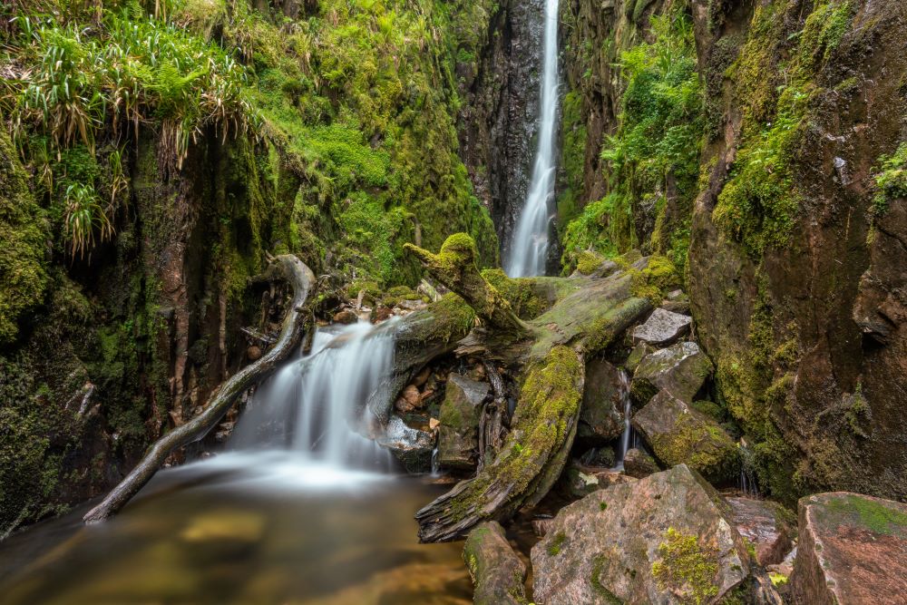
Interesting Facts about Crummock Water:
- Crummock Water is home to Scale Force, the tallest waterfall in the Lake District.
- It’s popular for wild swimming and peaceful walks.
- The lake was once part of a larger body of water with Buttermere.
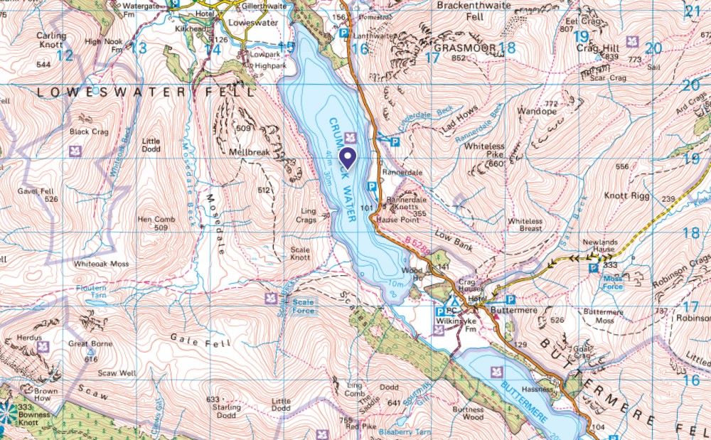
Swimming on Crummock Water is permitted, canoes, kayaks and paddleboards need a permit
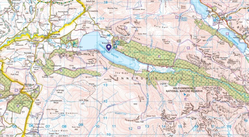
Ennerdale Water – The only major lake with no road beside it
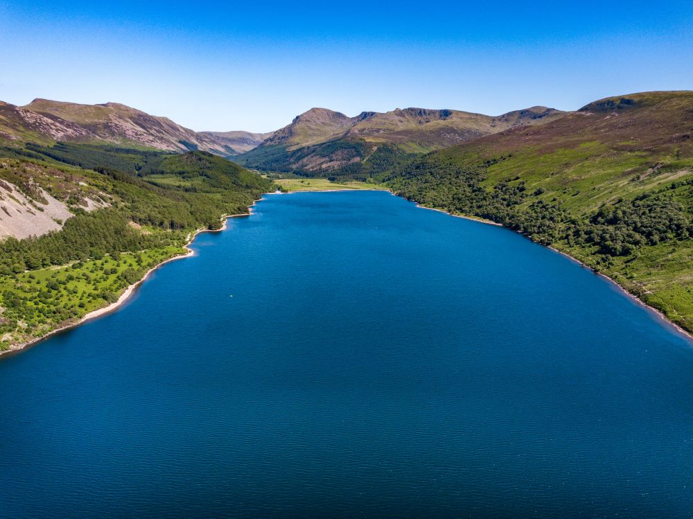
Search Volume: 4,400 per month
Size: 3.0 km²
Max Depth: 42 m
OS Maps: Explore Ennerdale
OS Paper Map: Buy a Map of Ennerdale Water
Nearest Peaks:
- Crag Fell offers stunning views of the lake and surrounding valleys.
- Pillar is a remote and rugged challenge for experienced hikers.
- Steeple is sharp and dramatic, ideal for adventurous walkers.
Interesting Facts about Ennerdale Water:
- Ennerdale Water was featured in the film 28 Days Later as a refuge from zombies.
- It is one of the most remote and least visited lakes in the region.
- The lake marks the starting point for the Coast to Coast Walk.
Swimming & paddleboarding are not permitted on Ennerdale Water, canoes & kayaks are permitted.
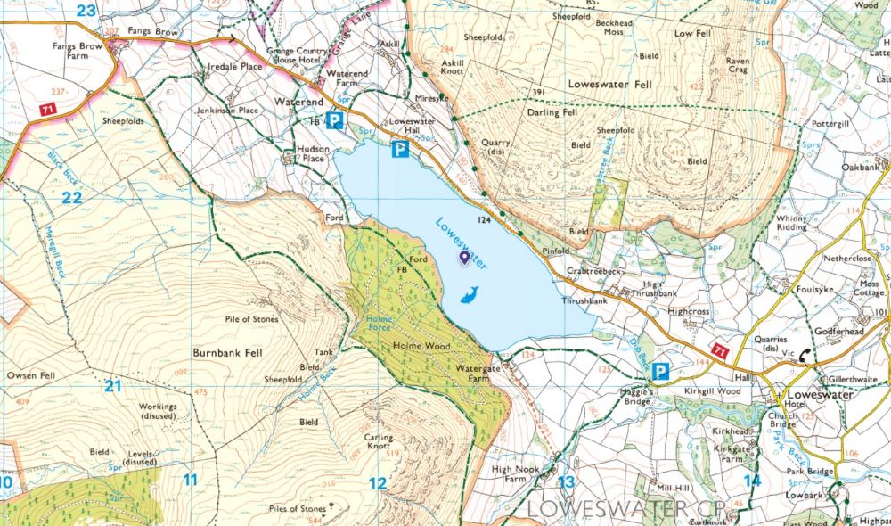
Loweswater – The only lake in the Lake District that drains inland
Search Volume: 4,400 per month
Size: 0.6 km²
Max Depth: 16 m
OS Maps: Explore Loweswater
OS Paper Map: Buy a Map of Loweswater
Nearest Peaks:
- Burnbank Fell is a gentle grassy summit ideal for quiet walks.
- Carling Knott offers views over Loweswater and the surrounding valleys.
- Blake Fell is the highest of the Loweswater Fells and provides a rewarding climb.
Interesting Facts about Loweswater:
- Loweswater is one of the few lakes that flows away from the centre of the Lake District.
- The western shore features peaceful woodland walks.
- It is less visited than neighbouring lakes, making it ideal for solitude.
Swimming is permitted in Loweswater but canoes and paddleboards need a permit
Rydal Water – Be sure to visit the famous Rydal Cave
Search Volume: 4,400 per month
Size: 0.3 km²
Max Depth: 18 m
OS Maps: Explore Rydal
OS Paper Map: Buy a map of Rydal Water
Nearest Peaks:
- Loughrigg Fell offers panoramic views over multiple lakes and valleys.
- Nab Scar is the start of the Fairfield Horseshoe and provides a steep climb.
- Heron Pike is a ridge walk from Rydal with scenic views.
Interesting Facts about Rydal Water:
- Rydal Water is overlooked by Rydal Mount, the home of William Wordsworth.
- It features Rydal Cave, a filming location for The Witcher.
- Wordsworth’s Seat, his favourite viewpoint, is located nearby.
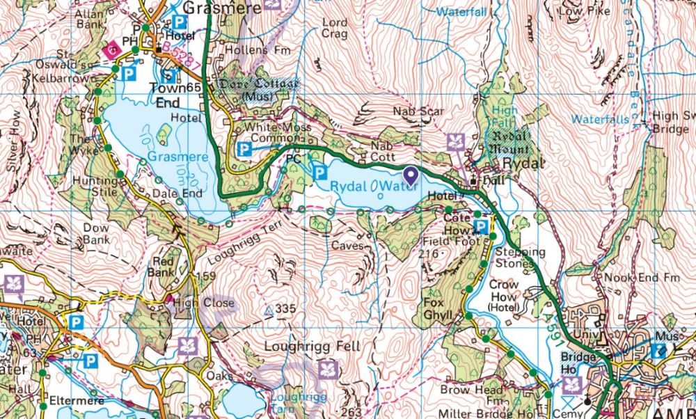
Swimming is permitted in Rydal Water but canoes, kayaks and paddleboards are not
Esthwaite Water – Beatrix Potter’s favourite lake
Search Volume: 1,900 per month
Size: 1.0 km²
Max Depth: 15.5 m
OS Maps: Explore Esthwaite
OS Paper Maps: Buy a Map of Esthwaite Water
Nearest Peaks:
- Claife Heights is a gentle woodland walk with tarns and quiet trails.
- Latterbarrow offers a short climb with a distinctive summit cairn.
- Black Fell is a peaceful spot with views over the surrounding valleys.
Interesting Facts about Esthwaite Water:
- Esthwaite Water is closely associated with Beatrix Potter, whose home was nearby.
- It is designated a Site of Special Scientific Interest due to its rich ecology.
- The lake is popular for private fishing and birdwatching.
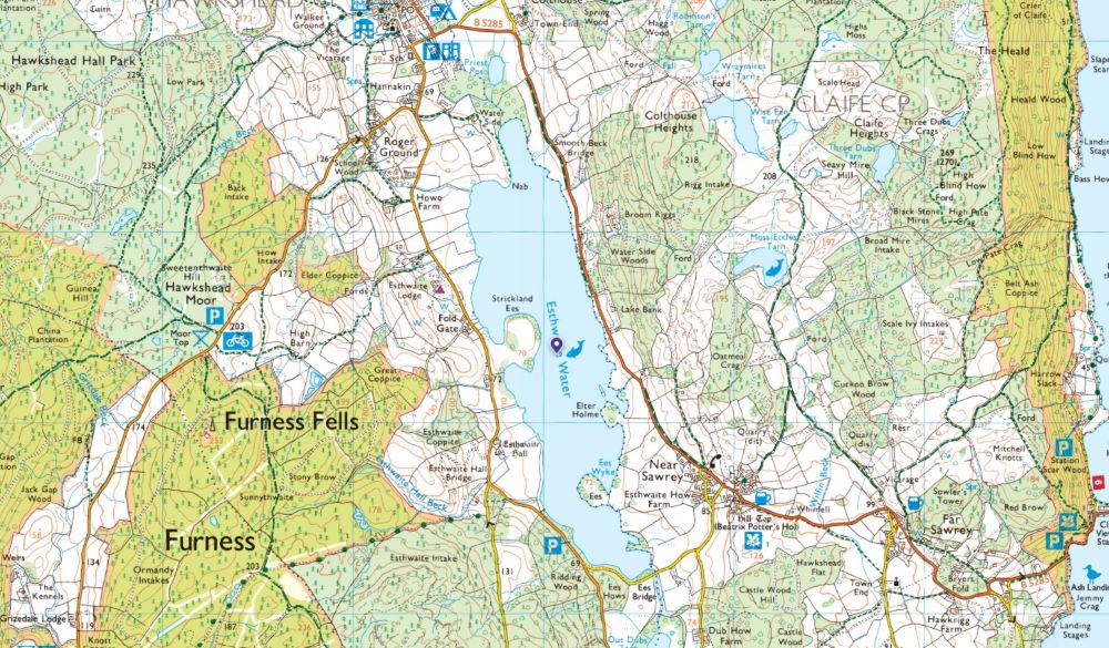
No swimming or paddling is permitted in Esthwaite Water – it is a private fishing lake
If you’re looking for further information on what kind of activities are permitted on each of the lakes, head to the official Lake District Information Site.
EXPLORE THE
OS Shop
We are with you every step of the way. Shop our trusted walking and hiking maps and guidebooks so you can explore the outdoors with confidence.
Go to the shop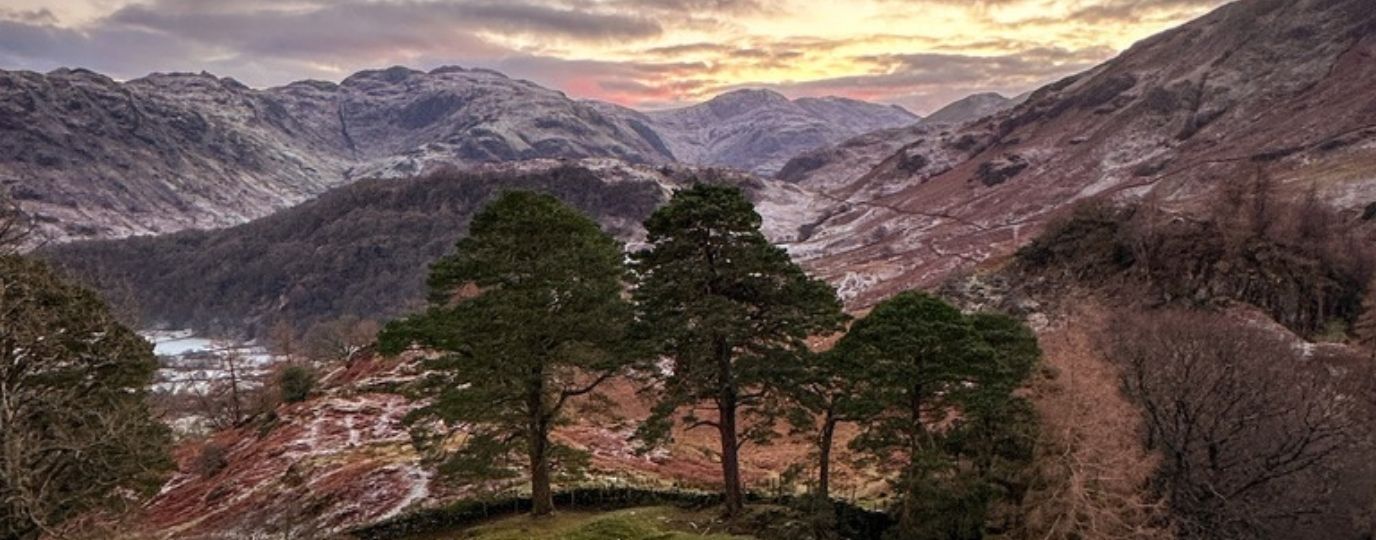
3 Winter Wainwright Hikes: Lake District North Western Fells
Lake District North Western Fells Walks – a short walk, a medium walk and a long walk – great ideas for a hiking weekend in the Lakes!
Lake District National Park
Discover the breathtaking beauty of the Lake District. Find inspiring Lake District adventures, Hiking Routes, cycling and paddling locations
Best Autumn Walks in the Lake District
Autumn in the Lake District is a feast for the eyes. An array of reds, yellows and oranges span the horizon and cover the ground. Here are some of the best autumn walks to be enjoyed in the Lake District this season.
Lake District Horseshoe Hikes
3 of the best Lake District Horseshoe Hikes – learn about these beautiful walks and why horseshoes routes are more challenging!
Lake District Paddle Boarding: 15 great spots to launch
Lake District Paddle Boarding – Where to launch a paddle board in the lake district. Expert paddler Jo Moseley shares 20 great spots to launch a paddle board in the Lake District
8 Epic Lake District walks you need to do
It’s no secret that the Lake District is one of the most beautiful places in England with some epic walks to boot. Walker and cyclist Jamie Knop has listed eight of the most epic Lake District walks you need to tick off your bucket list.