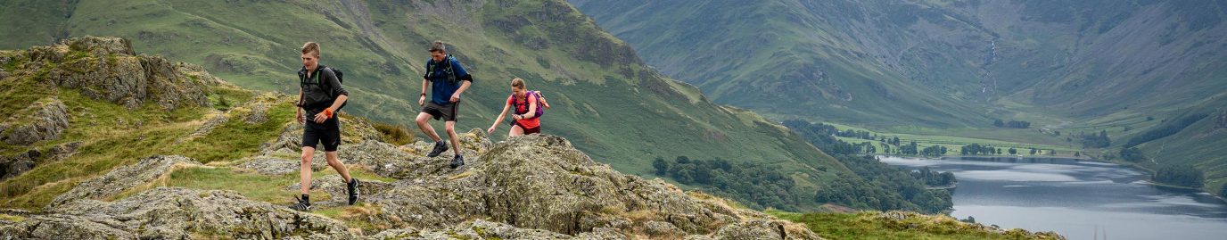
The 13 Valleys Ultra takes in an unmissable route spanning all 13 valleys of the Lake District National Park. Discover this challenging route which can be enjoyed all year round or in smaller sections for a leisurely walk.
The annual event is split into four distances ranging from 20km to 180km meaning there’s something for every type of runner. The 2 Valleys (20km) is a great introduction to trail running and many will go on to collect all four distance badges. The full 180km 13 Valleys is a beast, even for the most experienced ultrarunner, and the inaugural event saw it being dubbed one of the most challenging ultramarathons in the UK.
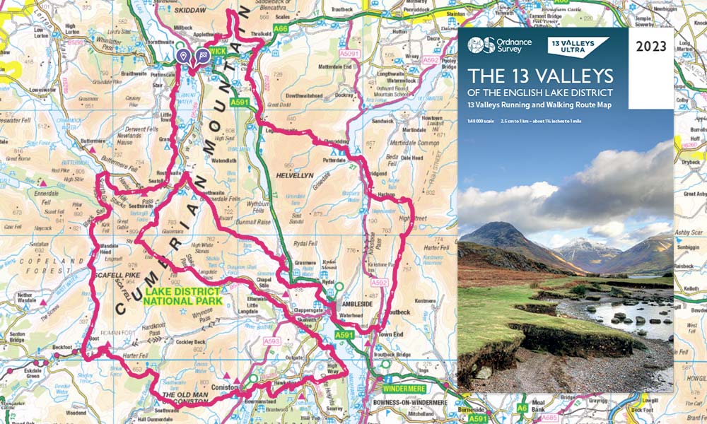
Full 13 Valleys route in OS Maps and OS Paper Map
If running isn’t your thing, the route has been carefully planned in collaboration with the Lake District National Park Authority to ensure it makes a fantastic ramble. It’s the perfect route to experience the best of the Lake District and can be easily split into sections as the valleys provide a chance to refuel and rest. As the official mapping partner for the 13 Valleys, you can find all four routes in OS Maps and there’s even a limited-edition OS Paper Map showing the routes and encapsulating all four corners of the Lake District.
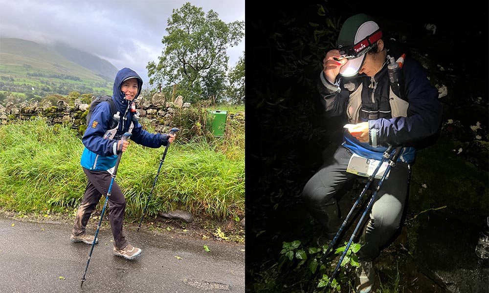
Helen Newman from the OS Team completed the inaugural 180km13 Valleys Ultra and shares her experience of the full route to help inspire you to take on some or all of it yourself. She was joined by OS Champions Alex Staniforth and Gee Jackson who both completed the 7 Valleys (110km) and Sam Taylor-Frost who completed the 2 Valleys (20km).
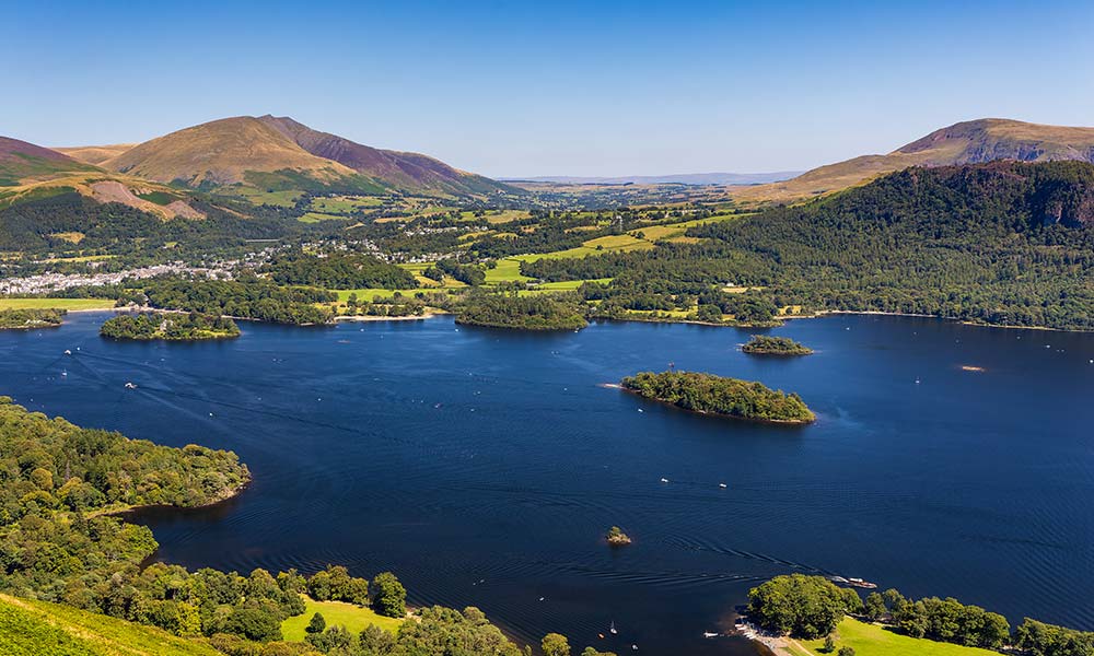
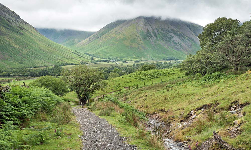
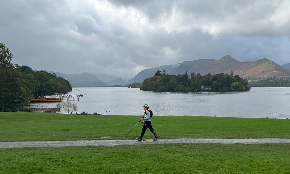
Views over Derwentwater from the path beneath Catbells
Keswick to Honister Pass
9.5 miles / 15.5km
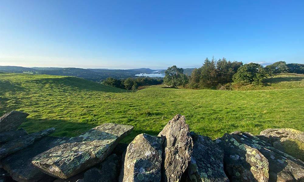
Crow Park in Keswick is the official starting point for the 13 Valleys Ultra and boasts an unrivalled backdrop of Derwent Water and the surrounding peaks. The route meanders around the north of the lake on pavement and the well-trodden Cumbrian Way, before skirting around Catbells, one of the most popular viewpoints in the area. These low-level trails made easy running but still provide stunning views of Derwentwater. Sunset provided a warm glow and showcased the Lake District in all its glory. I relaxed into the pace, chatting with other whilst marvelling at the incredible scenery.
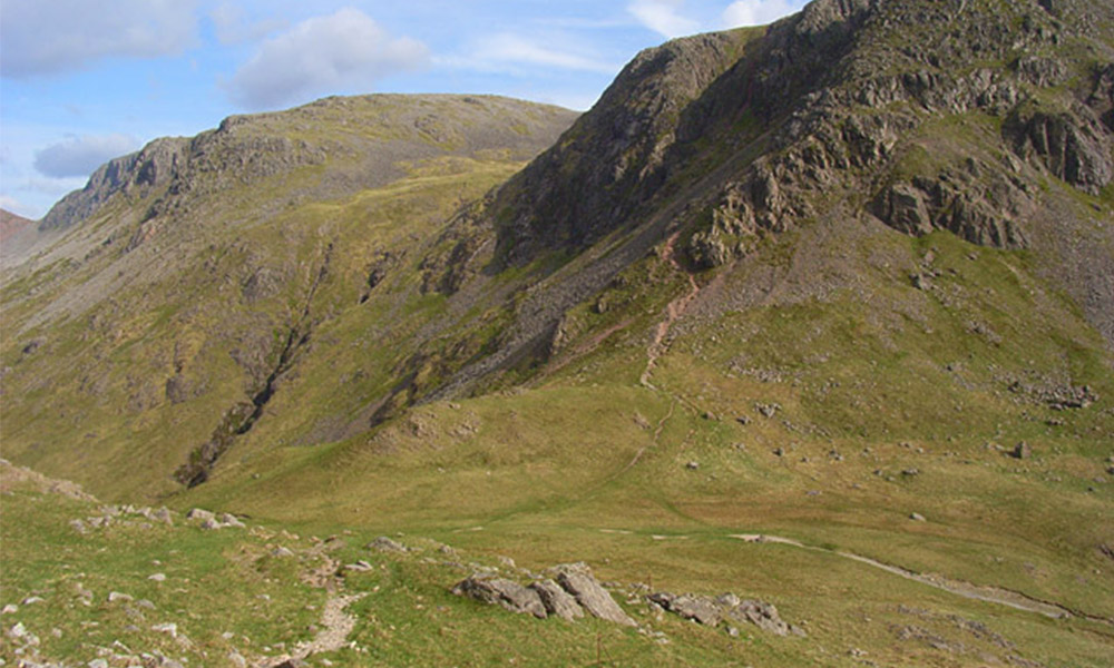
Black Sail Pass
Honister Pass to Black Sail Hut
5 miles / 8km
Darkness arrived as YHA Honister Hause came into view and offered a welcomed pitstop and a chance to refill my water. The route continues up onto a dismantled tramway and through a disused quarry. It was rocky underfoot which provided a real challenge in moonlight, the tranquillity of the area often stopping me in my tracks. It was breathtaking. I had heard that the route crossed close to a waterfall which was a little tricky in getting round. However, I didn’t encounter anything too strenuous and passed it with ease.
Helen at sunrise and during the second night
I headed down to Buttermere, a lake I had not yet visited, and the darkness added to its mystery. It was a Harvest Moon that night and so reasonably clear, which provided a good amount of light to make out the surrounding terrain. Heading over Buttermere Fell and Scarth Gap Path was an experience I’ll never forget. The path was quite hard to follow in the late-night hours but it was soft underfoot so posed no problems.
The prior rain made it rather wet in places but a group of us got into a rhythm and made great progress. I could feel the vastness of it all and every now and again saw some bright eyes starting back at me. Sheep, cows and horses roamed freely but were unruffled by our presence. I promised myself I’d be back to experience this section of the route in daylight.
Kirk Fell Mountain and Wasdale Head
Black Sail Hut to Wasdale Head
4 miles / 6.5km
If there ever was a perfect place to escape then YHA Black Sail Hut is it. Only accessible by foot, this remote mountain hut is nestled between picturesque peaks. It made a heavenly spot to stock up on food and drink and get on top of footcare. Tackling a route like this in one go doesn’t just require good strength and fitness, but discipline and careful planning too – especially when it comes to nutrition, hydration and feet!
I could sense the empty nothingness around me, mountains overhead and valleys down below. Being in a place like this at night is such an experience and one I will never forget. Running down to Wasdale Head welcomed me back to civilisation with its cosy pub shut up for the night but remaining dimly lit.
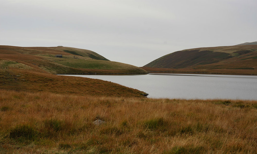
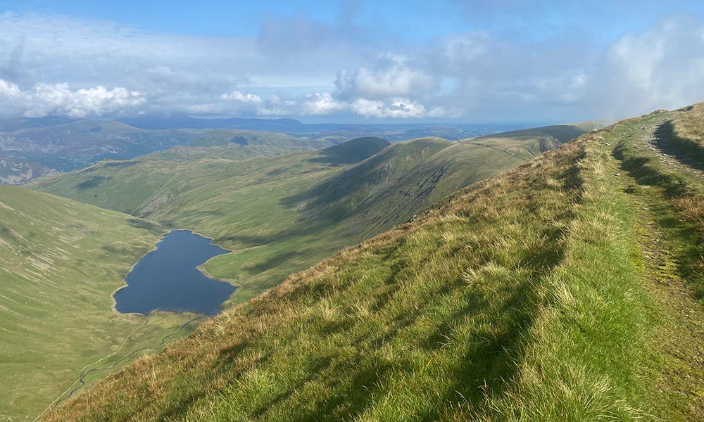
Burnmoor Tarn
Wasdale Head to Eskdale
9 miles / 11km
It was time to ascend again, this time over Eskdale Fell. I found myself running alongside a large body of water named Burnmoor Tarn. I did not expect to be so close to the water’s edge so I stopped to check my OS Maps app as I thought I had gone off course. The reflexion of the moon was so clear in the water it lit up the path I was running on. This was moorland running at its best!
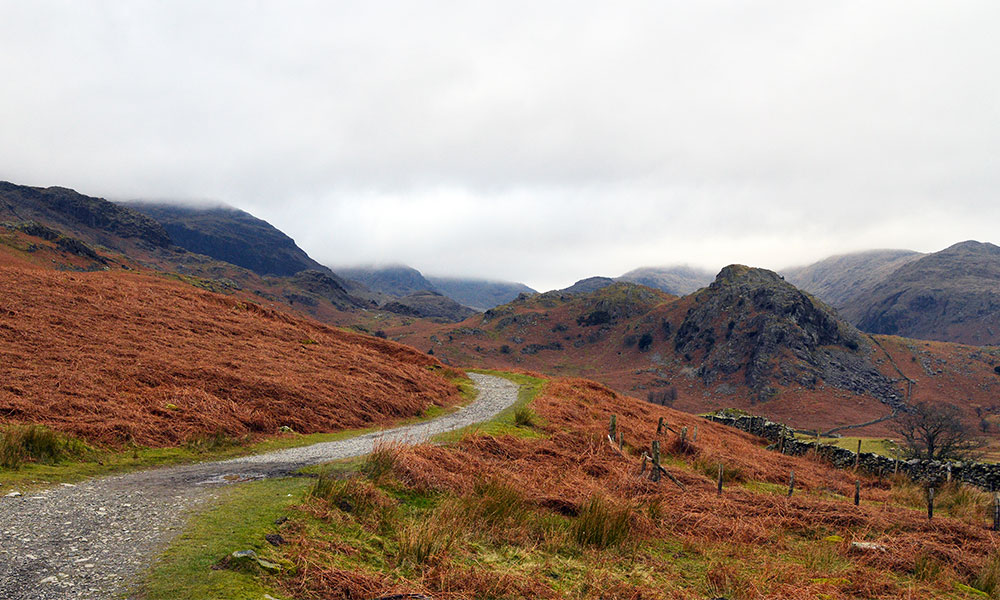
Walna Scar Road
Eskdale to Coniston
11 miles / 18km
Arriving in Eskdale saw the route transition from trails for tarmac as it followed quiet country lanes on a short detour to the next checkpoint, YHA Eskdale, where I enjoyed some hot pasta. It was the middle of the night but I had already completed a marathon. The trails through Eskdale were well-trodden and easy to navigate, giving my knees a short-lived rest. I was excited to head into the Cumbrian Mountains, a new place for me, and into Dunnerdale Forest.
Despite seeing the line of the surrounding peaks so clearly, I couldn’t quite work out which one was the Old Man of Coniston. The 13 Valleys takes a lower-level route around this iconic summit along the Walna Scar Road which made for some enjoyable running. The bright lights of Coniston came into view and I quietly pitter-pattered through the sleeping town to the next checkpoint.
Lake Windermere near Wray Castle
Coniston to Wray Castle
9 miles / 15km
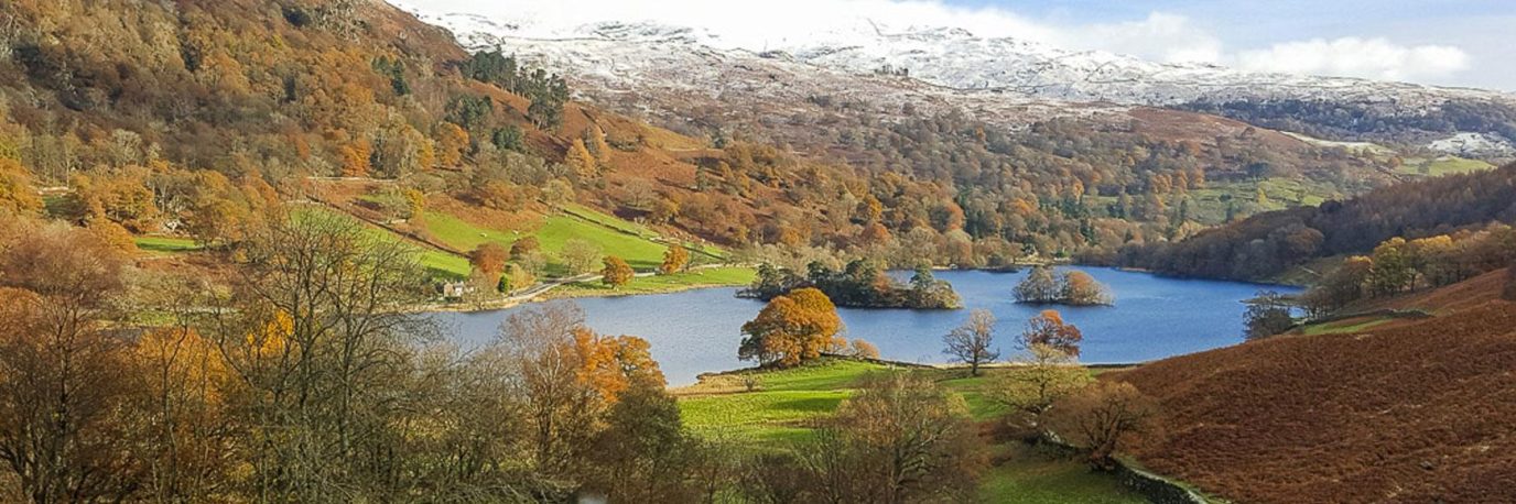
This relatively flat section of the route was much more undulating than I had expected. I followed Coniston Water to its north and into Monk Coniston Moor on beautiful forest tracks. It was beginning to get light and I could make out Esthwaite Water in the distance. It was so peaceful. I snuck through Hawkshead not wanting to disturb anyone just as the sun came over the horizon. Past Hawkshead, the route follows logging tracks which had become incredibly wet and muddy underfoot thanks to the previous week’s heavy rain.
It was a real struggle to cover ground but it provided some great entertainment amongst the group and we were slipping and sliding everywhere. As I reached the shoreline of Lake Windermere I was blown away by its size. Officially the largest lake in England, it was nice to explore its west side, an area I had never visited until now. The route follows hard-packed trails along the short with the lake to the right. I picked up the pace as I made my way around to beautiful Wray Castle.
Wray Castle aid station
Wray Castle to Sticklebarn
8 miles / 12.5km
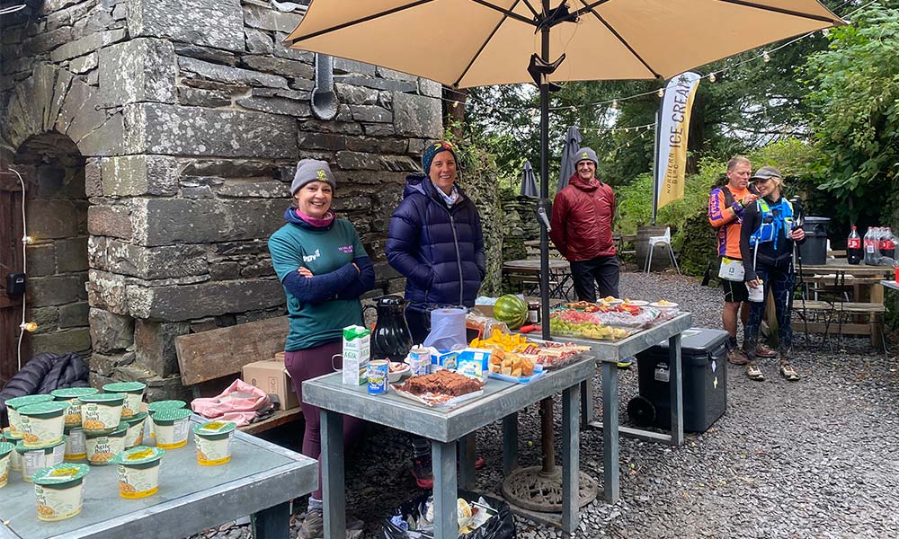
Wray Castle looks like something out of a movie. It’s a National Trust site and home to a wealth of facilities including Joey’s Café. It was early morning so the café was closed but we had the event’s wonderful checkpoint volunteers who had gone out of their way to bake brownies. It may have lingered far too long drawn to this magical place and its brownies! From here the 13 Valleys route to Sticklebarn is relatively easy going. Much of the route follows quiet country lanes, established footpaths and forest tracks. It was here I saw my first dog walker who was also enjoying the sunny Saturday morning.
The route re-joins the Cumbrian Way at Skelwidth Bridge which is home to an impressive waterfall and makes a lovely place for a picnic. From here the flat trail sticks close to the water’s edge, passing the unique stillness of Elter Water before continuing deep into the Langdale Valley. The Langdale Valley is one of my favourite places in the Lakes and even though it can be quite far to reach, it has a fine selection of campsites and pubs. Our next stop was the Sticklebarn check point for some much-needed food and drink.
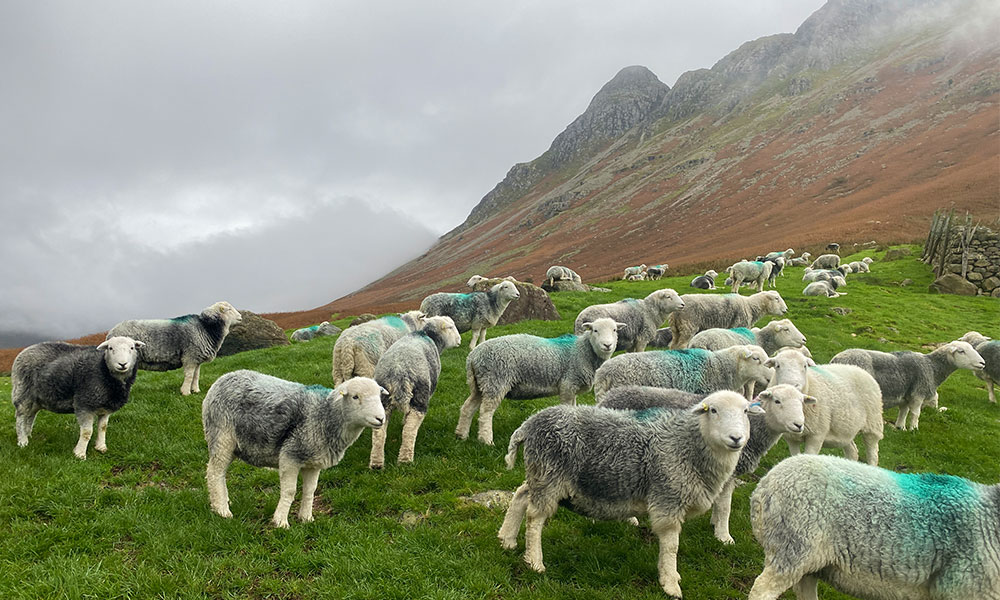
Herdwick sheep in the Langdale Valley
Sticklebarn to Rosthwaite
11 miles / 17.5km
It’s a long old slog over the Langdale Fells but one that’s worthwhile. The scenery up here is fantastic and Angel Tarn is a popular spot for a picnic. Sharing some of the routes up Scarfell Pike, the trail was busy on a fine Saturday morning but it was nice to say hello to people as I ran. I passed two more tarns as I descended into the valley taking a sharp right at Sty Head where the Mountain Rescue stretcher box is. The paths here are rocky but well-trodden and clear to follow. Once through Seathwaite Farm the route follows scenic country trails pass a number of rural farms before reaching Rosthwaite which is a delightful quaint English village.
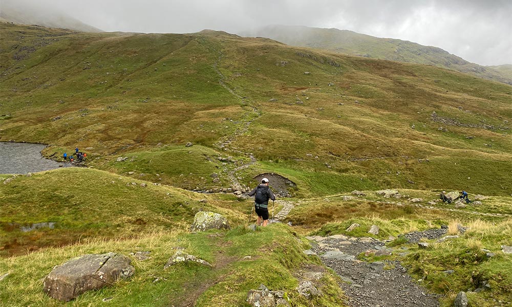
Running past Angel Tarn
Rosthwaite to Grasmere
8 miles / 13km
Back on the Cumbrian Way – a waymarked, more well-defined path – the route follows Stonethwaite Beck up into the Borrowdale Fells. In complete contrast to the Langdale Valley, the Grasmere Fells is incredibly quiet. So much so, I nearly had the place to myself. Up near Greenup Edge the route is rather exposed and it was here the heaven’s opened. Some of the event safety team had a shelter up there to make sure we were ok and to offer some welcomed support. Before you go over Greenup, take a look behind you over Stonethwaite Fell, the scenery is out of this world.
I was extremely focused on my way down into Grasmere, knowing that a set of dry clothes and a warm bowl of soup were waiting for me at the next checkpoint. The route down through Grasemere Common seemed to take longer than it should, which was probably due to the bad weather and the wet rocky paths underfoot.
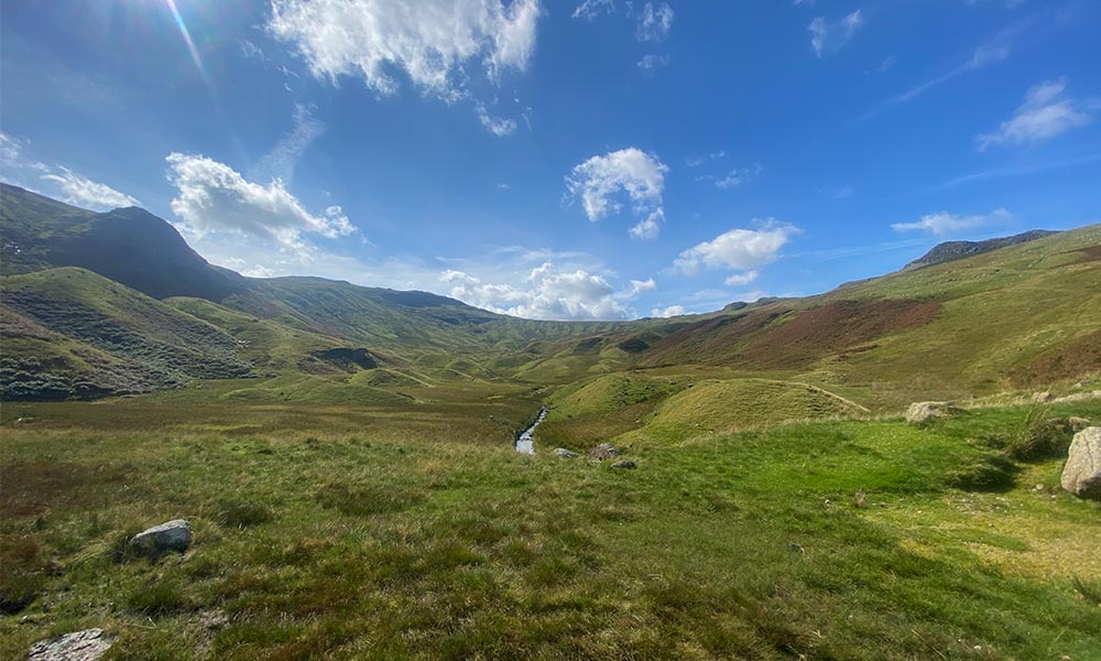
Grasmere Common
Grasmere to Ambleside
6 miles / 10km
It’s only 6 miles (10km) from Grasmere to Ambleside on a section of the route that is completely runnable. With a new lease of life, thanks to the volunteers and my crew at Grasmere checkpoint, I covered it in no time. The sun had just set so I welcomed tarmac with open arms. Running through Ambleside on a Saturday night was an interesting experience. Looking a pub-goers through passing windows, I wondered where I’d rather be and decided it was on the amazing, yet tiresome adventure I was on.
From Ambleside to Troutbeck
Ambleside to Hartsop
11.5 miles / 18.5km
Departing Watershead, the route makes it way up through farmland showcasing views of Lake Windermere below, until it reaches the village of Troutbeck. It’s a sleepy village, evident by the fact the local tearooms don’t open until 10am, but it’s a charming place. The route continues through the valley as far as one can go before climbing up to the beacon on Kentmere Common. It’s a short but steep climb and one that certainly gets the heart rate up. The Roman Road towards High Street makes spectacular running (or walking) and the trails are well-defined and easy to navigate. The views here are second to none. Descending to Hayeswater is a little trickier to follow but a bit of common sense will keep everyone on track. There’s always OS Maps if you loose your way.
During the 13 Valleys event, the bad weather route was activated and so I didn’t do this section of the route but I have been lucky enough to run and walk it before. The High Street continues to be one of my favourite vantage points to admire the beauty of the Lake District.
Views of Hayswater from the High Street
Hartsop to Glenridding
6 miles / 9.5km
It was at Hartsop check point where I felt an immense wave of exhaustion come over me. I had been awake for over 40 hours and running for 18. As usual, the volunteers perked me up by telling me it wasn’t too far to Glenridding and mostly all flat. I put on my emergency “survival playlist” my partner had made for me and set off singing my heart out to Lionel Richie.
I’ve enjoyed a couple of family holidays in Glenridding so know the area well but the 13 Valleys route took me to a completely different part of the nearby mountains. Instead of heading up to Helvellyn, which many people do, I the route follows the miners track towards YHA Glenridding, which happened to be the next checkpoint.
Sticks Pass
Glenridding to Threlkeld
9 miles / 14.5km
Slumped on the sofa with my face in my hands, I realised I hadn’t eaten much for most of the night. It was now 2:30am. I was joined a couple of cheery childhood friends from Sweden and we sat there munching on ready salted crisps. I knew the next section of the route was going to be tough. It was still raining and we were heading up to Sticks Pass. Luckily the path was easy to follow and although rocky, not too technical. A series of switchbacks took me over Sticks Pass which felt like I was on Mars or some faraway planet. Once again, I felt a unique sense of remoteness which was partly down to the fact I was unable to see the village of Legburthwaite until I reached the steep decent just before town.
It is an undulating 8km to Threlkeld on pleasant valley trails, much of it following St John’s Beck, which kept me topped up with water. At this point I struggled to find enjoyment on what would have been a delightful route if I wasn’t so tired and wet. My eyes kept closing so I resorted to walking, which turned a quick 8km into a long muddy slog.
Threlkeld to Keswick – 2 Valleys route
Threlkeld to Keswick
9 miles / 14.5km
I lingered for far too long at Threlkeld checkpoint enjoying a warm bowl of soup and a chitchat. By the time I left it was daylight and I felt reenergised and ready to tackle the finial 15km. I was excited to now be following the 2 Valleys route. My partner and OS Champion Sam Taylor had taken part in the event the previous day and thoroughly enjoyed it.
They were right, it’s a glorious route and would make a fantastic day walk from Keswick. This section is all runnable and you can see the path weave around the mountain. I was frustrated as by this point my feet had swollen up so much, I found it unbearably painful to run. I resorted to a fast walk.
Crow Park, arriving to the finish line
Arriving at Keswick was incredible. I had people shout my name and stop on the street to cheer me on. I was amazed at how many locals were tracking the event and spending their Sunday morning support the runners coming through. Soaking up my 15 minutes of fame, I powerwalked across the finish line in second (female) place.
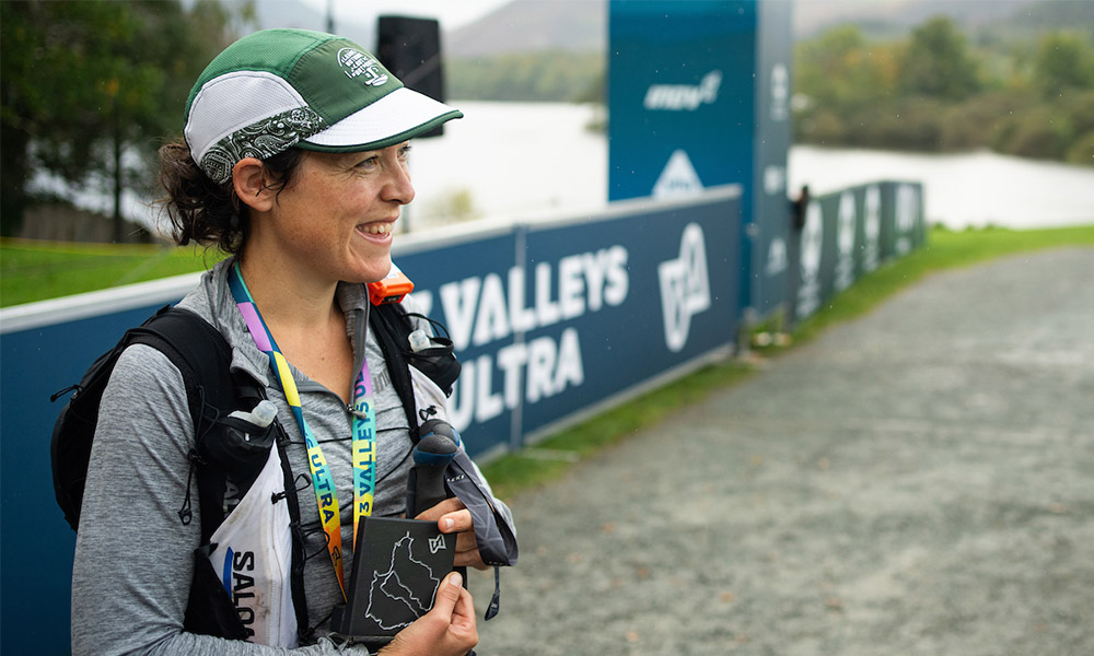
Helen from the OS Team – second female
The 13 Valleys Ultra is one I will never forget. It follows the most incredible route which truly takes in the very best of the lake district and I highly recommend taking on one of the four distances next September or, if you’re more of a rambler, walking sections of it yourself. With the help of OS Maps on my phone, I was able to self-navigate my way around – much of it being in the dark – and the 13 Valleys paper map offered a vital backup in my pack, not to mention a great planning tool and souvenir!