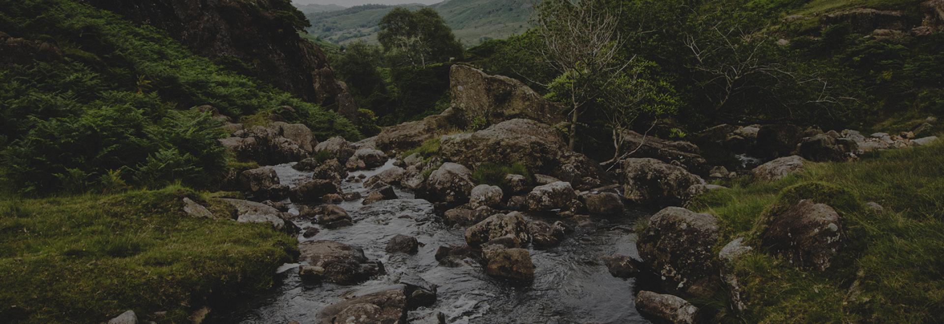
The Lake District National Park is the largest National Park in Britain. Famed throughout the world for its stunning landscapes, sprawling fells and beautiful waterways, it has inspired poets, writers and artists alike for almost three centuries. If you have an adventurous streak or just a love of the great outdoors, then you must pay this place a visit.
Of the many towns and villages in the Lake District, Keswick is widely regarded as the adventure capital. Here you will find something for everyone, be it bars restaurants or outdoor shops. There are also some pretty good walks that can be started from here. I have selected three that offer amazing views for very little effort. All can be completed in half a day or less. These walks can be enjoyed by all ages at any time of the year. Each season brings its own stunning vistas.
Walk this way….
Catbells – 5.15 km
Catbells is probably the most recognisable fell in the Lake District; it is also the most popular. Sitting on the Western side of Derwentwater, its profile entices and invites the adventurer within us to stand atop its shapely summit.
If you want to squeeze more out of this adventure then why not catch the Keswick launch and sail across to Hawse End jetty. For the purpose of this walk our route starts at the small parking area at the foot of Skelgill Bank. From the base head up the path in a southerly direction until you reach the top of Skelgill Bank. The path is quite steep in places, but is manageable at a leisurely pace. As you gain height take the time to look back towards the towering hulk of Skiddaw behind you. This is a very popular walk and you will find walkers and fell runners of all ages enjoying this beautiful part of Lakeland. After reaching the top of Skelgill Bank there is a flat plateau walk for around 1km in distance. This is a good place to stop and enjoy a hot drink from the flask you have undoubtedly packed in your rucksack.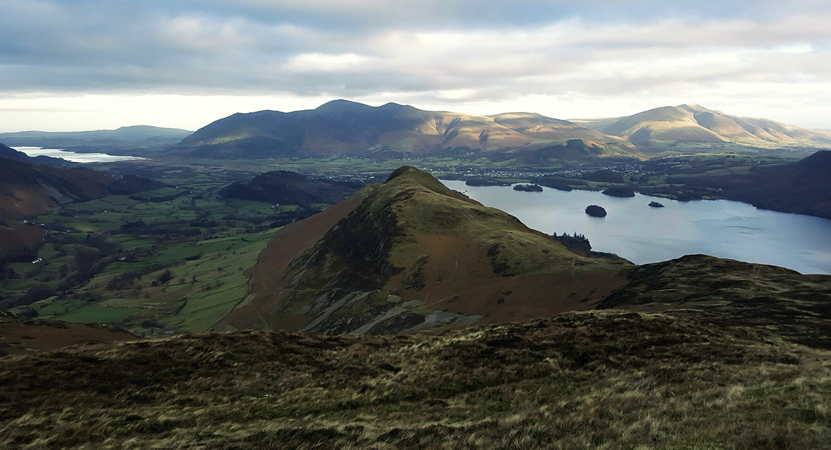
Whilst enjoying your brew, look down to the West at Newlands Valley and you will see Little Town. Beatrix Potter fans will know Little Town as home to Mrs Tiggy-Winkle. Once you have finished your drink and reminisced over your childhood, it is time to tackle the summit of Catbells. The climb to the summit can look quite imposing but is not as steep once on it. There are a few sections (particularly towards the top) that are quite rocky, and you may want to use your hands as well as feet to scramble up these sections.
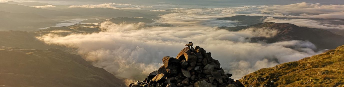
Before you know it you will be standing at 451 metres on the summit, marvelling at the 360 degree views on offer.
Catbells according to guidebook writer and Lakeland legend Alfred Wainwright is “One of the great favourites, a family fell where grandmothers and infants can climb the heights together, a place beloved”


Take a look around at the diverse mix of people you will likely to be sharing the summit with and it is hard to disagree with AW. It really is a great family fell.
The eagle eyed adventurer may also spot some disused mineshafts along the way, as Catbells also has an interesting copper and lead mining history. More of this can be explored back in the safety of Keswick Museum!
After spending some time on the small rocky summit follow the path from the summit and drop down to Hause Gate. From here you turn right and head down in to Newlands Valley, or left from here will take you down to the woodland walk along the shore of Derwentwater (my preferred route). Both options will take you back to the parking area or Hawse End Jetty.
Latrigg Fell – 8.48 km
Latrigg is one of the smallest fells in the Lake District. In truth it is easily overlooked in favour of the loftier fells around this area, namely the Skiddaw range which this forms the Southerly end of, but what Latrigg lacks in height and stature, it more than makes up for with its views!
What I really like about this walk is its accessibility from the centre of Keswick. However there is parking available at Gale Gill at the Northern end if you just want a quick hike to the summit. For the purpose of this route I have started from Keswick to extend the walk to around 8km. Starting on Main Street head North Westerly and turn right on to Crosthwaite Road. Follow this road as it bends to the left and you will arrive at Brundholme Road. Take a right here until you reach a public footpath approx 300 metres in.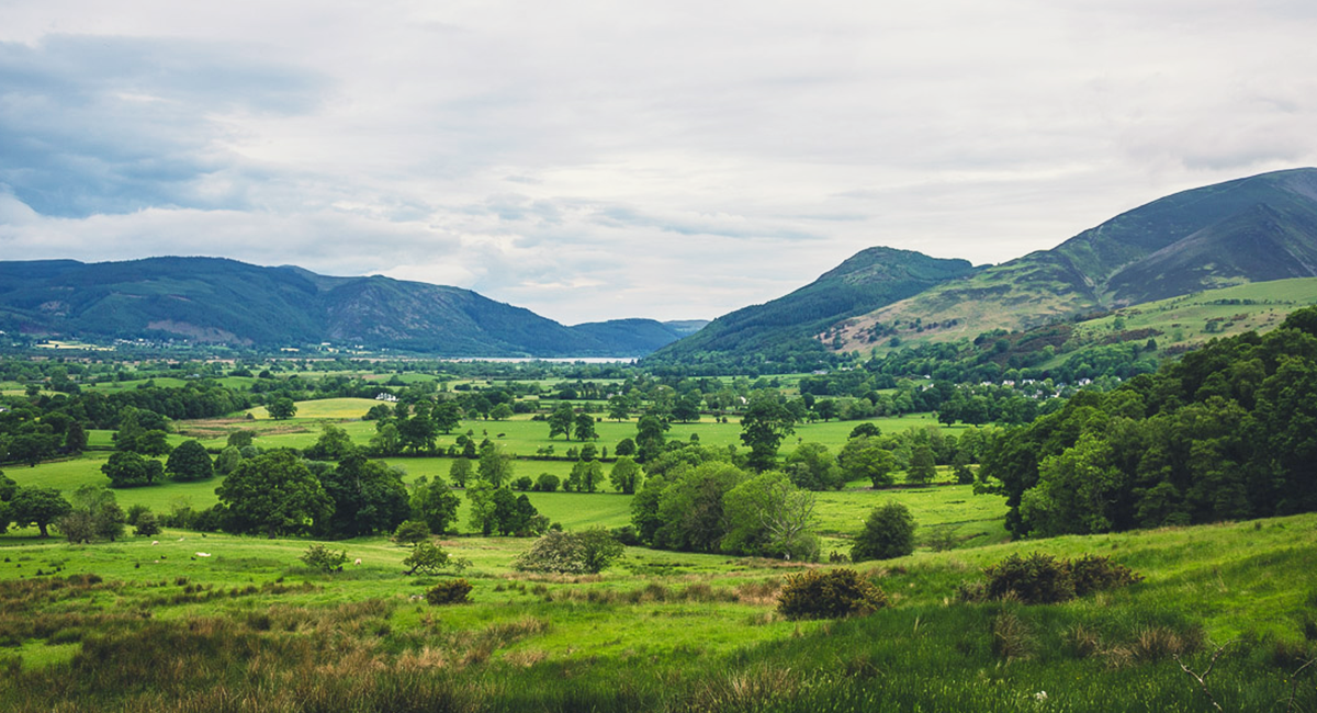
Take a left on to the footpath and head North towards the woods. Head over the footbridge that crosses the A66 dual carriageway and you’ll soon leave the hustle and bustle behind and enjoy the tranquillity of Latrigg Woods. Keep an eye out for Roe Deer as well as all the other wildlife that call this place home. The path is well defined with handy signposts along the way. On leaving the woods the path then zigzags slightly before gently ascending to the summit. Take time to admire the views to the West of Bassenthwaite Lake, and North to the mighty Skiddaw range


Within an hour or so of starting this walk you’ll find yourself on Latrigg summit, enjoying fine views over Keswick, Derwentwater and the North Western Fells. For a short walk and only a little effort on the climb tot he summit, the views from here are some of the best in Lakeland, and that is why I always recommend this and Catbells as perfect introductory walks to anyone wishing to experience the beauty of the Lake District but not confident or perhaps fit enough to tackle the higher more mountainous fells.
Just below the summit is a lovely wooden bench perfectly placed for you to sit and admire the view over a cup of tea. The return leg of this walk is a direct reversal of the way up, taking you back into the centre of Keswick for the best fish and chips money can buy!
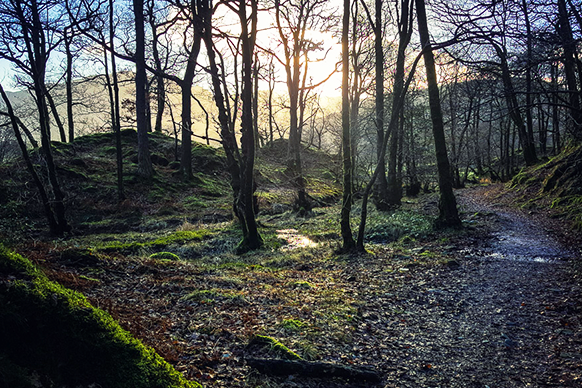
Borrowdale Woods – 5.92 km
This walk will require transport to the start point near the picturesque village of Grange. Why not add to the experience and take an open top bus from Keswick and enjoy the views of Derwentwater and Borrowdale Valley along the way. Conveniently this walk starts at a bus stop! Now before I go any further I feel it is my duty to forewarn you that this walk will take you in to officially the wettest part of England!
Still reading? Good, I will go on. Do not let this title put you off though, as being the wettest part of England does bring some benefits, namely the lush green vegetation and vibrant wildlife that thrives here. This woodland walk has shades of Narnia or The Shire from Lord of the rings. You will not find any Hobbits or Tree creatures here, but there was a man who lived in a cave once…I will come back to the Professor of Adventure shortly!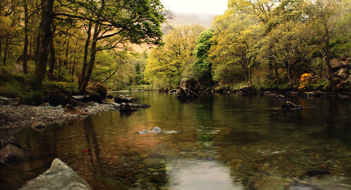
So starting from the footbridge that crosses the beautiful River Derwent, head in to the village of Grange until you come to a little cafe/coffee shop opposite the village church. Here you will come to a single track road that leads to Hollows Farm. Turn left at a fork in the path that is signposted Castle Crag. You will see the farm campsite to your right. Continue on the main path with the River Derwent on your left hand side as you head into Dalt Wood and Low Hows Wood. It is here that you will get your first taste of the lush vegetation I mentioned earlier. Take time to stop at the river here and feed the ducks that frequent the shoreline, or let the children skim stones along the flat smooth water (away from the ducks of course). I personally have many happy memories of walking these woods with my children when they were young. I quite often go back alone and reminisce. When the wind drops I am certain I can hear my children’s laughter in the trees.
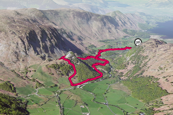
The path splits away at the bend in the river and you can really take any option you want from here but I prefer to skirt the river all the way along the woods as the scenery on this side is simply breathtaking!
When heading through the woods, after roughly a kilometre you will notice a faint path that traverses the fell Castle Crag on your right. If you take a slight detour up this path you will come across a very interesting cave system. Interesting for the fact that Millican Dalton, The self styled “Professor of adventure” made this place his summer home in the 1920`s and stayed for the next 50 years. Millican would catch fish from the River Derwent and cook them outside of his cave on a fire pit. He made a small living from taking people out on his makeshift raft, and on climbing adventures on the nearby crags. Speak to any of the locals here and they will all have a tale to tell about this eccentric man! If you do visit his cave, look out for his carvings on the entrance wall. I will not spoil it by disclosing what they say, but rather go and see for yourself.
After visiting the caves if you choose to do so, simply retrace your steps back down to the main path and continue on the riverside path. On leaving the woods you will notice a fork in the river as it splits off into Stonethwaite Beck. At this point turn right and ascend the path over Lingly Bank following the wooded tree line. From here you have the option to continue up to the summit of Castle Crag at 290 metres, or drop down to Broadslack Gill and follow the path back into the woods. A point to note is that if you do decide to tackle the summit of Castle Crag, although not particularly high, the path to this summit is an old slate quarry and quite difficult underfoot, so please do take care here.
Following the path back to Broadslack Gill will return you to the fork in the river (the ducks will still be there), and from here the return journey is a reverse of the route in.
If you have time before the bus arrives, do stop at the little cafe for a cream tea. It is a perfect end to a lovely little walk.
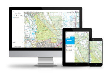
Get started with OS Maps
OS Maps is the digital mapping application from Ordnance Survey. Use the web version on your desktop to discover or plot routes, and then print to take with you. You can also use the smartphone app to follow and record routes when you’re out.