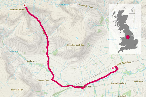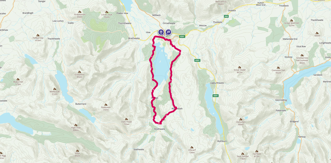
Derwent Water is one of the most picturesque areas of the Lake District, but at the time I went I had to carefully plan a route to avoid recent flood damage.
NY 264 235
The first half of the walk follows the left hand side of Derwent Water along the Cumbria Way to Rosthwaite. This is all signposted, although we decided to leave the waymarked path at several locations to shorten the route. It was a very wet day and the dry pub and roaring fire of the Scafell Hotel in Rosthwaite was too tempting to delay! If, like my companions, the weather proves too much you can catch a bus back to Keswick from here.
I, however, found that fortune (or rather sunshine) favour the brave and continued the walk up Brund Fell over to Watendlath. The normal bridge over Watendlath Beck was closed due to the flooding however there was a replacement bridge in place.


15.1 km
Follow the Beck up to Thwaite House. As mentioned above, this bridge was severely damaged when I completed the walk in February 2016 and it was necessary to have a wee paddle to reach the other side of the Beck. Continue on through Moss mire coppice to Lodore Wood.
The next bit of the walk follows the road until you cross Ashness Bridge. Then take the next footpath to your right. Follow the lower footpath for 1.3km until you enter Great Wood. After 300m in the trees, look out for the track and footpath to your right which is signposted for Walla Crag. (Ignore the distances on the sign post as these are for a different circular walk of Walla Crag.)


24.5
Follow the footpath until you reach Castlerigg, then turn left down towards Springs Wood and back to Keswick.
24.0 km NY 264 235
24.0 km / 15 miles