Which are Britain’s most popular National Parks?
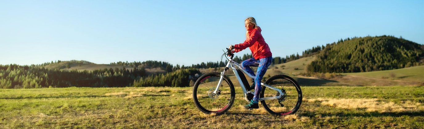
When OS Maps users are out and about, a lot of them like to record their routes. In 2024 there were two million walking routes, 291 thousand cycling routes, 256 thousand running routes, 13 thousand horse riding routes and 12 thousand paddling routes created.
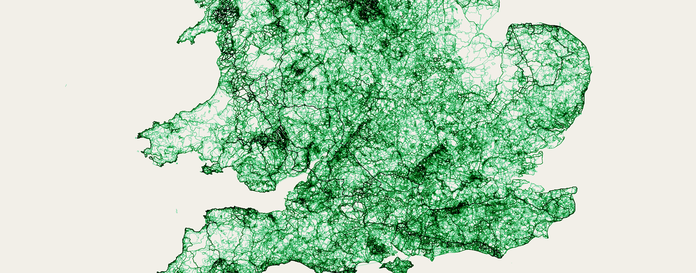
Our database specialists decided to take all those routes and lay them on a single map, creating a huge network showing the most popular paths and areas. The darker the line, the more routes there are!
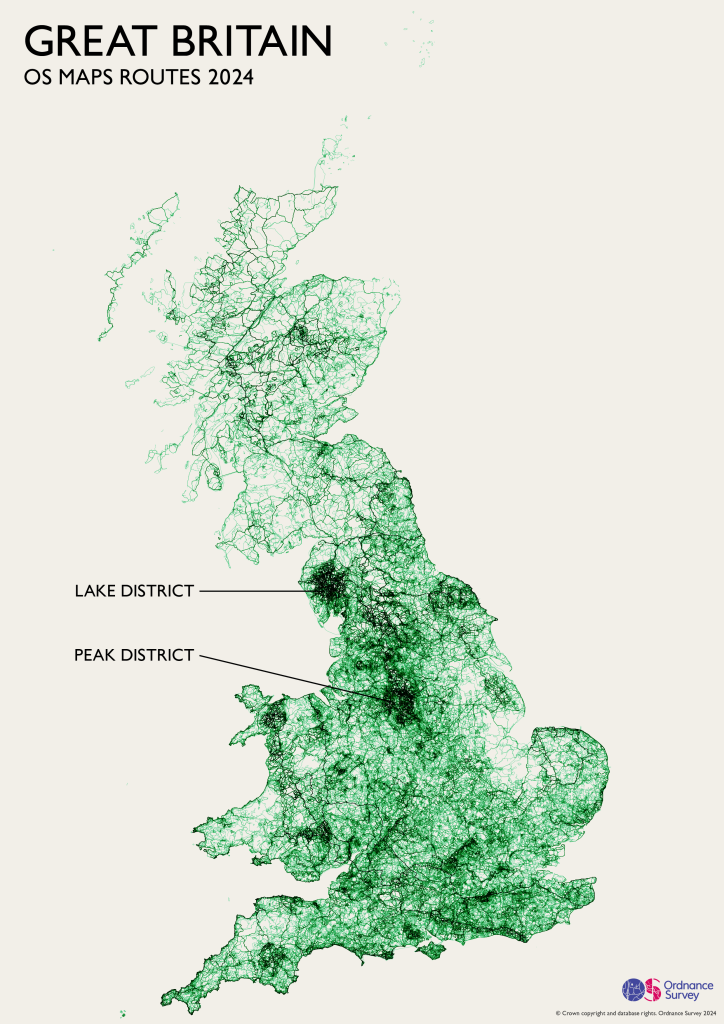
Our database enables us to create a list of the most visited areas of Britain by walkers, hikers, cyclists, runners, paddlers and riders. With this data we can give you the definitive answer on which is the most popular National Park in Britain according to number of routes created in 2023, but which is your favourite? Have you visited all 15 of Britains National Parks?
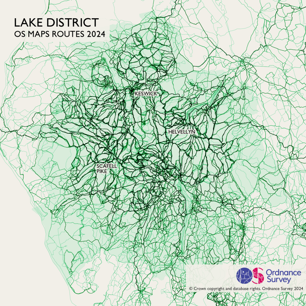
1. The Lake District National Park
The Lake District is the most popular National Park in Britain. It shows the highest density of routes, especially around the highest peak in England, Scafell Pike. Keswick, one of my favourite towns and home of the Keswick Mountain Festival is also a key nexus for many walking routes. Total routes – 278,467.
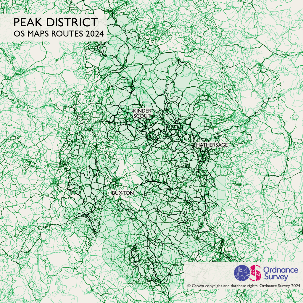
2. The Peak District National Park
The Peak District, is heavily crossed by trails, both popular and less often used. The main focus is Kinder Scout, Hathersage and the Edale valley between them. With large cities all around the Peak District it’s no wonder this area is such a popular escape. Total routes – 144,327
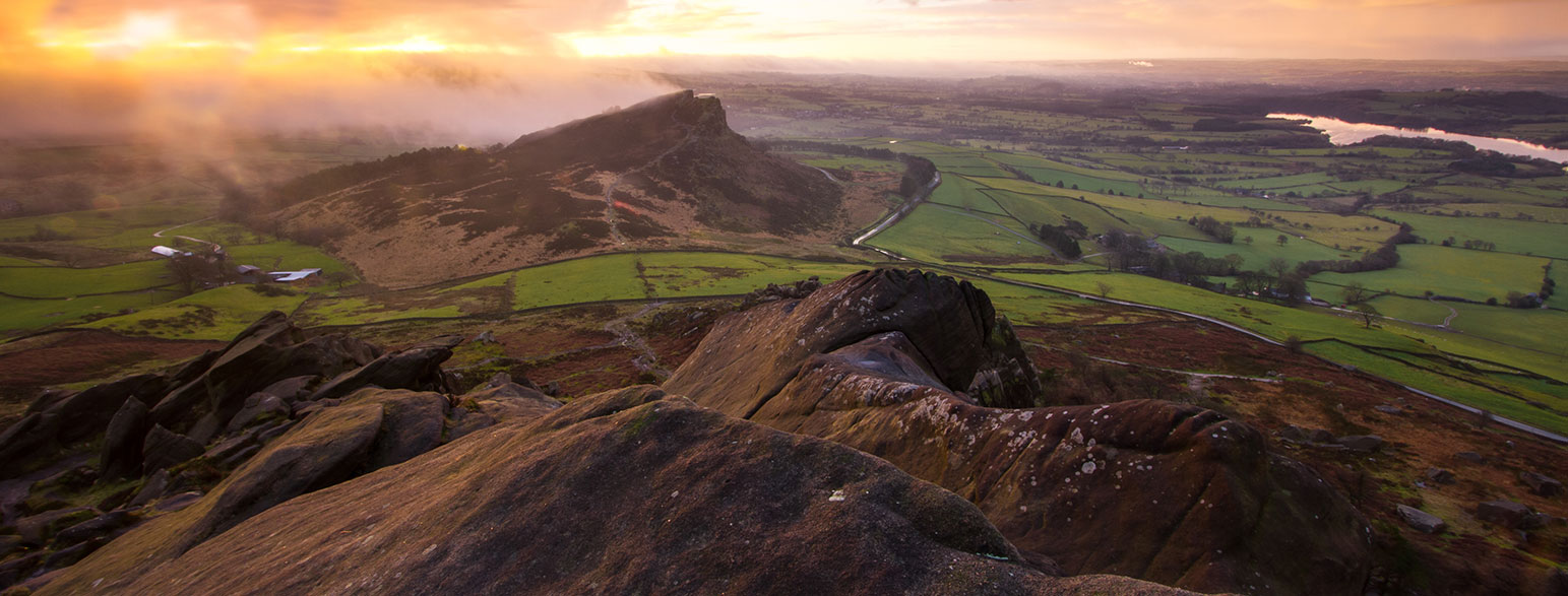
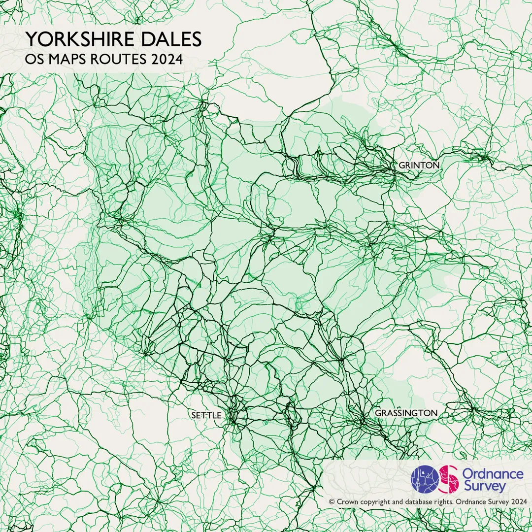
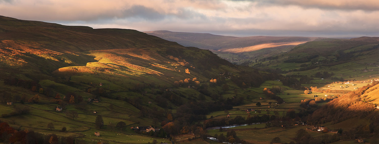
3. The Yorkshire Dales
The Yorkshire Dales comes in third, with its rolling hills, picturesque villages, and stunning limestone formations, it’s no wonder so many people have been exploring. The Three Peaks Challenge is very popular as is the route to Malham Cove. Total routes – 73,744
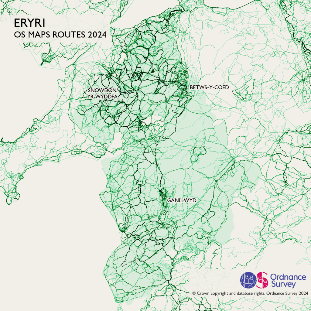
4. Eryri National Park (Snowdonia)
Moving north, Eryri (Snowdonia) remains a key focus for many walkers, with popular walking routes over the whole range. If you’re interested in walking this area you might want to start with Yr Wyddfa, the highest peak in England and Wales.
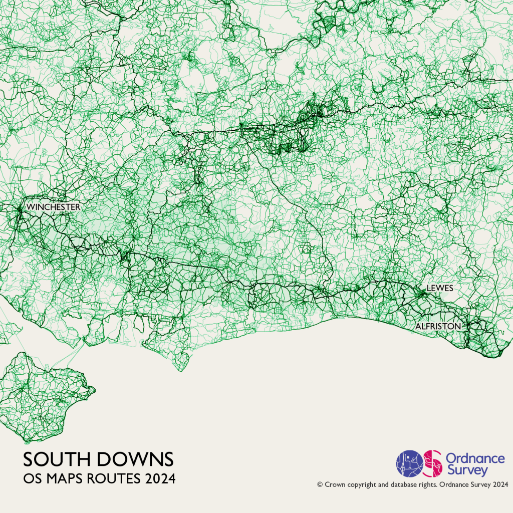
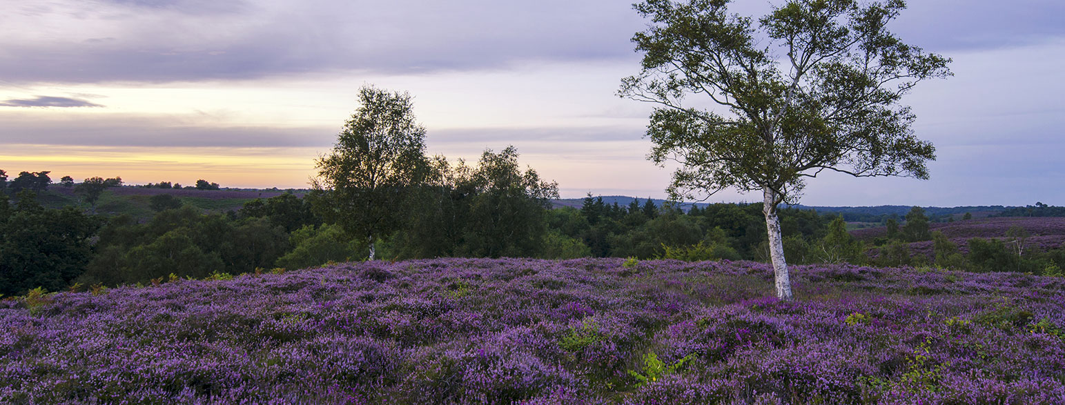
5. The South Downs
The South Downs is one of my favourite areas to walk. While this map looks crowded, there’s such a choice of trails you can often find a route where you will only see a couple of other people in a morning.
The main artery you can see running east-west is the South Downs Way, and ancient path that became one of the first National Trails.
In Southampton you can see the Solent Way, while at Keyhaven some hardy souls have recorded routes paddling across the busy Solent to the Isle of Wight. Total routes (53,009)
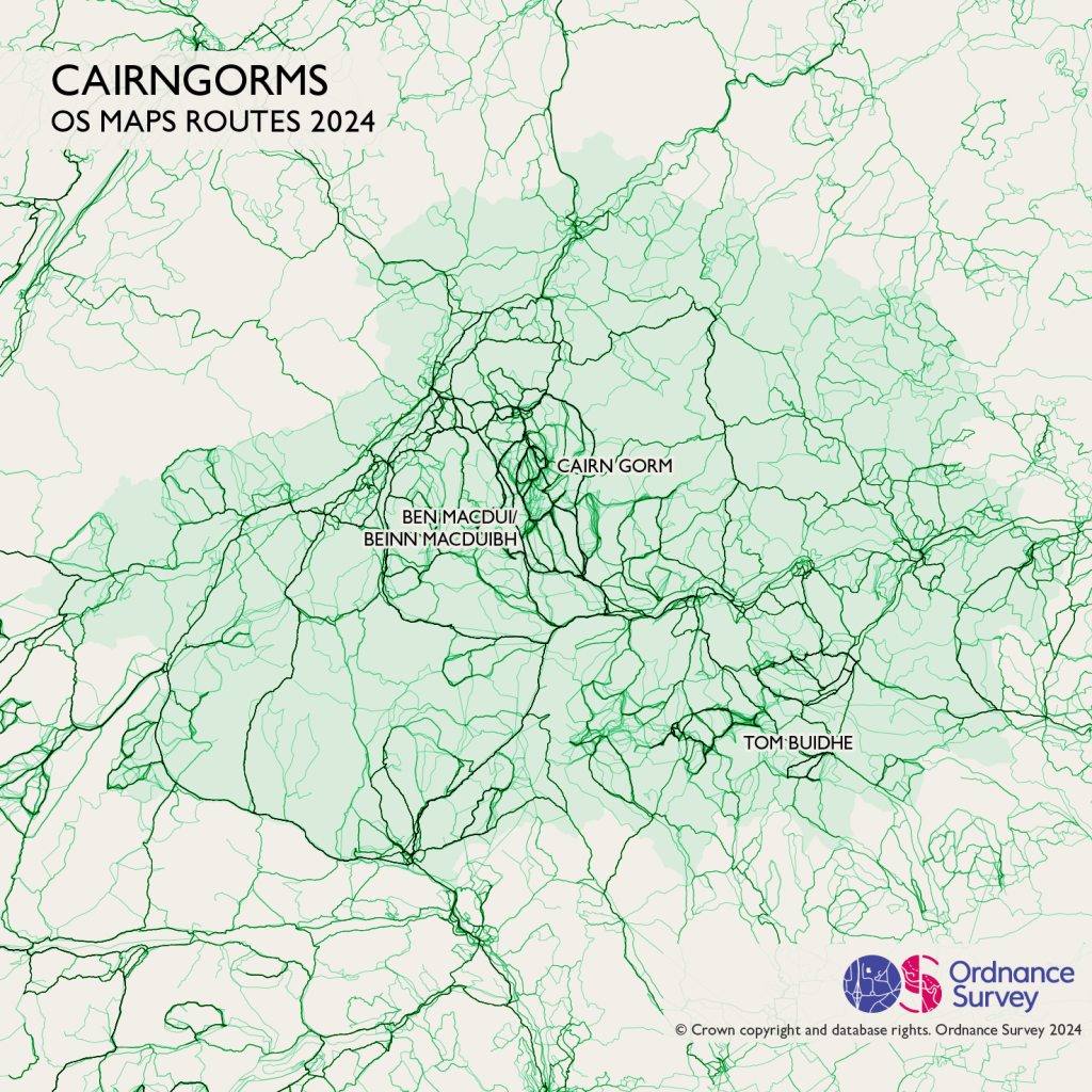
6. The Cairgorms National Park
The Cairgorms is all about the peaks, with Cairngorm, Ben Macdui and Cac Carn Beag all popular. Want to get away from everything? Head to areas like Creag Dhubh and Gleann Eanaich, with very few recorded routes (for experts only!) Total routes 50,239.
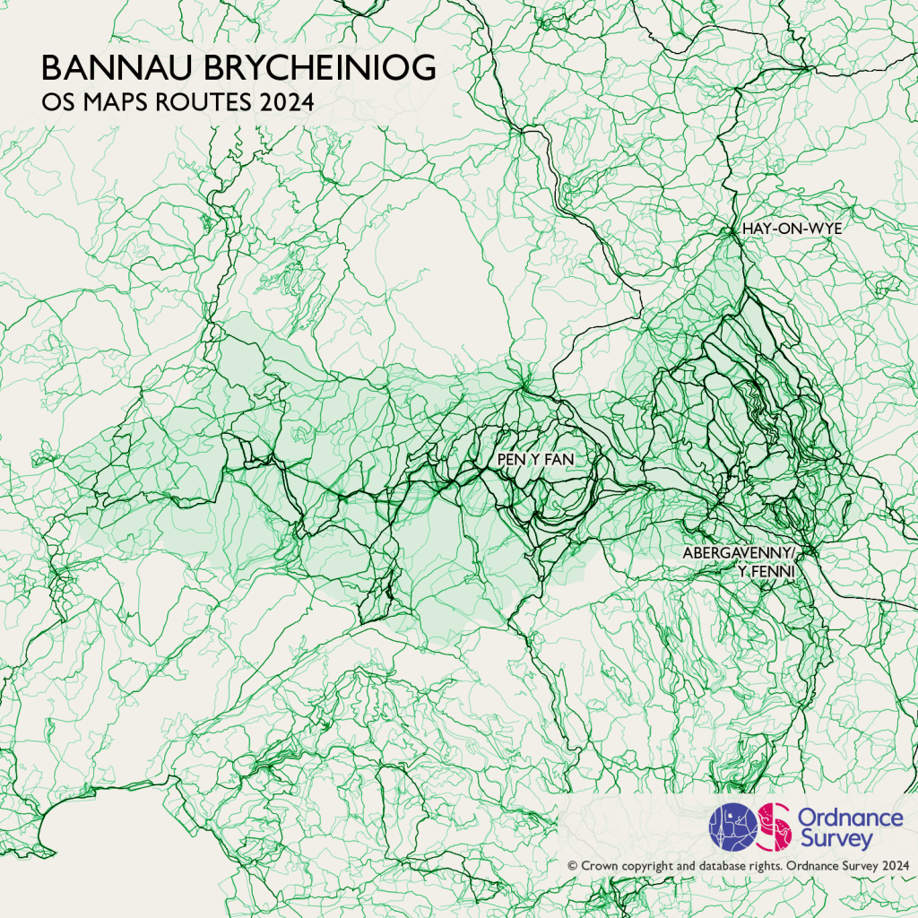
7. Bannau Brycheiniog National Park (Brecon Beacons)
Moving to Wales, Bannau Brycheiniog (Brecon Beacons) has it’s most popular routes in the Black Mountains above Y Fenni (Abergavenny). If you were looking for quieter routes the hills above Aberhonddu (Brecon) is much less popular, but watch out for the Sennybridge military training area. Total routes – 50,089.
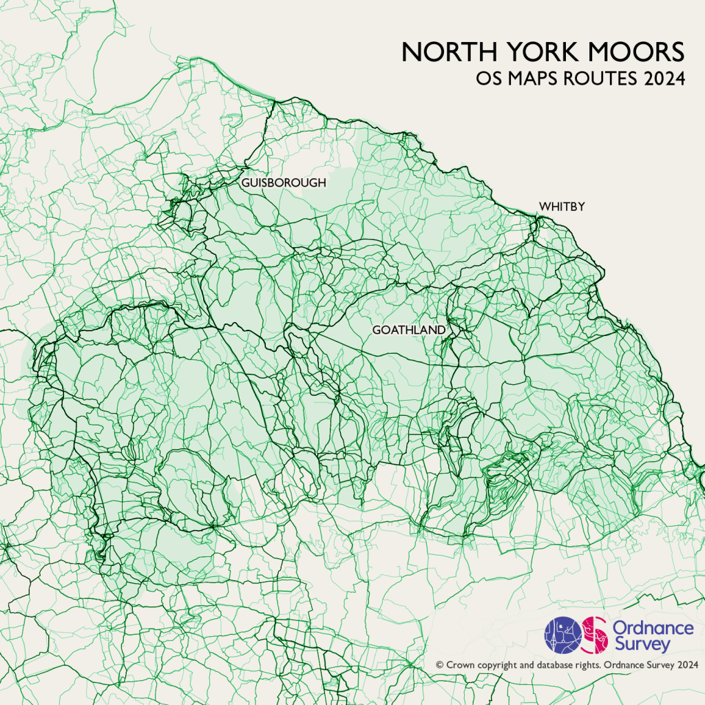
8. The North York Moors
Criss-crossed with paths, the North York Moors and Cleveland Hills are popular areas for walkers looking for more challenging routes. Famous peaks such as Rosebury Topping attract many visitors summer and winter, looking for views over the beautiful landscape. Total routes – 37,157.
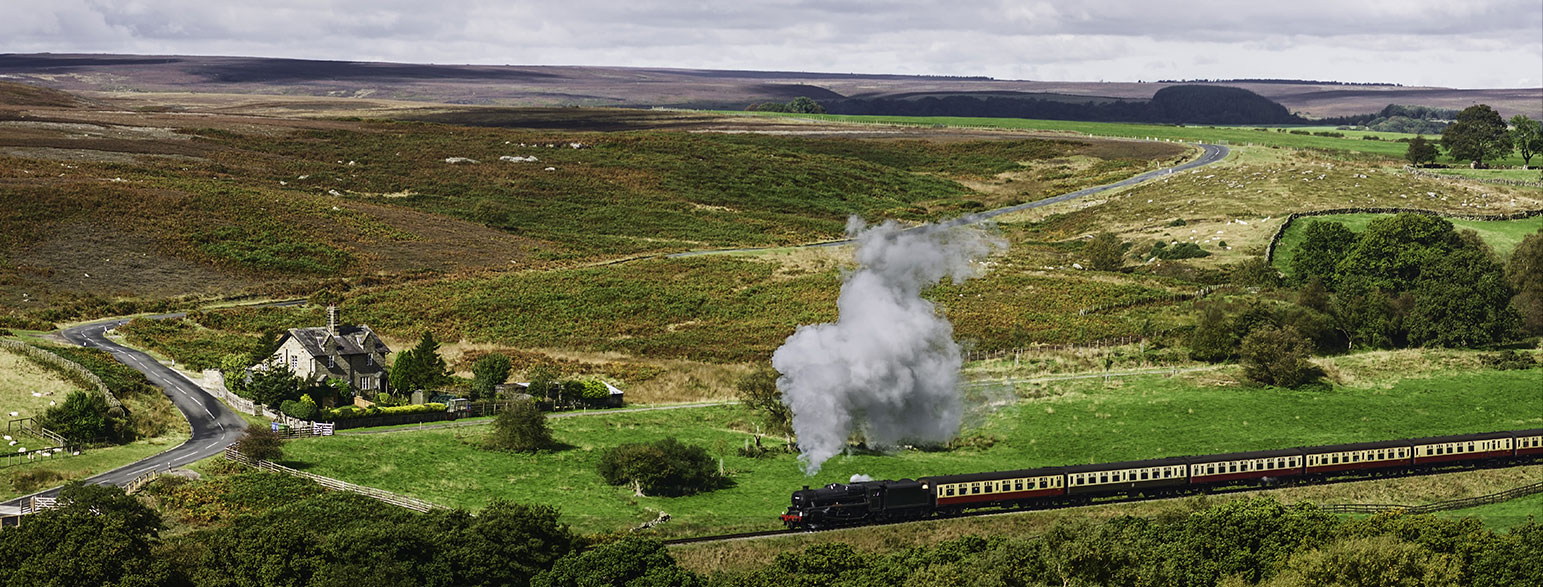
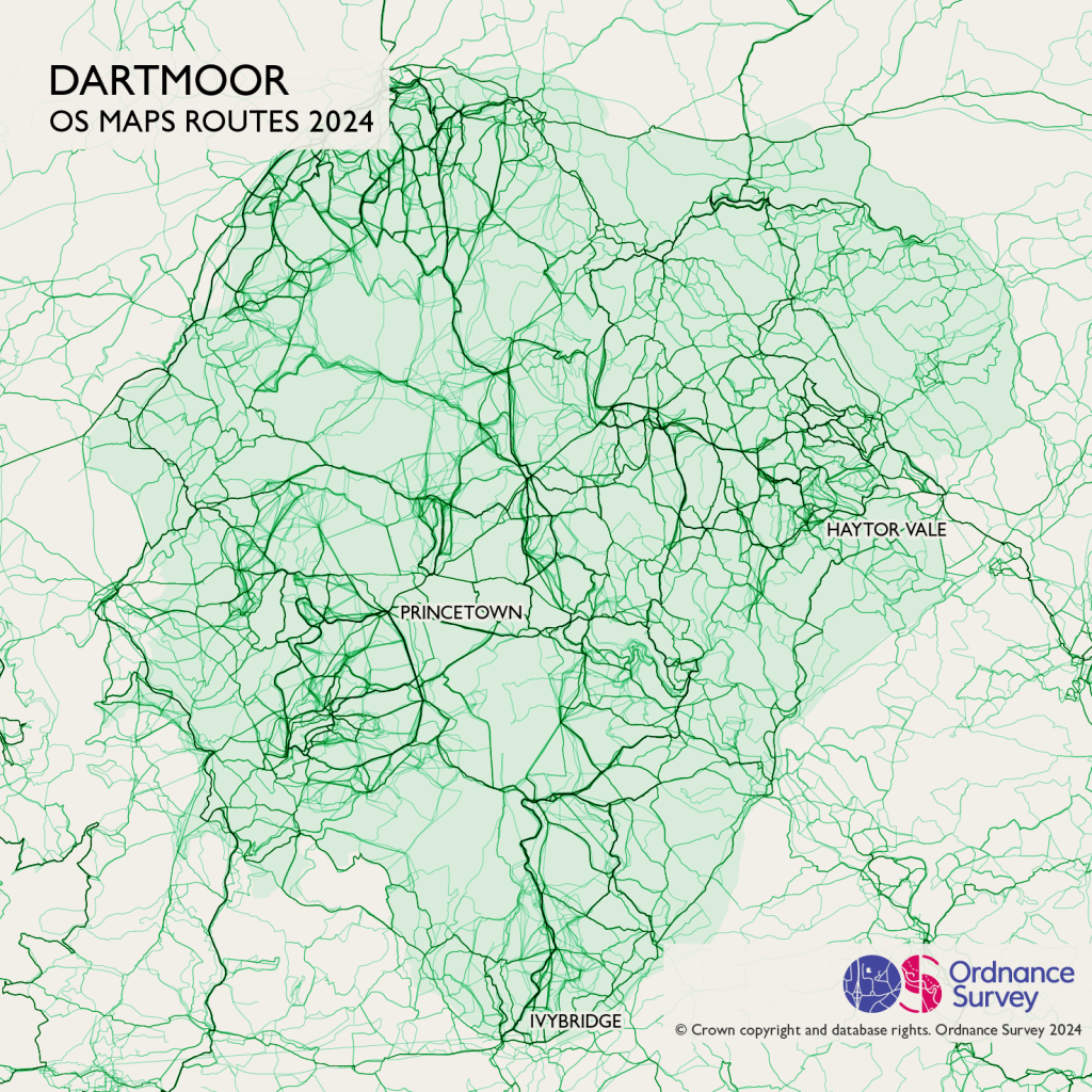
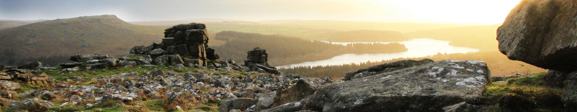
9. Dartmoor National Park
Dartmoor is a little more accessible than Exmoor, with paths and cycle trails across the whole National Park. It’s also popular for wild camping. Lots of the walking routes here are based around one or more of the Tors, with events like the Ten Tors Challenge. Total routes – 36,654
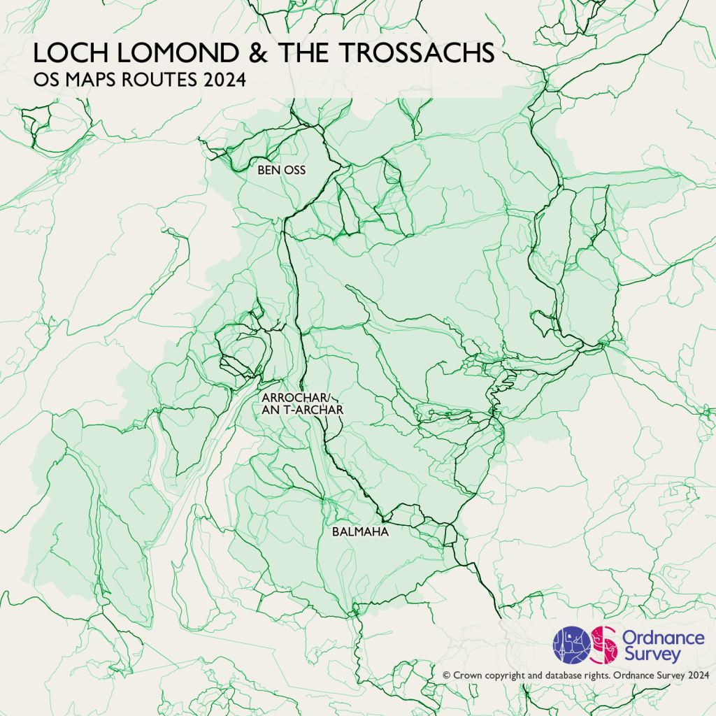
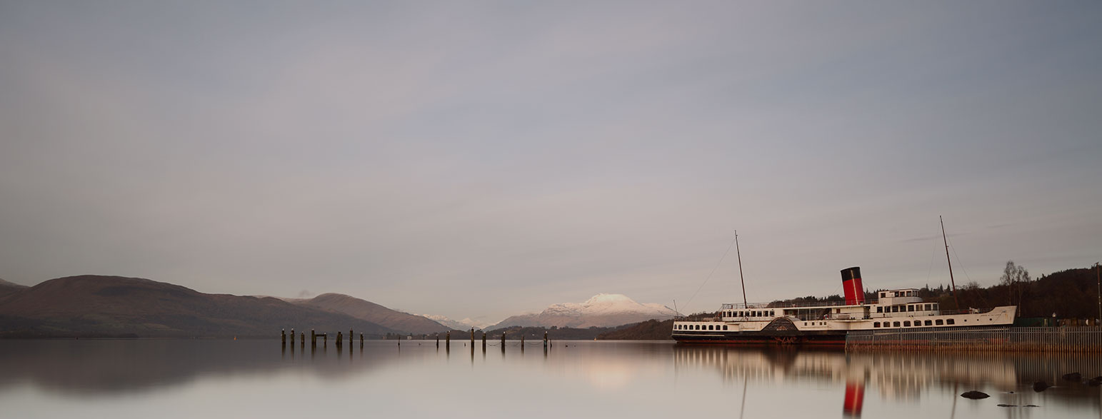
10. Loch Lomond and The Trossachs National Park
Loch Lomond itself is popular for all forms of boating, while the area around Arrochar and Beinn Ime is popular with walkers. The West Highland Way heads north into the Grampians, although the main route itself mainly sticks to the valleys. Total routes – 25,693.
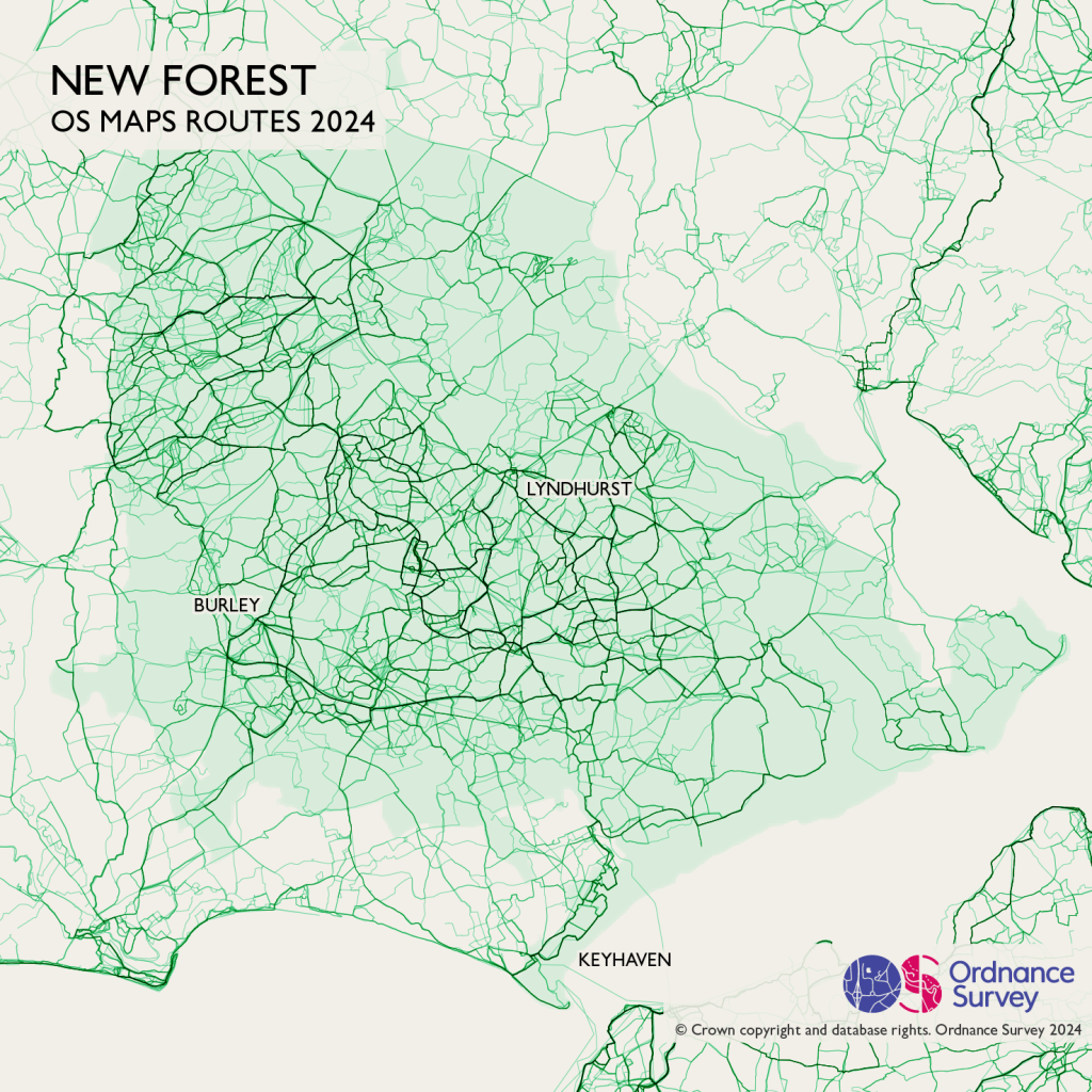
11. The New Forest National Park
In the New Forest, the steeper terrain to the west gives way to much more gentle hills, making the area popular with cyclists. Much of the area is crossed by tracks and paths, which walkers and riders share with the famous New Forest Ponies, as well as cattle and donkeys. Total routes – 21,997
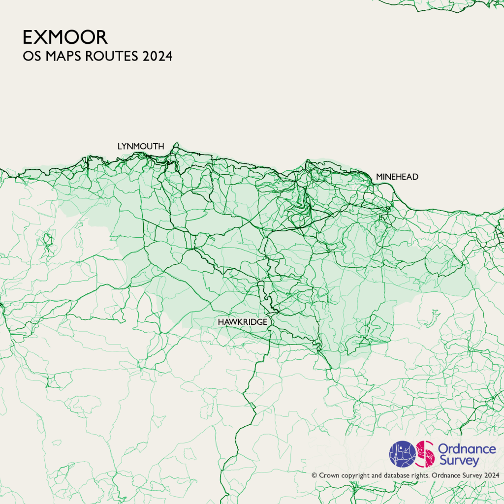
12. Exmoor National Park
Exmoor is a wild, tough landscape. The most popular routes are the South West Coast Path, but some take on the Two Moors Way, crossing from coast to coast. South-west of Lynmouth there’s a popular area around Wistlandpound Reservoir, with some lovely views and picnic spots. Total routes 15,213
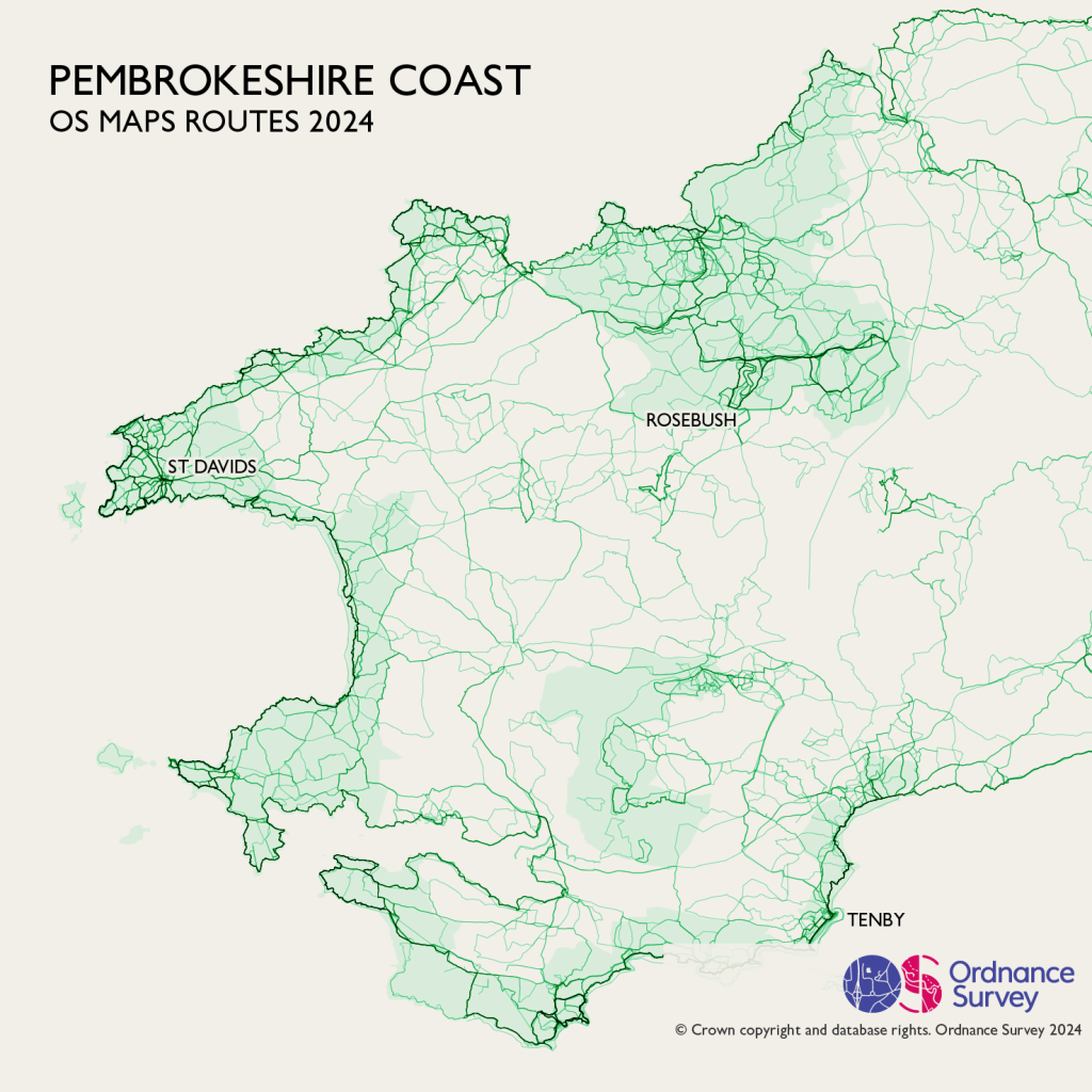
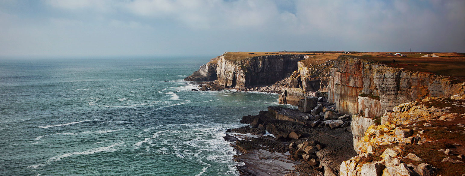
13. Arfordir Penfro (Pembrokeshire) National Park
Pembrokeshire is all about that coastal path, as it winds it’s way over rugged cliffs and sandy beaches. Lots of people take inland paths from Newport, perhaps looking for one of the many castle ruins in the area. Total routes – 13,983.
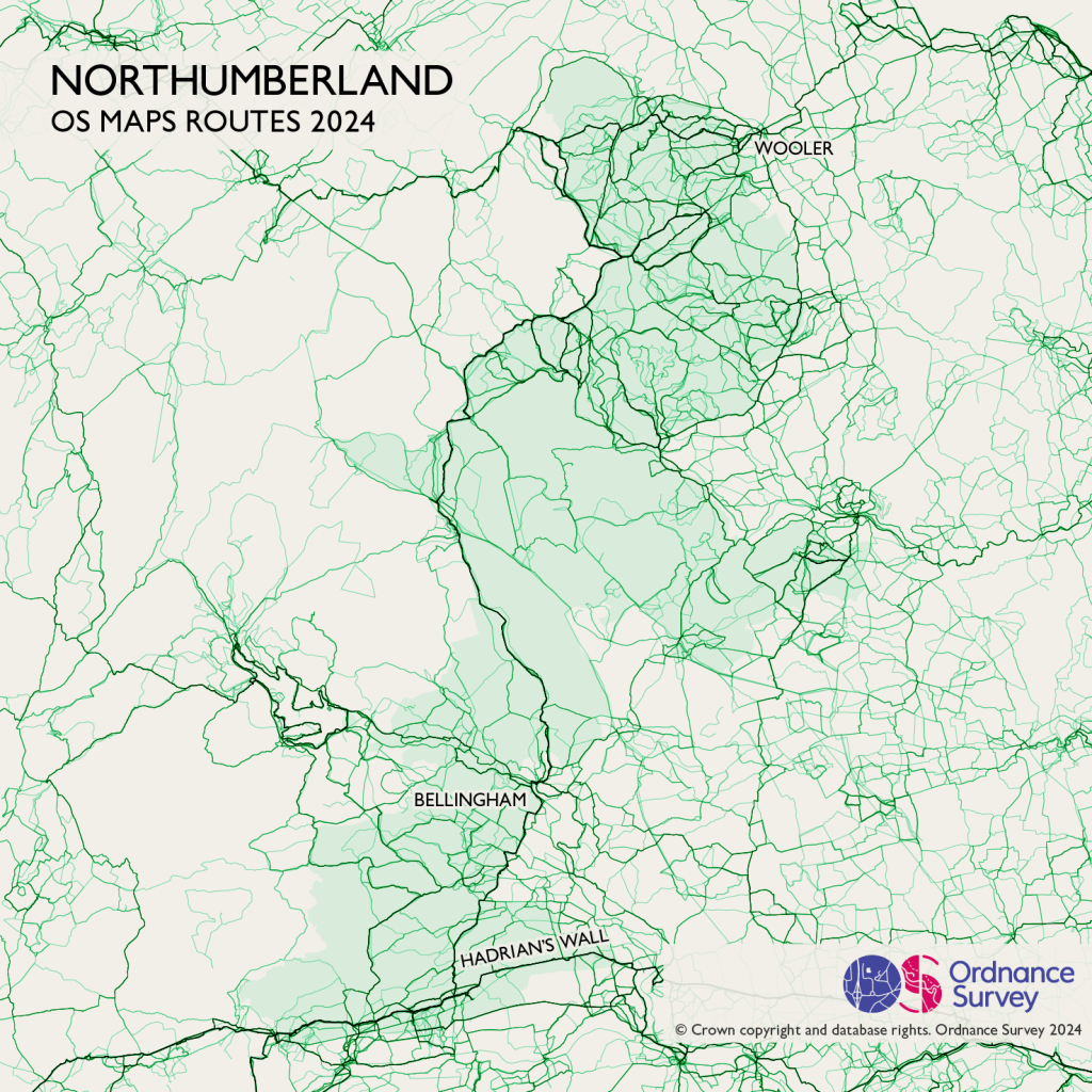
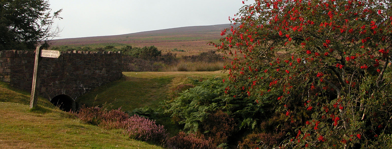
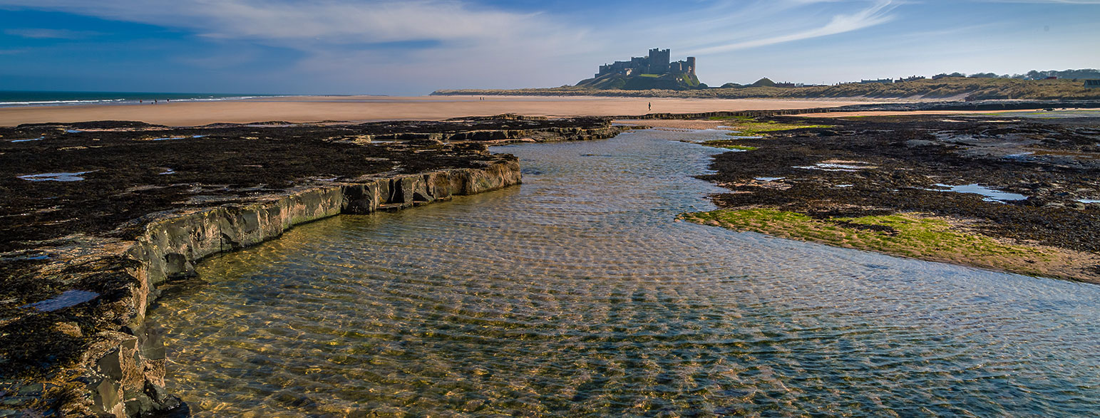
14. Northumberland National Park
Northumberland shows the popular path along Hadrian’s Wall, plus the route north up the Pennine Way. Near Wooler you will find other popular places top visit such as Gains Law and the Newton Tors. Total routes – 11,189.
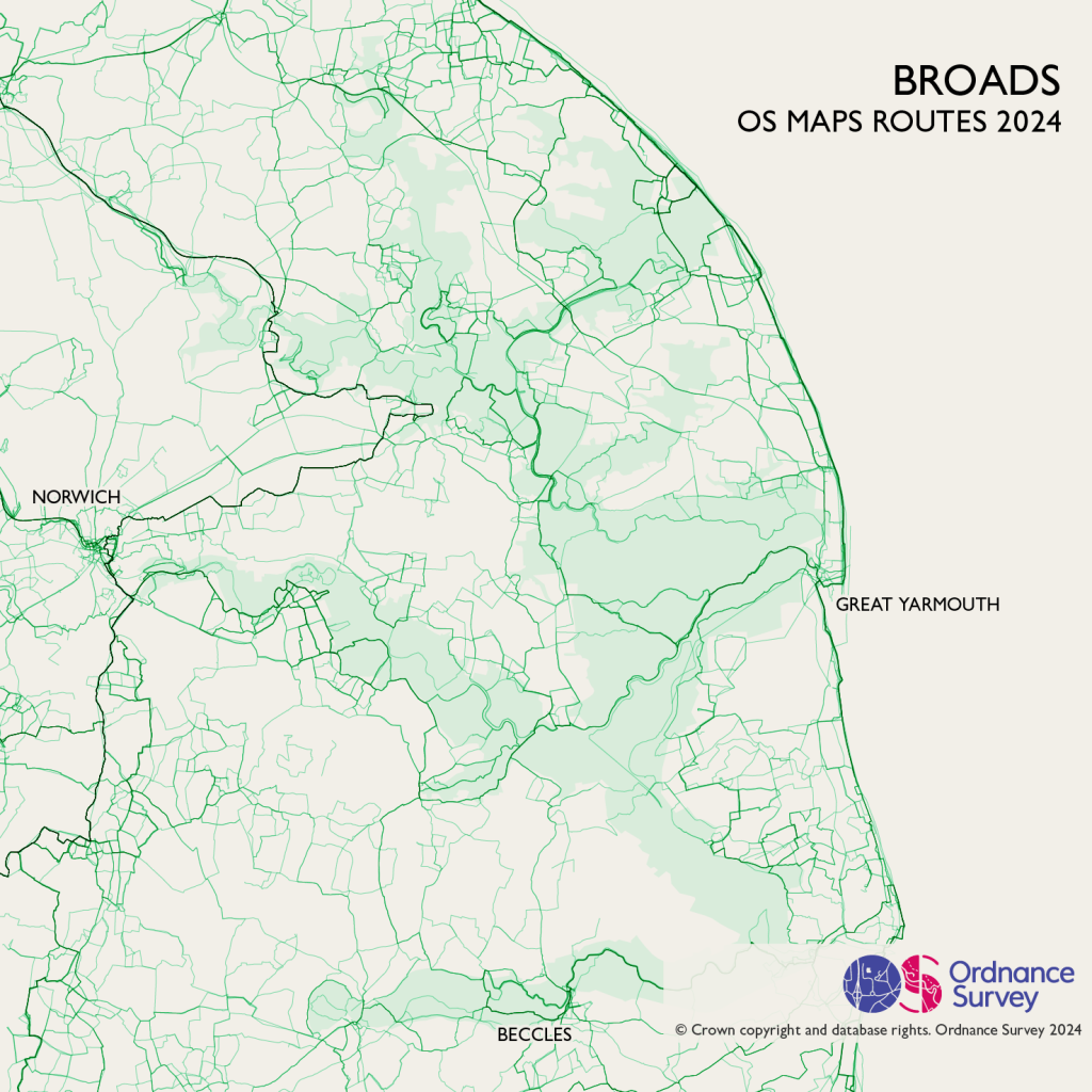
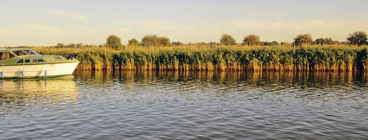
15. The Norfolk Broads
Famously flat, the Norfolk Broads has it’s own coastal path, the Norfolk Coast Path. Other routes appear both on and off the water. Total routes – 2,374.
Find your next route on OS Maps
There’s millions of routes to discover on OS Maps and not just in our beautiful National Parks, or you can use the tools to plan your own. From simple strolls through green spaces to epic multi-day National Trails, off-road cycle rides to peaceful paddleboarding spots, you can search for routes created by professionals or shared by other users.
There’s even a free trial of Premium features such as offline mapping and Aerial 3D view.