In middle England we are blessed to have a huge range of walking opportunities available to us, and the Peak District is an excellent place to start if you have not explored this area before. One of my favourite places to head for hill walk is Edale, where the famous Pennine Way starts/finishes, and where you have easy access to Kinder Scout, Mam Tor, and a huge number of other walks with great views.
Even on a cold, wet and rather wintery day you can luck out on the hills in this area, which is a good job as the day I joined some of my GetOutside Champion friends the weather was not at all kind to us – but we were dressed appropriately and prepared to motivate each other as we marched along.
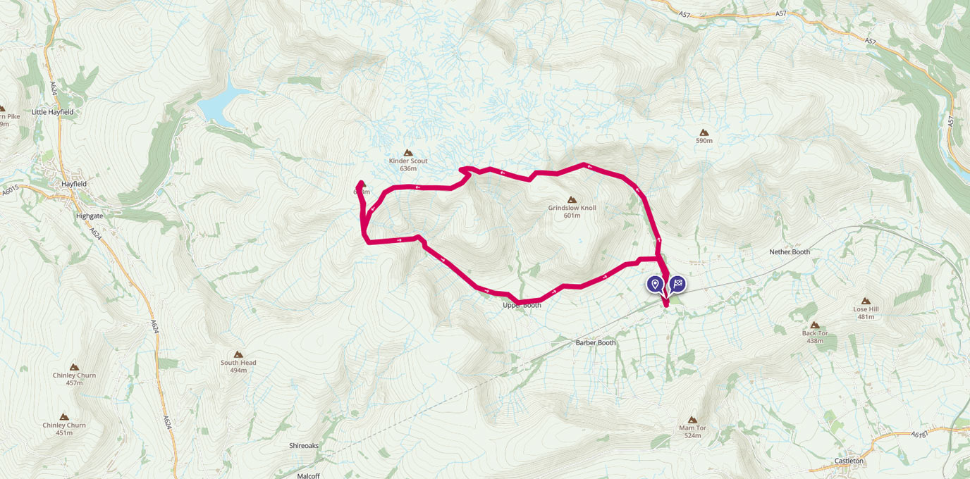
One of my favourite bimbles from Edale is a 8.5-ish mile loop that goes up onto the Kinder Plateau via Grindsbrook, along the South Ridge, and then down Jacob’s Ladder back into the village. It’s a moderate walk ideal for those wanting something more than undulating farmland but don’t want to break out too much of a sweat. It’s easy to navigate, with a range of terrain to keep things interesting. Come prepared, though, Kinder is notoriously boggy and, as I can confirm from personal experience, it is easy to sink a little more than you might like if you’re not careful.
SK 123 852
The route starts and finishes at the main village carpark close to the railway station. It’s a popular meeting point for walkers but there are plenty of spaces, costing £5 for the day, and there are decent public toilets too.
We started our loop by walking up into Edale and past The Old Nags Head pub, following the footpath signposted Grindsbrook over the river and up along the bank, heading gradually up with the river and path eventually meeting on a level. Grindsbrook, fast flowing in winter and less so in summer, cascades down boulders off Kinder Plateau, making some parts of the rock covered path more slippery than other parts. As you make your way up the path becomes less obvious, but keep going in an upwardly direction, crossing the brook and following its route onto the Plateau.


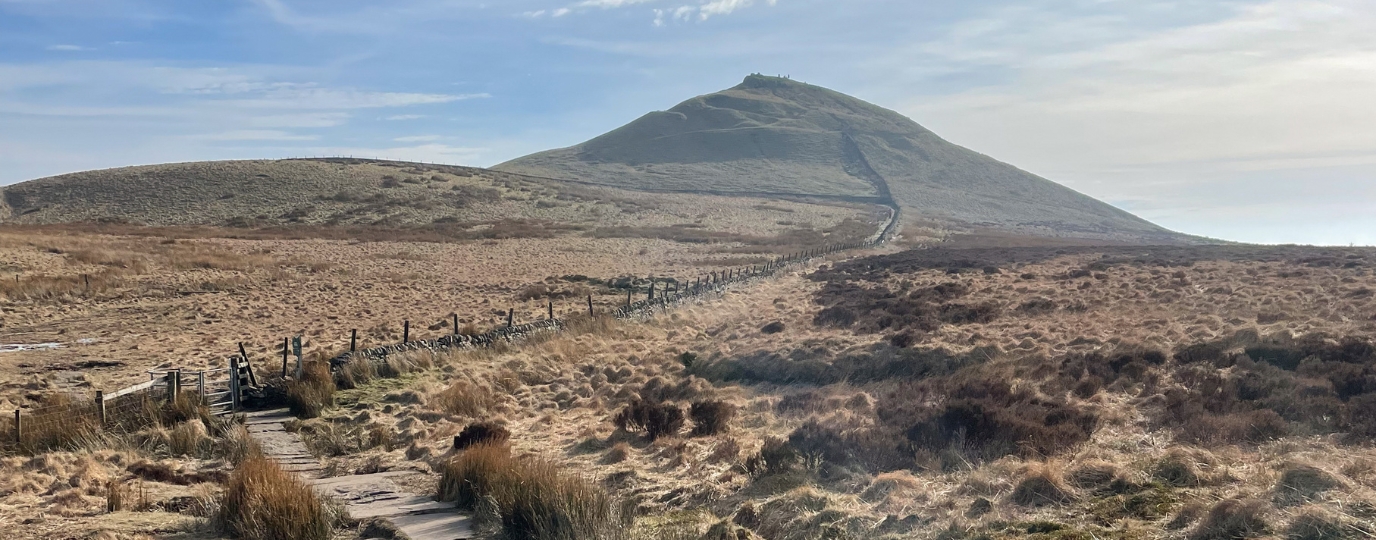
The best views here are behind you, so feel free to make a stop or two to catch your breath and take some photos. It was blowing a gale and chucking thick globules of rain at us when I walked this most recently, so my photos aren’t quite as lovely as they could have been, but there is still something very special about being up in the hills regardless of what the weather is doing.
You’ll almost certainly need your hands for the last section up onto the top, I know I do but that may just be because I’m short and need a little extra help making my way up and over the bigger boulders. There are also a couple of places where you need to cross the river; easier in summer when the water is lower, but not difficult even with the fast flowing full brook we had as long as you step confidently. The whole thing is over in no time though – it might look like a long way when you’re at the bottom but you do climb quickly and are at the top before you know it.


Once at the top take a left to follow the ridge to the south of the Kinder Plateau. There are lots of paths from here and as it’s open access land you can pretty much go in any direction, but for this walk we head along the edge for all the great views down into the valley and across to the next set of hills. There’s a decent National Trust created flagstone path much of the way, to help protect the important moorland landscape, with a few sections of muddy and boggy path to contend with by some of the rocky outcrops. Be warned, the bog is thick and wet and will have your boot if you’re not careful! (Yes, I’m talking from experience!) A few graceful but flat-footed hops will help reduce the sinking, but to be honest at this time of year when the weather and therefore ground is wet, you’ll struggle to keep mud-free so just go for it and enjoy!


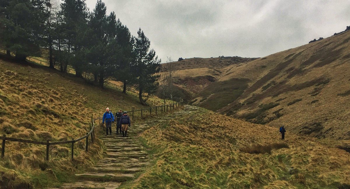
It is easy to detour from the mainly circular route to grab a Trig Point selfie at Kinder Low before joining up with the Pennine Way and heading back down off the Plateau into the valley. Again, there are lots of choices here, but this route takes us down via Jacob’s Ladder, which is a very steep but very easy to navigate section of the Pennine Way. The stream running down the hard uneven stone steps was flowing well thanks to recent weather, and we met a lot of people heading up on this busy section of footpath. If you’ve got dodgy knees poles will help you on this section.


From the bottom of Jacob’s Ladder, where there was a handy stream to remove some of the mud if you got caught in the bog, it is just a mile or two of rolling farmland through Upper Booth and back to Edale. This final section of the route is waymarked Pennine Way, and brings you out back to the Old Nags Head pub in the village, which is a mud and dog friendly place for a spot of lunch before you wander back down the village road to the car park.
Jacob’s Ladder
15km SK 123 852
14.5 km / 9 miles