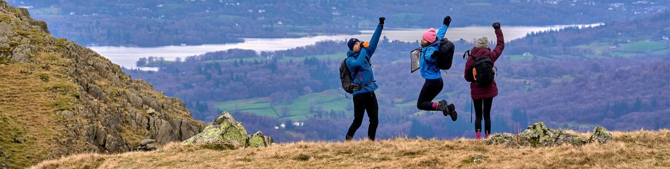
Measure distance on a map
An important part of navigation is being able to calculate distance on a map, then estimate that distance on the ground to reach your next navigation point. This advanced map reading guide explains how to calculate distance on the ground for walking or running to improve your navigation skills.
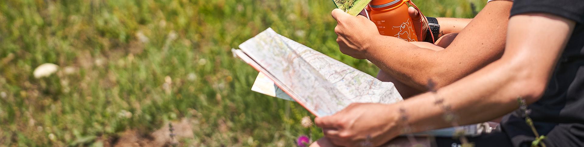
You already know how to calculate distance accurately on your map, but how do you translate this on to the real world? While a GPS device, or our very own OS Maps app, will give you an exact distance from or to a waypoint, being able to estimate distances using a paper map is a critical navigation skill.
Measuring the distance travelled on the ground
You know the direction you need to be heading in, but even if the next waypoint is a distinct feature it would be expecting too much from both your equipment and yourself to be able to reach your target spot on every time. So you must be able to tell when you have missed your target location and have gone too far. As much as possible you need to track your position on the ground while you are walking. This can be done using features both on the map and on the ground.
The first step is to use your map to measure the distance to your next waypoint, and convert to real-world distance.
You then need to measure your distance on the ground. There are two ways of doing this:
Pacing
To pace successfully you need to know in advance how many paces (two steps) you can take for every 100 metres. Pacing is better than measuring steps as it makes counting easier. A person of average height will take 65 paces every 100 metres, but it is vital you work it out to your own pace count. Do this by walking normally over a known distance, ideally repeating it a few times to get an average. Remember slopes or poor conditions underfoot will require an adjustment and steep slopes will shorten your stride dramatically.
Timing
If you know, or can at least guess, how fast you are walking you can work out how long it is going to take you to walk from your starting point to your next target location. At 4km/hr, which is an ‘average’ speed, it will take you 1½ minutes to cover each 100 metres, so a leg of 700 metres should take you 10½ minutes to walk. Again, as with pacing, this will be affected by your personal speed, slopes, poor underfoot conditions and other factors, so you will have to adjust your time accordingly.
Good to know
Using metres and kilometres makes the calculations easier, but you can also use yards and miles
Naismith’s rule
Estimating the time you take to travel a distance can be very accurate if you are travelling on a flat landscape. However, in reality this won’t be the case. With this in mind, a Scottish climber called Naismith created a simple but effective formula that took into account the changes in height while calculating speed over the ground – 5km/hr plus ½ hour for every 300 metres of ascent.
For convenience, this formula is often expressed in terms of extra time required to climb a given number of contour lines – for example, it takes an additional minute to climb one 10-metre contour line or an additional five minutes for each thick contour line crossed. On a descending slope it is assumed that you will be walking faster on shallow slopes, but possibly a lot slower on steep descents – it is therefore taken that this will even out over the course of a day’s walk.
Naismith’s rule is most accurate for hillwalking. If you are ascending or descending steep mountain slopes you may need to allow extra time for both ascents and descents.
Walking on a bearing
As you walk on a bearing, errors will undoubtedly creep into the actual direction you are travelling and the distance you have measured. For example, when walking across a slope on a compass bearing you will tend to stray off slightly downhill. Also, your pacing may become inaccurate as a result of difficult terrain.
To help counteract this, choose closer checkpoints to ‘reset’ your pacing, preferably between 1,000m and 500m – but this will ultimately depend on the terrain you are crossing. Also, try lining up a distant object on your bearing and walk towards it with your eyes constantly on the object and not on your map and compass – this will help to prevent veering off course.
There are a couple of methods you can use when walking on a bearing to help guarantee you reach your chosen checkpoint.
Aiming off: If your checkpoint is on a linear feature such as a stream or a track, by simply aiming off slightly to one side of the checkpoint, you can guarantee which direction you need to head to reach your checkpoint upon hitting the linear feature.
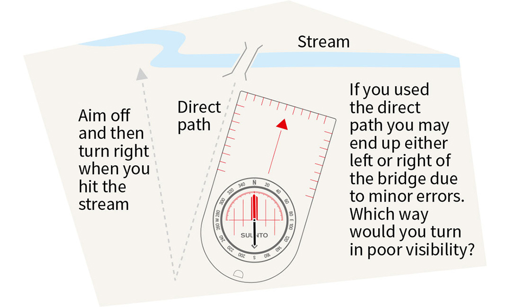
‘Aiming off’ to make it easier to find the footbridge
Attack points: To locate difficult features simply find another definite, prominent feature nearby and make your way to the centre of it. Once there, use pacing to find the original feature you are looking for.
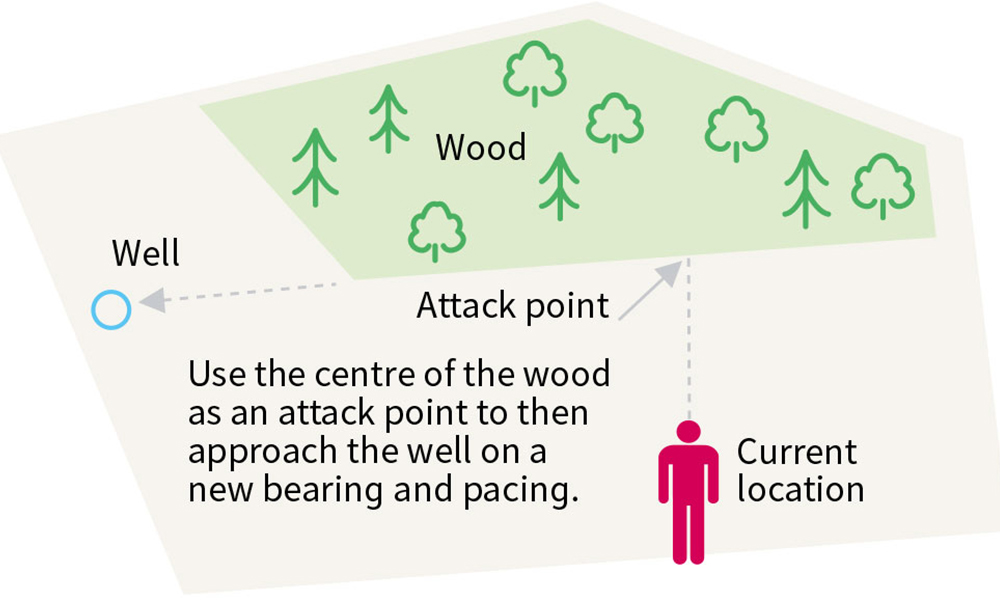
Using an ‘attack point’ to find a hard to locate feature
Catching points: If you are aiming for a hard to locate feature or turning, it can be useful to define a catching point. This is a feature that is on your direction of travel past the waypoint. Large, linear features such as tree lines, walls, streams and similar are preferred as they are harder to miss.
If you reach the catching point, you know you have missed your target, and the distance back along your route to the location. Reverse your compass bearing and pace back until you reach the location.
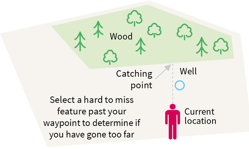
Use a ‘catching point’ so you do not go too far past your target
These skills can make a huge difference, especially in difficult, untracked terrain or when there is poor visibility in fog, rain or darkness. However, to use them effectively you will need to practice them in good conditions until you can rely on your skills.
This guide is part of National Map Reading Week, which encourages everyone to improve their map reading skills and discover new adventures. Browse our beginner map reading guides if you’ve found this article too advanced.