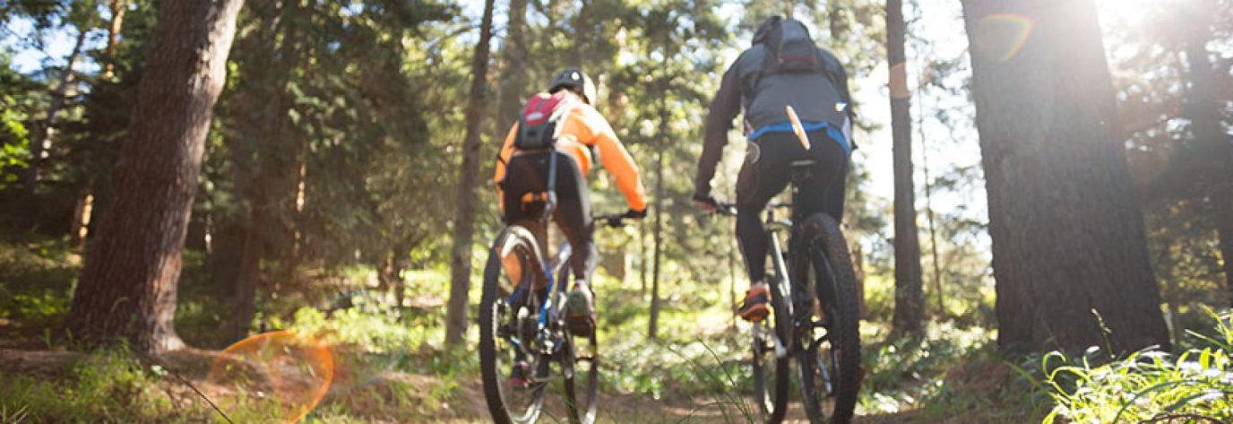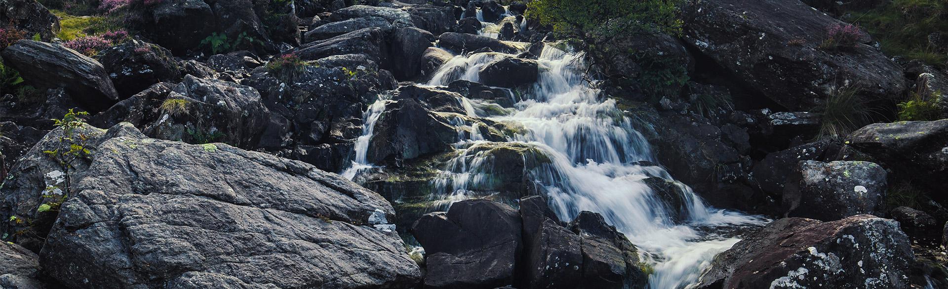
Waterfalls are a great place to visit for a leisurely stroll and we’re lucky enough to have many across Great Britain. Find waterfall walks near you including details of each route. Our OS GeOutside Champions share with us 10 of their favourites.
1. Snuff Mills Waterfall
Bristol

Snuff Mills waterfall walk
Distance: 2.5 miles / 4 km return
Difficulty: Easy
Parking: Snuff Mills Car Park, BS16 1DL
This 2.5-mile linear walk on the outskirts of Bristol takes you along and over the River Frome. You’ll find it hard to believe that this hidden little gem is so close to the centre of the city of Bristol. Here you have a chance to catch a glimpse of kingfishers, herons, foxes, owls, and bats. The children (young and old) were delighted to spot kingfishers on our last visit in September.This is a popular dog walkers route and the car park can become busy at peak times, so we advise to get there early. We found this walk accessible with the use of an all-terrain wheelchair or a front wheel attachment for a regular wheelchair. It was lovely to be able to go over the little accessible bridge crossing the river. The path can become muddy especially near the man-made waterfall, so don’t forget your wellies!
Recommended by OS GetOutside Champions the Hauxwell family. Follow them on Instagram.
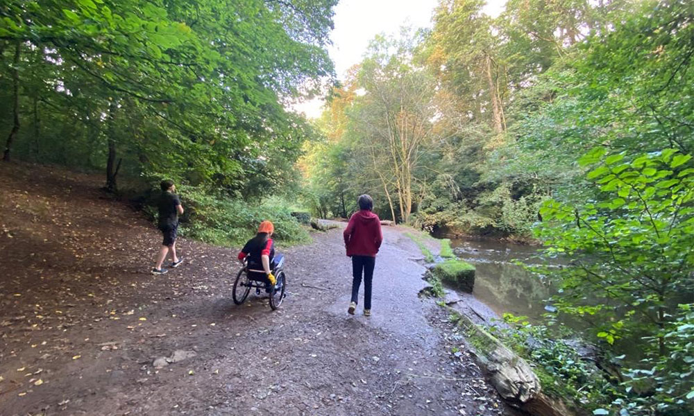
Snuff Mills Waterfall
2. Virginia Water Cascade
Virginia Water, Surrey
Virginia Water Cascade walk
Distance: 4.5 miles / 7 km circular
Difficulty: Easy
Parking: Virginia Water Car Park, GU25 4QF
London and the South East of England are not renowned for their waterfalls. This is primarily due to the geology of the region. Most of our water is underground in giant aquafers and most of the larger expanses of surface water are manmade, usually gravel quarries. Virginia Water is a man-made lake with easily accessible paths around this it.
From the car park you can go left for a couple of hundred metres to the cascade or follow the route anti-clockwise for a leisurely 4.5-mile walk around this beautiful lake. The Cascade is a man-made waterfall at the eastern end of the lake where the water exits into the River Bourne. For those that just want a leisurely day out, there is a well-furnished visitor centre and café near the main car park.
Recommended by OS GetOutside Champion Glyn Dodwell. Follow Glyn on Instagram.
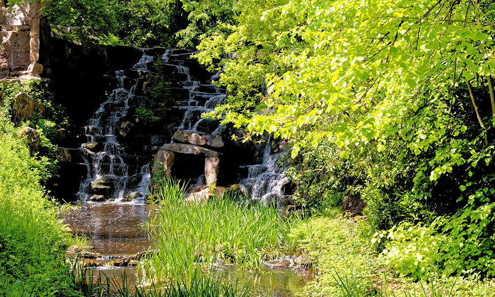
Virginia Water Cascade
3. Stockghyll Force
Lake District, Cumbria
Stockghyll Force walk
Distance: 2 miles / 3 km circular
Difficulty: Easy
Parking: Rydal Road Car Park, LA22 9AN
Stockghyll Force is a fabulous 70-foot waterfall just a stones throw from the centre of Ambleside. Part of the River Rothay, it has industrial heritage, once incorporated with no fewer than 12 waterwheels to power paper and fabric mills as well as agricultural usage.
A walk up steep Stockghyll Road (100m from the post office) brings you to the gated woodland that houses the force. A circular stepped trail ambles through the woods offering fenced, precarious viewpoints of the falls. Upon reaching the top, you can take a left and head towards a wooden footbridge situated directly above the force which gives you a great indication of its power, especially after wet weather.
There is gated access at the top, an elevated area of the woods that would be suitable for wheelchair access. This would allow access up to the fenced viewpoints but not to the footbridge. This is a wonderful short walk suitable for children or a leisurely rest day, Stockghyll Force is a well visited favourite of mine that is teeming with foliage and wildlife that appear at quieter times of the day.
Recommend by OS GetOutside Champion Harrison Ward. Follow the Fell Foodie (Harrison) on Instagram.
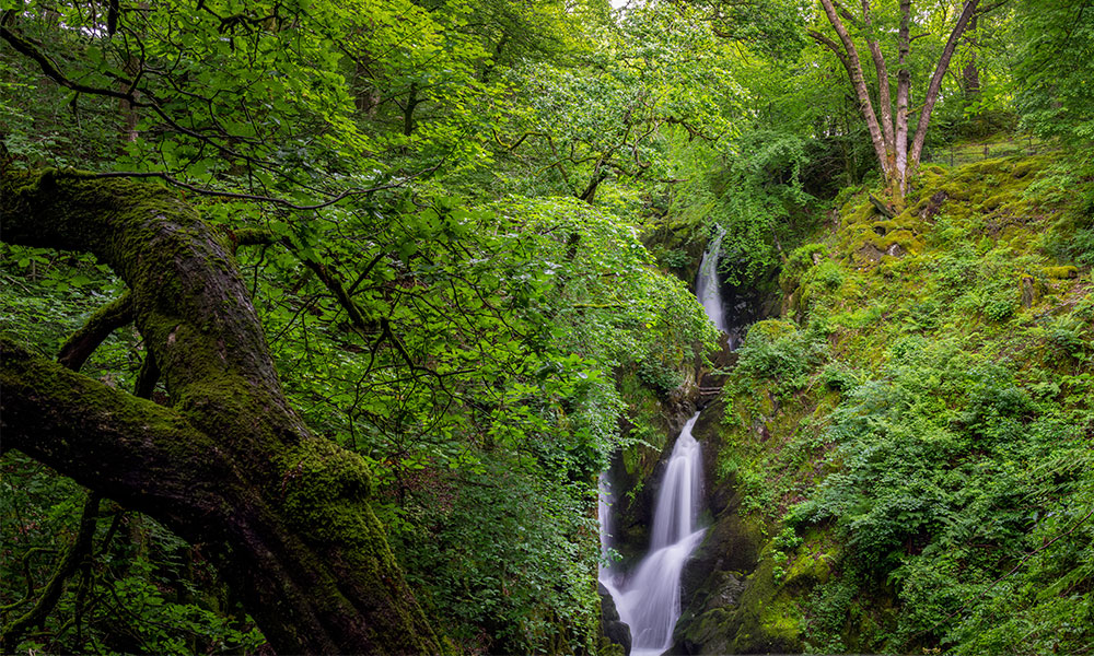
Stockghyll Force walk
4. Ingleton Waterfall
Yorkshire Dales
Ingleton Waterfall Trail
Distance: 4 miles / 7 km circular
Difficulty: Easy-Moderate
Parking: Broadwood Carpark, LA6 3ET
A classic waterfall walk and a favourite since Victorian times. The Ingleton Waterfall Trail follows a well-defined footpath which runs as close to the edge of the two rivers as possible to provide spectacular views of the waterfalls. Steep, rocky paths with some manmade steps. Can be slippery when wet. The total length of the trail is 4.3 miles (7km). Parking is included in the price of admission.
Recommended by OS GetOutside Champion Alan Hinkes. Follow Alan on Instagram.
Ingleton Waterfall
5. The Four Falls Trail
Brecon Beacons, Wales
The Four Falls Trail
Distance: 4.5 miles / 7km circular
Difficulty: Easy
Parking: Cwm Porth Car Park, CF44 9JF
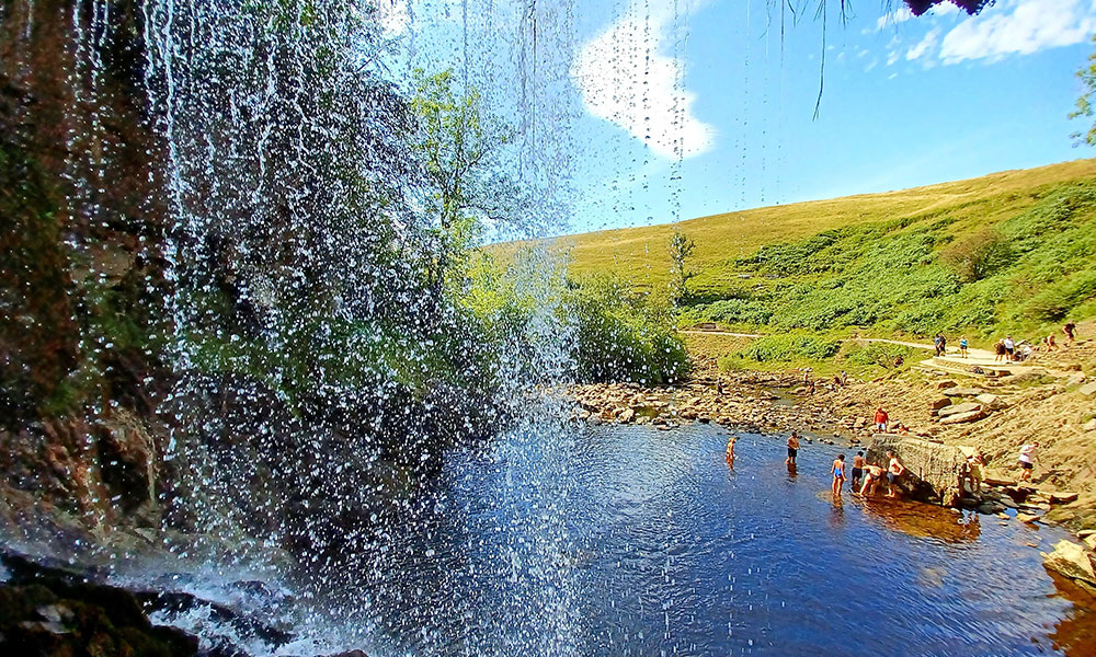
The Four Falls Trail is a 5.5 mile hike (when done from Cwm Porth) taking in four large waterfalls and some smaller ones near the village of Ystradfellte inside the Brecon Beacons National Park. The four waterfalls are Sgwd Clun-Gwyn, Sgwd Isaf Clun-Gwyn, Sgwd Y Pannwr and the most famous – because you can walk behind it – Sgwd Yr Eira.
It’s important to note before you continue that while the main circular trail is accessible, you cannot see the waterfalls from that trail – you have to take link trails down to the falls to see (and feel) the rushing water.
The scenery is lush and green, the falls were noisy, the rocks gnarly and the nature is incredibly stunning. The whole walk, even the accessible path at the top, has a soundtrack of rushing water.
Recommended by OS GetOutside Champion Zoe Homes. Follow Zoe on Instagram.
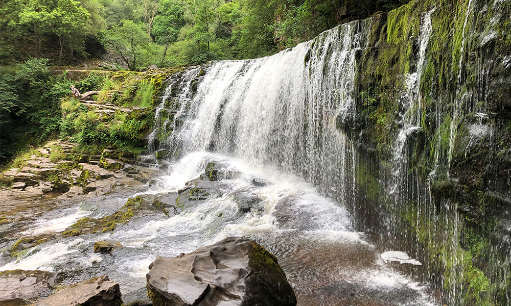
The Four Falls Trail
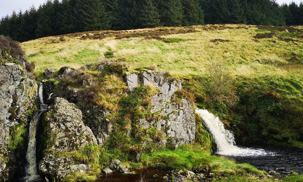
6. Langley Waterfall
Petersfield, Hampshire
Langley Waterfall walk
Distance: 4.5 miles / 7.5 km circular
Difficulty: Moderate
Parking: All Saints Church, GU32 2DF
Hampshire’s Highest Waterfall! Starting at the Steep Village church, follow the waymarked signs for the Hangers Way heading north towards Ashford Hangers. The initial footpath joins Mill Lane for a few metres before departing to the left. At this point you will pass the highest waterfall in Hampshire! You could, if you wish, return to the village along Mill Lane or continue to follow the Hangers Way onto the top ridge above the Ashford Hangers. It is well worth stopping at the Trig Pillar, as the views to the north are very impressive. Return via the path to Ashford Farm where you turn left for 0.5 km picking up the the footpath back to Steep via Steep Farm.
Recommended by OS GetOutside Champion Glyn Dodwell. Follow Glyn on Instagram.
Langley Waterfall
7. Keld’s Waterfalls
Keld, Yorkshire Dales
Keld’s Four Force walk
Distance: 4 miles / 6 km circular
Difficulty: Moderate
Parking: Keld Car Park, DL11 6LJ
A 4-mile circular walk from Keld, taking in Catrake, Kisdon, Currack and Wain Wath Force (Waterfalls). There are some tricky sections of paths leading to the falls but otherwise a leisurely walk with good parking, toilets and a pub at the start/finish.
Recommended by OS GetOutside Champion Sal Thornton. Follow Sal on Instagram.
Wain Wath Force
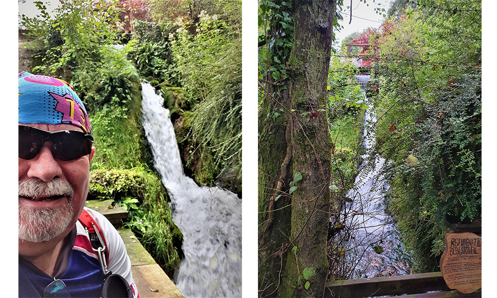
8. The Birks of Aberfeldy
Perth and Kinross, Scotland
The Birks of Aberfeldy walk
Distance: 2 miles / 3.5 km circular
Difficulty: Easy
Parking: Upper Birks Car Park, PH15 2DX
The beautiful wooded gorge of the Moness Burn, just outside the Perthshire village of Aberfeldy, was once known as the Dens of Moness. But the area was renamed after Robert Burns’ poem, The Birks O’ Aberfeldie, which was penned by the national bard in 1787 after he enjoyed a visit here. You’ll find a few lines of the poem, and a life-sized statue of Burns himself, as you explore.
It’s impossible not to have an adventure here, following winding, stepped paths and wooden walkways around a densely wooded, rocky ravine, discovering hidden caves and unexpected views. All around as you walk, the air is filled with spray and thunder from the Moness Falls, the highest of which drops 25 metres into the heart of the gorge.
The Birks of Aberfeldy
Although ‘birks’ is Scottish for birch trees, the woods are actually a fine mixture of oak, birch, hazel and ash trees with a scattering of pine, and predominantly beech around the lower slopes. During the autumn these are ablaze with leaves of orange, red and yellow. It is through the gorge has been continuously covered in woodland for some 8,000 years, and today is designated a Site of Special Scientific Interest for its flora.
This walk follows the clear path on an adventurous journey up through the trees to reach the viewpoint at the very top. From the bridge here there are outstanding views down the gorge and the Tay valley to the mountains beyond and a real feeling of being high in the tree canopy. This is a great place to spot red squirrels, peering beady-eyed from between the boughs.
Route taken from the 2021 book 100 Great Walks with Kids by Jen & Sim Benson, published by Bloomsbury. Follow Jen & Sim on Instagram.
10. Davidson’s Linn
Upper Coquetdale, Northumberland
Davidson’s Linn walk
Distance: 10.5 miles / 17 km circular
Difficulty: Moderate
Parking: Wedder Leap Car Park, NE65 7BP
This 10.5 mile walk takes you to one of Northumberland National Park’s best waterfalls, Davidson’s Linn. Davidson’s Linn (Linn means waterfall in Northern England) is tucked away on the slopes of the Cheviot Hills, and this walks takes you there via the Border Ridge and one of it’s most famous peaks, Windy Gyle. On this slightly strenuous walk, you’ll visit the Scottish-English border before descending down to the Usway Burn and the tranquillity of the waterfall. Take some time to appreciate this silent and secluded spot, which was once a perfect place for illegal whisky production! Can you spot Rory’s Still from the 19th century? As you continue the walk, you’ll loop round pass other waterfalls, all well worth a stop.
Recommended by OS GetOutside Champions Dave Wilson. Follow Dave on Instagram.
Davidson’s Linn
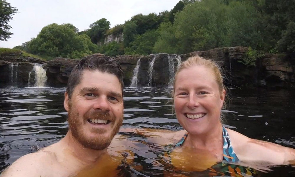
Waterfalls are a great place to visit year round as you’ll witness the beautiful change of seasons. Linger long enough to lay down your picnic blanket or if you’re brave enough, grab a towel and take a dip!