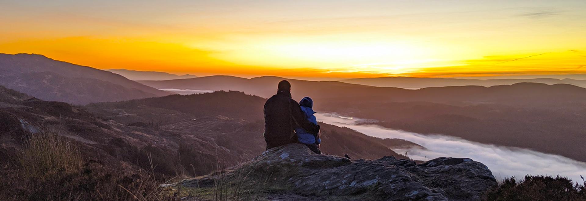
We spoke to our OS GetOutside Champions about their favourite places in Britain to watch sunset. It was hard to choose a favourite so here’s ten of the best sunset views with details on how to get there.

A sunset brew over the Brecon Beacons
There’s some fantastic places across the nation to go and watch sunset. Admire it from a hill, across the ocean or through woodland trees; there are so many options. Just step outside!
For those seeking an extra special sunset, pack your OS picnic blanket and some snacks and check out these outstanding sunset views across Great Britain below.
1: A peaceful sunset at Fan Frynych
Wales
- Start/finish point: Forest Lodge, Libanus, LD38NW
- Distance: 5 miles circular walk (GPX can be downloaded from OS Maps)
- Time taken: 2 hours
- Difficulty rating: Moderate
- Parking: Plenty of parking on quiet roads around Forest Lodge, just off the A4215
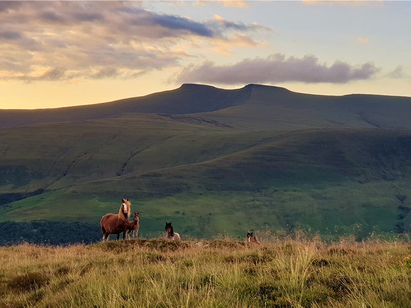
Wild horses
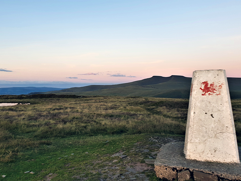
OS trig pillar with the Welsh dragon
Fan Frynych hosts the perfect location for a peaceful sunset experience. It is the neighbouring peak to one of the most visited areas in the Brecon Beacons National Park, although it sees just a fraction of the number of visitors as nearby Pen-y-Fan. This circular route takes you on a gradual ascent to the summit of Fan Frynych (629m), where you will be welcomed by an Ordnance Survey trig pillar decorated with the Welsh Dragon. As you start to walk uphill the views immediately open up. Look out at the patchwork of fields, farm holdings and the bumps of hills dotted around the landscape. These sweeps towards the north to reveal Sennybridge military training area and the Cambrian mountains in the far distance.
By sunset lover: Tracy Purnell. Follow Tracy on Instagram.ROUTE IN OS MAPS OS EXPLORER MAP OL12
2: Seaside sunsets at Abereiddy’s Blue Lagoon
Wales
- Start/finish point: Porthgain
- Distance: 4.5 miles circular walk (GPX can be downloaded from OS Maps)
- Time taken: 2 hours
- Difficulty rating: Easy
- Parking: Porthgain car park. Charges may apply.
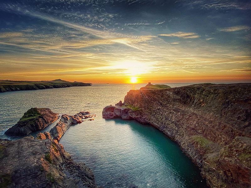
Sunset over the Blue Lagoon at Abereiddy
I love watching the sun sink into the sea and the Blue Lagoon, at Abereiddy, is one of my favourite places for amazing sunsets – the view south to St David’s Head is incredible. For an easy walk, park your car in Abereiddy and walk up to the Blue Lagoon and back, a round trip of just one mile. The Blue Lagoon is a former flooded slate quarry and in the summer, it attracts cliff divers and people Coasteering. Come sunset you may have it all to yourself to enjoy the most spectacular of sights. There’s the option of turning your sunset stroll into a longer 4.5 mile circular walk – highly recommended.
This longer route takes in the Wales Coastal Path, past beautiful beaches and hidden inlets. You’ll see remains of the industrial heritage, including a former railway, workers cottages and slate quarries. The route starts and ends at the village of Porthgain, further up the coast, which boasts two great places to eat and drink – the famous Sloop Inn, that dates from 1743 or the Shed Bistro, which has won awards for its seafood. There’s a car park in the middle of the village. Whatever time of year you visit, it’s a very special spot.
By sunset lover: OS GetOutside Champion Phillipa Cherryson. Follow Phillipa on Instagram. Photo Credit: Esther van der Spoel.
ROUTE IN OS MAPS OS EXPLORER MAP OL35
3: A sunset swim in Portpatrick
Scotland
- Start/Finish point: Portpatrick
- Distance: 2.5 miles return (GPX can be downloaded from OS Maps)
- Time taken: 1 hour
- Difficulty rating: Easy – short but steep in one section
- Parking: Portpatrick has a large car park overlooking the sea and harbour (NW 99891 53953). Charges may apply.
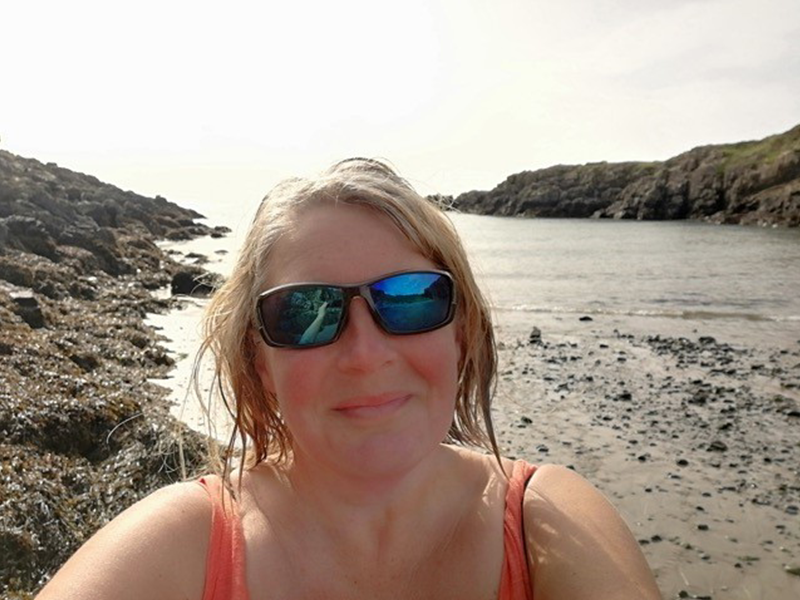
Fi enjoying a sunset swim
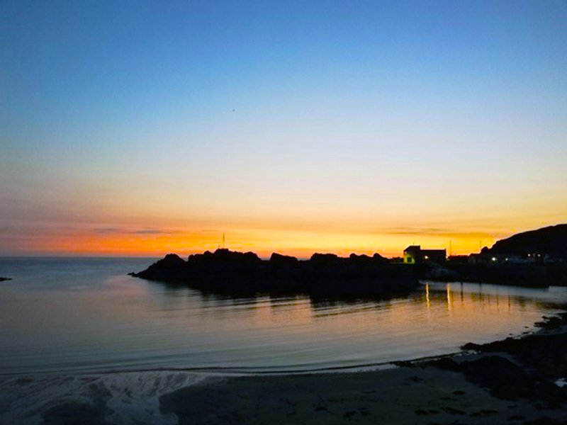
Sunset in Portpatrick
With boats, beaches and even a lighthouse, Portpatrick has everything you would wish to find in a small seaside town. Once a hub for journeys across the Irish Sea to Belfast, this now sleepy place will have you feeling relaxed almost as soon as you step out of your vehicle. The Mull of Galloway has an exposed coast, but its seas are warmed by the Gulf Stream, perfect for dipping your toes or even taking a wild swim. Don’t forget your quick-drying towel! This short coastal walking route takes you along the start of the 214-mile Southern Upland Way. It may well tempt you to wander further but make sure you are back at Portpatrick to enjoy the sunset, either from the beach or from the comfort of one of the local hostelries.
By sunset lover: OS GetOutside Champion Fi Darby (Two Blondes Walking). Follow Fi on Instagram.ROUTE IN OS MAPS OS EXPLORER MAP 309
4: Sunset over secluded Sandwood Bay
Scotland
- Start/Finish point: Blairmore
- Distance: 8 miles return (GPX can be downloaded from OS Maps)
- Time taken: 3 hours return
- Difficulty rating: Easy
- Parking: Blairmore Car Park, Lairg, IV27 4RU. Charges may apply.
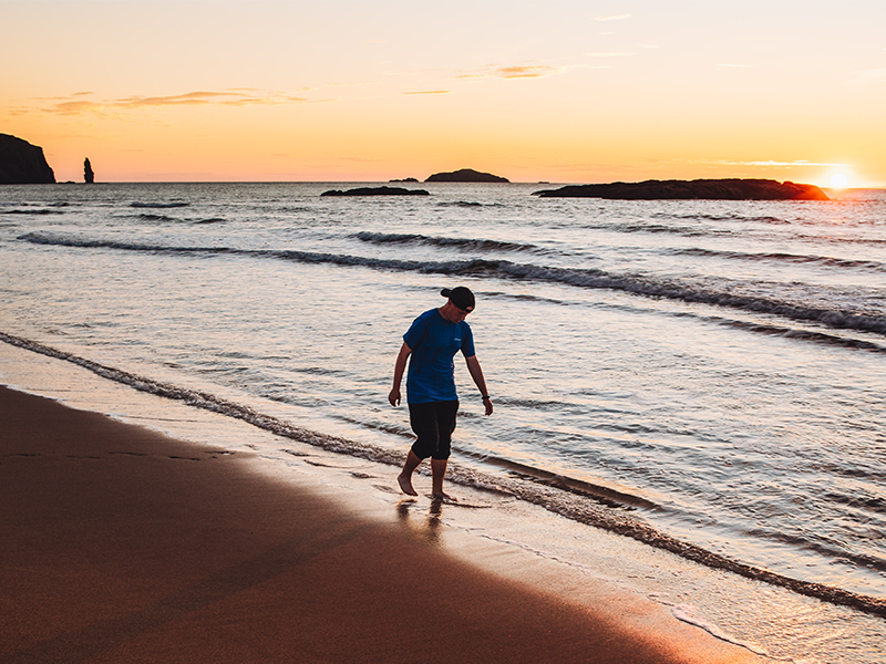
Eddie enjoying sunset at Sandwood Bay
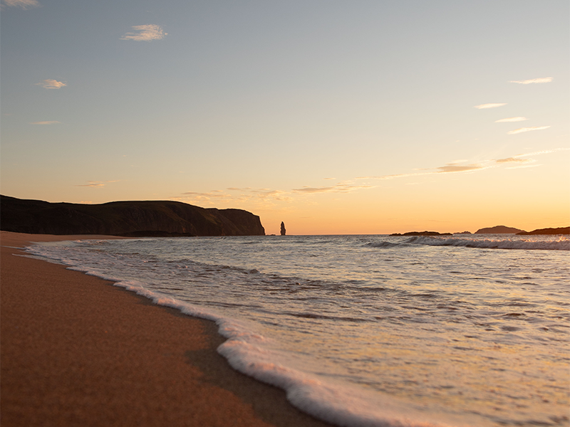
Beautiful beach at Sandwood Bay
There is absolutely no better way to end the day than with an epic sunset. My favourite? It’s a difficult choice, however, I would have to say that the most awesome sunset I have experienced would have to be at Sandwood Bay, Lairg. This was my absolute highlight of the Cape Wrath Trail! I had dreamed of reaching Sandwood Bay for so long and not because it’s one of the most incredible beaches, but because I knew the following day, I would reach the Cape Wrath Trail finish line. When we got to the beach it was a night I will never forget; the sun was shining, there was no midges and it was just incredible.
It was so good to just pause for a moment. Despite the sun’s rays I had so many goose bumps, as the emotion ran through me knowing I was so close to completing the Cape Wrath Trail! It’s definitely my highlight from the trip and a night I won’t forget forever! The route, for me, came after walking around 200 miles of the Cape Wrath Trail. However, anyone can reach this beautiful spot very easily from Blairmore. From the car park, stroll along the 4-mile track to the beach where you will be rewarded with the most amazing sunset.
By sunset lover: OS GetOutside Champion Eddie Fitzpatrick. Follow Eddie on Instagram.
ROUTE IN OS MAPS OS EXPLORER MAP 446
5: Sunset on top of St. Martha’s Hill
England: South East
Sunset views from St Martha’s Hill
- Start/finish point: Halfpenny Lane Car Park
- Distance: 1.8 miles circular walk (GPX can be downloaded from OS Maps)
- Time taken: 45 minutes
- Difficulty rating: Easy
- Parking: Halfpenny Lane Car Park, GU4 8PZ. Charges may apply.
Taking in a short section of the North Down’s Way national trail and the Pilgrim’s Way, this gorgeous short circuit takes you to one of the top viewpoints in the Surrey Hills. St Martha’s Hill provides far reaching views – absolutely ideal for sunset and sunrise. Walk up the sandy path to the summit and you’ll find St Martha’s Church which was built during the Norman period. There has been a church on this site since Saxon times and local parishioners continue to walk to the top every Sunday. It’s said that on a clear day you can see eight counties from this beautiful hill.
By sunset lover: OS GetOutside Champion Tom Sigler. Follow Tom on Instagram.
ROUTE IN OS MAPS OS EXPLORER MAP 145
6: An unforgettable sunset on the Jurassic Coast
England: South West
- Start/Finish point: Ringstead National Trust car park
- Distance: 6.6 miles circular walk (GPX can be downloaded from OS Maps)
- Time taken: 3 hours
- Difficulty rating: Moderate. Easy to follow/underfoot but hilly!
- Parking: Ringstead National Trust car park. Charges may apply.
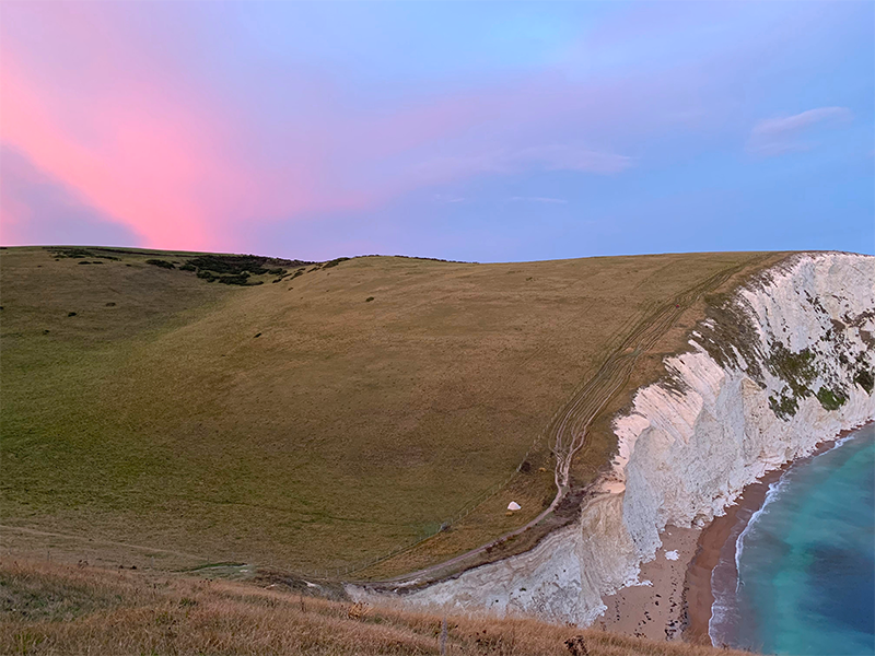
Crystal clear waters off the Jurassic Coast
The most spectacular sunset colours
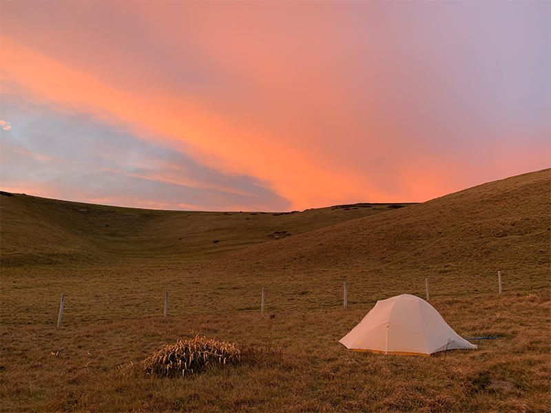
To visit Bat’s Head, avoiding the popular (and very busy!) car park at Durdle Door, start at the Ringstead National Trust car park. This 6.6 mile loop will take you just short of Durdle Door itself, but by no means are the views any less impressive. The coastal section of the loop follows the South West Coastal Path which is clearly signposted, and the inland section takes you through peaceful farmland. There are a couple of rather testing, but doable, hills including one at Bat’s Head where you can take in spectacular views of the Jurassic coastline. This spot is particularly good for sunset and sunrise.
Durdle Door is only a mile away and visible from the top of the headland. We enjoyed a camp stove dinner of curried couscous here at sunset on a bank holiday weekend. Despite the busy weekend and the proximity to Durdle Door, we only saw one other person. Look out for Bat’s Hole (under Bat’s Head). It’s a small arch formation in the rock, similar in appearance to Durdle Door. Out at sea you can spot other rock formations unusually named; the cow, the calf, the blind cow, and the bull. This is a peaceful scenic walk with plenty of photo opportunities.
By sunset lover: Helen Newman from the OS team. Follow Helen (aka Felicity) on Instagram.
ROUTE IN OS MAPS OS EXPLORER MAP OL15
7: Sunset with a beautiful 360′ view
England: Midlands
- Start point: Earnslaw car park
- Distance: Less than a mile one way! (GPX can be downloaded from OS Maps)
- Time taken: Just over an hour total
- Difficulty rating: Moderate – short but steep.
- Parking: Earnslaw car park, Upper Wyche, WR14 4EG. Charges may apply.
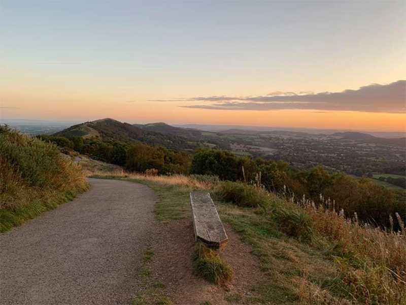
Park in either the Earnslaw car park or if full, Upper Beacon Road at Upper Wyche. It’s a lovely short one mile walk from the car park to the beacon. Just follow the main path north. It’s very obvious footpath but it does split near to the top. At you head over Summer Hill, keep right at the junction and follow the footpath up the side of Worcestershire Beacon. To your right you’ll see all of Worcester, Malvern and Pershore. Looking to your left (west) you’ll see Hereford and if the weather is clear you can see Wales too!
Look out for Hay Bluff, an obvious sloped mountain on the horizon. The sun will set in this direction. As you near the top, there are a few rocks underfoot. Take care here. At the summit you’ll find an OS trig point and a large beacon. Enjoy the beautiful 360′ view on a clear evening. The sunset casts multiple colours across the entire sky in all directions. Watch as all the little village lights turn on beneath you as they get ready for bed in the valleys below. Your walk down is simply the same way you came up.
By sunset lover: OS GetOutside Champion Anna Humphries. Follow Anna on Instagram.
A beautiful sunset from Worcestershire Beacon
ROUTE IN OS MAPS OS EXPLORER MAP 190
8. Sunset on a SUP
England: North West
- Start point: Quarry Road, Lancaster, LA1 1AG
- Distance: 3.7 mile paddle (GPX can be downloaded from OS Maps)
- Time taken: 1 hour. Continue as long as you like!
- Difficulty rating: Easy
- Parking: Public parking nearby in Lancaster centre. Charges may apply.
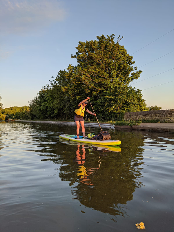
A sunset paddle
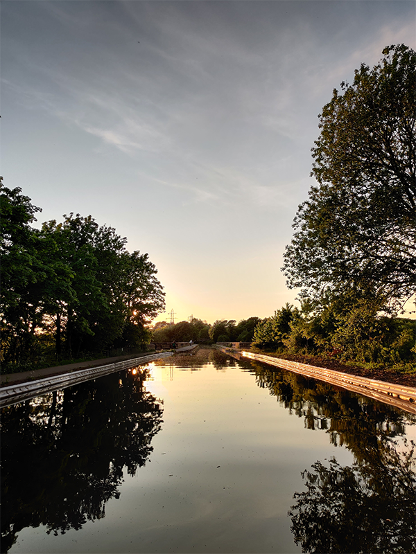
Sunset on the canal
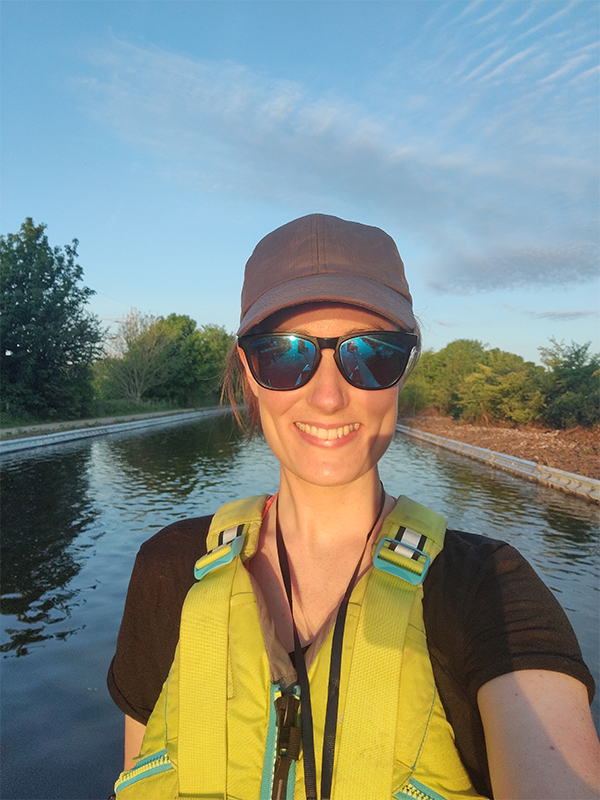
Fiona on her SUP
This is a sunset with a difference! Enjoy a magical sunset paddle on a stand up paddle board (SUP). For this spot, find easy access to the canal next to Quarry Road bridge, with space to pump up your SUP board if you’ve got an inflatable. Hop onto the canal and head north, initially passing pretty back gardens before glimpsing country fields beyond the over hanging trees as you reach the edges of the city. As the canal snakes left the Lune Aqueduct is revealed with views down over the river Lune below. This is a lovely easy sunset paddle without having to travel far at all. Head back the way you came with the light fading behind you as the city lights gently begin to replace daylight. If you keep going and double the distance you’ll head towards the coast. You can make it as long or short a paddle as you like.
By sunset lover: OS GetOutside Champion Fiona Quinn. Follow Fiona on Instagram.
ROUTE ON OS MAPS OS EXPLORER MAP OL41
9. Sunset over Hadrian’s Wall
England: North East
- Start/Finish point: Steel Rigg Car Park
- Distance: 5 miles circular walk (GPX can be downloaded from OS Maps)
- Time taken: Just over 2 hours
- Difficulty rating: Moderate
- Parking: Steel Rigg Car Park, NE47 7AN. Charges may apply.
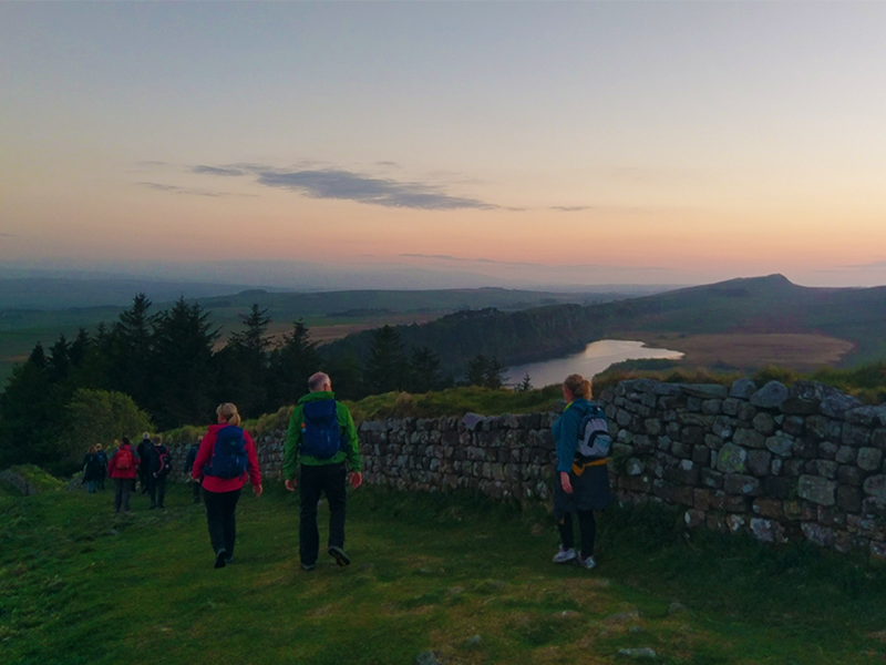
Hadrian’s Wall sunset walk
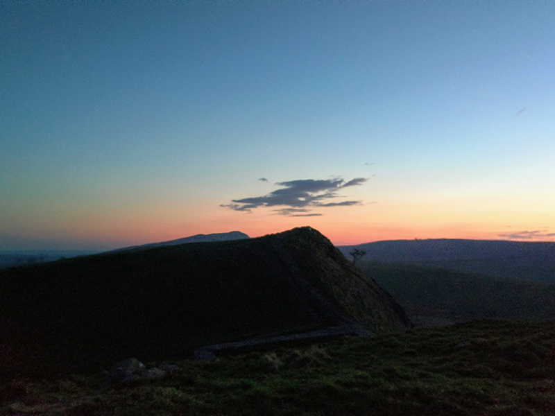
Spectacular sunset views
A classic walk in Northumberland National Park to enjoy the north face of Hadrian’s Wall. To reach the perfect spot to witness sunset, walk along the Roman frontier to get onto Highshield Crags which, overlook the majestic Crag Lough. Enjoy panoramic views all around as the sun sets, before a short walk west along the wall back to Steel Rigg car park.
By sunset lover: OS GetOutside Champion Dave Wilson. Follow Dave on Instagram.
ROUTE IN OS MAPS OS EXPLORER MAP OL43
10: Sunset with wildlife
East England
- Start/finish point: Woodbridge Station, Station Road, IP12 4AU
- Distance: 6 miles circular walk (GPX can be downloaded from OS Maps)
- Time taken: 2 hours
- Difficulty rating: Easy
- Parking: Plenty of parking in and around Woodbridge Station. Charges may apply.
Time this walk well and you will be rewarded with a stunning sunset over the River Deben and Martlesham Creek. This 6.2 mile / 10km walk starts outside of Woodbridge Station, where is plenty of parking, and circles around Martlesham Creek and the Deben Estuary. The terrain is easy but the views are stunning with big skies and colourful reflections. Keep an eye out and you might be lucky enough to see barn owls hunting, searching for their prey along side the creek. For the best sunset, ensure you’re on the east side of Martlesham Creek. Here you’ll have views back to Martlesham boat yard and Woodbridge, including the famous Tide Mill.
By sunset lover: OS GetOutside Champion Tom Wake. Follow Tom on Instagram.
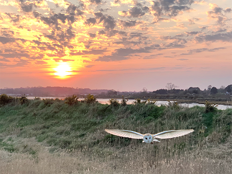
A barn owl flying at sunset
ROUTE IN OS MAPS OS EXPLORER MAP 212 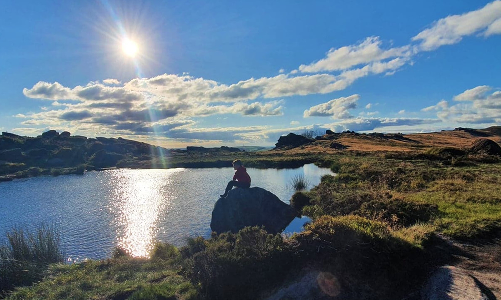
Sunset from The Roaches, Peak District
Get kitted out for a sunset picnic or a sunset paddle!
SHOP PICNIC BLANKETS SHOP QUICK-DRYING TOWELS
More great content to help you GetOutside!