From the OS Short Walks Made Easy guidebooks
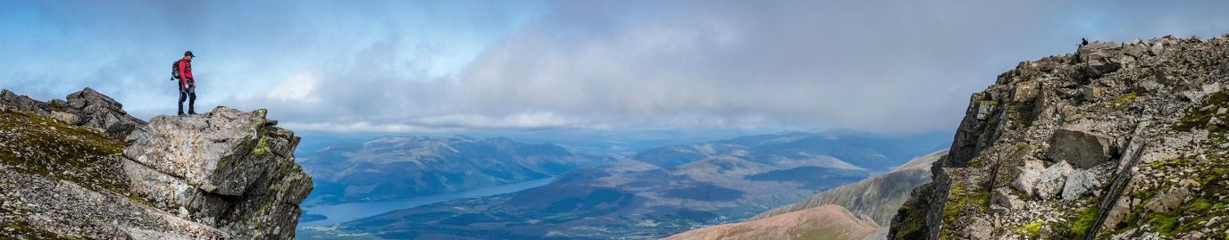
Discover Britain’s 10 best short walks for a great day out. Featured in the OS Short Walks Made Easy guidebooks, each walk provides key information like where to park, where to eat and what to see on route.
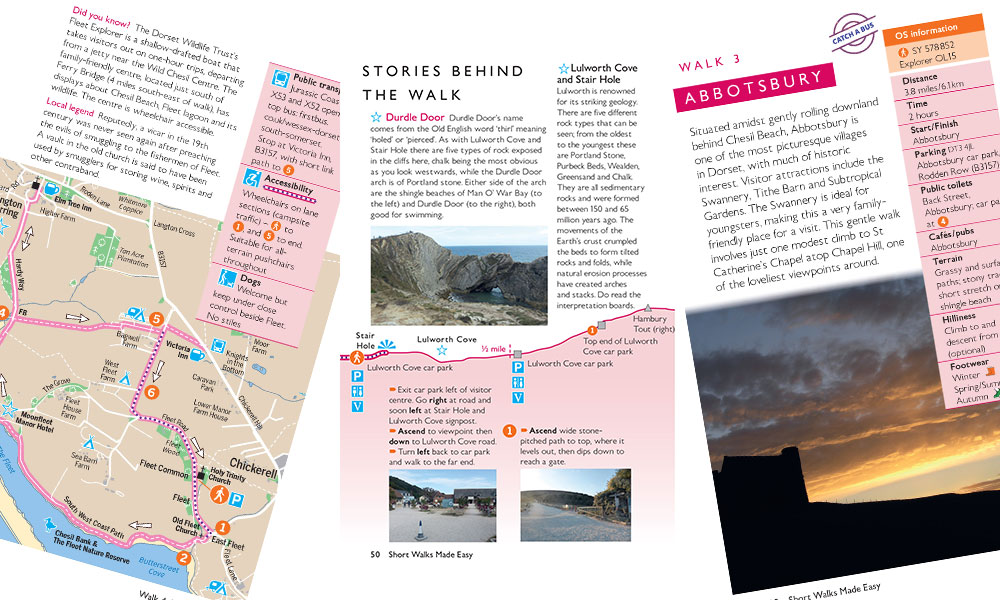
Inside a OS Short Walks Made Easy guidebook
The OS Short Walks Made Easy guidebooks are perfect for those with little to no walking experience. Each pocket-sized guide includes 10 bottom-of-the-hill leisurely walks, ranging from 2 to 5 miles, in popular outdoor locations like the Lake District, Snowdonia or Dorset’s Jurassic Coast. They include plenty of practical information like public transport, accessibility and dog-friendliness to help you plan your day. You’ll also find interesting stories about the area and nature you may see on each route. For more information about the OS Short Walks Made Easy Guides, check out our guide to OS walking books.
Rhossili and Worms Head
Gower and Swansea – OS Short Walks Made Easy
• Distance: 2.7 miles / 4.3 km
• Start / Finish: Rhossili
• Parking: SA3 1PR, National Trust car park
• Cafés / pubs: Rhossili
• Public toilets: By National Trust information centre at far end of car park
• Terrain: Firm paths, tracks and lanes
• Hilliness: Gently undulating
From the Gower and Swansea – OS Short Walks Made Easy book
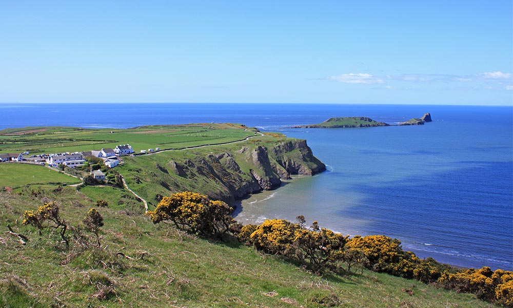
Rhossili and Worms Head
Rhossili Down plunges to the 3-mile sandy beach at the end of the Gower Peninsula. This creates a spectacular sight, especially when the sea breeze is making white horses on the waves. Worms Head, a rugged ‘serpent’ of sharp rocks jutting into the sea, is an island at high tide. This route rounds the clifftops to pass ‘the Worm’ then peers into Fall Bay before a cross-pasture return to Rhossili. If the tide’s out, take a stroll along Rhossili sands to see the skeletal wreck of the ship, Helvetia. The Norwegian barque, Helvetia, got into trouble around Mumbles and was stranded here in 1887. All the crew survived, as did the cargo, but five men from the salvage crew were drowned when their boat capsized.
Skylarks frequent the area and choughs have recolonised the cliffs after an absence of over a century. Butterflies such as the small blue, gatekeeper and dark green fritillary can be seen fluttering over the fields and by the hedgerows. On the coast you may see Atlantic grey seals and common seals basking on the rocks (do not disturb them).
Worth Matravers
Dorset’s Jurassic Coast – OS Short Walks Made Easy
• Distance: 4.7 miles / 7.6 km
• Start / Finish: Worth Matravers
• Parking: BH19 3LE, Worth Matravers car park
• Public toilets: In car park
• Cafés / pubs: Tea & Supper Room and Square & Compass, Worth Matravers
• Terrain: Grassy paths, including coast path; stony tracks; village roads
• Hilliness: First half involves gradual descent and corresponding ascent; second half is level except for long flight of steps (handrail) down and up steep-sided valley – avoided on alternative route
From the Dorset’s Jurassic Coast – OS Short Walks Made Easy book
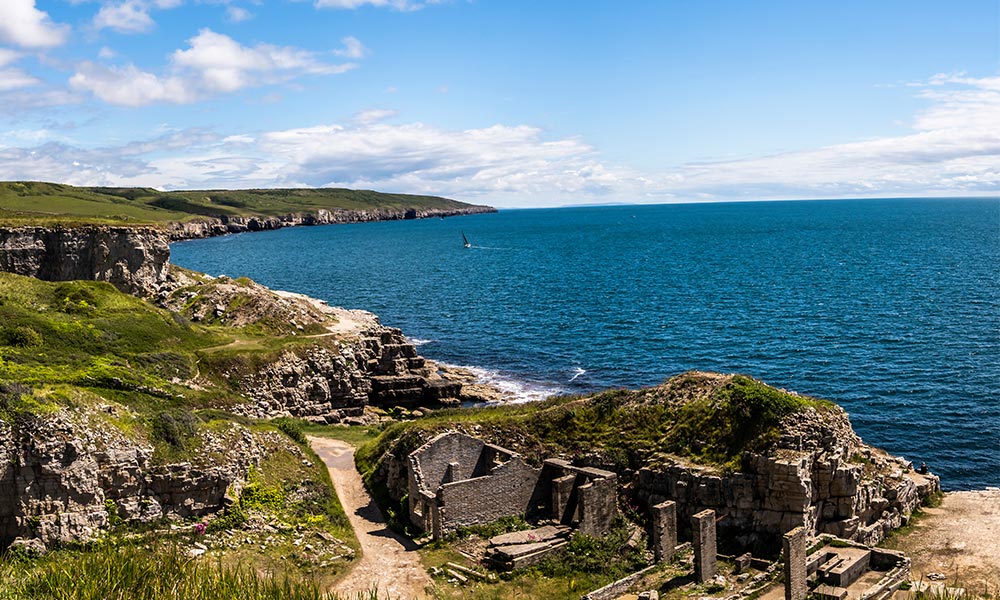
Winspit near Worth Matravers
This walk is set in the area of southeast Dorset known as the Isle of Purbeck. From the picturesque village of Worth Matravers, with its characterful 18th-century pub, the route takes in some spectacular views, notably from St Aldhelm’s Head. The headland – also called St Alban’s Head – is the most southerly point on Purbeck’s coastline and a splendid viewpoint. Like elsewhere along this coast, the headland has been heavily quarried. The Purbeck stone industry has been the economic mainstay of the region for centuries.
Walking down the valley to Winspit, note the deep ridges in the hillsides – these are strip lynchets, which were cut in medieval times to provide extra arable land. In late summer, ahead of their migration to Africa, it is typical for sizeable flocks of swallows and house martins to gather over the headland’s fields feeding up on insects.
Box Hill
North Downs – OS Short Walks Made Easy
• Distance: 1.9 miles / 3 km
• Start / Finish: Box Hill
• Parking: KT20 7LB, National Trust Box Hill main car park, Zig Zag Road
• Public toilets: By the National Trust café, opposite car park
• Cafés / pubs: National Trust café
• Terrain: Tarmac; chalk grassland and woodland paths
• Hilliness: Mostly level or gently undulating
From the North Downs – OS Short Walks Made Easy book.
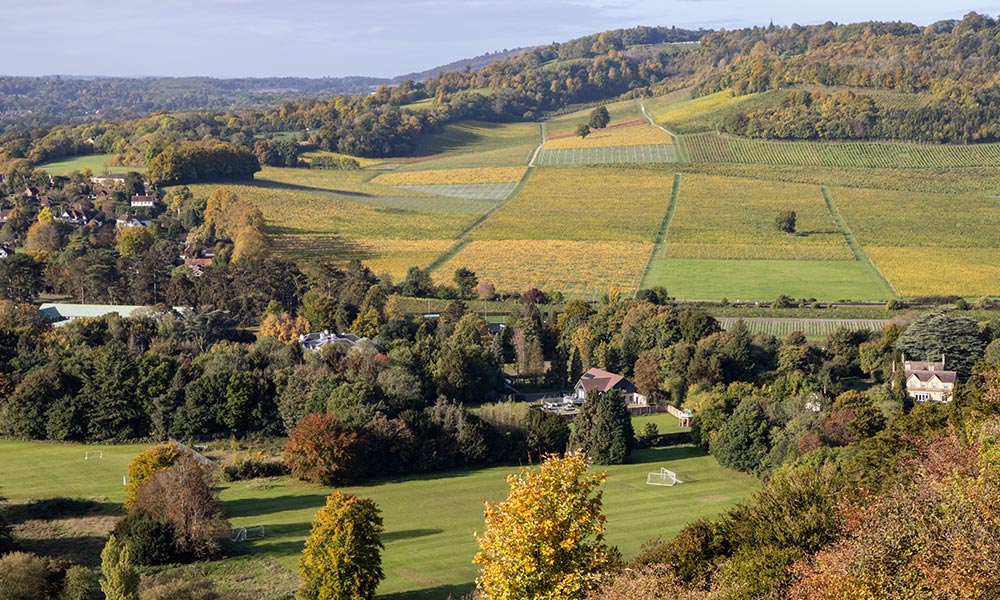
View from Box Hill
At just 735 feet, Box Hill may only be the twelfth highest peak in Surrey but it’s far and away the county’s most popular mount. Cyclists love the challenge of climbing it, lepidopterists come for the wonderful variety of butterflies, while day-trippers are attracted by the ravishing views across the Weald. This walk visits Box Hill’s premier viewpoint but also uncovers its fleeting military career, meets one of its more off-beat locals, and explores the fine woods that grace the summit.
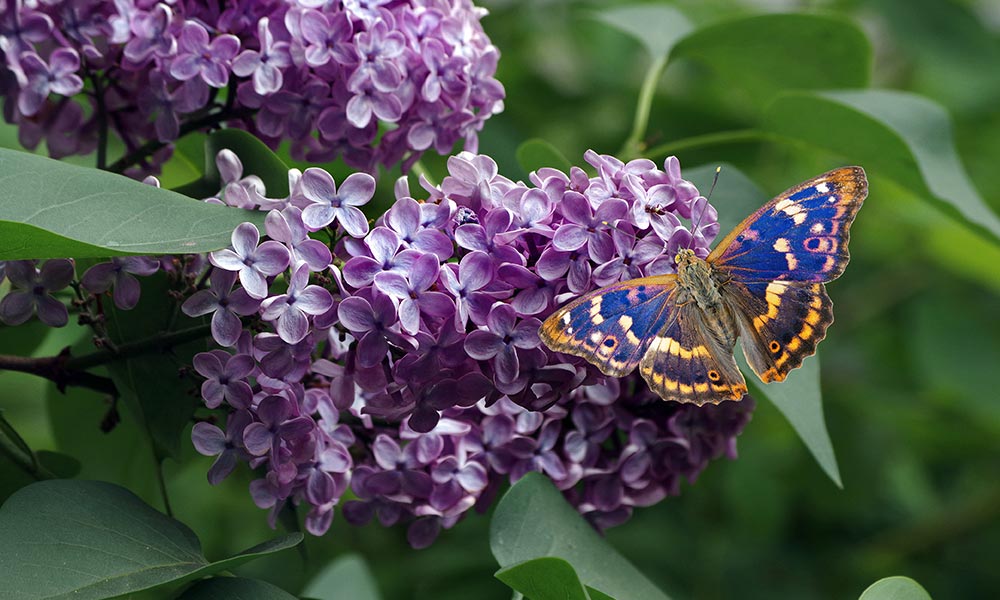
Purple Emperor butterfly
Part of the snappily titled Mole Gap to Reigate Escarpment Site of Special Scientific Interest (SSSI), Box Hill is a mecca for butterflies. No fewer than 38 species can be seen here. Come in March to see right yellow brimstones, orange-tips and holly blues, the earliest of the blue butterflies. Head for the woods in June and July to see purple emperors (Britain’s second-largest butterfly), white admirals and the jagged-edged wings of the comma. And out on the chalkland, in early summer try to spot marbled whites and in August silver-spotted skippers and, of course, chalk hill blues.
Ribblehead Viaduct
Yorkshire Dales – OS Short Walks Made Easy
- Distance: 2.9 miles / 4.7 km
- Start / Finish: Ribblehead Station
- Parking: LA6 3AS, Station car park for rail users only; roadside parking beside B6255, near its junction with B6479
- Public toilets: Station toilets for rail users
- Cafés / pubs: The Station Inn, Ribblehead
- Terrain: Mostly good tracks and surfaced lanes; short sections of rougher track
- Hilliness: Short ascent on rough track and descent on steps
From the Yorkshire Dales – OS Short Walks Made Easy book
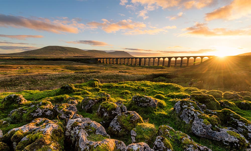
Ribblehead Viaduct
Ribblehead Viaduct is one of the most remarkable pieces of railway engineering in Great Britain. Its 24 arches span a distance of 440 yards, towering more than 100 feet above the surrounding moorland. Starting from Ribblehead Station on the Settle-Carlisle Railway, this walk heads out across the moorland and passes under the massive viaduct. Then, using a combination of farm lanes and tracks in the shadow of Whernside, Yorkshire’s highest hill, it comes back round to view the amazing structure from another angle.
The Settle-Carlisle Railway was the last English railway built almost entirely by hand. Work on it began in 1869 and, at the height of construction, about 6,000 workers from all over Britain and Ireland were involved. Climbing to almost 1,100 feet above sea level, this walk visits some of the highest ground encountered in the Short Walks Yorkshire Dales book. The wildlife reflects this with moorland grasses and sedges covering large areas.
Coombe Hill
Chilterns – OS Short Walks Made Easy
- Distance: 2.5 miles / 4 km
- Start / Finish: Coombe Hill
- Parking: HP17 0UR National Trust’s Coombe Hill car park, Lodge Hill, Ellesborough; 3 miles west of Wendover
- Public toilets: None
- Cafés / pubs: Wendover; ice cream van often in car park
- Terrain: Surfaced path; woodland trails and tracks; rougher paths across grassland and scrubland
- Hilliness: Flat then mostly gently undulating but with short, steeper slopes nearer the end
From the Chilterns – OS Short Walks Made Easy book.
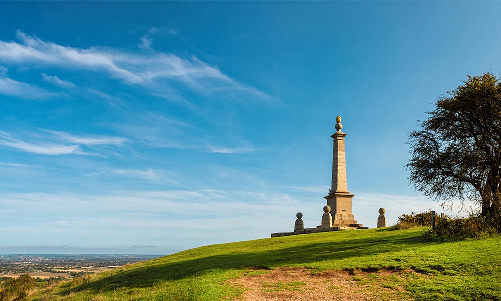
Coombe Hill
As befits the highest point in the Chilterns – 853 feet above sea level – the views from the memorial on Coombe Hill are truly magnificent. After heading out to the summit on a wheelchair friendly path, this figure-of-eight walk then continues along the top of the escarpment, allowing opportunities to soak up this amazing outlook as well as enjoy the birds, plants and insects typical of chalk country. The return route uses a track flanked by grand old beech trees.
This walk passes through a number of habitats, each giving rise to different species. You’ll find gorse, hawthorn, bramble and even juniper on the scrubland on Coombe Hill’s summit plateau, while the rare chalk grassland is home to fragrant orchids, bee orchids, clustered bellflowers, harebells, common rock-rose and wild thyme. Among the butterflies found here are the chalk hill blue, brown argus, marbled white and meadow brown.
Gisburn Forest
Forest of Bowland – OS Short Walks Made Easy
• Distance: 2.25 miles / 3.6 km
• Start / Finish: Stocks Reservoir car park
• Parking: BB7 4TS, Stocks Reservoir car park, at junction of School Lane and Hole House Lane
• Public toilets: Nearest at Gisburn Forest Hub, about 2 miles east from walk start along Hole House Lane
• Cafés / pubs: Café at Gisburn Forest Hub
• Terrain: Good, firm, stony forest tracks
• Hilliness: Gently undulating
From the Forest of Bowland – OS Short Walks Made Easy book.
Gisburn Forest. Credit: Peter McDermott (Geograph)
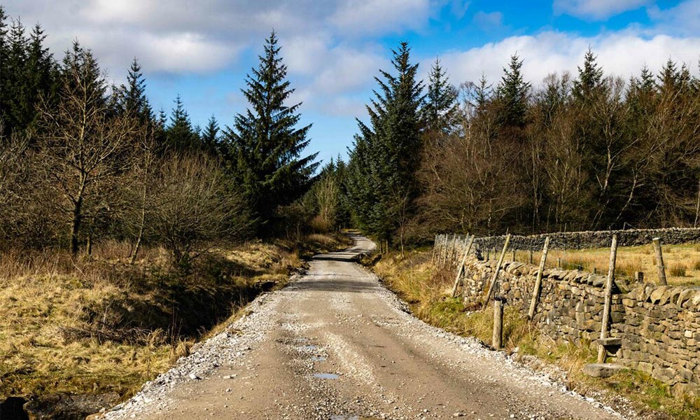
Gisburn Forest lies in the north-east corner of the Forest of Bowland, tucked between the wild Bowland heather moors and the chequered fields of the Hodder Valley. A good path network allows visitors the freedom to roam through the woods. Although most of the trees are either spruce or pine, you will not notice as the tracks are often lined with broad-leaved trees, which soften the scenery and let in the light for wildflowers and shrubs. For bird lovers there’s much to see on the shores of Stocks Reservoir.
Covering an area of 2,955 acres, Gisburn Forest is the largest wooded area in Lancashire. Most of the forest is planted with Sitka spruce and Scots pine but there is an area of ancient woodland known as Park Wood, south-east of Bottoms Beck. The 20-acre broad-leaved wood is classified as a Biological Heritage Site.
Ravenglass
Lake District – OS Short Walks Made Easy
• Distance: 2.2 miles / 3.5 km
• Start / Finish: Ravenglass car park
• Parking: CA18 1SQ Lake District National Park pay-and-display car park on Croftlands Drive, Ravenglass (not railway car park)
• Public toilets: At start
• Cafés / pubs: In Ravenglass; café at Ravenglass and Eskdale Steam Railway
• Terrain: Village Lane, shore path, beach and good track under trees
• Hilliness: Level walking
From the Lake District – OS Short Walks Made Easy book.
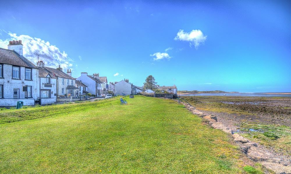
Ravenglass
Did you know the Lake District has a coastline? Not only that, but it also has a pretty little seaside village, called Ravenglass. Ravenglass is the only coastal village within the Lake District National Park. It sits on an estuary where three rivers meet –the Esk, Mitre and Irt. On a clear day, from higher points on this section of the coast, it’s possible to lookout across the Irish Sea to the Isle of Man.
The Romans knew about Ravenglass and built a port here. Take a stroll along the England Coast Path to see the remains of the Roman bath house and to enjoy the serenity of the village and the estuary. Beware, the 150-yardsection of the route beside the River Esk floods at exceptionally high tides
Ilam
Peak District – OS Short Walks Made Easy
• Distance: 1.9 miles / 3 km
• Start / Finish: Ilam Hall
• Parking: DE6 2AZ, National Trust car park
• Public toilets: Ilam Hall
• Cafés / pubs: National Trust tearoom
• Terrain: Lanes, tracks and open grassy hillside
• Hilliness: Gently undulating
From the Peak District – OS Short Walks Made Easy book.
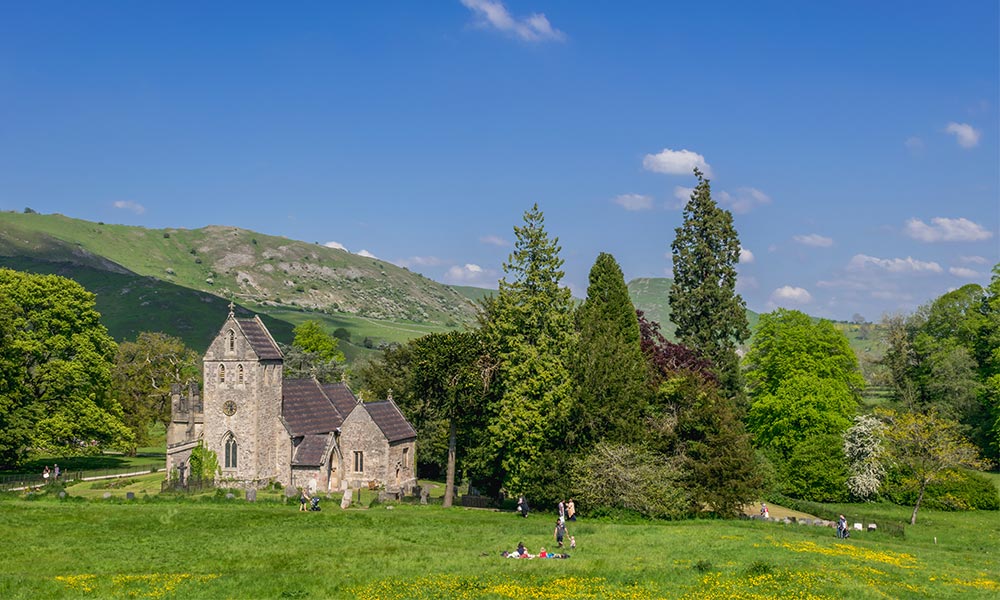
Ilam church
One of the prettiest in Derbyshire, the 19th-century estate village of Ilam offers an enjoyable and relaxing stroll taking in parkland, woods and riverside. There’s plenty to see along the way including the resurgences of underground rivers, a Saxon cross and an interesting church that has Saxon roots. Although the village has no pub, there is a National Trust tearoom in Ilam Hall.
Ilam Hall’s gardens are well worth visiting. Prominent medieval ridge and furrow marks can be seen across the wooded park, where sheep graze freely. The parkland includes a line of lime trees, Lebanese cedar and a giant sequoia, planted around 200 years ago.
Dolgellau: The Mawddach Trail
Snowdonia – OS Short Walks Made Easy book
• Distance: 2.4 miles / 3.8 km
• Start: Dolgellau Bridge
• Finish: Penmaenpool
• Parking: LL40 1DL, The Marian car park, Dolgellau
• Public toilets: The Marian short-stay car park, Dolgellau; by the toll bridge, Penmaenpool
• Cafés / pubs: Dolgellau; George III Inn, Penmaenpool
• Terrain: Well-surfaced tracks
• Hilliness: Level throughout
From the Snowdonia – OS Short Walks Made Easy book.
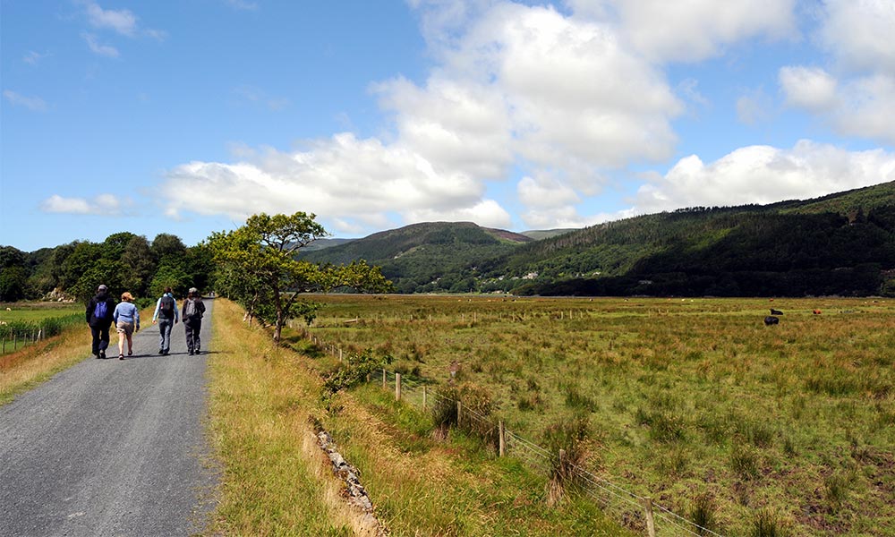
The Mawddach Trail
This easy-paced stroll begins alongside the riverside recreation ground known locally as the Marian. The river by your side is the Wnion, which has flowed down from the Aran mountains. Entering the marshy valley of the Mawddach, the track eases across wetlands until it comes to Penmaenpool, with its little signal box/information centre, a fine wooden toll bridge and the welcoming George III Inn – a splendid place for some refreshment before the bus ride back to Dolgellau.
Dolgellau today is a splendid town built from stone and slate and dominated by Gau Crag, the last buttress of the Cadair Idris range. Although Roman coins have been found, there was no significant settlement here until the 12th century, for the lands were marshy. The original church was established at this time, as was Cwmer Abbey, an important religious centre. The stone bridge dates back to 1638 and the current church of St Mary was built in 1716.
Kingussie
Aviemore and the Cairngorms – OS Short Walks Made Easy
• Distance: 3.6 miles/5.7km
• Start / Finish: Kingussie
• Parking: PH21 1EU, Ardvonie car park
• Public toilets: Ardvonie car park
• Cafés / pubs: Kingussie
• Terrain: Good paths and road to Ruthven Barracks; road and earth paths with steps around Gynack Burn
• Hilliness: Fairly flat except for short climb to top of Ruthven Barracks mound and undulations on Gynack Mill Trail
From the Aviemore and the Cairngorms – OS Short Walks Made Easy book.
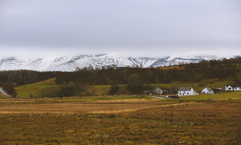
Kingussie in winter
Kingussie is a planned town, built by the 4th Duke of Gordon in the 1790s.The original settlement was on the other side of the Spey at Ruthven, where old roads came together at a ford across the river. The first part of this walk is there-and-back to historic Ruthven Barracks. The second part follows the Gynack Mill Trail around a wooded stream where there are several interpretation boards about the history of the place.
The steep little valley of the Gynack Burn is shaded by native deciduous woodland that is rich in wildlife. In spring it is carpeted in wildflowers, such as wood anemone, wood sorrel and primrose. In autumn red squirrels can be seen overhead in the hazels, looking for nuts. A very different habitat is found across the Spey at the foot of Ruthven Barracks, where the Ins Marshes are home to redshank, lapwing and oystercatcher.
These may be our favourite short walks in Britain but there are plenty more to explore! Our growing collection of OS Short Walks Made Easy Guidebooks help you plan your next adventure at home and follow the routes when you’re out. Want to find out more? Check out our guide to OS walking books so you can choose the right guide for you.