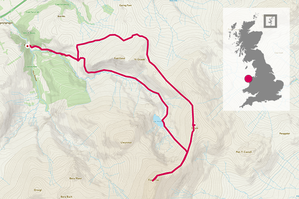
Get the sense of adventure and solitude and see many aspects of Snowdon across the day. You’ll see amazing waterfalls, rocks, old settlements, ridge lines and of course, the famous summit trig pillar!
SH 627 526
This path was named after Sir Edward Watkin who was a Member of Parliament who retired to live in Snowdonia. He was responsible for the first designated footpath in Britain as he extended the path to the slate quarry all the way to the summit, for tourists. What amazing history!
Starting from the village of Nantgwynant, which is about 15mins drive from the popular Pen y Pass starting point, get on the path which is nicely sign posted from the road. It’s a gently ascent and soon you’ll be at the beautiful waterfalls that follow up to Gladstone Rock. This is a decent place to stop for a quick slurp of tea and bite of flapjack. It’s worth a read of the plaque and try to imagine the hundreds of people gathered to listen to William Gladstone.
2.4 km
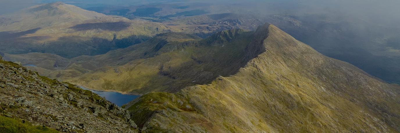
The path jiggles around here as you’ll head West, and then East, but it’s nicely defined and a short pinch and you’ll be up on the ridge line between Lliwedd and Snowdon. Don’t forget to have a look around as there are wonderful old buildings and settlements from the old barracks for the South Snowdon Slate Quarry.


3.33 km
This valley was also used for the film ‘Carry on up the Khyber’ and have a look for old marks on the buildings where they were used for target practice during WW1. A great place for kids to explore if you’ve got family with you.
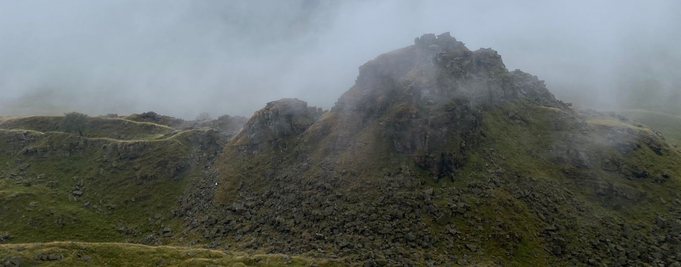
I hope the views are good for you as you’ll be able to see a lot of features around you. Push towards the summit now, following the path, although it’s not very defined in places and can be a scree scramble in places. Keep bearing with it and it’ll soon be over. There is a project to help define this path in more detail!
You’ll hit some flat ground where the Rhyd Ddu path intersects and swing round and head to the summit. On a nice day it may be crowded, even though you’ve only seen a few people, so decide how to play this. Perhaps bag the trig point summit and head back a little to find some solitude to reflect on the route up.
6 km


On the way down follow the Rhyd Ddu path BUT be careful to not go too far. To hit the South Ridge you need to stay tight to the drop on your left but not too close! Make sure you’ve got your map and compass to hand and please check along the way.
8.4 km
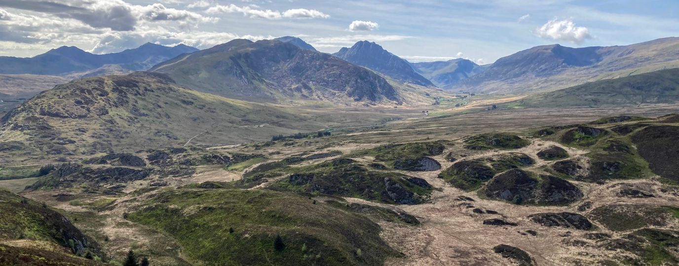
You’ll head south for a while now until you hit Bwlch Cwm Llan where you pick up a path going East that works it’s way back towards where you would have been just before the Gladstone Rock. With a sense of self satisfaction head back along the same path, dip your feet in the cool water, and work your way back to the start point.
Caffi Gwynant serves amazing coffee and cake…just saying 😉
12.07 km SH 626 505
12.07 km / 7 miles

EXPLORE THE
OS Shop
We are with you every step of the way. Shop our trusted walking and hiking maps and guidebooks so you can explore the outdoors with confidence.
Go to the shopShop Eryri OS Maps & Hiking Guidebooks
See More Eryri National Park (Snowdonia) Articles
Yr Wyddfa (Snowdon): Routes to the top
There are many routes to the top of Snowdon (in Welsh ‘Yr Wyddfa’) with some big paths that can get crowded and some lesser-trodden trails. Here’s all you need to know about the routes up Snowdon.
Best Beginner Hikes in Eryri (Snowdonia)
Beginner hikes in Eryri! Hilary Pullen, North Walian and Editor of Get Outside has picked some great beginner hikes to try in Snowdonia!
Eryri National Park (Snowdonia)
Peaks, paths and lakes for great walks, climbs and fishing.