Rippon Tor Trig Pillar
Where am I?
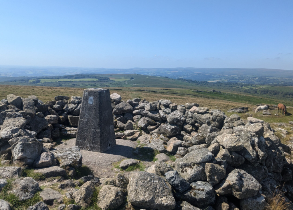
If you have just scanned a QR Code and opened this page then you are at Rippon Tor trig pillar, which stands at 473 meters (1,552 feet) above sea level. It offers 360-degree views across Dartmoor.
OS Grid Ref: SX 74637 75570
Rippon Tor Local trivia:

War and peace: Can you see a tall, buttressed brick structure about a mile to the south? This is the Rippon Tor Rifle Range, built and used to train soldiers for the Second World War and in active use until the 1970’s.
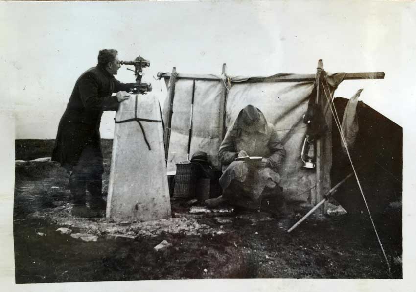
Navigation aid: When Devon was mapped in 1895, the surveyors triangulating the area for the first time apparently exchanged signals from here with Wells Cathedral, 66 miles away (have a look north-east and see if you can spot it!). For centuries Rippon Tor has also guided sailors into the harbours of Teignmouth and Dartmouth as it has a clear singular peak, visible from the sea.
PALs: The area around Rippon Tor has been designated a Premier Archeological Landscape (PAL) as it has the largest system of prehistoric land division in Britain (likely to have been around 4000 hectares at its peak). These linear boundaries, or ‘reaves’ run north-west to south-east. See if you can see any parallel lines of stones, rubble or changes in the vegetation, particularly running down the south-east slope of the Tor towards Horridge Common.
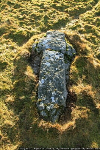
Criss Cross: About 25 metres north-west of the summit cairn, look for a stone cross lying on the ground. Some say it was never meant to be separated from the boulder it is carved from, acting to ward off evil spirits. Others think it was a medieval stone masons’ worst nightmare – the rock fracturing during the quarrying process.
Trig Quiz
Test your trig pillar knowledge!
More information
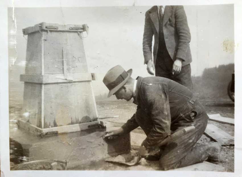
About trig pillars: What even is this?
You are standing at a triangulation pillar, commonly known as a ‘trig pillar’. They were built across Great Britain in the late 1930’s to help map the country.
About Rippon Tor: What can I see?
Orientate yourself to the north. The most captivating views from Rippon Tor are those in front of you, where the high open moorland stretches inland to the west.
Turning clockwise, slightly east, you can see the dramatic drop in elevation towards the sea. Before accurate mapping, topographers believed Rippon Tor was the second-highest point on Dartmoor, after Cosdon Hill on the North Moor!
Much closer, you’ll find a plethora of artifacts around Rippon Tor, including three massive prehistoric burial cairns, a probable granite cross set into the ground, two abandoned millstones, and one apple crusher.
Southwards, the landscape broadens into dramatic countryside, extending into the remote wilderness.
Continue turning towards the west, and you can see sweeping views across Dartmoor, with other tors dotting the horizon.
About the landscape around Rippon Tor
The rocks around Rippon Tor are mainly granite, and as with the other Tors in the area, typically has as many as 60 species of lichen covering much of the rock surface.
The land here is high moorland. It is one of two high and remote plateaus, separated by the Dart Valley.
These large areas of grasses, heather and blanket bog have a network of streams and mixed valley mires cutting through them (the water that drains off the moorland is the source of many of the major rivers in Devon). This mix provides rich and important habitats for some distinctive wildlife:
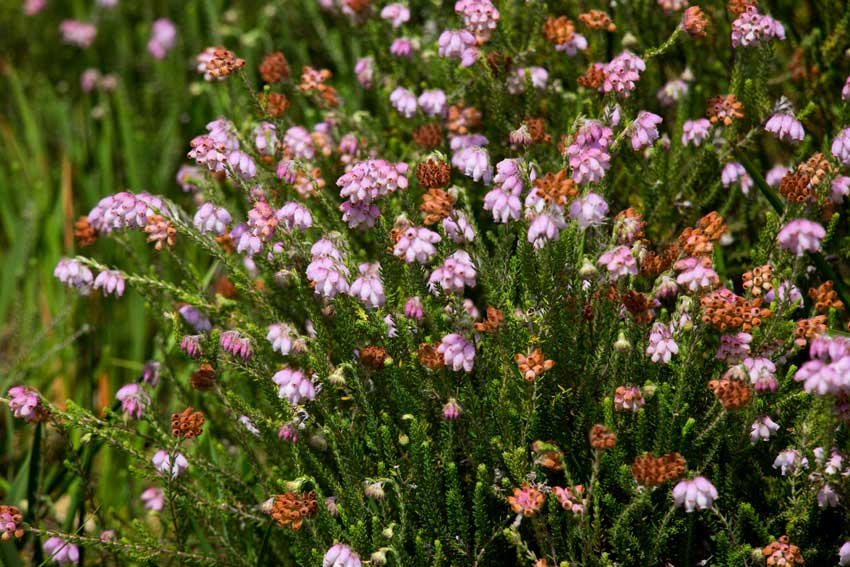
The upland areas you can see from Rippon Tor are dominated by dwarf shrubs; heather, bilberry, cross-leaved heath and western gorse, and grasses including purple moor grass and bristle bent grass.
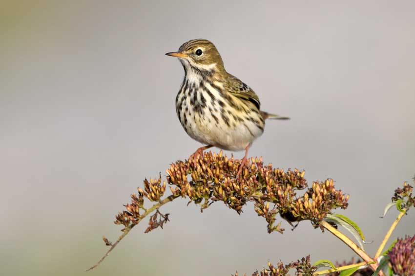
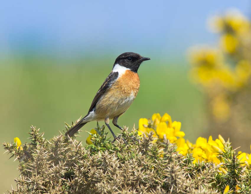
You might be able to spot some of the animals and insects that make their home here – the adder and common lizard, red grouse, raven, meadow pipit, and stonechat. In the spring and summer you can hear skylarks singing overhead.
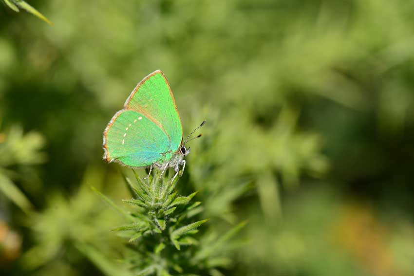
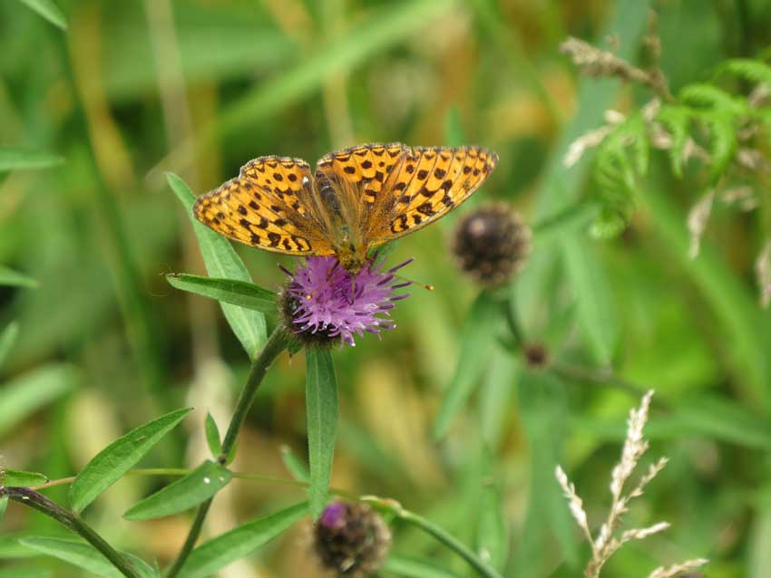
Emperor and fox moths and the green hairstreak butterfly are also characteristic of this area. If you look around bracken stands, you may even see a rare high brown fritillary butterfly.
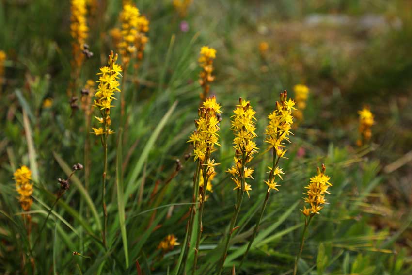
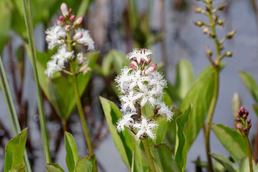
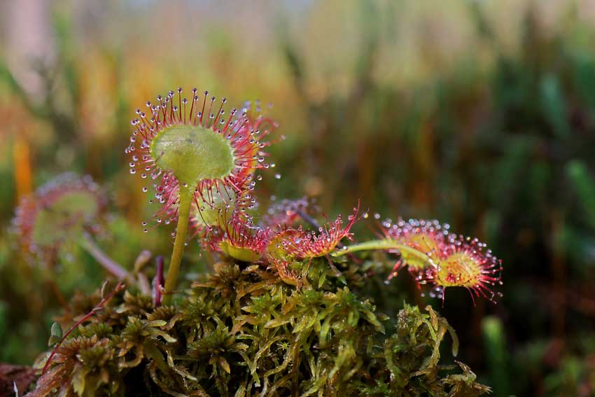
The valley mires are areas of deep water-logged peat in the valley bottoms. Here you’ll see plants such as cotton-grass, cross-leaved heath, bog asphodel, bog-bean, round-leaved sundew, pale butterwort, marsh St John’s-wort, moorland water crowfoot and bog pimpernel.
Snipe and curlew can be seen and heard in the mires, along with common frog, golden-ringed dragonfly and black darter dragonfly.
Find out more about Dartmoor habitats, the challenges they face and the work being done to help them flourish through the Dartmoor National Park.
Inspiration
Local activity ideas
Dartmoor National Park is managed by the Dartmoor National Park Authority and you can find out more about the work they do, local activities and events and how you can get involved through their site below:
Local routes
Famously desolate and mysterious, Dartmoor National Park is ideal for learning navigation skills, or just finding somewhere away from the crowds.
Hundreds more routes on OS Maps
Find Dartmoor related maps and products in our online shop
Staying Safe
We hope you’re enjoying your adventure today. Here are some top tips to help keep you safe:
Do you know where you are and where you’re going?
Getting lost can lead to serious trouble. Weather and visibility can change quickly and it can be easy to lose track of a path.
If you’ve got a map with you and aren’t confident in how to use it, have a quick look at some of our map reading guides.
If you don’t have a map, open or download OS Maps to find out exactly where you are and help you plan an alternative route to safety if you need it.
Livestock
Leave gates as you found them – open or closed. Respect livestock and pay particular notice when paths cross cattle fields as they can become aggressive if protecting their calves, especially if you have a dog with you. Keep dogs under control and in sight at all times
Road walking
Take care on narrow country roads without pavements and walk facing oncoming traffic.
Hills & Slopes
Risk of slips and falls is much greater on steep or uneven terrain, so go steady. Walking poles or a stout stick can help.
Battery drain
Keep an eye on the battery of your phone – make sure you’ve always got enough to call for help if you need it.
Injuries
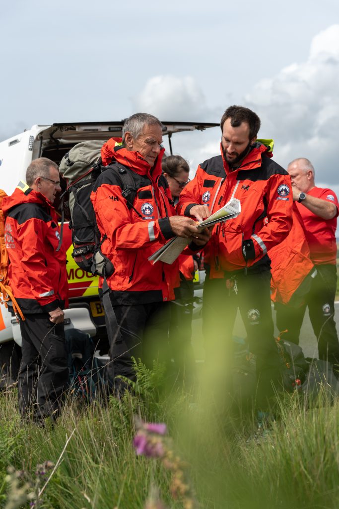
Mountain Rescue in England and Wales is a voluntary service, available via 999 and the Police for those in trouble on upland and mountainous places. Their volunteers are available to help 24/7 and 365 days a year.
You can set up your mobile phone in advance to use emergency SMS text. There are (at least) two good reasons to register:
- If there’s not enough signal to call, you can often still send a text.
- If the weather’s windy it can be hard to hear a voice call.
Contacting Mountain Rescue by Phone
- Call 999 and ask for the Police. Then ask for Mountain Rescue.
- Provide as much detail as you can: who you are, where you are, number in your group, how you all are and a contact number.
- Keep as safe and warm as you can and wait for Mountain Rescue to contact you with advice.
- Do not move unless asked to by Mountain Rescue. They need to keep in touch and mobile signals vary a lot in the hills.
If you cannot make voice calls, you can contact the 999 emergency services by SMS text from your phone.
Contacting Mountain Rescue by SMS Text
- If you have not registered, text ‘register’ to 999 and follow the instructions.
- Text 999 with
- Who you need (Police – Mountain Rescue)
- What is the problem (briefly)
- Where you are
- The emergency service will either ask for more information or will tell you that help is on the way. Don’t assume that your message has been received until the emergency service sends a message back.
- It will usually take about two minutes before you get a reply. If you don’t get a reply within three minutes, try again or find other ways of getting help

