North Hessary Tor Trig Pillar
Where am I?
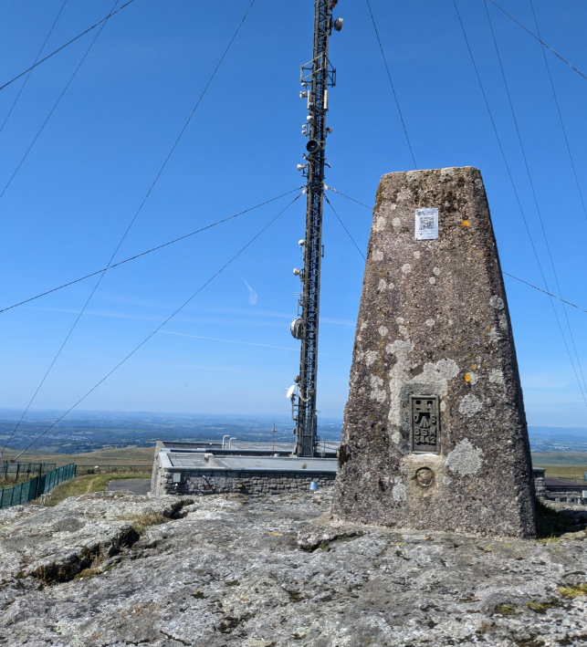
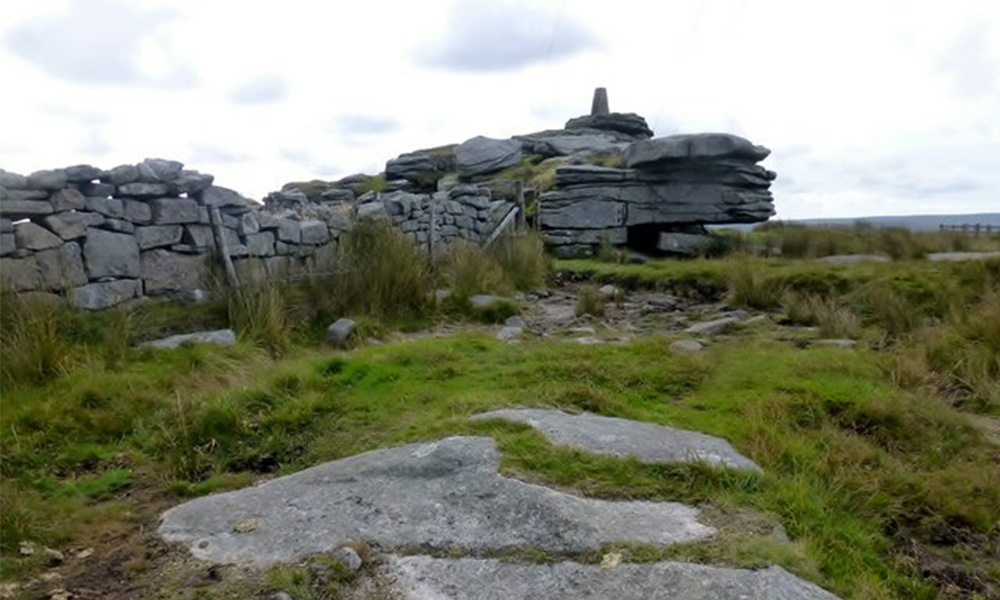
If you have just scanned a QR Code and opened this page you are at North Hessary Tor trig pillar, which stands at 517 meters (1,696 feet) above sea level. It offers a phenomenal viewpoint from which you could see over 100 tors across Dartmoor and the surrounding area.
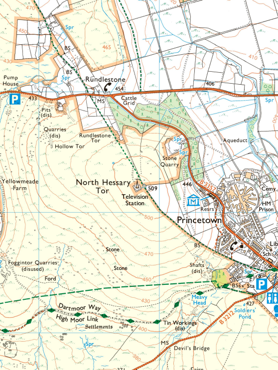
OS Grid Ref: SX 57873 74216

North Hessary Tor is a phenomenal viewpoint at 517 metres (1,696 feet) above sea level. Its trig pillar commands a staggering panorama that few others can possess, embracing no less than 100 other tors across Dartmoor and surrounds.
North Hessary Tor Local Trivia
Manmade Landmark: The most striking feature here, obviously, is the remarkable 196-metre high transmitter mast, built in 1955, and still transmitting FM radio and TV signals to the area. It is perhaps Dartmoor’s most recognisable manmade landmark.
Boundary Conditions: The tor was formerly known as North Hisworthy Tor, and was once a boundary point on the Dartmoor Forest Perambulation of AD 1240; Twelve knights walked the route on the orders of King Henry III to define the boundary of the royal forest. Lydford was the administrative centre of the Royal Forest, and anyone who died within this massive parish had to be carried in a coffin to the town; along what is known as the ‘Way of the Dead’ or the ‘Lych Way’. Some coffin bearers had to trudge over 10 miles to do their duty!
Water Works: See if you can find the inscription “PCWW / 1917” on the south-west face of the tor. This denotes “Plymouth Corporation Water Works”, the company behind the construction of Burrator Reservoir about 3 miles south of here. There are around 70 granite posts making the edge of the catchment area of the reservoir. North Hessary, the highest part of the catchment, is unusual in that the inscription is not on a post but a tor!
Trig Quiz
Test your trig pillar knowledge!
More information
About trig pillars: What even is this?
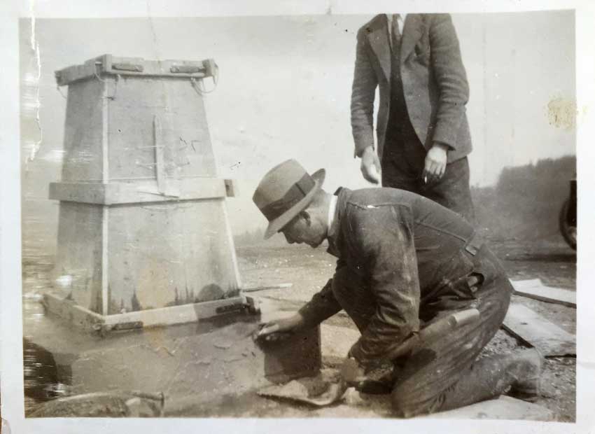
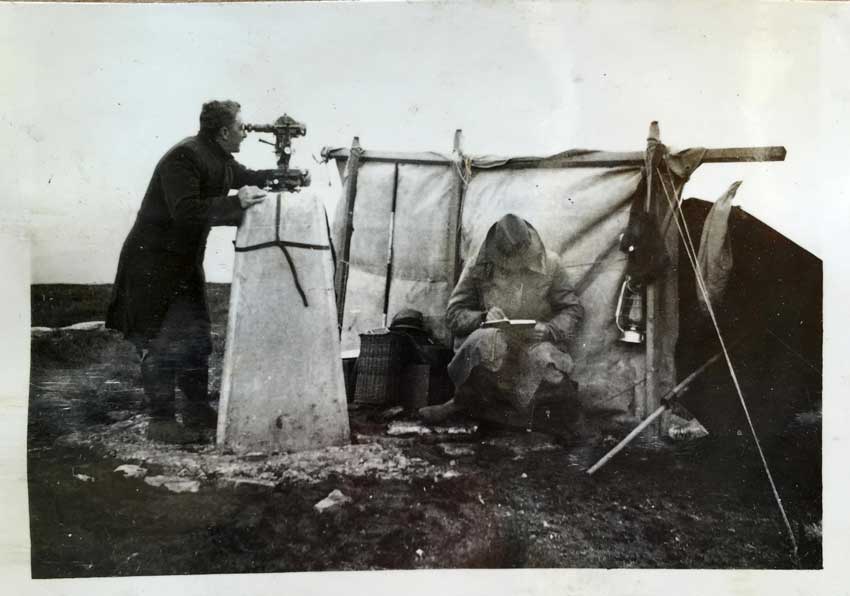
You are standing at a triangulation pillar, commonly known as a ‘trig pillar’. They were built across Great Britain in the late 1930’s to help map the country.
About North Hessary Tor: What can I see?
Orientate yourself to the north. The most captivating views from North Hessary Tor are those in front of you, where you will see the iconic tors of Dartmoor.
Turning clockwise, slightly east, you can spot Great Mis Tor, followed by Fur Tor, Beardown Tor, and Longaford Tor. Much closer, you’ll see the prominent shapes of Bellever Tor, Hay Tor, Rippon Tor, Sheeps Tor, and Leather Tor.
Continuing southwards, the landscape broadens into the dramatic countryside, leading to the heights of Cut Hill and Fur Tor.
Turning west and southwest, you can see the rugged outlines of Great Mis Tor and beyond the Walkham Valley, while the distant Bodmin Moor stretches towards North Cornwall.
Be aware of the nearby Army Firing Range at Merrivale. Avoid approaching if a red flag is flying.
More About North Hessary Tor: The History
The tor itself, formerly known as North Hisworthy Tor, was once a boundary point on the Dartmoor Forest Perambulation of AD 1240, which was defined by the knights who rode the boundary on horseback and to which everyone who died within this massive parish had to be carried a long way in a coffin to Lydford; along what is known as the Lych Way.
Another interesting feature is the inscription PCWW / 1917 on the south-west face of the tor, which denotes Plymouth Corporation Water Works, the company that instructed the construction of Burrator Reservoir, completed in 1898. There are around 70 granite posts all around the catchment area of the reservoir so that Plymouth Corporation could put a stop to pollution coming from any of the surrounding farms, which were subsequently abandoned by moving out the inhabitants with no compensation offered. North Hessary, the highest part of the catchment, is unusual in that the inscription is not on a post but a tor!The most striking feature here, obviously, is the remarkable 196-metre high transmitter mast, perhaps Dartmoor’s most recognisable manmade landmark.
About the landscape: flora and fauna
The mean daily temperatures on North Hessary Tor, at 510 metres above sea level, are always 2 to 4°C below those at Yarner Wood, which stands at 198 metres and is tucked away in the more sheltered eastern side of the moor. Frequent strong winds and many days of poor visibility with mist and rain result in a climate that can present a formidable challenge for both wildlife and the people who work the land.
The high moorland around North Hessary Tor is characterized by extensive grasses, heather, and blanket bog, creating a lush landscape crisscrossed by streams and valley mires. These water sources feed many of Devon’s major rivers, fostering rich habitats for a wide range of wildlife.
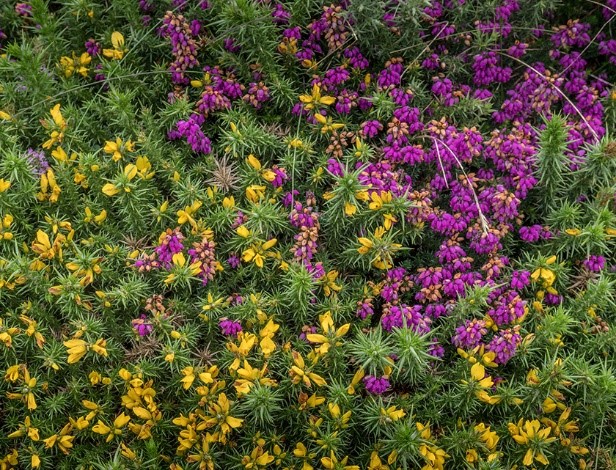
The upland areas are covered with dwarf shrubs like heather, bilberry, cross-leaved heath, and western gorse, as well as grasses such as purple moor and bristle bent. This diverse flora supports various wildlife, including adders, common lizards, red grouse, ravens, meadow pipits, and stonechats. During the spring and summer, the air is filled with the melodic songs of skylarks.
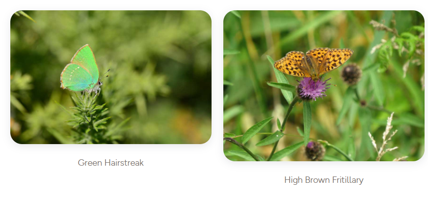
Emperor and fox moths, along with the green hairstreak butterfly, are typical of this area. If you look closely around the bracken stands, you might even spot the rare high brown fritillary butterfly.
The valley mires, with their deep, waterlogged peat, support specialized plants like cotton-grass, cross-leaved heath, bog asphodel, bog-bean, round-leaved sundew, pale butterwort, marsh St John’s-wort, moorland water crowfoot, and bog pimpernel. These mires are vital habitats for snipe, curlew, common frogs, golden-ringed dragonflies, and black darter dragonflies, all of which contribute to the region’s rich biodiversity.
Find out more about Dartmoor habitats, the challenges they face and the work being done to help them flourish through the Dartmoor National Park.
Inspiration
Local activity ideas
Dartmoor National Park is managed by the Dartmoor National Park Authority and you can find out more about the work they do, local activities and events and how you can get involved through their site below:
Local routes
Famously desolate and mysterious, Dartmoor National Park is ideal for learning navigation skills, or just finding somewhere away from the crowds.
Hundreds more routes on OS Maps
Find Dartmoor related maps and products in our online shop
Staying Safe
We hope you’re enjoying your adventure today. Here are some top tips to help keep you safe:
Do you know where you are and where you’re going?
Getting lost can lead to serious trouble. Weather and visibility can change quickly and it can be easy to lose track of a path.
If you’ve got a map with you and aren’t confident in how to use it, have a quick look at some of our map reading guides.
If you don’t have a map, open or download OS Maps to find out exactly where you are and help you plan an alternative route to safety if you need it.
Livestock
Leave gates as you found them – open or closed. Respect livestock and pay particular notice when paths cross cattle fields as they can become aggressive if protecting their calves, especially if you have a dog with you. Keep dogs under control and in sight at all times
Road walking
Take care on narrow country roads without pavements and walk facing oncoming traffic.
Hills & Slopes
Risk of slips and falls is much greater on steep or uneven terrain, so go steady. Walking poles or a stout stick can help.
Battery drain
Keep an eye on the battery of your phone – make sure you’ve always got enough to call for help if you need it.
Injuries
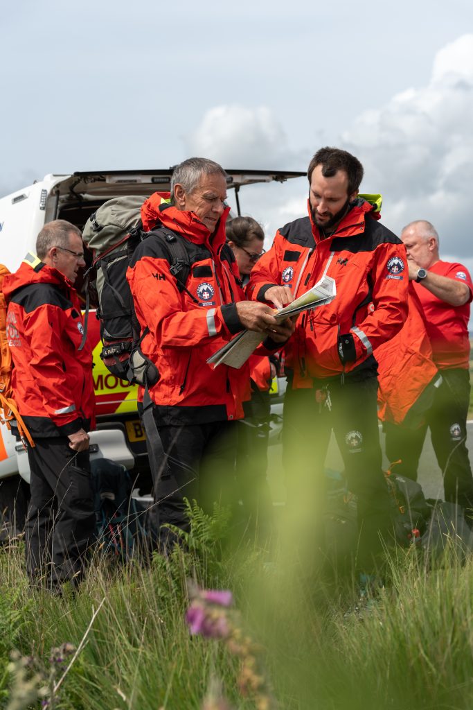
Mountain Rescue in England and Wales is a voluntary service, available via 999 and the Police for those in trouble on upland and mountainous places. Their volunteers are available to help 24/7 and 365 days a year.
You can set up your mobile phone in advance to use emergency SMS text. There are (at least) two good reasons to register:
- If there’s not enough signal to call, you can often still send a text.
- If the weather’s windy it can be hard to hear a voice call.
Contacting Mountain Rescue by Phone
- Call 999 and ask for the Police. Then ask for Mountain Rescue.
- Provide as much detail as you can: who you are, where you are, number in your group, how you all are and a contact number.
- Keep as safe and warm as you can and wait for Mountain Rescue to contact you with advice.
- Do not move unless asked to by Mountain Rescue. They need to keep in touch and mobile signals vary a lot in the hills.
If you cannot make voice calls, you can contact the 999 emergency services by SMS text from your phone.
Contacting Mountain Rescue by SMS Text
- If you have not registered, text ‘register’ to 999 and follow the instructions.
- Text 999 with
- Who you need (Police – Mountain Rescue)
- What is the problem (briefly)
- Where you are
- The emergency service will either ask for more information or will tell you that help is on the way. Don’t assume that your message has been received until the emergency service sends a message back.
- It will usually take about two minutes before you get a reply. If you don’t get a reply within three minutes, try again or find other ways of getting help

