
Where am I?
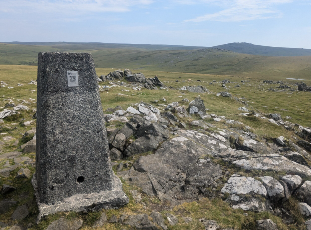
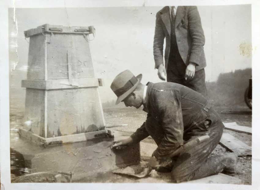
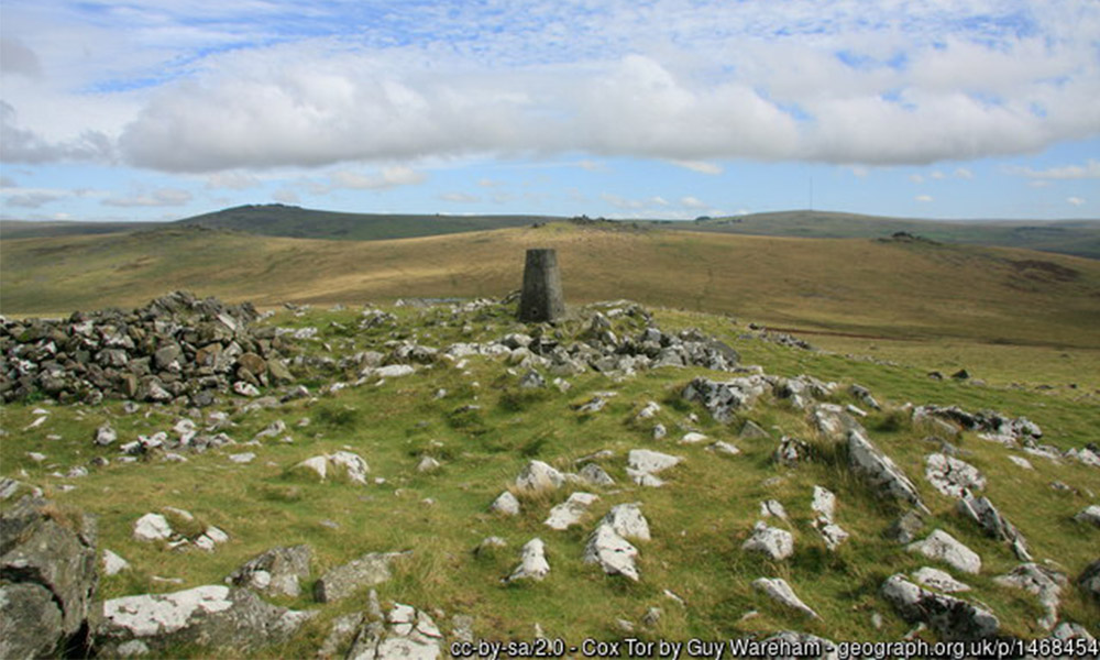
If you have found this page by scanning an Ordnance Survey QR Code then you are at Cox Tor trig pillar, which stands at 442 metres (1,450 feet) above sea level. It is a commanding viewpoint on the western side of Dartmoor, overlooking the ancient town of Tavistock.
OS Grid Ref: SX 530 751
Cox Tor Trivia
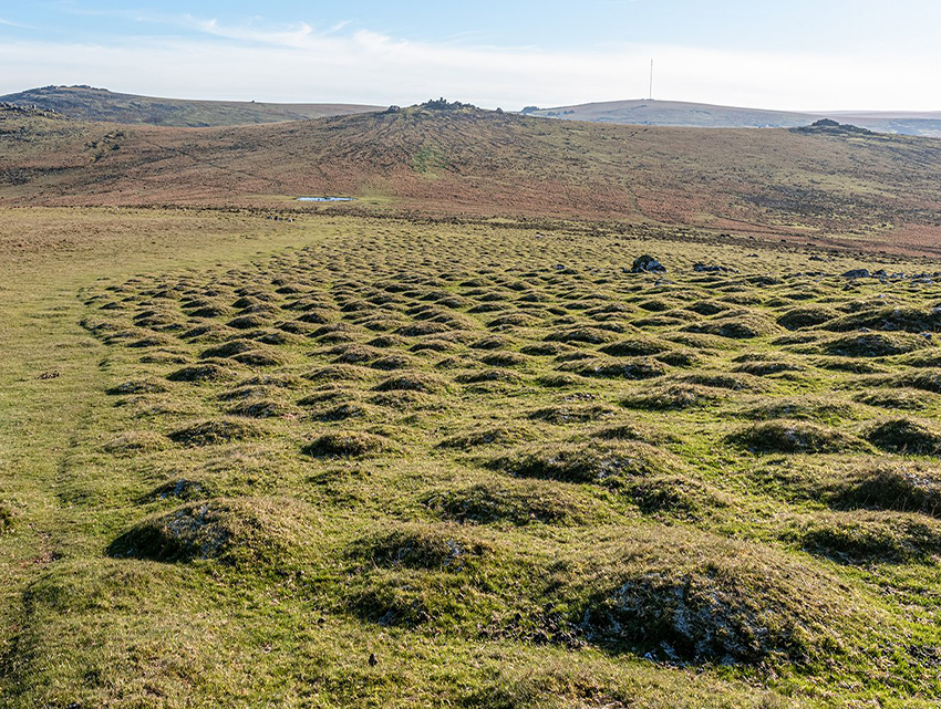
Did you spot any thufurs on your way up? These are the small earth bumps on the moor. Some say they are due to frost heave during the last ice age – this area was the edge of a glacier and experienced seasonal freezing and thawing. Others think they are the work of the yellow meadow ant taking advantage of the well-drained soil here. What do you think caused them?
Below the trig pillar, look for 8 carved boundary stones with the initials R.B., rumored to refer to ‘Reep Bounds’, as the Reep family farmed the area since the 14th century.
What’s in a name? Some say Cox or Cock’s Tor is derived from the old Cornish word for “cuckoo,” (Kok) while others believe it could simply be from an old man named Cock.
Trig Quiz
Test your trig pillar knowledge!
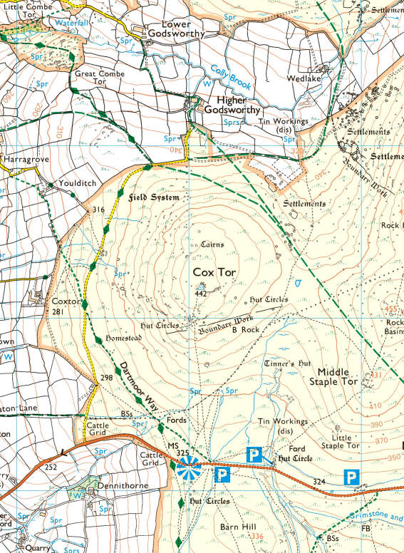
About Cox Tor: What Can I See?
Cox Tor is Dartmoor’s second-highest non-granite tor (after White Tor) that is composed of dolerite and metamorphic rocks. The views all around are mesmerising: looking far north the great escarpment of tors and hills climbs to the spine of rocks at Great Links Tor. Moving clockwise and much closer to us the grand tors of Roos, Great Mis, Great and Middle Staple, each with their huge clitters that sparkle in the sunshine, rise dramatically above Beckamoor Combe and the Walkham Valley.
Southward you can glimpse the wooded Walkham departing the moor, with lower tors crowning the hillside above its right (west) bank; Vixen, Heckwood and Pew Tors. The River Tamar, and the railway bridge across the Tavy at its confluence with that river, can be made out on an exceptionally clear day. Farthest west can be discerned the eastern heights of Bodmin Moor, including Caradon Hill, Stowe’s Hill and Kilmar Tor.
There are multiple Bronze Age cairns at Cox Tor, especially to the north of the trig point.
About the Cox Tor landscape: flora and fauna
The rocks around Cox Tor are primarily composed of dolerite and metamorphic rocks, setting it apart from the granite Tors nearby. These rocks host a variety of lichens, adding a vibrant texture to the landscape and highlighting the diversity of Dartmoor’s geology.
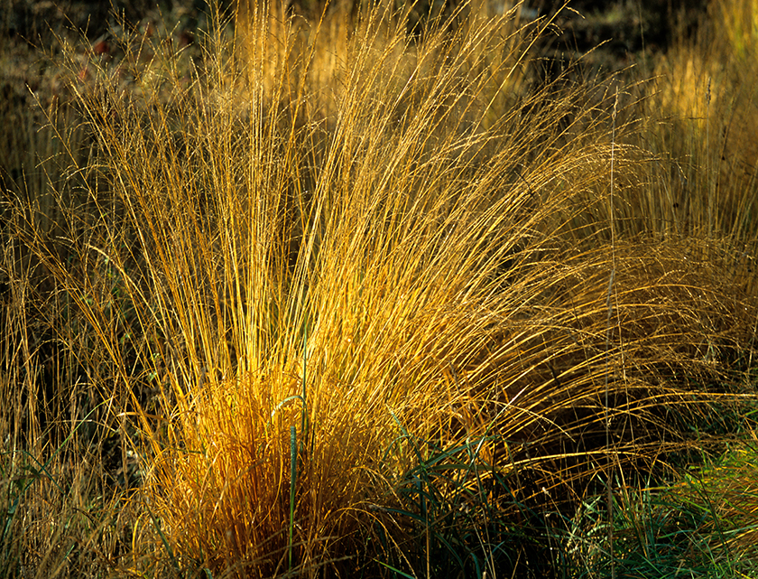
This is an area of open moorland, a vast expanse increasingly dominated by grass moor over heather and blanket bog.
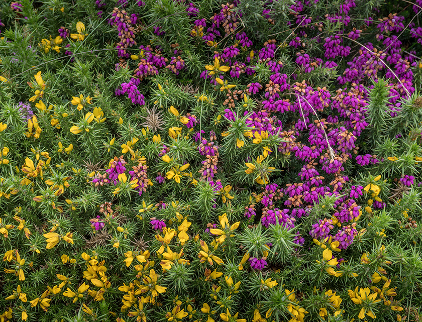
The vegetation around Cox Tor has a heathland character – look out for heathers, gorse scrub, tufts of Molinia grass, bracken and scattered, windswept trees.
While the moorland appears wild and unmanaged, its distinctive character is maintained by commoners grazing cattle, sheep and ponies across it.
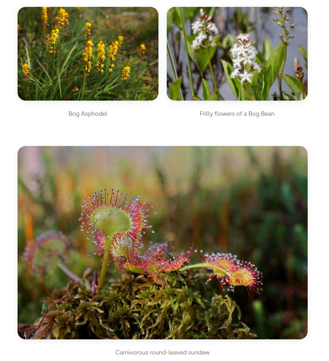
The blanket bogs around the Tor join the valley mires in creating a network of waterways threading their way through the landscape feeding fast-flowing tributary streams cutting through the steep sided valleys off the moor.
The valley mires, deep, waterlogged peat areas, are home to specialized plants like cotton-grass, cross-leaved heath, bog asphodel, bog-bean, round-leaved sundew, pale butterwort, marsh St John’s-wort, moorland water crowfoot, and bog pimpernel.
In the mires, you might spot or hear snipe and curlew. Common frogs, golden-ringed dragonflies, and black darter dragonflies also inhabit these areas, adding to the rich biodiversity.
Cox Tor’s landscape and ecology are a testament to Dartmoor’s beauty and complexity. To learn more about these habitats, the challenges they face, and conservation efforts, visit the Dartmoor National Park website.
Inspiration
Local activity ideas
Dartmoor National Park is managed by the Dartmoor National Park Authority and you can find out more about the work they do, local activities and events and how you can get involved through their site below:
Local routes
Famously desolate and mysterious, Dartmoor National Park is ideal for learning navigation skills, or just finding somewhere away from the crowds.
Hundreds more routes on OS Maps
Find Dartmoor related maps and products in our online shop
Staying Safe
We hope you’re enjoying your adventure today. Here are some top tips to help keep you safe:
Do you know where you are and where you’re going?
Getting lost can lead to serious trouble. Weather and visibility can change quickly and it can be easy to lose track of a path.
If you’ve got a map with you and aren’t confident in how to use it, have a quick look at some of our map reading guides.
If you don’t have a map, open or download OS Maps to find out exactly where you are and help you plan an alternative route to safety if you need it.
Livestock
Leave gates as you found them – open or closed. Respect livestock and pay particular notice when paths cross cattle fields as they can become aggressive if protecting their calves, especially if you have a dog with you. Keep dogs under control and in sight at all times
Road walking
Take care on narrow country roads without pavements and walk facing oncoming traffic.
Hills & Slopes
Risk of slips and falls is much greater on steep or uneven terrain, so go steady. Walking poles or a stout stick can help.
Battery drain
Keep an eye on the battery of your phone – make sure you’ve always got enough to call for help if you need it.
Injuries
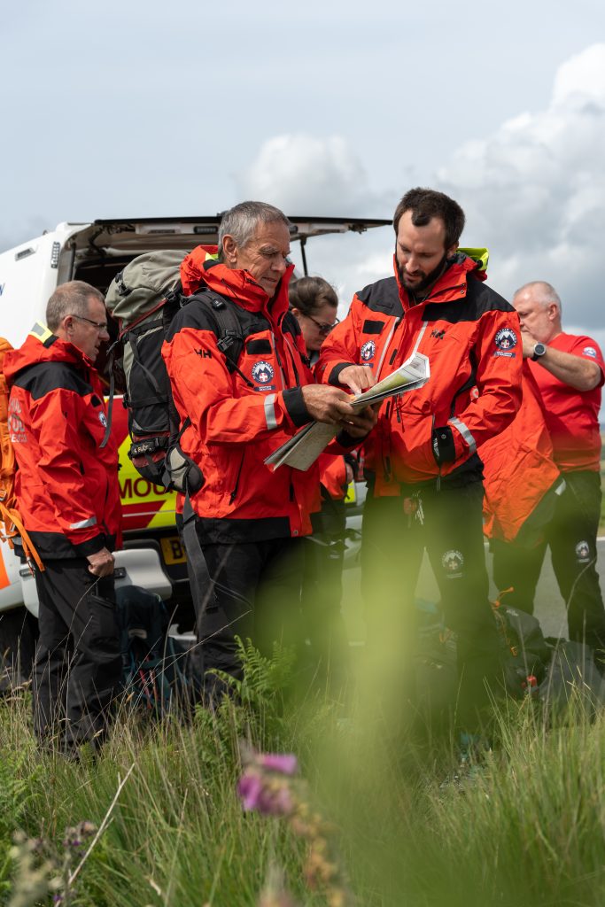
Mountain Rescue in England and Wales is a voluntary service, available via 999 and the Police for those in trouble on upland and mountainous places. Their volunteers are available to help 24/7 and 365 days a year.
You can set up your mobile phone in advance to use emergency SMS text. There are (at least) two good reasons to register:
- If there’s not enough signal to call, you can often still send a text.
- If the weather’s windy it can be hard to hear a voice call.
Contacting Mountain Rescue by Phone
- Call 999 and ask for the Police. Then ask for Mountain Rescue.
- Provide as much detail as you can: who you are, where you are, number in your group, how you all are and a contact number.
- Keep as safe and warm as you can and wait for Mountain Rescue to contact you with advice.
- Do not move unless asked to by Mountain Rescue. They need to keep in touch and mobile signals vary a lot in the hills.
If you cannot make voice calls, you can contact the 999 emergency services by SMS text from your phone.
Contacting Mountain Rescue by SMS Text
- If you have not registered, text ‘register’ to 999 and follow the instructions.
- Text 999 with
- Who you need (Police – Mountain Rescue)
- What is the problem (briefly)
- Where you are
- The emergency service will either ask for more information or will tell you that help is on the way. Don’t assume that your message has been received until the emergency service sends a message back.
- It will usually take about two minutes before you get a reply. If you don’t get a reply within three minutes, try again or find other ways of getting help

