What are the best waterfalls to visit in the Peak District?
Waterfalls in the Peak District are among the most captivating natural spots you can visit.
Some spill through mossy woodland, others twist their way down rugged gritstone cloughs, while a few hide deep within tranquil, tree‑lined valleys. These stunning blue spaces invite everyone to explore. Whether you’re a walker, photographer, family adventurer, or simply someone who loves spending time in nature, you’ll find a waterfall that feels just right.
Discover the best waterfalls in Central and Northern England
With so many cascades scattered across the Peaks, choosing where to go first can feel like a challenge. Some falls offer gentle, family‑friendly strolling, others provide dramatic backdrops perfect for photography, refreshing pools for wild swimmers, or quiet corners far removed from busy paths.
To help you find the perfect spot, this guide highlights the best waterfalls in the Peak District by category, showcasing what makes each one special. Although this doesn’t mean that they’re not all beautiful, or photographic! And because the Peaks are full of hidden treasures, you’ll also find plenty of extra cascades to explore if you’re keen to discover even more waterfalls in central and northern England.
Where can you find more of the best waterfalls in the UK?
If you’re looking for waterfalls in other National Parks around Great Britain take a peak at our other waterfall walks guides. We also have a selection of waterfalls near to Manchester and London, in case you’re looking for something a little closer to home.

The top waterfalls in the Peak District
| Best for… | Waterfall | Location |
| Accessibility | Monsal Dale Weir | Little Longstone |
| Beauty | Kinder Downfall | Hayfield |
| Scenic walks | Middle Black Clough | Glossop |
| Wild swimming | Three Shires Head | Buxton |
| Photography | Seven Falls | Tintwistle |
| Seclusion | Waterfall Swallet | Eyam |
| First-time visitors | Lumsdale Falls | Lumsdale |
| Fairy tale charm | Padley Gorge | Grindleford |
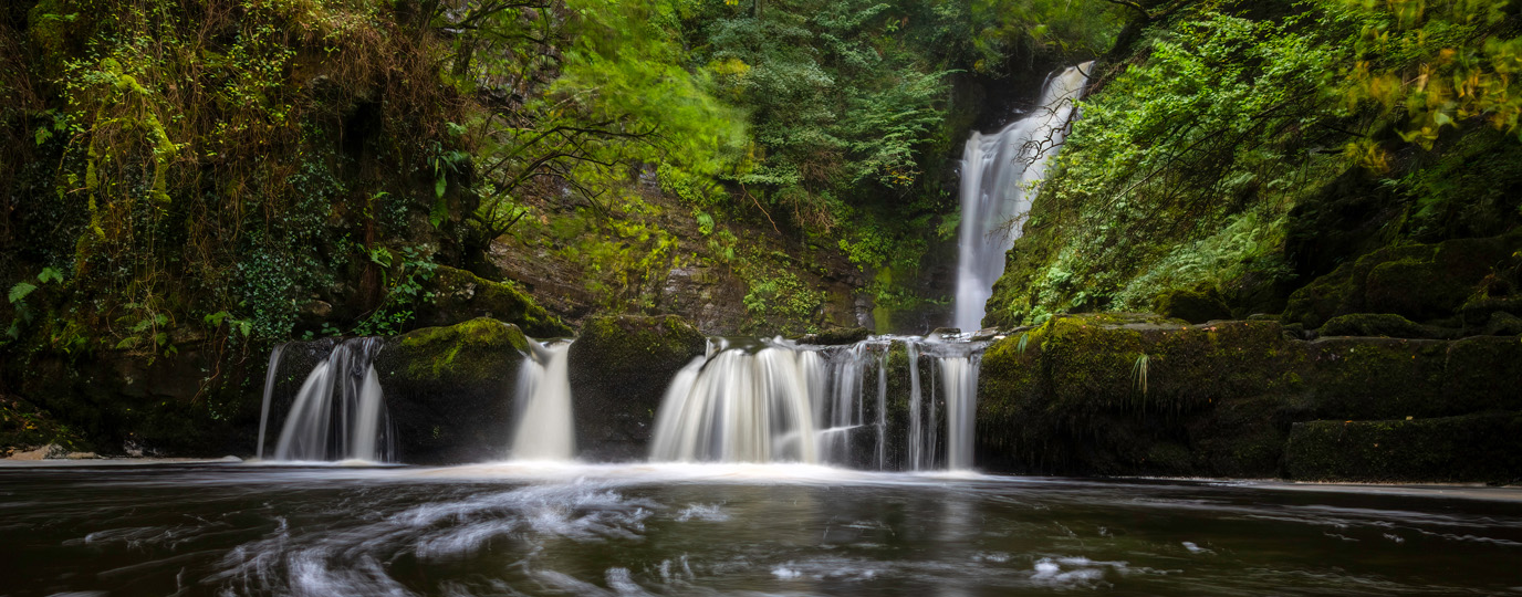
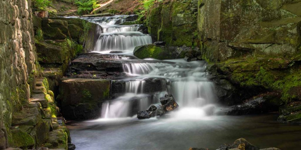
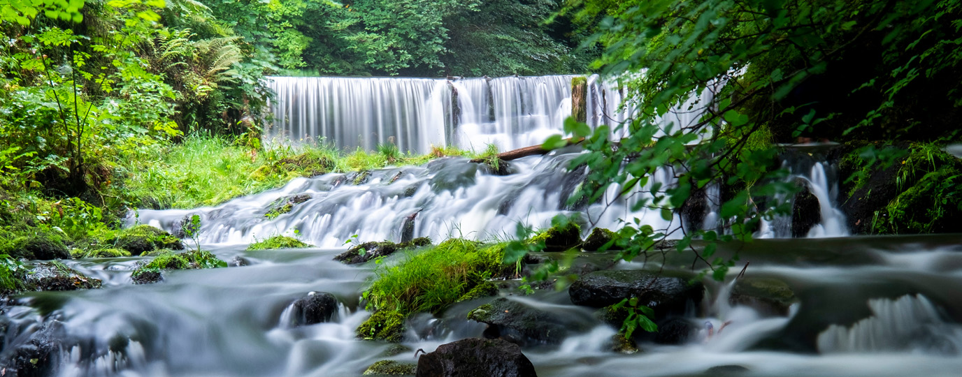
Monsal Dale Weir – For the families
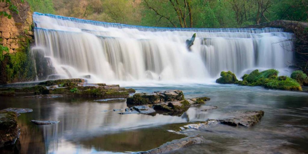
- Best for: Accessibility
- Waterfall height: No official height
- Nearest postcode: DE45 1NL
- Parking: Monsal Head Car Park (DE45 1NL)
- OS grid reference: SK 17734 71390
- OS Explorer map: Explorer OL24 – The Peak District – White Peak Area
Although Monsal Dale Weir is technically not a natural waterfall, it still delivers the same dramatic visual impact while being one of the most accessible waterfall‑like experiences in the Peak District.
Set along the beautifully restored Monsal Trail, the weir sits beside a smooth, level, and well‑maintained former railway line that is suitable for wheelchairs, mobility scooters, and pushchairs. This makes it an ideal stop for families, visitors with limited mobility, and anyone wanting a scenic outdoors experience without challenging terrain.
Reaching the weir involves no steep climbs, scrambling, or uneven footpaths, just an easy, flat stroll surrounded by dramatic limestone valleys, tunnels, and sweeping views of the River Wye. The powerful rush of water spilling over the weir creates the same sense of movement and atmosphere you’d expect from a natural waterfall, but without the accessibility barriers that can sometimes accompany them.
Top tip
Check recent rainfall before heading to a waterfall. Some falls, such as those as Lathkill Dale, can be dry in summer.
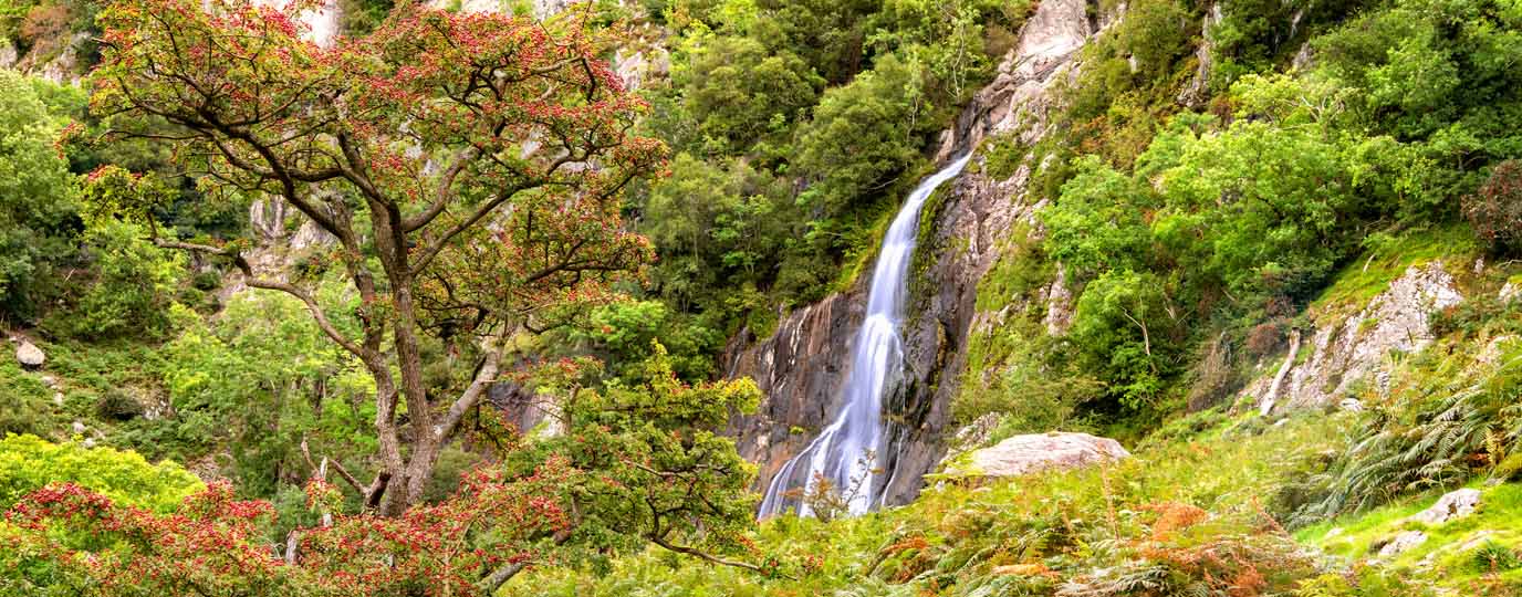
Kinder Downfall – For the beauty seekers

- Best for: Beauty
- Waterfall height: 30m (98 ft)
- Nearest postcode: SK22 2LH
- Parking: Bowden Bridge Car Park (SK22 2LH), Snake Pass Lay-by (SK13 7PQ)
- OS grid reference: SK 08309 88947
- OS Explorer map: Explorer OL1 – The Peak District – Dark Peak Area
As the the Peak District’s tallest waterfall, Kinder Downfall is not only popular for its height; it is also widely regarded as the most dramatic and beautiful waterfall in the national park.
Set on the edge of the Kinder Scout plateau, the fall plunges from impressive gritstone cliffs, making it a breath-taking reward for anyone exploring the high moorlands. At around 30 metres high, the waterfall is known for its powerful spray and the way strong winds can blow the water back upwards, creating an unforgettable natural spectacle. In the winter, the waterfall can sometimes freeze, creating stunning ice formations.
Reaching Kinder Downfall is part of what makes it even more special. The surrounding area offers some of the finest walking in the Peak District, with long circular routes, rugged moorland trails, and expansive views across the Dark Peak. Walkers on the Pennine Way often stop at the waterfall to rest and take in the dramatic scenery, while those approaching from Hayfield or Edale can enjoy a full day immersed in wide‑open landscapes and fresh upland air.
Top tip
Some waterfalls are poorly signposted, such as Waterfall Swallet, and can be tricky to find. Use OS Maps to help you navigate and stay on course.
Middle Black Clough – For the hikers
- Best for: Scenic walks
- Waterfall height: Approximately 10m
- Nearest postcode: SK13 1JE
- Parking: A628 Lay-bys (SK13 1JE), Trans Pennine Trail Car Park (SK13 1JE)
- OS grid reference: SK 11621 99014
- OS Explorer map: Explorer OL1 – The Peak District – Dark Peak Area
Nestled in one of the Peak District’s wild valleys, Middle Black Clough Waterfall offers hikers an unforgettable blend of scenery, adventure, and accessible walking.
The route leading to the waterfall follows a beautiful clough framed by woodland and rugged hills, as you trace the stream upward through the valley. You can enjoy a relatively short but engaging trail with sections of gentle paths mixed with light scrambling, making it appealing to a wide range of outdoor enthusiasts. The area is also known for its peaceful, secluded feel, offering an escape into nature.
Beyond the main out‑and‑back route, the surroundings offer plenty of opportunities to extend your adventure, with nearby trails allowing you to adjust the distance and difficulty of your walk. The five nearby reservoirs offer an excellent extension to any walk, and can provide a perfect day of hiking.
Top tip
Rocks near waterfalls are extremely slippery! Avoid leaning over edges, and use designated scrambling paths when climbing.
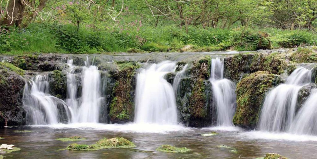
Three Shires Head – For the wild swimmers
- Best for: Wild swimming
- Waterfall height: No official height, but a series of small cascades
- Nearest postcode: SK11 0BD
- Parking: Gradbach Car Park (SK17 0SU), Clough House Car Park (SK11 0BD)
- OS grid reference: SK 00944 68514
- OS Explorer map: Explorer OL24 – The Peak District – White Peak Area
Tucked among rolling hills and meeting county borders, Three Shires Head is one of the Peak District’s most beloved waterfalls, celebrated for its inviting plunge pools and scenic countryside setting.
Panniers Pool beneath the twin cascades is perfect for a refreshing dip on a warm day. You can reach the falls via gentle trails through open fields, rocky paths, and classic Peak District scenery, with the historic stone packhorse bridge providing a picture‑perfect backdrop to the falls. The area is well‑known as one of the prettiest and most accessible wild‑swimming spots in the region, offering shallow entry points and naturally carved basins ideal for a safe but exhilarating plunge. It’s also a perfect location for nature lovers and bird watching.
Beyond the pools themselves, the surrounding countryside provides a wealth of walking opportunities. Several routes allow you to tailor their day out, whether they want a quick swim with minimal effort or a full day exploring valleys, riversides, and hilltop views. The trails are straightforward and scenic, often passing grazing sheep, heather moorland, or winding waterways before emerging at the falls.
Top tip
Golden hour light is magical at waterfalls, and quieter paths make for more atmospheric photography. Visit early or late for the most peaceful experience.

EXPLORE THE
OS Shop
We are with you every step of the way. Shop our trusted walking and hiking maps and guidebooks so you can explore the outdoors with confidence.
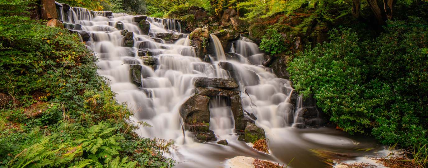
Go to the shopSeven Falls – For the photographers
- Best for: Photography
- Waterfall height: No official height, but a series of small cascades
- Nearest postcode: SK13 1HP
- Parking: Crossgate Farm Campsite Parking (SK13 1HP), Arnfield Reservoir (SK13 1HP)
- OS grid reference: SK 02818 98903
- OS Explorer map: Explorer OL1 – The Peak District – Dark Peak Area
Tucked away on the northern edge of the Peak District, Seven Falls at Tintwistle is a dream location for photographers, offering a dramatic sequence of cascades tumbling down Arnfield Brook.
With seven distinct drops, some gentle curtains of water, others more forceful chutes, the falls create a dynamic landscape ideal for experimentation behind the lens. The rugged moorland backdrop, narrow gorge‑like sections, and constantly shifting light add to its atmospheric appeal, making it one of the most photogenic waterfall settings in the Peaks.
Reaching the falls is an enjoyable outdoor adventure in itself, with a circular walk that winds through woodland, moorland, and riverside paths. The ascent to the falls is gentle but scenic, and once you arrive, the multitude of cascades gives endless opportunities for both photography and exploration. Scrambling sections around some of the drops allow closer vantage points for dramatic compositions, while more elevated viewpoints offer wide, sweeping images of the whole ravine.
Top tip
Clough scrambles like Crowden Brook, Fair Brook, or Blackden Brook can become dangerous after prolonged rain. Choose safer paths or different waterfalls in wetter weather.
Waterfall Swallet – For the adventurers
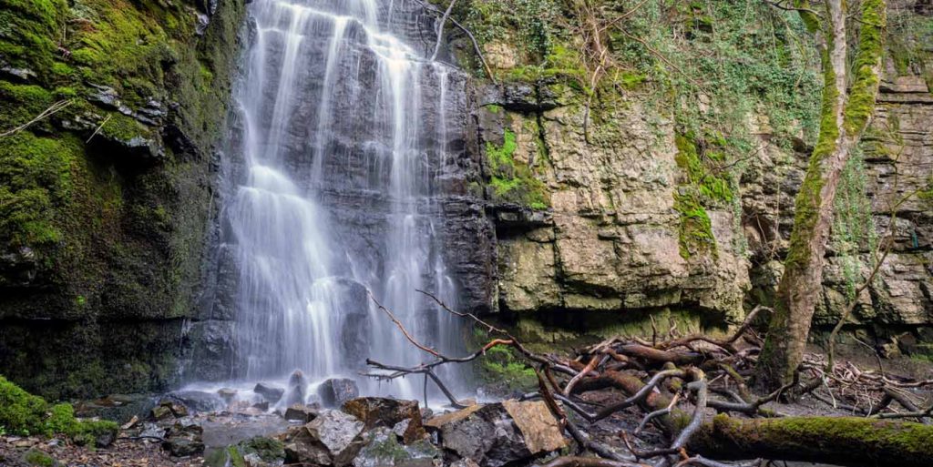
- Best for: Seclusion
- Waterfall height: No official height, estimated to be between 6-8m
- Nearest postcode: S32 5AD
- Parking: Eyam Car Park (S32 5AD)
- OS grid reference: SK 19865 77063
- OS Explorer map: Explorer OL24 – The Peak District – White Peak Area
Secreted away in a quiet wooded gorge, Waterfall Swallet is one of the Peak District’s most enticing hidden gems.
Secluded, lightly visited, and far from the bustle of the more famous tourist routes, its charm lies largely in its secrecy. The falls are unmarked, tucked behind a small gate and down a steep, rustic path, making them easy to miss unless you know exactly where to look. This off‑the‑beaten‑track setting means the area tends to be much quieter than other Peak District hotspots, offering peaceful surroundings where the sound of water echoing off moss‑covered cliff walls quickly replaces any trace of nearby roads or villages.
For walkers who enjoy discovering lesser‑known spots, the journey to Waterfall Swallet is part of the appeal. Whether approached from a nearby lay‑by or as a stop on longer routes between Eyam and Foolow, you can explore stretches of countryside that gradually transition into a sheltered woodland hollow. Once at the base, stones and fallen logs invite you to sit, soak in the tranquillity, and enjoy a quiet pause amid nature.
Top tip
A clough is a steep, narrow valley, which are perfect for waterfalls to form.
Lumsdale Falls – For the first-timers
- Best for: First-time visitors
- Waterfall height: No official height as a multi-tiered cascade
- Nearest postcode: DE4 5LB
- Parking: Lay-by near Highfields School (DE4 5NA), Matlock Town Centre Car Parks (DE4 3RQ)
- OS grid reference: SK 31325 60628
- OS Explorer map: Explorer OL24 – The Peak District – White Peak Area
Situated in a steep, wooded valley rich with history and natural drama, Lumsdale Falls is one of the Peak District’s most popular and accessible waterfalls, making it an ideal first stop for newcomers eager to explore the area’s great outdoors.
Although close to Matlock in the Lumsdale Valley, the falls feel worlds away, offering an easy walk through ivy‑covered mill ruins, mossy stonework, and to the narrow rocky channel where the water cascades over multiple tiers. Its growing popularity and reputation as one of the best‑known waterfalls in the region make it a must‑visit for anyone wanting to see a classic Peak District waterfall early in their adventures.
Beyond the falls themselves, Lumsdale Valley offers a compact but immersive walking experience ideal for those new to outdoor exploring. Trails lead past old mill sites, tranquil ponds, and sections of woodland where Bentley Brook tumbles through the gorge. The route options range in distance, giving beginners the chance to enjoy an easy introduction to Peak District walking while still experiencing one of its most scenic historic landscapes.
Top tip
Alongside spare clothes in case you get wet, bring a drybag or a waterproof pouch for your precious essentials. It’ll keep your clothes, snacks, maps and keys safe and dry.
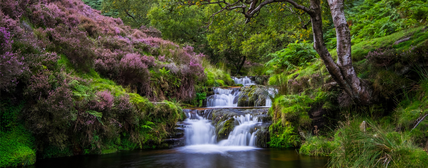
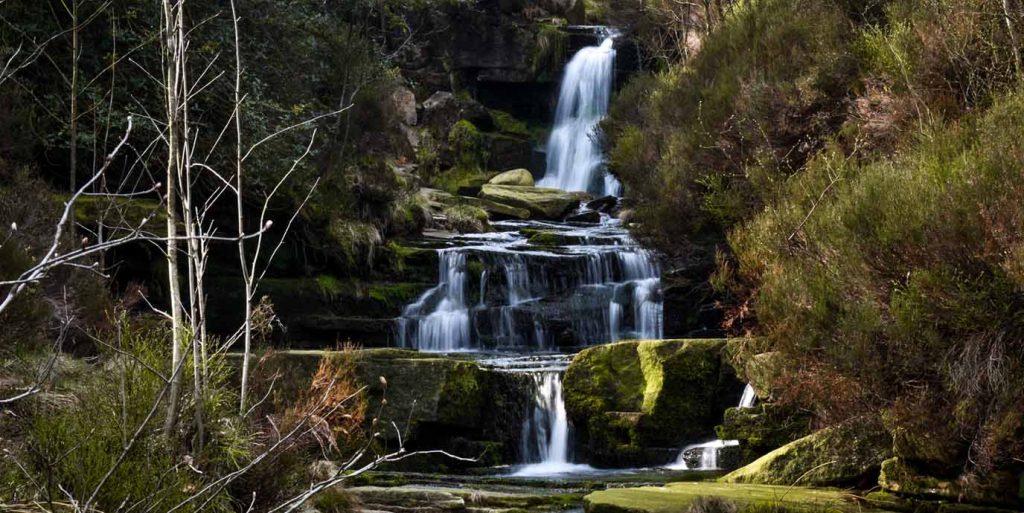
Padley Gorge – For the romantics
- Best for: Fairy tale charm
- Waterfall height: No official height, but a series of small cascades
- Nearest postcode: S32 2HY
- Parking: Longshaw Estate National Park Car Park (S11 7TZ), Surprise View Car Park (S32 1DA)
- OS grid reference: SK 25770 80119
- OS Explorer map: Explorer OL24 – The Peak District – White Peak Area
Wrapped in ancient woodland and moss‑cloaked boulders, Padley Gorge is part of one of the Peak District’s most enchanting, fairy tale‑like landscapes.
The gorge is often described as mystical and magical, with tumbling streams, gently flowing falls, and a lush canopy that filters light in a dreamy, storybook way. Wandering along Burbage Brook you are surrounded by twisting trees, fern‑lined paths, and countless miniature cascades that lend the entire valley an ethereal ambience.
Reaching the cascades is part of a beautiful walk that winds through the valley, with routes ranging from short strolls to longer circular hikes linking nearby gems such as Longshaw Estate and Surprise View. While the falls might not be as dramatic as many others, the many low cascades created by water tumbling over rocks are just as beautiful.
Top tip
Keep an eye out for rainbows. After showers, waterfalls like Kinder Downfall or Middle Black Clough can produce spray bows. Stand with your back to the sun for the best chance to spot one.
EXPLORE THE
OS Shop
We are with you every step of the way. Shop our trusted walking and hiking maps and guidebooks so you can explore the outdoors with confidence.
Go to the shop
More unmissable waterfalls in the Peak District
While these waterfalls highlight some of the Peak District’s most iconic and characterful spots, they’re only the beginning. Beyond the well‑known favourites, countless other cascades lie tucked within its valleys, cloughs, and wooded gorges. Explore these additional unmissable waterfalls and you’ll uncover more of the Peak District’s wild and varied landscapes.
Wyming Brook Falls
- Waterfall height: Approximately 100m total descent (series of cascades)
- Best for: Families, with woodland walking, and accessible scenic trails around the reservoirs
- OS grid reference: SK 27146 86096
- OS Explorer map: Explorer OL1 – The Peak District – Dark Peak Area
- OS Maps route: Redmires and Rivelin Reservoirs
- Distance: 8km
- Time: 2 hours
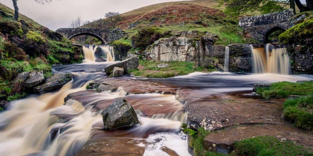
Wessenden Waterfall
- Waterfall height: No official height
- Best for: Hiking through wild valley scenery for a remote-feeling adventure
- OS grid reference: SE 05537 08759
- OS Explorer map: Explorer OL1 – The Peak District – Dark Peak Area
- OS Maps route: Wessenden Waterfall and Reservoir
- Distance: 7.6km
- Time: 2.5 hours

Blackden Brook Falls
- Waterfall height: No official height
- Best for: Scrambling for adventurous walkers over rugged terrain
- OS grid reference: SK 12162 88394
- OS Explorer map: Explorer OL1 – The Peak District – Dark Peak Area
- OS Maps route: Blackden Brook scramble, Peak District
- Distance: 5km
- Time: 2 hours
Chee Dale Waterfalls
- Waterfall height: No official height, but a a series of small cascades along the River Wye
- Best for: Family-friendly walks with stepping stone within a limestone gorge
- OS grid reference: SK 12285 73338
- OS Explorer map: Explorer OL24 – The Peak District – White Peak Area
- OS Maps route: Cheedale Stepping Stones, Circular Walk
- Distance: 5.8km
- Time: 1.5 hours
Lathkill Dale Falls
- Waterfall height: No official height, as small cascades are usually only apparent in wet weather
- Best for: Nature lovers who prefer gentle walking through limestone landscapes
- OS grid reference: SK 18108 65698
- OS Explorer map: Explorer OL24 – The Peak District – White Peak Area
- OS Maps route: Lathkill Dale
- Distance: 3.8km
- Time: < 1 hour
Greenfield Falls
- Waterfall height: No official height, but a a series of small cascades
- Best for: Challenging hikes with scrambling in a moorland adventure
- OS grid reference: SE 03705 04995
- OS Explorer map: Explorer OL1 – The Peak District – Dark Peak Area
- OS Maps route: Dove Stone Reservoir, Greater Manchester
- Distance: 9.4km
- Time: 2.5 hours
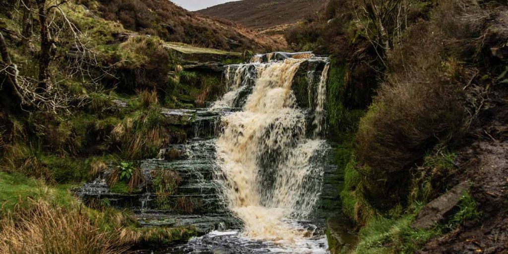
Fairbrook Falls
- Waterfall height: No official height, but a number of cascades
- Best for: Scrambling and wild swimming, with the option for quieter Kinder Scout routes
- OS grid reference: SK 09358 89123
- OS Explorer map: Explorer OL1 – The Peak District – Dark Peak Area
- OS Maps route: Fair Brook
- Distance: 4.2km
- Time: 1.5 hours
Crowden Brook Waterfalls
- Waterfall height: No official height, but a number of cascades
- Best for: Quieter hiking and a possible Kinder ascent, set amongst rugged clough scenery
- OS grid reference: SK 10149 86326
- OS Explorer map: Explorer OL1 – The Peak District – Dark Peak Area
- OS Maps route: Crowden Clough
- Distance: 6.2km
- Time: 1.5 – 2 hours
Looking for more to explore in the Peak District?
If you want to discover more of the Peak District beyond its waterfalls, the National Park is full of opportunities. Take a look at some of our guides to find something for you:
Where are the Best Waterfalls near London?
Explore stunning waterfalls near London and find the perfect walk just a short drive or train ride away from the city.
Waterfalls in the Lake District
Explore breath-taking waterfalls in the Lake District, perfect for outdoor lovers seeking unique beauty, wild swims or scenic hikes.
Where are the Best Waterfalls near Manchester?
Find the best waterfalls close to Manchester with scenic walks in beautiful surroundings.