The Dark Peak is home to some of the most iconic views in the Peak District. Discover 3 of the best, and follow the routes when you’re out.
The Peak District is so large and diverse that it’s split into two sections: White Peak in the south and Dark Peak in the north. Dark Peak consists mostly of moorland, and is the more desolate and lonely of the two areas. This only adds to its quiet, awe-inspiring beauty, though. It’s wild, remote and there’s more here than just heathland.
We’ve collated three walks that will allow you to see the very best of what Dark Peak has to offer, from its fascinating tors to its tiny, chocolate-box hamlets.
Hope village to Win Hill
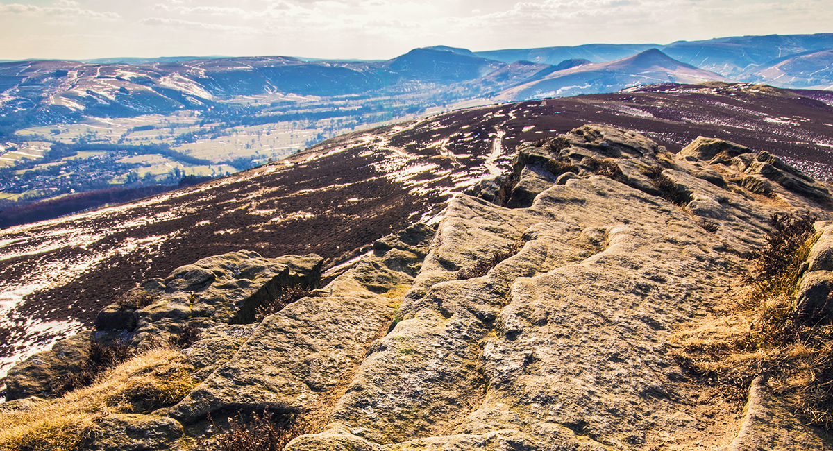
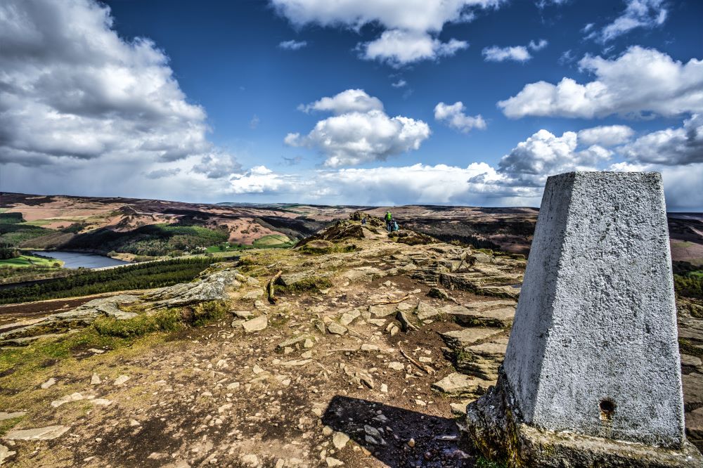
View from Win Hill
Not far from the quaint village of Hope is Win Hill, which boasts incredible views of the surrounding area. This walk starts and end in Hope, and will take you up Win Hill on the way, so pack a camera!
The route shouldn’t take you more than a few hours to complete, as it’s around 6.5 miles long. It’s a fairly easy route, but that ascent up the hill can be a bit of a challenge for some. Luckily, there are lots of place you can easily stop at along the way, so take a packed lunch and some snacks with you.
Start by walking down Edale Road, which is opposite the church. You’ll pass a primary school on the left-hand side, then turn right down Bowden Lane. Cross the stone bridge and head under the railway arch, after which you need to turn right. Follow this track up the hill to Twitchill Farm, where you should see a marked right of way – follow this and prepare for a view that only improves with the ascent!
Once you’re nearing the top, the path to the summit should be clearly outlined for you. Now’s the time to stop and admire that breath-taking view. When you’re ready to start walking again, head back the way you came and take the main ridge path to Hope Cross. From here, follow the path down until you see a broken wall, then turn left downhill – you should meet a wide track, at which you need to turn left.
The track you’re on will turn into a tarmac one, which you should follow until it comes to a sharp right. From here, take the signposted footpath on the left and head over the fields until you arrive at another lane. Continue on the lane and you should soon spot the railway arch you passed under at the beginning; you know where to go from here!
OPEN IN OS MAPS
Mam Tor and beyond
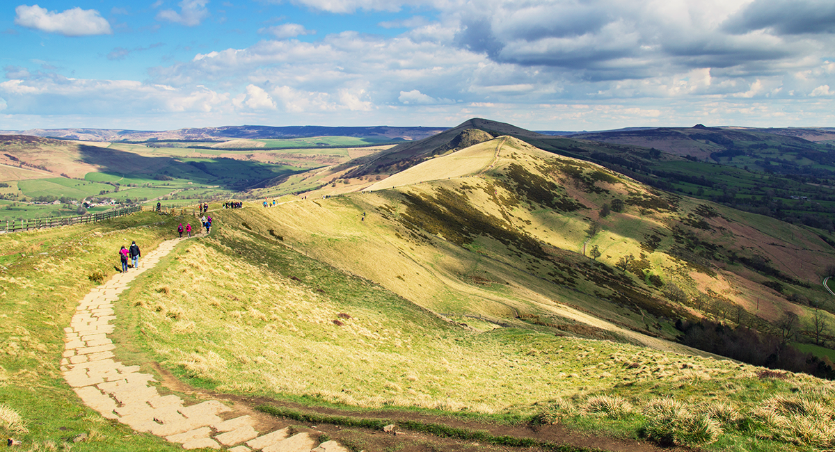
View from Mam Tor across the Great Ridge
As you might have guessed, Mam Tor means ‘mother hill’, but what you may not know is that it boasts some of the best views in the whole of the Peak District. Walking up it is certainly a must, and this route will take you over it and along the Great Ridge, which finishes at Lose Hill.
It’s an easy walk that spans across five miles, meaning it should take between two and three hours from start to finish. The majority of the route consists sturdy footpaths and even the ascents are fairly gentle, so the kids will love it too! Just be sure to bring along a few supplies with you and take stops where necessary.
Start from the Mam Nick car park, owned by the National Trust, and exit out of the route at the back. Head up the steps and the follow the path – this is where the climb up the hill begins. The path eventually meets a small road, at which you should see a gate on the right-hand side. Head through it and go up the steps to the summit.
Once you’re at the top, you’ll be able to admire incredible views, as well as some fascinating history. Here lies the second-highest fort (of this kind) in Britain and its believed to date back as far as the late Bronze Age, though little is known about it. There are also two Bronze Age burial mounds, though one is underneath the summit, so you may not realise it’s even there.
The next part of this journey is simple – just follow the path along the Great Ridge, where you’ll make a short ascent up Back Tor, before descending to Lose Hill. Take some time to enjoy the views and rest, before heading back the way you came.
OPEN IN OS MAPS
Broomhead Moor circular walk
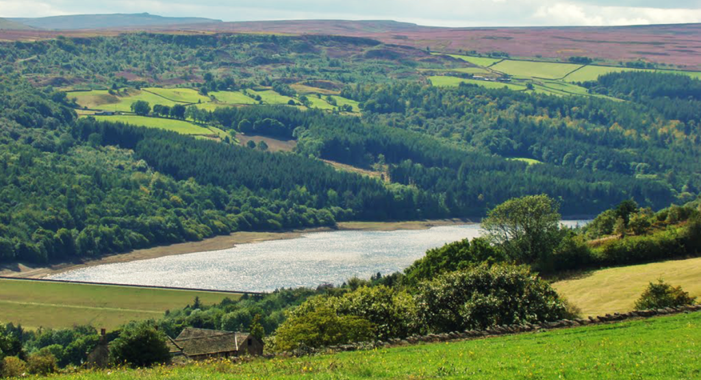
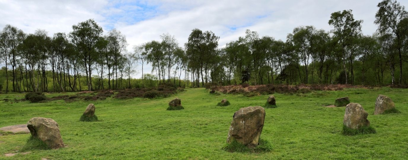
Broomhead Reservoir and Broomhead Moor, Image: SixSixx
This is a fairly gentle, varied walk through beautiful moorland, during which you’ll traverse across a valley with a stone circle, a picturesque hamlet and the stunning grounds of Broomhead Hall. Be wary that you need to be steady on your feet for this six-mile walk, as the paths are well-defined but rough and the ground is uneven in places.
Your starting point is Mortimer Road, which is opposite Broomhead Hall Farm. You should see a gate onto Broomhead Moor – go through it and take the path which heads in a north-west direction; you’ll cross a stream and eventually see a footpath marker.
To see the stone circle, you’ll need to make a slight detour from the marker – head right instead of left. Once you’ve paid it a visit, you can then return to the path and head up the farm track. Keep going until you pass a shooting lodge, then turn left up onto the moor. When the farm track comes to an end, continue south across the moor, walking across the heather for about 300m or so. You should reach a main path, at which you should turn left and follow it.
The track will take you back to Mortimer Road. Turn left here and walk until you arrive at a junction – you should see one of our markers in the fenced enclosure! From the junction, head through the gate which leads onto a bridle path. Keep going until you reach another junction, then take a left onto Lee Lane. Cross the stile and head up towards the gate; go through it and walk through the field on your left-hand side, heading in a north-west direction.
You should soon see some blue footpath markers ahead, follow these and go up the hill, walking to the right of the farm building. Once you’ve passed the building you should see a stone wall with a gate, but instead of heading through it you need to go over the stile to the left. From here you need to follow the lane until you reach Mortimer Road again.
OPEN IN OS MAPS
We hope you enjoy the three walks above – don’t forget to get yourself a Dark Peak area map before you head off. It will certainly come in handy!
Have a favourite walk of your own? Tell us about it in the comments below.
OS Paper Maps
Never explore without one
Stay safe, and stay active with Britain’s most accurate outdoor maps
Be inspired to do more and go further by equipping yourself with the best tools for the job. Our maps are built on 220 years of experience – we keep walkers, runners, cyclists and more safe in the great outdoors all year round.