Stretching for 267 miles and following the backbone of England, the Pennine Way is not just an arduous long distance walk that attracts crazy fell runners and determine hikers – it also links some of England’s most amazing landscapes and fantastic features. So even if you don’t want to walk the whole route is worth hunting out these gems.
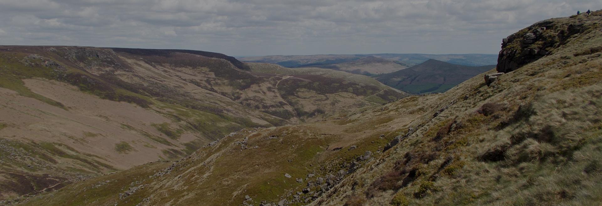
1. Kinder Scout, Peak District
At 600m high the Kinder Scout plateau is a wild landscape of gritstone and moorland, where it’s easy to feel like you’ve escaped from life. Despite this, it’s very accessible from both Manchester and Sheffield on public transport, so it’s easy to understand its important role in the Mass Trespass in 1932, which gave people the right to roam across Britain’s countryside.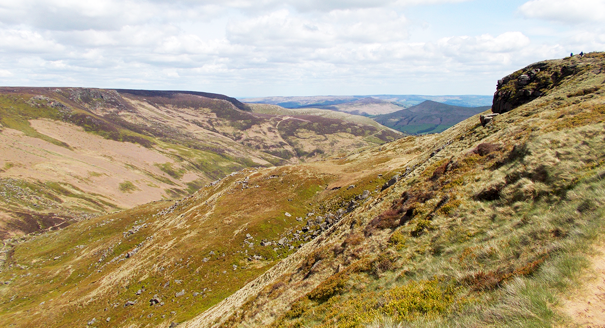
Kinder Scout also provides a tricky start to the Pennine Way with poor weather across the top providing an early navigational challenge.
2. Stoodley Pike, Todmorden.
Completed in 1856 to commemorate the end of the Crimean War, Stoodley Pike is a welcome sight after miles of moors and farmland, and marks the descend from the Pennine Way down in to Hebden Bridge. It’s possible to climb the monument to the viewing platform for a great view across the Calder Valley.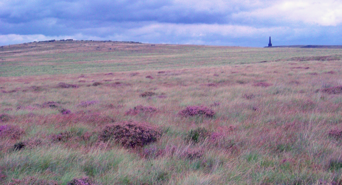
3. Malham Cove, Yorkshire Dales
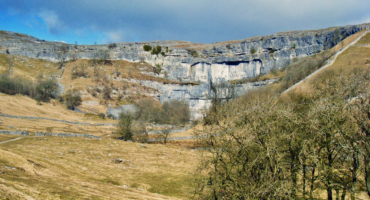
The impressive limestone amphitheatre of Malham Cove stands 260 ft high. Formed by a waterfall in the last ice age, the Pennine Way crosses the old river bed that is now a limestone pavement across the top of the cove. This geological feature is unique to the Yorkshire Dales and is most spectacular at Malham Cove. The walls of the Cove also provides experienced climbers a variety of difficult routes.
YORKSHIRE DALES OS EXPLORER MAP SET
4. Pen y Ghent, Yorkshire Dales
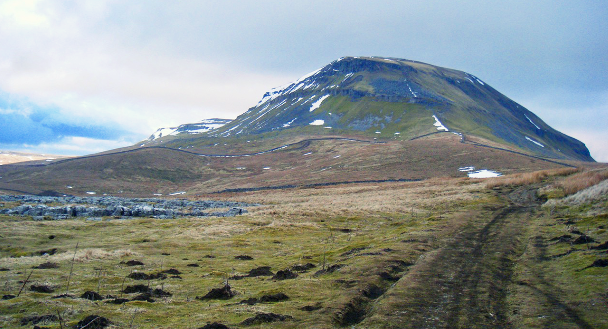
The distinctively shaped hill top of Pen Y Ghent is immediately recognisable as you ascent from the Pennine Way from the south. Also part of the Yorkshire 3 Peak challenge, Pen Y Ghent is a challenge whichever way you climb it and is certainly worth climbing in its own right.
5. Tan Hill Inn, Richmondshire
Approximately half way along the Pennine Way the Tan Hill Inn is also the highest pub in Britain at 528m above sea level and provides an easy wild camping spot along the route.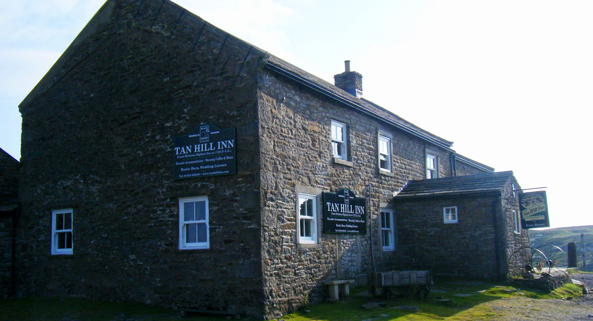
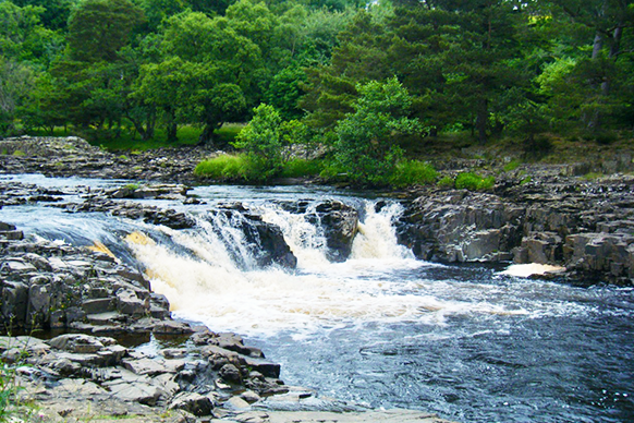
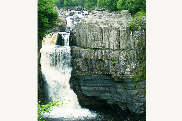
6. Low and High Force waterfalls, Middleton-in-Teesdale
The route along the River Tees between Low and High Force waterfalls is one of the most picturesque sections of the Pennine Way with miles of wildflower meadows along the river. High Force waterfall, drops 21m making it England’s biggest waterfall and therefore a must-see sight along the route.
7. High Cup Nick, North Pennines
The U shaped glacial valley of High Cup Nick is edged by dolerite crags and provides a dramatic contrast to the moorland fells of Middleton in Teesdale.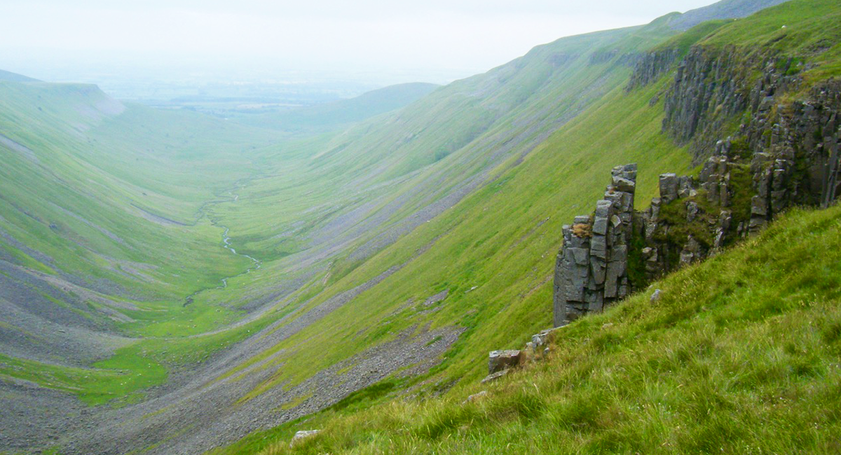
8. Cross Fell, North Pennines
Cross Fell marks the highest point in the Pennine Way but it is not a great place to be in poor weather. At 890m high, the ridge is often shroud in dense fog and strong winds. It’s also the only place in Britain with its own named wind – the Helm wind – which creates a shrieking sound as it crosses the fell top. Careful navigation is needed to cross the fell down to Greg’s hut and onwards to Tynedale.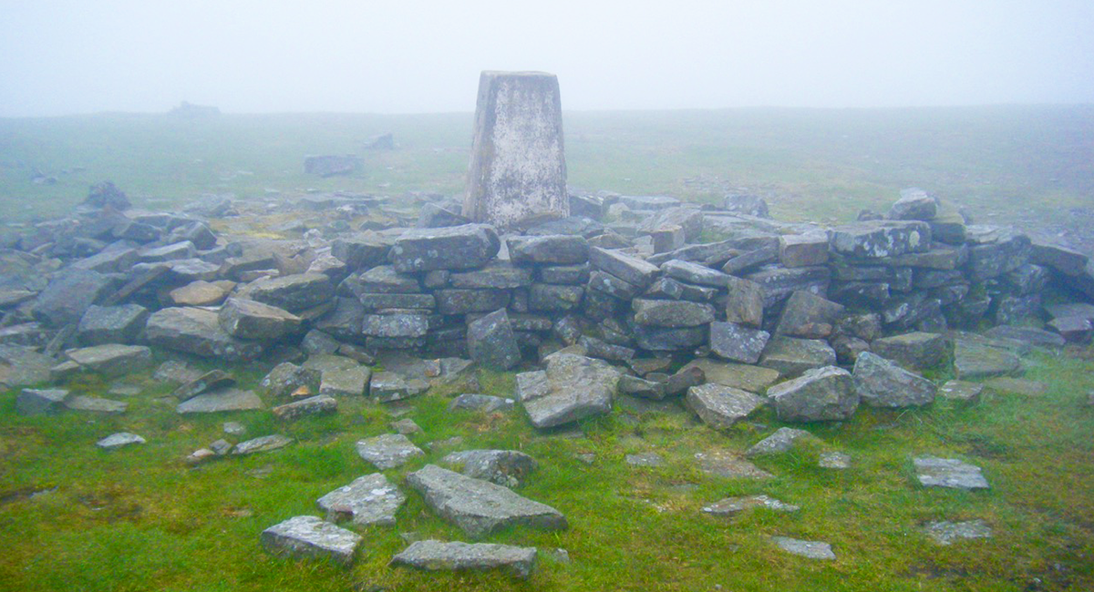
The Trig point at Cross Fell
9. Hadrian’s wall
Heading east for approximately 13km, the Pennine Way joins Hadrian’s wall from Thirlwall castle at Greenhead to Housesteads Roman Fort, providing you with the opportunity to see the best section of Hadrian’s Wall and the best preserved fort along the route.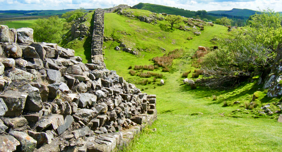
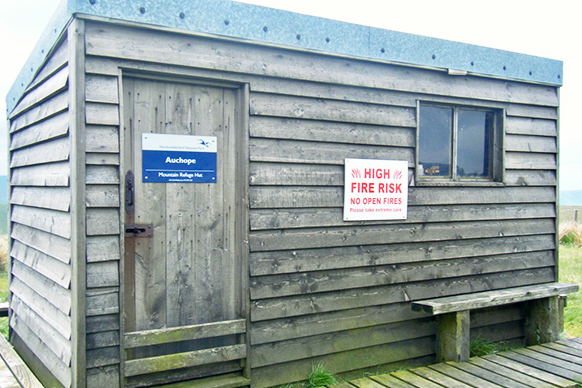
10. The huts on The Cheviot, Northumberland
The Cheviot is the final challenge before reaching the end of the Pennine Way. The route is largely well paved across the peat moorland tops to protect the landscape. If you don’t fancy the challenge of the 43km from Bryness to Kirk Yetholm in one go, you could wild camp at one of the two basic huts along the route to overnight – the first before Lamb hill the second after The Cheviot itself.
Let us know your own personal favourites in the comments below!

EXPLORE THE
OS Shop
We are with you every step of the way. Shop our trusted walking and hiking maps and guidebooks so you can explore the outdoors with confidence.
Go to the shop