A List of 24 Hour UK Mountain Challenges
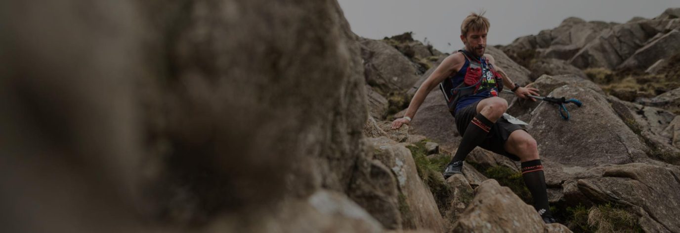
If you’re looking to test your endurance, explore breathtaking landscapes, and push your limits, the UK offers some iconic 24 hour mountain challenges. From the rugged peaks of Scotland to the rolling hills of England, here is a list of legendary routes that every adventurer should consider.
Respect The Countryside Code
If you complete any challenge you must respect the countryside code and ensure you leave no trace as well as being considerate of other hikers who may not be in such a rush.
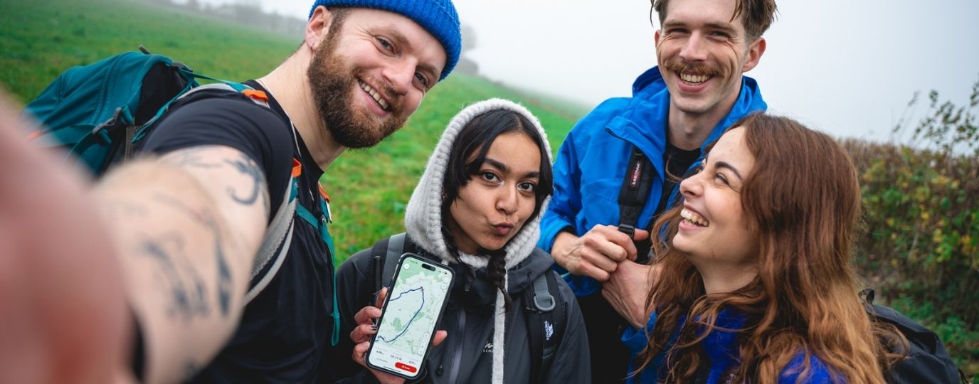
There are many mountain leaders, hiking organisations and adventure companies that can support your challenges. Using a paid guide or joining a group is the safest way to attempt any of these challenges in the 24hr period. Click the links on the table below to find out more about each challenge.
If you love a challenge be sure to check out the 75 Hard Challenge and how you can use OS Maps to stick to it!
🏔️ UK 24-Hour Mountain Challenges Comparison Table – Distances & Ascents
| Challenge | 📏 Distance | 🧗 Ascent | 🚗 Notes |
|---|---|---|---|
| National Three Peaks | 42 km (26 mi) | 2957 m (9700 ft) | 🚙 Driving required between the UK’s 3 highest peaks in England, Scotland and Wales |
| Welsh Three Peaks | 27.4 km | 2334 m (7657 ft) | 🚙 Driving required between these 3 famous Welsh peaks |
| Cairngorms 4000s | 28 km | 2250 m (7380 ft) | 🏞️ 5 highest peaks in the Cairngorms (Scotland) |
| Mourne Seven Sevens | 30 km | 2505 m (8218 ft) | ⛰️ 7 highest peaks in the Mournes (Northern Ireland) |
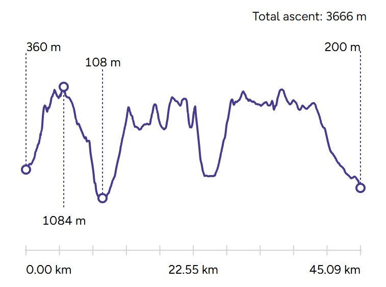
| Welsh 3000s | 45.09 km | 3666 m (12,028 ft) | 🏔️ All 15 peaks over 3000 ft in Eryri (Snowdonia) |
| Lyke Wake Walk | 61.1 km | 1452 m (4764 ft) | 🌄 Walk from West to East across the North York Moors (no official mountains included) |
| Bob Graham Round | 102 km | 8066 m (26,463 ft) | 🔥 42 Lake District peaks in under 24 hours (for trail runners) |
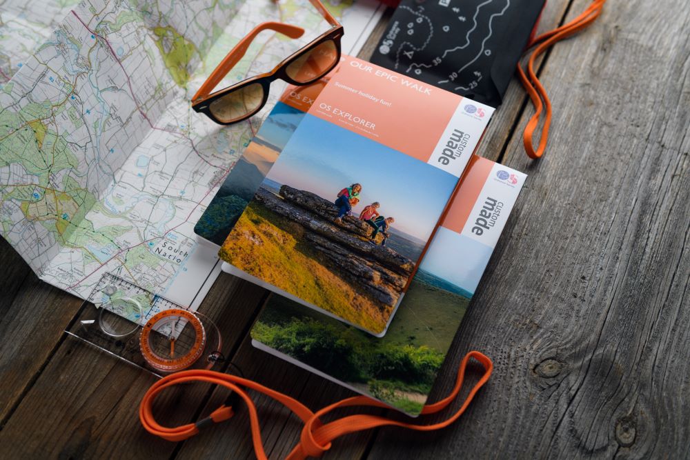
If you’re hiking in a group why not print your own customised OS Maps or create a set if undertaking the challenges involving driving. You can put the date and a group picture on the front and choose any location as the centre point. They make great personalised and inexpensive, challenge mementos.
Set Your Own Challenge
If the idea of these 24hr Mountain Challenges is a bit out of reach, why not transform any of these amazing routes into multi-day hikes to suit your own pace. Use OS Maps App to plan your routes or find 1000’s of ready made routes.
The National Three Peaks Challenge
The Challenge: Tackle the highest mountains in England (Scafell Pike), Wales (Yr Wyddfa (Snowdon)), and Scotland (Ben Nevis) – all within 24 hours. This is one of the most popular 24 hour mountain challenges and made particularly challenging with having to drive between each and deal with potential traffic jams en route. These are not the three highest mountains in Britain but the three highest in each of the 3 countries. There are in fact 100’s of mountains in Scotland higher than Scafell Pike and Yr Wyddfa. It is recommended you do not drive yourself if hiking, so you should have a designated driver (or a few) or do this as part of an organised group.
Ben Nevis – 1343m (4406.17ft)
Scafell Pike – 978m (3208.66ft)
Yr Wyddfa (Snowdon) – 1085m (3559.71ft)
- Total ascent: 9700 feet/2957m
- Total approximate distance: 26 miles

EXPLORE THE
OS Shop
We are with you every step of the way. Shop our trusted walking and hiking maps and guidebooks so you can explore the outdoors with confidence.
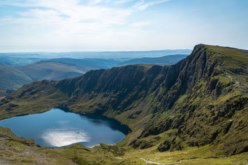
Go to the shopWelsh 3000s
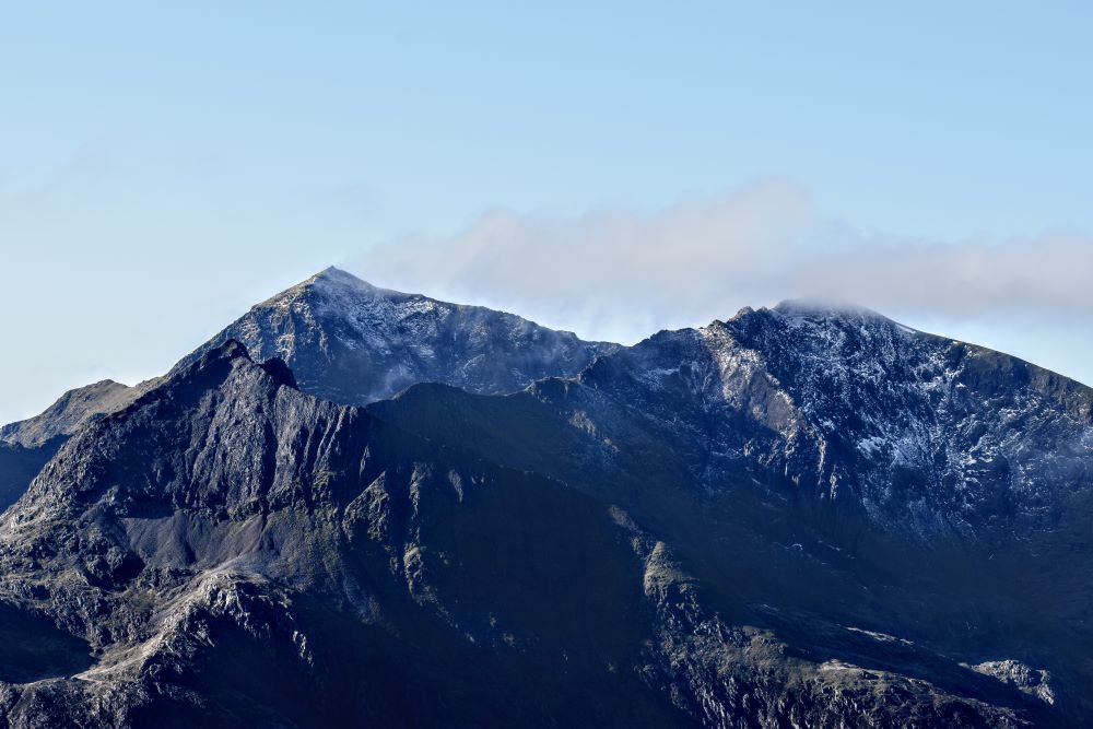
The Challenge: Summit all 15 Welsh peaks in Eryri National Park over 3,000 feet in a single day. This Eryri based challenge offers the most beautiful views and is very popular and it can be walked (rather than run) in under 24hrs with good conditions. You can do the peaks in any order but you must start on the summit of Yr Wyddfa if you’re going for a record time (which is under 5hrs – good luck with that!). The clock officially starts from the top of Yr Wyddfa, some people wild camp on top so they can start at dawn.
Snowdon Massif
- Crib Goch – 923m (3028ft)
- Garnedd Ugain – 1065m (3494ft)
- Yr Wyddfa (Snowdon) – 1085m (3559ft)
Glyderau
- Elidir Fawr – 923.85m (3031ft)
- Y Garn – 947m (3106ft)
- Glyder Fawr – 1001m (3284ft)
- Glyder Fach – 994m (3261ft)
- Tryfan – 918m (3011ft)
Carneddau
9. Pen yr Ole Wen – 978m (3208ft)
10. Carnedd Dafydd – 1044m (3425ft)
11. Carnedd Llewelyn – 1064m (3490ft)
12. Yr Elen – 962m (3156ft)
13. Foel Grach – 976m (3202ft)
14. Garnedd Gwenllian – 926m (3038ft)
15. Foel-Fras – 942m (3090ft)
- Total Ascent is 3666m (12,028 ft)
- Total Distance is 45.09 km
Cairngorms 4000s

The Challenge: Summit five of the highest peaks in the Cairngorms National Park in 24hrs. These are some of the biggest mountains in the UK so this challenge should definitely not be underestimated because it has just 5 summits. There can be patches of snow on these hills that persist right through into summer, especially on North facing slopes.
This challenge is referred to as a ‘classic’ however it’s not clear how it originated, if you have any history of this challenge to share please do let us know.
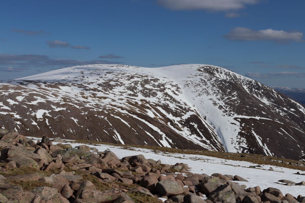
- Cairn Gorm – 1245m (4085ft)
- Ben Macdui – 1309m (4295ft)
- Cairn Toul – 1291m (4236ft)
- Sgor an Lochan Uaine – 1258m (4127ft)
- Braeriach – 1296m (4252ft)
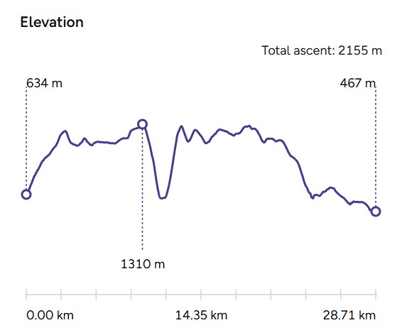
Distance: 28km
Ascent: 2250m (7380ft)
Lyke Wake Walk
The Challenge: Cross the North York Moors National Park from west to east in 24hrs on this long-distance trek known for its boggy terrain and haunting beauty. This is a true test of advanced navigation skills as the moors are often featureless.
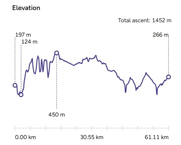
This challenge was created back in 1955 by Bill Cowley and is one of the first challenge walks of its kind. The route is meant to commemorate the many corpses carried over the moors on old coffin routes and the ancient burial mounds encountered on the way.
Distance: 61.1km
Ascent: 1452m (4764ft)
EXPLORE THE
OS Shop
We are with you every step of the way. Shop our trusted walking and hiking maps and guidebooks so you can explore the outdoors with confidence.
Go to the shopGet A Custom Challenge Map!
Commemorate your adventures by creating a custom map with the route included and a custom front cover. Or create maps for your hiking group ready to use on your upcoming challenges.
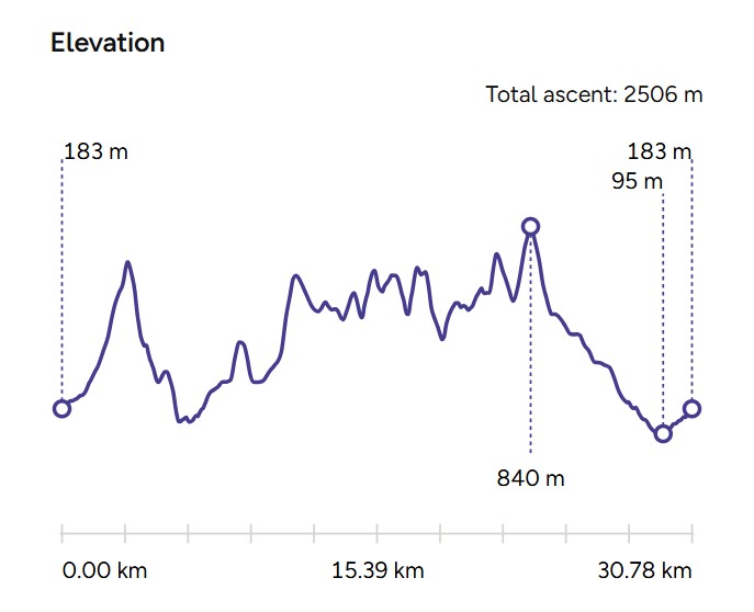
Bob Graham Round
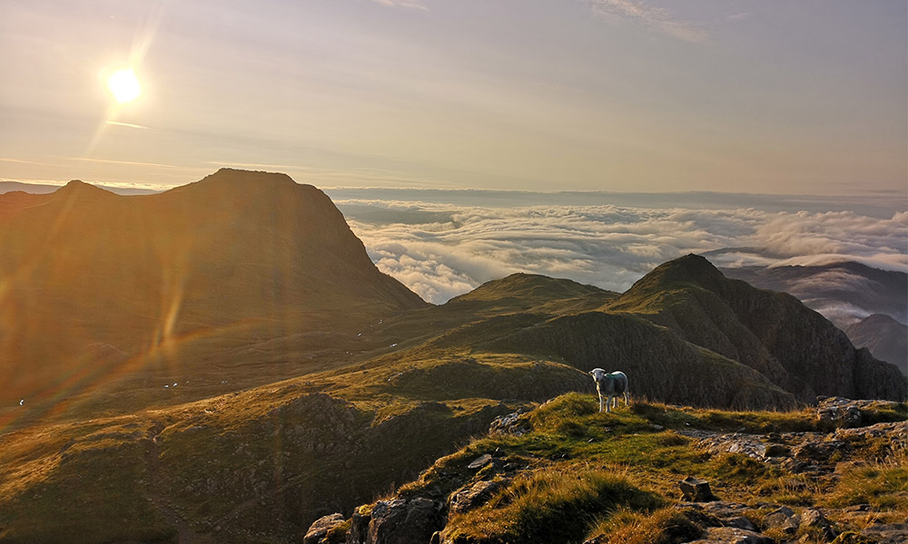
The Challenge: A legendary Lake District National Park challenge involving 42 peaks in under 24 hours. A true test of stamina and navigation. There are too many to list, so use the interactive map above to explore the route. This has to be the most challenging in this list and to complete it in 24hrs you have to run some of the way.
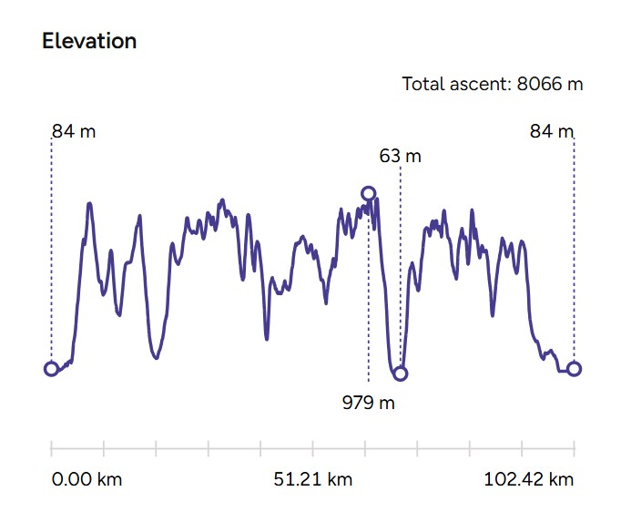
Distance: 102km
Ascent: 8,066m (26,463ft)
Mourne Seven Sevens
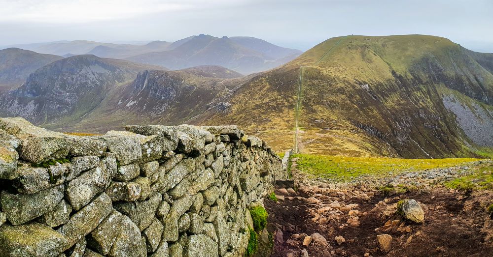
Climb the seven highest peaks in Northern Ireland’s Mourne Mountains, each over 700 metres. This is a long and strenuous route following the Mourne Wall featuring 7 of the 10 highest mountains in the Mournes and Northern Ireland. There are 12 summits in total and the challenge was created in 1992.
- Slieve Donard – 853m (2799ft)
- Slieve Commedagh – 765m (2510ft)
- Slieve Lamagan – 704m (2310ft)
- Slieve Binnian – 747m (2451ft)
- Slieve Meelbeg – 708m (2323ft)
- Slieve Meelmore – 687m (2254ft)
- Slieve Bearnagh – 739m (2425ft)
Distance: 2505m (8218ft)
Ascent: 30km
Welsh Three Peaks
A condensed version of the National Three Peaks, this challenge includes three famous Welsh peaks in Northern Eryri, Southern Eryri and Bannau Brycheiniog that can be completed in 24hrs including driving between each peak.
Yr Wyddfa (Snowdon) – 1085m (3559ft)
Cader Idris – 892m (2,927ft)
Pen Y Fan – 886 m (2,907ft)
Distance: 27.4km
Ascent: 2334m (7657ft)
We haven’t included the popular Yorkshire Three Peaks because it is a 12hr challenge or the 48hr 5 Peaks Challenge which adds Northern Ireland and Eire’s highest peaks to the National Three Peaks Challenge.
Ready to take on one of these 24 hour Mountain challenges?
These routes promise unforgettable experiences and a profound sense of achievement. However, preparation is key. Ensure you’re ready for all conditions and have undergone mountain training to be physically prepared for these challenges. If you’re tackling these routes without a guide, advanced navigation skills are a must.
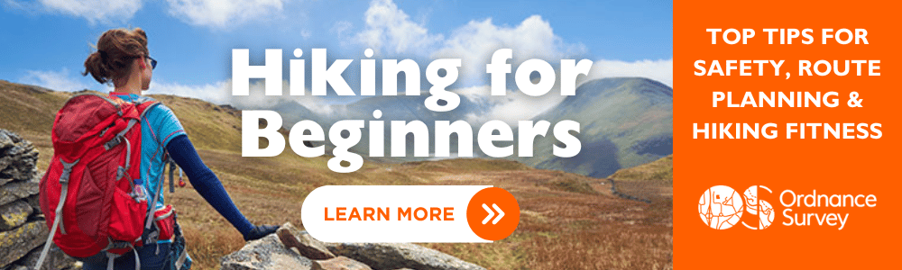
New to hill and mountain walking? Check out our hiking for beginners advice – the perfect starting point for your journey towards completing a 24-hour mountain challenge.
Which one will you conquer first? Be sure to let us know on our social channels by tagging us @ordnancesurvey #ordnancesurvey
EXPLORE THE
OS Shop
We are with you every step of the way. Shop our trusted walking and hiking maps and guidebooks so you can explore the outdoors with confidence.
Go to the shop