Step Into History with Roman Sites Across Britain
Britain’s Roman legacy isn’t just preserved in its remarkable archaeology; it’s woven into some of the country’s most stunning natural landscapes and urban centres. From the rugged hills of Northumberland to the sweeping Welsh countryside and the gentle countryside of Shropshire, Roman sites are scattered across the nation.
We’ve curated a selection of Britain’s most distinctive and historically rich Roman locations for you to discover on your next adventure. These sites offer sweeping views from ancient forts, scenic walking trails through national parks, and tranquil paths that connect historic towns with modern villages.
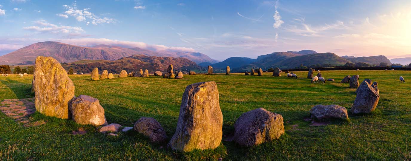
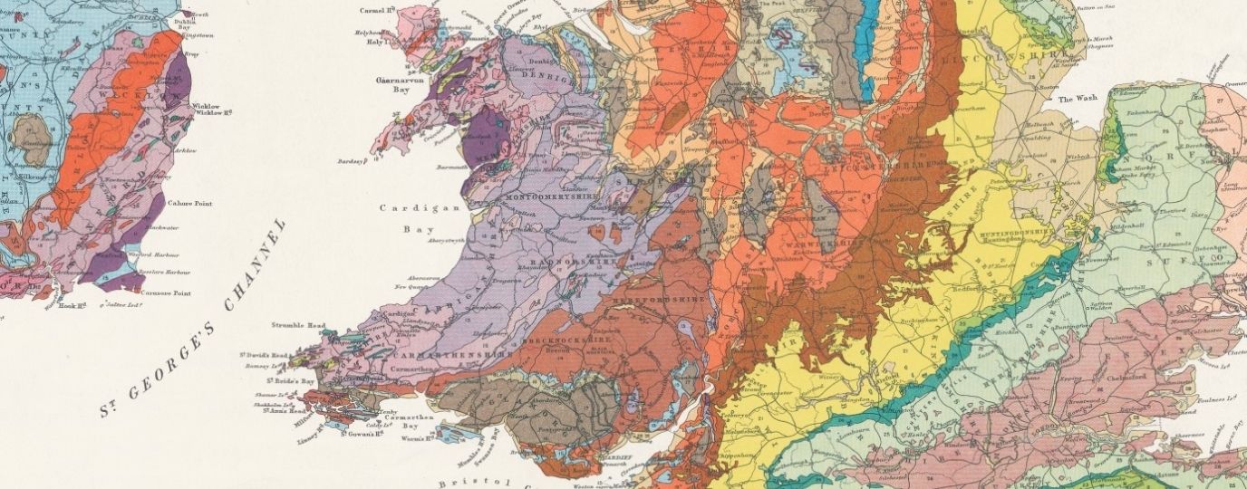
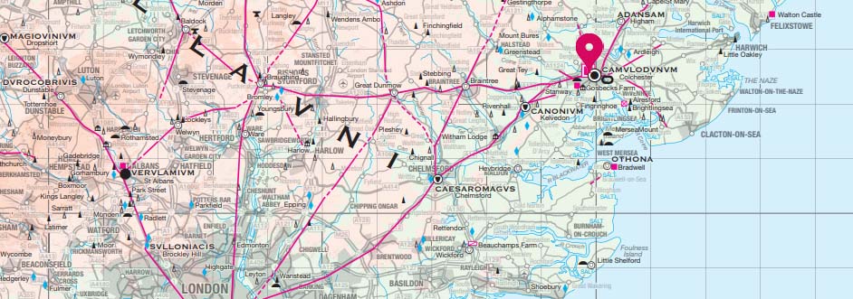
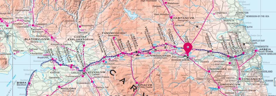
If these Roman treasures ignite your curiosity, take a look at our 10 must-see stone circles in Britain for more fascinating historical locations to visit. And if you’d like more Roman history, don’t miss our Roman Britain map. It’s packed with even more fascinating sites across the country, showcasing the enduring Roman influence on the British landscape. Whether you’re planning a hike or exploring from the comfort of home, it’s a brilliant way to uncover the stories behind some of Britain’s most atmospheric places.
Poltross Burn Milecastle
Age: Constructed around AD 122-128
Site type: Milecastle controlling access through Hadrian’s Wall
Garrison: 10-30 soldiers
Situated on a dramatic stretch of Hadrian’s Wall, Poltross Burn Milecastle (Milecastle 48), one of the best-preserved milecastles. These small forts were built to guard gateways through the Wall, allowing Roman soldiers to patrol the northern frontier. The site overlooks a deep, wooded valley, with the burn (stream) winding through it, creating a peaceful and atmospheric setting.
The steep terrain gives this milecastle a distinctive tilted appearance, adding to its dramatic setting. From the site, you can enjoy panoramic views of the surrounding landscape, making it a rewarding stop for walkers and history lovers alike.
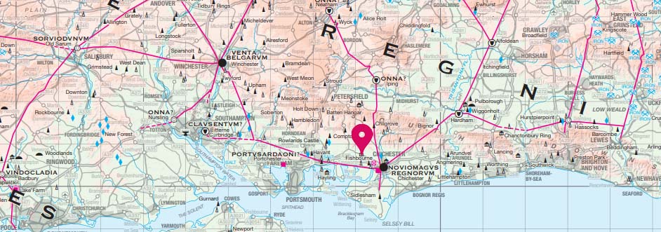
Fishbourne Roman Palace
Age: 75 AD
Site type: Roman residence
Owner: Likely Tiberius Claudius Cogidubnus
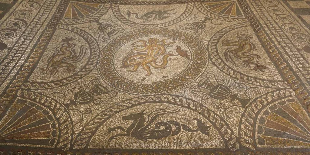
Tucked into the scenic West Sussex countryside, Fishbourne Roman Palace is a remarkable testament to Roman luxury in Britain. As the largest known Roman residence north of the Alps (and even larger than Buckingham Palace!) it offers a rare glimpse into elite Roman life.
The palace once featured a bathhouse, over 50 intricate mosaic floors, and a sophisticated hypocaust heating system, showcasing advanced Roman engineering and artistry. Located at the head of a natural harbour, the area offers a mix of formal Roman-style gardens and more natural features, including a pond and stream, which reflect the palace’s original setting. Although tragically destroyed by fire around AD 270, its remains still evoke the grandeur of its heyday.
The surrounding countryside is ideal for leisurely walks. Walking routes around Fishbourne connect to the Chichester Harbour National Landscape, making it easy to combine a visit to the palace with scenic strolls through nature reserves, waterside trails, and charming villages.
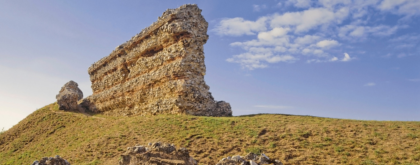
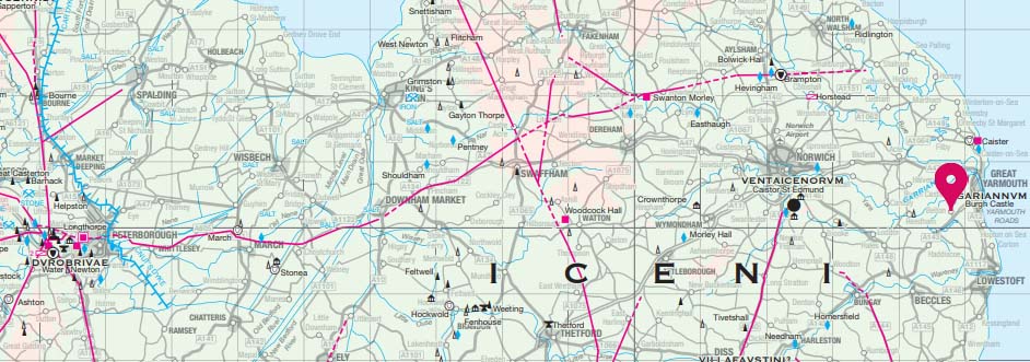
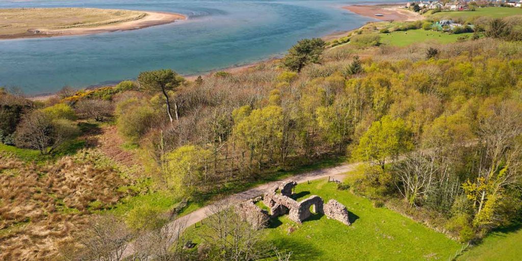
Burgh Castle Roman Fort
Roman name: Gariannonum
Age: Constructed between 260-280 AD
Site type: Defensive fortification against Saxons from the North Sea
Garrison: 500 – 1,000 foot soldiers or 500 mounted soldiers
Set within the peaceful expanse of the Broads National Park, Burgh Castle Roman Fort is one of the best-preserved Roman forts in Britain. According to the late Roman document Notitia Dignitatum, the fort once housed the elite cavalry unit known as the Equites Stablesiani, a testament to its strategic importance.
Beyond its imposing stone walls, evidence of a vicus, or civilian settlement, reveals the daily life that thrived outside the fort’s defences. The surrounding landscape is rich in wildlife, especially birdlife, making it a popular destination for birdwatching. The area is crisscrossed with walking routes, including the scenic Angles Way, which passes through the fort and continues along Breydon Water and through quiet countryside.
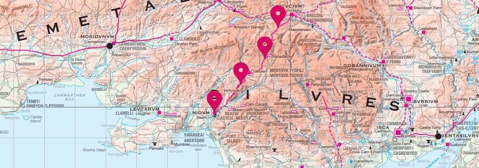
Sarn Helen
Age: 1st Century AD
Site type: Roman Road
Length: Approximately 160 miles
Sarn Helen is not a single road or site but a remarkable network of Roman routes that once stitched together the military and economic heart of Roman Wales. Stretching over 160 miles from Aberconwy in the north to Carmarthen in the south, this ancient highway connected key forts, settlements, and the famed Dolaucothi Gold Mines, offering a vivid glimpse into the infrastructure that supported Roman rule in Britain.
Though time, erosion, and changing land use have obscured parts of the original route, many sections remain visible and walkable today. Some are incorporated into modern roads, while others form part of scenic hiking and cycling trails. For hikers, Sarn Helen offers a journey through history. The route traverses some of Wales’s most breath-taking landscapes, including the rugged peaks of Eryri (Snowdonia) and the rolling hills of Bannau Brycheiniog (Brecon Beacons). Along the way, walkers encounter Roman forts, ancient settlements, and dramatic natural scenery that has remained largely unchanged for centuries.

EXPLORE THE
OS Shop
We are with you every step of the way. Shop our trusted walking and hiking maps and guidebooks so you can explore the outdoors with confidence.
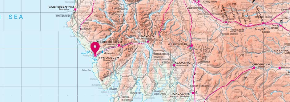
Go to the shopRavenglass Roman Bath House
Roman name: Itunocelum
Age: c.130AD
Site type: Roman baths and part of a Roman Fort and naval base
Located within the Lake District National Park, Ravenglass Roman Bath House is surrounded by a unique blend of coastal and countryside scenery. Located in Ravenglass, the only coastal village in the national park, the site offers a peaceful and picturesque setting where Roman history meets natural beauty.
The bath house sits on gently rising ground with views across the River Eske, and the surrounding landscape includes saltmarshes, woodlands, and open fields. With walls reaching up to 4 metres high, the bath house stands as one of the tallest surviving Roman structures in northern Britain. With the Roman fort of Glannoventa nearby, this remarkably well-preserved site served both military personnel and possibly the nearby civilian vicus (town).
The bath house is part of the Frontiers of the Roman Empire World Heritage Site, and can be reached via a ‘Miles Without Stiles‘ accessible walking route from Ravenglass village.
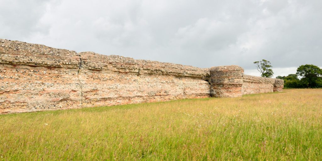
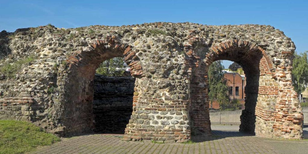
Colchester’s Roman Wall
Roman name: Colonia Claudia Victricensis
Age: 43 AD (conquered during Roman invasion)
Site type: Town – the first capital of Roman Britain before Londinium (London)
Peak population: 30,000
Long before London rose to prominence, Colchester (also know as Camulodunum) was the first Roman settlement and city in Britain. Strategically located on the River Colne, it became a symbol of Roman power and urban planning. In 60–61 AD, the city was dramatically destroyed during Boudica’s revolt, but resilience prevailed, and it was rebuilt by 65 AD.
Today, walking routes around Colchester often incorporate its Roman history, including the town walls and archaeological sites linked to ancient Camulodunum. The town walls are one of the longest and best preserved Roman walls in Britain. While the walls would have one had six gates, only two survive today, Balkerne Gate and Duncan’s Gate, with Balkerne Gate as the original entrance to ancient Colchester. The Castle Park is a central green space that provides the best views of the wall.
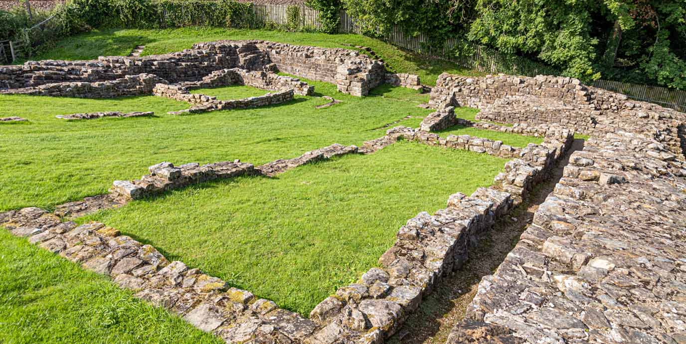
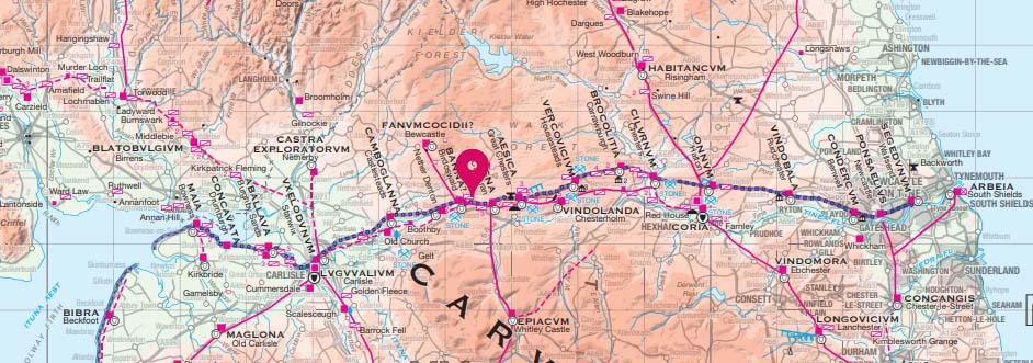
Corbridge Roman Town
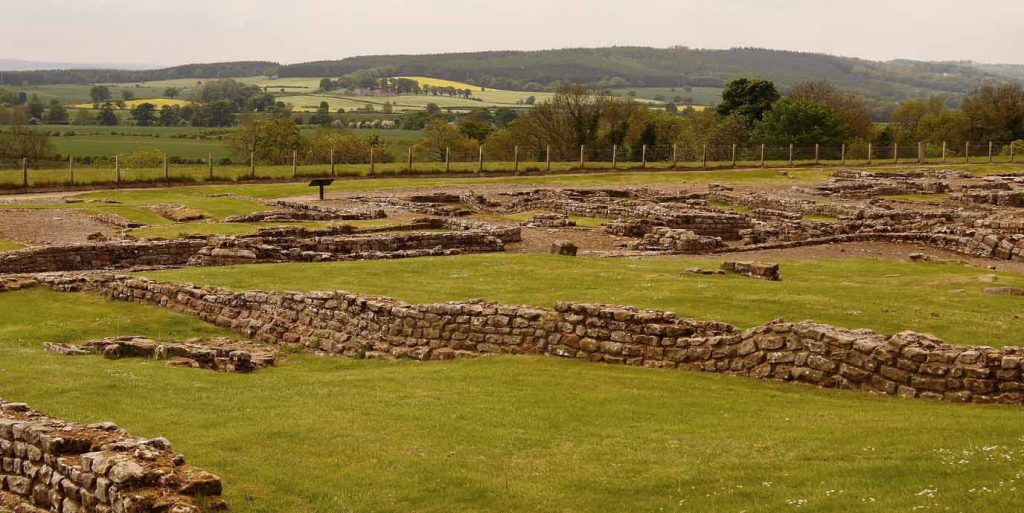
Roman name: Coria
Age: 85 AD (Fort), c. 3rd century (town)
Site type: Originally a military fort, but evolved into a civilian town
Garrison: 500 cavalry
Peak population: Unknown
Nestled in the Tyne Valley above the River Tyne, Corbridge Roman Town offers a rare glimpse into civilian life on the Roman frontier. It was originally built as a fort, but after the Roman retreat to Hadrian’s wall, military presence wanted. Following this, it slowly evolved into a town as temples and granaries were erected. As one of only two substantial towns around Hadrian’s Wall, it served as a bustling hub of trade, supply, and settlement. You can explore remarkably the well-preserved granaries, roads, and buildings, mostly dating from the 3rd and 4th centuries, which reveal the town’s evolving role in Roman Britain.
With a nearby trail providing a scenic riverside route that links the ancient site to the modern village of Corbridge, there is plenty of ample walking opportunities nearby. This trail allows visitors to enjoy views of the site and the river, spot local wildlife, and experience the charm of the surrounding landscape. The area also connects to longer walking routes, including paths that lead toward Hadrian’s Wall, making it a great base for extended hikes through Roman frontier country.
EXPLORE THE
OS Shop
We are with you every step of the way. Shop our trusted walking and hiking maps and guidebooks so you can explore the outdoors with confidence.
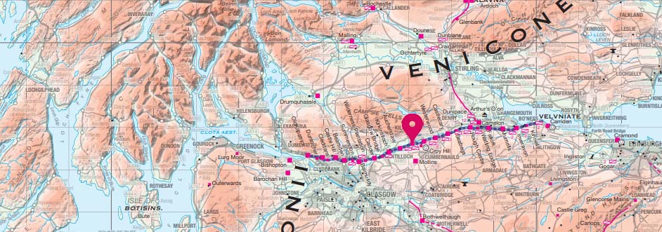
Go to the shopBar Hill Fort
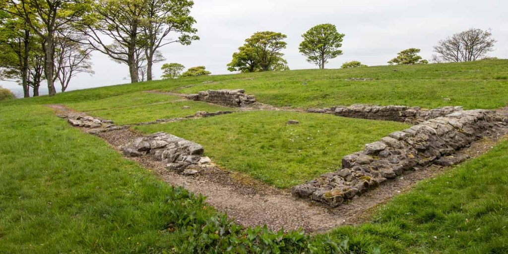
Age: 142 AD
Site type: Auxiliary fort
Garrison: 500 soldiers
Occupation period: 142 AD – c.160s AD
While Hadrian’s Wall often steals the spotlight as the edge of the Roman frontier, the Antonine Wall marks a bold attempt to push further into Scotland. Among its 14 known forts, Bar Hill Fort stands out as a fascinating site where history and landscape meet. Once home to a barracks, headquarters, latrines, and a bathhouse, a thriving village grew just beyond its walls to support the soldiers.
Set high above a valley, the site offers sweeping views and a striking panorama of the Forth and Clyde Canal. The fort is accessible via a well-marked walking track from Twechar village, which winds through open fields and gentle woodland, offering a peaceful approach to the site. The nearby landscape also includes an Iron Age stronghold, adding another layer of historical interest to the walk.
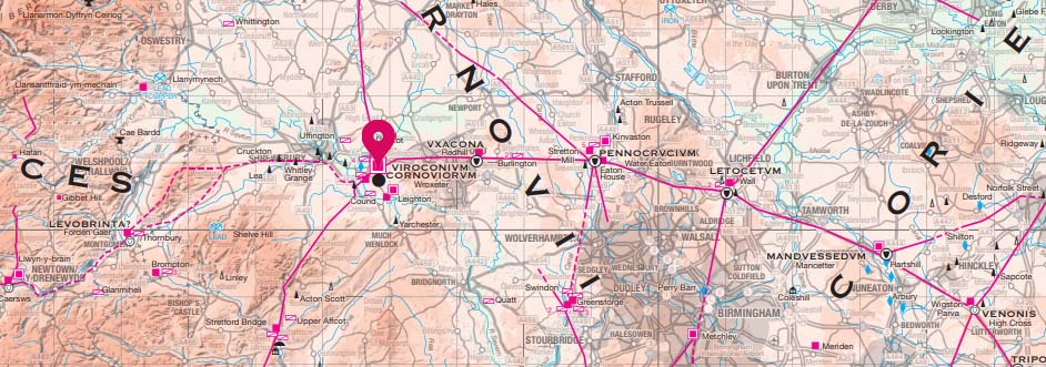
Wroxeter Roman City
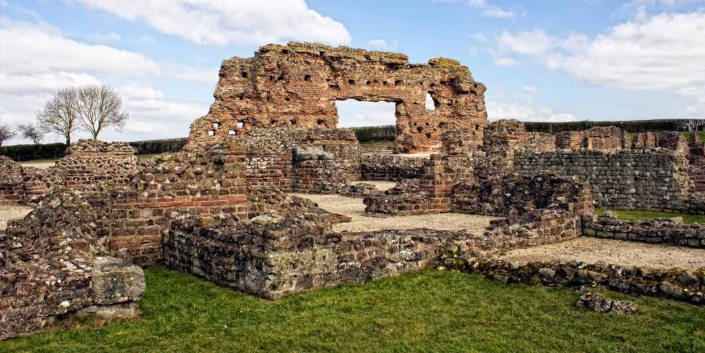
Roman name: Viroconium Cornoviorum
Age: 55 AD
Site type: Founded as a legionary fortress, and later became a civilian city after the military moved to Deva Victrix (Chester) in 88 AD
Peak population: c. 15,000
Set in the peaceful Shropshire countryside, between Shrewsbury and Telford, at its peak Wroxeter Roman City was the fourth-largest city in Roman Britain. Covering over 70 hectares, it rivalled Londinium in size and was larger than Pompeii in Italy. What you can see today represents just one-eighth of the original city.
The site once featured a vibrant mix of public baths, a forum, basilica, temples, shops, and townhouses, reflecting the sophistication of Roman urban life. One of its most striking features is ‘The Old Work’, a 7-metre-high wall, which is the largest free-standing Roman wall in Britain. Adding to the immersive experience is a reconstructed Roman townhouse, built in 2010 using authentic Roman tools and techniques, offering a tangible sense of daily life in the ancient city.
The landscape is characterised by open fields, rolling hills, and quiet lanes, making it perfect for leisurely walks. Nearby walking routes follow the course of an ancient Roman wall. To the south is a Roman road connects the archaeological site with nearby villages and natural features, allowing you to combine historical discovery with scenic walking.
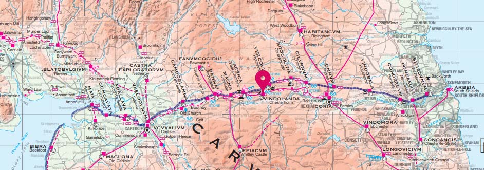
Vindolanda
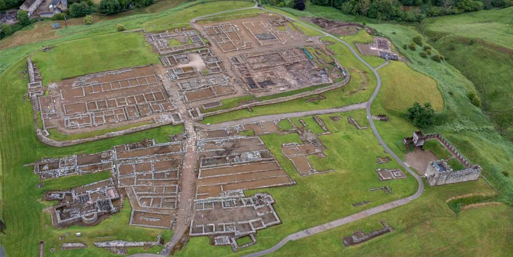
Age: 85 AD
Site type: Auxiliary fort
Garrison: Variable, but at its height 1,000 – 1,500 soldiers
Occupation period: 85 AD – 370 AD
Nestled in the heart of Northumberland National Park, Vindolanda is a remarkable Roman site. This ancient fort predates Hadrian’s Wall, having been established to guard the Stanegate, a vital Roman road that connected key military outposts across northern Britain.
Vindolanda’s story is one of continual transformation. Over the centuries, it was rebuilt nine times, creating a rich archaeological tapestry where layers of Roman life are literally stacked upon one another. Among its most extraordinary discoveries are the Vindolanda tablets, the oldest surviving handwritten documents in Britain. These fragile wooden leaf tablets offer a vivid glimpse into daily Roman life, with messages ranging from military orders to personal letters and even shopping lists.
In addition to the fort, walking opportunities around Vindolanda are plentiful. The site connects easily to the Hadrian’s Wall Path, a long-distance national trail that follows the line of the Roman frontier across dramatic terrain. Nearby circular walks and countryside paths allow visitors to explore the area at a relaxed pace, with views of stone walls, ancient forts, and sweeping valleys.
Looking for more of Britain’s history?
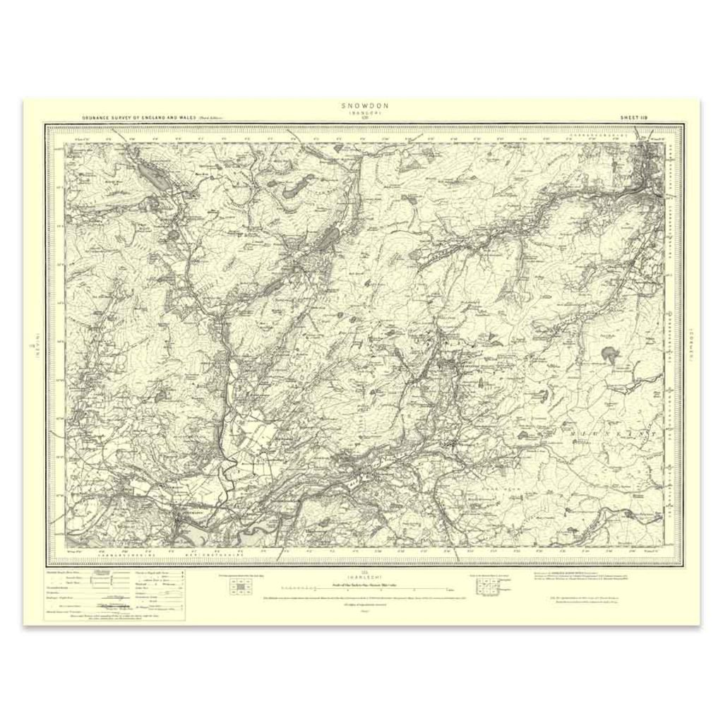
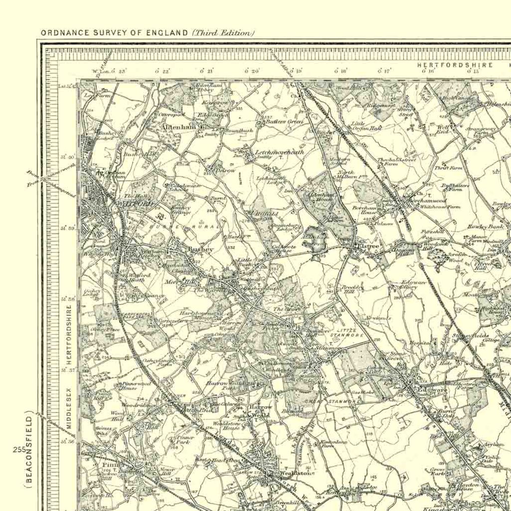
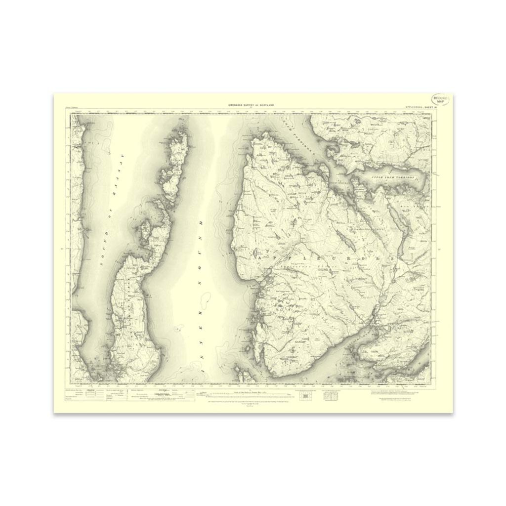
If these Roman sites have whet your appetite for history, take a look at these vintage maps on the OS shop. While they might not be hundreds of years old, we have over 470 available covering the whole of Great Britain from 130 years ago. Not only do they make for a great gift for a history or map lover, but they also look fantastic framed on a wall. You can even compare them side by side with modern OS Maps to see what changes have occurred over time.