Hadrian’s Wall Path showcases 84 miles of UNESCO World Heritage site, two historic cities, a National Park, a picturesque coast and countryside, and of course a BIG wall! OS GetOutside Champion David Wilson gives us the highlights of this beautiful trail.
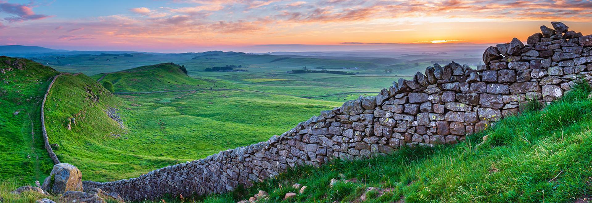
Peel Crags to Crag Lough
The path follows two thousand year old footsteps of the Roman legionaries who constructed the Wall from the West to East coasts of England. The Northern most frontier of the Roman Empire it is the biggest Roman artifact in the world – impressive considering its 1150 miles from Rome. Built to control customs, immigration and the Barbarians of Britannia, Hadrian’s Wall is more than just bricks and mortar, it is genuinely one of the best opportunities in England to walk back in time.
The trail stretches from Bowness on Solway in Cumbria, passes through the historic city of Carlisle, before making the journey across the southern edge of Northumberland National Park and along the River Tyne to Wallsend. The trail is well managed and easy to navigate with the help of OS Hadrians Wall Path Map. As this walk appears to be along a prominent feature, the temptation might be to handrail along the Wall but this is something to avoid. There are sections where the trail leaves the true line of the Wall, requiring navigation, but also having a map to hand ensures you don’t miss out on some of the amazing places during your adventure e.g. St Oswald’s Church at Heaven Fields, the site of a historic battle back in 633 and an amazing place to visit.
HADRIAN’S WALL PATH MAP
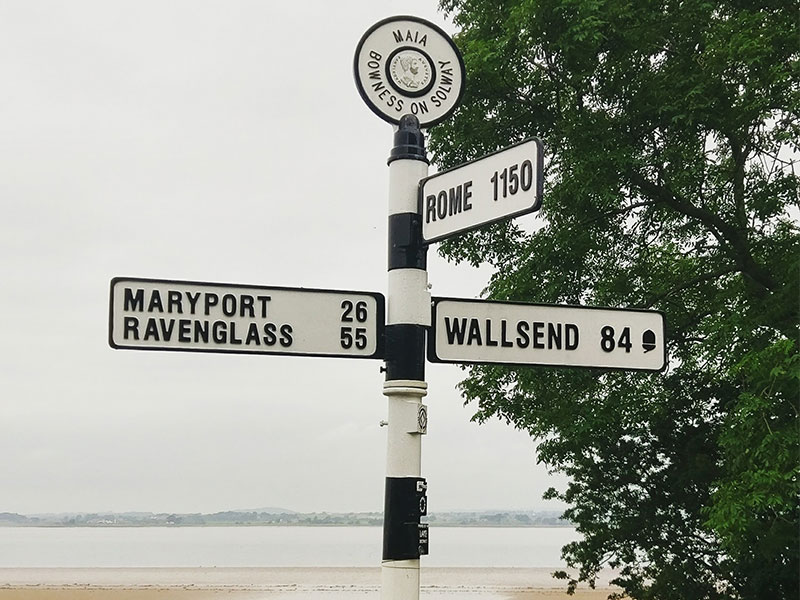
Start of Hadrian’s Wall Path (Bowness)
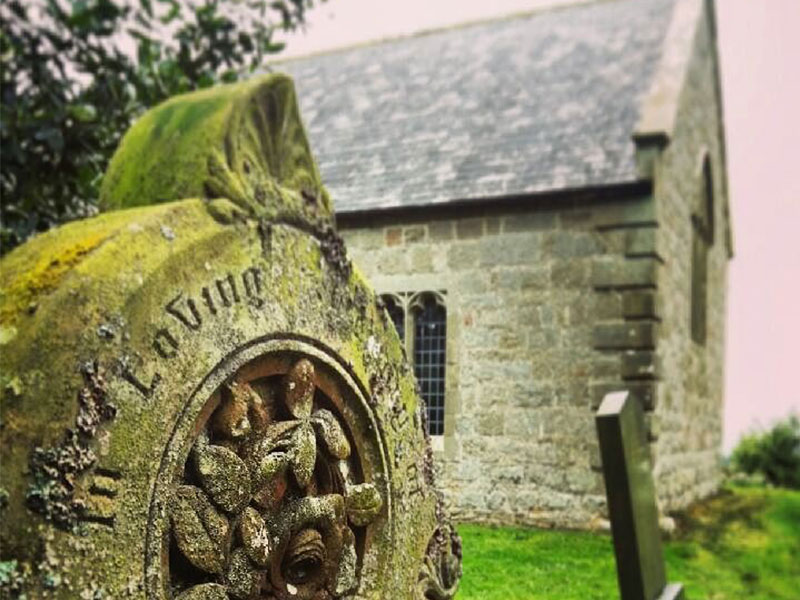
Heaven Fields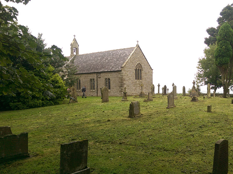
Heaven Fields
While the Wall is of European and military influence it is visited by people of all ages, backgrounds and enjoys worldwide popularity. This means that the route is well managed and caters for a broad range of requirements, from high end hotels to camping in the largest protected Dark Sky Park in Europe.
At eighty four miles the trail offers a compact route which can easily be split according to a person’s ability or time allowed. A long weekend challenge or a couple of weeks immersed fully in the experience, the choice is yours. One of my best (and worst) experiences of Hadrian’s Wall was completing it in less than 30 hours!
Hadrian’s Wall Path is a historical, cultural and natural wonder which should be on everyone’s walking bucket list; and at eighty four miles it’s a route which can be comfortably completed with the right gear and planning. Here’s a quick guide to what to expect, walking West to East, and travelling approximately fifteen miles per day.
Bowness to Carlisle
Starting out at the site of the second largest Roman fort, Maia, this section of the walk enjoys coastal views across the Solway Firth to Scottish shores. The first few miles of the trail are subject to tidal flooding (check your tides) as you walk along the Solway Coast Area of Natural Beauty.
As you reach Burgh by Sands the risk of wet feet (from the sea at least) disappears and you leave the road to walk along the River Eden in to Carlisle – Carlisle was a key settlement during Roman times serving Hadrian’s Wall Forts and now boasts a more modern (900 years old!) castle which is open to the public.
Carlisle to Banks
The River Eden remains a prominent feature at the start of the days walking as you leave Carlisle City Centre. Just outside of the city you pass over the M6 Motorway and it’s from here that you can start your journey in the wilder side of Hadrian’s Wall Trail.
Five miles from Carlisle is the village of Crosby on Eden which sits south of the original line of the Wall but still holds significance in Roman history. The road through Crosby is the original Stanegate Roman Road built some time before Hadrian’s Wall. This road joined Carlisle in the West and Corstopium (Corbridge) in the East – a major link to the North and South of England.
As you approach the thirty mile point of your journey you’ll come to the hamlet of Banks – and at this stage the start of some fantastic sections of Hadrian’s Wall. Prior to this point Hadrian’s Wall was mainly made of turf which accounts for the lack of visible sections of the Wall.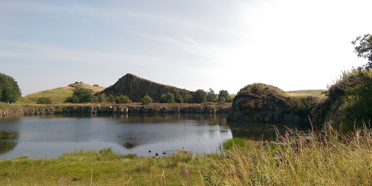
Cawfield Quarry
Banks to Once Brewed
Before leaving Banks you should visit Banks Turret – the best preserved turret (observation tower) along the wall and a chance to enjoy the Southerly views over the valley of the River Irthing.
Today’s walk is the start of two days of true immersion into Roman history and the natural environment. A few miles from Banks is Birdoswald, and the longest continuous stretch of wall. This section offers you the chance to take the time to appreciate the feat of engineering that tested the abilities and commitment of Roman Legionnaires over its six years of construction.
After Birdoswald you pass through the peaceful village of Gilsland before approaching the edge of the neighbouring village of Greenhead – the gateway to Northumberland National Park (NNP). NNP is a treasure trove of Roman and natural delights starting with Thirlwall Castle and Walltown Quarry. Walltown is a great place to spend a little time and also visit the nearby Roman Army Museum.
The final part of the day sees you scale the Great Whin Sill at Cawfields Quarry, which is the volcanic plateau which large sections of the Wall are built on, before a slight descent to Once Brewed where the newly built Youth Hostel (YHA The Sill at Hadrian’s Wall) offers a value for money bed for the night.
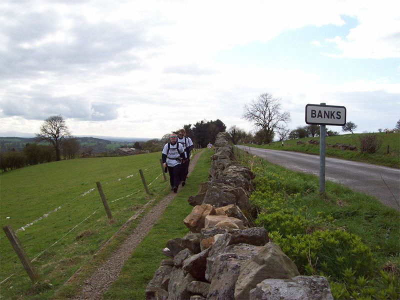
Banks
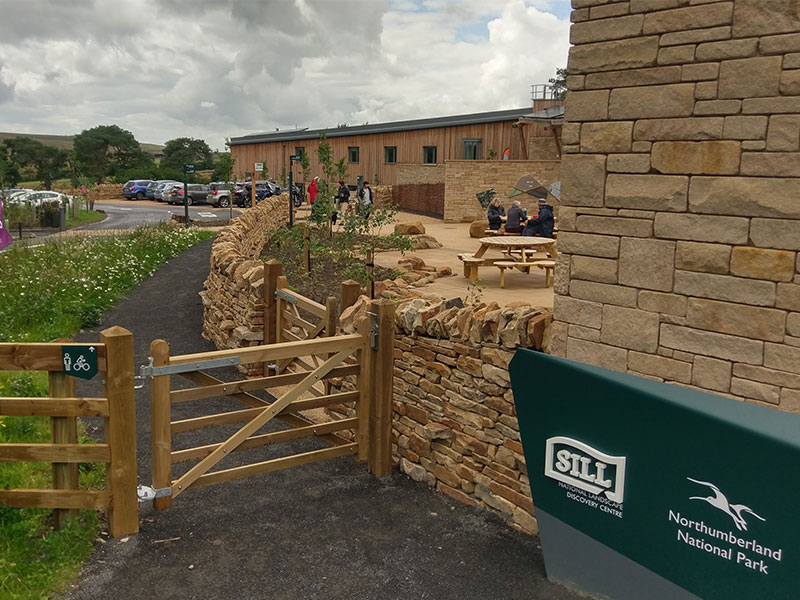
YHA at The Sill
Once Brewed to Heavenfield
This morning should start with a walk around The Sill: National Landscape Discovery Centre – the £14.8 million visitor centre built by Northumberland National Park – which will give you information and inspiration for the days walking.
Heading out from Once Brewed you’ll quickly be on the Wall again and witnessing one of the trails best views. Steel Rigg offers views along Peel Crags to Crag Lough with the Wall cresting above them. A mile along Peel Crags will bring you to one of the most iconic places on Hadrian’s Wall, Sycamore Gap. Take a moment to enjoy this famous spot, but not too long, as ahead are crags, loughs, ancient temples and the Forts of Housesteads and Chesters.


Heavenfield to Heddon on the Wall
A brief cross over with St Oswalds Way will see you heading Eastward away from Heaven Fields and following closely the line of the wall. The wall was only one part of the infrastructure of Hadrian’s Wall with a defensive ditch also being dug. The Vallum appears throughout the trail but this section has some prominent sections leading to Milecastle 18 and Vallum Farm, a nice spot for some refreshments.
Tracking the Military Road alongside the trail makes for a leisurely day through fields and villages until the aptly named Heddon on the Wall is reached. In the village there is a section of wall which is the best preserved original section, dating back to AD122 when the wall was first started.
Heddon to Segedunum
The final day, and a journey into the busy city centre and industrial areas of Newcastle and the River Tyne. This section of the path deviates from the original route of the wall in a number of places, but delivers a picturesque route along the Tyne into the City Centre.
The river walk may not be truly Roman, but it does lead nicely to views of the many modern bridges over the river in contrast to the original Roman site of Pons Aelius and the bridge it protected. A few more urban miles, with the wall hidden below city centre offices and housing, brings you to Segedunum, Wallsend. The easternmost part of the wall, Segedunum, is the most extensively excavated fort along the trail and an ideal end to your adventure.
Top tops for completing Hadrian’s Wall Path
- Don’t climb on the wall – don’t leave you mark on the remarkable.
- If in a group don’t walk single file – enjoy the space offered by the great outdoors.
- Leave nothing behind – this means everything, including fruit waste.
- Spend money – places to visit, stay and eat depend on people spending to stay open.
- Respect the land – most land is privately owned along the wall so respect the land and it’s owners.
Useful websites:
Northumberland National Park
National Trails
Getting there
Hadrian’s Wall Country
TOP DAY WALKS IN NORTHUMBERLAND
GET THE HADRIAN’S WALL MAP
THE HIKING CHECKLIST