Types of compass and their features
Improve your map reading skills with this beginner’s guide to the compass. We take a look at the different types of compass, such as a baseplate compass, and explain how to orientate a map with one.
Whether you are out walking or cycling or simply driving somewhere new, being able to use a compass is a great skill that will always come in handy. Rather than just showing north, modern compasses have many features to assist in planning and navigation.
Without a compass, you can still use your map by relying on visible features, but a compass allows you to be more accurate and navigate where there are few obvious landscape features,
Types of compass
There are loads of magnetic compasses available, from ones attached to penknives to huge, expensive ships compasses. Here’s some of the most common:
Basic compass
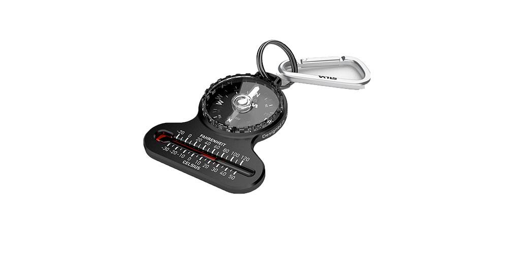
Silva Pocket Compass
This will tell you which way is north, but without a rotating bezel or an easy way of alignment, it will never be very accurate. They are inexpensive, but very cheap ones can be poor.
Best for: driving and road cycling where you only need the approximate direction, or as an emergency spare
Baseplate or orienteering compass
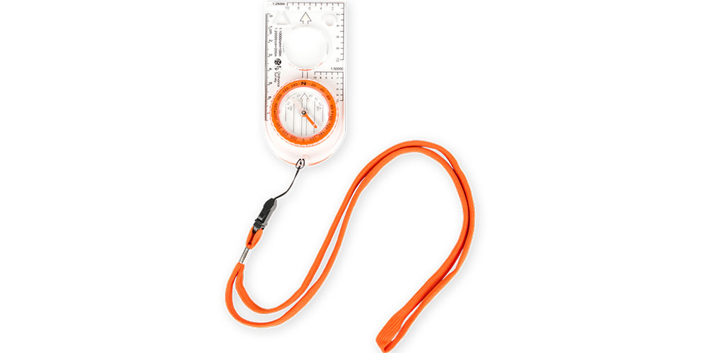
OS Compass
This is probably the most flexible type, as it can be used for taking bearings, setting a heading and measuring distances. The clear base allows it to be laid on top of the map.
Best for: accurate navigation with a map
Mirror compass
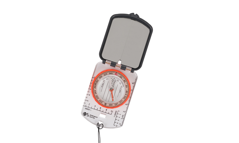
OS Mirror Compass
Some more advanced compasses have mirror housing. The mirror allows the user to see the bezel and the landscape at the same time improving accuracy.
Best for: long treks in pathless terrain
Sighting compass
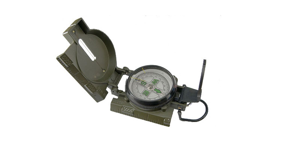
Source: Wikimedia commons – Adamantios
This compass is designed to make it easy to take a bearing from a distant object, and are still often used by the military. They don’t have all the features you may want, but can be very accurate.
Best for: Using triangulation to work out exactly where you are
Know your compass
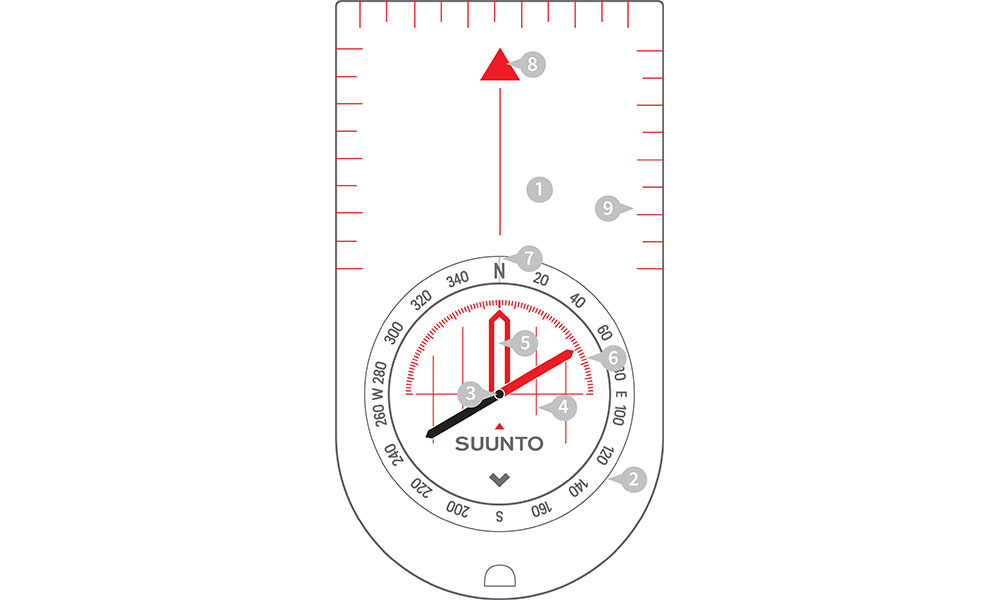
A compass and its features
- Baseplate – The mounting of the compass. Clear, so when placed on top of the map you can still see the map features
- Compass housing – Contains the magnetic needle and has the points of the compass printed on a circular, rotating bezel.
- Compass needle – Floats in liquid so it can rotate freely but without being too sensitive to movement, the red end points to magnetic north.
- Orienting lines – Fixed within the compass housing and designed to be aligned with the eastings on a map.
- Orienting arrow – Fixed within the compass housing, aligned to north on the housing. Enables conversion between grid and magnetic north.
- Magnetic variation – allows accurateadjustment for magnetic variation or declination
- Index line – Fixed beneath the rotating bezel of the compass, it marks the bearing you wish to travel along.
- Direction of travel arrow – Shows the direction that you want to travel along once you have taken your bearing. It is an extension of the index line.
- Compass scale – Displayed along the edge of the base plate so you can measure distances on maps.
Features of a compass with Steve Backshall
Using your compass
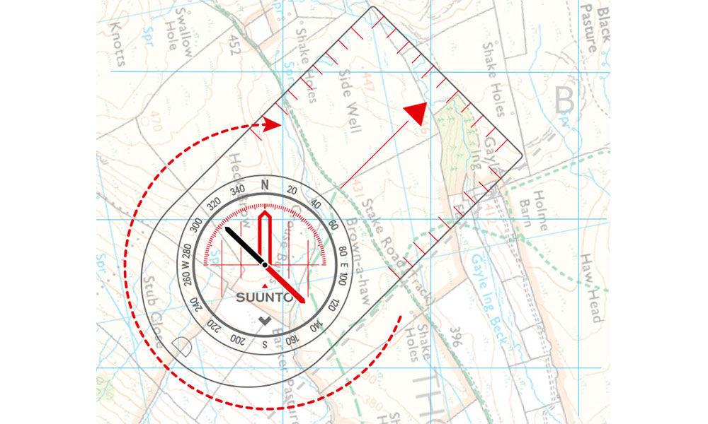
How to orientate a map
Where do you want to go?
- From your starting point on the map, place the index line on an imaginary line between where you are now and where you want to be – with the direction of travel arrow on the base plate pointing the way. Start by drawing a line from A to B now.
- Holding the baseplate in place, rotate the compass housing so the orienting arrow lines up with grid north on the map. The orienting lines should be parallel with the vertical blue grid lines (eastings).
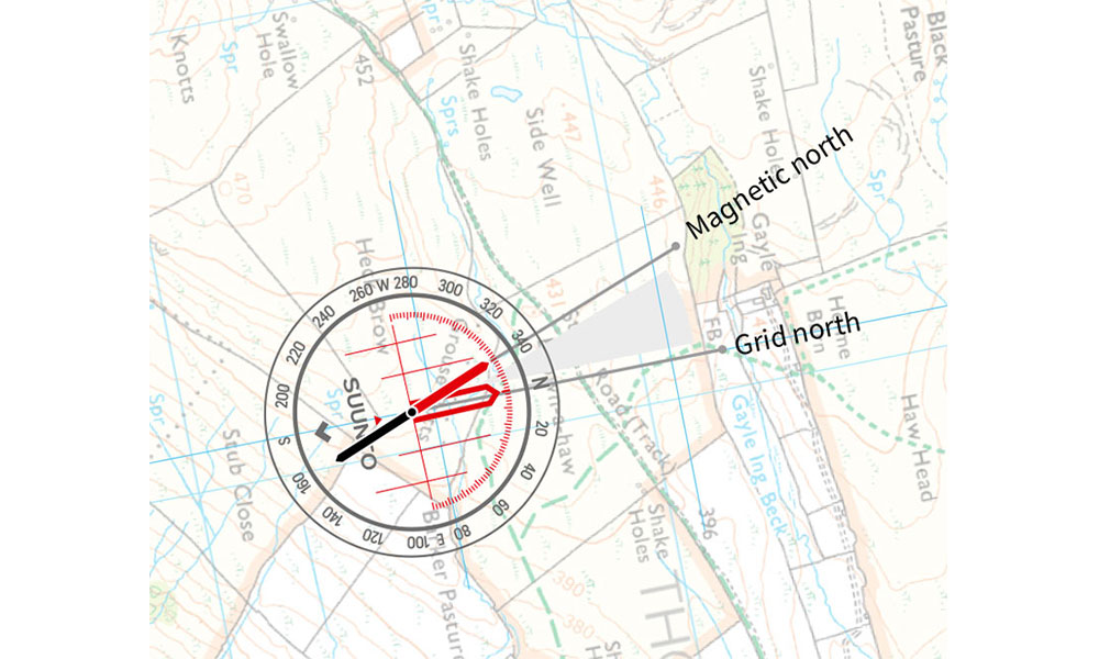
Adjust for magnetic variationim
- Your compass does not point to grid north. Magnetic north throughout Great Britain can range from 0º to 5º. The amount of variation changes every year, so check your OS map to work out the most current value. You’ll find this in the map legend. Add magnetic variation to your bearing by rotating the compass housing.
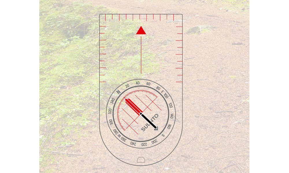
Adjust the compass, line up the arrow and follow the direction of travel
- Take your compass off the map. Hold your compass flat at waist height and turn yourself until the red needle meets up with the letter N and is positioned over the orienting arrow. You’re ready to go. The red direction of travel arrow will point the way.
Compass readings are also affected by the presence of iron and steel objects, so be sure to look out for – and stay away from – pocket knives, belt buckles, mobiles and GPS devices when using your compass.
How to take a compass bearing with Steve Backshall

Top tip
The red end of the compass points to north, the black end points to south
Using land features instead
As an alternative to using a compass to orientate your map, you can use your eyesight. This method will only work if you are in an area with visible prominent features or landmarks. First, locate yourself next to a feature or landmark and place your finger on the map at the point where you are standing. Then begin to rotate the map so that other features and landmarks on the map begin to line up with the actual ones you can see. The map is now orientated with the land, although not as accurately as it would be using a compass.
For more information on map reading, take a look our collection of guides. We have those for beginners just starting out on their map reading journey, as well as those who are more advanced and looking to hone their skills or set themselves a challenge.

