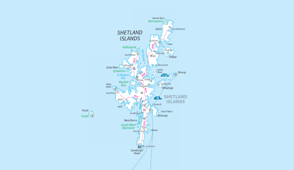
Exploring Shetland’s Best Walks
When visiting Shetland, you don’t struggle to find beautiful walks. The islands are encased in the most jaw dropping coastlines, there is history everywhere you look, and the beaches have white sand and turquoise water. With so many beautiful places to visit, I thought it would be helpful to list some of my favourite routes.
7 of the Best Shetland Isles Walks
My 7 Shetland Isle walks cover six different islands for a true taste of what Shetland has to offer and range from easy to moderate, all varying in distance, terrain and ascent involved. Some routes require ferry crossings from Mainland. If they do, details are given. It is highly recommended that you book ferries in advance during busy times of the year. Visit the Shetlands Islands Council website for up-to-date ferry information before travelling. All other listed routes are on islands with bridge crossings from Mainland.
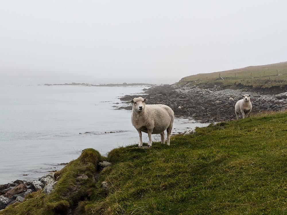
If you own binoculars, I would take them on any of the routes below. One of the most amazing things about Shetland is its wildlife, you are almost guaranteed to have an encounter whilst visiting the archipelago. Examples of wildlife you may spot include migratory birds not usually seen on mainland UK, a whole host of cetaceans and my personal favourite, otters! What I love about this is that it encourages you to take your time while exploring Shetland. It is not a place to rush, but somewhere to savour.

EXPLORE THE
OS Shop
We are with you every step of the way. Shop our trusted walking and hiking maps and guidebooks so you can explore the outdoors with confidence.
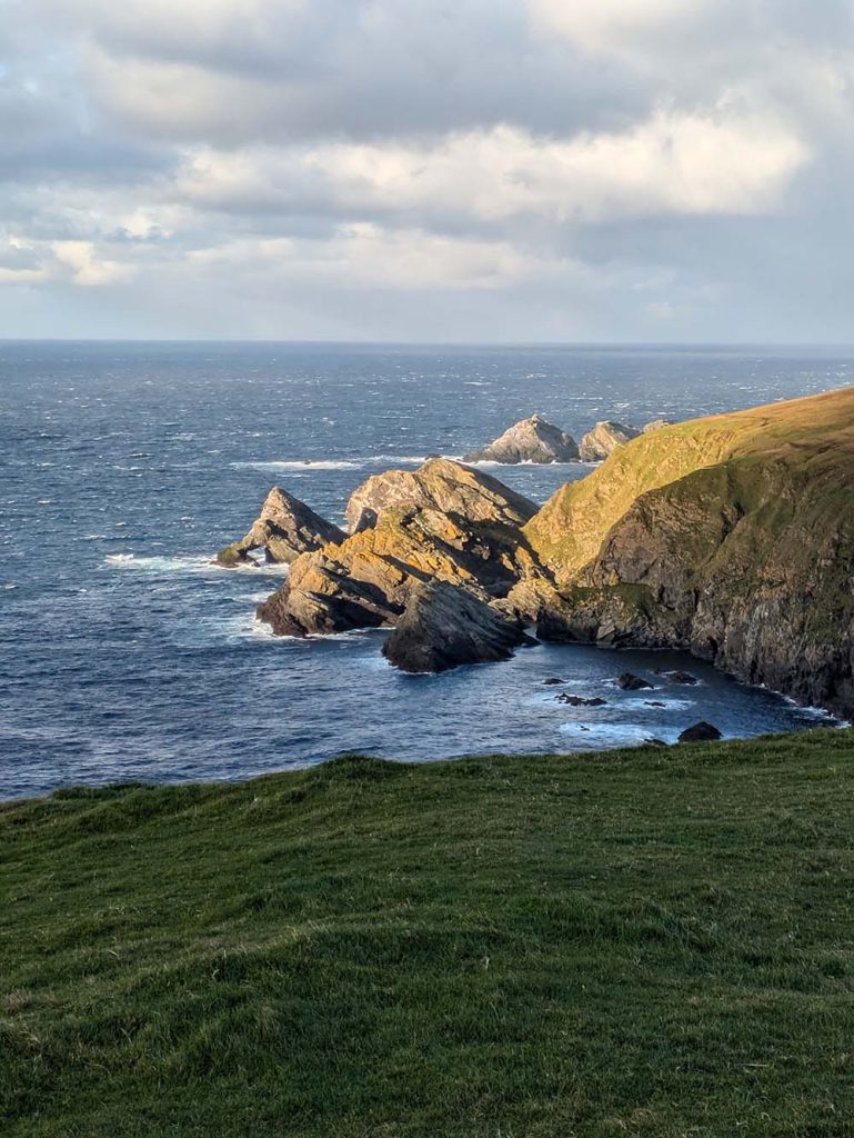
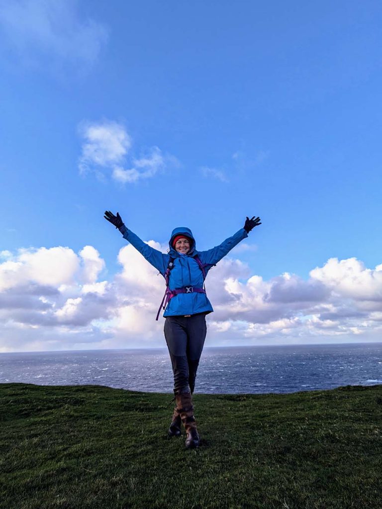
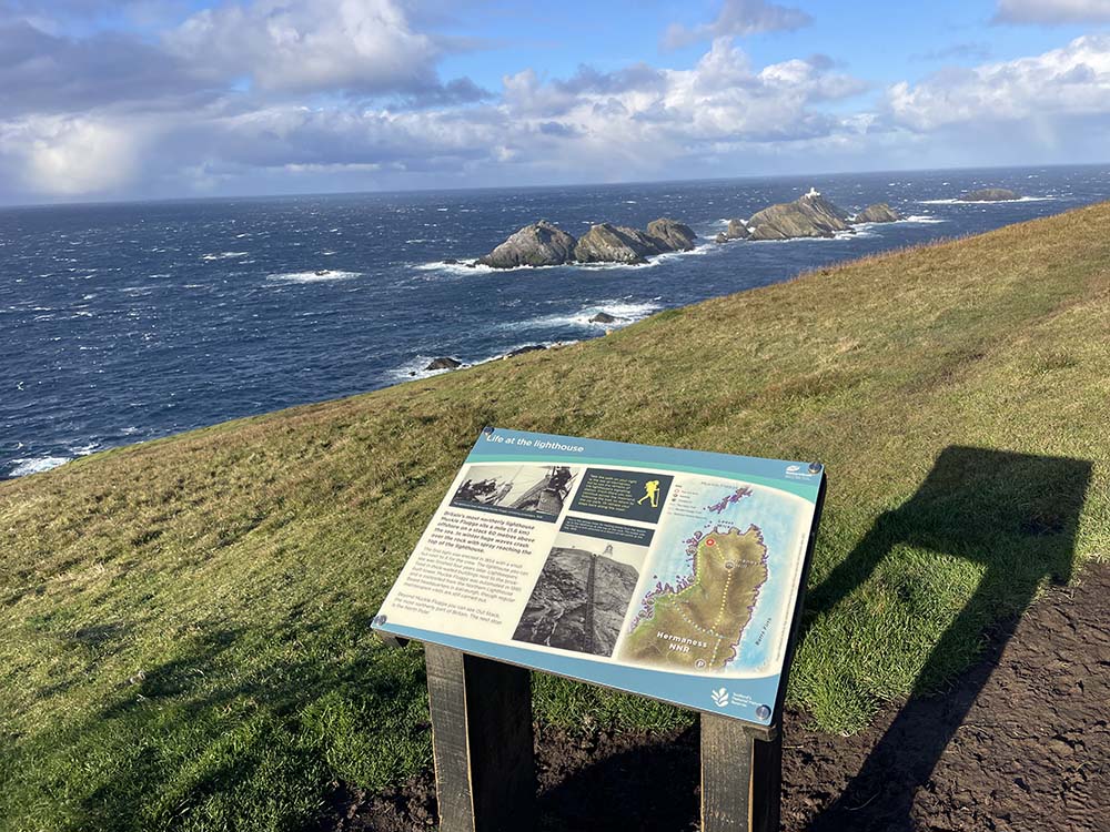
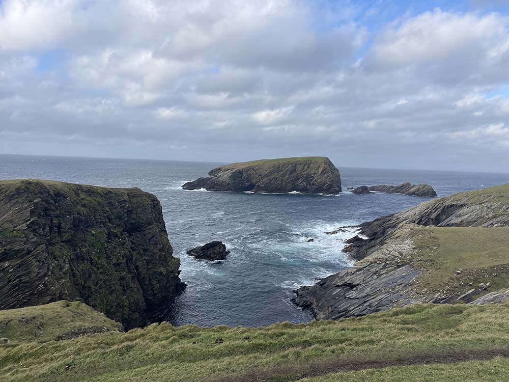
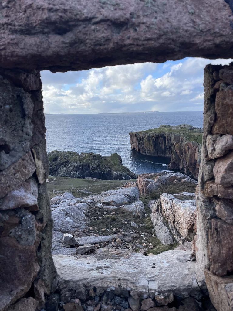
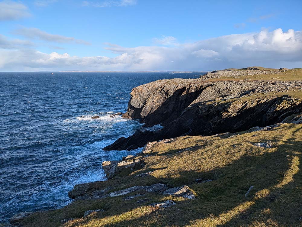
Go to the shopHermaness National Nature Reserve to Muckle Flugga viewpoint, Unst
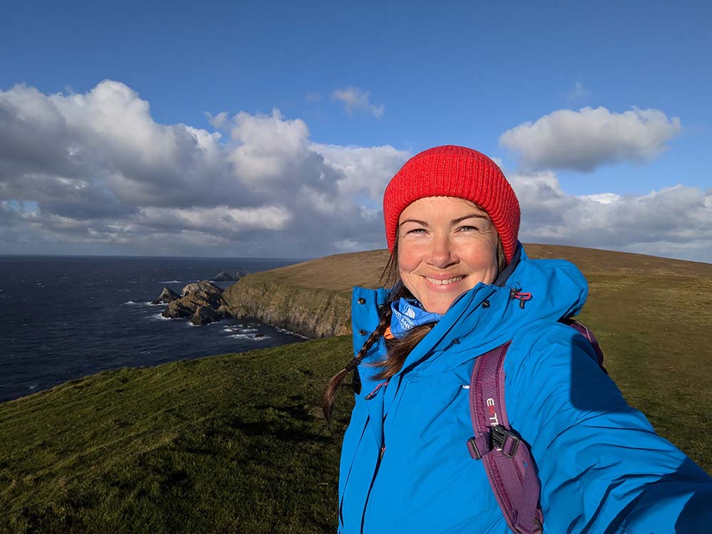
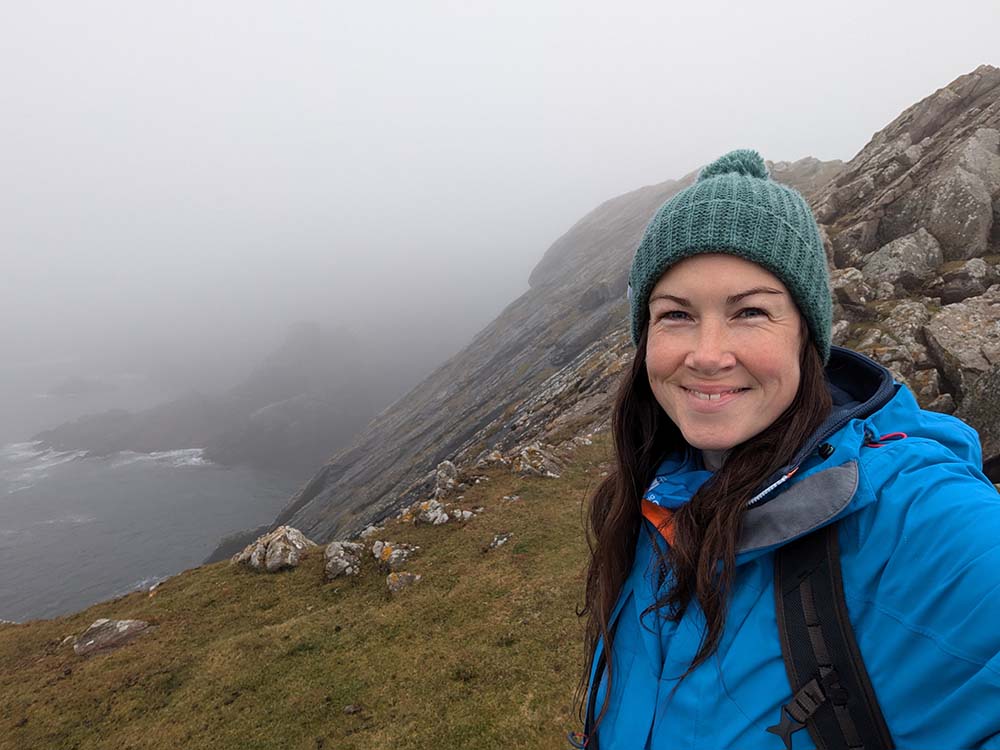
From Mainland, take the Toft-Ulsta ferry (20 min crossing) over to Yell, drive North and then take the Gutcher-Belmont ferry (10 min crossing) to Unst. Hermaness National Nature Reserve is at the Northerly tip of Unst, the northernmost inhabited part of Britain.
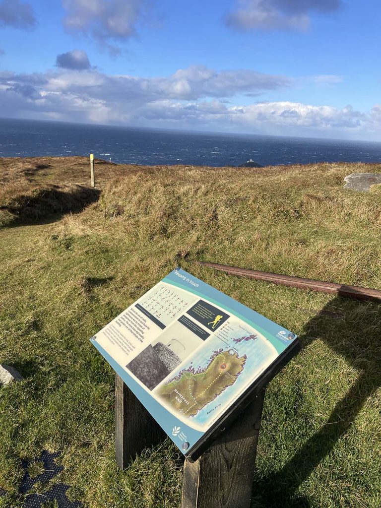
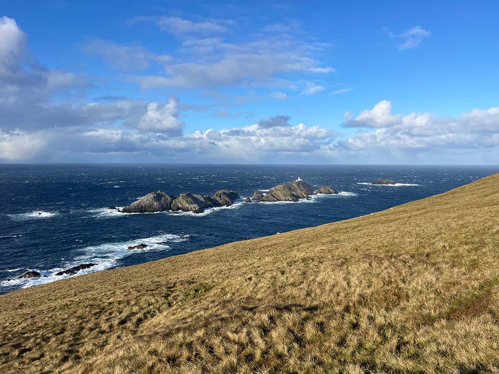
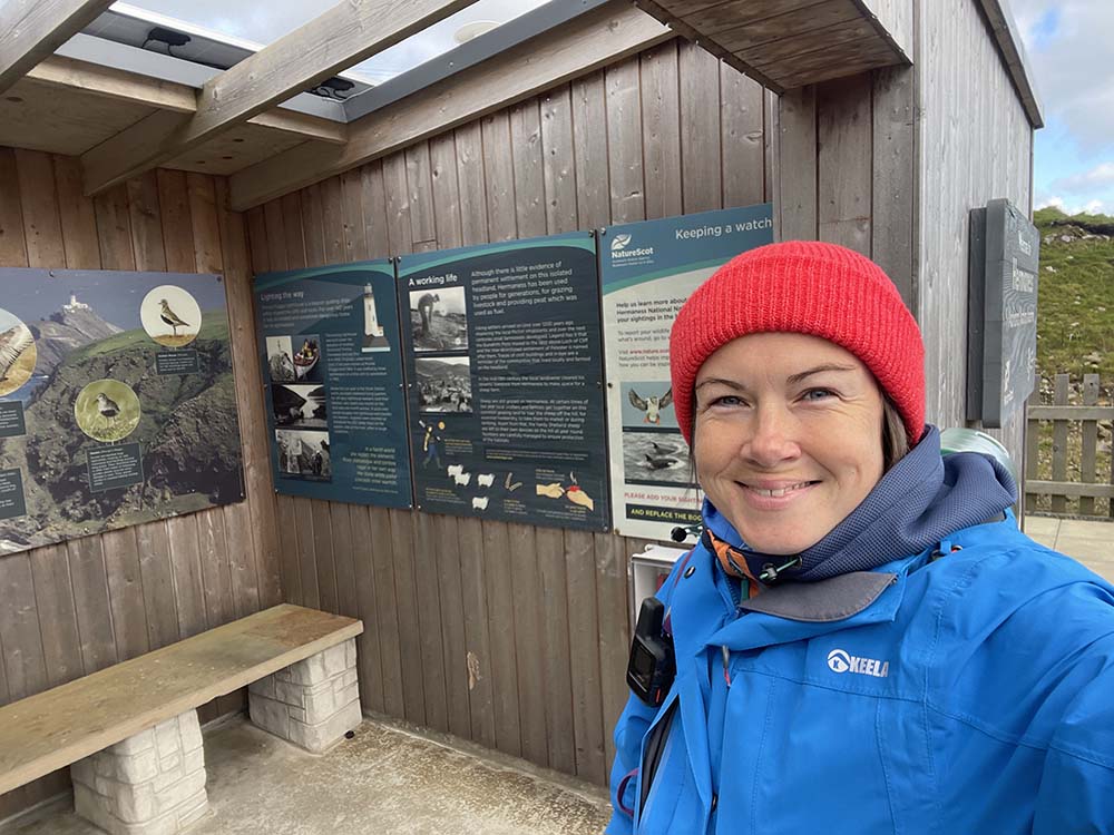
The walk begins at the NNR car park which has a very small, unmanned visitor centre. The centre has a roofed information area and public toilets that are open daily 1 April – 31 October. The terrain is firstly sturdy boardwalk, then open moorland. There are sections that come close to cliff edges, something to be aware of. The highlight of this route, and what I went to see, is the view over to the famous Muckle Flugga lighthouse. Muckle Flugga was built on the most northerly rock in the British Isles in 1854 and is a truly spectacular structure to behold. There are some information boards near the lighthouse viewpoint, they make for some really informative reading. Save this walk for a clear day.
Difficulty: moderate
Parking: yes, free (and seasonal toilet access)
Hermaness National Nature Reserve Image Gallery

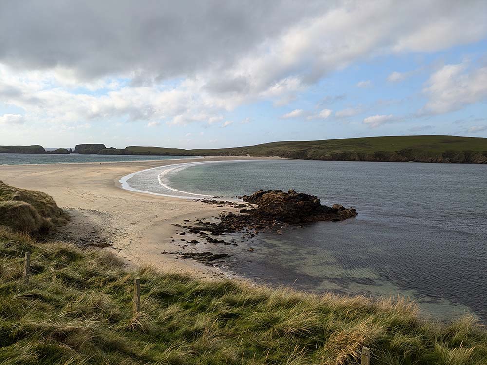
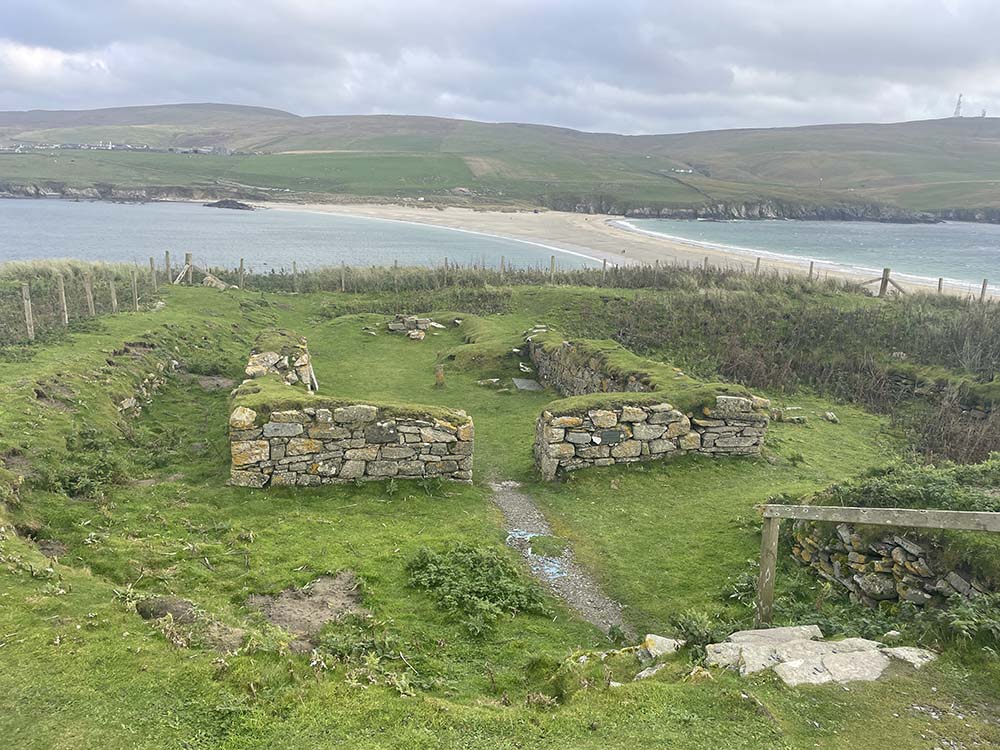
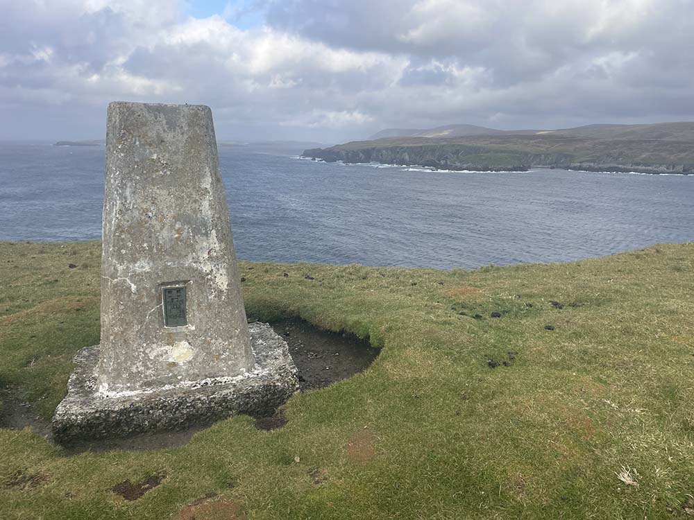
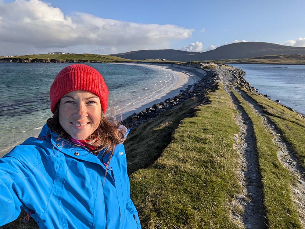
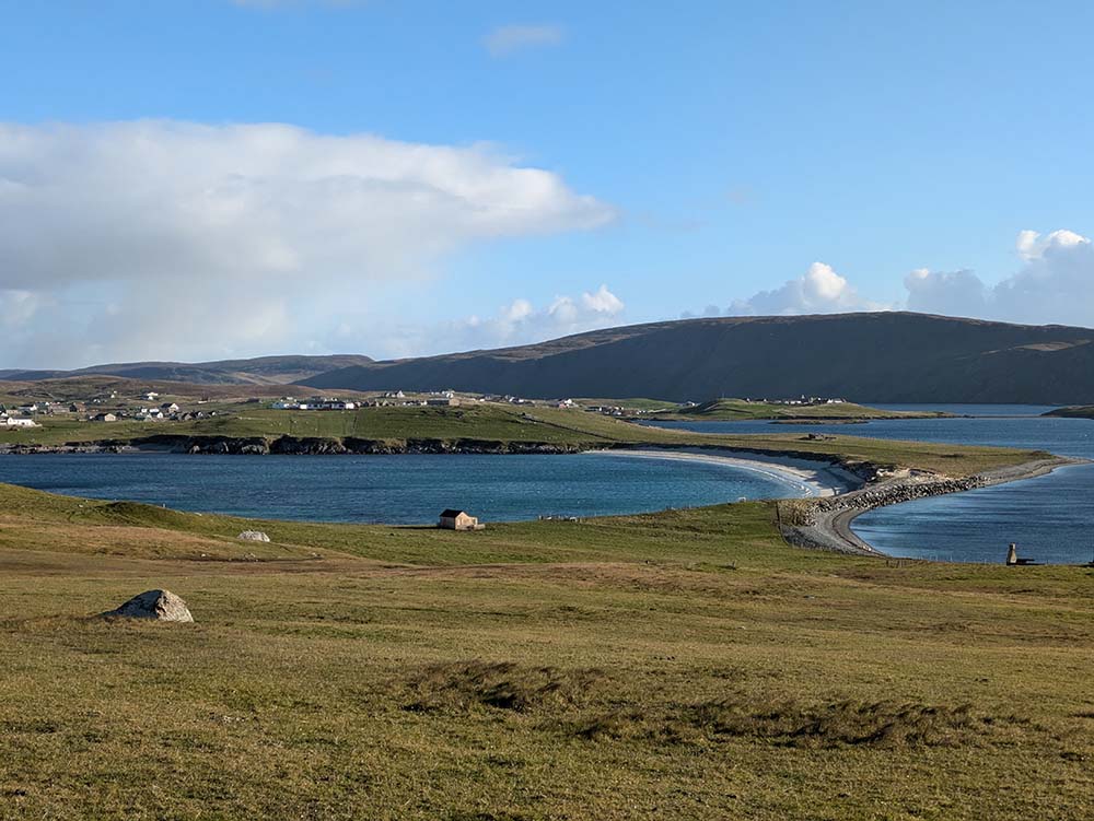
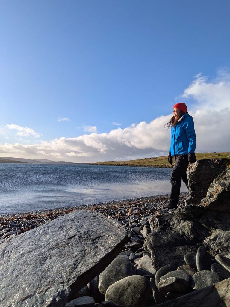
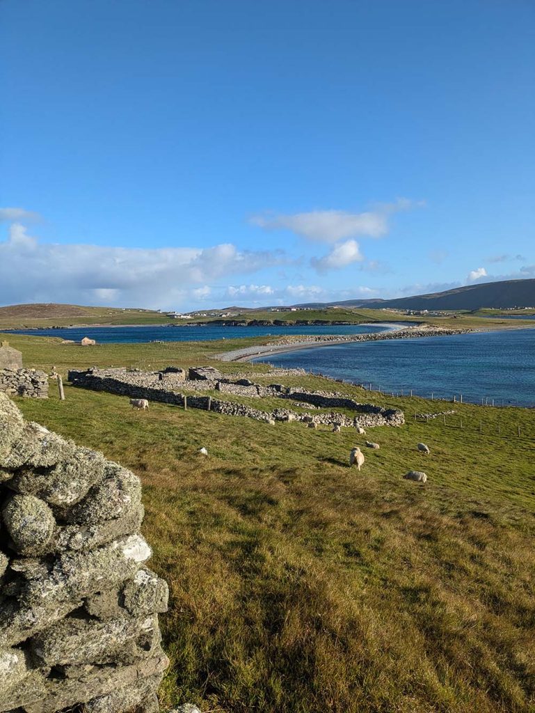
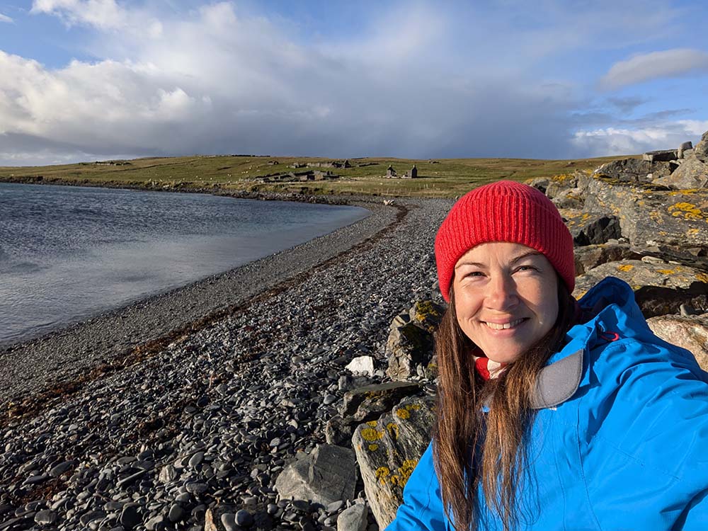
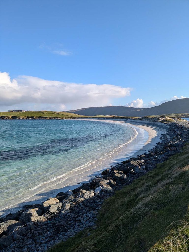
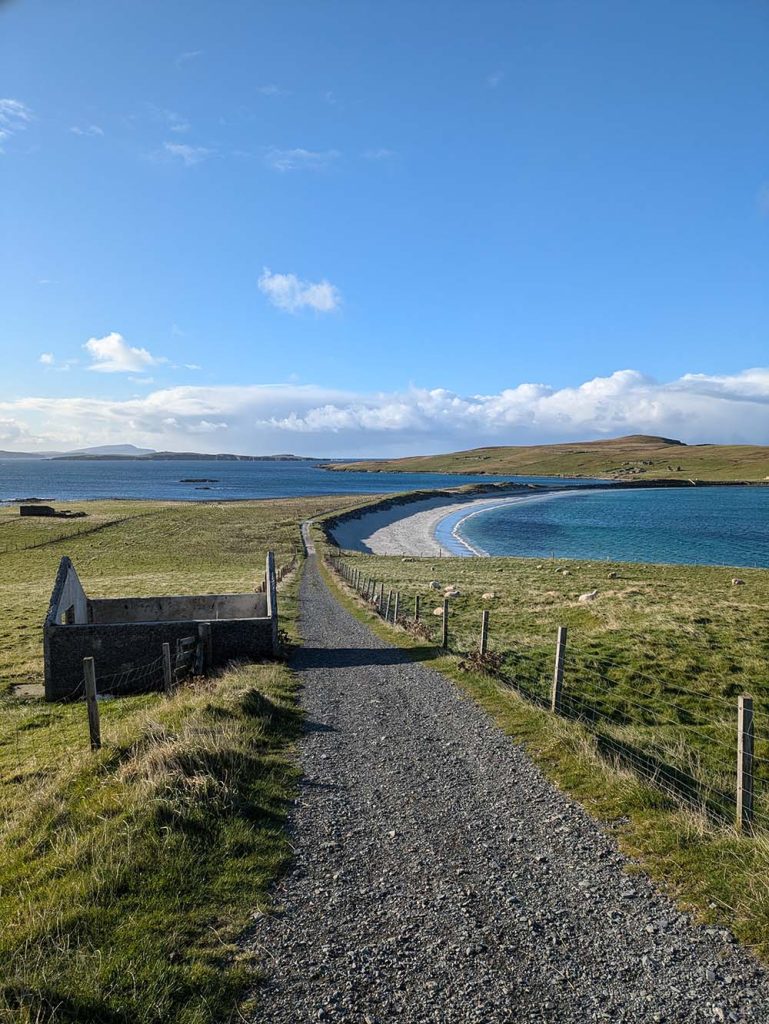
St Ninian’s isle circular walk, Mainland
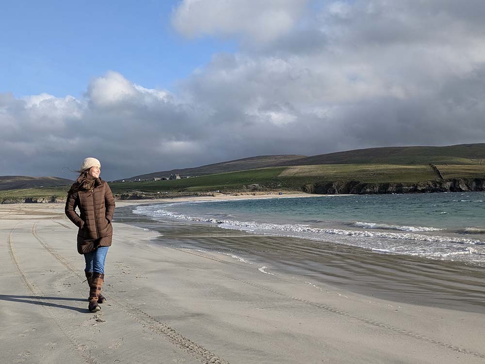
Many people visit the stunning tombolo of St Ninian’s beach, but when I visited few continued over to the isle. It is such a beautiful peninsula; I encourage you to take a slightly longer walk and complete a loop. Not only will you see lots of stunning coastline, but there is a trig point (for all you baggers out there) and the ruin of a chapel to enjoy.
Starting and ending at the beach, there is a reasonably well defined path that goes all the way round the peninsula. You can choose which way round to walk it, but I decided to go anticlockwise to leave the trig and chapel ruin to the end. With little to no shelter, walk this route on a day with minimal wind to enjoy it the most.
Difficulty: moderate
Parking: yes, free
St Ninian’s Image Gallery

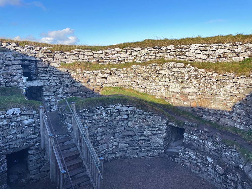
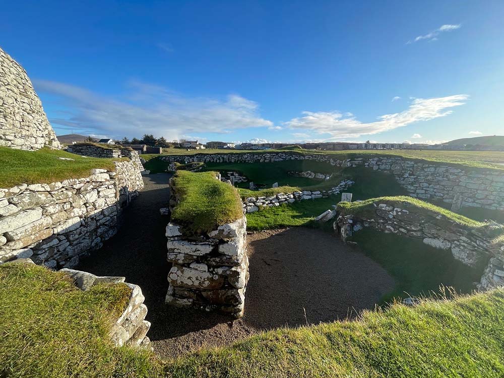
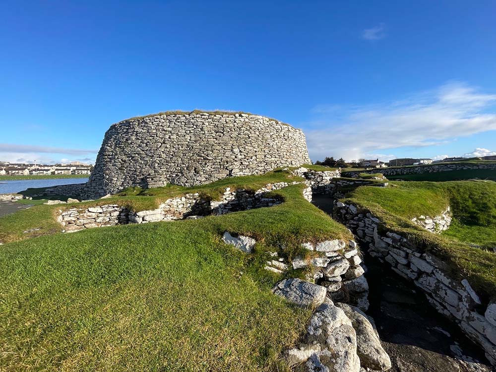
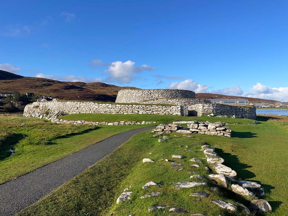
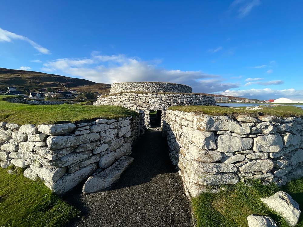
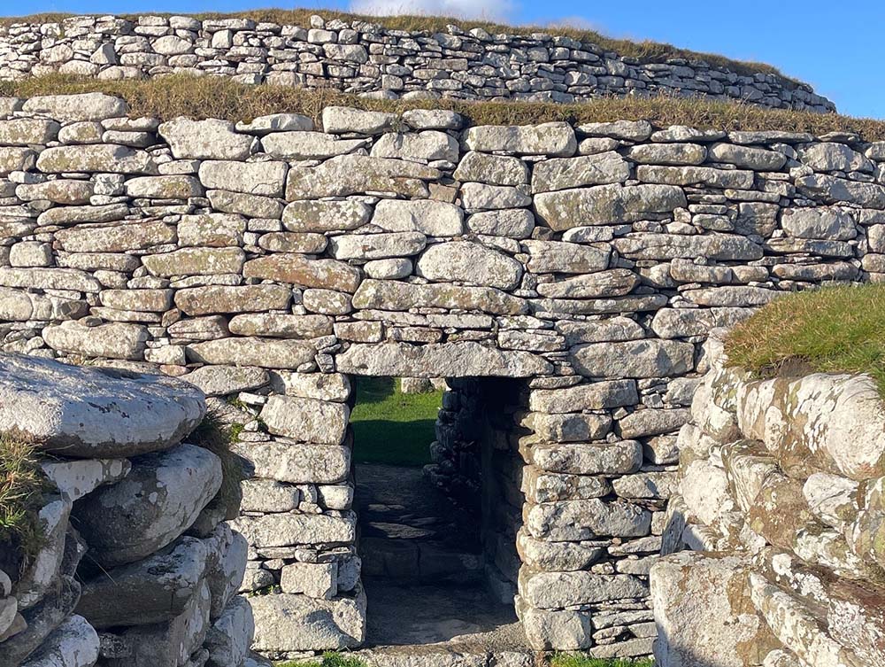
Clickimin Broch circular walk at Lerwick, Mainland
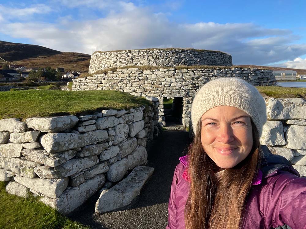
The Clickimin Broch is situated near a residential area of Lerwick. With its entrance opposite a petrol station and near the local Tesco, you can gather that this route is neither remote nor long. What Clickimin Broch is, however, is accessible, explorable and of great historical interest. You can also fit this route in whilst nipping for a pint of milk, what’s not to love?!
The walk starts and ends at the gated entrance to the broch, visiting the ruin and then taking in a loop of the loch that surrounds it. There is an information board about the broch at the entrance and you are free to explore the ruin, including inside the main walled structure. At just over 1.5 miles in total length, this route is lovely for a leisurely stroll on a sunny day.
Difficulty: easy
Parking: yes, many different free or paid car parks nearby to choose from.
Clickimin Broch Image Gallery

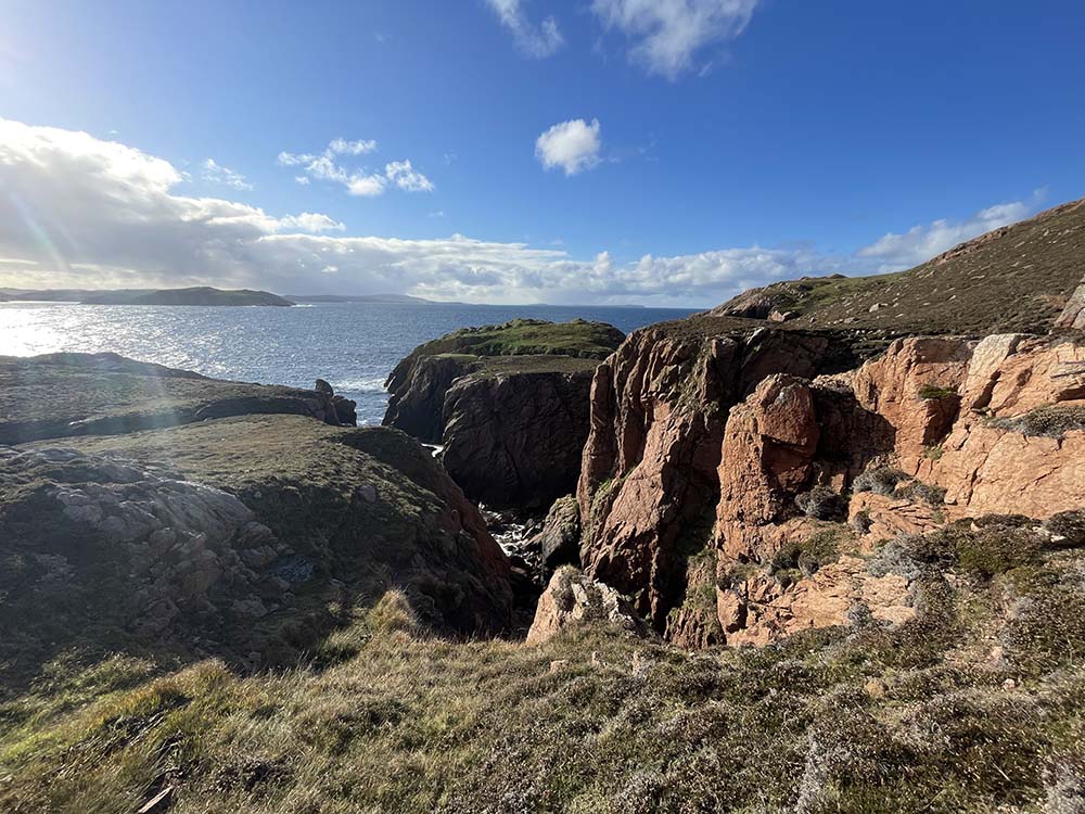
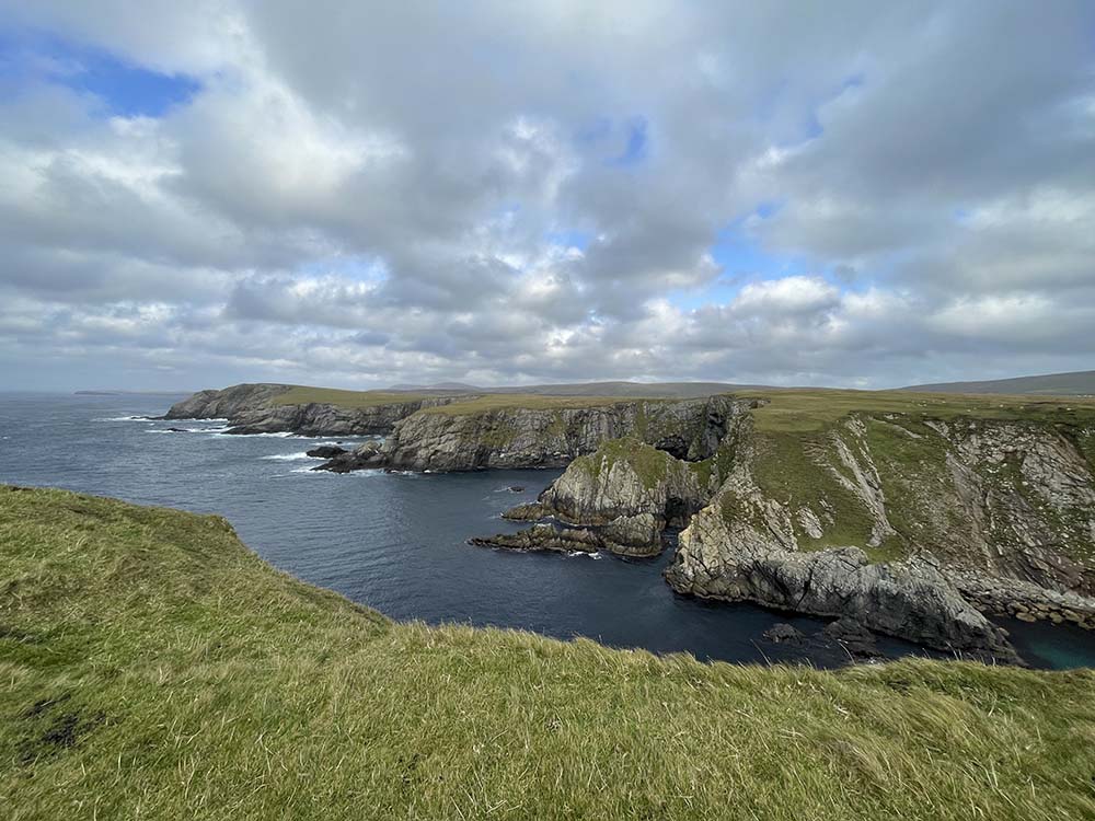
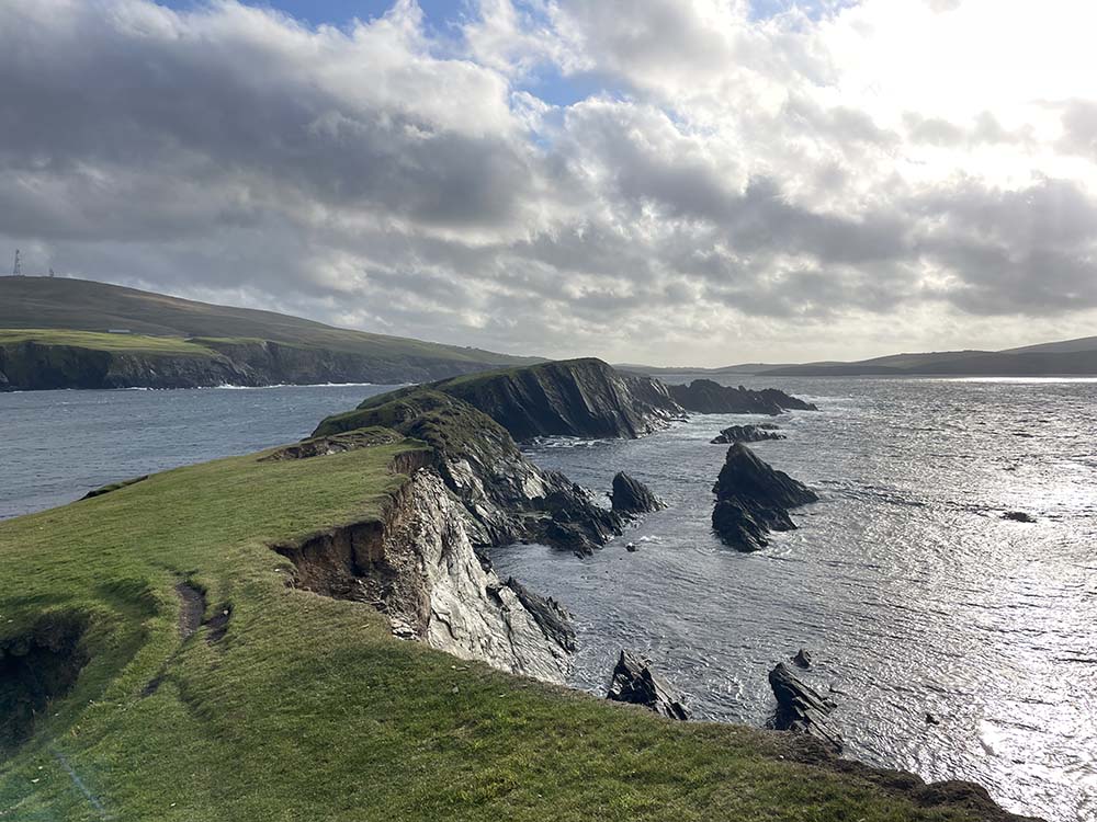
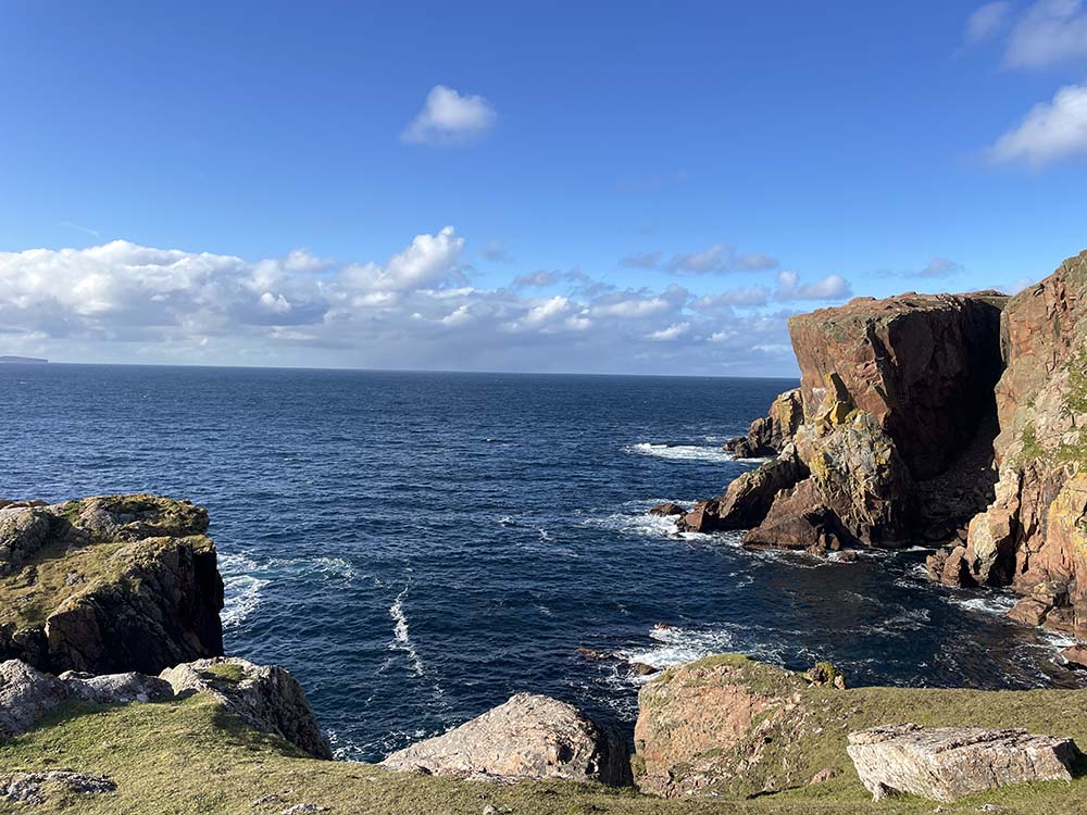
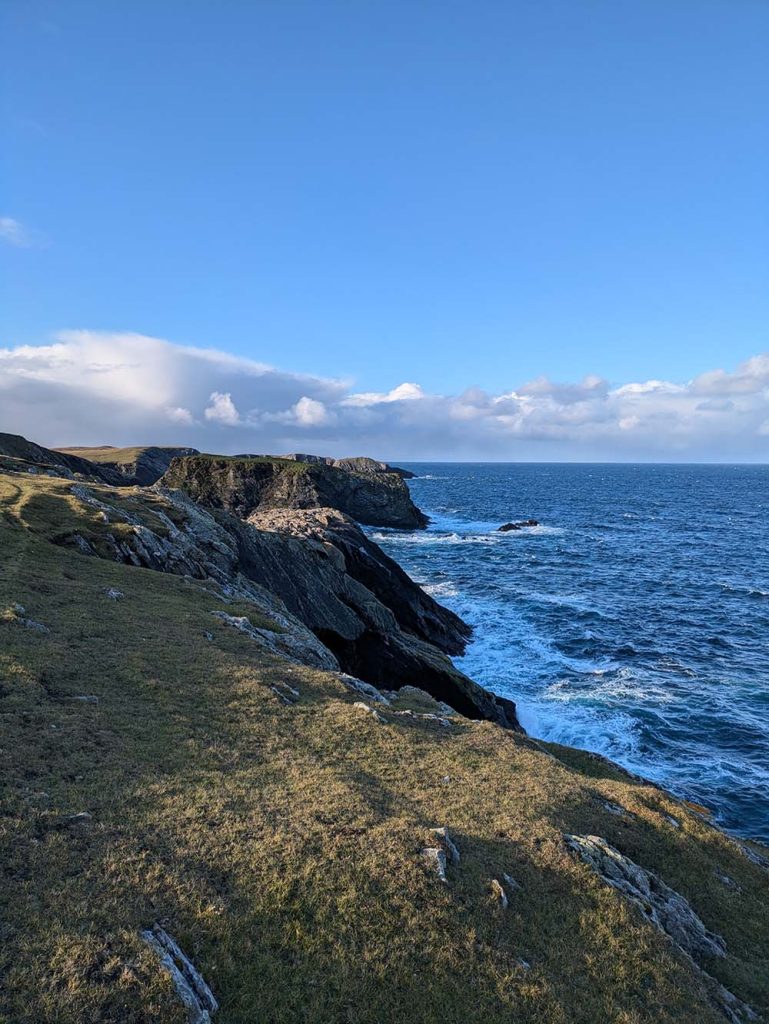
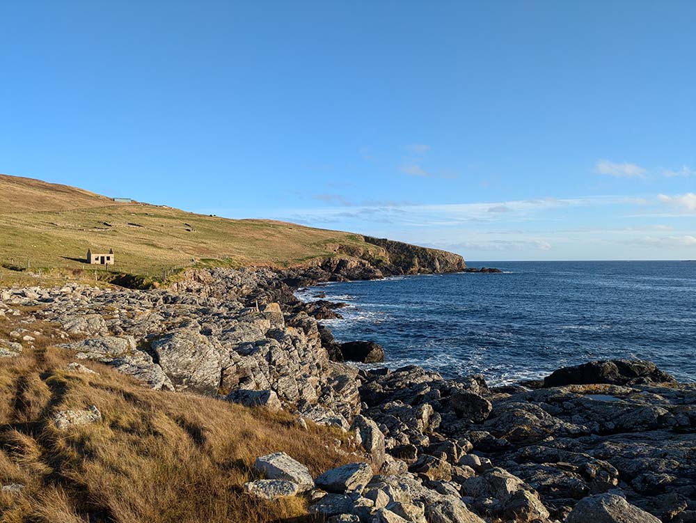
Little-ayre to Riding Stack, Muckle Roe
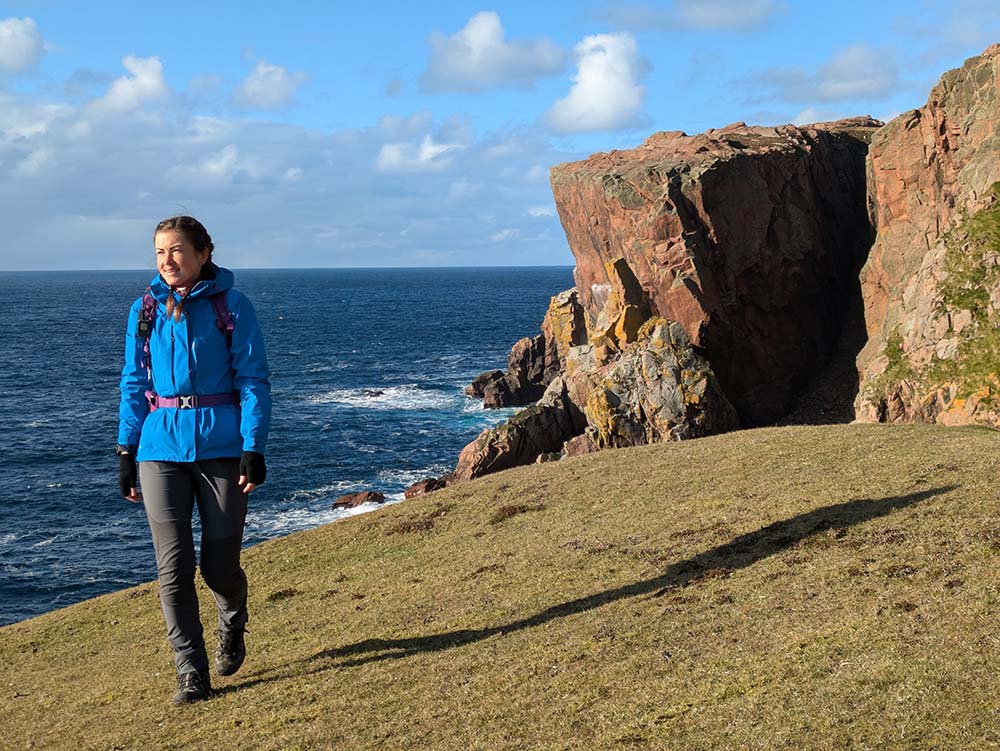
The Muckle Roe coastline offers miles and miles of incredible walking. With this route, I chose a more relaxed pace and time to sit and take in the views, rather than exploring its full potential. The coastline undulates quite a lot, so be mindful of the ascent involved. You could shorten this route to only visit the beautiful Muckle Ayre bay, or continue further north for a more challenging distance. Do not get overly excited at the prospect of passing the lighthouse marked on this stretch of coast, it is a modern, metal structure, not a traditional lighthouse building.
Difficulty: easy, but with some ascent
Parking: yes, free
Muckle Roe Image gallery
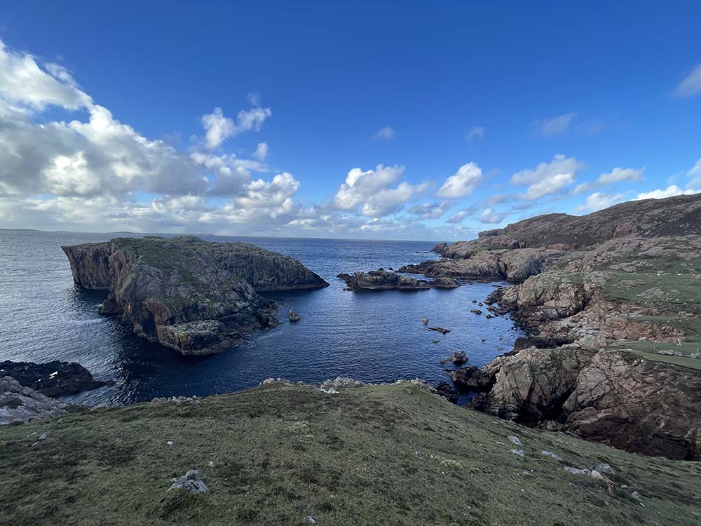
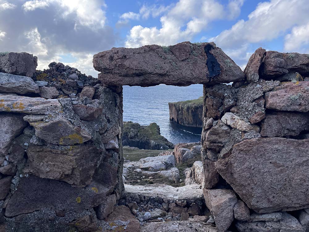
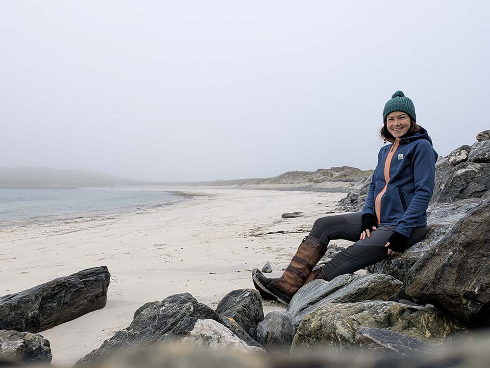
Minn beach and Kettla Ness circular, West Burra
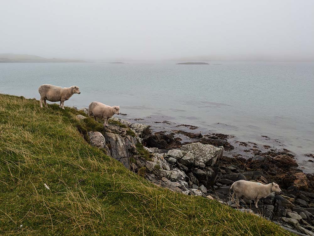
Minn beach is a breathtaking sight. Approached from the small car park at Duncansclett, you descend a short track overlooking the white sand tombolo with turquoise water and know you are somewhere very special. This route takes you across the tombolo to also explore the peninsula of Kettla Ness. It is fascinating and extremely calming to explore an uninhabited area. You may pass the occasional other person, but in general it is just you, your thoughts and some friendly sheep. With that in mind, please always let someone know where you are, how long you will be and when you expect to finish your walk. There may not be anyone close by or passing to help if you need it. Also be aware that there are steep cliff areas on Kettla Ness and the path can come relatively close at points. The route itself is only moderate in effort, but I’d say the terrain is more technical than the other listed walks and this would not be one for a blustery day.
Difficulty: moderate
Parking: yes, free
West Burra Image Gallery
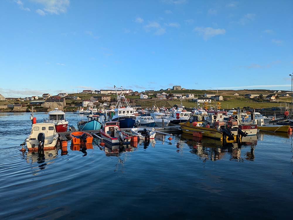
Symbister, Whalsay
Leaving your vehicle on one island to explore another by foot is very easy and cheap in Shetland. All of the ferry terminals have free car parking and a return foot fare is only £2.80. The ferry to Symbister (30 min crossing) usually leaves from Laxo on Mainland, but in some weather conditions, it leaves from Vidlin, so be sure to check which service is running the day you travel.
Setting off from the ferry terminal itself, this route walks you through Symbister village, out along some of the Whalsay coastline which looks back across to Mainland, returning through uphill village streets to get a view down over the harbour. Symbister has a wonderfully friendly community, I lost count of how many people said hello as I walked past on the sunny day I visited. Consider paying a visit to the couple of independent Symbister shops (which the route takes you past) to support the businesses that bring essential provisions to the island’s population.
Difficulty: moderate only due to the many stiles and fences to cross along the coastal section
Parking: yes, free
Symbister Image Gallery
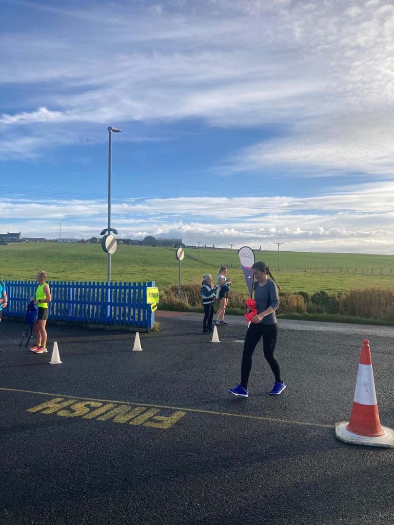
Bressay ParkRun, Bressay
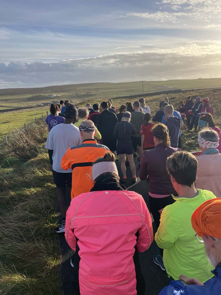
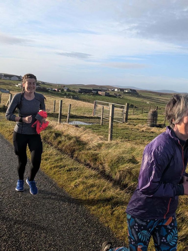
I end on one of my personal highlights from visiting Shetland. What better way to meet locals and feel part of the community than to join Shetland’s only ParkRun event. If you are not familiar with ParkRun, they are free, weekly 5 km running events that are open to everyone and held in outdoor spaces all over the world. ParkRun’s take place at 9:30 AM every Saturday morning, which makes this the only one of my routes with an allocated start time. Importantly, you don’t have to run ParkRun events, walking is absolutely welcomed and there is always a rear volunteer marshall walking the course at the speed of the slowest walker – no one is left behind.
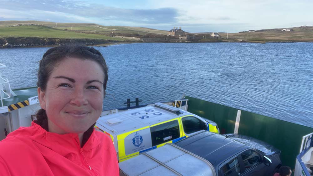
The fact that Bressay is the UK’s most northerly ParkRun is notable in itself, but add the fact that you have to get a ferry to/from the start, it makes for an incredibly memorable morning out. When I attended there were runners and walkers from all over the world joining a core community of locals. I easily chatted to people before, during and after the event. I was even invited to join a running club’s trail run the next day! You start from near the Bressay ferry terminal and it is an out and back, slightly undulating route. There is a cafe (Speldiburn Cafe) at the end that visitors and locals alike descend on for post-event refuelling. Get involved!
Difficulty: easy if walked, moderate if run
Parking: yes, many free car parks in Lerwick. I recommend you don’t take your vehicle over to Bressay and simply get to the start of the route as a foot passenger on the ferry, but if you decide to drive over, there is also parking at the Bressay ferry terminal.
Bressay Park Run Image Gallery
If you’re planning to explore what Shetland has to offer, take a look at our guide to the origin of Scandinavian place names. With so many Scandinavian and Old Norse names across the islands, this guide will help you with understanding how the names originated. It also explains how to pronounce them and meaning behind them, adding a little more context and interest to your adventures.