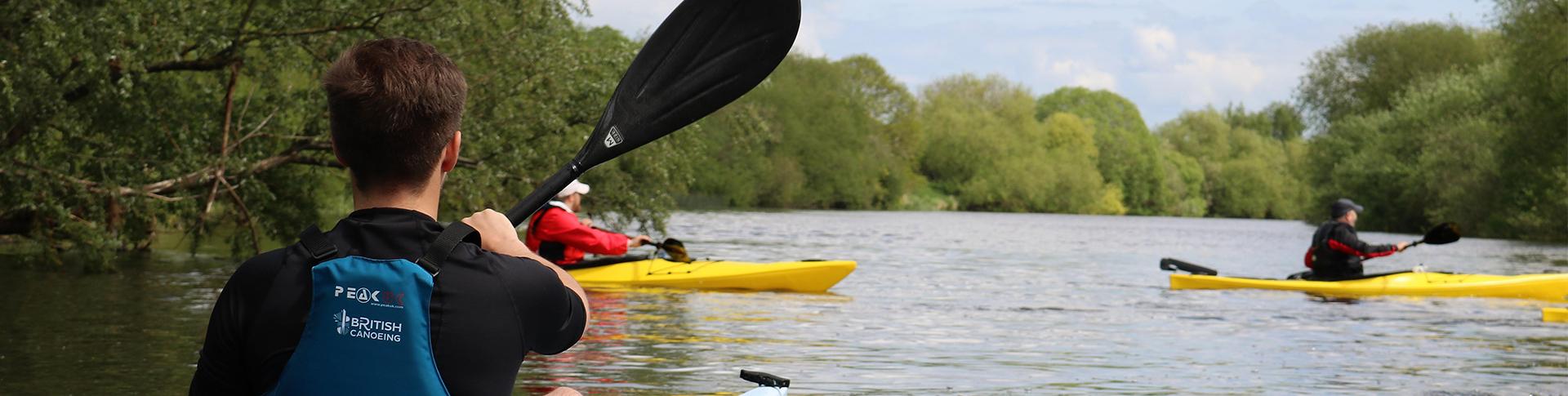
Find paddle routes near you
British Canoeing share their best paddle routes across the UK that you must try. These recommended paddle trails can be found on OS Maps, making it easier to navigate and plan your next on-the-water adventure.
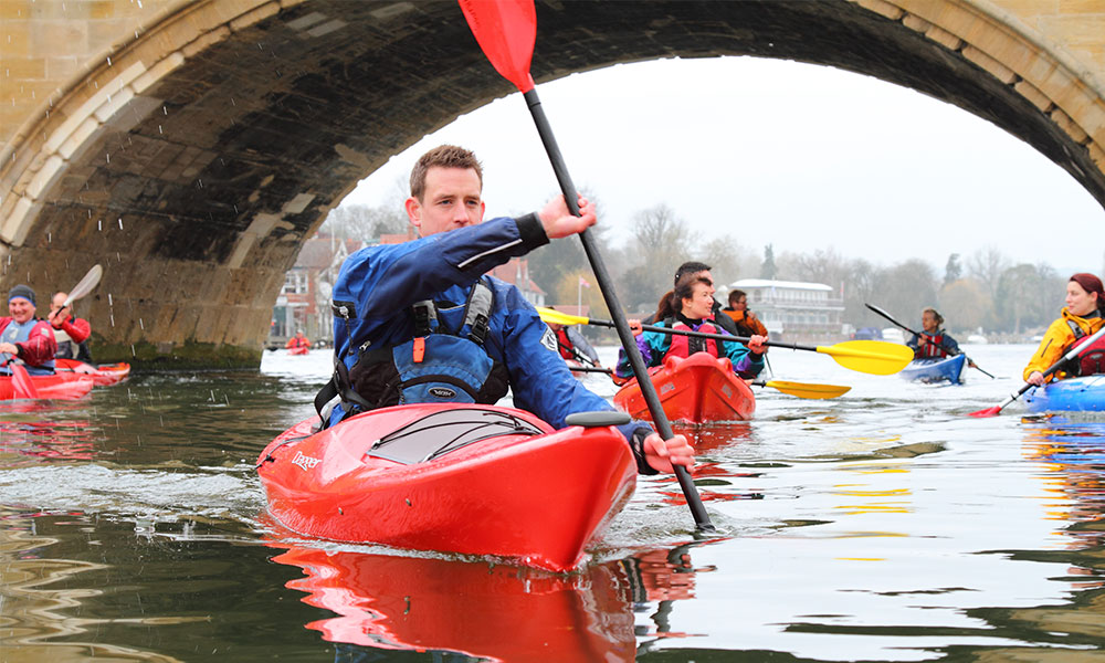
Credit: British Canoeing
More people than ever before are taking to our waterways to paddle. The most recent Watersports Participation Survey, suggested that a whopping 7.6 million people across the UK said that they had either kayaked, used a canoe or a stand-up paddleboard (SUP).
Many waterways in England and Wales require a licence to paddle. British Canoeing’s ‘On the Water’ membership gives paddlers instant access to a waterway licence, insurance, plus a range of great benefits including discount on OS Maps.
Here are 10 of the best paddle routes across the UK, recommended by British Canoeing.
1. Cromford Canal Heritage Trail
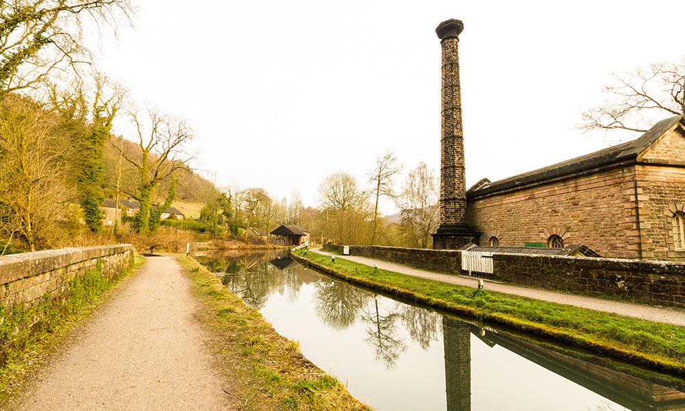
Leawood Pump House
- Distance: 3 miles / 4.8km
- Difficulty: Easy
- Trail Type: Out and Back
- Number of Locks / Portages: 2
Not many heritage trails are best experienced by paddling, but this one certainly is! This route takes you from the canal’s terminus at Cromford Wharf, with a portage at High Peak Junction before continuing to Leawood Pump House. There’s only a small section of Cromford Canal which has enough water in it to make a reliable paddle, so this route is one of your only chances to experience it for yourself.
On this paddle route, you’ll experience beautiful views across the last limestone ‘white peaks’ hills. Water voles are one of the species likely to be spotted as you paddle, especially when looking at the bank opposite the towpath. High Peak Junction is makes a great stop as it is an important historical site.

Top tip
Time your paddle for a day when the pump house is in steam. The steam engine pumps a mighty four tonnes of water with each piston stroke!
2. Llangollen Canal – Ellesmere to Chirk
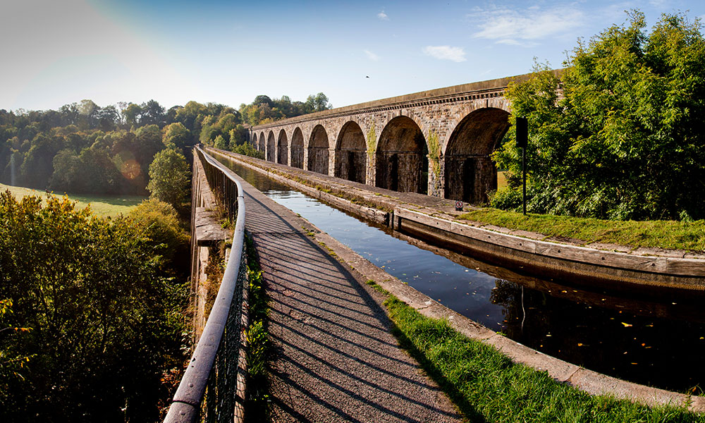
Chirk Aqueduct
- Distance: 10 miles / 16km
- Difficulty: Easy
- Trail Type: One Way
- Number of Locks / Portages: 2
The Llangollen Canal leaves the Shropshire Union main line at Hurleston and rapidly establishes its credentials as one of the most popular leisure waterways in the country. It snakes its way forty-six miles through Cheshire and Shropshire, entering Wales at Chirk and joins the river Dee at horseshoe falls in Llantysilio. This trail covers the lovely stretch from Ellesmere to Chirk including the impressive Chirk Aqueduct crossing the river Ceiriog and the equally fine railway viaduct alongside. Thomas Telford the greatest of all canal builders constructed the masonry and stone structure 70ft over the river Ceiriog with spans of 40ft to carry the navigation from England into Wales, it opened in 1801.
The scenery is remote and pretty, so it seems incredible that this waterway was nearly lost in 1944 when it was closed to navigation and quickly became weeded and silted up. Fortunately, it served another important purpose, that of transporting approximately twelve million gallons of water per day from the river Dee to the towns and villages of Cheshire which made restoration a priority.
Top tip
At the end point the canal enters the 461-yard long Chirk Tunnel which should not be entered. Get out in the small basin before the tunnel entrance and walk up to the road.
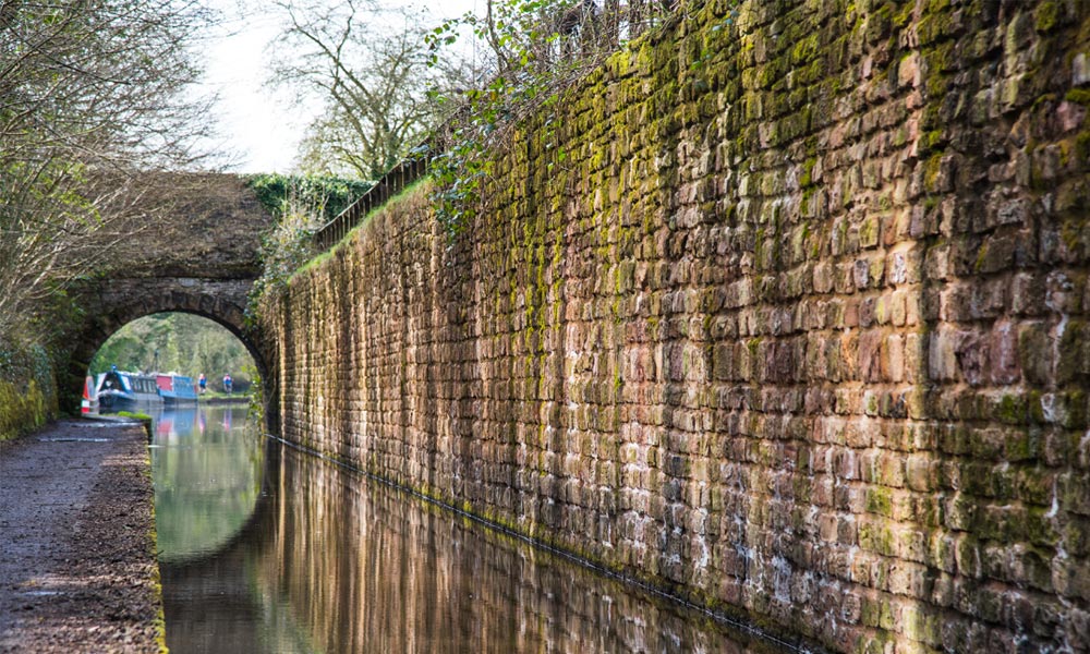
3. Gloucester & Sharpness Canal – Purton to Parkend Bridge
Saul junction
- Distance: 15 miles / 24km
- Difficulty: Easy
- Trail Type: Out and Back
- Number of Locks / Portages: 0
This is a gentle out and back trail with views of the Forest of Dean in the distance and the mighty river Severn close by. This is the longest of the trails on this canal is a great way to spend a day. It’s ideal for a first canoe or kayak trip as there is little traffic and it’s very quiet and wide enough not to hit anybody. You can visit the famous Wildfowl and Wetlands Trust Reserve on route which is home to a large number of Nene (Hawaiian geese).
The Sharpness to Gloucester canal is a new experience for most English paddlers – much more like a continental European Canal, or like the Caledonian Canal in Scotland, easily wide enough to avoid anglers’ lines, and with large ships going up to Gloucester docks at times. This trail is the last of four possible trails on this wide and quiet canal.
Top tip
Both Slimbridge (inland) and Saul junction (next to the water) has a café and loos.
4.Lake Coniston Circuit
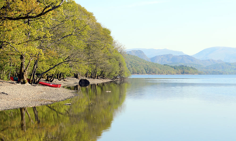
Coniston Water
- Distance: 11.5 miles /18.5km
- Difficulty: Moderate Challenge
- Trail Type: Circular
- Number of Locks / Portages: 0
When you spot Brantwood House high on the left bank, pull up to the ferry landing and shingle bank to stop for a well-earned cup of tea in the tea shop. Peel Island is also a great place to stop for a bite, although you’ll have to bring your own food and drink. The route is circular and can be done in either direction depending on the wind. Be mindful this is an open stretch of water and the wind can have a real bearing on time and ability to paddle.
Top tip
Be very aware of all the commercial craft to-ing and fro-ing from jetties, with the lake steamers accessing the biggest jetty.
5. Broads, Wroxham and Salhouse Broads

Wroxham Broads
- Distance: 4.5 miles / 7.2km
- Difficulty: Easy
- Trail Type: Circular
- Number of Locks / Portages: 0
Enjoy a paddle through a remote
and quiet haven for wildlife where there is very little through traffic. For
many years the Broads were regarded as natural features of the landscape. It
was only in the 1960s that it was proved that they were in fact flooded
medieval peat excavations. Despite the construction of wind pumps and dykes,
the flooding continued and resulted in the typical Broads landscape of today,
with its reed beds, grazing marshes and wet woodland. The Broads are connected
by a number of navigable rivers and the whole area is managed as a National Park by the Broads Authority who levy a licence on all craft using the
waterways.
Top tip
There are no facilities – toilets, cafes, etc on this paddle. Enjoy the peace and quiet!
6. Peak Forest Canal: Bugsworth Basin to New Mills Marina
Peak Forest Canal. Credit: British Canoeing
- Distance: 6.5 – 7.5 miles / 10km – 11km
- Difficulty: Easy
- Trail Type: One Way
- Number of Locks / Portages: 0
A paddling trail for those with a sweet tooth, as the canal paddle trail passes past through an area with the sweet smell of parma violets in the air. This 1800’s canal was restored and reopened for use in 2005. On a clear day, it offers spectacular views of the Pennines and the Kinder Scout plateau.
The start and finish of this trail is just next to the Café Kirianna, taking you to the peaceful canal system. Taking the right turning at the first T-junction will lead you under a couple of low bridges and through Furnace Vale Marina. On the other side of the marina, you will paddle past the beautiful mills and town of New Mills. Across the valley you will be able to spot the viaduct. The marina in New Mills marks your turning point, where you begin the journey back to the café.
Top tip
Avoid the giant hogweed which is known for causing skin irritation and burns.
7. River Tees, Tees Barrage to Yarm
Tees Barrage
- Distance: 17 miles / 27km
- Difficulty: Moderate
- Trail Type: Out and Back
- Number of Locks / Portages: 0
Yarm is a delightful place to paddle with picturesque meadows and town. In summer the still water reaches bath temperature. You can paddle from Yarm downstream and return to the start when you have done enough (the pubs are excellent). A paddle to Preston Park and back can take a couple of hours if you go slowly. For a longer paddle start at the Barrage in Stockton and enjoy the whole range.
This paddle takes you through overgrown areas of the river only accessible by paddle power. It’s a real opportunity to reconnect with nature and go on a little adventure. Paddle through many different environments to experience some of the wonderful things this area has to offer; historical buildings, nature reserves and regeneration are all within reach of this urban and rural trail. You’ll even pass a bird reserve on reclaimed marshes which offers the perfect opportunity of stop still and take in the tranquillity. Many different species of bird and duck will be sighted, as this is bird heaven –Either way there is no significant current and the water is clean. Why not stop off on the way north to Scotland? Much nicer than a service station.
Top tip
Many decide to paddle up the small River Leven but this is narrow and has barbed wire across in places.
8. River Wey Guildford to St Catherines Lock
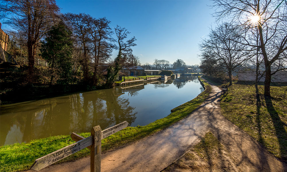
River Wey in Guildford
- Distance: 7.3 miles / 11.7km
- Difficulty: Moderate
- Trail Type: Out and Back
- Number of Locks / Portages: 3
Enjoy a paddle on the Wey; one of the first rivers to be made navigable and opened to barge traffic in 1653. This enjoyable route passes a mixture of beautiful countryside, pretty bridges and historic and industrial buildings. You’ll also see Woodbidge Meadows which are natural meadows with impressive wooden sculptures – well worth a look.
Just a mile into your paddle you’ll reach Dapdune Wharf which has a National Trust visitor centre. This houses a museum telling the story of the history of the Wey navigation and the people who lived here and worked along it.
The river splits as you leave Guildford, where you should stick to the right and head into open countryside. There are some good examples of Ox Bow lakes here. Check there are no events happening at the Way Kayak Club before leaving home as the roads can get busy on event days.
Top tip
Launch from the small triangle of land near the road bridge or at Wey Kayak Club down the road.
9. River Soar: Normanton on Soar to Stanford on Soar
River Soar. Credit: British Canoeing
- Distance: 4.3 miles / 7km
- Difficulty: Easy
- Trail Type: Out and Back
- Number of Locks / Portages: 0
One of our more historic paddle trails, this one starts in the 11th century village of Normanton on Soar. Home to one of the last operational chain ferries in the country, and the only cruck building that was lived in, the village is situated in one of the most southerly points of Nottinghamshire.
On this paddle route you will enjoy the views of the village’s 13th century grade 1 listed church, cruise round the natural meanders of the river Soar, and be immersed in all the beauty the riverbanks have to offer. You’ll paddle your way under bridges and past all kinds of wildlife until you reach the turning point, a secluded island that is perfect for a quiet picnic before the return trip.
Perfect for all paddleboards, kayaks, and canoes, this slightly shorter paddle route is ideal for a family trip out in Nottinghamshire. With stretches of the trail only accessible by water, you will have the opportunity to see sights not many get to see on a mini adventure.
Top tip
You can pick up some food and drink at the Plough, Normanton on Soar, where the trail begins.
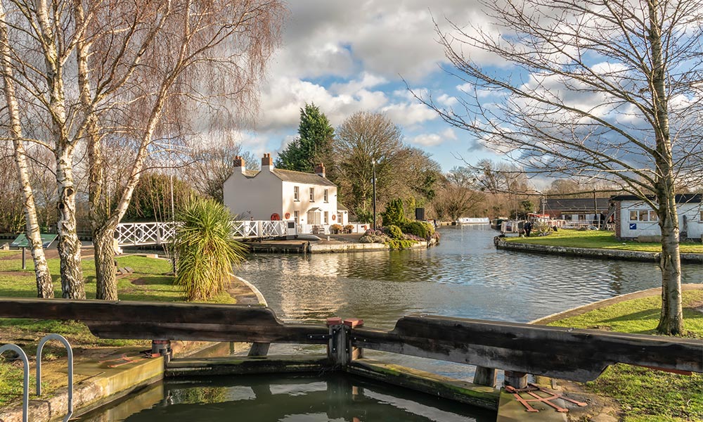
10. River Thames: Hampton Court to Richmond
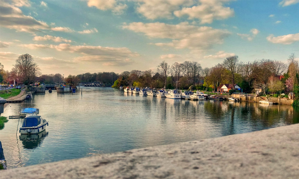
The Thames at Hampton Court. Credit: British Canoeing
- Distance: 7.8 miles / 12.5km
- Difficulty: Easy to Moderate
- Trail Type: One Way
- Number of Locks / Portages: 2
The perfect combination of both rural and urban paddling. Taking in the views of Hampton Court Palace’s grounds, Hampton Bridge, and other historically interesting builds. At times you will be paddling down the Thames with rural palace gardens on your left and London suburbia on your right, a contrast that to many is beautiful.
This paddle trail also provides a multitude of islands to feast your eyes on, many home to the historical builds on this route. One of the historical entities to see on your trip is the world’s oldest canoe club. Formed in 1866, the Royal Canoe Club is accredited with the title of world’s oldest club. You will also be able to take in the sights of the Pope’s Villa, an imposing red building where the original poet’s mansion was built and houses his famous Grotto which is open to the public too.
Top tip
Being a linear paddle route, the get out point is found in the Twickenham district, so a car shuttle would be needed. Alternatively, there are brilliant public transport links to get you back to the starting point.
You can find more recommended paddle routes from British Canoeing and other trusted partners in OS Maps.
To help you stay safe on the water and protect our much-loved blue space, follow British Canoeing’s Paddler Code. Inspired by the Countryside Code, it follows three basic principles: respect, protect, and enjoy. Take a read of the Paddlers’ Code before you next launch.