One of David Wilson’s favourite challenges is walking The Yorkshire Three Peaks. He shares the basics with us of what you can expect on this epic 25 mile walk taking in the summits of Pen-y-ghent, Ingleborough and Whernside.
There’s a saying that life’s greatest challenge is finding out who you really are, then the second challenge is being happy with who you find!
If finding yourself is something you think about, try throwing in an outdoors challenge as a catalyst to the process? The great outdoors offers everyone a fantastic opportunity to fill our lungs, open our minds and get under our own skin.
I love challenges and the chance to get out of my comfort zone, push myself mentally and physically and to test my mettle. A physical challenge strips me down to a basic level, allowing me to look at myself with a better focus, whilst also giving me a satisfaction which helps to cement what I’ve learned.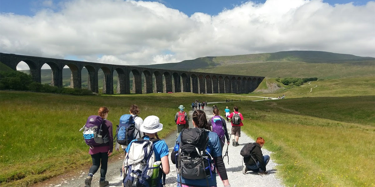
Ribblehead Viaduct
I’ve enjoyed a variety of challenges over the years from the Lakes 24 Peaks, to a non-stop walk along Hadrian’s Wall. Even a simple run in the rain when you don’t fancy getting wet can be challenge enough. All different, and all can teach us what we can do, not what we can’t do.
One of my favourite challenges, and the only one I’m in to double figures for completing (thanks to guiding groups for the last few years), is the Yorkshire Three Peaks Challenge.
The Yorkshire Three Peaks Challenge (Y3P)
The Y3P is a twenty five mile walking challenge taking in the summits of Pen-y-ghent, Ingleborough and Whernside – the highest points in the Yorkshire Dales National Park. The circular route offers so much more than just three peaks, and has been a firm favourite of mine since 2014.
The Y3P is an amazing experience combining a range of elements that any good challenge should offer;
- It’s physically challenging. 25 miles, across three good peaks, in a target time of 12 hours.
- It’s a well-managed popular route, where you’re never too far from civilisation if things get too much.
- It’s an amazing place to visit. There’s so much more to this walk that just the challenge. You’ll always come away with some fantastic memories.
Interested? Lace up your boots and let’s go!
The Y3P Basics
The day usually starts around 7am in Horton in Ribblesdale in full view of the first peak, Pen-y-ghent.
The ascent to Pen-y-ghent isn’t a long walk but is a baptism of fire to get started. After a tough start, and a steep final climb, you’re quickly on top of the first peak and feeling great about the challenge ahead.
After Pen y Ghent, it’s steadily downhill for around nine miles with lots of points of interest on the way if you know where to look (the importance of using a map to discover an area, not just solely for navigation).
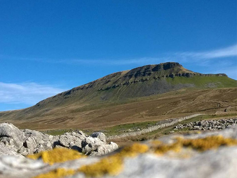
Pen y ghent
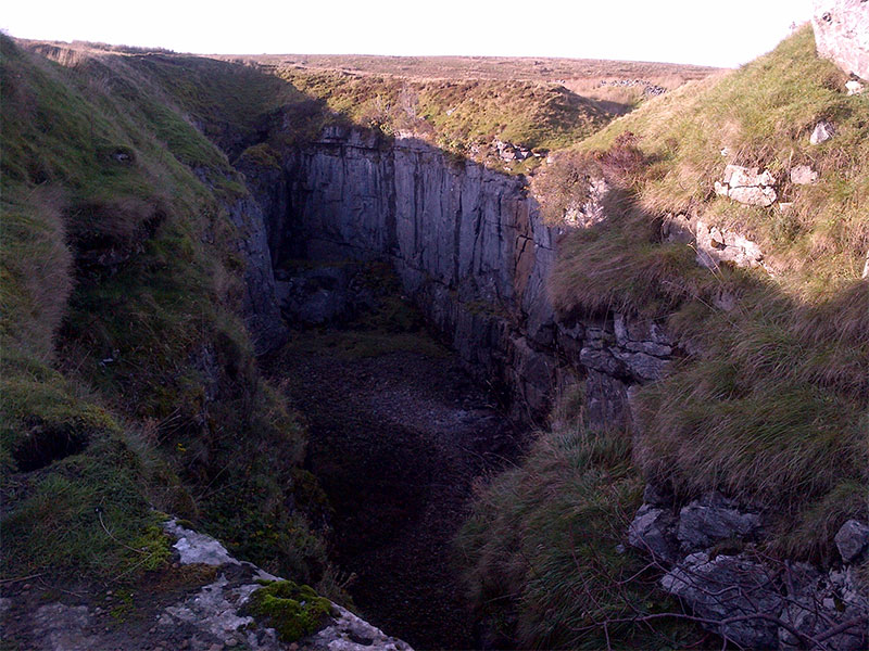
Hull Pot
One such place (which comes at a cost of about 20 minutes added to your walk) is Hull Pot (SD824745), a 300 feet long and 60 feet deep collapsed cavern. Because it isn’t on the main route, it’s often missed, but it’s worth the extra effort.
The second thing people often miss which is on the main path, you’ve just got to look over your shoulder, is God’s Bridge (SD798775).
This is a huge slab of rock which goes over Brow Gill Beck and is a great place to take a quick break. Most people walk past not realising it’s even there.
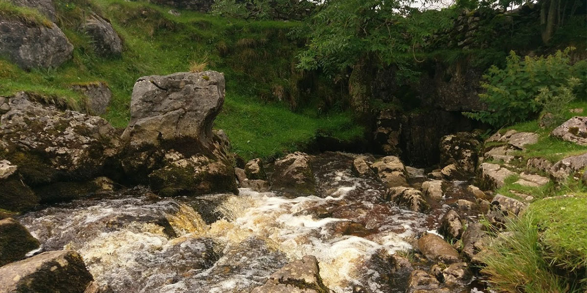
Gods bridge
After Gods Bridge it’s on to Ribblehead and beyond to the biggest peak of the day, Whernside. The Whernside section tends to be a slow and steady climb as you make your way to the flat level ridge at 736 metres.
You feel as if you’re walking away from the top as you follow the Settle to Carlisle train line, but once you cross the line the route ahead is soon in sight.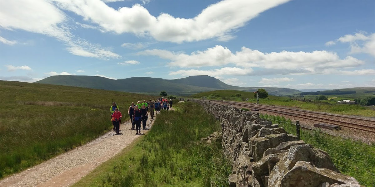
Settle to Carlisle
The walk to the ridge is an amazing experience in all weathers, and on a clear day you can enjoy views down into the valley and across to Pen-y-ghent and beyond.
Once you’ve touched the trig pillar on Whernside it’s downhill following tracks, some steep steps and the road to Philpin Farm. A welcome respite when the little snack van and toilets are open.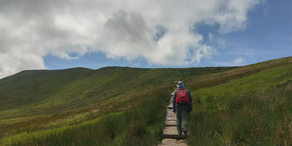
Up to Whern Ridge
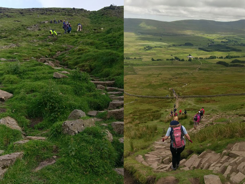
All that stands between you and the finish line now is Ingleborough. A walk past the Old Hill Inn and your again on a slow and steady climb to the base of a much steeper ascent to the top of Ingleborough.
The final climb can be a bit daunting as you walk on a ‘don’t look down’ section but slow and steady progress sees you close to the final approach to the summit.
The summit of Ingleborough is a large flat plateau and you’ll need to walk a few minutes to reach the trig point at 724 metres. When you reach the top with success fresh in your mind, it’s time for the final journey to Horton in Ribblesdale.
As with lots of descents it’s not just a quick walk off, so with six miles to go it’s important to keep eating and drinking. Even on the final leg the Y3P has lots to offer, giving views of Pen-y-ghent, Horton and some great limestone pavements, before the finish line at Horton Station.
Ingle Climb & Whernside steps
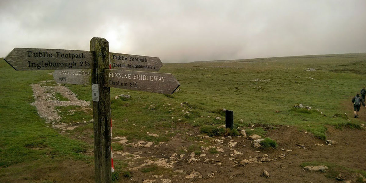
Horton Signpost
25 miles, 3 Peaks and some great memories later you’ll be proud of your achievements but more importantly you’ll have hopefully learned a little bit more about yourself. For some people it’s the lesson of ‘I’m never doing that again’ but for most it’s ‘what’s my next challenge’.
After my first time it doing the Y3P I knew I wanted to spend more time on the peaks and be able to share the experience with people who were up for a challenge.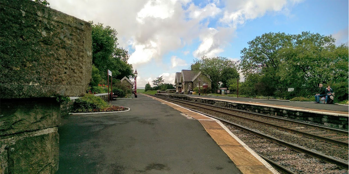
Horton Station
So, get up, #GetOutside and challenge yourself. You never know who you might meet!