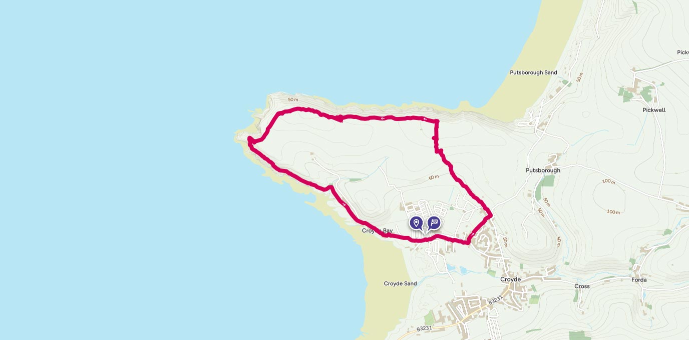
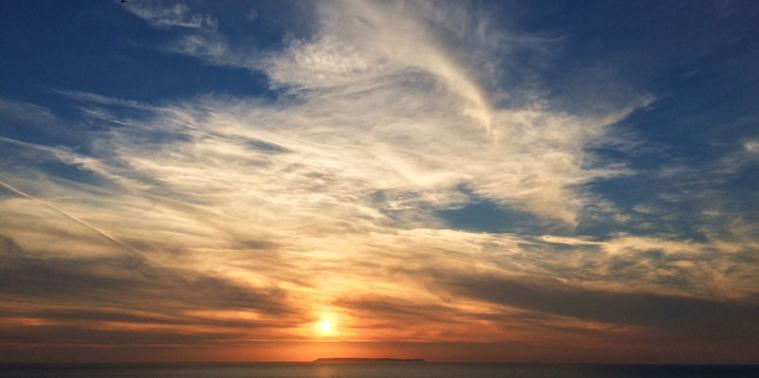
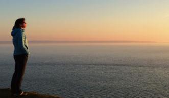
Along this stretch of the North Devon coast the skies are vast, the seascape is panoramic and the sunsets can be epic. And Baggy Point – the mid-point of this circular walk – is most definitely a top-notch sunset viewing spot.
SS 436 395
From the National Trust car park turn left and follow the lane past Croyde Bay on your right and Ruda Holiday Park on your left, taking care on the pavement-free sections of the road. Turn left onto a private road signed Pathfields and continue to the top of the road to reach a wooden stile leading to a public footpath running alongside a house. At the end of the footpath cross another wooden stile and take the lane immediately on your left signposted to Cherry Tree Farm. This high-hedged tarmac lane passes Cherry Tree Farm campsite on the left before merging into a farm track at Broadway Lane – stout footwear is recommended along this stretch of track as it can get muddy after wet weather. Follow the track as it gradually climbs past fields on both sides.
1.7 km
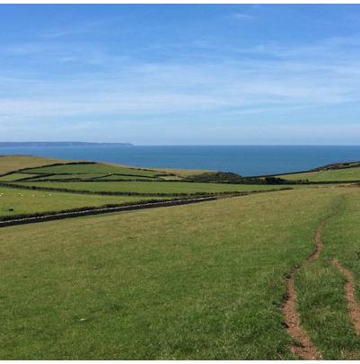
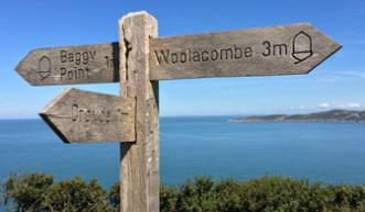
At the top of the hill the track meets a path on the right signposted to Putsborough Sands; ignore this path and instead continue on the track as it bends to the left and immediately cross a wooden stile on your right into a field, signposted Coast Path. The path follows the hedge to the top of the field to reach another wooden stile. It’s at this point that you meet the panoramic coastal views that will keep you company for the rest of the walk – to your left you’re greeted with views across Bideford Bay to Hartland Point. Continue over the wooden style and follow the path down though a field to join the South West Coast Path to meet a glorious vista across Woolacombe Bay to Morte Point, and to your right the expansive surf-pounded beach of Putsborough Sands leading to Woolacombe Sands at the far end.
2.1 km
For the rest of the walk you’re following the South West Coast Path as it makes its way along the high cliffs around the Baggy Point peninsula. As you join the coast path a wooden signpost indicates Baggy Point is 1 mile to your left. Follow the exposed coast path for 0.5 miles, passing through two wooden gates and over one wooden stile, until you reach another signpost indicating ‘Baggy Point ½ mile’. A brief diversion along a path signposted ‘NT Car Park ¾ mile’ takes you to the remnants of a dummy pillbox; one of ten built on the headland for American troops training for D-Day preparations between 1943-44.
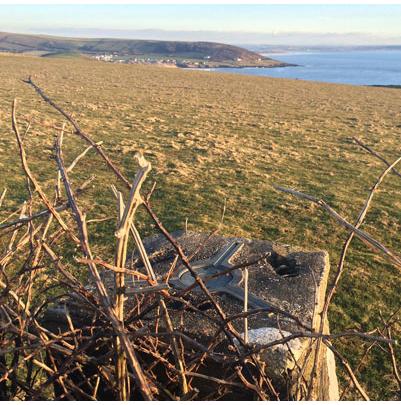
Returning to the coast path follow the lichen-covered dry stone wall on your left, where halfway along hides the trig pillar. Be warned, it is not an easy one to find as it’s tucked in close to the high dry stone wall on the opposite side of the coast path – according to my OS Maps app I was standing on top of it and yet still struggled to find it. But persistence prevailed and I managed to peer over the top of the stone wall to catch a glimpse of the pillar hidden among brambles. At 94m it may not be the highest trig, but what it lacks in elevation it more than makes up with spectacular coastal views.
3.8 km
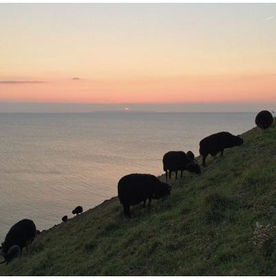
At the end of the stone wall the path opens up into a wide grassy area. Follow the grassy path past the newly restored coastguard training post – built to resemble a ship’s mast, the pole was used by coastguards to practise operating their life-saving apparatus, but now it’s a popular landmark on Baggy Point. From the pole continue along the grassy path as it follows a fence line and descends to a wooden gate. Pass through the gate to reach Baggy Point headland with its magnificent coastal views and top-notch sunset viewing credentials. On a clear day you can see Hartland Point on your left; the granite lump of Lundy Island, situated 10 miles ahead of you; and to your right, Morte Point and, if you’re lucky, the South Wales coastline. Between March and June the sheer cliff-faces around Baggy Point are alive with nesting seabirds, whereas out of nesting season it’s a popular spot for climbers. Below the headland is Baggy Leap, a sunken reef and the final resting place for HMS Weazle, which was wrecked off Baggy Point during a gale in February 1799, tragically drowning all 106 on board.
4.5 km
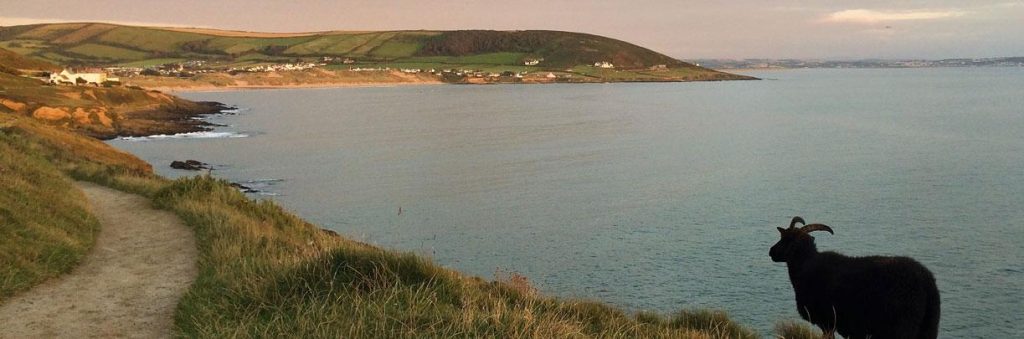
Continue along the coast path where, depending on the season, you’ll see an array of flora: in spring the banks are a colourful display of sea campion and thrift; and in summer it’s full of yellow gorse and purple bell heather. On this section of the coast path keep an eye out for Baggy Point’s locals, the hardy black-fleeced Hebridean sheep who are employed by the National Trust to keep the cliff tops free from gorse. Follow the coastal path as it gently descends along the exposed cliff to a wooden gate where you’ll find a memorial plaque to Henry Williamson, the author of Tarka the Otter, who lived in the area at different times throughout his life – shortly after the gate steps off to your left lead to a wildlife pond. The final stretch back to the car park follows a level path with views across Croyde Bay. The significant landmarks on the closing section of this walk are the large modernist Baggy House on your left and shortly afterwards a lichen-covered bone from a whale that was washed up on Croyde Beach in 1915. Now all that’s left to finish off this walk is a well-deserved cream tea at the Sandleigh Tea Rooms next to the car park.
6.6 km SS 436 395
6.2 km / 4 miles