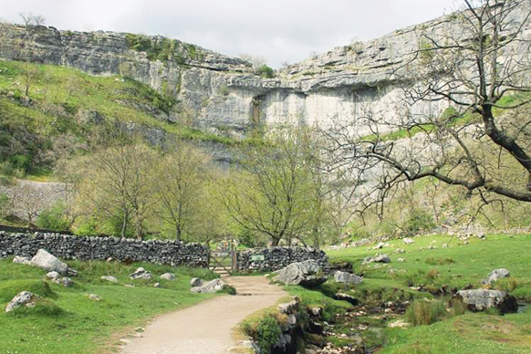
It’s busy in the summer but busy for a reason. This short walk packs a lot in; take in part of the Pennine Way National Trail, cross the stunning limestone pavement of Malham Cove, marvel at the enormity of Gordale Scar and get whisked away by the magical Janet’s Foss.
If you’ve got a couple of hours spare and don’t want to venture too far away from the car park, then this short walk is the ideal place to spend a sunny afternoon.
SD 90001, 62683
The car park at the Malham National Park centre is situated just south of the village and it’s the first thing you see if you’re coming up from the A65.
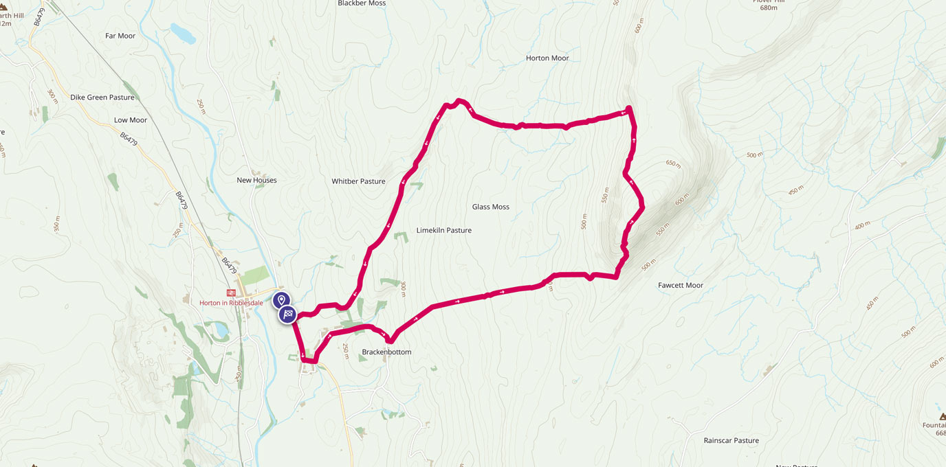
From the car park head back towards the centre and turn left along the main road before crossing over just before the Malham Smithy where a small footbridge crosses Malham Beck and gets you onto the well-defined Pennine Way.
Turn right alongside the stream until you reach the junction of another footpath leading east off to the left.
Leave the Pennine Way behind as the path cuts through the picturesque fields all framed by Yorkshire’s iconic dry stone walls and soon you come to a gate which signals the start of an area of National Trust woodland.
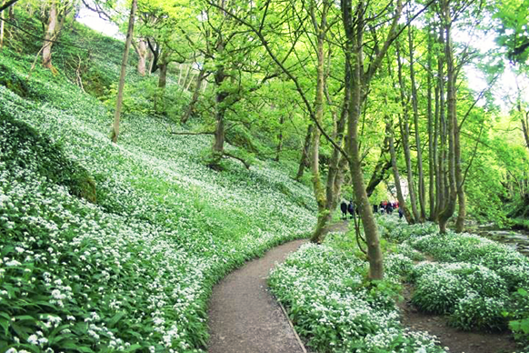
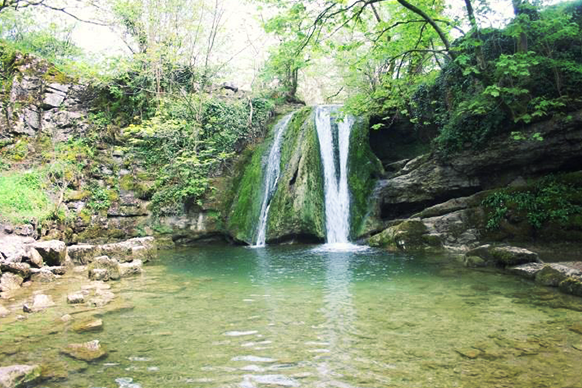
Follow the path as it winds its way deeper into the woods surrounded by swathes of wild Garlic flowers before it comes to a dramatic end at the picturesque Janet’s Foss, a stunning pool and water fall where legend has it a fairy queen used to inhabit one of the caves at the rear of the pool.
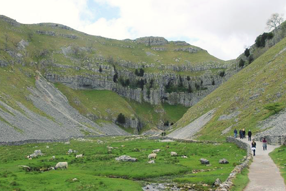
At the foot of the Scar spend a few minutes testing your scrambling skills at the back of the gorge where Gordale Beck spills over the top. But remember the higher you go up, the greater the descent – you will need to turnaround and head back out of the scar and back towards the junction with the road unless you want to do the much longer walk to Malham Tarn which leads out of the top of Gordale Scar.
Once back at the road junction go over Gordale Bridge and through the gate onto the path heading traversing the hillside. This soon becomes grassy underfoot and quickly gains height eventually turning back into a more obvious rocky path winding its way up the side of the hill before coming to a road which feels a little out of place up here.
Take care crossing as it’s on a bend and go over the steps on the opposite beside some sheep pens.
Now the path heads diagonally over Shorkley Hill past some very inquisitive sheep and over the grassy plateau. Be careful not to go too near the shear edge in front of you and instead go through the gate in the wall which is just slightly off to the right.
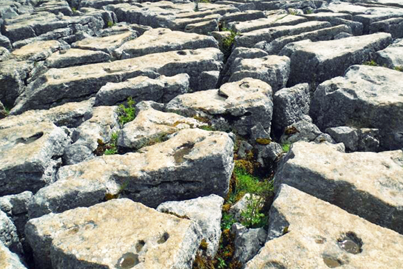
This now brings you onto the highlight of the walk, the crevasses of the Limestone pavement on the top of Malham Cove. This strange looking ‘pavement’ was created as rainwater eroded the soft flat limestone surface leaving individual stones (clints) looking just like they’ve all been delicately placed to create the world’s largest garden patio.
Be careful stepping between them as some of the stones are loose and just waiting to throw you into one of the deep crevasses (grikes) between them.
Once it’s time to go, head for the steps at the western end of the Cove that lead down and swing round to the left. These will take you to the foot of the wall before heading south away from the cove following the undulating smooth path that runs alongside Malham Beck and eventually meets Cove Road.
Carefully walk along this road back into Malham and back to the car park and a well-earned pint in The Buck Inn.
7km SD 90001, 62683
7 km / 4 miles