Let’s face it, 2020 was a horrible year, with many people stuck inside and unable to see friends, family, and loved ones. However, many of us found solace in the outdoors, something that we usually took for granted suddenly became the highlight of the day. Reconnecting with nature and our local areas has helped us both mentally and physically and allowed us to appreciate a slower pace of life.
Reflecting on 2020: A New Year’s Eve Walk
I went out to discover a new route on New Year’s Eve, spending time reflecting on the small things to be thankful for in a year like no other.
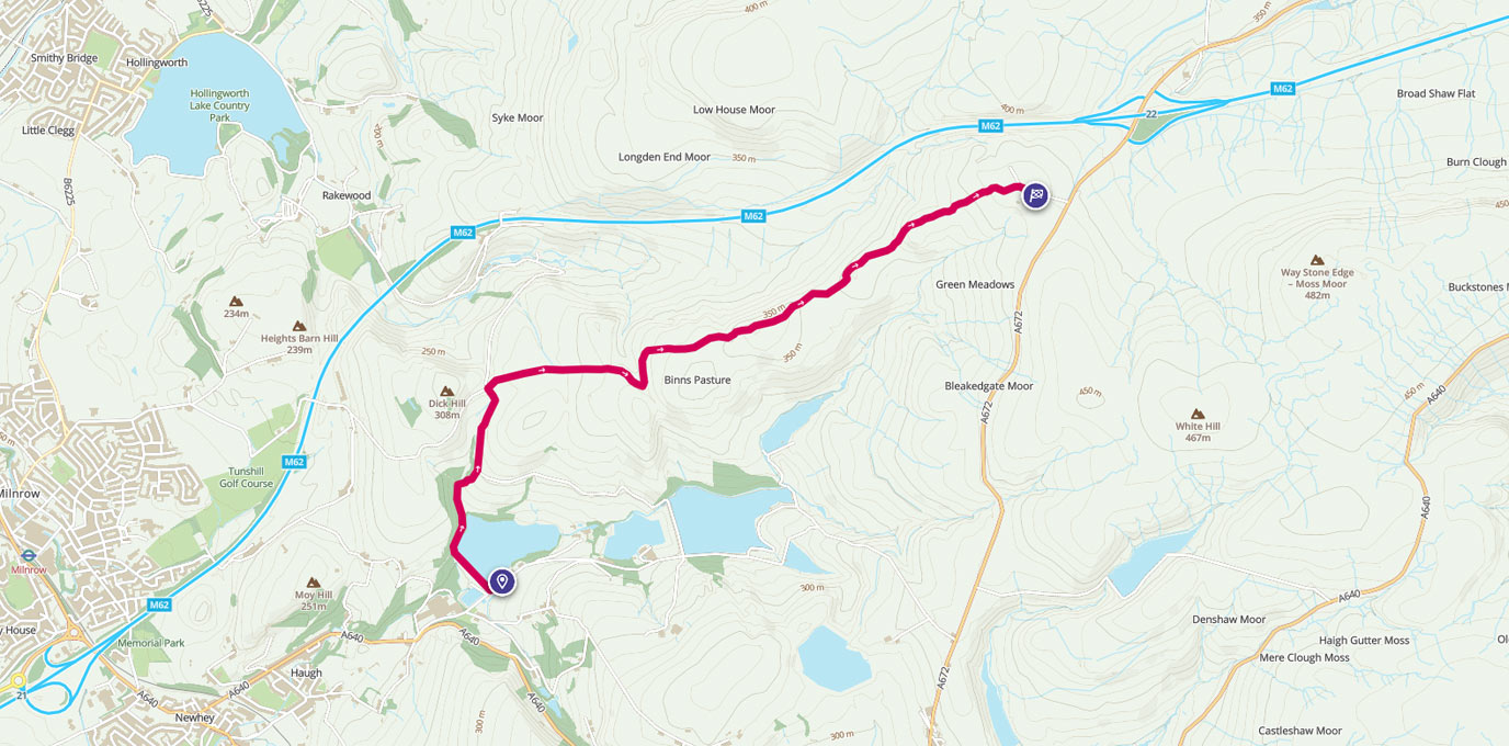
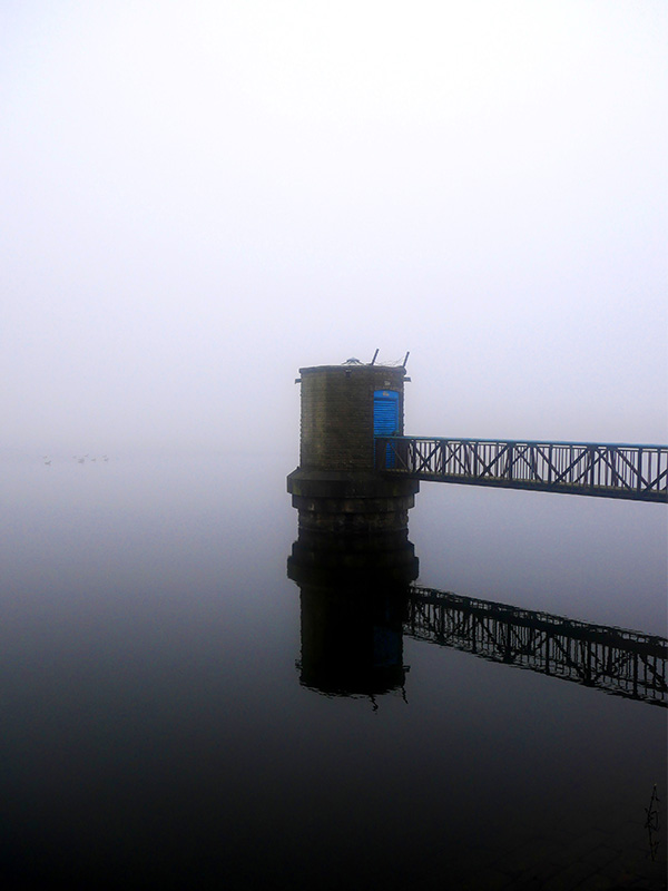
This particular route begins at Ogden Reservoir in Newhey, North Manchester. It is undoubtedly one of my favourite places to explore and is luckily just 5 minutes away from home. The area consists of 6 reservoirs stepped down the hillside, constructed in the 1800s as a way to provide the exploding local population with clean drinking water, as workers flocked to Manchester during its boom in the cotton industry.
Each of the 6 reservoirs were named after the farms that existed on the site prior to construction: Ogden, Kitcliffe, Piethorne, Norman Hill, Hanging Lees and Rooden.
SD 95289 12250
Treading these routes has been one of the only ways in which I have been able to meet up with my mum during the pandemic, and so has become an increasingly important and enjoyable activity over the past few months.
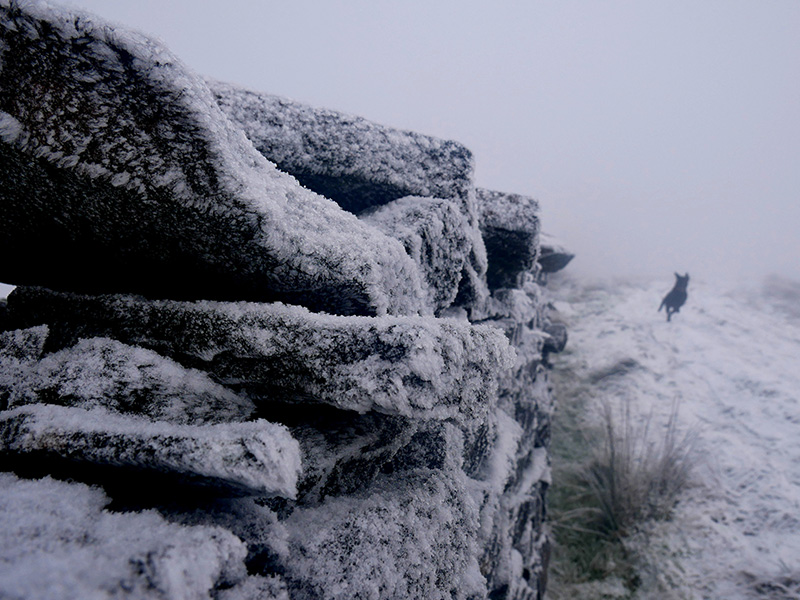
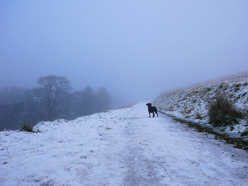
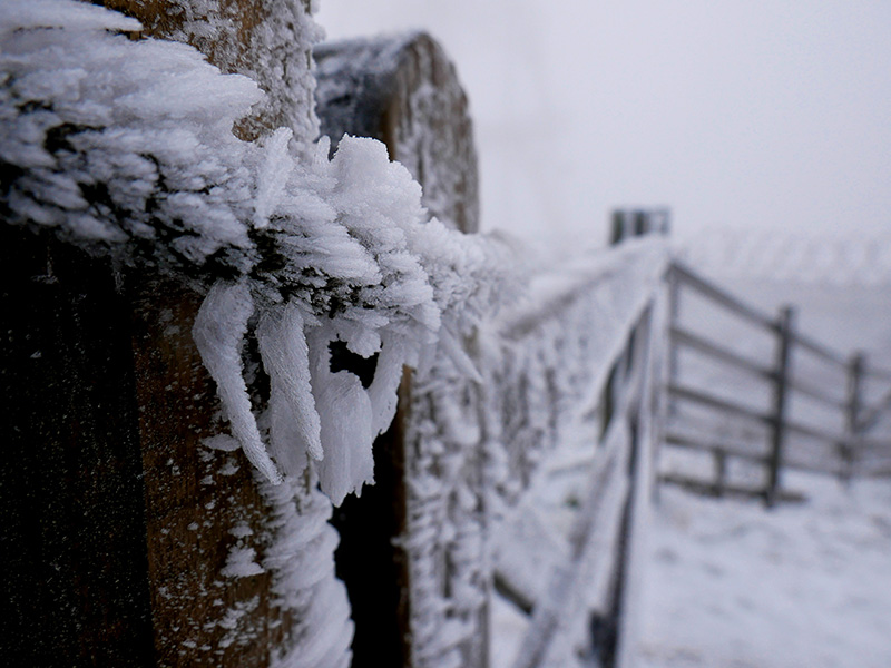
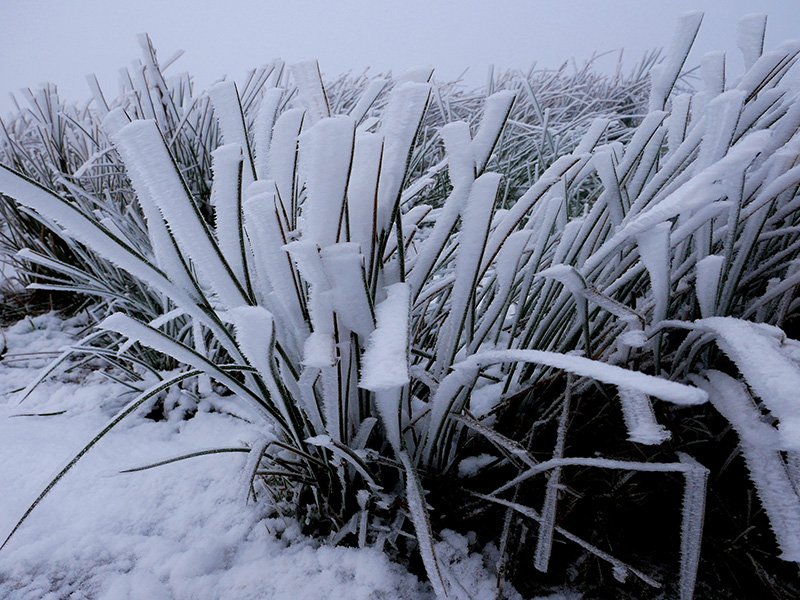
The route to Windy Hill was one that we had wanted to explore for some time, so on New Year’s Eve we headed out with my Mum’s black Labrador Nellie to follow the trail. The conditions weren’t ideal for heading over the open moorland, with freezing temperatures, plenty of snow, and dense, low-lying fog providing a dramatic backdrop to the walk.
The route starts at Ogden Reservoir car park and by walking across the dam wall. From here you follow the trail between the woodland before taking the path that intersects Town Hill and Dick Hill.
Following this path will lead to a crossroads onto which you will turn right onto Tunshill Lane. Following this will lead you to another intersection with a signpost pointing left to Windy Hill (1 ¾ mile). From this point the pathway becomes fairly poorly maintained, but you should be able to follow it as it climbs its way up to Windy Hill, just under 400m above sea level.
Windy Hill lies just on the border of Greater Manchester and West Yorkshire at J22 of the M62, and prominently features a large radio transmitter.
There is a car park located here as it is a popular spot for walking. Windy Hill is also crossed by the Pennine Way, a 268-mile trail that stretches from the Northern Derbyshire Peak District to Kirk Yetholm, just inside the Scottish border.
This route is an example of the stunning landscape found in the South Pennines. There are plenty of ways to extend the walk, make it a circular trail, or simply head back the way you came to continue to enjoy and appreciate the local area.
10 TOP PLACES ON THE PENNINE WAY
EXPLORE WITH OS MAPS
SD 98219 14354
5 km / 3 miles