Discovering bluebell woods with the Isle of Wight Walking Festival – an ideal spring walking route
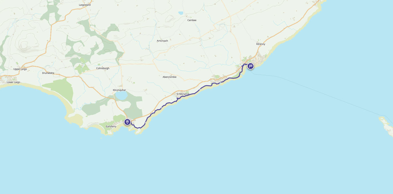
SZ 543 919
Having spotted this walk as part of the Isle of Wight Walking Festival, we’d decided it was the perfect opportunity to see more of this famous holiday island. Getting there from the mainland is easy, with car ferries from Southampton or a hovercraft from Portsmouth.
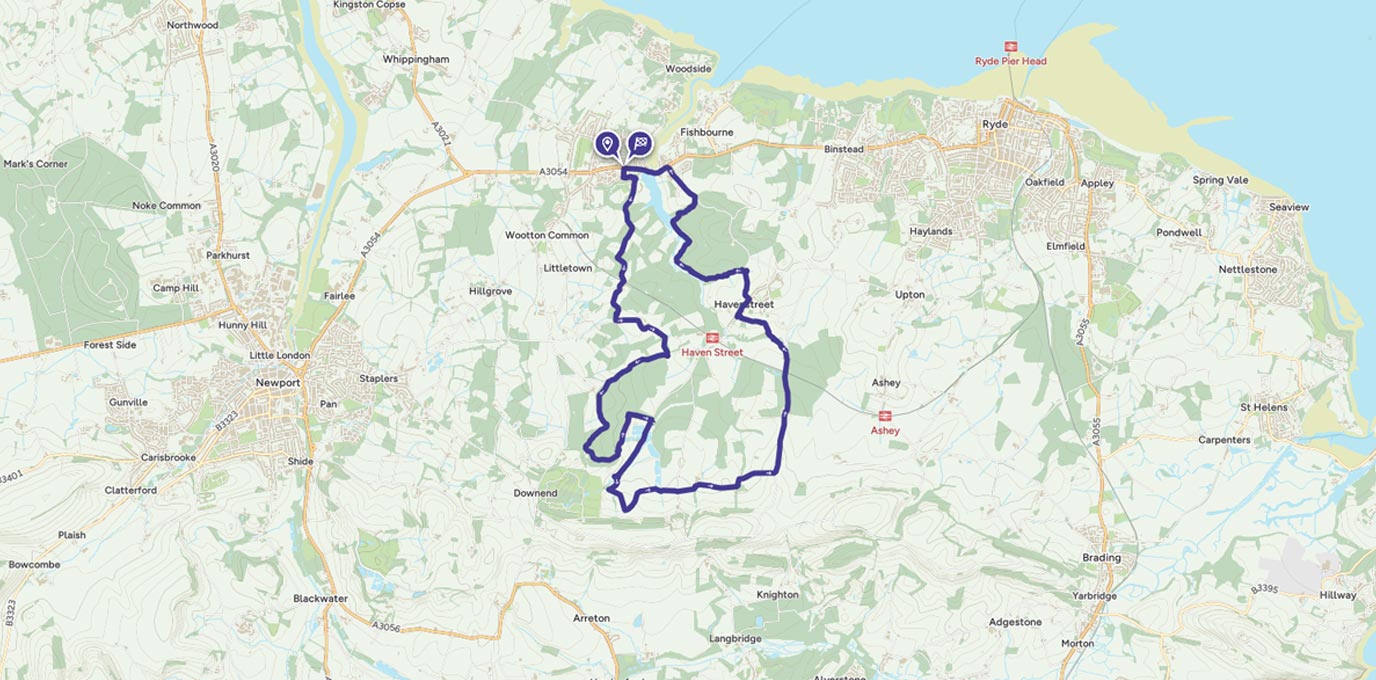
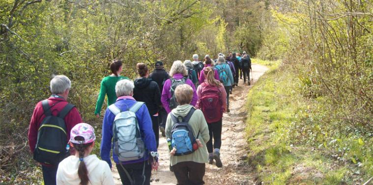
We met John, our guide for the day, near the car park (paid, but free on-street parking available) in Brannon Way in Wooton Bridge bright and early on a Sunday morning. There were already a few walkers waiting, and by the time we set off there were a total of 33 people, from 10 years up to an age where paying for the bus back would not be a problem.
We were promised a walk to see the wild flowers in the local woods – mostly bluebells – but as the route had not been published in advance the rest was a bit of a mystery tour. We were fortunate in having one of the best days of the year so far with bright sunlight meaning most of us were busy taking off extra layers and stuffing them in rucksacks before we even started.
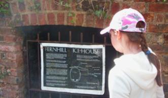
Start off heading down Mary Rose Avenue, then off on to the gravel bridleway at the bottom. We were sharing the path with some mountain bikers at this point, but they soon left us behind. As with any large group the pace tended to be a little slower, but we still made good time heading out to the first stop at an underground ice house at SZ 544 912. Before electric refrigeration this was used to store large blocks of ice, harvested in the winter and used to keep food fresh at Fernhill House, the local manor, which was subsequently destroyed in a fire.
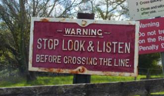
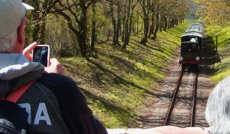
Continue on the main path through the woods, and you will soon reach a couple of points where the path splits. Carry on heading generally south until you reach a level crossing for the Isle of Wight Steam Railway – we’d been hearing the trains occasionally as we got closer. The crossing is unmanned, so you have to check before attempting to cross – fortunately they are easy to hear coming, and they don’t move that fast!
SZ 544 905 – 2.0 km
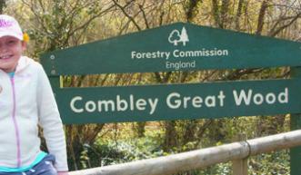
Once over the crossing, take the bridleway past Woodhouse Farm, then turn left on to the Bridleway N16, with the train line occasionally glimpsed through the trees to the left. At the end of this section, bear right on to a minor road (Combley Road). There’s no pavement, although grass verges give some room to avoid traffic. Keep an eye on the left side of the road – you will shortly come across a lay-by with a path into Combley Great Wood, which will allow you to get off the road.
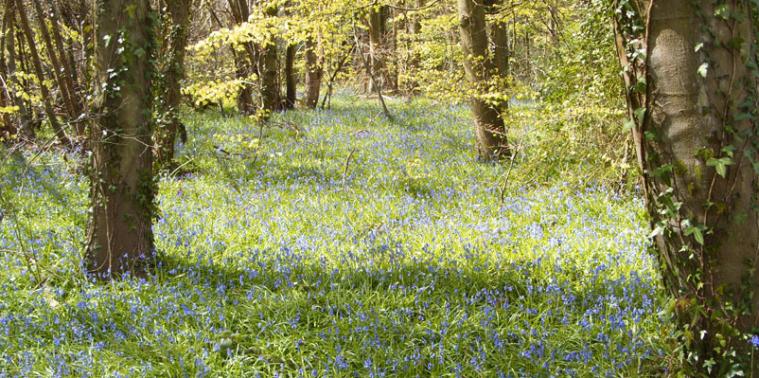
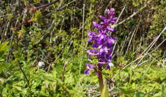
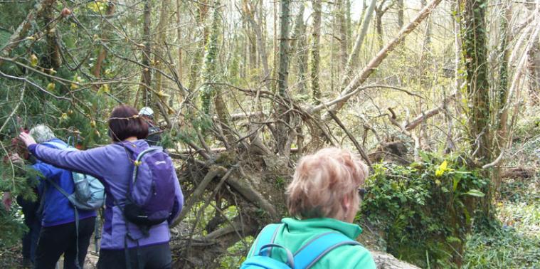
Take the first path to the right to follow a route around the edge of the woods, rather than the main path straight though the centre and you will start to see a lot more bluebells, celandine, wood anemones and the occasional orchid. We were lucky enough to have a sunny day when they were at their best, but even at other times of the year, the mixed woodlands would make this a pleasant route.
In this area, try to stick to the narrow path, as you otherwise risk damaging the fragile plant life. Carry on with a big loop around the woods, crossing over a couple of slightly tricky streams, then turn back south on the Bridleway – we stopped at Combley Farm for a quick lunch break.
SZ 543 480 – 7.5km
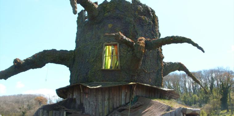
Just past the farm, turn off the main bridleway, then cross a field to the left and through the next gate. Directly opposite you in the next field you will see an unusual sight – what appears to be a house made out of a huge tree stump (SZ 544 877).
On closer inspection, this turns out to be, not a witches residence, but the Wishing Tree, part of the annual Bestival Music Festival. Stood alone in the middle of a field it looks rather sinister – I’m glad it was daylight as at night it would extremely creepy!
Rejoin the main path, crossing the next field then carrying on to Duxmore Farm. Just past here, turn right off the main path and head up through the trees, then uphill past a farmhouse. Carry on until you reach a minor road (Rowland Lane) and follow that back towards the railway line. This is a quiet road, but narrow, so keep an ear out for traffic approaching from behind. You will soon come to a bridge over the railway, and we happened to arrive a just as a train passed underneath, awarding us with a wave and toot from the driver and a face-full of smoke from the engine.
SZ 564 893 – 12.0 km
Just after the railway bridge, take a left on to the footpath, passing Rowland’s retreat café. We didn’t have time to stop here so we carried on heading over three 3 stiles and across a stream.
The next section offers you a choice of paths, but for this route keep left at the fields, then over another pair of styles at SZ 561 900. You can then follow the hedge on your left towards the houses, and once you reach them turn right to head down the main road of Havenstreet. Pass by the White Hart Inn – by this stage the signs advertising real ales will look tempting – and take the path labelled R6 off to the left.
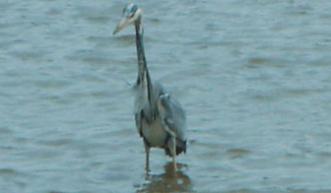
When you reached the edge of Firestone Copse, ignore the main route to the right and take a left, following a small stream. This way is a bit trickier – the unmaintained path is blocked by fallen trees in places, and some areas were muddy even in good weather. Following the stream will eventually lead out on to the road leading back into Fishbourne, surrounded by thick Hedgerows, then on to the main road and the bridge over The Old Mill pond. As we passed this tidal area we were lucky enough to see a pair of Egrets in the distance and a solitary stork standing guard in the river. This was pretty much the first wildlife we’d spotted on this walk, which is not surprising for a large group.
Optionally, pause at the Sloop Inn for some refreshments before making your way back to the start point.
17.2 km SZ 543 919
17.2 km / 11 miles