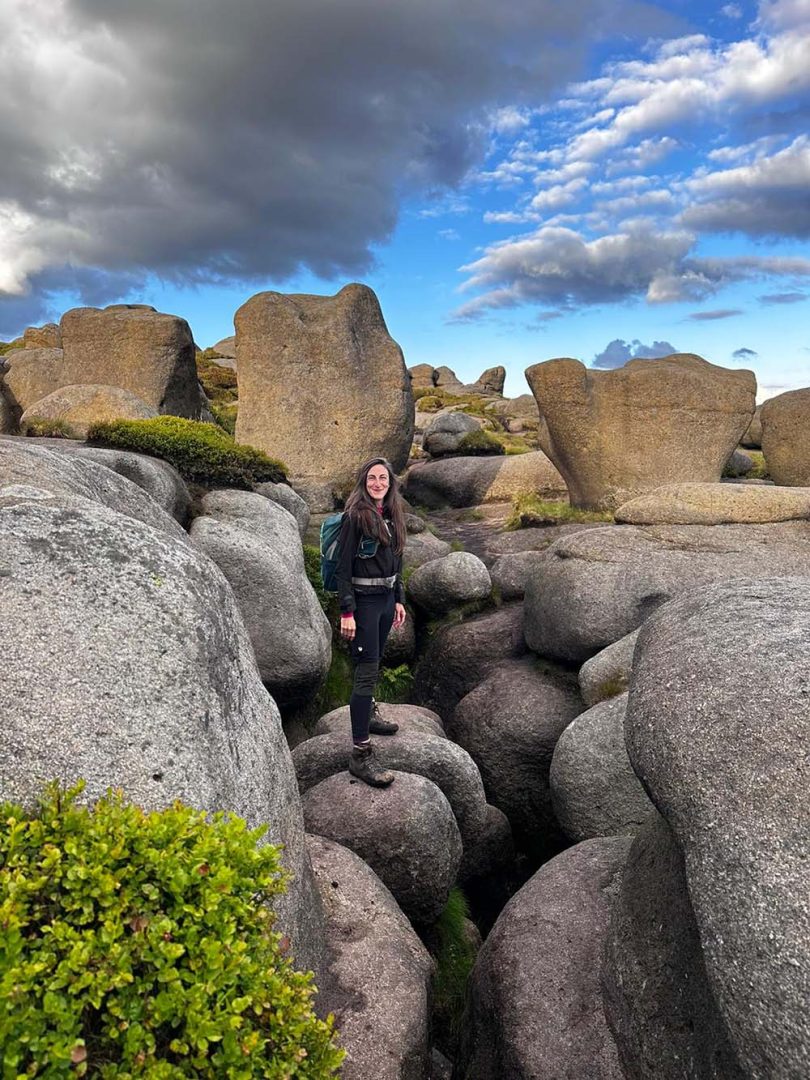
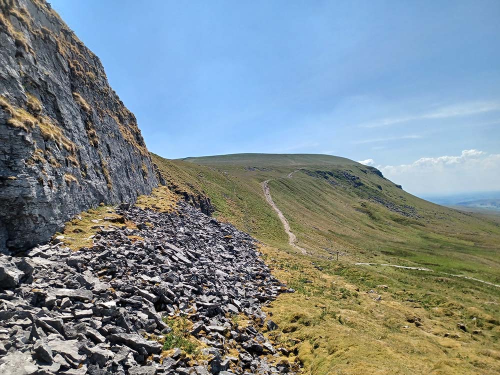
The Yorkshire Three Peaks, nestled in the Yorkshire Dales National Park in northern England, comprise a trio of mountains that showcase some of the most spectacular landscapes in the region. The terrain is marked by rugged beauty, dramatic cliffs, and expansive views of the countryside, offering a diverse and awe-inspiring experience.
We had the pleasure of speaking with Yorkshire Three Peaks expert Hannah Collingridge about this iconic mountain trio and her new guidebook.
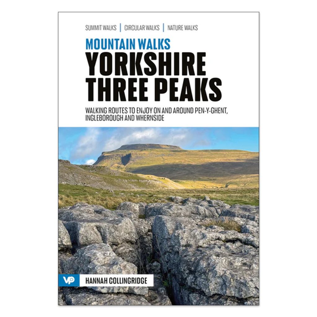
Hannah is the author of “Yorkshire Three Peaks, 15 routes to enjoy on and around Pen-y-Ghent, Ingleborough and Whernside,” part of the fantastic new Mountain Walks series from Vertebrate Publishing, which we are proud to stock in the Ordnance Survey Shop.
Yorkshire Three Peaks – an Iconic Mountain Mountain Trio
Rich in history and local lore, the area surrounding the Yorkshire Three Peaks has been settled for millennia, with remnants of ancient communities and routes still evident. These mountains are part of the Pennine range, often dubbed the “backbone of England,” and they form a circle around the head of the River Ribble’s valley.
The three peaks are as follows:
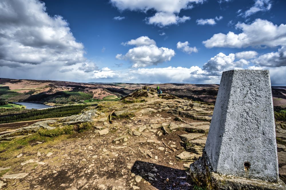
- Pen-y-ghent – 694 meters (2,277 feet)
- Whernside – 736 meters (2,415 feet)
- Ingleborough – 723 meters (2,372 feet)
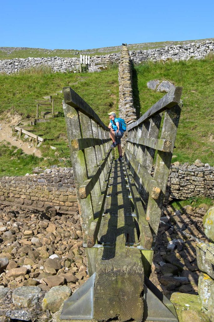
Accessible from various nearby towns and villages, the peaks draw both avid hikers and leisurely walkers. The local populace has taken the Three Peaks to heart, organizing numerous events, guided excursions, and conservation initiatives to maintain the area’s natural splendor, including the renowned Yorkshire Three Peaks Challenge.
The Yorkshire Three Peaks Challenge is an esteemed endurance event challenging participants to summit all three peaks within 12 hours. The 24-mile (38.6 km) loop includes a cumulative climb of 1,585 meters (5,200 feet). It draws thousands of hikers annually, cementing its place as a notable fixture in the UK’s outdoor adventure scene.
Meet Hannah Collingridge, author of Yorkshire Three Peaks, 15 routes to enjoy on and around Pen-y-Ghent, Ingleborough and Whernside
How did you feel to be chosen as author and expert for the Yorkshire Three Peaks?
It was an area I hadn’t really been to for a few years having spent many years there previously. I’d ridden through whilst writing the Pennine Bridleway Guide which had reminded me what a cracking area it really is. Being asked to write a guide book was the best excuse to return and immerse myself in this fascinating landscape.
Can you tell us a little about your passion for Yorkshire and the area and how it came about?
Both my parents knew the limestone Dales from their own youth so trips there when I was young were a natural progression. My parents became self-employed so spare time, especially at weekends was in short supply so the trips died off for a few years. Mum and I started walking the area again when I was a teenager and went to the limestone areas regularly as they are close to home as well of beautiful. I’d also learned a lot about the geology and geomorphology whilst studying geography and became fascinated by what happens to water in limestone areas. Then add a passion for maps of all ages and the availability of the old OS maps on the NLS site, an interest in placenames and languages, history and archaeology, and it all starts becoming more of an obsession than a passion.
Can you give some advice to beginner hikers thinking about visiting this area for the first time, which route do you think would be best to start with and why?
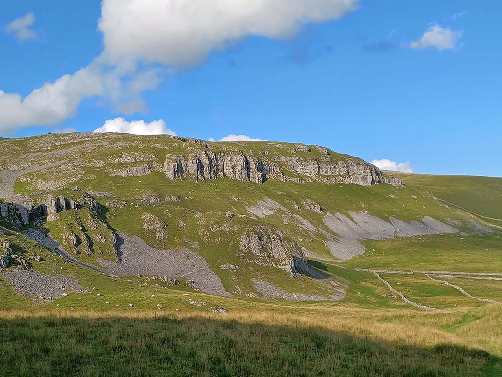
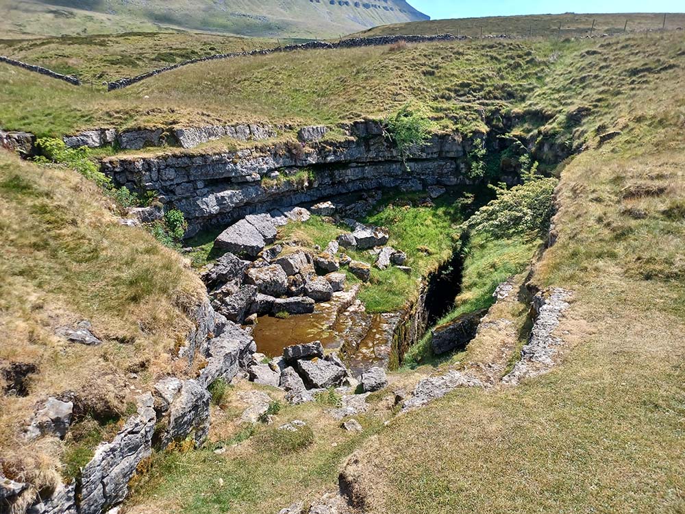
If you’ve never walked in a limestone area before then one of the best introductions to the landscape of limestone is the walk from Settle through the caves and karst of Warrendale Knotts and Attermire Scar. It’s not overly long (there is a steep pull out of Settle), but includes amazing limestone scenery and a number of caves that you can wander into with a good torch but without danger or crawling. And there are plenty of paths to explore the area a bit more than the specific route in the book. A walk to take time over and savour.
If you fancy one of the Three Peaks then Pen-y-ghent is a great introduction. Again, not too long a walk and very easy navigation if you are nervous about that sort of thing. It may be quite a small hill but really packs in top quality views, a little bit of scrambling up the nose where you feel very close to the hill, plus a couple of great potholes to look at just off the path (and mentioned in the book).
Can you choose your favourite routes from the book and tell us why they are special to you
I genuinely like all 15 walks! And all of them have some pretty good memories attached with them which always make them special.
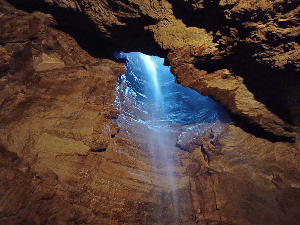
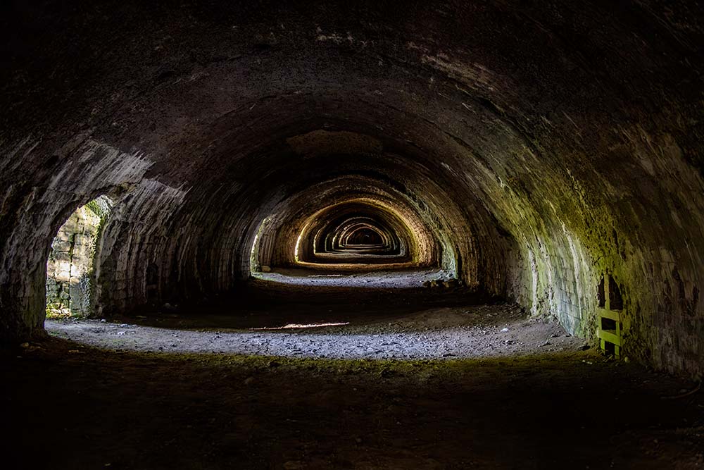
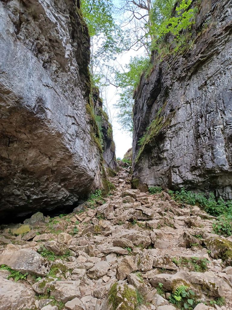
Ingleborough from Clapham is always an absolute belter. On the way up you pass Ingleborough Cave, go through the spectacular Trow Gill, walk right on the edge of limestone and sandstone meeting, peep carefully into stunning depths of Gaping Gill and then walk up to the top under the remains of the hill fort – it’s an absolutely fascinating ascent. If you can, make the effort to go down Gaping Gill on one of the winch days – it’s a special trip and well worth it. After the busyness of the summit you drop down off the limestone and there’s a little spring on the right hand side of the path – cool water fresh from the hillside is perfect

EXPLORE THE
OS Shop
We are with you every step of the way. Shop our trusted walking and hiking maps and guidebooks so you can explore the outdoors with confidence.
Go to the shop
By Hilary Pullen
Meet Hilary, Editor of Get Outside – the Ordnance Survey Blog. Hilary is based in North Wales and loves hiking with her dogs in the mountains of Eryri and Bryniau Clwyd, you can find her on Instagram @nearlyuphill and read her guides to walking in North Wales on her blog. Drop her an email hilary.pullen@os.uk if you are interested in posting an article on Get Outside.