Great hidden swimming spots in the Lake District National Park
Daniel Start, author of the Wild Guide to the Lakes and Dales, reveals his top 6 favourite hidden places to go wild swimming in the Lake District. From the emerald pool at tongue pot to plunge pools at Ullswater, we have your next trip to the lakes covered.
To help you find these 6 hidden gems, simply click the links below for each one, and use OS Maps to find a direct route to the spot. There’s a 7-day free trial too, so you can access all of Great Britain anytime, anywhere.
1. Tongue pot, Upper Eskdale
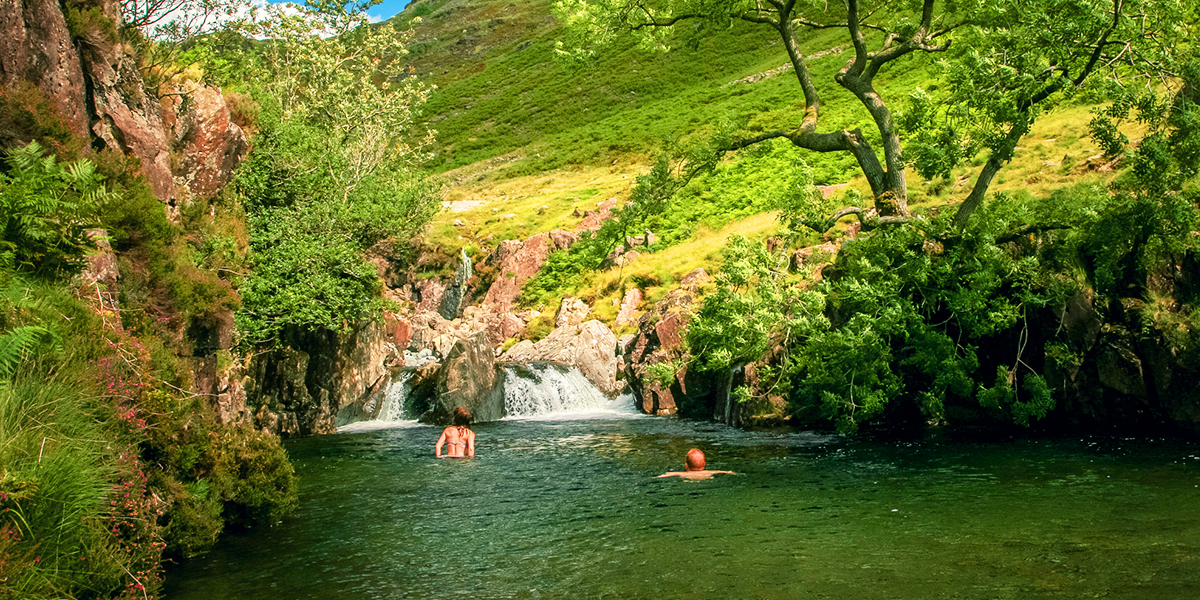
The legendary Tongue Pot forms a long emerald pool beneath a roaring waterfall in a cleft of the mountain stream, just beneath a mountain packhorse bridge. A pebble beach shelves down on one side of the pool into the crystal clear water and an oak tree overhangs. On each side sheer rock walls rise up, making the place famous for jumps. When the sun is shining there is no better place on earth to be. Park at the car park nearest to the cattle grid (marked CG on an OS Map)
Coordinates: 54.42119, -3.19260
2. Galleny Force, Stonethwaite, Borrowdale
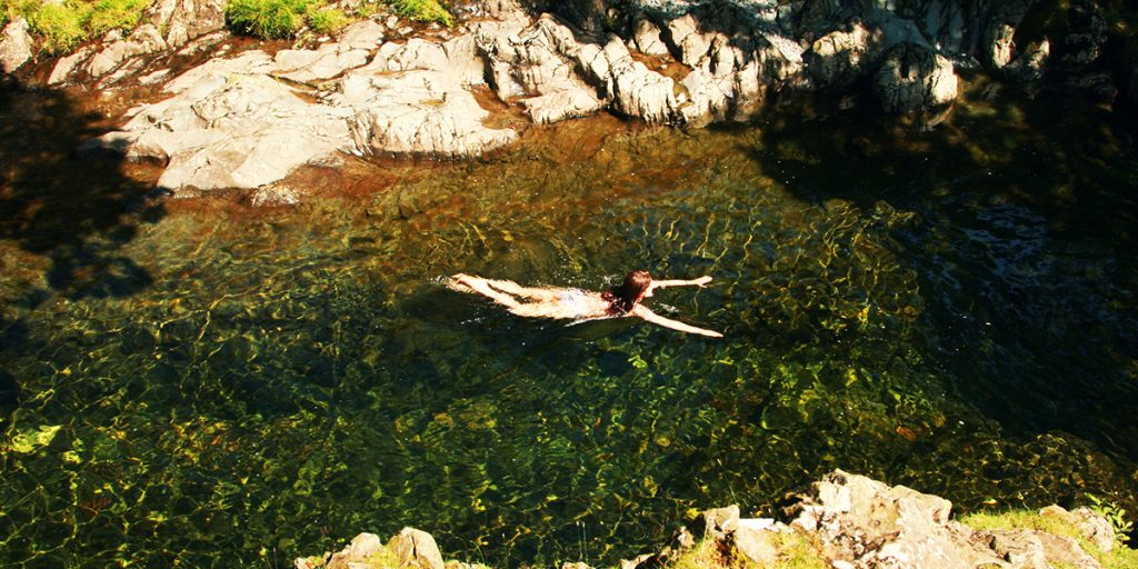
With grassy knolls and ancient rowan trees, perfect clear water and flat rocks for sunbathing, these are mountain waterfalls to surpass all others. The perfect place for a plunge in nature’s Jacuzzi. There are two pools here, and the lower ones are often overlooked. Head on up the valley for Black Moss pot where the brave dare each other to jump into a deep water-filled chasm.
After Rosthwaite, turn L at crossroads with post box in wall signed Langstrath Country Inn (carry on along lane beyond CA12 5XG) and follow lane to Stonethwaite. If you are planning to camp, continue on rough track for further 600m to park at Stonethwaite riverside campsite (0176 87 77234). The path above the campsite leads through the woods ½ mile to find first set of pools, below on L, followed by the main pool after another 200m. 15 mins.
Coordinates: 54.50729, -3.12340
3. Kailpot Crag, Ullswater
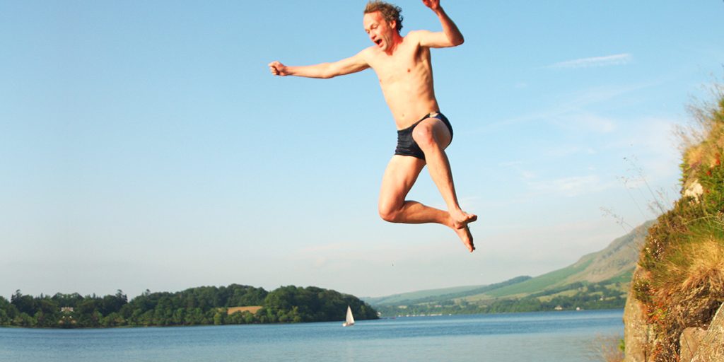
This high, craggy cliff beneath Hallin Fell plummets into deep water. Great for jumps and snorkelling. Wood behind, beach alongside; it’s a great spot.
Take the ferry to Howtown and follow the shore path a mile SW. Or take Howtown road from Pooley Bridge at N end of Ullswater; you will pass several beaches en route and Park Foot camping (CA10 2NA, 0176 84 86309) has lakeshore pitches. Follow 4 miles to Howtown pier (tricky parking) or approach from Sandwick Bay. This should take around 20 mins.
Coordinates: 54.57629, -2.87341
4. Coniston Water, Lake District

The adventures of Titty, Roger, Susan and John have captured the imagination of children and teenagers for generations and were inspired by Coniston: Peel Island was Wildcat Island and Brown Howe was where the Amazons lived. The silver lake beaches between Hoathwaite and Conistan Hall are backed by meadows and ancient parkland, make for a perfect beginners’ stretch and are situated between the two campsites of the same name.
Park at Coniston Hall (LA21 8AS) and walk south, or disembark at Hoathwaite Landing and walk north (or walk from Torver, LA21 8AX).
Coordinates: 54.35030, -3.07291
5. Stanley Gill Force, Lower Eskdale

Discover the elegant splendour of Stanley Gill Force, one of Lakeland’s most graceful falls, once revered by Victorian traveller but now well off the beaten track. With a shimmering chute falling 20m into a deep plunge pool, it’s hidden in a mossy and verdant tropical-looking ravine reached by crossing several wooden bridges and some final scrambling along a slightly tricky path. The brave can descend down to the pool for a dip in the cool waters. You can also swim in the deep pools beneath Dalegarth Bridge on the way up to the parking area – some jump from the bridge, and there are rope swings too.
Turn right off the road from Eskdale to Dalegarth, after Beckfoot station (CA19 1TF). Cross Dalegarth Bridge (deep pool below) and find the car park on the left after 200m. Carry on by foot up the road, bearing left. After 300m you’ll see a gate into the woods on the left. Follow the track upstream for ½ mile.
Coordinates: 54.38509, -3.27320
6. Holme Fell Lake, Southern Langdale
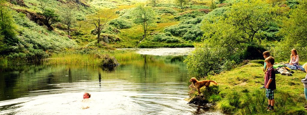
This is one of our favourite little lakes, and a great escape on a sunny day. It’s an old reservoir on the route up Holme Fell, used for the mines below. It’s deep enough to dive in from the old dam wall, and small enough that it warms up nicely in the sunshine. The fell above is a lovely little-visited peak and very easy to reach, with views down over Coniston.
From the SE corner of Hodge Close quarry (itself an amazing place), a path leads up through woods to old mine ruins 300m. Keep climbing on the upward path (don’t bear R along the wall path) and you reach the lake after 300m more. This takes around 15 mins.
Coordinates: 54.40100, -3.05470
Discover more
Discover more great hidden places to go in the Lake District with The Wild Guide to the Lake District and Yorkshire Dales by Daniel Start. Buy your copy today and get over 30% off with free P&P go to Wild Things Publishing and use discount coupon ‘OS‘ at checkout.
Next time you’re in the Lake District, why not take a vitalising dip in one of these beautiful wild swimming spots. Find nearby walking routes below. Don’t forget your towel!


