How understanding Welsh words can transform your next walk
Wales is a country shaped by landscape – mountains, coastlines, valleys and forests that feel especially atmospheric in winter. But look closely at any OS map and you’ll see something else shaping it too: language.
Welsh place names are among the oldest in Europe. Many were created long before modern maps existed, describing the land in practical, memorable terms that still make sense today. Learn just a few key words and your next walk in Wales becomes more than a route. It becomes a story.
Here’s how reading place names can help you understand the Welsh landscape, improve your map-reading skills, and enrich winter walking adventures across the country.
Why place names matter in Wales
Place names in Wales often describe physical features: slopes, valleys, rivers, ridgelines and woodland. They’re incredibly useful for walkers and anyone planning a route with OS Maps. When daylight is short and weather conditions change quickly, these clues become even more valuable.
A few common Welsh words you’ll spot again and again:
- Cwm – a valley or hollow, often steep-sided
- Allt – a wooded hillside or slope
- Bryn – a hill
- Mynydd – mountain or upland
- Aber – the mouth of a river
- Llyn – lake
- Pen – the end or head of a hill or ridge
- Coed – woodland
- Nant – a stream or brook, often forming narrow valleys or wet ground
Once you know these, OS maps start to feel different. The landscape becomes more predictable before you even step outside. You can tell whether a route is likely to climb quickly, follow a river, cross open moorland or dip into forest.
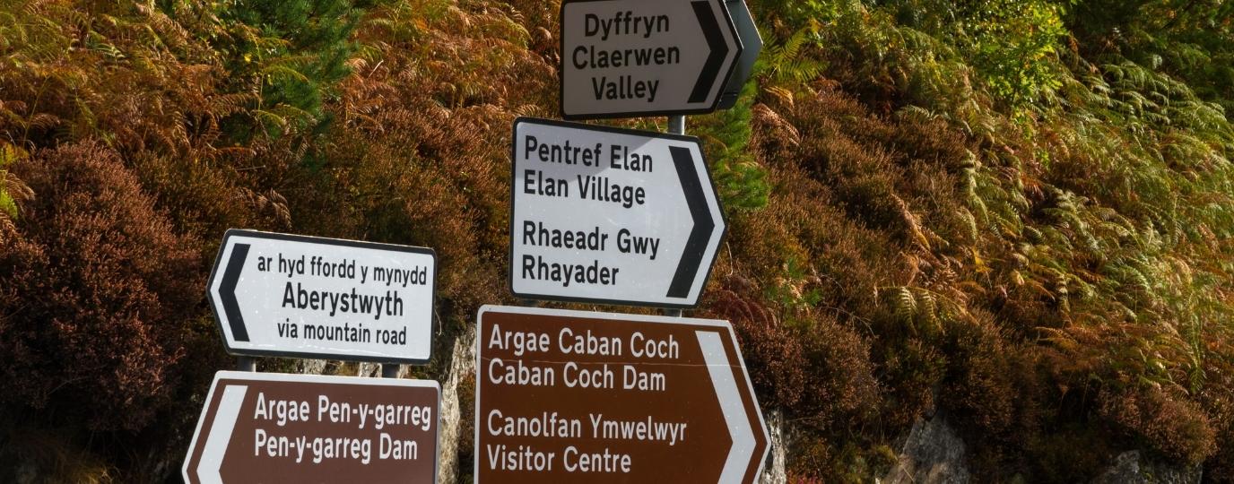
The landscape written on the map
Many Welsh place names read like tiny sketches of the terrain:
- Llyn y Fan Fach – the lake below the small peak
- Pen y Fan – the top of the beacon
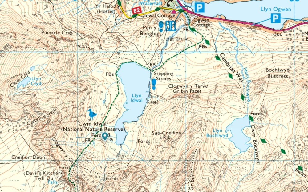
- Cwm Idwal – Idwal’s valley, clearly reflected in its dramatic glacier-carved bowl
- Rhiwsaeson – the slope of the Englishmen
- Bryn Bettws – the hill of prayer
These names aren’t accidental. They tell you exactly what to expect underfoot, which is especially helpful for planning safe and enjoyable winter walks in Wales.

History and folklore hidden in names
Not all Welsh place names describe the landscape directly – some reveal stories of people, settlements and legends. Look at the OS map and you’ll find layers of history written into the grid:
- Aberfan – the river mouth of the Fan valley
- Castell Coch – the red castle
- Tredegar – Tudor’s town
Others echo Welsh mythology.
Walk to Llyn y Fan Fach, and you’re following the legend of the Lady of the Lake, or climb Cadair Idris (Idris’s Chair) and you’re stepping into a tradition that claims anyone who sleeps on its summit wakes as either a poet or a madman.
These names are reminders that Wales’s landscapes are not just beautiful – they’re cultural and historic places that have been lived in, worked in and told through stories for centuries.
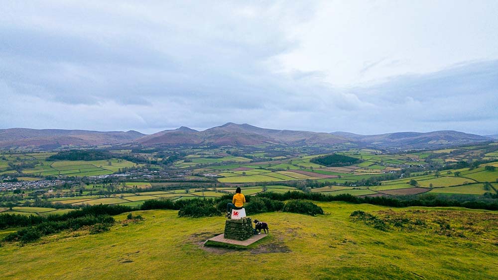
Why winter is the perfect time to notice place names
Shorter days and cool, clear conditions make December an excellent month to explore Wales on foot. With foliage thinned and visibility often sharper, it becomes easier to understand why somewhere was named the way it was.
- Frost highlights ridges behind pen, bryn and mynydd
- Low light exaggerates the shapes of cwm and nant
- Bare trees help define woodland edges marked by coed
- Seasonal water flow underscores names linked to rivers and streams
Place names become a practical part of navigation – helping walkers anticipate terrain, understand their surroundings and plan suitable winter routes.
Using OS Maps to interpret Welsh place names
The OS Maps app makes it easy to explore Welsh names, check route gradients, view terrain layers and understand the features the names are describing. When planning a winter walk or hike in Wales, these clues can be particularly useful for:
- choosing safer, well-marked paths
- identifying steep slopes or exposed ridges
- predicting boggy areas or stream crossings
- planning daylight around valleys and shaded sections
- linking local stories and landmarks to your route
Even learning just a few Welsh map words can significantly enhance both navigation skills and your connection to the landscape.
See Wales differently this winter
Place names offer a new way of understanding Wales – one rooted in geography, heritage and culture. They turn every walk into a conversation with the landscape and bring the map to life in a uniquely Welsh way.
So next time you’re planning a winter walk, pause on a name in OS Maps.
- Say it out loud.
- Look at how it matches the land around you.
- Because in Wales, the map doesn’t just guide you.
- It explains the place you’re standing in.
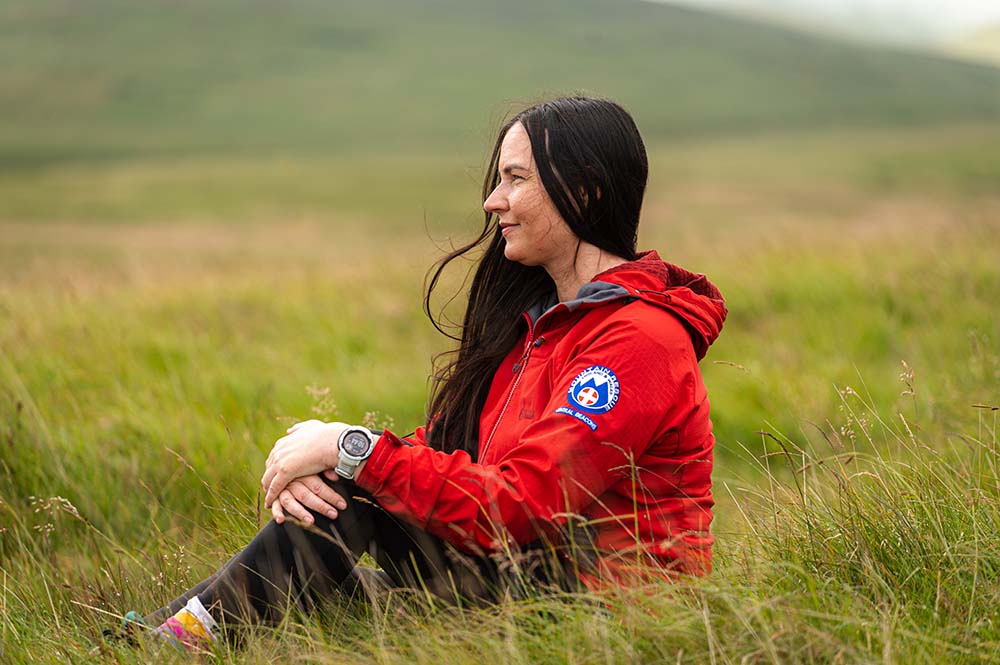
By Carys Rees
Meet Carys, a member of Central Beacons Mountain Rescue Team as well as a hiker, swimmer, wild camper and paddler who runs the This Girl Walks website which shares routes, hints, tips and discounts to help get you outside in South Wales.