During wetter months there may be a fair bit of mud on the trails, which can turn a leisurely stroll into a slippery mud bath. Some routes do remain relatively mess-free – you just have to know where to go! Our OS GetOutside Champions share their tried and tested walks to keep your feet dry.
Exeter Ship Canal walk
Location: Exeter, South West England
Distance: 10 miles / Time: 3.5 hours – Return
Difficulty: Easy, can be shortened
Parking: Exeter Quayside, EX2 8GY. Charges may apply.
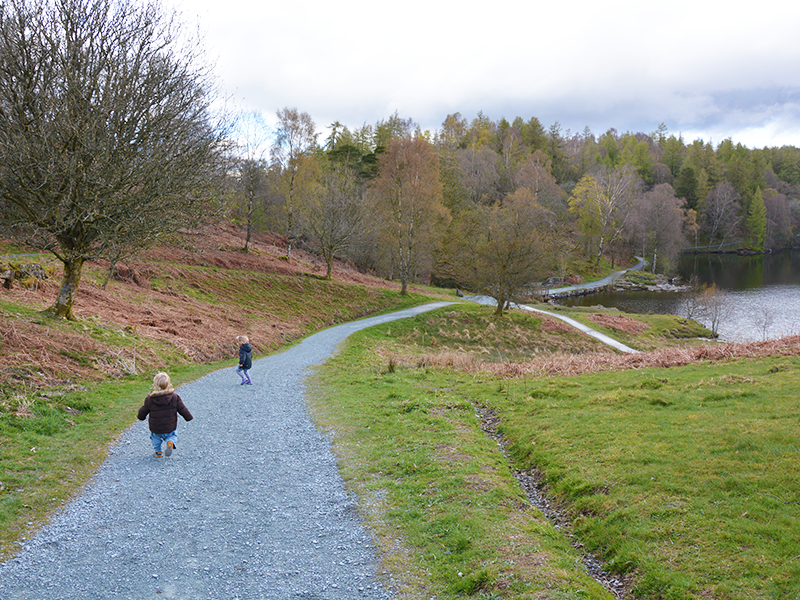
Exeter Ship Canal
Walking route in OS Maps for: Exeter Ship Canal
The Exeter Ship Canal is one of the oldest manmade waterways in the UK. This walk takes you from the bustling centre of Exeter along the tow path to the beautiful Exe Estuary. With 16km of industrial heritage to explore, make sure you leave time to enjoy the two historic pubs you’ll find along the way. In the winter months look out for Bewick’s and Whooper swans, back from Siberia and Iceland for the colder season.
Recommended by OS GetOutside Champion Fi Darby. Follow Fi on Instagram. Visit Fi’s website.
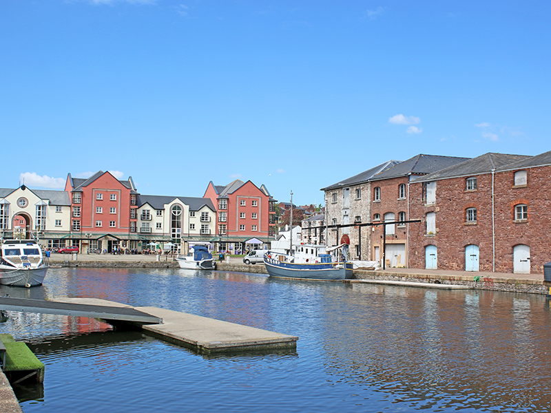
Exeter Quays
Durham Coastal Path
Location: Crimdon, North East England
Distance: 11 miles / Time: 11.5 hours – One way
Difficulty: Easy, can make shorter
Parking: Car park in Crimdon by the coast. Charges may apply.
Durham Coastal Path
Walking route in OS Maps for: Durham Coastal Path
The Durham Coastal Path starts in Crimdon and ends in Seaham and most of this stretch of coast is a designated national nature reserve helping protect its wildlife and natural habitat. This section is also part of the longer England Coast Path National Trail and crosses cliff-tops meadows, wooded gorges, coastal denes and coastal grasslands. On your walk you’ll meet a vast array of wildlife and uncover the rich heritage of the area. This 11-mile ramble is one-way so you may wish to turn around before Seaham, depending on the distance you wish to walk.
Recommended by Helen Newman from the OS Team. Follow Helen (Felicity) on Instagram.
Durham Coastal Path
Carding Mill Valley walk
Location: Church Stretton, Midlands England
Distance: 1 miles / Time: 1 hour – One way
Difficulty – Leisurely, with a few short scrambles
Parking: National Trust car park Postcode: SY6 6JG. Charges may apply.
Carding Mill Valley walk
Walking route in OS Maps for: Carding Mill Valley
Starting at the car park, walk ahead, past the café and toilets. Head over the bridge to the right and carry on straight. Follow the water upstream. The path is gravelly, but not muddy. Follow the water to the left, (here you will have to jump across the water, but there are plenty of places to cross) and up and over the rocky path. Stop at the Lightspout Waterfall to take in the four metre cascade before returning on the same path as you came.
Recommended by OS GetOutside Champion Zoe Turner. Follow Zoe and her family on Instagram.
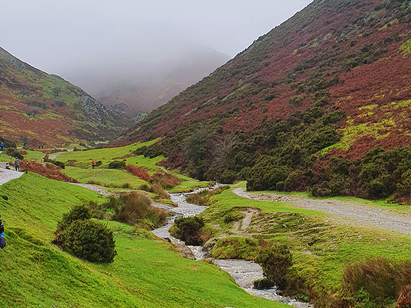
Carding Mill Valley walk
Merthyr Mawr circular walk
Location: Merthyr Mawr, South Wales
Distance: 4 miles / Time: 1.5 hours – Circular
Difficulty: Leisurely but there is a climb up the Big Dipper sand dune to start
Parking: Merthyr Mawr Candleston pay and display car park. Charges may apply.
Merthyr Mawr circular walk
Walking route in OS Maps for: Merthyr Mawr
This walk is a dream for dog walkers and families – actually it’s great for everyone! Sand dunes, woodland and sea! The car park is pay and display but it does have toilets. From here, head up the steep sand dune and follow the path along the top. There are fantastic views over the coastline from here.
The path will naturally drop down to sea level and follow the track until you finally reach a path which heads straight down to the sea. Turn left and either follow the Wales Coastal Path or walk along the beach. Keep going all the way around the headland and back up the river before cutting back into the sand dunes and then returning to the car park. There are so many variations of this walk. If it’s really wet, it’s best to walk on top of the sand dunes!
Recommended by OS GetOutside Champion Phillipa Cherryson. Follow Phillipa on Instagram.
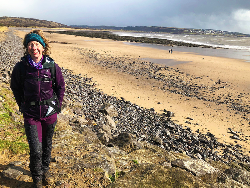
Phillipa on the Merthyr Mawr circular walk
Centurion Way
Location: Chichester, South Eest England
Distance: 5 miles / Time: 2 hours – One way
Difficulty: Easy and accessible
Parking: Multi-story car park near Chichester Railway Station. Charges may apply.
Centurion Way
Walking route in OS Maps for: Centurion Way
The Centurion Way is a 5.5 mile (9km) path that runs between Chichester, Lavant and West Dean following the old dismantled Chichester to Midhurst railway line. This is a leisurely linear walk along a tarmac/compacted gravel track. The number 60 bus runs every 20 mins to take you back to your car or just retrace your steps.
Recommended by OS GetOutside Champion Glyn Dodwell. Follow Glyn on Instagram.
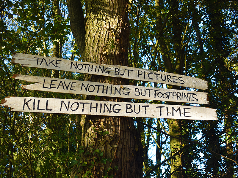
Take nothing but pictures
Glasgow Mural Trail
Location: Glasgow, Scotland
Distance: 6 miles / Time: 2 hours – Circular
Difficulty: Leisurely
Parking: Buchanan Galleries car park, Glasgow. Charges may apply.
Glasgow Mural Trail
Walking route in OS Maps for: Glasgow Murals Trail
The Glasgow Mural Trail is a great way to explore the city. Glasgow has a wonderful selection of murals which decorate blank walls and empty buildings turning them into a work of art. This walk visits a number of these beautiful creations in the city centre and makes for an exciting walk through urban streets. The murals change from time to time with new ones being added, so make sure to always keep an eye out for new impressive artwork on your adventure. Find out more.
Recommend by OS GetOutside Champion Eddie Fitz. Follow Eddie on Instagram.
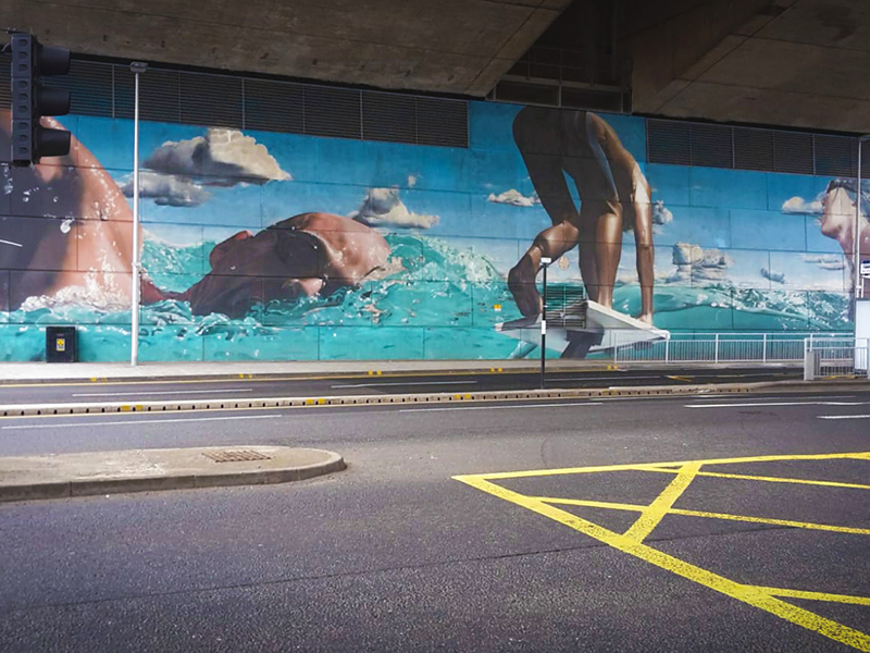
Glasgow Mural Trail
Hampstead Health circular walk
Location: Hampstead Health, London
Distance: 4.5 miles / Time: 2 hours – Circular
Difficulty: Easy
Parking: Parking in Hampstead or at the car park near Hampstead Ponds. Charges may apply.
Hampstead Heath circular walk
Walking route in OS Maps for: Hampstead Health
This is a classic London walk across Hampstead Heath taking in Parliament Hill, the Pools and Kenwood. Walk through wooded heathland on well-trodden trails. If you stick to the main paths you’re unlikely to get muddy. Make sure you stop on top of Parliament Hill to take in the fantastic views of London. The grounds of Kenwood House (on the northern boundary of the Heath and managed by English Heritage) are closed at sunset but the rest of the heath is accessible at all times.
Recommended by Helen Newman from the OS Team. Follow Helen (Felicity) on Instagram.

Hampstead Heath
Tarn Hows circular walk
Location: Lake District, North East England
Distance: 5 miles / Time: 2.5 hours – Circular
Difficulty: Leisurely
Parking: National Trust Tarn Hows car park. Charges may apply.
Tarn Hows circular walk
Walking route in OS Maps for: Tarn Hows
Nestled in a low-level valley between Hawkshead and Coniston, Tarn Hows is quite unlike anywhere else in the Lake District. Easily accessible, and with a surfaced trail all the way around, its wild and mountainous backdrop gives the place a wonderfully adventurous feel, yet remains achievable by most at any time of the year.
Originally formed from three separate tarns, Tarn Hows was landscaped in the 1860s to create a single large ornamental lake. Bought by Beatrix Potter in 1929 to protect it from development, the estate is now managed by the National Trust using traditional techniques and conservation grazing with Belted Galloway cattle to preserve the unique and fragile habitats.
This walk follows the gently undulating surfaced trail on a complete circumnavigation of the tarn. The terrain is suitable for buggies and wheelchairs, although there are some uneven sections; cycling is not permitted. Our favourite time of year to visit is in spring when the banks are bright with daffodils. If you’re lucky you might spot red squirrels, too.
Recommended by OS GetOutside Champions Jen and Sim Benson. Follow Jen and Sim on Instagram.
Tarn Hows walk
Pin Mill walk
Location: Chelmondiston, East England
Distance: 2 miles / Time: 50 minutes – Circular
Difficulty: Leisurely
Parking: Pin Mill car park. Charges may apply.
Pin Mill circular walk
Walking route in OS Maps for: Pin Mill
Take in some of Suffolk’s stunning coast through the Pin Cliff Plantation. This circular walk takes in woods, open farmland and sandy shorelines. To start the walk head down to the shore and take in the stunning views over the River Orwell, you may have to do a little detour to keep your feet dry depending on the tide. If it is out you can walk along the river side but if it’s in you can head back up to the Stour and Orwell Walk route that goes through the woods.
The route then takes you through native woods where there are plenty of opportunities to build a den or take a seat on one of the benches to enjoy the views. When you reach Clamp House take a moment to a look out over Butterman’s Bay, then turn right and head up the farm track which will take you back to the road.
Recommended by OS GetOutside Champion Charlotte Ditchburn. Follow Charlotte on Instagram.
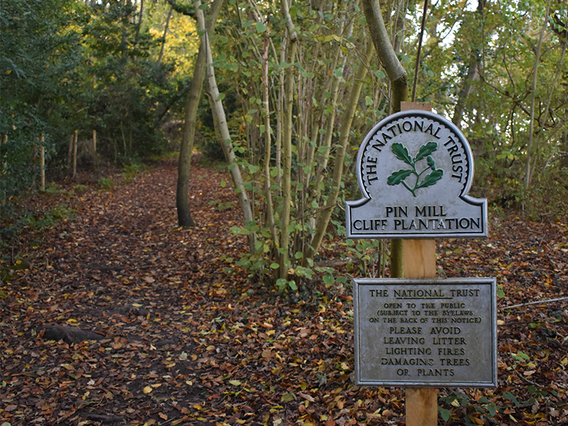
Pin Mill walk
Mallerstang accessible walk
Location: Yorkshire Dales National Park, Yorks and Humber
Distance: 1 mile / Time: 30 minutes – One way
Difficulty: Moderate, can be done on foot or a 4×4 all terrain wheelchair. Can be made longer.
Parking: The Thrang, off street parking.
Mallerstang accessible walk
Walking route in OS Maps for: Mallerstang
Mallerstang is a dale at the head of the upper Eden Valley, Cumbria and was originally part of Westmorland. This linear walk follows a section of the Pennine Bridleway from The Thrang to The Water Cut.
The Water Cut, a stone sculpture by Mary Bourne, sits high up on the eastern side of the Mallerstang valley and is one of ten stone sculptures that are located at intervals along the length of the River Eden.
To see the sculpture close up, and to get the awesome views down the valley, you’ll first have to climb up the side of the hill. Although this route follows a bridle path and in general the terrain is good, it is uphill all the way to the top and therefore requires some serious leg work or a robust all terrain wheelchair/mobility scooter.
Recommended by OS GetOutside Champion Debbie North. Follow Debbie on Instagram.
Worcestershire Beacon walk
Wyche Cutting, Midlands England
Distance: 2 miles / Time: 50 minutes – Return
Difficulty: Leisurely
Parking: Black Hill, Wyche Cutting. Charges may apply.
Worcestershire Beacon walk
Walking route in OS Maps for: Worcestershire Beacon
This pleasant walk starts in the village of Upper Wyche with a pay and display parking area. The route is straightforward with a track heading north towards the Worcestershire Beacon from the car park. Stay with the path to reach the summit of the beacon. In good visibility the panorama is superb. From the summit you can return down the path you walked, or if the weather is a little more appeasing you can extend the walk by walking down below the summit on well-maintained gravel/grass paths.
If you choose to take this route descend northwest off the summit to join a gravel path which contours around the side of the beacon back in the direction you have come. This leads back to the track that you initially used at the beginning of the walk. All that remains is a gentle downhill section back to Upper Wyche. This accessible walk is also suitable for a robust all terrain wheelchair/mobility scooter. Cafe H2O within the Malvern Hills GeoCentre have one for hire.
Recommended by OS GetOutside Champion Elinor Bishop. Follow Eli on Instagram.
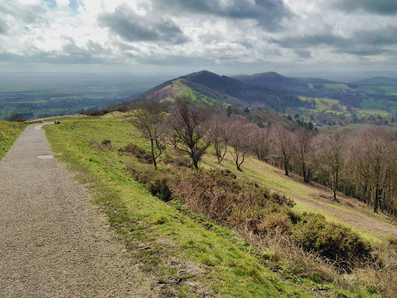
The Malverns
Thanks to all our OS GetOutside Champions for their insider knowledge. When you know the right routes, mud-free* walks can be enjoyed all year round! If you want to share some of your own, please leave a comment.
*We cannot guarantee you’ll escape totally mud-free, especially when it’s been raining cats and dogs! A little mud never hurt anyone, just wash your shoes off when you get home and enjoy the squelch!