The Met Office team share their favourite walking and running routes across the UK and tells us how they differ across the seasons. Find walks for different weather conditions from the weather experts.
Whatever the weather, getting outside for some fresh air will do you the world of good. As the saying goes “there’s no such thing as bad weather, just bad gear!”. Walking and running are a great year-round activity but some routes are better suited to certain weathers and seasons.
The Met Office team share their favourite walking and running routes across the UK and tells us how they differ across the seasons. Remember to check the forecast before setting off and if you’re heading into the hill, the mountain forecast.
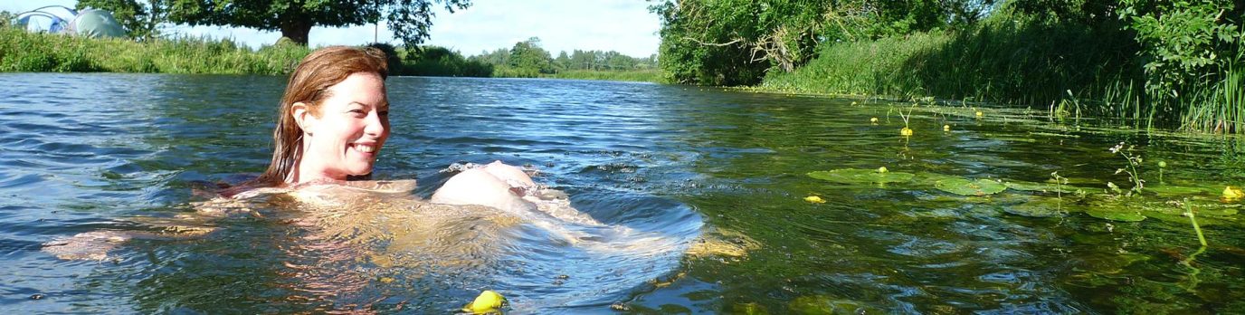
1. Witney to Ducklington, Oxfordshire
Perfect for summer, even when the heavens open
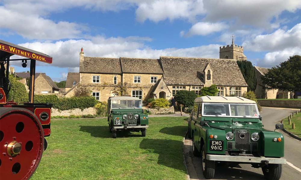
Ducklington Village, Oxfordshire
This route is brilliant on a summer’s day when you can pick up some home grown veg left out by the local villagers. The public right of ways across the Oxfordshire farmland are great, you can go for miles in any number of directions. This little route is a favourite and you are almost guaranteed to see some deer in the fields at South Leigh. After rain it can be boggy in some places, but the hedge line and numerous barns offer plenty of shelter from sudden downpours.
In summer the villagers leave out surplus veg that they have grown so it is always worth bringing a bag and the occasional plum tree can be found along the route. As you descend the concrete drive of Springhill Farm, the elevation offers a sweeping view. We would recommend pausing here for a moment, on a day with good visibility you feel very close to the aircraft as they descend into Brize Norton. Being a little more exposed here, you can watch the clouds race across the sky and decide if you need to speed up if a rain cloud is approaching. Loop round the chocolate box village of Ducklington where you can pause at the thatched Bell Inn and watch the spring chicks as they venture from the duck pond to the pub garden.
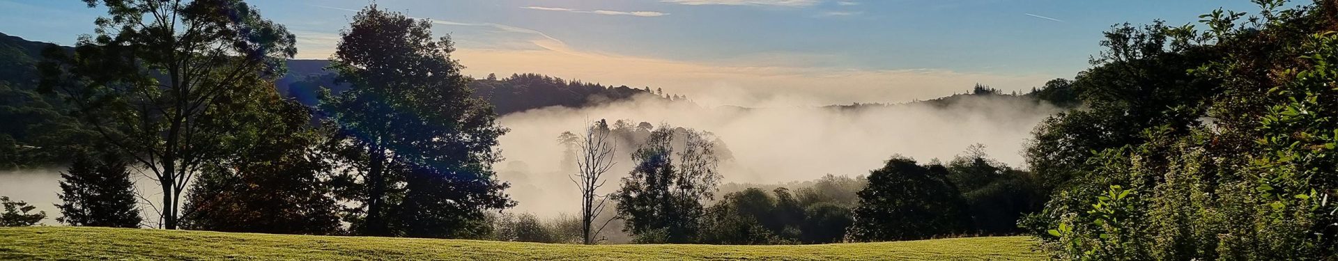
2. Elterwater to Skelwith Bridge, Cumbria
Best in spring or autumn, or after heavy rainfall to see the waterfall at its most striking!
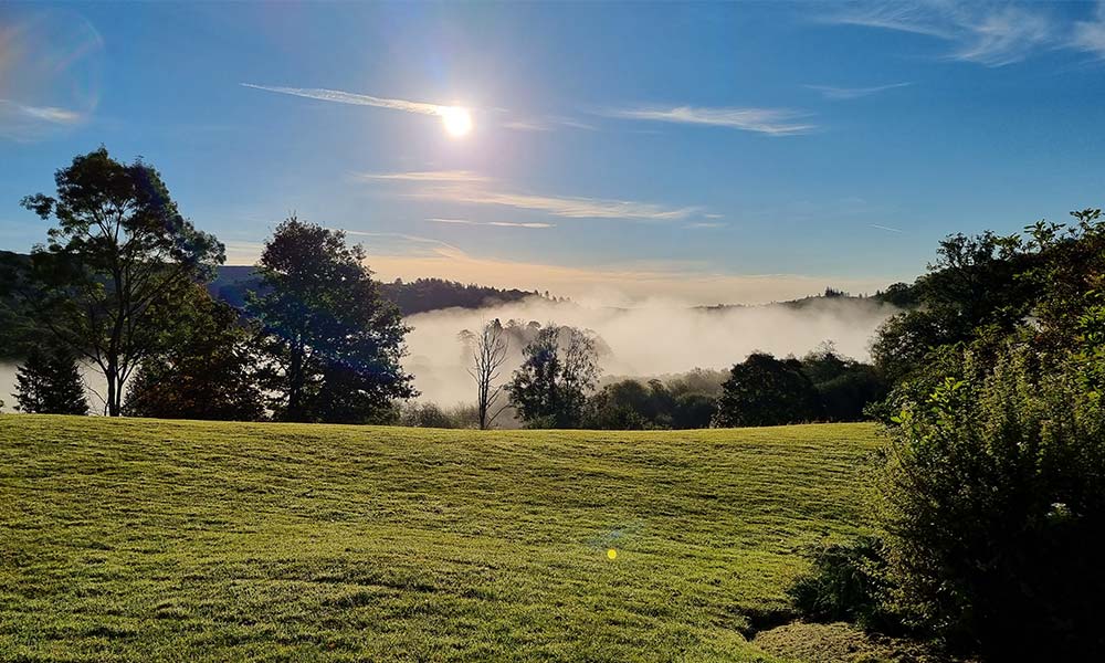
Low lying fog in Elterwater
There are many more difficult hikes and climbs in the Lake District but if you are looking for a short leisurely walk, then this route, at just over 2km in each direction, could be for you. The route takes you through meadows and woodland into a rocky gorge giving stunning views of the waterfall, Skelwith Force. The waterfall is of course most striking after heavy rainfall, but the route is worth it whatever the weather.
Starting from the back of the National Trust car park in Elterwater village, you take the wide stone path alongside the Great Langdale Beck towards the shores of Elterwater. The path continues through open meadows, into woodland, gradually drawing you towards the sound of the waterfall. Here you can take some steps down to take a closer look at the water pouring through the gorge and then it’s not much further until you reach Skelwith Bridge and a break for tea and cake at Chesters Café before the return trip.
3. High Willhays and Yes Tor, Dartmoor
Great for winter runs or brisk walks
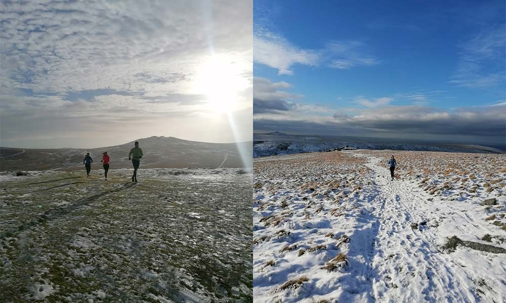
High Willhays in winter
Dartmoor is often boggy underfoot even during dry spells, however when it is colder this can freeze which makes it easier to run or walk on top of the frozen bog – but do take care! It rarely snows in the southwest as most areas are quite low and close to the warm seas. However, over the moors snow is much more common as the temperature is cooler higher up so it is more often below zero degrees. If following this route in winter, it’s a good idea to wear micro spikes or miniature crampons to make sure you don’t slip around.
The route starts from the Meldon Reservoir car park in Dartmoor. You then cross the dam that gives you fantastic views across the reservoir but also down the valley towards the Meldon Viaduct. From the reservoir you are then onto open moorland with the route heading almost straight up to Yes Tor (619m). You will cross the Dartmoor firing range boundary before you get to Yes Tor so you need to check the firing timetable to make sure you can enter. Red flags along the perimeter will warn you if the firing range is in operation and you shouldn’t continue.
From Yes Tor, it’s just along the ridge to High Willhays Tor, the highest Tor in Dartmoor (621m) before heading towards Great Links Tor and descending back down to the western side of Meldon Reservoir. It is often windier over high ground, this effect can be slightly underestimated on Dartmoor as it is more rolling than other national parks, but when you are standing on top of a Tor, you’ll certainly feel it! When out on the moor in winter, please be prepared and carry all the necessary kit you may need.
4. Pen Y Fan, Bannau Brycheiniog (Brecon Beacons) National Park
For the best views from the top, choose a clear day.
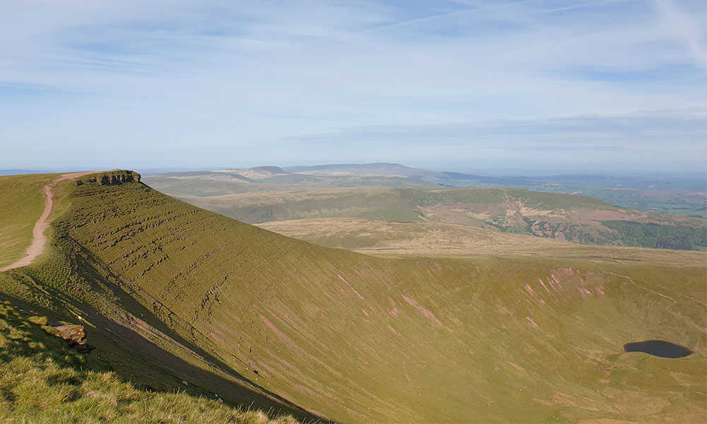
Views of Pen Y Fan
Pen Y Fan is South Wales’ highest peak at 886m/2906 feet above sea level and the Pont ar Daf car park is one of the most popular access points for climbing to the top. You also get two for the price of one as Corn Du, the second highest peak in South Wales at 872m/2864 feet sits alongside it. On a clear day the summits offer mesmerising views of the surrounding countryside. You’ll feel like you’re on top of the world! The Pont ar Daf car park is located straight off the A470 in the centre of the National Park. It is a National Trust car park so members can park for free, otherwise a daily charge applies.
Be careful as the path leading up is stony or gravelly and can be slippery when wet. There are also several narrow streams and channels crossing it which can be gushing with water after heavy rain. Equally after a prolonged period of dry weather the gravelly parts of the path can become loose.
As the route is popular there is a well-defined path, but it can get very busy, which can be a comfort to those who are less familiar with hill walking. However, if you are looking for a quieter walk, getting there earlier or later can be better to avoid the crowds. As with all hill walking, the weather you experience at the base can be vastly different from what is at the summit. Warm, clear conditions in the car park can be much cooler and windy up top. Always check the mountain forecast before setting off.
5. Weston Mouth, East Devon
Best on a sunny, calm spring or summer’s day, as the route can be exposed to the wind and rain.
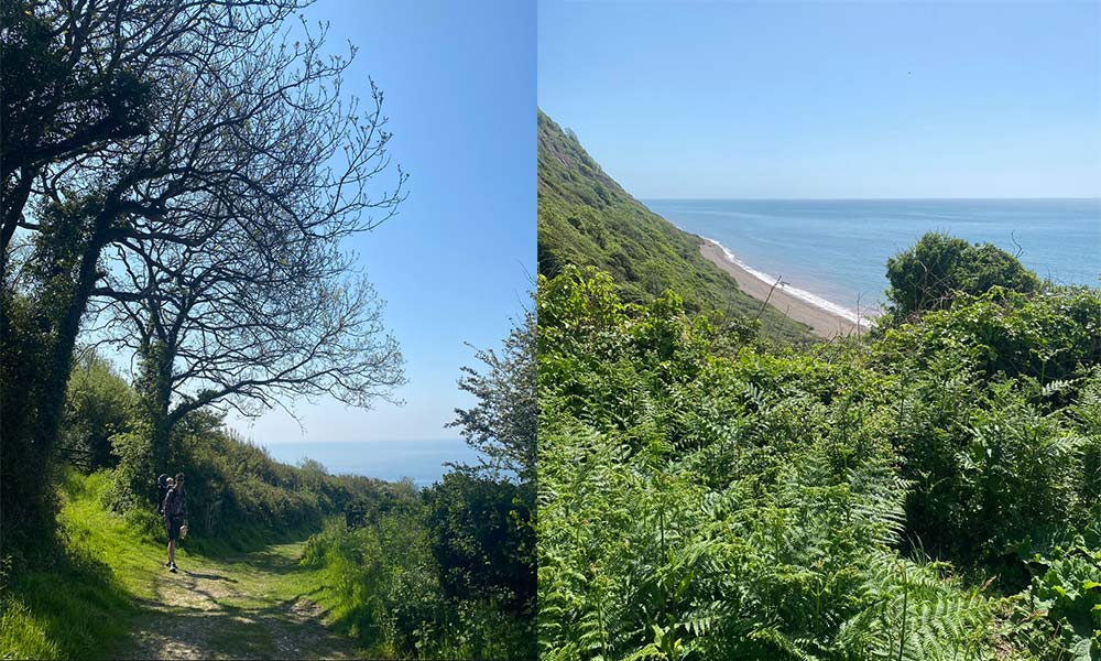
Weston Mouth, East Devon
Weston Mouth is a beautiful pebble beach in East Devon, which is only accessible by foot. It’s a great place to go to avoid the crowds, especially during the holiday season. This circular route starts from a carpark on the outskirts of the village of Weston, heading down to the beach and then back to Weston via Devon’s famous Donkey Sanctuary. The initial descent from the carpark is gentle, it then gets steeper as the route opens out onto fields, but the sea views are spectacular. The route intersects the Southwest Coast Path just before you arrive at the beach.
The first part of the route is sheltered by trees. Once it opens out on the descent towards Weston Mouth, the fields are much more exposed to the wind and the path becomes steeper. If the wind is coming from the south or southwest, which it often does in Devon, there will be nothing to protect you from the wind for a large part of this route. Best avoided if there are any wind warnings covering the area. The pebble beach can be completely empty during winter. It’s a great place to pause and watch the weather and the sea, which can get quite rough even on relatively calm days if there’s enough swell.
The return leg is slightly steeper and there are quite a few steps, which can be challenging for some, but the views looking back are very rewarding. During or after a spell of wet weather, especially during the autumn or winter, the steep paths on this route can become muddy and slippery. Bear this in mind and make sure you take sturdy, waterproof footwear.
You might encounter free-roaming horses on your way back and donkeys in the Donkey Sanctuary. You might like to stop here for hot drinks, ice cream or something more substantial from their café. After the Donkey Sanctuary, follow Slade Lane until you return to the carpark at Weston.
This route is perfect on a sunny and calm spring or summer’s day. However, make sure you protect yourself from the sun since a large part of the route is exposed and UV levels can be high or very high. Devon is one of the mildest parts of the UK in the winter and, with this route being so close to the moderating effect of the sea, snow and ice are relatively rare. However, snow and ice do still happen and could make the paths slippery.
6. Glen Tanar, Cairngorms National Park
Check the wind direction on the day before deciding whether to do the clockwise or anticlockwise route.
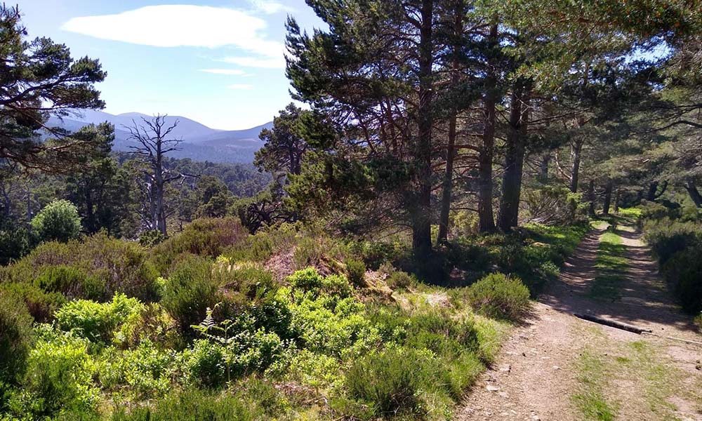
Glen Tanar, Cairngorms National Park
Explore the stunning Glen Tanar, Ballochan and Birsemore using two ancient trading routes, Firmounth Road and The Fungle.
The route starts and ends at a small car park (NO545963) but as an alternative could also be started from the small Ballochan car park (NO532906). If you are looking to shorten the walk, then this could be done by traversing the Hill of Duchery (NO503914).
The route reaches a modest elevation and stays below the tree line for much of its northern portion, making this a good choice for good and poor weather days alike. Although the tracks are seldom used in winter and can hold significant snow drifts, making progress arduous.
It’s best to check the wind direction and speed for the day as the route is fairly exposed above the treeline. It might be better to travel clockwise around the route if the winds are from the south, or anticlockwise if the winds are from the north. The highest point of the route reaches 731m at the summit of Gannoch. On its southern extent, you will briefly pass the Slochd, the watershed between the Dee and Esk catchments to the north and south respectively.
7. Linn of Dee to Ben MacDui, Cairngorms National Park
Great for summer walks and best suited to experienced walkers.
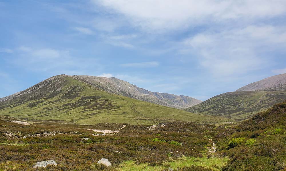
Ben MacDui, Cairngorms National Park
This is a quieter route up to the second highest summit in the UK, Ben MacDui, which is also the highest of the Cairngorm mountains at 1,309m starting from the Linn of Dee car park. It takes in the beautiful remote Glen Luibeg, along with the additional Munro of Derry Cairngorm.
From the car park you follow the banks of the Liu Water to Derry Lodge, a disused shooting lodge, before heading up through the remote Glen Luibeg, taking in the beautiful views of Càrn a’ Mhàim, Devil’s Point and Lochan Uaine (which translated from Scottish Gaelic is Green Tarn), before reaching the summit of Ben MacDui. It is possible to cycle to Derry Lodge which can save a bit of time and energy. There’s a stream (NO 011957) which is the last reliable water source before descending towards Loch Etchachan.
As you head on to take in the additional Munro of Derry Cairngorm at 1,155m you pass Loch Etchachan a remote freshwater loch and the highest water body of its size in the UK, the surface being 927 metres above sea level. On a warm day it would be tempting to jump in and cool off but do take care. Although the water may look calm and inviting, there can be many hidden dangers from underwater obstacles to the water being icy cold even in summer, which could lead to cold water shock. As you head back, the stream (GR NO 003995) is the last water source before Derry Lodge. The route crosses the Cairngorm Plateau close to steep cliffs so good navigation skills are essential, especially if visibility becomes poor.
Our seasons offers a unique experience in the outdoors; from snowcapped mountains to rushing waterfalls. Some routes are better suited to certain types of weathers, to help you stay safe or enjoy the scenery at its finest.
Before setting off on a walk or run, check the weather forecast and have a think what the route may be like. Is it suitable for that type of weather? Will you enjoy it if exposed to the elements? Do you have all the kit you need? We hope these seasonal routes have highlighted the impacts weather can have on your time outside and the importance of choosing the best route for the conditions.