Follow the Two Blondes as they explore the dramatic countryside around the Two Moors way and Bowerman’s nose in Dartmoor – while being followed by a film crew for ITVs Britain’s Favourite Walks
The Two Moors Way is a 102-mile walk that takes in the contrasting terrain of Devon’s two wonderful National Parks, Dartmoor and Exmoor. The walk starts (or ends) at Lynmouth, which is on the North Devon Coast and within the boundaries of Exmoor National Park and ends (or starts) at Ivybridge on the southern edge of Dartmoor National Park. Most of the Two Moors Way is well sign-posted and, when wandering around either Dartmoor or Exmoor, you will often find yourself walking along a section past the distinctive Two Moors Way two M’s sign.
This walk takes in a short section of the Two Moors Way across the top of the Hamel Down Ridge (which is packed with history ) above Dartmoor’s picturesque Widecombe in the Moor. We have made it into a circular route that takes in some of our favourite Dartmoor locations. We had great fun filming the route for ITV’s Britains 100 Favourite Walks Britain’s Favourite Walks: Top 100 and are very excited that so many other walkers appreciate our very favourite walking location. There are many interesting things to see along this fascinating route, we have even had a giant’s chair and giant’s ladder for a while, but we have chosen four permanent highlights to keep you walking.
Location One – Bowerman’s Nose SX742805
If you walk about a kilometre along the lane from the Hound Tor car park and look up to your right, you might see a giant gazing out over the landscape. This is Bowerman’s Nose, one of Dartmoor’s most well loved rock formations. Legend has it that Bowerman was a hunter who was turned into stone after driving his hounds right through a coven of witches. We Blondes love visiting Bowerman’s Nose so much that Fi wrote a children’s story about a boy called Thomas and his adventures with Mr Ignatius Bowerman. ‘The Non-Story of Ignatius Bowerman’ is a tale for map lovers and adventurers and is guaranteed to get youngsters out exploring Dartmoor.
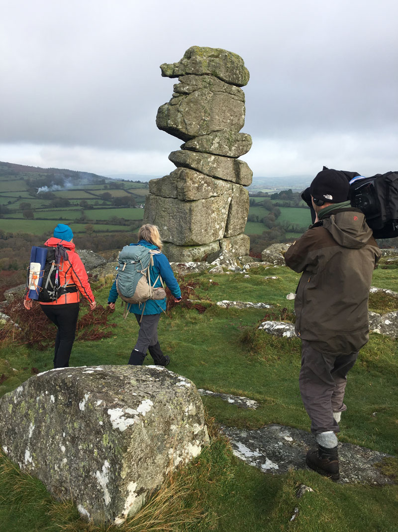
Bowermans Nose and the Two Blondes – © Chris Simpson
Location Two – (Kitty) Jay’s Grave SX732798
Poor old Kitty Jay had a sad life. She fell in love with a farmer’s son but was rejected by him when he found out that she was expecting a baby. So ashamed was Kitty that she took her own life and was buried at a crossroads so that her soul couldn’t find its way back to the village. Kitty Jay is, perhaps, better loved now than she was in her lifetime because her grave always has flowers on it… and nobody knows who puts them there.
Location Three – Grimspound SX 700807
Even if you aren’t interested in Bronze Age history, you can’t fail to get excited as you walk into the Grimspound enclosure, through the stone, circular boundary wall. Inside you will find the walls of several round huts and it is easy to sit inside one and imagine what life must have been like on that lonely but beautiful hillside. As you gaze west from Grimspound, across towards the high moor, you get a real sense of the wilder side of Dartmoor and might even spot a pub whose fire has been burning since 1845.
Location Four – Widecombe in the Moor SX718767
If you haven’t heard of Widecombe then you probably don’t know the famous song about Tom Pearce and his grey mare. Tom Pearce and all of his friends (including Old Uncle Tom Cobley and the grey mare) still appear at Widecombe Fair every September but even if you don’t arrive in September, Widecombe has everything a walker needs with pubs, cafes, a picturesque church and even a legend about the devil. All just in time to help you with that final uphill push towards Hound Tor.
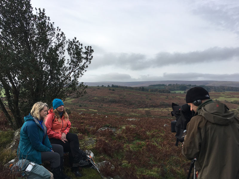
Filming for the program – © Chris Simpson
You can find the route on OS Maps here.
Britain’s Favourite Walks: Top 100 is being broadcast on 30 January at 7.30pm. You will also be able to find the complete list of walks with links to each route here.