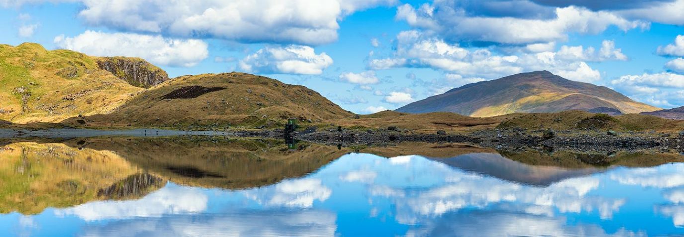
The Solent Way – 60 Miles of Hampshire Coastline
Discover one of England’s most scenic long-distance footpaths – the Solent Way. Stretching across Hampshire’s stunning coastline, this 60-mile trail offers castles, nature reserves, seaside towns, and ferry crossings. Whether you’re planning a weekend escape or a multi-day adventure, this guide has everything you need to walk the Solent Way with confidence.
What is the Solent Way?
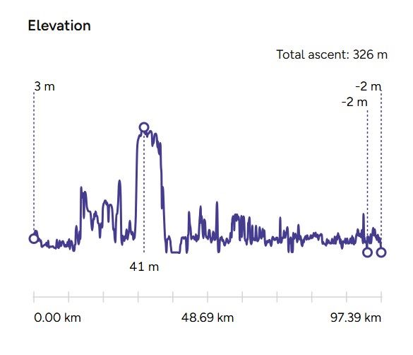
The Solent Way is a 60-mile (97 km) long-distance footpath that follows the Hampshire coast from Milford-on-Sea to Emsworth, tracing the shoreline of the Solent. The Solent is the strait that separates mainland England from the Isle of Wight.
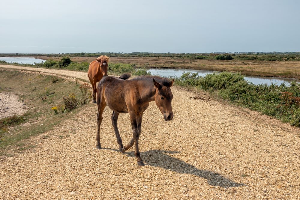
It’s a flat, well-waymarked trail, ideal for walkers of all abilities, and easily accessible by public transport. Along the way, you’ll pass through historic towns, nature reserves, castles, and coastal marshes, with plenty of opportunities for detours and day walks. Plus you might come across some of the famous New Forest Ponies
Solent Way Interactive Map
- Start: Milford-on-Sea
- End: Emsworth
- Distance: 60 miles (97 km)
- Terrain: Coastal paths, promenades, woodland, marshes
- Waymarking: Follw the Green diamond path on OS Maps
- Transport: Train stations at both ends, ferry crossings at Hythe and Gosport

EXPLORE THE
OS Shop
We are with you every step of the way. Shop our trusted walking and hiking maps and guidebooks so you can explore the outdoors with confidence.
Go to the shopThe Solent Way – OS Paper Maps
Suggested Solent Way Stages
Stage 1: Milford-on-Sea to St Leonards
Distance: 22.4 km
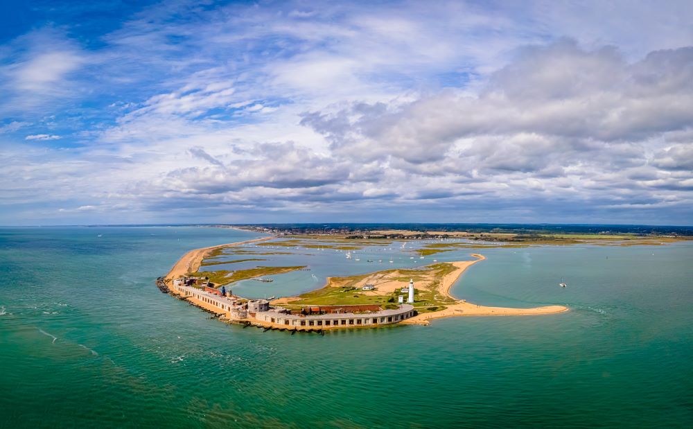
Start at the seaside town of Milford-on-Sea Walk along the shingle spit to Hurst Castle, built by Henry VIII in 1544 to defend the western Solent
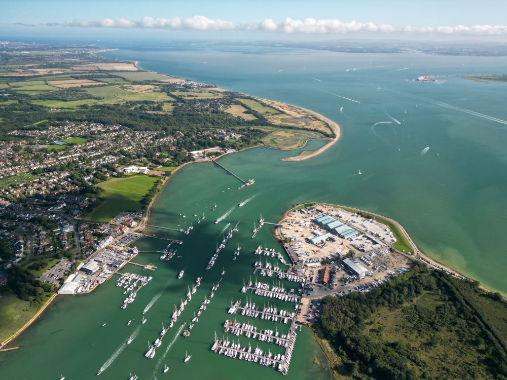
Pass through the Lymington-Keyhaven Nature Reserve, a haven for wetland birds and rare species like lagoon shrimp and starlet sea anemone
Arrive in Lymington, a historic yachting town with cobbled streets and Georgian architecture
Stage 2: Beaulieu to Southampton
Distance: 20.1 km
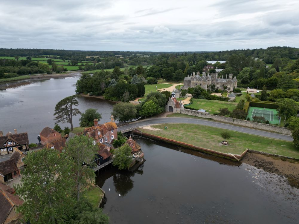
Walk through Buckler’s Hard, a preserved shipbuilding village on the Beaulieu River.
Visit Palace House and Beaulieu Abbey, a 13th-century monastic ruin
Finish in Southampton, a city rich in maritime history
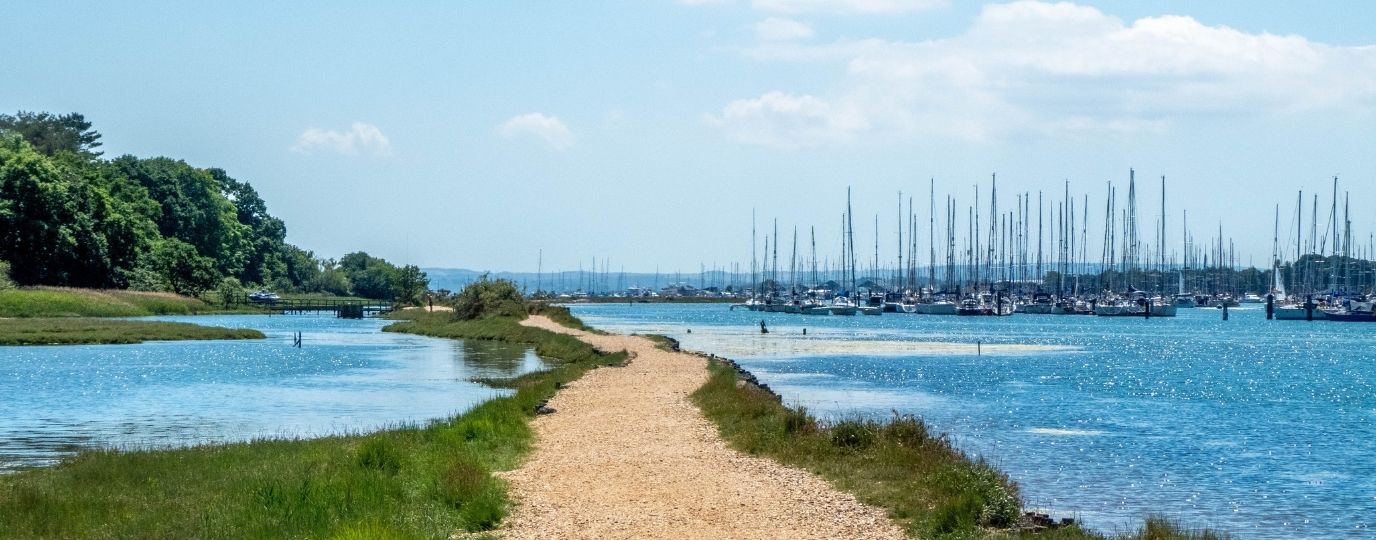
Stage 3: Southampton to Solent Breezes (Fareham)
Distance: 14.1 km
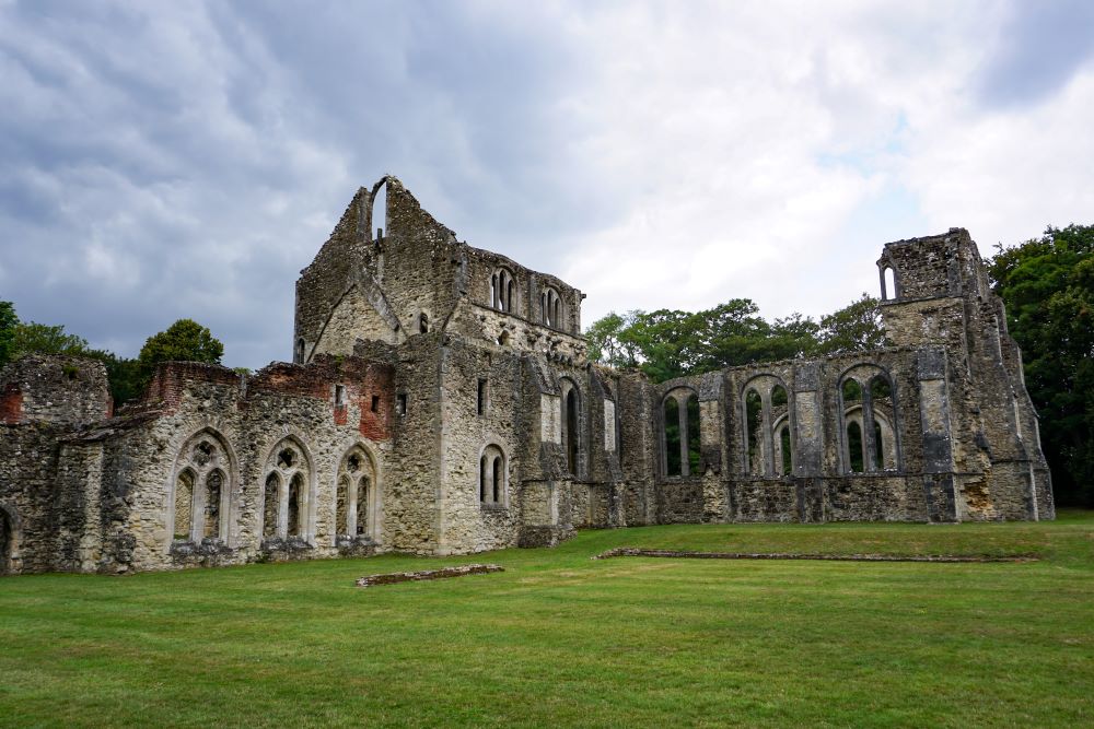
Follow the shoreline past Netley Abbey, the most complete surviving Cistercian monastery in southern England
Enjoy views across Southampton Water and then cross the Hamble Estuary to Warsash on a little pink ferry!
Reach Solent Breezes near Fareham, a beautiful stretch of beach
Stage 4: Solent Breezes to Portsmouth
Distance: 21.8 km

Cross the River Meon and walk through Gosport, home to naval museums and historic forts. Take a ferry across Portsmouth Harbour and keep a look out for the impressive HMS Warrior, the crown jewel of the Victorian Navy.
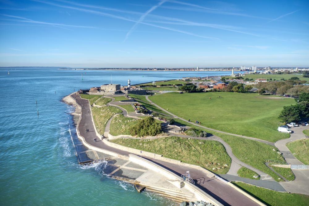
Arrive in Portsmouth, where you can visit Portsmouth Cathedral, and Southsea Castle, built by Henry VIII
Stage 5: Portsmouth to Emsworth
Distance: 20.3 km
Walk through Langstone Harbour, an internationally important wetland excellent for birdwatching
Finish in Emsworth, a charming coastal town with a rich maritime heritage
Trains & Ferries
Train stations at Milford-on-Sea, Southampton, Portsmouth, and Emsworth
Ferries at Hythe, Hamble Le Rice and Gosport
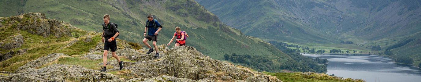
If you’re looking for long distance footpath to challenge yourself take a look at our complete list – Long Distance Footpaths in the UK
Planning a long distance walk
There’s nothing more exciting than heading out the door on an adventure, especially walking a long-distance path. Here’s everything you need to know to walk one of Britain’s National or Regional trails or, plan your own multi-day route.

Best British long-distance walks
If there’s one thing Britain excels in, it’s long-distance walks. We’ve taken some of the best lesser-known routes from the book, Epic British Walks, to help you plan the hike of your dreams. Find route information and suggestions for day trips.

UK 24 Hour Mountain Challenges – Distances & Ascents
A list of the UK’s most iconic 24hr hiking challenges – how many have you conquered?
EXPLORE THE
OS Shop
We are with you every step of the way. Shop our trusted walking and hiking maps and guidebooks so you can explore the outdoors with confidence.
Go to the shop