A 100-mile walk through the Brecon Beacons (Bannau Brycheiniog)
The Beacons Way is a 100-mile-long distance footpath, that transverses through the centre of the Brecon Beacons (Bannau Brycheiniog) National Park in South Wales. OS Champion Tracy Purnell takes us on a whistle-stop tour of the top spots along the way.
The Beacons Way is a 100-mile-long distance footpath, that transverses through the centre of the Brecon Beacons (Bannau Brycheiniog) National Park in South Wales. The route begins at the market town of Abergavenny to the far East and ends in the village of Llangadog to the west, on the outskirts of the park. Follow the route in OS Maps here.
This long-distance footpath travels through some of the most diverse landscape and offers something to suit everyone. It can be split into sections and walked over several days, there are many types of accommodation along the route to suit all.
Beacons way is such a diverse experience, whether walking, trail running, mountain biking or horse riding. It passes through historic towns and villages, with some of the most beautiful castles and scenic canals. Navigate your way over vast open moorland and experience the beautiful waterfalls nestled between the sculptured mountain ranges.
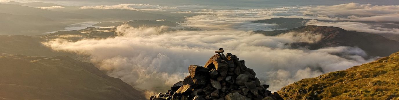
It is home to some of the most picturesque reservoirs and lakes and you will travel above huge cave systems, one of which is the longest in wales and the deepest within the UK. It offers some of the most dramatic landscapes with breath taking views.
The Beacons way is rich with wildlife. The Red Kite is a common sight soaring overhead, scouring the landscape for their next meal.
Other birds of prey that you may see while walking the Beacons way are Buzzards, Peregrine Falcons and Kestrels. Red Grouse can be seen on the uplands in the eastern area of the national park.
The low land areas are great for spotting the Bullfinch, Pied Flycatchers, Yellow Hammers and Owls at dusk. Kingfishers can be found along the streams, rivers and canals. The Heron is also a common sight around waterways of the park.
The Beacons Way starts at Abergavenny Castle to the east of the National Park. Abergavenny is a market town which is promoted as ‘The gateway to Wales’ and provides good accessibility to the Black Mountains, the introduction to the Beacons way. Abergavenny castle was established around 1087, although now in ruins it is very beautiful and home to a museum. Abergavenny was once a Roman fort, guarding the road and valley of the river Usk in the late 2nd century AD.
On completion of the Beacons Way a total of 28,000 ft of elevation will have been achieved. The Black Mountains to the east of the National Park include the Skirrid Fawr (known locally as The Skirrid, The Holy Mountain or The Scared Hill). The old red sandstone ridge runs from south to north with a collapsed western side due to ice age land slips. An iron age hill fort and medieval chapel lie at the summit.
The climb to Hatterrall Hill ridge forms a border between England and Wales and boasts 360 views of patchwork farmland and sculptured mountain ranges, before the path gently descends to Llantoney Priory in the Vale of Ewyas.
Bal Bach and Crug mawr are climbs that will take you over 500 meters each and the views showcase the Black mountains perfectly. Table Mountain (Crug Hywel) is a flat-topped mountain, its summit is completely taken up by a Celtic iron age hill fort and over looks the town of Crickhowell.
The Beacons Way passes through quaint historic villages and Llangynidr is one such village. The route passes over the River Usk via an 18th century six arch stone bridge. It then runs alongside the Brecon and Monmouthshire canal until Llangynidr lock where a small iron bridge leads you through a wooded area ascending fields and farmland to the base of Tor y Foel and the Brimore Tramroad. Glancing behind as the path lifts you onto the ridge, the views of Crawnon valley are breath taking.
As the path descends into the next valley Talybont reservoir comes into view, nestled between the shapely tree covered hills, it’s the largest still water reservoir in the Brecon Beacons.
![]()
The Central Beacons has to be the most visited area of the Brecon Beacons National Park. Home to Pen-y-Fan the highest peak in southern Britain it really flaunts the most striking and dramatic sculptured mountain ranges.
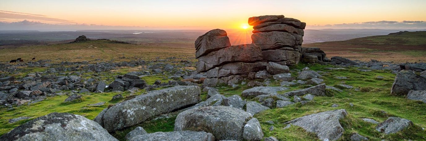
The Fforest Fawr area of the National Park was the first geopark in Wales. It is an UNESCO site of scientific interest. It is home to vital habitats for rare birds, insects, plants and lichens. It has the most impressive waterfalls and the deepest cave in the UK. This area is quite remote passing through Craig Cerrig Gleisiad and Ogof ffynnon Ddu nature reserves.
![]()
The western area of the Brecon Beacons National Park is the most remote area of the park. Passing through only two small villages. Llanddeusant lies just below the glacial lake of Llyn Y Fan Fach.
There is an alternative low-level route of the Beacons Way footpath which runs directly below the spectacular escarpments of the western beacons, snaking its way along side the river bank and leading towards one of the largest glacial lakes in southern wales, Llyn y Fan Fawr. The name translates as lake of the big peak, which refers to Fan Brycheiniog, the highest peak of the Black Mountain Range.
The Beacons Way passes by Carreg Cennan Castle, which translates as castle on the rock. It looks quite magnificent perched up high on a limestone precipice. It has been in ruins since the 1400’s, however it is still a spectacular sight.
Garn Goch is one of the largest iron age hill forts in wales, Beacons Way travels directly over the top of this iron age settlement and into a small farming village of Bethlehem, before reaching the village of Llangadog and the end of the Beacons Way.
Good navigational skills are essential for many parts of this route. There is little in the way of signage especially in the western area of the park. The remote areas of open moor land have little or no GPS signal, so a map and compass and the ability to use them is a must.
Follow the full route in OS Maps that Tracy took here.
Please note that the route was revised in 2016. Previous versions are shown on older OS paper maps. Find out more about the Beacons Way here.
Check out these Brecon Beacons guides for more inspiration of what to see at do in the area.
By Tracy Purnell
Tracy Purnell – OS Champion
Meet OS Champion Tracy Purnell – dog lover, trail runner and Brecon Beacons National Park Ambassador.