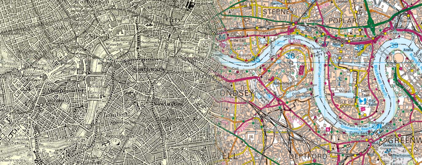
Britain’s Past and Present – 1890s vs 2020s OS Maps
Have you ever wondered what some of the most well-known areas of Britain used to look like?
We live on a fast moving, ever-changing but ultimately fascinating island. Over time, we’ve worked on acres of green and pleasant farmland, and been at the forefront of the industrial revolution. Our cities and towns have been scarred by bombs and new towns have been developed to cater for the always expanding population. We’ve experienced coastal erosion, road constructions and demolition. We’ve seen sprawls, reclamation and gentrification. How, though, has this altered what the landscape looks like?
With over 230 years of mapping Britain, Ordnance Survey has captured the evolving story of our landscape through countless maps. Now available on our shop, the Revised New Edition series, an extraordinary collection of vintage maps from 1896-1904, offers a fascinating glimpse into the past. We’ve selected some of our favourite towns and cities and placed these historic maps side by side with their modern counterparts to reveal how much has changed over the last 120 years.
London
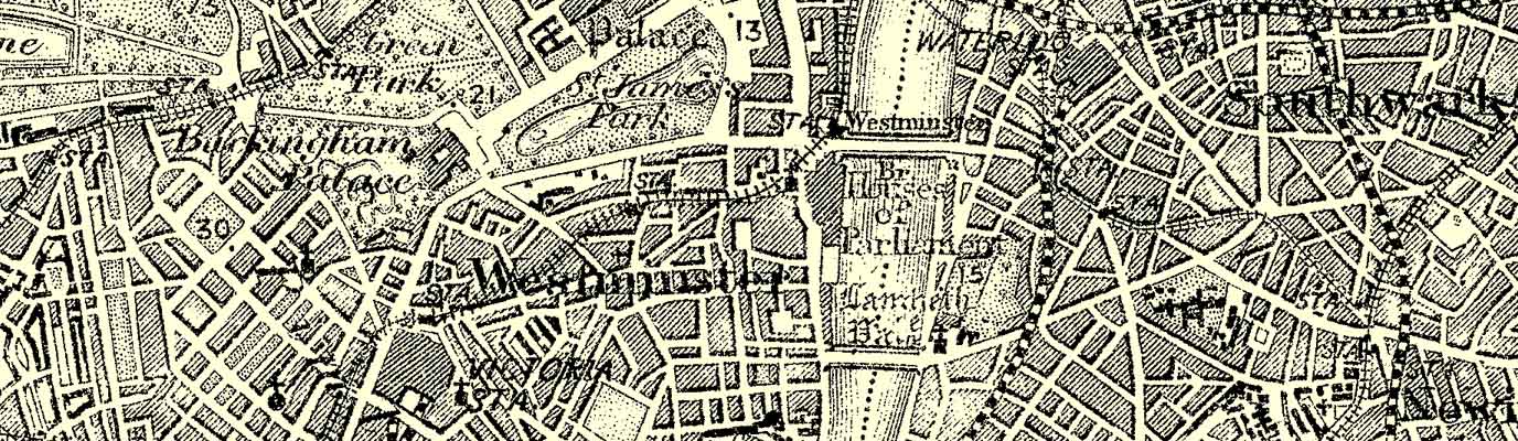
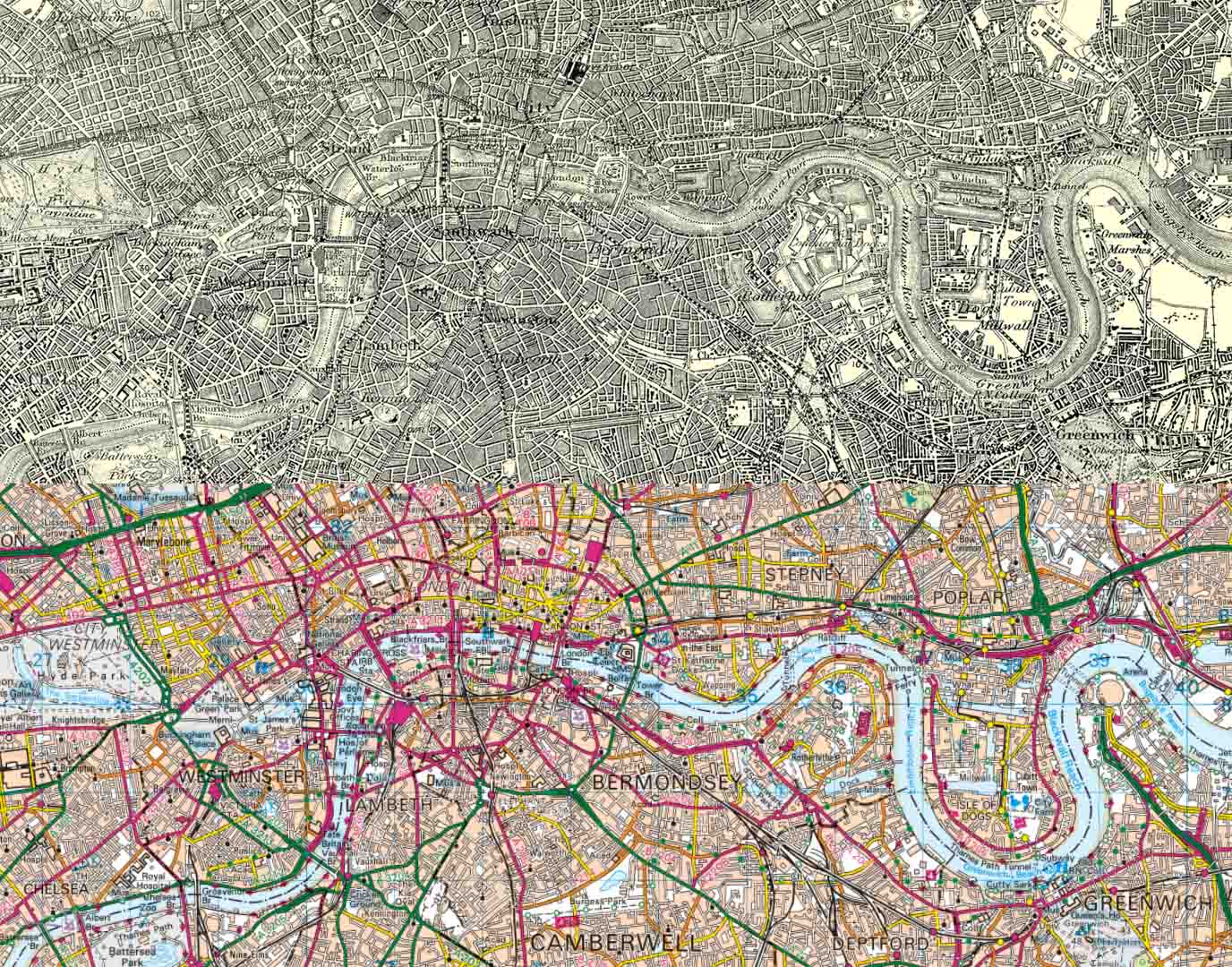
As a capital city, London is forever changing and developing before our eyes. In the early 20th century, it was the heart of the British Empire. The city endured two World Wars, with the Blitz of 1940–41 leaving deep scars and prompting widespread rebuilding. Post-war London saw the rise of council estates, the decline of industry, and the expansion of the welfare state. The 1960s brought cultural revolution, while the late 20th century ushered in financial deregulation and the rise of Canary Wharf.
To see how London looked over a 100 years ago on the ground, take a look at an extensive collection of photographs. Our map from the turn of the 20th century shows that London was already a bustling metropolis, much like today, but there have been a few changes.
Key differences you can see in the side by side maps:
- The development of Canary Wharf
- Construction on the Greenwich Marshes of The O2
- The construction of buildings on the Surry Commercial Docks
Southampton
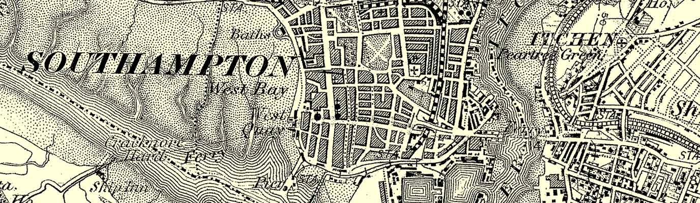
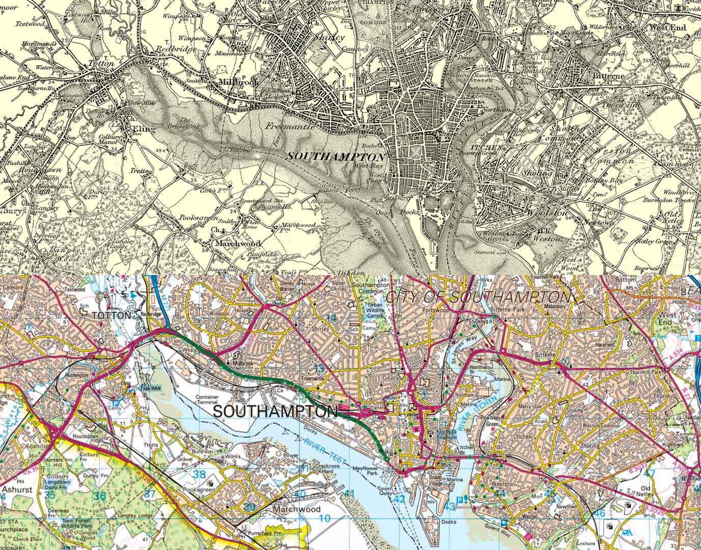
Since the early 1900s, Southampton has evolved from a bustling Edwardian port into a modern maritime city. In the early 20th century, it was a key departure point for transatlantic liners, including the ill-fated Titanic in 1912. The city suffered heavy bombing during World War II, which reshaped its historic centre and led to extensive post-war redevelopment. The decline of traditional shipping gave way to containerisation and cruise tourism, with the port remaining central to its identity and expanding to meet demand.
For a visual history of Southampton take a look at some photos of Southampton’s main shopping street, Above Bar as it has changed over 120 years.
Key differences you can see in the side by side maps:
- Development of the banks and land reclamation of the River Test
- Expansion of Totton, Shirley and Milbrook
- New trunk roads, such as one crossing the River Itchen

EXPLORE THE
OS Shop
We are with you every step of the way. Shop our trusted walking and hiking maps and guidebooks so you can explore the outdoors with confidence.
Go to the shopSheffield
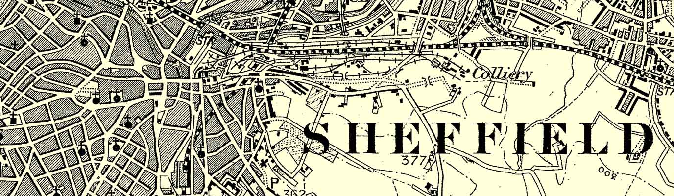
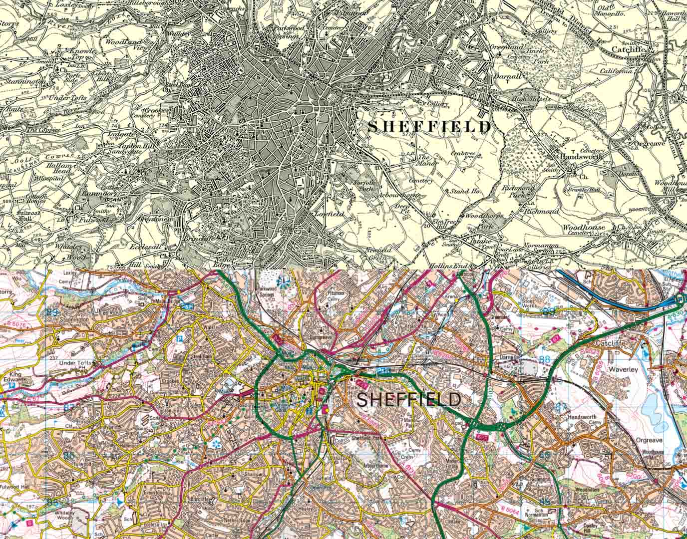
Sheffield played a central role in the Industrial Revolution and gained worldwide renown for its steel production, as factories and forges dominated the landscape. To ensure a sufficient water supply for the growing population, engineers constructed reservoirs and dams. Tragically, when one dam burst in 1864, it caused the e Great Sheffield Flood, destroying parts of the city and claiming many lives. Overtime, the ‘City of Steel’ has bounced back and is now a vibrant place with investment in green spaces while preserving its industrial heritage through museums, repurposed buildings, and public art.
If you’d like to see just how Sheffield has changed over the years, there are plenty of fascinating videos available on YouTube.
Key differences you can see in the side by side maps:
- Substantial urban sprawl, especially to the southeast
- More green spaces within the centre of the city
- Multiple new trunk roads created
Bristol
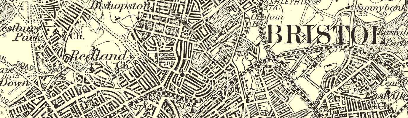
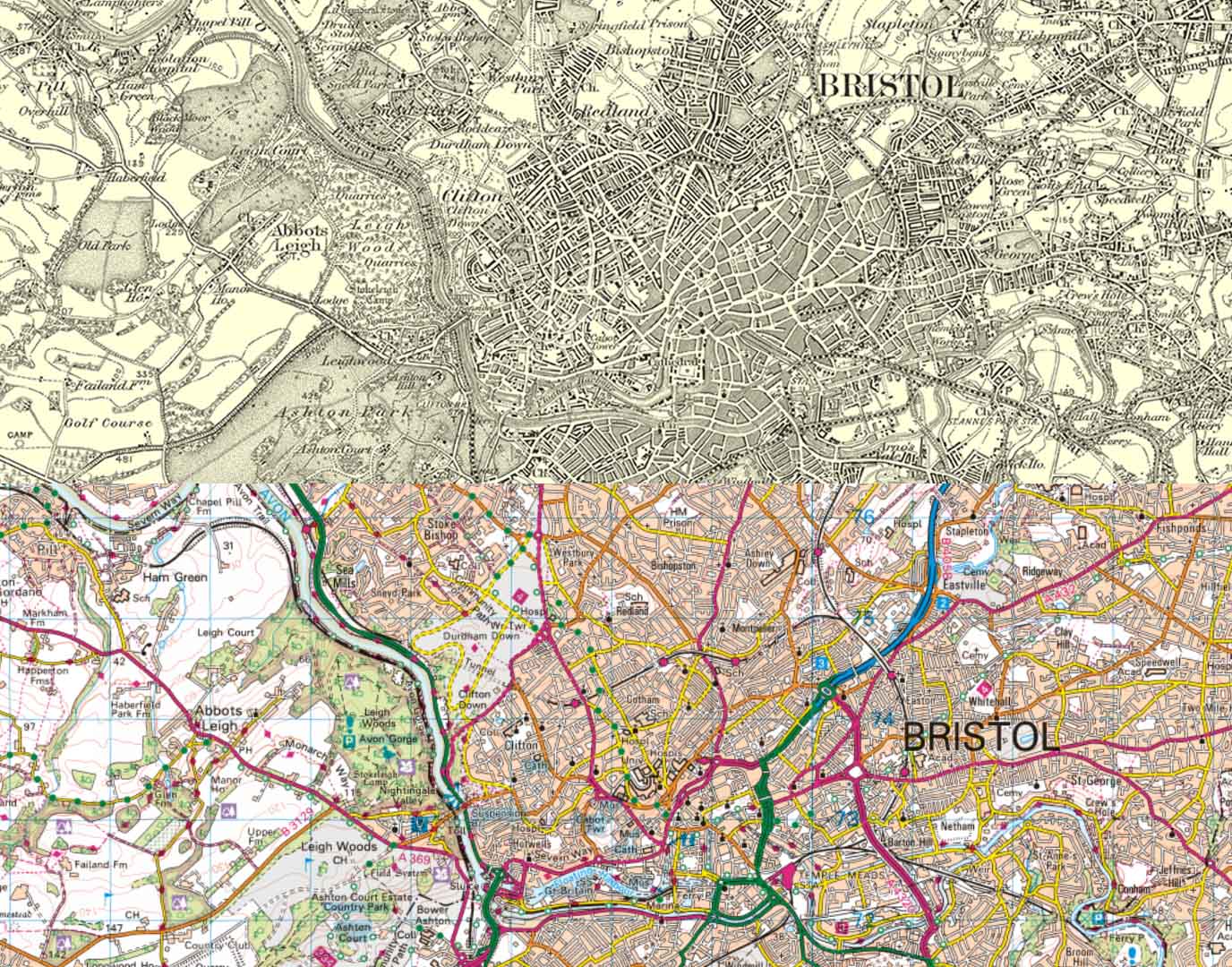
Since the early 1900s, Bristol has shifted from a thriving Edwardian port city to a dynamic centre of culture, innovation, and maritime heritage. In the early 20th century, its docks were vital to trade and industry, though its role in the transatlantic slave trade cast a long historical shadow. During World War II, Bristol suffered extensive bombing, which reshaped much of its historic architecture. Post-war redevelopment and the decline of traditional shipping led to urban renewal, especially around the harbourside.
Have a look at some old photographs of Bristol to see how it looked over the 20th century.
Key differences you can see in the side by side maps:
- The building of the M32
- Additional bridges over the River Avon
- The River Frome was more visible running through the city
- Urban sprawl to the east
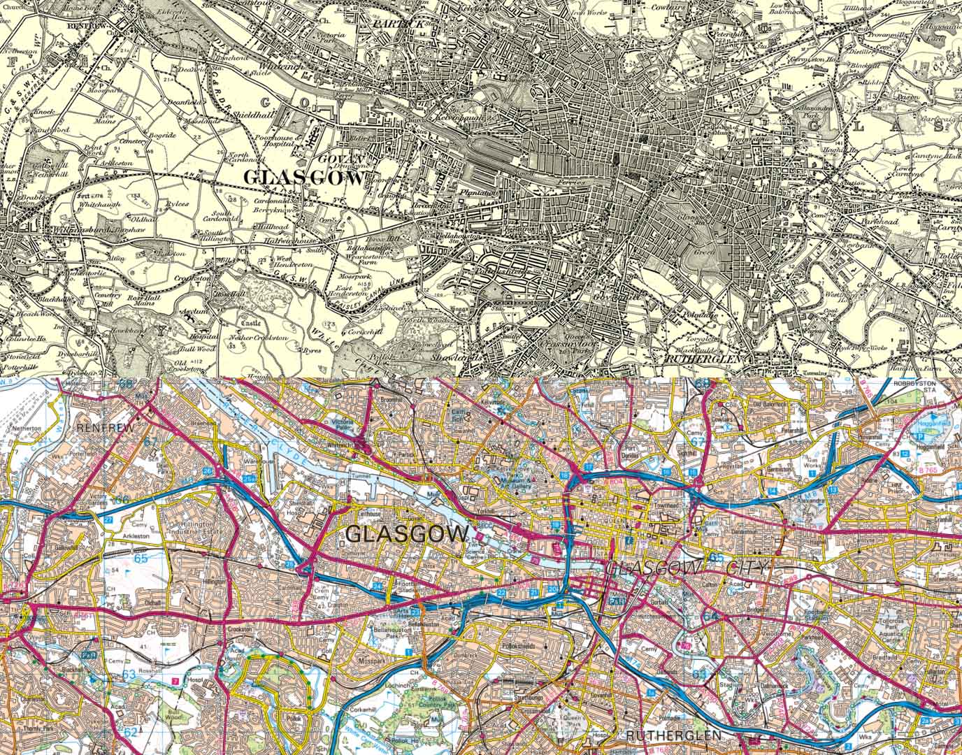
Glasgow
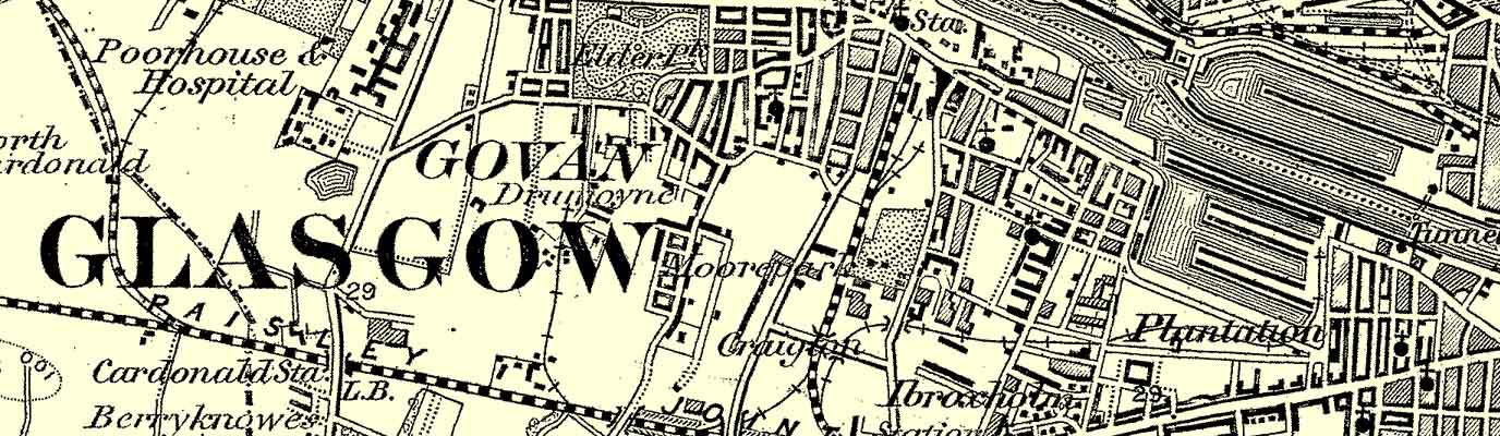
By comparison, Glasgow has changed noticeably. Since the 1900s, Glasgow has transformed from a booming industrial city into a vibrant cultural and academic hub. In the early 20th century, it was one of the world’s leading shipbuilding and engineering centres, with the River Clyde at the heart of its global trade. The city played a crucial role during both World Wars, supplying ships and munitions. Post-war decline in heavy industry led to economic challenges and urban decay, but also sparked major regeneration efforts.
What was once a small, riverside settlement has grown into the largest city in Scotland. In recent years, it has seen many urban renewal developments which have moved people to the outer districts, plus numerous changes to the city’s boundaries. Well over a third of Scotland’s total population reside in and around Glasgow.
To discover old photos and footage of Glasgow, head over to YouTube for a view into Glasgow’s past.
Key differences you can see in the side by side maps:
- New major roads into and through the city, including two motorways
- Urban spawl, especially to the north and south of the River Clyde
- The addition of docks along the River Clyde
Buy Old Ordnance Survey Maps – Printed on Premium Quality Paper – Great for Gifts!
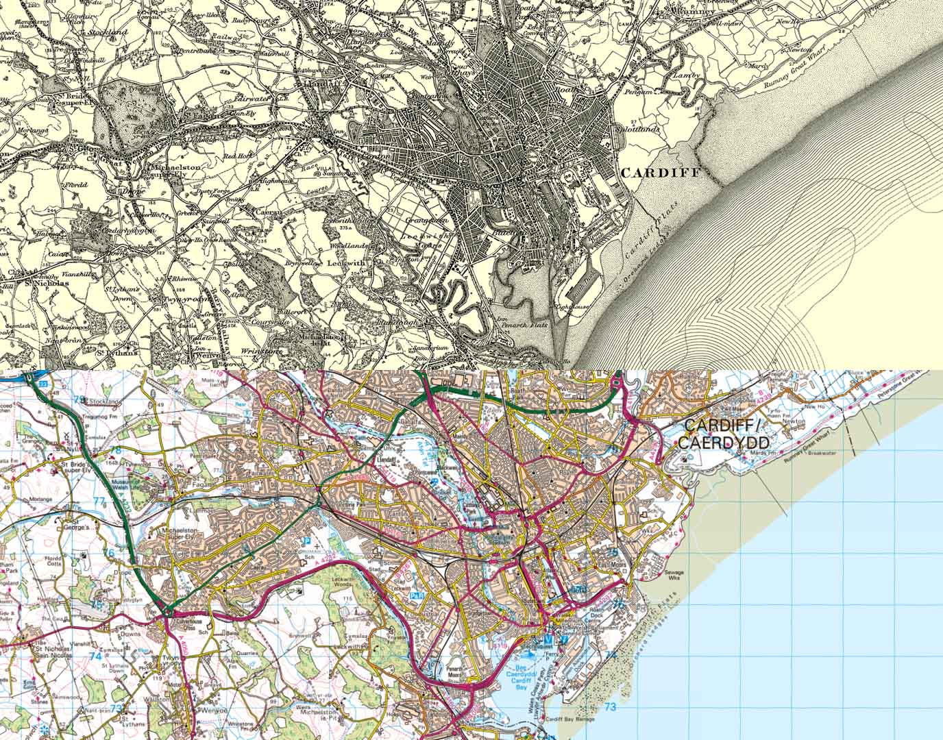
Cardiff
In the early 20th century, Cardiff was one of the world’s busiest docks, central to the global coal trade. The decline of heavy industry after World War II led to economic challenges, but also paved the way for regeneration. Cardiff was officially declared the capital of Wales in 1955, marking a shift toward political and cultural prominence. The late 20th and early 21st centuries saw major redevelopment, including the transformation of Cardiff Bay (with more change to come in the future) and the construction of the Senedd and Millennium Stadium.
If you’d like to see what Cardiff looked like though the years, take a look at this historical archive of photographs.
Key differences you can see in the side by side maps:
- The expansion of the Cardiff docks and changes to Cardiff Bay
- The regression of the Cardiff Flats
- The change to the mouth of the Afon Taf (River Taff)
- Expansion of the docks
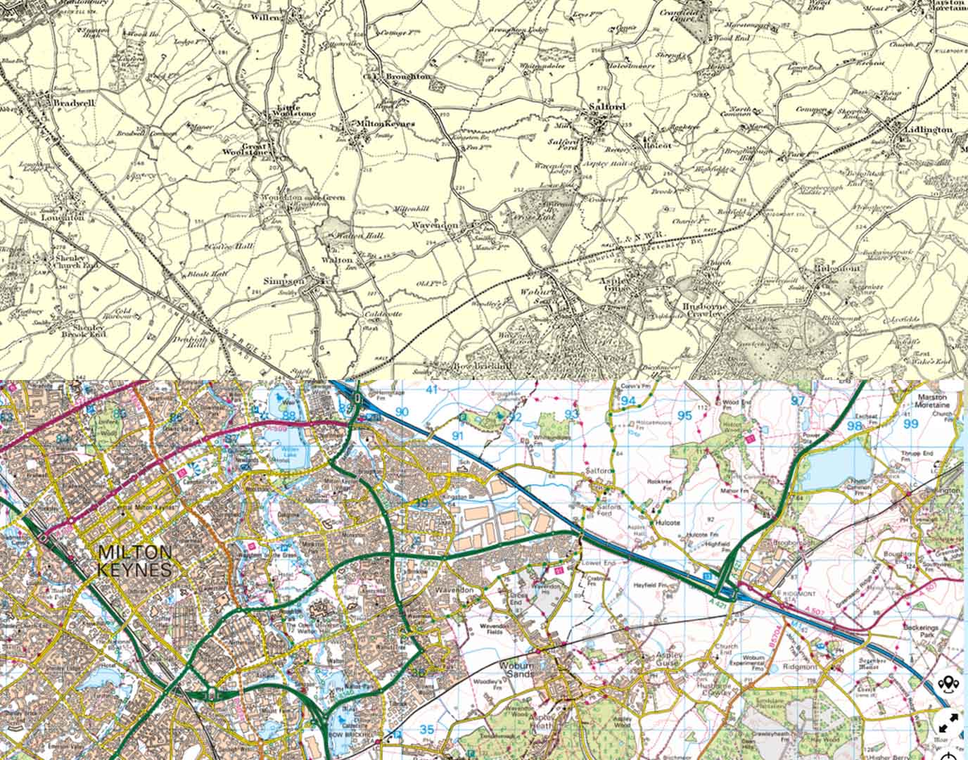
Milton Keynes
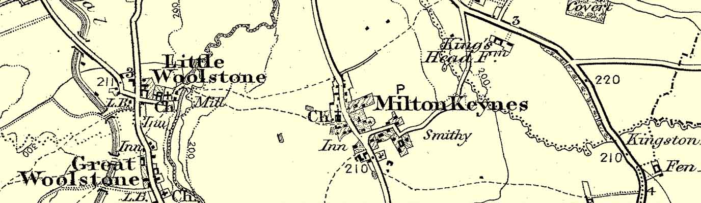
Milton Keynes was one of several ‘new towns’ created in the 20th Century with the aim of housing thousands of people. Though there are said to have been human settlements in the area from Palaeolithic times, Milton Keynes has risen from rural farmland to a purpose-built city, designed in the 1960s to ease housing pressure in London. Unlike older cities, its development was planned with modernist ideals such as wide roads, grid layouts, and abundant green spaces. Vertical roads are ‘streets’ and horizontal ones are ‘way’. It’s probably now best known for its roundabouts, concrete cows and popular indoor snow sports complex.
Why not travel back to the 1960s and the beginning of the city, and watch some fascinating Pathé footage of Milton Keynes.
Key differences you can see in the side by side maps:
- The city wasn’t there in the early 1900s
- The creation of lakes
- The M1 as a direct route into London
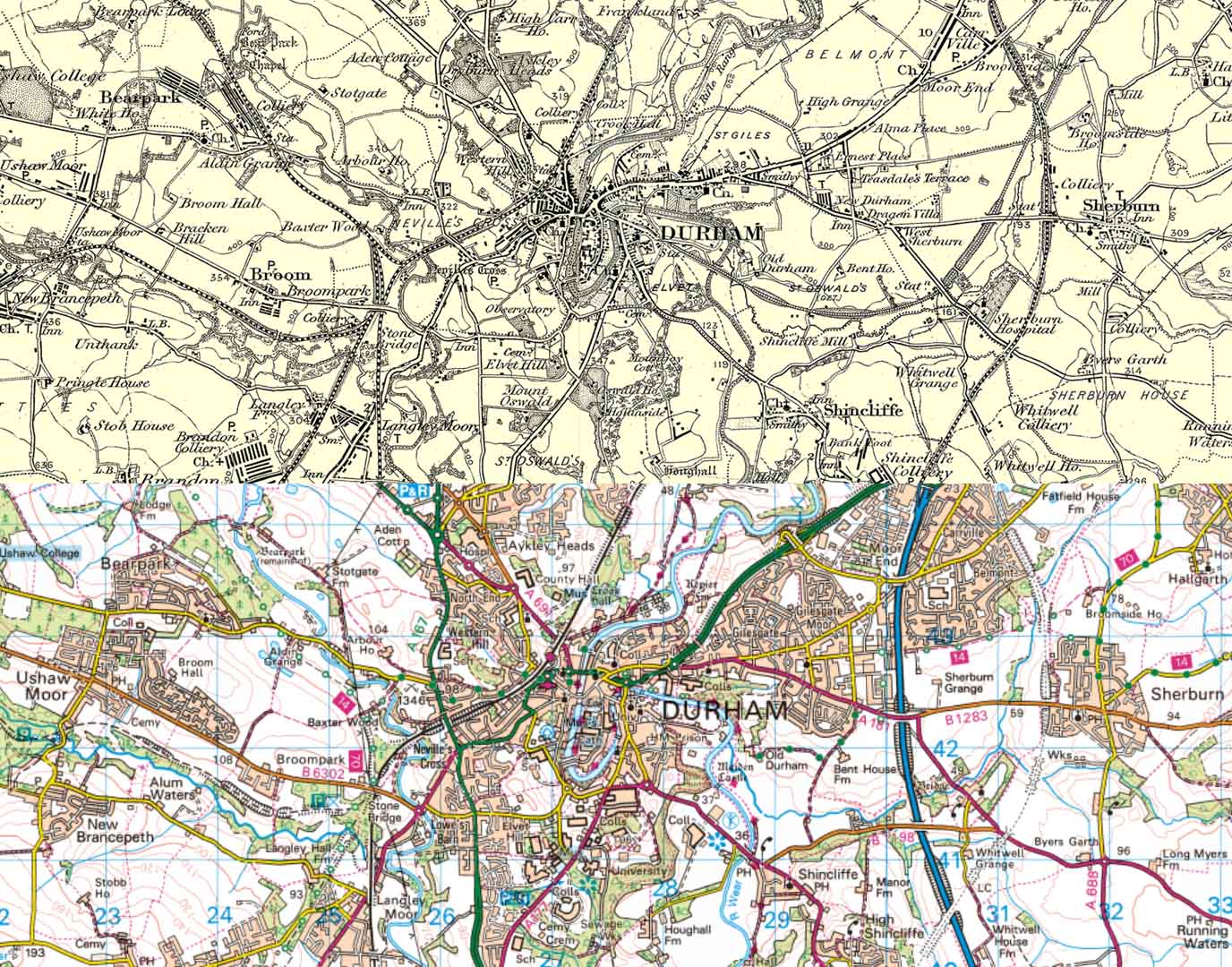
Durham
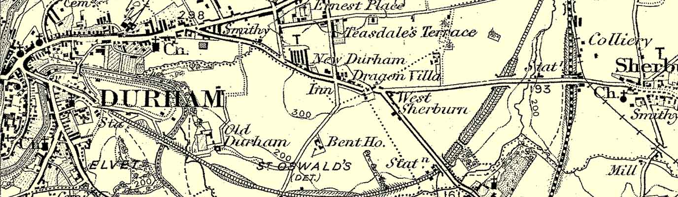
A historic location, it’s thought that the earliest settlers in Durham lived there back to 2000BC. At the turn of the 20th century, it was a small cathedral city rooted in ecclesiastical and academic traditions, with Durham Cathedral and Castle dominating the skyline. The surrounding coalfields and railways shaped its economy and working-class communities. The decline of mining in the mid-20th century brought economic challenges, but also led to a shift toward education and tourism. Durham University expanded its global reputation, and the city invested in heritage conservation and cultural events. The entire centre is a designated conservation area, comprising more than 630 listed buildings. In fact, Durham Castle was among the very first to receive such a classification – along with the Taj Mahal and Palace of Versailles.
Take a look at the changes to the city with these old pictures of Durham.
Key differences you can see in the side by side maps:
- Considerable amount of urban sprawl to the east and west
- New roads in and out of the city
- New schools and colleges
- The construction of the A1
EXPLORE THE
OS Shop
We are with you every step of the way. Shop our trusted walking and hiking maps and guidebooks so you can explore the outdoors with confidence.
Go to the shopPlymouth
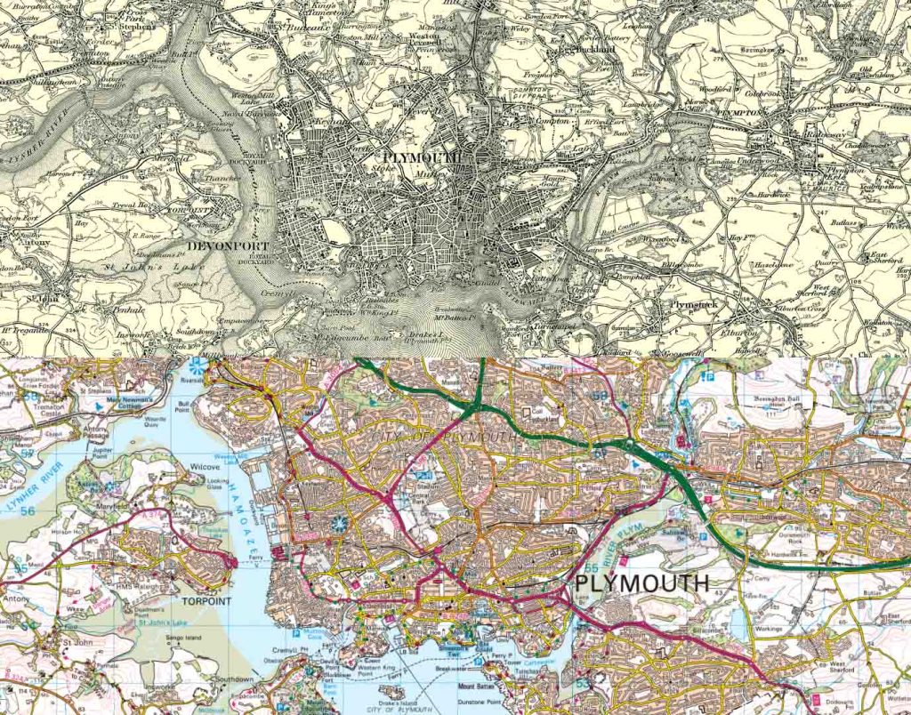
A seaside city, Plymouth has been an important port for centuries; it was from Plymouth that the Pilgrim Fathers departed for America in 1620. In the early 20th century, it was a key base for the Royal Navy and a departure point for global voyages. The city was heavily bombed during World War II, especially in the Blitz of 1941, which destroyed much of its historic centre. Post-war reconstruction introduced modernist architecture and new urban planning. It now proudly claims the fastest broadband speeds in the west and the largest proportion of cobbled streets in England.
To view photos of Plymouth in years gone by, visit the local council website.
Key differences you can see in the side by side maps:
- Development of road networks over what was once fields
- Considerable amounts of land has been reclaimed from the water
- The River Plym has narrowed to make way for the A374 and buildings
- The development of Ropoint
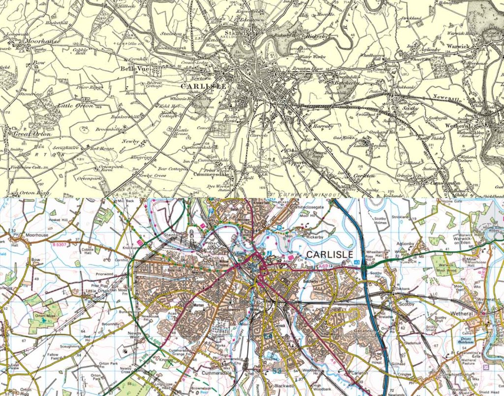
Carlisle
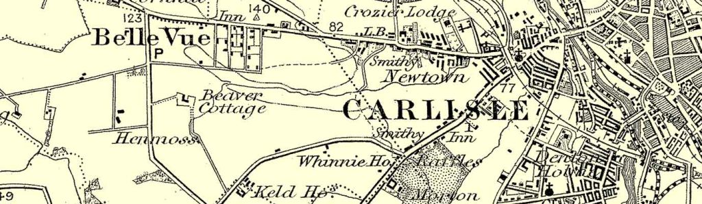
Over time, Carlisle has evolved from a Victorian industrial and military hub into a modern city that exemplifies the development of the British countryside. In the 19th century, the construction of factories, textile mills, and engineering works dramatically altered the landscape and boosted the population. The city’s boundaries expanded in 1912 to include neighbouring Stanwix and Botcherby, reflecting its growing urban footprint. During both World Wars, Carlisle played a strategic role in logistics and munitions. Though post-war industrial decline brought challenges, the city shifted toward heritage, education, and tourism. Fun fact: it was the first place in mainland Britain to have a post box, installed in 1853.
For a glimpse into historic Carlisle, have a look at this YouTube video, comparing historic and modern images of the city.
Key differences you can see in the side by side maps:
- Development along the edge of the River Eden
- Fields have been built upon to accommodate new homes, industrial estates and roads
- Expansion is mainly to the south of the River Eden
It makes you wonder what we’ll be comparing today’s maps with. How different will the urban and rural landscape be in, say, as little as 20 years’ time? One thing we do know, is that nothing stays still for long.
If you’d like to see how much your home or a specific area has changed, don’t for get to take a look at these vintage maps on the OS shop. We have over 470 available covering the whole of Great Britain. Not only do they make for a great gift for a history or map lover, but they also look fantastic framed on a wall. And if you want to do your own side by side map comparisons, check out OS Maps for our most up-to-date mapping.
This article was originally published on 16 December 2015.
Family-Friendly Historical Days Out
Across Great Britain, there are countless places where families can enjoy fresh air and fascinating history side by side. From ancient stone circles to Roman forts and industrial heritage sites, these locations offer more than just a walk—they’re a chance to step into the past and enjoy a historical day out.
11 Most Instagrammable Locations for the Ultimate Historic Selfie
Britain showcases countless historic landmarks, but some of the most breath-taking spots, and most Instagrammable spots, are those where ruins have been reclaimed by nature.
Top 10 English Heritage castles
English Heritage asked their Facebook fans for their favourite English Heritage castles for a great day out. Here’s the 10 best!