Squeezing a short walk into our busy lives can seem like an impossible task but with a little planning, it’s more than doable. Here are five tips to help you incorporate a peaceful stroll into your day plus our favourite short walks in Hampshire for you to enjoy too.
Celebrate National Walking Month this May by increasing the time you spend outside. Just 30 minutes of brisk walking every day can make all the difference and you’ll feel healthier, happier and more productive. Squeezing a short walk into our busy lives can seem like an impossible task but with a little planning, it’s more than doable.
Discover hundreds of thousands of walking routes, or plot your own, with a free trial of OS Maps. Or, if you’re a fan of paper maps, personalise your own Custom Made map putting your home in the very centre.
Five tips for planning a short walk
Here are five tips to help you incorporate a peaceful stroll into your day.
- Look at a map. Where is your nearest footpath? Can you create a route from your front door? Where is your nearest greenspace? Do you have a park, pond or a woodland near you? Use a Custom Made map to place your home right in the middle to get a better view of what’s around.
- Keep the distance manageable so you can fit it into your day. We’d suggest between 1-3 miles which should take you less than an hour depending how fast you walk. You’ll enjoy it more if you’re not rushing to get back.
- Cease every opportunity but also try to make it part of your routine. It’s much easier to stick to something if you make it a habit.
- Give your walk a purpose. Whether it’s taking the dog, chatting with a friend, listening to a podcast or visiting somewhere new.
- Leave the car at home. This saves money, the environment and extra hassle. You’re more likely to squeeze in a short walk if you don’t have to use the car.
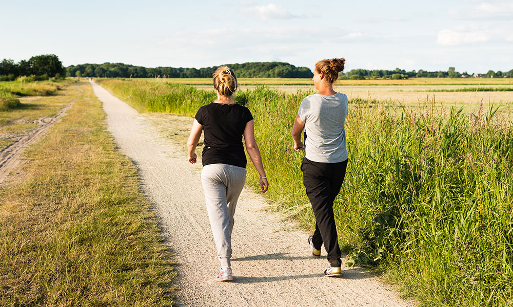
Take a short walk with friends
Short walks in Hampshire
Here at Ordnance Survey, we live and breathe the outdoors. We’re actively encouraged to get outside on our lunch breaks, whether it’s from our office in Southampton or from our front doors. We’ve rounded up our favourite short walks in Hampshire for you to enjoy and find inspieration to head out on your own.
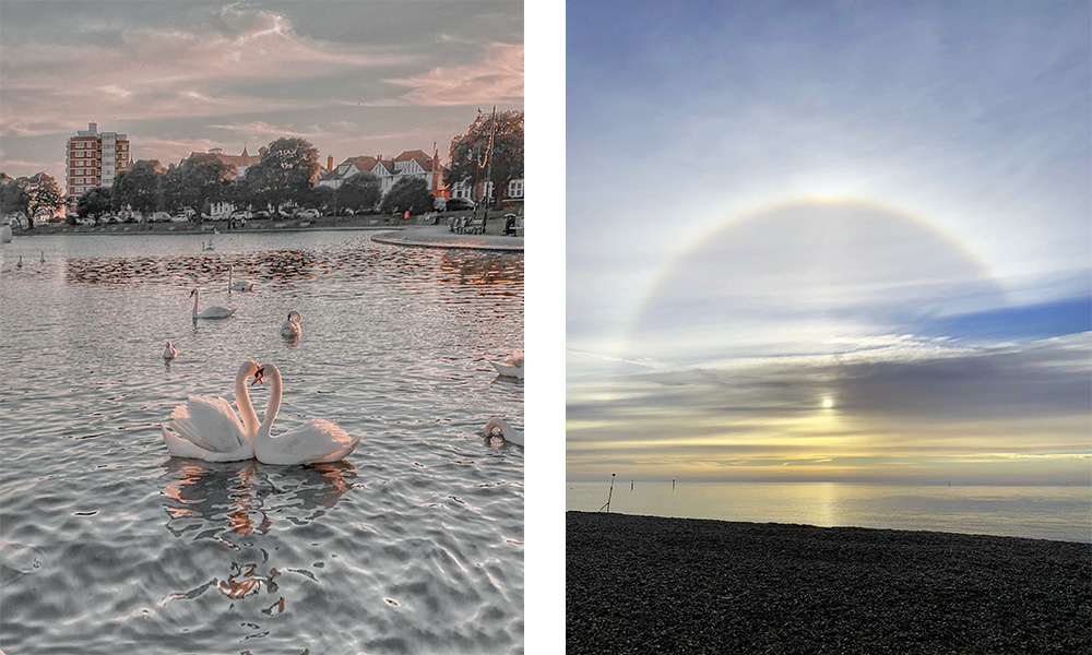
Southsea seafront walk, Portsmouth
2.2 miles / 3.5km
A walk along Southsea seafront is a must for anyone living in or visiting the area. The walk takes you through the streets of Southsea East and through the beautiful Rose Gardens before arriving at Canoe Lake, a popular area with families. There’s a playground with zip wire and sandpit, plenty of cafes and ice cream shops, a model village, mini golf, a large field and a lake with paddle boats and areas for crabbing. You could easily spend the day here.
Southsea seafront walk, Portsmouth
Across the road you’ll find Southsea Beach which you can walk or cycle along for miles. I like to walk up to the Rock Gardens before looping back around. I often take this route on my lunch break as it incorporates some of the best sights of Southsea in less than an hour. There are plenty of places to pick up a coffee which is always a great excuse for a walk even if they weather isn’t on my side! The best thing about this walk is that there’s plenty to see and it changes depending on the season and weather. The sea air never fails to revitalises me and seeing wildlife (swans, squirrels, birds) and flowers (mostly in the Rose Gardens and Rock Gardens) is always pleasant. This is an easy, accessible walk on paved surfaces (apart from through the Rock Gardens) and no incline.
St Catherine’s Hill walk, Winchester
3.3 miles / 5.3km
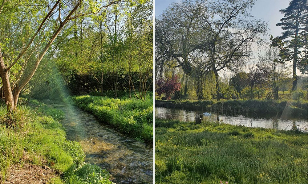
This is a fantastic short walk from Winchester city centre where you can really escape and find tranquillity in nature. Follow the riverside path towards St Catherine’s Hill which is a large greenspace suitable for dog walkers. There’s a short steep climb up St Catherine’s Hill which is more than walkable and boasts great views down on Winchester and over the surrounding countryside.
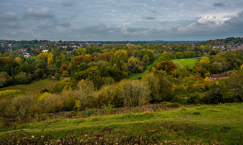
View from St Catherine’s Hill
Instead of retracing your tracks, you can follow the path back to town on the opposite side of the river which is sometimes less busy. On this trail you’ll pass the Hospital of St Cross, former 1132 hospital buildings with a gift shop and tearoom. This walk is amazing for sunset or sunrise.
Southampton Common walk
2.1 miles / 3.4km
You’d think after three lockdowns with Southampton Common being my main green space I’d be bored of it, but it’s such a varied park that there’s so many different routes you can walk around it and spot something new each time. This route takes you past three of the common’s lakes which are abundant with wildlife all year round. It starts in the car park and heads up the main path before turning off down a side gravel path to walk through a woodland area, as you come out the other side, join the main path again past the Cemetery Lake.
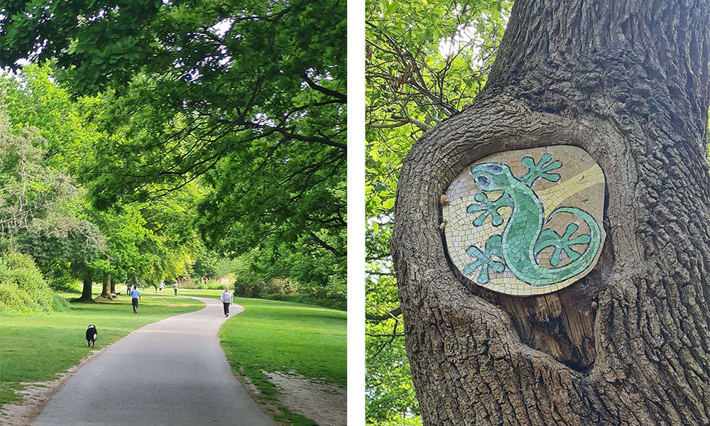
Southampton Common
Keep following the path round up to the ornamental lake, great for spotting ducklings in spring. There’s also benches here if you want to stop and take in nature for a little while. Continue to follow the tarmac path round, up a gentle hill and once you get to the top turn right to head back into the centre of the common to the boating lake (a great spot for watching the sunset too in the evening!). As you near the end of the walk the Cowherds is just to your right serving up delicious pub food, cold beers and coffees all day. I’d personally recommend the small puddings and coffee for a little end of walk treat!
Petersfield Heath walk
1.8 miles / 2.9km
An easy, flat and short walk starting and finishing from the main square in the centre of the historic market town of Petersfield, where (if time allows) you can browse the local shops or stop in one of the many cafes, pubs or restaurants.
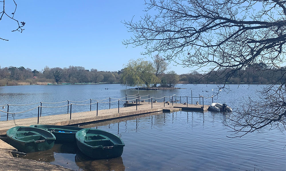
Petersfield Heath Pond
The majority of the walk takes you around ‘The Heath’, a 69-acre, designated conservation area and an ancient Bronze Age burial site. Loop around the Heath Pond and through the small sections of woodland, take a visit to the popular café stop at The Plump Duck or make use of the large grassy areas for a picnic. As you walk around ‘The Heath’ look out for the children’s playground and boating lake, all of which make this a popular spot for lunchtime walks and weekend activities.
Peartree Green walk, Southampton
2.2 miles / 3.5km
This short walk explores Peartree Green, the former site of the Spitfire factory in WWII. Heavily damaged by bombing, it’s now a nature reserve allowed to grow wild, creating a space that feels wild, even when you are only a few metres from housing and railway lines – it’s also part of the route of the Itchen Way long distance path. You can find lots of alternate paths that will take anywhere from 20 minutes to an hour or more.
Peartree Green walk
This walk is dog friendly, but narrow rough terrain make parts unsuitable for wheelchairs or prams. Nearest refreshments is Peartree Inn behind the church, or Prestige Café at the bottom of Athelstan Road.
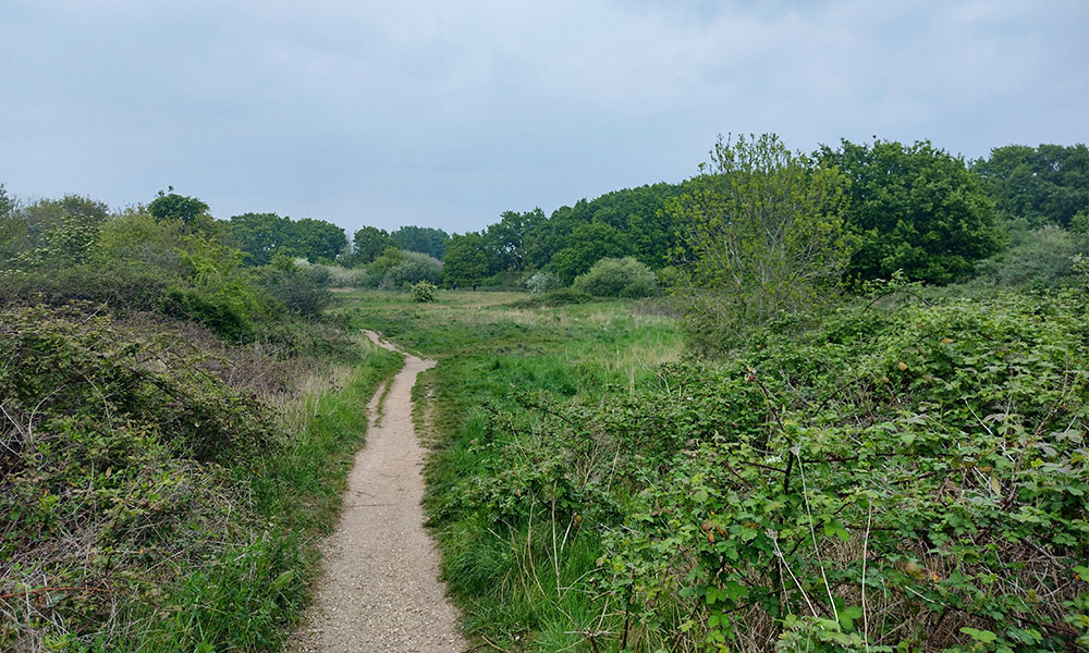
Basingstoke short walk
3.7 miles / 6km
This short walk is easily accessible from Basingstoke and allows you to step out into the countryside and immerse yourself in nature. It’s mainly on well-trodden country trails and part of it follows a railway line which makes easy walking. If you have kids in tow, they can stand on the bridge and wave at the driver for a ‘toot toot’. Most of the route has views out to farmers fields and there are plenty of trees and foliage around which is particularly nice at dusk or dawn when the birds are singing. It’s usually dry underfoot but of course, can get muddy during wetter months.
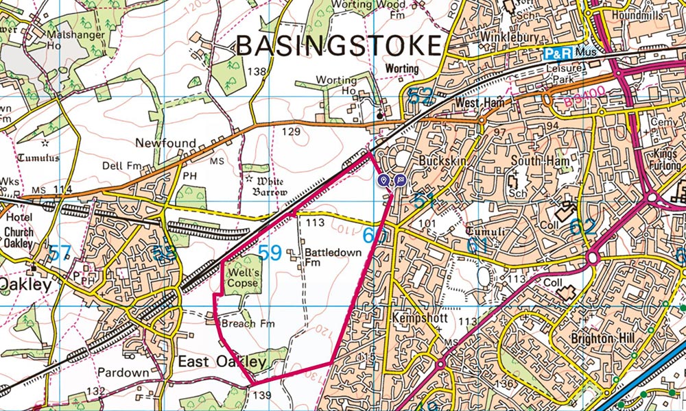
Basingstoke short walk in OS Maps
This route makes a great dog walk or lunch time stroll as it can be done in an hour if you’re a fast walker. If you have longer and you fancy a coffee, Jolly Ollys café (closed Sundays) in Oakley isn’t too far off the route. There’s a place to park cars on Pack Lane and an offical car park nearby (St John’s Road Car Park) which is free of charge.
Andover parkrun walk
1.5 miles / 2.4km (one loop)
Have you ever thought about walking your local parkrun course any other time apart from 9am on a Saturday morning? Well, you should! Local parkrun routes can be walked (or ran) at anytime of the week and they make a great stroll from your front door. This 1.5 mile route (two laps for parkrun) in Andover is mostly on grass with some tarmac and gravel pathways. There are sections which are narrow and although dogs aren’t allowed to take part in the official parkrun, they are allowed on route at any other time.
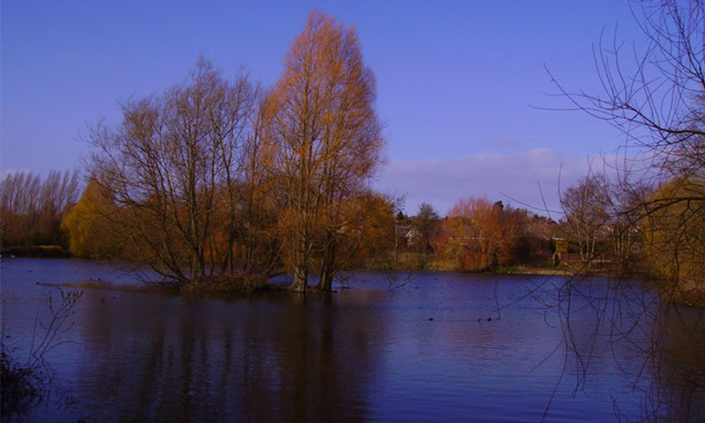
Charlton Lake. Credit: Geograph
The route loops around Charlton Lakes which has a playground, café, mini golf and large playing field – lots of greenspace to enjoy. You could extend this walk eastwards and visit Anton Lakes, another lovely area to walk around. Find your nearest parkrun in OS Maps and plan your next lunch time walk.
Boardwalks from OS HQ, Southampton
4.7 miles / 7.5km
We’re lucky enough to have our office (OS HQ) so close to nature and in just over an hour you can walk on boardwalks, lakeside trails and country lanes. This walk is an all-time favourite of those in the Ordnance Survey office looking to break up their day with a lunch time walk. As with most offices (and some homes too) there’s a couple of busy roads to navigate across (with the help of traffic light crossings) but once you cross the railway track, you’ll be surrounded by nature.
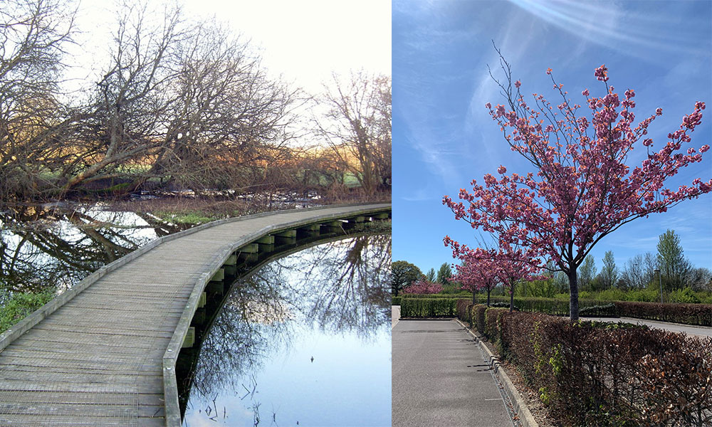
Boardwalk and beautiful spring blossom at OS HQ
The boardwalk goes through the Lower Test Nature Reserve which is a haven for birdwatching. You’ll then follow the footpath through an industrial estate before reaching beautiful Testwood Lakes. This route passes Little Testwood Lake but you can easily extend it to include the larger Testwood Lake as well. Fields of horses are regularly seen on route and if you’re lucky you may even spot a cow!
Silk Mill to Bere Mill, Whitchurch
2.8 miles / 4.5km
Whitchurch may be small, but it packs a cultural punch with a rich history and renowned natural spaces. Uncover the medieval town’s fascinating past, on a leisurely jaunt along the world-famous River Test. Start at the Silk Mill which has been weaving the luxury fabric since 1817, including material for Princess Diana’s wedding dress. It’s now an Industrial Heritage Museum with a riverside café and well worth a visit. Whitchurch Silk Mill – Industrial heritage museum in rural Hampshire Before crossing Winchester Street, take a detour into the mini nature reserve by the Gill Nethercott Centre. Afterwards, cross the road and follow the route, walking behind Whitchurch Primary School.
Silk Mill to Bere Mill
To your left, a few metres off the path, you’ll see the River Test, one of the most famous chalk streams in the world. It’s known for its fantastic fly fishing and a precious ecosystem created by pure, warm water springing from chalk aquifers deep underground. The mineral rich water supports a vast range of flora and fauna from glorious yellow flag irises, to mayfly and otters. Wander on past open fields, oak trees, and cattle – the type of landscape Gainsborough would have recognised – until you reach Bere Mill. Britain’s bank note paper was once printed here until operations moved up-stream. It’s now a family home which was sadly destroyed by fire in 2018 but has been carefully restored. Continue along the route crossing the Test. Before you reach the B3400, bear left across farmland heading back towards Whitchurch town centre. If you need a bite before heading home, pop into Kudos for coffee and cake.
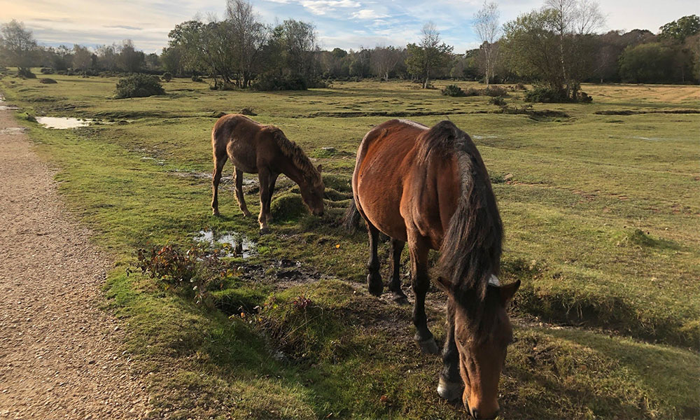
Aldridge Inclosure walk, Brockenhurst
3.4 miles / 5.5km
This walks starts just round the corner from the centre of Brockenhurst village heading out over Black Knowl on a gravel path towards Highland Water which has a stream perfect for a paddle for dogs or people! On Black Knowl there is always wildlife to be seen, particularly New Forest Ponies and if you go at the right time of year and are lucky deer and pigs! Then you walk round the top of Block Knowl to Ober Corner. Here you shortly join a road (limited traffic as only an access point for a campsite), before heading off into the trees at Aldridge Inclosure. After a little bit, you turn off to cross Ober water and head across Whitefield Moor (where there are more ponies). Then finally you head back to the starting back into Brockenhurst.
The terrain is mainly gravel so it is easy walking. Whitefield Moor is open moorland but as it is higher ground it is often dry. This makes it good for all seasons – particularly as the route is easily adaptable such as walking back along the road from the campsite instead of going into Aldridge Hill Inclosure. There is lots of open space and water to be enjoyed, making it a good walk for dogs.
This walk could be joined from different points – from Brockenhurst village, the Caravan and Motorhome site and Forestry Commission (free!!) parking around Whitefield Moor. It also is an easy walk to adapt, by changing your route back into the village along North Weirs or spend more time in Aldridge Inclosure. If looking for a shorter walk just head across Black Knowl to the stream and back.
Make it your mission this National Walking Month to plot a new route from your front door and get walking. Why not set yourself the challenge of adding an extra walk into your weekly routine, or if you’re feeling extra healthy, make it part of your day? These small steps (pun intended!) can make all the difference.
When following routes, please remember to take care of the great outdoors and follow the Countryside Code at all times.