Ramblers walks: top routes across Britain
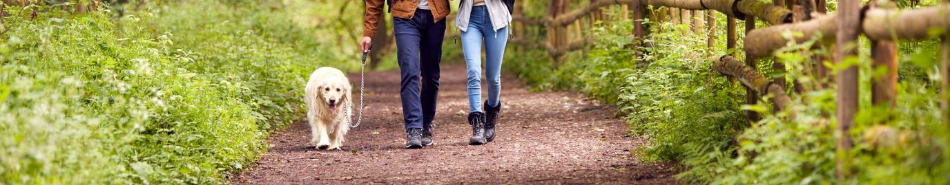
Our friends at the Ramblers share their favourite walks from The Ramblers Handbook. With routes for every season, these leisurely day walks will guide you around Britain through picturesque locations to soak up stunning scenery as you go.
More of us than ever before are making time to enjoy the great outdoors. Combining the promise of fun and fresh air, opportunities for self-care and wellbeing, the pure pleasure of doing something we love, and time spent away from the usual stresses of daily life, walking is the perfect way to reconnect with nature, ourselves and each other.
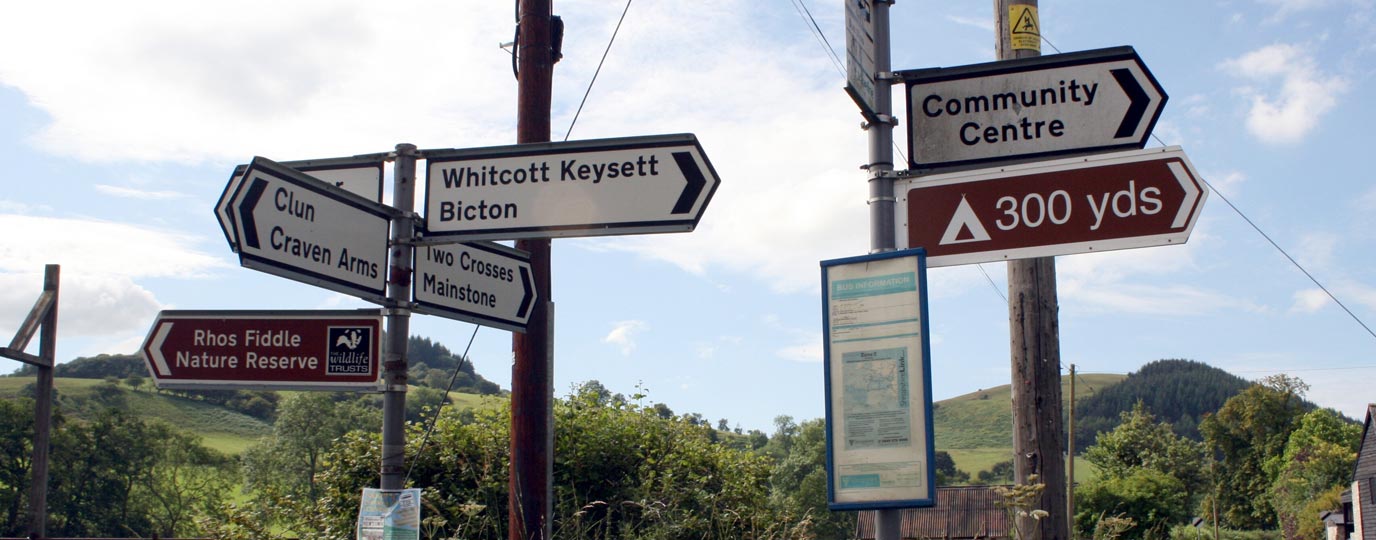
Ordnance Survey and the Ramblers have come together to help get more people outside, more often. Dedicated to encouraging people to enjoy the benefits and freedoms of exploring the outdoors on foot, for over 85 years the Ramblers has been committed to campaigning to keep our countryside open to all. The Ramblers organises group walks as well as providing information and high-quality routes to independent walkers. Supporters of the Ramblers can also benefit from an exclusive 25% off OS Maps and for every subscription sold, we’ll donate £5 to the Ramblers charity.
To celebrate our partnership, here are seven delightful British walks for you to enjoy, taken from The Ramblers Handbook.
1. Skelwith, Lake District

Skelwith walk
- Distance: 8.9 km (5.5 miles)
- Time: 3 hrs
- Difficulty: ✪ ✪
- Start: North end of the bridg on the A593 in Skelwith Bridge, Cumbria LA22 9NN (grid ref: NY344033)
- Best in spring
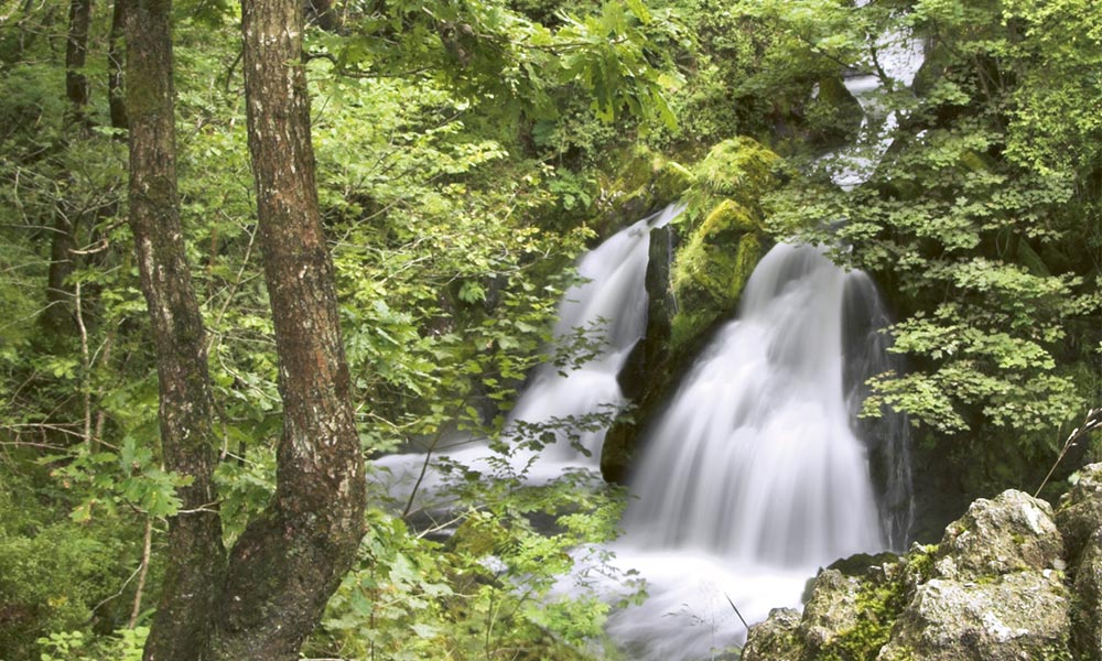
Colwith Force, Skelwith
The wonderful waterfall views at Skelwith Force and Colwith Force are spectacular on this leisurely circular walk. Although of course the falls are most striking after heavy rains, this route is well worth a wander whatever the weather.
The whole of this walk lies within the present-day county of Cumbria, which was created in 1974 when the historic counties of Cumberland and Westmorland merged with the Furness region of Lancashire. The old boundary between Lancashire and Westmorland ran along the River Brathay here, then went on up to the Three Shires Stone at the top of the Wrynose Pass, where the three old counties met. Although the old boundary no longer has any administrative significance, the old counties still live on in the hearts and minds of many local people.
2. Ditchling Beacon, South Downs
Ditchling Beacon walk
- Distance: 16.5 km (10.2 miles)
- Time: 4 hrs
- Difficulty: ✪ ✪ ✪
- Start: Hassocks Station, West Sussex BN6 8JD. (grid ref: TQ303155)
- Best in summer
Ditchling Beacon
This route leads across the Downs by way of Ditchling Beacon and Wolstonbury Hill, with glorious far-reaching views in every direction. Exploring the South Downs is always enormously enjoyable, whatever the weather, but summertime is surely the most rewarding season of all for a walk here as the wildlife is at its busiest. Summer flowers bloom all across the downland, while ground-nesting skylarks pop up all over the place, singing as they fly, and butterflies bustle about. The rarely sighted silver-spotted skipper may be seen here too, as well as the green
hairstreak and marbled white butterflies.
3. Rhossili, Gower Peninsula
Rhossili walk
- Distance: 6.9 km (4.3 miles)
- Time: 2 hrs
- Difficulty: ✪ ✪
- Start: The car park opposite Worm’s Head Hotel, Rhossili, Gower Peninsula SA3 1PP (grid ref: SS415881)
- Best in summer
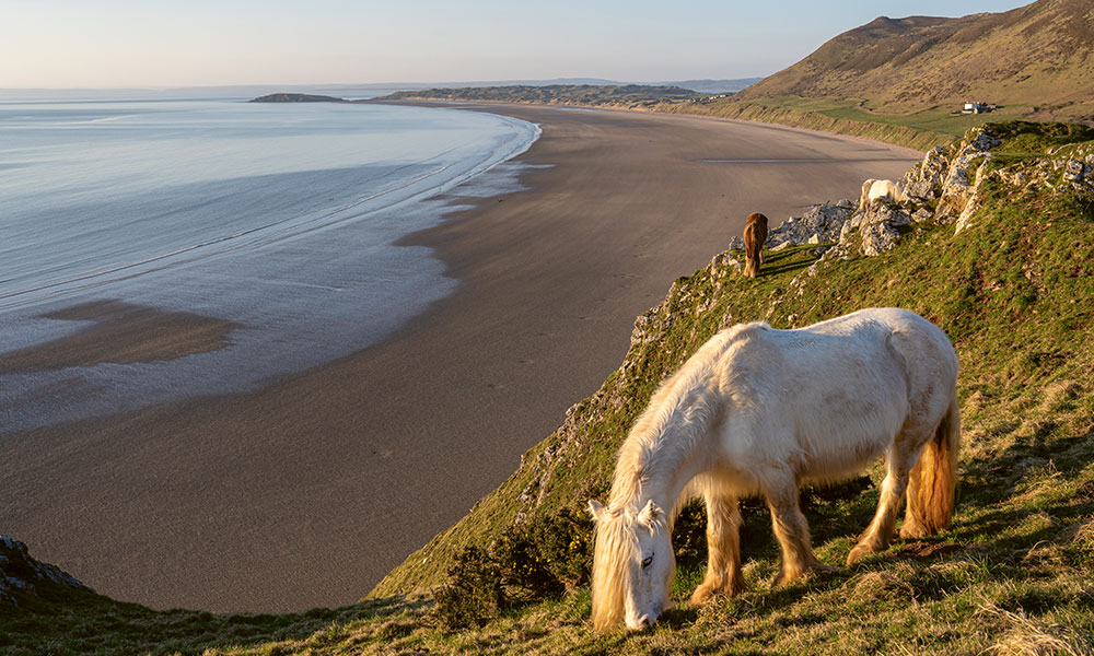
Rhossili Bay Beach
Exploring a stunning coastal route, this walk displays some truly breathtaking views and strings together both of Rhossili’s golden view points – the jewels in the Gower’s crown. Your ramble will include sand and surf, a swim if you fancy it, a hill climb and the crest of Rhossili Down, just inland, which is studded with prehistoric cairns and burial chambers. Don’t forget your camera – Rhossili was recently ranked 11th in a list of the most
beautiful coastal locations in the world.
4. Cley-next-the-Sea, Norfolk
Cley-next-the-Sea walk
- Distance: 12.3 km (7.6 miles)
- Time: 4 hrs
- Difficulty: ✪ ✪
- Start: Blakeney Quay, Blakeney, Norfolk NR25 7NE (grid ref: TG027441).
- Best in winter
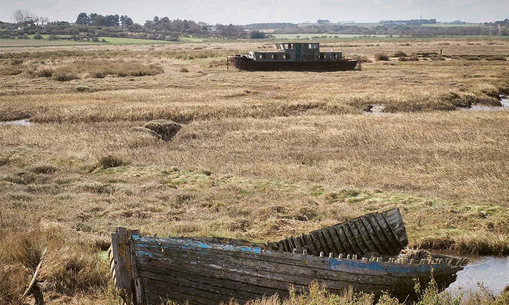
Cley-next-the-Sea
The first half of this route is, strictly speaking, a coastal walk. All the ingredients are here: quays, jetties, boats and general maritime gear, but you will barely glimpse the sea. Instead this section of the Peddars Way and Norfolk Coast Path navigates a course along the top of the sea defences, through the wide salt marshes and creeks left behind when the sea turned its back on this once-prosperous port over a hundred years ago.
The second half of this route retreats inland through the low-lying fens of the Glaven Valley, before climbing onto Blakeney Esker for panoramic views of north Norfolk from a rare vantage point high above sea level.
This tapestry of golden marshland stretches north to the shingle spit of Blakeney Point, and from the raised ridge of the esker you finally catch a glimpse of the elusive North Sea, as you descend on the final leg of your journey back to Blakeney harbour. This area is a twitchers’ paradise, and the seal colony out on nearby Blakeney Point welcomes newborn grey seal pups in November/December each year.
5. Pentland Hills, Edinburgh
Pentland Hills walk
- Time: 5 hrs
- Distance: 12.5 km (7.7 miles)
- Difficulty: ✪ ✪ ✪
- Start: Flotterstone car park, Midlothian nearest postcode EH26 0PW (grid ref: NT233631).
- Best in autumn
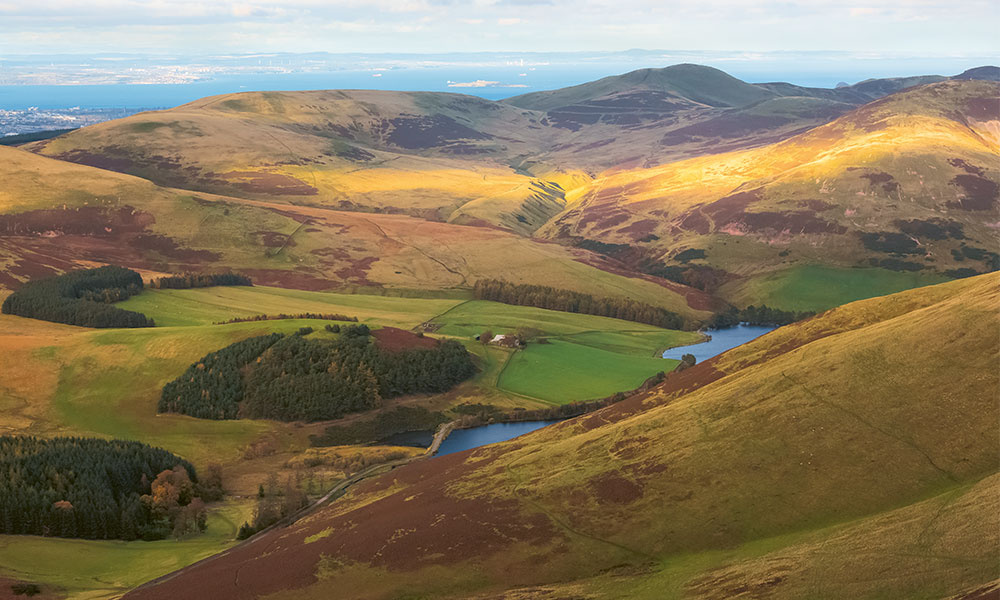
Pentland Hills
A superbly scenic circular route with wonderful panoramic views, which leads you up and over a chain of three hills – Scald Law, Carnethy Hill and Turnhouse Hill. Clear hill paths with stretches of stones or gravel make up most of this walk. There are a few steep climbs and descents to negotiate, but you will be rewarded with spectacular views.
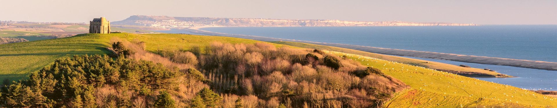
6. Abbotsbury and Chesil Beach, Dorset
Abbotsbury walk
- Distance: 12.7 km (7.9 miles)
- Time: 4 hrs
- Difficulty: ✪ ✪
- Start: Car park next to church, Abbotsbury, Dorset DT3 4JL (grid ref: SY578853).
- Best in winter
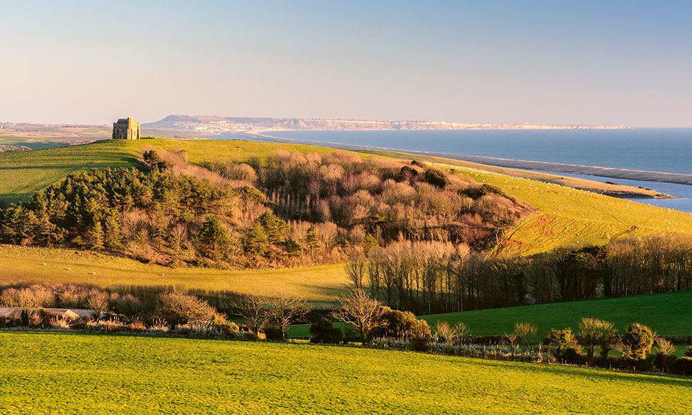
Views over Abbotsbury and Chesil Beach
This circular route leads from Abbotsbury via Abbotsbury Castle, West Bexington and Chesil Beach along grassy chalk downland and a level path alongside Chesil Beach. Situated amid gently rolling downland behind Chesil Beach, Abbotsbury is one of the most picturesque and historically interesting villages in Dorset. Its 600+-year-old Swannery is unique: the only place in the world where you are able to walk through the heart of a colony of nesting mute swans. The outward leg of this walk leads along a ridge-top path to the northwest of the village via an Iron Age hillfort called Abbotsbury Castle. It then heads down to the coast and returns
alongside Chesil Beach. A short detour at the end to climb Chapel Hill to St Catherine’s Chapel affords one of the loveliest view points around.
Stow-on-the-Wold, Cotswolds
Stow-on-the-Wold walk
- Distance: 12.7 km (7.9 miles)
- Time: 3 hrs 30 mins
- Difficulty: ✪ ✪ ✪
- Start: The Stag at Stow, Cheltenham, Gloucestershire GL54 1AF (grid ref: SP191257).
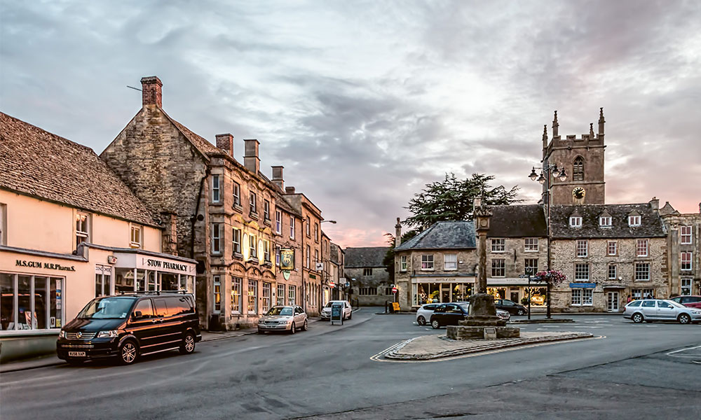
Stow-on-the-Wold
A beautiful circular walk over the high Cotswold Hills to two beautiful, contrasting villages. This route includes a mixture of quiet road walking, unsurfaced lanes and field paths, with one fairly long ascent on a track after
about a mile.
The beautiful church at Icomb you pass on your left is worth visiting. It contains the interesting tomb of Sir John Blaket, who died in 1431 after fighting with Henry V at the Battle of Agincourt. Wyck Rissington is another
beautiful Cotswold village, and worth a diversion if you have time. In contrast to Icomb, where many houses were built crammed together, the cottages here are all well spaced out along a wide village green.
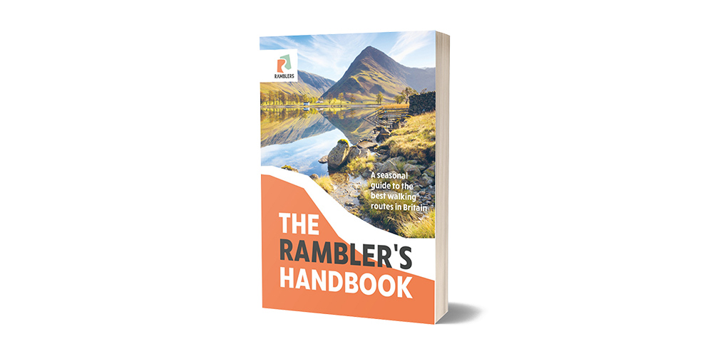
The Ramblers Handbook
Britain is brimming with stunning walks, and The Ramblers Handbook sets out the Ramblers 40 favourite routes around the UK. Arranged by season, each walk includes detailed route instructions, a map, and notes about landmarks and wildlife to keep an eye out for. From short country strolls to challenging hill hikes, gentle woodland wanders to breathtaking cliff-path adventures, there are routes here for everyone to follow, no matter their level of fitness or experience. With so many beautiful walks to choose from, the biggest challenge will likely be deciding which to embark on first!
The Ramblers Handbook