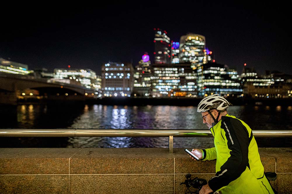
How OS Maps Makes Winter Evening Outdoor Exercise Safe and Easy
So many of us resort to sweaty, overcrowded gyms on dark winter evenings. But did you know that you can still exercise outdoors confidently using OS Maps Ordnance Survey’s mapping and route-planner on web and app, has everything you need to stay safe when the sun goes down — from easy-to-read maps on your phone, to quick location sharing with ‘Locate me’. The app helps you plan well-lit routes for extra peace of mind, and even when physical landmarks aren’t visible, you can navigate with the iconic red arrow. Read on to discover how OS Maps helps you ditch the after-work gym, and enjoy outdoors exercise all year round!

Readable Maps on Your Phone
Having OS Maps on your phone revolutionises navigation in low-light conditions. It provides a reliable and user-friendly solution for evening adventures. The bright, backlit screen means you can clearly see detailed maps, even in complete darkness.
This eliminates the hassle of using paper maps, which can be tricky to read under dim or uneven lighting and require another light source. That said, paper maps are still useful when it comes to planning routes at home and it’s best practice to always carry one when out exercising. Let’s be honest, paper never runs out of battery!
Whether you’re heading out after sunset, navigating shaded woodland, or tackling a late-night hike, OS Maps means you can easily spot paths, contours, and landmarks. Its intuitive features, like zooming and panning, let you focus on specific details without squinting or struggling to interpret your surroundings.
With OS Maps, exploring after dark becomes stress-free and enjoyable. The app empowers you to tackle new routes confidently, knowing you have clear, accessible guidance at your fingertips. Whether you’re planning an evening run or walk or cycle OS Maps helps you escape the gym and turn your winter evenings into an outdoors adventure!
Quick Emergency Location with ‘Locate me’
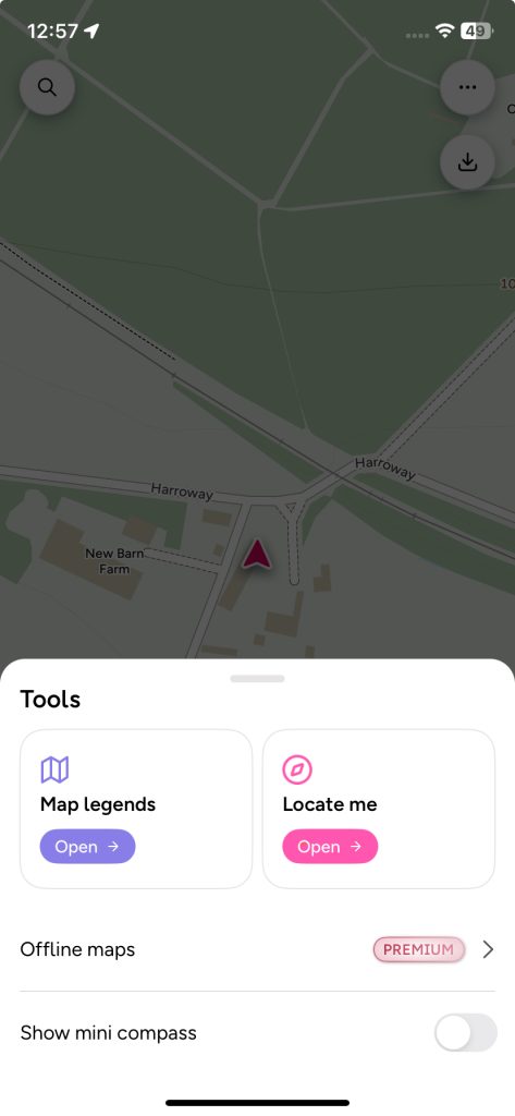
‘Locate me’ is a vital OS Maps tool to help you safe while exercising in the dark or low light. It provides precise and reliable location tracking so you can navigate confidently and call for help if needed, even in challenging conditions.
The tool provides your exact grid reference, which can be shared with emergency services in seconds. If the worst happens and you’re alone in the dark, this functionality ensures help can reach you quickly, even in remote areas.
When landmarks are hidden, the tool’s built-in compass and location data let you orient yourself without relying on visual cues, making it ideal for foggy conditions or unlit paths.
Additionally, its offline functionality means ‘Locate Me’ works without a mobile signal, ensuring you always know your location. Paired with OS Maps or a physical map, this feature offers peace of mind, helping you plan and navigate your route confidently during night-time exercise.
How to Use the ‘Locate me’ Tool in OS Maps mobile app:
Open the OS Maps mobile app: Ensure the app is installed and open it on your mobile device.
Enable Location Services:
Check that GPS/location services are turned on in your device’s settings.
Ensure OS Maps has permission to access your location.
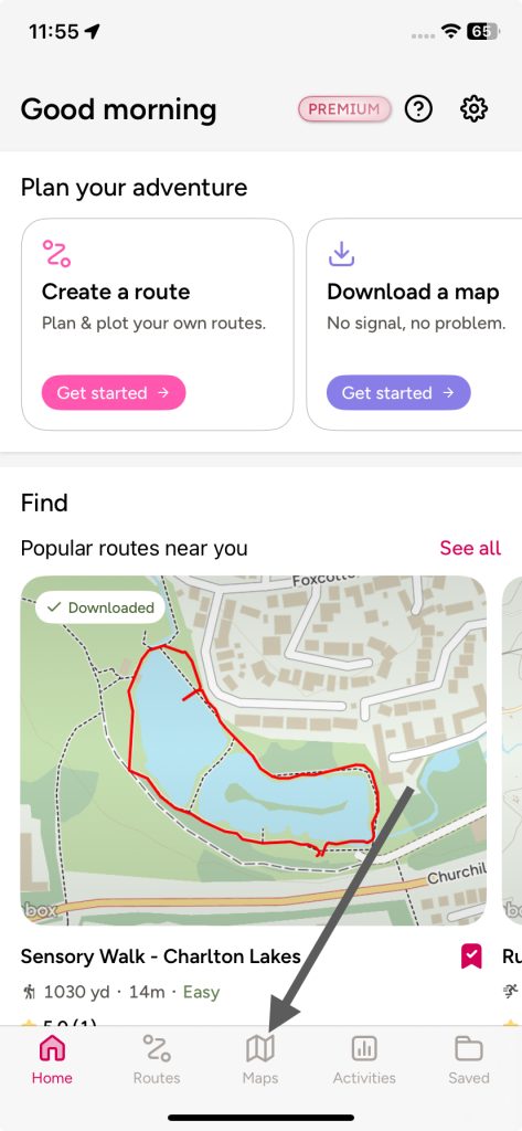
Access the Map View:
Go back to OS Maps and navigate to the main map screen within the app.
Access ‘Locate me’:
Tap the kebab menu (the three dots arranged vertically on the top righthand of the screen)
A ‘Tools’ menu will pop-up.
Tap the pink ‘Locate me’ Icon:
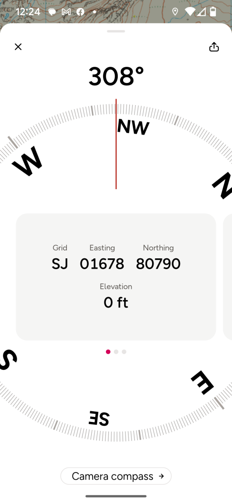
This will send you to:
Either a ‘compass’ tool giving you your grid reference.
Or a ‘camera compass’ tool.
You can toggle between these compass options using the button at the bottom of the screen.
Share Location Details:
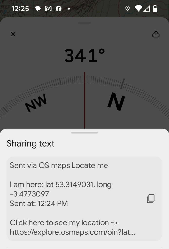
Tap the ‘share’ icon at the top righthand side of the screen (it has a little arrow pointing up)
Choose which app you want to use to share your location or click on the copy symbol to paste the location into a message.
Troubleshooting:
- If your location doesn’t appear, check you have enabled location services (see details above).
- Ensure your app and device software are up-to-date.
Always Know Where You Are with the Red Arrow
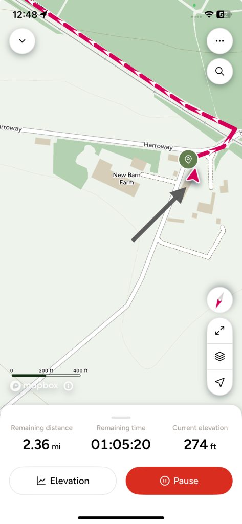
The iconic red arrow is a cornerstone of OS Maps , so integral that it’s used as the app’s logo. This simple yet powerful symbol transforms outdoor adventures, especially in low-light or dark conditions. It means you always know where you are and which direction you’re heading.
When exercising in the dark, landmarks can be hard to see, making it challenging to orient yourself. The red arrow solves this by showing your exact position on the map and the direction of your movement at a glance.
Whether you’re running through unlit rural paths, walking in shadowy woodlands, or navigating foggy trails, the arrow gives you instant clarity.
Its real-time positioning feature works seamlessly with OS Maps’ detailed layouts. It helps you make confident decisions about your route without pausing to interpret your surroundings.
For runners, walkers, or cyclists tackling routes after sunset, the red arrow is an essential companion offering peace of mind when visibility is limited.
Plan and Share Safer, Well-Lit Routes
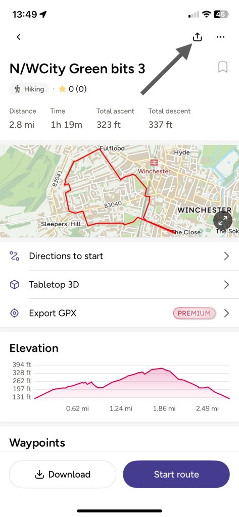
Planning safer, well-lit routes with OS Maps is a smart way to stay active while prioritizing safety during low-light or night-time exercise. The app’s detailed mapping allows you to identify areas with urban paths, or routes close to populated locations. These features are invaluable for runners, walkers, or cyclists seeking a safe and enjoyable experience after dark.
The ability to pre-plan routes ensures you can avoid poorly lit or isolated areas, reducing risks such as tripping on uneven terrain or encountering unexpected obstacles. For urban explorers, OS Maps helps you choose paths that remain visible and accessible, even in challenging lighting conditions.
An added advantage is the option to download your route in advance. This ensures you can access it offline, providing peace of mind if mobile signal drops during your outing. The downloaded map keeps you on track, even when landmarks or directional cues are obscured in darkness.
You can also share routes easily, so you can stay safe by exercising with friends when head to more remote areas.
By carefully selecting well-lit, safe routes with OS Maps , you can maintain your fitness routine confidently, knowing you’ve taken steps to protect yourself. Whether you’re jogging around a park, cycling on urban routes, or walking in a new neighbourhood, OS Maps, makes night-time exercise secure and stress-free.
Don’t let winter evenings keep you indoors—OS Maps, makes exercising outdoors in the dark both safe and enjoyable.
Whether you’re running, walking, or cycling, the app’s tools help you navigate confidently: from ‘Locate me’ so help is always nearby, to the red arrow keeping you on track. Explore millions of routes or create your own with ease, knowing you have reliable mapping at your fingertips. Stay safe, stay active, and make every evening count with OS Maps! Download the app on iOS or Android now.
To find out more about exercising outdoors in winter head here: No Excuses: Practical TIPS for Exercising in Winter
