Mountain Rescue England and Wales share with us a handful of accident black spots across Britain, in which they are often called to, and how you can stay safe when visiting these areas.
Mountain Rescue teams are deployed to all sorts of locations, day and night, for all sorts of reasons. A lower leg injury on a descent slope late in the afternoon continues to be one of the most frequent reasons for a call-out and it is also very much the type of thing that can happen to anyone.
However, if you ask the teams, each one has a couple of locations in their area that crop up a lot and account for a fair number of call outs each year. Many of these are popular location and some are not always the places you’d expect! Whether it’s Roseberry Topping in the northeast or Pen-y-Fan in Bannau Brycheiniog (the Brecon Beacons), some hills attract crowds of walkers because of their accessibility.
Click on each image to see its location!

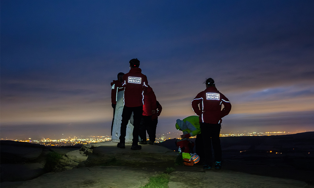
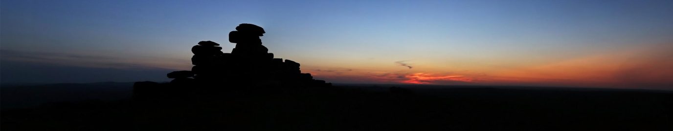
Rescue on Roseberry Topping
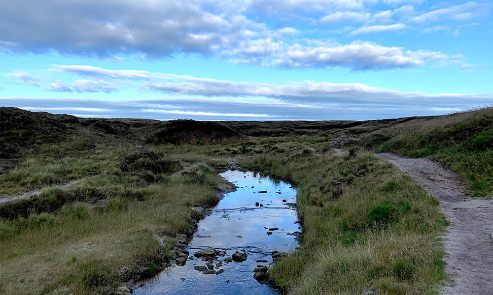
Roseberry Topping, North York Moors
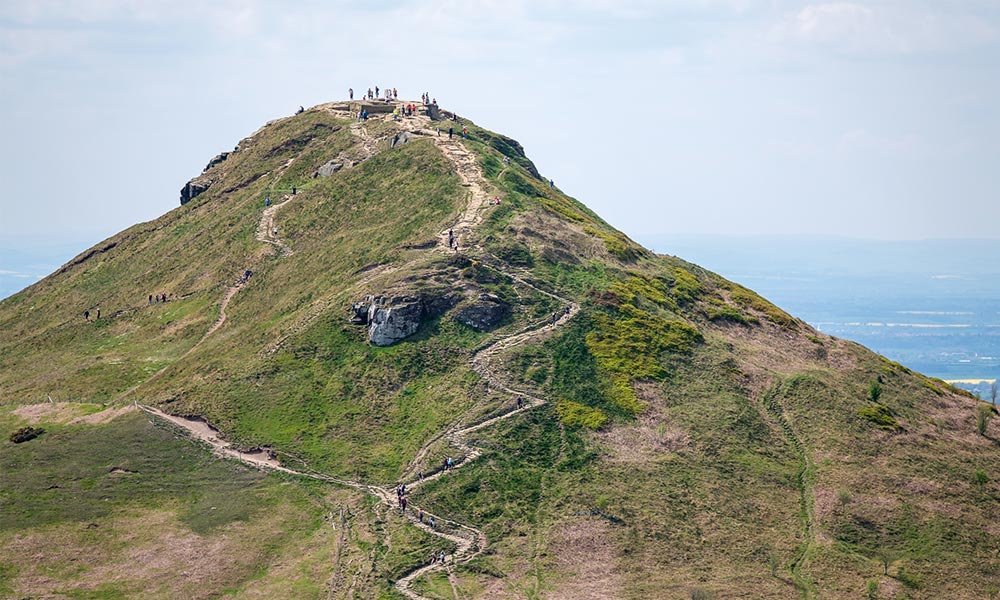
For Cleveland MRT, Roseberry Topping in the North York Moors is a regular call-out location. Gary Clarke of Cleveland MRT explains the issues:
“Although not particularly high at 320 metres, Roseberry Topping is a distinctive peak that attracts a lot of local and visiting walkers and runners of varying abilities and at all times of the day. The summit gives spectacular views across North Yorkshire, Teesside and across to the northeast coast and it can be reached via a network of paths. The terrain is quite variable and uneven in places with a mixture of steps and rough surfaces with some steep gradients. When wet, the paths, especially the stone step sections, can be very slippery. The lower areas are flanked by woodlands and heather moorland and the muddy woodland paths also regularly catch people out!”
Roseberry Topping
“Probably 10% of the team’s callouts are to Roseberry Topping and the woodlands below, mainly to help people who have sustained lower leg injuries from slips and trips. Although some are for people wearing inappropriate footwear, it can also catch out the most experienced and well-equipped walkers.”
“Roseberry Topping is often walked as a straight up-and-down route from a car park (payable and can get busy) at the bottom of the hill. But that is quite a steep route in parts and we get called to it regularly.”
“For an easier, slightly circular route, walk from that same car park along the path (marked on OS Maps as Roseberry Lane) as if heading directly to Roseberry Topping. At the end of the path go through the gate but, instead of heading straight up, turn right into Newton Wood and follow the track up (to NZ 5762 1228), emerging from the woods at that point. Roseberry Topping will be on the left and an old stone-built ‘shooting lodge’ will be on an incline to the right. Walk between the two, turning left to follow the path up the rear side of Roseberry Topping. After resting at the summit and taking in the views, head back down the main path back to the car park, taking care on the descent.”
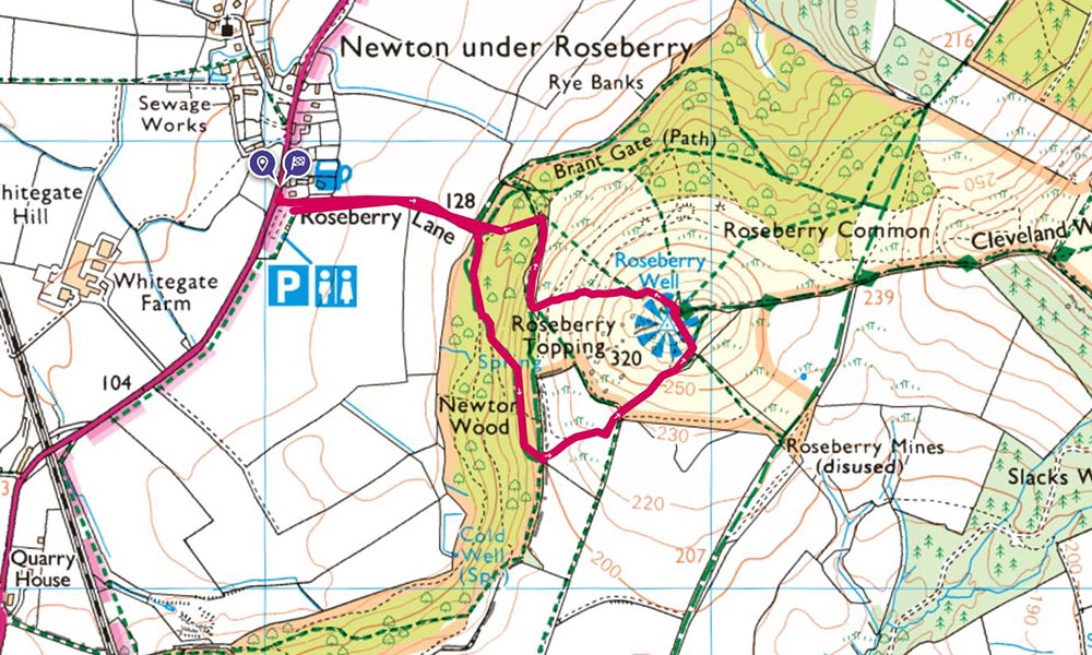
A great route to Roseberry Topping – and safer than others
“That’s only a 2.5 kilometre, circular route but ideal for those wanting a short walk that gets the lungs working!”
“An alternative is to park on the far side of Roseberry Topping at the free Gribdale car park and walk along the Cleveland Way national trail to Roseberry Topping. That’s a 5.5 kilometre there-and-back route. Another local landmark, Captain Cook’s Monument, is a short 20-minute walk from the car park (in the opposite direction), providing an alternative or an ‘add on’ after completing the round trip to Roseberry.”
Pen-y-Fan, Brecon Beacons (Bannau Brycheiniog)
Central Beacons MRT has been called out to Pen-y-Fan in the National Park all too often as Team member, Pete Spearing explains:
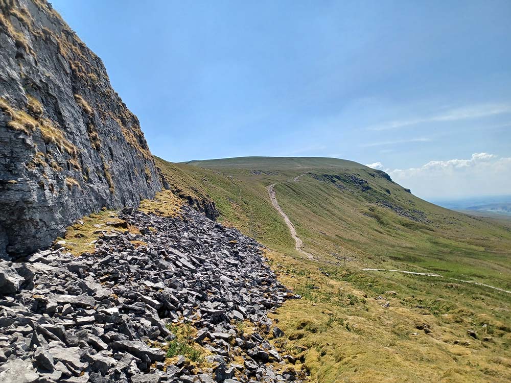
“The area is managed by the National Trust who have put a lot of effort into providing a well-maintained path to handle the hundreds of thousands of visitors who want to walk up Pen y Fan. As this path reaches Bwlch Duwynt (Welsh for windy gap), it crosses a stretch of bare rock and gravel where the way forward becomes very indistinct. On the way up, this is OK because simply continuing to walk forward for 50 meters or so soon brings the obvious path ahead into view even in poor visibility.”
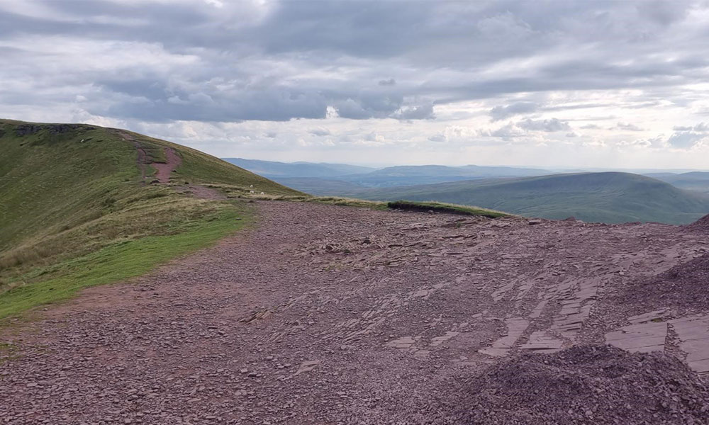
Bwlch Duwynt on Pen y Fan
“However, on the way back, the rounded shape of the Bwlch completely hides the obvious path down while continuing straight ahead takes you onto a path that, while clear at first, soon deteriorates. In the past, I have both over and under shot the turning several times in poor weather, even while looking hard for it.” See the correct path here.
Team colleague, Malcolm Walker agrees about this being a bit of a black spot: “Whilst stationed up on the ridge beyond the gap for an event at a checkpoint on a blustery autumn afternoon, I decided to pass the time by chatting to people who were heading past me and along the ridge. One in five thought they were heading down to the car park!”
Following your route on a map and checking at junctions – or, even better, anticipating what’s ahead so that you can recognise your route – can make all the difference. If you’ve had a great day out in the Beacons and you’ve enjoyed Pen-y-Fan, the last thing you want is to spoil it by having to call out Mountain Rescue.
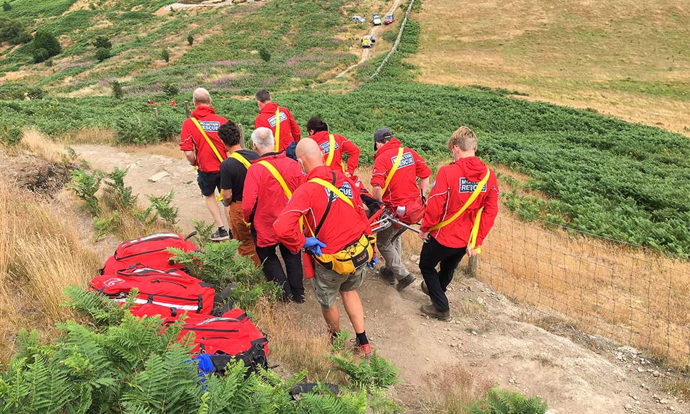
The Trinnacle, Saddleworth Moor
Some accident black spots are being created (or call outs increased) by social media with Instagram posts and hashtags attracting even more people to viewpoints and photogenic locations. Whether it’s natural “infinity” pools, aircraft wrecks or unusual rock features, a few of these “beauty spots” are becoming even more regular “black spot” locations for incidents. Birchen Clough and Raven Stones is one of them.
Rob Jones of Oldham MRT explains: “We have a location where many of our incidents occur and the general area is Birchen Clough and Raven Stones. The Trinnacle is a very picturesque three-fingered point of rock that is part of Raven Stones on the moorland edge. “
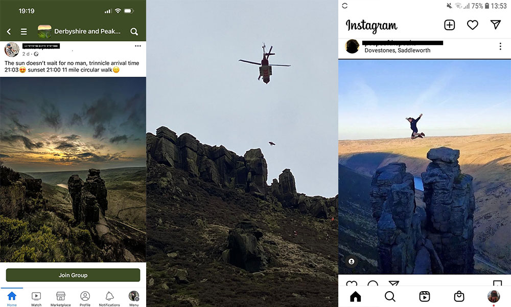
The Trinnacle and social media
“The Trinnacle (and unofficial Trinnacle Trail), together with the waterfalls in Birchen Clough, have featured heavily on social media in recent years and are increasing in popularity. The result is that many people are now walking this Trinnacle Trail via the Clough, including some who are then climbing on to the Trinnacle and performing stunts.”
“The only footpath that features on OS Maps is the “right” one, which goes along the moorland edge. This is airy but secure and is a good approach to get above the Trinnacle so that you can look down on it and capture it in context.”
The simplest route to take if wanting to view the Trinnacle
“However, Google Maps not only marks the Trinnacle itself, but also includes a route to it that goes up Birchen Clough and passes a waterfall. In places, the path up Birchen Clough on the ground is narrow, loose and sloping, and has a short vertical step alongside the waterfall. There is also a high path that traverses over the waterfall, which again is eroding and sloping. All in all, Birchen Clough is more of a scramble than a walk, needing careful foot placement and with hands required in places.”
“Oldham MRT has had a number of people fall off the crags near or on the Trinnacle; others have slipped off the path in Birchen Clough; and we’ve also had people caught out by nightfall and unable to find a safe route down.”
“To make the point even more clearly, the Team was called out to just four incidents in this area in the 3½ years up to December 2019. In the same period since then, there have been 24 incidents – and that’s with Covid lockdowns included! Also, given the terrain and some of the attempted “stunts”, a number of the casualties have had serious and, in some cases, life-changing injuries.”
Please don’t be the next one. Take the simplest route up to the Trinnacle.
Kinder Scout, Peak District
When is a path not a path? One answer is when it disappears and another is when it’s only a Right of Way.
First, the disappearing path of Kinder Scout. Alan Howarth of Kinder MRT in the Peak District explains this one: “I’ve been doing some analysis of the Kinder MRT callout data. It occurred to me that it would be useful to see where people actually walk on Kinder to see where the most popular routes are and, if possible, where people struggle with their navigation.”
“The heatmap for Kinder shows the main routes around the edge path really clearly, with most people going along the reservoir, up either William Clough or Sandy Heys, on to the Downfall and back via Kinder Low. However, the minor routes that people have followed are revealing too, especially when I map on the locations of our incidents, a mix of lost people and injuries over the last four years.”
Kinder Scout
“In reality, there isn’t a path through the middle of the plateau. If you follow the Kinder River up to the point where it splits (after Kinder Gates), the path disappears and it’s just a horrible (if weirdly beautiful) boggy wilderness. We have a cluster of callouts exactly where the path disappears and people become lost.”
“On a clear day you can usually see where you need to end up and make your way over there. If you are unlucky, you may end up waist deep in mud, but that should be about as bad as it gets. However, in the dark, low cloud or bad weather, it’s a different matter and, if you don’t have good navigation skills, it can be very challenging. When people call us from here to say they are lost and can’t find their way out, one of two things happen. If they manage to keep a good phone signal (and it’s notoriously patchy up there) and we get a GPS position from their phone, it’s just a very uncomfortable 2-3 hour wait for us to get to them and navigate them back down.”
Cleveland Mountain Rescue Team
“If we don’t have a position for them and are only working off a rough route description they gave to the 999 call handler, it becomes a major search. We have a pre-plan for this situation where the four teams who cover the area (Kinder, Buxton, Edale and Glossop) all search pre-defined areas of the plateau. This can take a long time, so what would have started out as a great day out on Kinder will now have turned into a really cold, really bad night.”
No one starts out planning to have a bad day, but the message behind Alan’s analysis is that, if you are thinking of taking one of these more challenging routes, consider whether you have enough equipment and clothing to sit around in the cold for 4-5 hours if the worst were to happen.
Nitting Haws, Cumbria
Now the Right of Way that isn’t really a path – in fact, to members of Keswick MRT, it’s known as the Lemming Road!
Adam Edmondson of the Keswick team explains: “Nitting Haws is on the descent from High Spy, above Grange and down into Borrowdale valley.”
“Back in 2018, there were three serious callouts in roughly the same area within two weeks of each other and my colleague, Nuala Dowie, began to investigate, especially when all three groups talked about losing “the path” and getting into difficulties.”
“In fact, the path on the ground is fine and quite clear, but the more obvious green Right of Way markings on the map were assumed to indicate a path too. There wasn’t really a path on the ground there and that green line was leading walkers into steep and unpleasant ground, rather than over the top of the Haws to the north and then down.”
Since 2018, Nuala, also a member of Keswick MRT, has worked with Ordnance Survey and the Right of Way markings have been re-routed, as now seen on the up-to-date printed maps and on the OS Maps app.
“It seems to have worked,” says Adam, “as we haven’t had a callout there for a couple of years.”
Cleveland Mountain Rescue Team
Piers Gill, Scafell Pike, Lake District National Park
The highest mountain in England has always been a compelling prospect, and a descent down the northern flank, alongside Piers Gill, has always been an accident blackspot for the local Mountain Rescue team, with a long history of serious events and fatalities. However, in 2023 and 2024 there has been a sudden increase in incidents of people walking down the gill bed (stream bed) and getting into trouble.
Piers Gill is extremely hazardous because it is made up of a series of waterfall climbing pitches and can only safely be attempted by rope access. They get progressively harder as you descend, and get more and more difficult or impossible to climb back up. This results in a ‘trap’ where either people become stuck, or risk taking the next descent, thinking it is the last one.
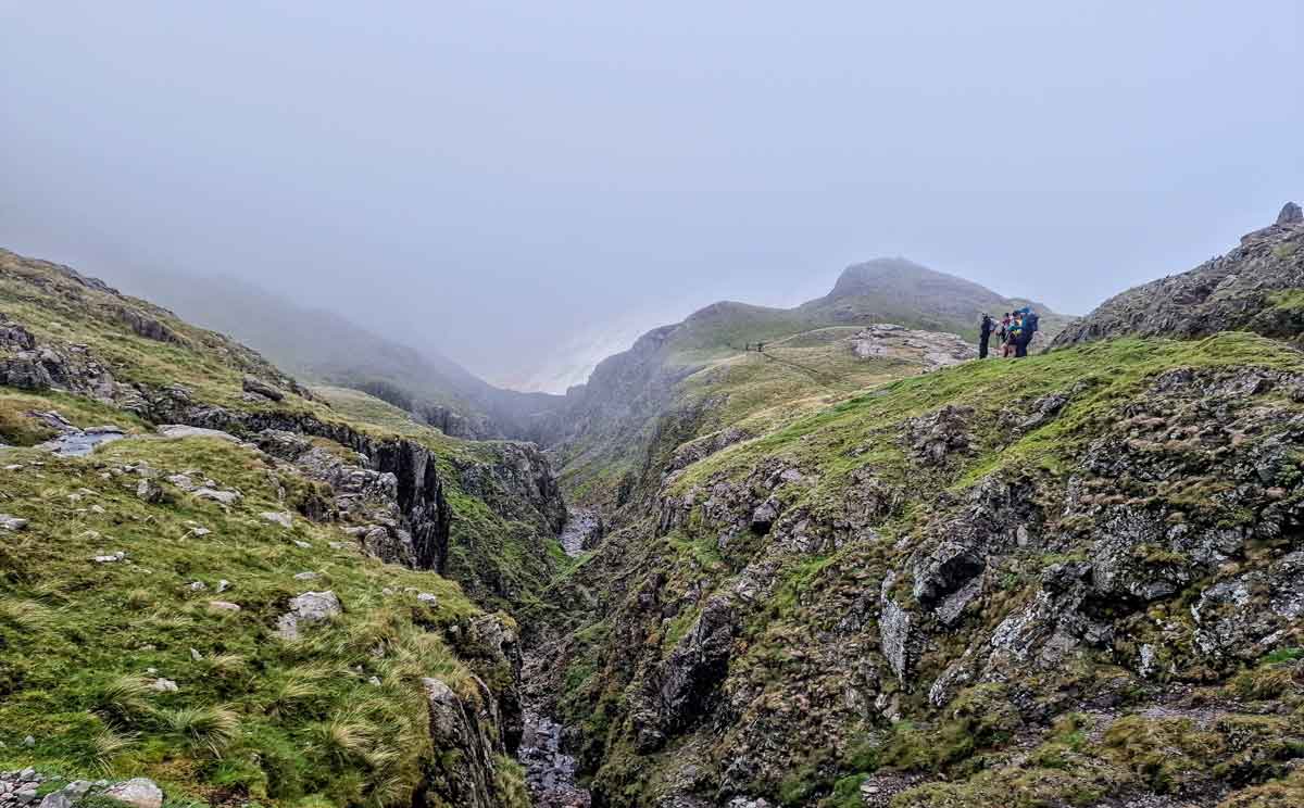
Piers Gill
The Wasdale Mountain Rescue team who cover the area, are finding that people either fall, resulting in traumatic injuries, or become stuck with increasing hypothermia risk. Or both. For the team, it is also a hazardous location to work – the Gill has steep sides and loose rocks with a continuous risk of rockfalls, even with a technically perfect rope system.
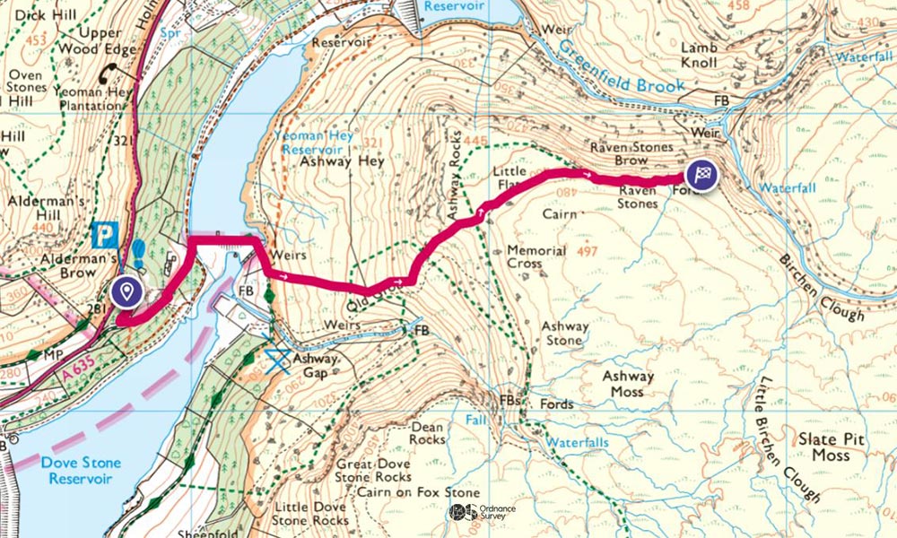
The top of the gill (marked in pink below) branches off the popular ‘Corridor Route’ and looks like an appealing choice, though the only path down is actually on the east rim of the gill (marked in yellow) and even that goes very close to the edge and has a rock step.
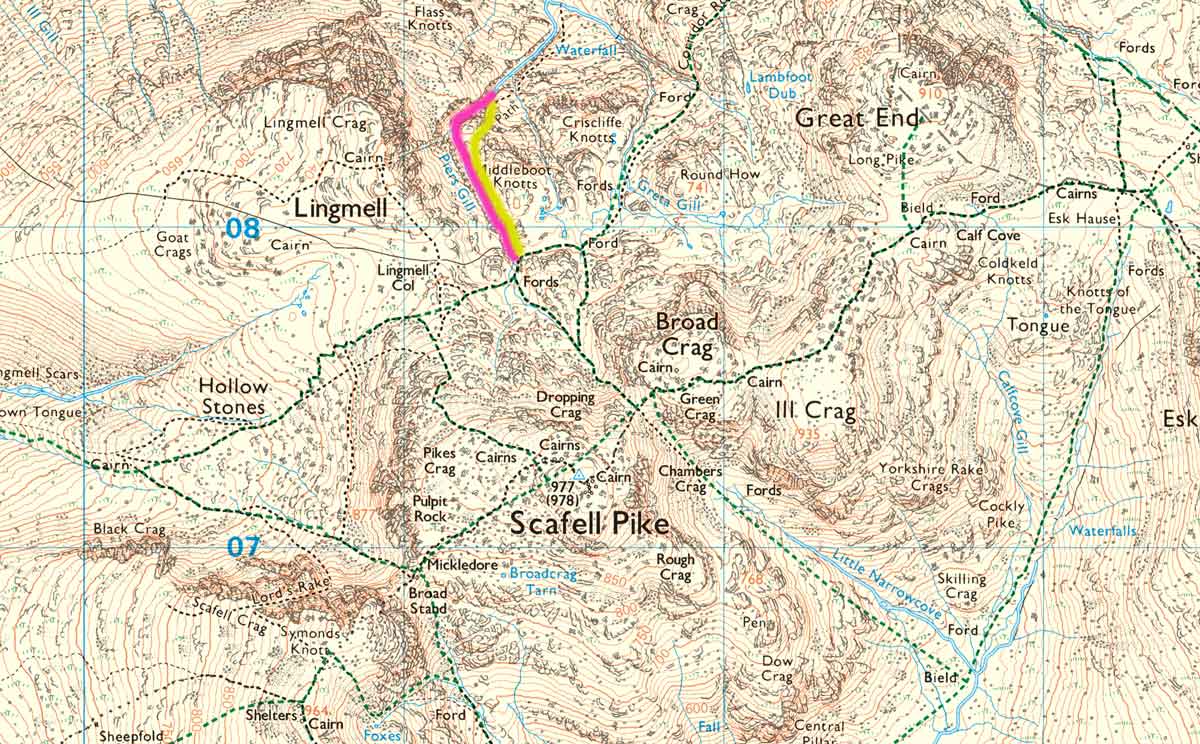
Piers gill showing the path in yellow and the danger area in pink
“Good navigation and awareness is needed, and none of the walkers in the serious events intended to be where they were found. As well as the well-prepared walkers, we see many people on Scafell Pike unaware of the very real hazards.”
The alternative route is to avoid the Gill altogether and head north east along the Corridor Route towards Spout Head.
If you are descending in this area, make sure you are comfortable navigating with a map and compass, download the map area for offline use in OS Maps and check your direction when you get to NY 2135 0786 to avoid getting into danger.
Top tips for having the best day out and staying safe
- Plan Ahead – Use OS Maps to find a route, or create your own and make sure you have a plan for where you are going.
- Be Prepared – Using OS Maps to navigate, make sure you can recharge your phone if needed and take enough kit to keep warm and safe if you have an accident.
- Check the weather – A quick check on the forecast for where you are walking could help you not get caught out by poor or changing conditions.
- It’s all about Being #AdventureSmart and you can find out more here www.adventuresmart.uk.
MREW and OS Maps partnership
The sort of joint working that happened between Nuala Dowie of Keswick MRT (see above) and the team at OS is a good example of how the partnership announced in 2023 between MREW (Mountain Rescue England and Wales) and OS Maps will contribute to safety in future.
It works well for everyone involved: volunteer rescuers have access to OS Maps; the two organisations work together to promote adventures in the outdoors; and MR volunteers feed back to the mapping team at OS Maps with their comments, feedback and suggestions on how to make the OS Maps app even safer. – Josh Warren, MREW Relationship Manager
Hiking for Beginners – A Complete Guide
Hiking for beginners, a complete guide to hiking safety, hiking fitness and the best UK Routes for beginners
Winter Hiking Tips from Mountain Rescue – Staying Safe in the Dark
As the days get shorter it’s important to take extra precautions when getting outside. Mountain Rescue share their expert advice for staying safe in the dark.
How to Avoid Blisters When Hiking
How to avoid blisters when hiking! Learn how to ensure you don’t get a blister on your next hike