Discover The Ridgeway, an historic National Trail, known as Britain’s oldest road
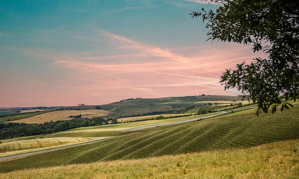
The Ridgeway National Trail is a historic long distance footpath that stretches for 87 miles (139km) across southern England, from the World Heritage Site of Avebury in Wiltshire to the ancient hill fort of Ivinghoe Beacon in Buckinghamshire. Discover our favourite historic spots along the route, plus key information to help you walk it.
Following the high ridges of the Chiltern Hills and the North Wessex Downs, the Ridgeway National Trail offers stunning views of the English countryside and provides a unique glimpse into the country’s rich cultural and natural heritage.
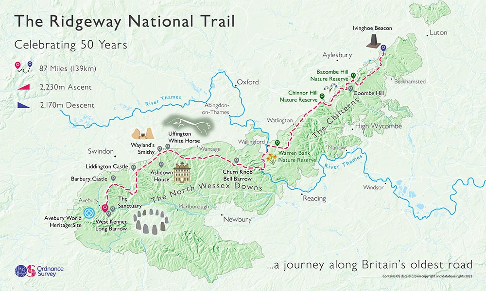
The Ridgeway map and historic points of intertest
The Ridgeway has a long history, dating back to prehistoric times when it was used as a trading route between the Thames Valley and the West Country. It was later used by the Romans as a military road and was also an important pilgrimage route in medieval times. Today, the trail is a popular destination for walkers, hikers, and nature enthusiasts, who come to experience its unique blend of history, culture, and natural beauty.
Dragon Hill
Along the way, visitors can explore a wealth of historical sites, including the Avebury stone circle, the Uffington White Horse, and the Iron Age hill fort of Barbury Castle. The trail also passes through a variety of landscapes, from rolling chalk downs to beech woodlands and quiet valleys, providing a rich and diverse habitat for a range of wildlife. Whether you’re looking for a challenging long-distance hike or a gentle stroll through the countryside, the Ridgeway National Trail has something to offer everyone.
To celebrate the trail’s 50th Anniversary we’ve selected the best historic points of interest along the Ridgeway which are well worth a visit.
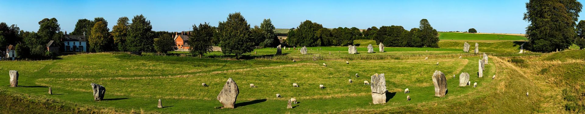
1. Avebury Stone Circle
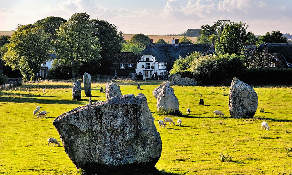
Avebury Stone Circle
The Ridgeway starts at the World Heritage Site of Avebury, which is home to the largest stone circle in the world. Dating back to around 2500 BC, the stone circle is a remarkable feat of engineering and provides an insight into the beliefs and rituals of prehistoric communities.
2. West Kennet Long Barrow
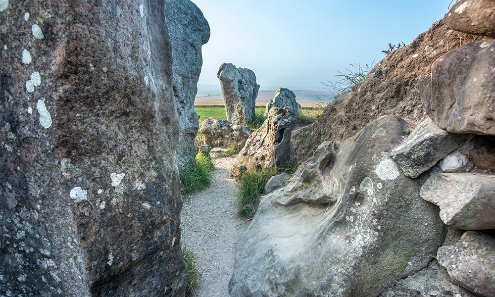
West Kennet Long Barrow
Just a short walk from Avebury, the West Kennet Long Barrow is a Neolithic burial chamber dating back to around 3650 BC. It is one of the largest and best-preserved barrows in the country and offers a fascinating glimpse into the lives and customs of our ancient ancestors.
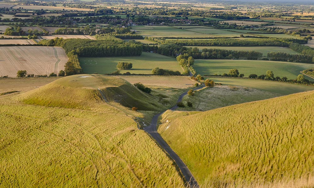
3. Uffington White Horse and Castle
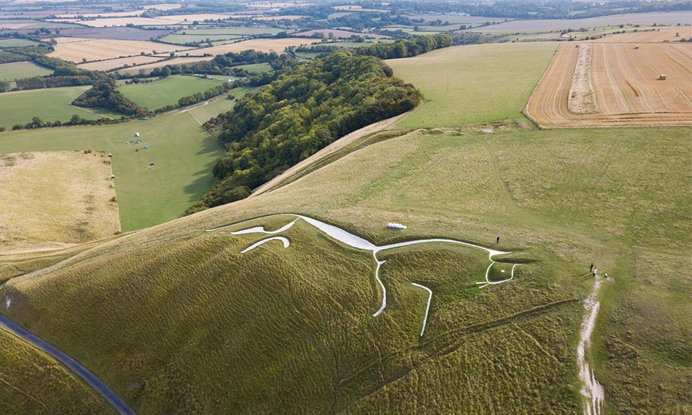
Uffington White Horse and Castle
One of the most famous landmarks on the trail, the Uffington White Horse is a prehistoric chalk figure of a horse that is thought to date back over 3,000 years. It is one of only a handful of white horses in the country and is an enduring symbol of the ancient landscape of the Ridgeway. Uffington ‘Castle’ sits at the summit of Whitehorse Hill and is a large Iron Age hillfort. Large Iron Age hillforts like this one are rare. Most are located on the high chalklands of the southern counties of England, and Uffington Castle is regarded as an impressive example.
Also nearby is Dragon Hill, a natural chalk hill with an artificial flat-top situated immediately below the prehistoric white horse. Legend claims that on its summit St George Slew the Dragon and that its blood was spilt on a batch of chalk where no grass will now grow. More information can be found here.
4. Wayland’s Smithy
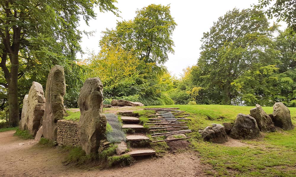
Wayland’s Smithy
This Neolithic burial chamber is located on the ancient Ridgeway walk and is thought to date back to around 3500 BC. Legend has it that the site was once used by the Saxon god Wayland as a blacksmith’s forge, and it has been a place of pilgrimage ever since.
5. Barbury Castle
Marlborough Downs near Barbury Castle
A well-preserved Iron Age hill fort that dates back to around 700 BC, Barbury Castle is located on a prominent hilltop overlooking the Marlborough Downs. It was an important defensive stronghold during the Roman and Saxon periods and offers stunning views across the surrounding countryside.
6. Liddington Castle
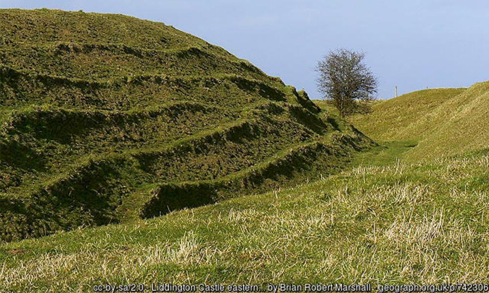
Liddington Castle. Credit: Brian Marshall, Geograph
Another Iron Age hill fort that dates back to around 500 BC, Liddington Castle is located on a steep escarpment overlooking the Vale of White Horse. It was an important strategic site during the Roman and Saxon periods and is now a popular destination for people walking or cycling The Ridgeway.
7. Ashdown House
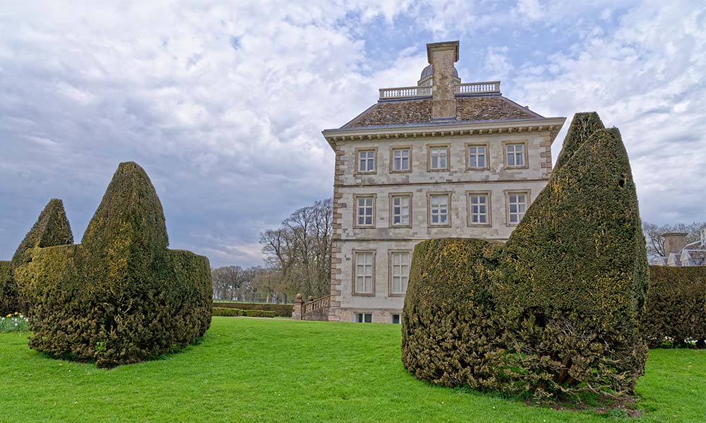
Ashdown House
Built in the 17th century for the Earl of Craven, Ashdown House is an impressive stately home that is situated on the Berkshire Downs. It is renowned for its beautiful gardens and is said to be haunted by the ghost of the earl’s daughter.
8. Churn Knob
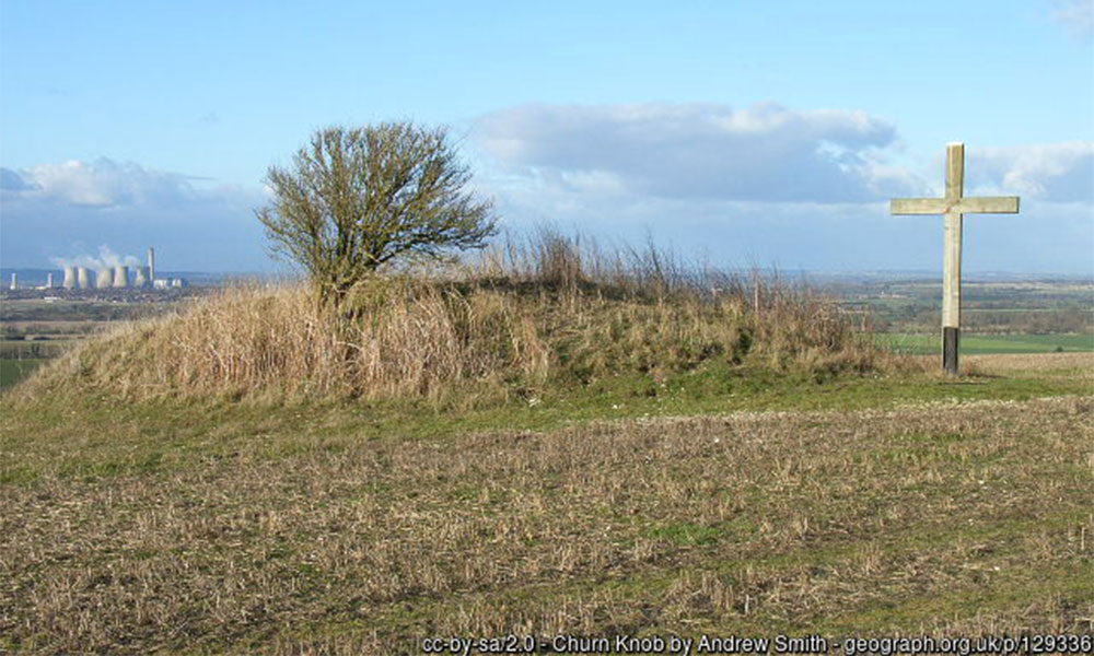
Churn Knob. Credit: Andrew Smith, Geograph
This Bronze Age burial mound is located on a hilltop overlooking the Thames Valley and is thought to date back to around 2000 BC. It is one of a number of prehistoric monuments along The Ridgeway walk and provides a fascinating insight into the religious beliefs and practices of our ancient ancestors.
9. Coombe Hill
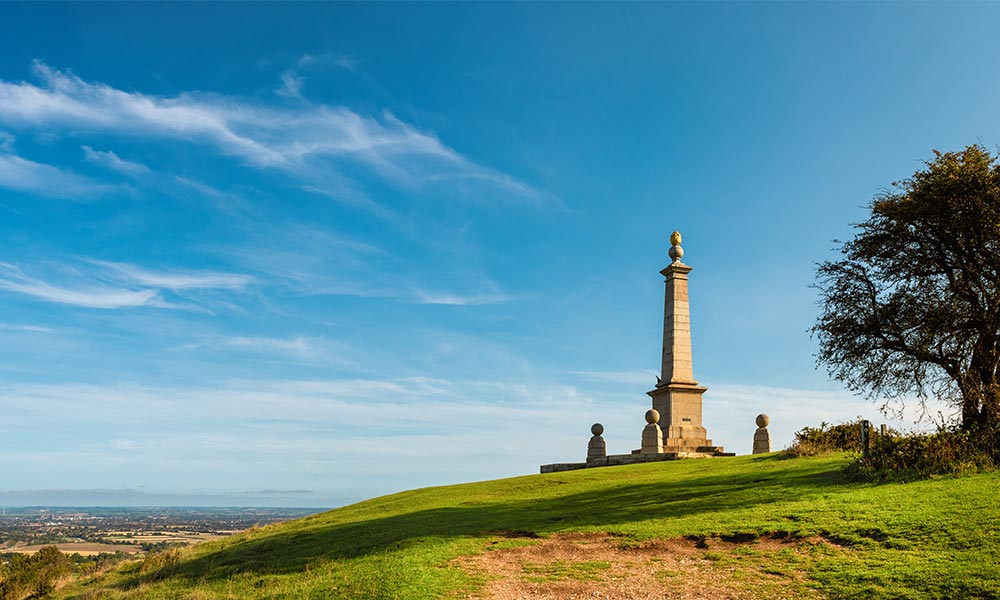
Coombe Hill
Coombe Hill is a Grade II listed monument and is one of the first and largest examples of a war memorial erected to honour the names of individual men who fell whilst fighting for their country. The monument is an iconic Buckinghamshire landmark and is a popular place for walking and picnics.
10. Ivinghoe Beacon
Ivinghoe Beacon
The eastern end of The Ridgeway walk is marked by Ivinghoe Beacon, an Iron Age hill fort that dates back to around 500 BC. It offers stunning views across the Chiltern Hills and is a fitting end to this historic and scenic trail.
It’s not just history that makes The Ridgeway National Trail so special. The beautiful countryside that engulfs the route is packed full of flora and fauna including red kites, marbled white butterflies and singing skylarks. Celebrate 50 years of this beautiful National Trail by experiencing it for yourself.
For more information, visit The Ridgeway National Trail website
Paper maps for the Ridgeway include:
OS Explorer 157: Marlborough & Savernake Forest
OS Explorer 169: Cirencester & Swindon
OS Explorer 170: Abingdon, Wantage & Vale of White Horse