Trusted routes saved as favourites
OS Maps users have been busy over the last six months, following thousands of routes and saving their favourites. To help inspire your next adventure, we’re sharing the top 10 most popular walking route. All these routes are Trusted Routes, so they’ve been tried and tested by our partner experts up and down the nation, guaranteeing a great walk.
If you want to discover thousands of other Trusted Routes, go
to the ‘find routes’ tab in OS Maps, click on your activity type and make sure
you’ve selected ‘Trusted Routes’. Get access to all 607 OS Leisure maps on and
offline with a free trial of OS Maps.
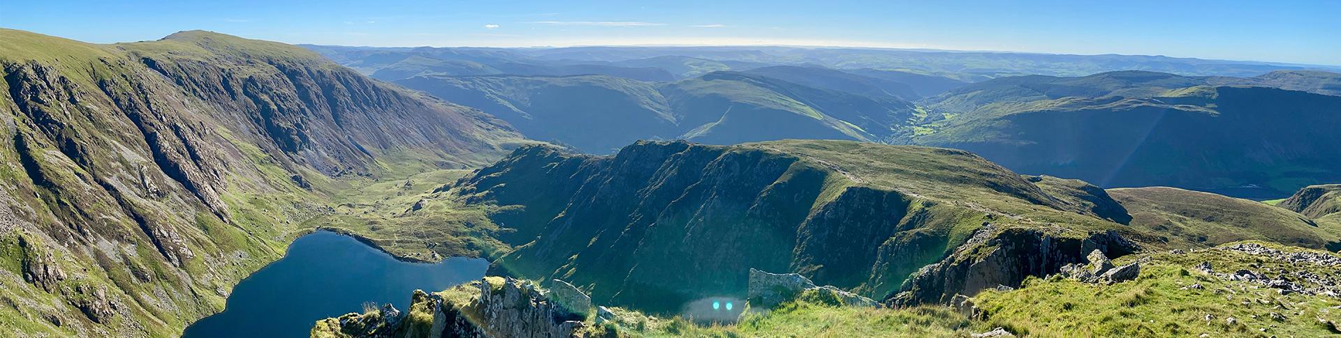
1. Yorkshire Three Peaks Challenge
Yorkshire Dales National Park
Yorkshire Three Peaks Challenge
Distance: 24 miles / 38km
Trusted routes partner: Country Walking Magazine
Difficulty: Severe
Start/parking: Car park in Horton in Ribblesdale, BD24 0HG
Forget racing between the nation’s highest peaks, this is the original Three Peaks Challenge, initiated in 1887 by two local teachers. The aim is to climb Pen-y-ghent, Whernside and Ingleborough in under 12 hours. At 736m, Whernside is the trio’s loftiest peak, pipping Ingleborough to the title of modern-day Yorkshire’s highest mountain. Popular with charity walkers, the challenge is a test of endurance, involving over 24 miles of ups and downs, cross-dale yomps and a net ascent of over 5000 feet. Best attempted in spring and summer (when weather and daylight hours are favourable), it’s a gruelling but hugely rewarding walk.
Walking towards Whernside
Good stamina is essential for this full-on walk, involving steep up and downs, twists and turns over rough terrain. There are four stiles on this route. It mostly follows clear footpaths/bridleways, plus unavoidable road sections. There are plenty of pubs nearby including the Golden Lion and The Crown, Horton in Ribblesdale; The Station Inn, Ribblehead; Philpin Farm and the Old Hill Inn, Chapel-le-Dale.
By Philip Thomas (Country Waking Magazine)
Walk more with Walk 1000 Miles.
2. Luds Church and the Roaches walk
Peak District National Park
Luds Church and the Roaches walk
Distance: 7 miles / 11km
Trusted routes partner: AA walks
Difficulty: Moderate
Start/parking: Parking on Roach Rd, Upper Hulme, Leek ST13 8UA
The jagged ridge of the Roaches is one of the most popular outdoor locations in the Peak District National Park. The name is a corruption of the French for rocks – roches. It was here on the gritstone crags that the ‘working class revolution’ in climbing took place in the 1950s. the Roaches and nearby Droxy Pool is the site of many mythical and non-mythical legends; the ghost of a young mermaid, Jenny Greenteeth, a hideous monster with green skin, Sir gawain and the Green Knight. There’s a huge amount of history to be found on the route.
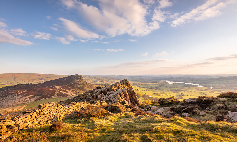
Views from the Roaches
After your walk, head to the nearby town of Leek which has a host of antique dealers and an open-air craft and antique market each Saturday in the historic Market Square. Other markets include the Butter Market, selling mainly fresh traditional produce, on Wednesday, Friday and Saturday. Also worth visiting is the water-powered corn mill at Brindley’s Mill.
The Roaches Tearoom at Paddock Farm sits beneath the rocky outcrop of Hen’s Cloud almost opposite the car parking area. The food is home-made, excellent and there’s plenty of it. There’s a conservatory overlooking a herb garden and superb views across Tittesworth Reservoir. It’s open daily all year.
3. Kinder Scout less-trodden route
Peak District National Park
Kinder Scout less-trodden route
Distance: 8 miles / 13km
Trusted routes partner: Trail Magazine
Difficulty: Moderate
Start/Finish: Bowden Bridge Car Park, Kinder Rd, High Peak SK22 2LH
Febreze a sparkle of new life back into your best-loved mountain by climbing it in a totally new way. Re-jig your walk into a route that sharpens your navigation, and you’ll get a spanking new perspective on any old favourite. Take Kinder Scout for example. By sticking only to the main paths and the Pennine Way, you risk glazing over with boredom while walking one of the Peak District’s most spectacularly windswept moorland summits.
Views from Kinder Scout
On this walk you’ll sneak up on Kinder’s rock topped trig point from a side you’ve never seen it from before, using skills from your mountain tool kit: bearings, pacing, handrailing, attack points and aiming off. Practise these as you walk a circular route. It’ll take you off the beaten track and over desolate peat hags and waterfalls, exploring wind lashed rocks and discovering plane wrecks using only a map and your own impressive new mountain knowhow. Not only will your navigation confidence improve, but you’ll be privy to a completely fresh look at one well-walked mountain.
4. Wansfell Pike hike
Lake District National Park
Wansfell Pike hike
Distance: 6 miles / 10km
Trusted route partner: Trail Magazine
Difficulty: Moderate
Start/parking: Low Fold Car Park, Ambleside, LA22 0DR
When there’s snow on the ground in the Lake District and time is short, it’s hard to beat Wansfell for a first foray into winter walking. However, this is a route which can be enjoyed at any time of year.
Follow the route to an atmospheric climb next to Stockghyll Force’s wooded ravine. There are several waterfalls along the way until just before the top when the footpath turns right at a T-junction. The path becomes steeper and takes a direct line up the fell side to the awaiting Wansfell Pike which comes into view. Be sure to stop to catch your breath and admire the expanding view behind you. It really is quite a sight, with Ambleside nestled in the valley. Continue to Wansfell Pike where you’ll enjoy the view from the 482m high top. You’ll see down the length of Windermere and across Ambleside to the westerly Langdales and Scafell ranges.
View from Wansfell Pike looking towards the Langdale fells
Once you reach Troutbeck you could turn left and make the short detour to the lovely Queen’s Head inn for lunch, or turn right and continue the route down the lane for a short while in the other direction to the bridleway to the right called Robin Lane, signposted to Ambleside. You’ll walk through Skelghyll Wood and then on to Jenkin Crag, which is worth a look as this rocky outcrop provides a wooded outlook straight over Windermere, to Wetherlam and the Old Man of Coniston.
5. Beacon Horseshoe route
Brecon Beacons National Park
Beacon Horseshoe route
Distance: 8.5 miles / 13.6km
Trusted route partner: OS Champions
Difficulty: Moderate
Start/parking: Taf Fechan car park, Dyfed, Kings Rd, Llandovery
This is the classic walk of the Brecon Beacons National Park. It takes in some of the most famous peaks and the views are incredible! Pick a clear day to make the most of it
The path up the Craig Fan Ddu ridge is steep but once on the ridge it’s worth it, pause for breath and take in the views. Turn right and follow the ridge around towards Corn Du and as you walk the main peaks of the Central Beacons will come into view.
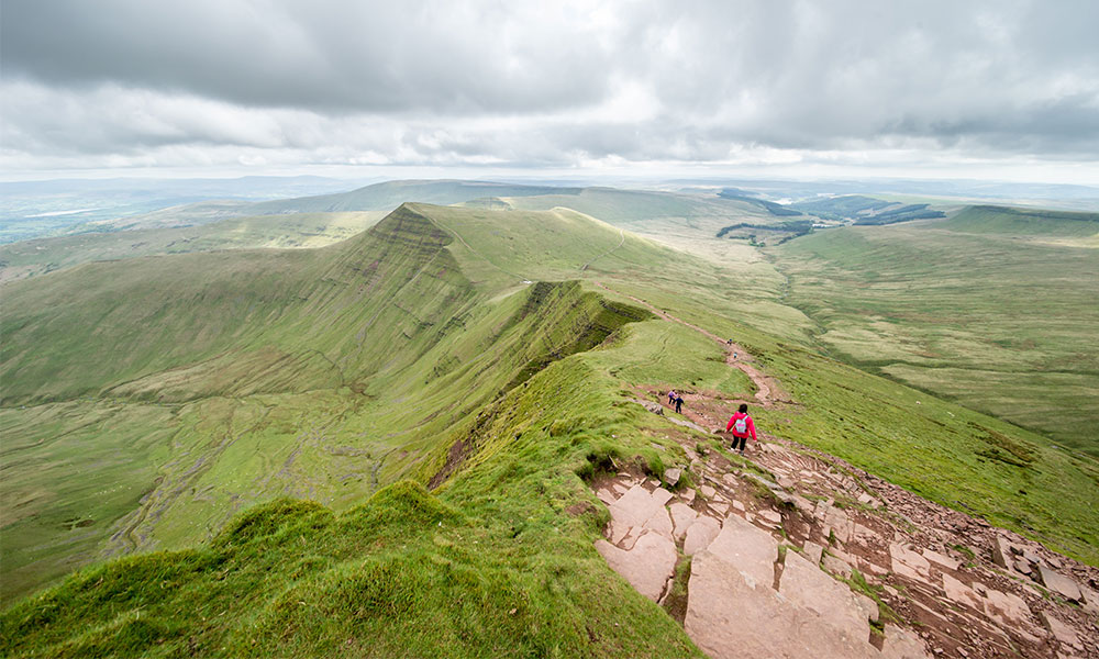
The path on Pen y Fan
As you approach Corn Du at Bwlch Duwynt, the path forks. If you go right, it will take you around the side to Pen y Fan, while if you go left you’ll first go over Corn Du. On the top you’ll see a Bronze Age burial cairn. Go straight ahead over the ridge and down the other side. Pen y Fan is ahead of you. Take your time to enjoy Pen y Fan and then continue straight ahead and there’s a steep descent off the summit until you get onto a stone path that takes you down Craig Cwm Sere, and up the steep climb to the summit of Cribyn. Around the back of Cribyn, some sections can get fairly boggy.
Once you reach Gap Road you can either turn right and follow the road straight back to the car park. Or… you can ascend your next peak – Fan y Big, by following the clear, steep path up to the summit. From Fan-y-Big follow the Craig Cwm Oergwm ridge heading back towards the Neuadd Reservoir. You’ll eventually come back onto the Gap Road where you’ll follow it to the pump house and then continue down the road to the car park.
by OS GetOutside Champion Phillipa Cherryson
Malham and Gordale Scar
Yorkshire Dales National Park
Malham and Gordale Scar
Distance: 8.5 miles / 13km
Trusted route partner: OS Champions
Difficulty: Moderate
Start/parking: Yorkshire Dales NP Car Park, Malham, Skipton, BD23 4DG
This popular route covers the dramatic landscape of Malham Cove, Gordale Scar, Janet’s Foss Waterfall and Malham Tarn – Britain’s highest lake. Travel through varied terrain and rugged landscapes. The scramble up Gordale Scar can be easy to challenging, depending on water levels. A less strenuous route is from Malham Village to Janet’s Foss.
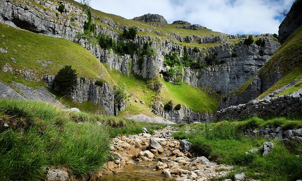
Gordale Scar
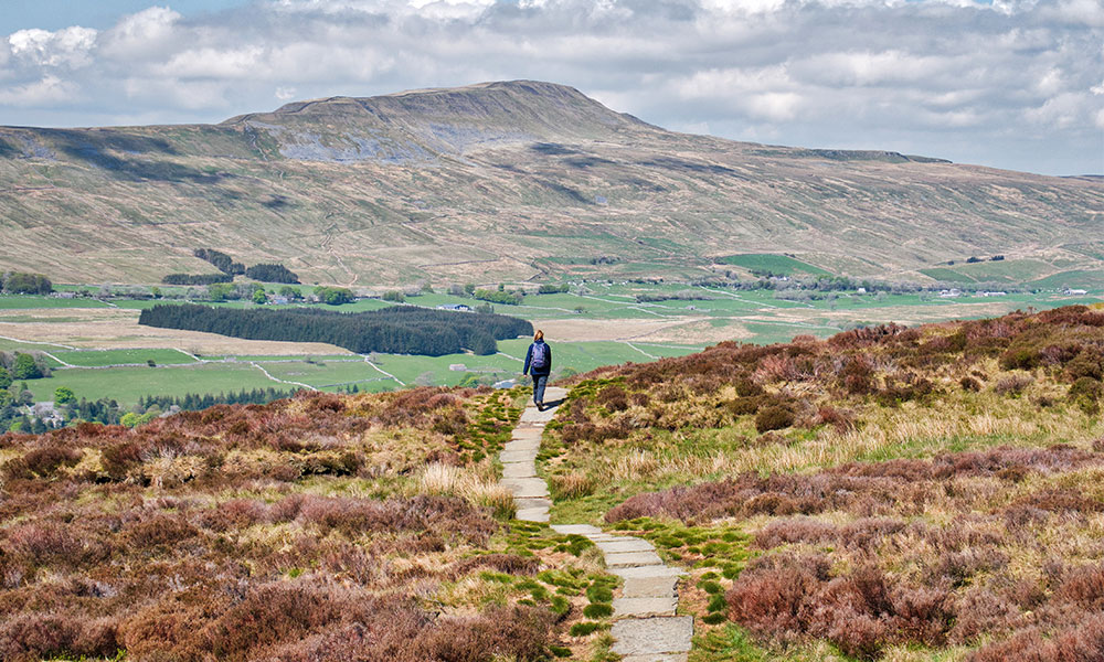
7. White Edge walk
Peak District National Park
White Edge walk
Distance: 6 miles / 10km
Trusted route partner: Country Walking Magazine
Difficulty: Moderate
Start/parking: Curbar Gap Car Park, Hope Valley, S32 3YR
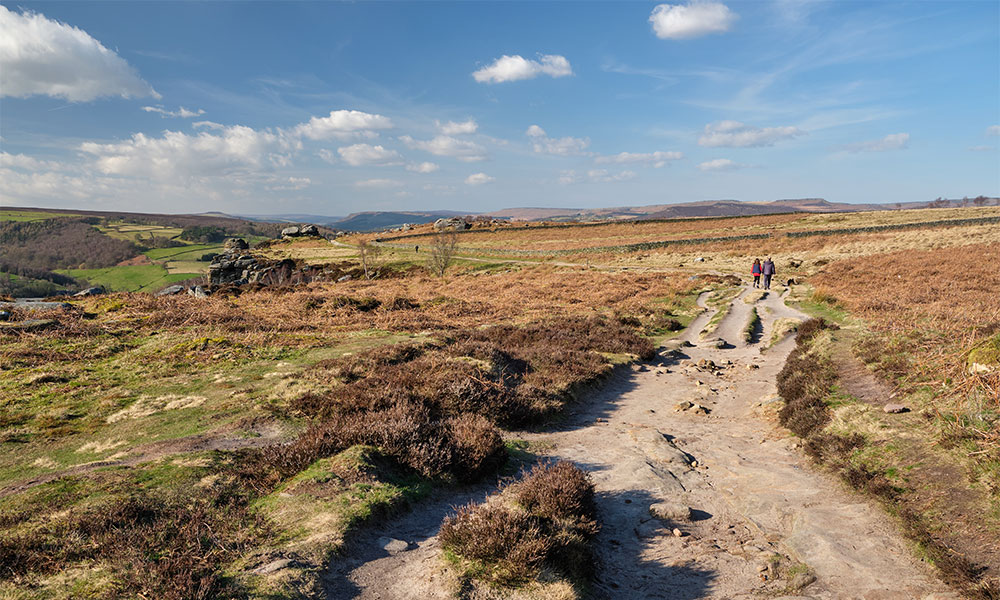
Path on top of Froggatt Edge
The famous edges of Froggatt, Curbar and Baslow are well known to many walkers; less so the parent ridge that hides behind them: White Edge. This intriguing walk sets that right by taking you out along the crest of this hidden hinterland to explore its delights, then sweeping down to return along the more frequented (and spectacular) paths of Froggatt Edge and Curbar Edge. There’s also a pleasant pub stop halfway round at the Grouse Inn, if you fancy it. This route follows mostly clear paths across open moorland, caution needed on cliff edges. There is 1 stile en route.
By Nick Hallissey (Country Walking Magazine)
Walk more with Walk 1000 Miles.
8. Helvellyn less-trodden route
Lake District National Park
Helvellyn less-trodden route
Distance: 9.5 miles / 15km
Trusted route partner: Trail Magazine
Difficulty: Moderate
Start/parking: Wythburn Car Park, A591, Keswick CA12 4TW
At 949m/3,118ft Helvellyn is the third highest mountain in England, and one of four English 3,000 footers. It is famous for Striding Edge, the knife-edge ridge that stretches from the summit towards Ullswater. The challenges of Striding Edge are not for the faint-hearted, and in winter a covering of snow can make the challenge yet more testing. The good news is that you don’t need to tackle Helvellyn via Striding Edge, and even in winter with the promise of snow cover there are relatively safe ways onto the mountain.
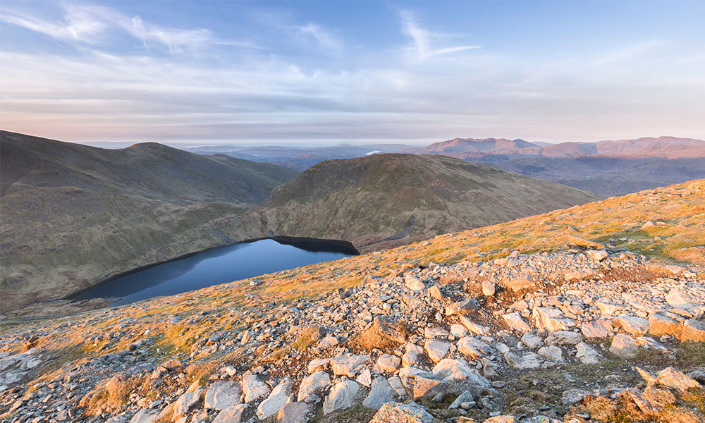
View of Grisedale Tarn from Dollywagon Pike
This route tackles Helvellyn from the west, which allows a relatively steady climb and descent from the mountain with an easy valley walk back to the start. Helvellyn is the highest point along a mountain spine that runs south to north through the heart of the Lake District. To the west the craggy tops of the Central Fells dominate the skyline, while to the east the rolling, grassy fells of the Eastern Fells lead the eye to the distant Pennines.
The Helvellyn range itself changes character too throughout its
length, with craggy Dollywagon Pike playing the role of guardian to the ridge,
while Helvellyn offers smooth western contours rising in extreme contrast to
the ragged ridges of Striding and Swirral Edges to the east. There is probably
no better hill than Helvellyn to visit in winter when the sun is setting across
the Central Fells. What’s even better is that when you’ve climbed Helvellyn,
you’ve bagged the third highest peak in England.
9. Cadair Idris Minffordd path
Snowdonia National Park
Cadair Idris Minffordd path
Distance: 6 miles / 10km
Trusted route partner: Country Walking Magazine
Difficulty: Difficult
Start/parking: Dol Idris car park, LL36 9AJ, grid ref SH732116
This is one of the great British mountain walks, starting in thick oak woodland and rising to the immense rocky amphitheatre that surrounds the hidden lake of Lyn Cau. The approach to Cadair’s true high point traverses a broad rocky ridgeline, climbs to a perfect pyramidal summit, then drops again before leading upwards through an ancient volcanic landscape to the trig point and shelter at Penygadair. From the 893m summit you’re treated to magical views across the surrounding peaks and lakes, out to the west coast, and north to the Llyn Peninsula and the distant mountains of northern Snowdonia.
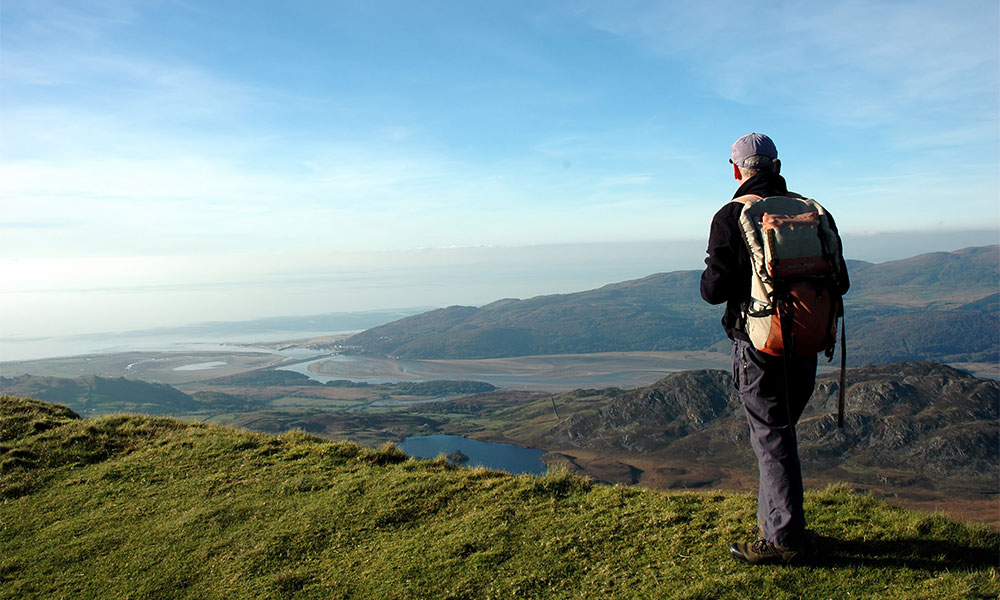
Views from Cadair Idris
This is a rocky and steep route on good paths but requires care and navigation skills in low visibility. Go prepared for all weathers, with good outdoor gear and plenty of refreshments, and you’ll come back telling tales of soaring peaks forged by mythical giants, crowned by rocks that are older than the dinosaurs. This route involves steep steps, rocky paths and tracks, loose stones. It covers mountainous terrain with some exposed ground. There are three stiles en route. Warm up with a hot drink from the Ty Te Cadair Tea Room or a cold one from The Cross Foxes Bar & Grill close to the start/finish
Walk more with Walk 1000 Miles.
10. Manifold Valley walk
Peak District National Park
Manifold Valley walk
Distance: 6 miles / 10km
Trusted route partner: OS Pathfinder Guides
Difficulty: Moderate
Start/parking: Wetton Village, Ashbourne, DE6 2AF
The Manifold is one of the lesser-known valleys of the White Peak area and is aptly named, since the River Manifold forms a whole series of folds or loops through attractive limestone scenery along its length. From Wetton, the walk takes an undulating course across the fields, passing the ruins of abandoned copper mines and eventually climbing to a most dramatic and expansive viewpoint overlooking the Manifold valley.

Manifold Valley
After a steep descent into the dale at Ecton, there is a lovely walk along the Manifold Track, a disused railway line that keeps alongside the winding river. Created in 1937 by Staffordshire County Council, the Manifold Way follows the disused Leek and Manifold Light Railway, a single-track line that had a brief 30-year career but is now a splendid passage for walkers and cyclists. Later, the walk passes the mightily impressive Thor’s Cave, inhabited during prehistoric times and, without doubt, the dominant feature of the surrounding landscape. Don’t forget to stop at the Wetton Village Hall and Tea Rooms for a slice of cake.
This is Walk 61 from 100 Outstanding British Walks, available to buy through the Official OS Shop and all good bookshops.
It comes as no surprise to find that the most popular walking routes in OS Maps are all in Britain’s National Parks. We’re so lucky to have such rich and diverse landscapes and public rights of way which allow us to enjoy them!
When following routes, please remember to take care of the great outdoors and follow the Countryside Code at all times.