Circular Walks Along the Coast of Monmouthshire
This section of the Wales Coast Path is 14 miles / 22.5km long and takes you through Monmouthshire, Caldicot, and Chepstow, offering a blend of history and nature.
Starting at Newport, the route heads along the seawall to Rogiet Moor, then diverts inland, crossing tracks and the M4 before reaching the coastline again near the Prince of Wales Bridge. You’ll pass Sudbrook’s ancient monument, wander through fields, and skirt Mathern’s golf course, eventually making your way into Chepstow via industrial estates and housing areas. Caldicot, with its industrial past tied to the Severn Tunnel and the Llanwern steelworks, offers plenty of green spaces and history, like the Tunnel Centre and the 12th-century Caldicot Castle.
The walk then continues to Chepstow, where the Wales Coast Path ends at the River Wye and Chepstow Bridge. If you’re feeling adventurous, you can pick up the Offa’s Dyke Path National Trail, which starts nearby and leads all the way to the coastal town of Prestatyn in the north. Along the way, you’ll find several historical landmarks, including the Priory Church of St Mary, the Old Wye Bridge. With the open, vast views of the Severn Estuary, this section of the path offers a lovely mix of walking through town and countryside with plenty of heritage to discover.
Caldicot & Sudbrook Circular Walk
Caldicot has an ancient history, but it was a small and quiet community until industries were located nearby and major transport links were forged. The first railway to pass it was opened in 1850, and the population doubled when workers cut the Severn Tunnel, which opened in 1886.
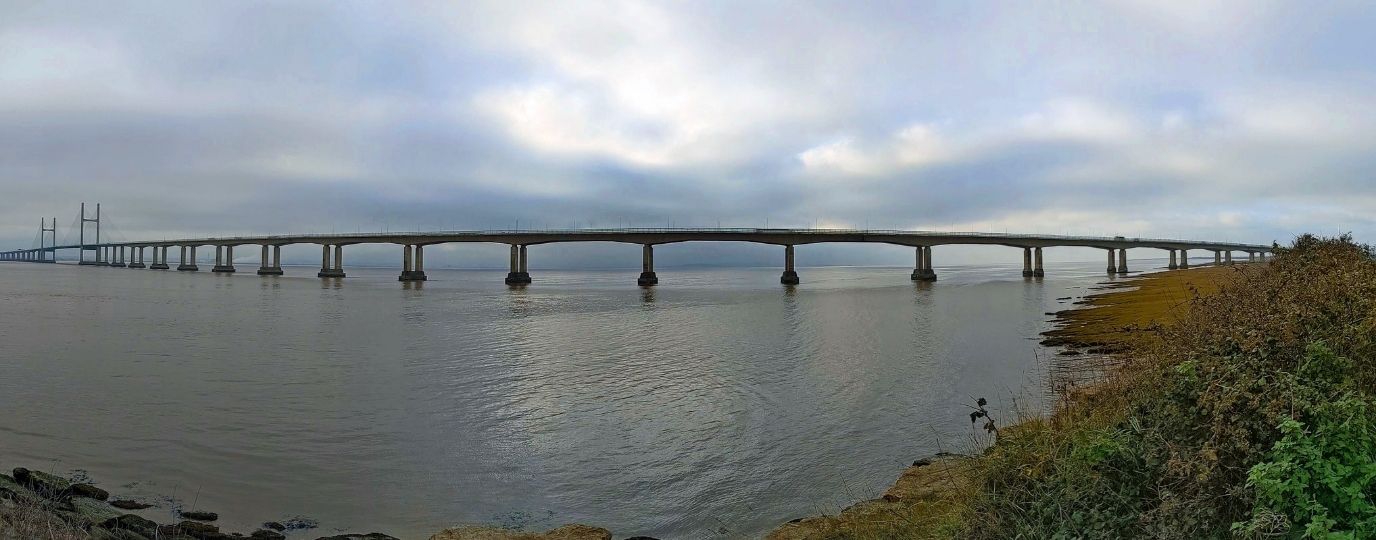
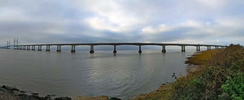
The nearby Llanwern steelworks opened in 1962 and thousands of workers needed housing. The opening of the Severn Bridge in 1966 and the Second Severn Crossing (now Prince of Wales Bridge) in 1996, saw Caldicot hemmed in between two motorways. A surprising amount of green spaces and interesting features remain around the town, which can be discovered on an easy walk of 7.1 miles / 11.5km.
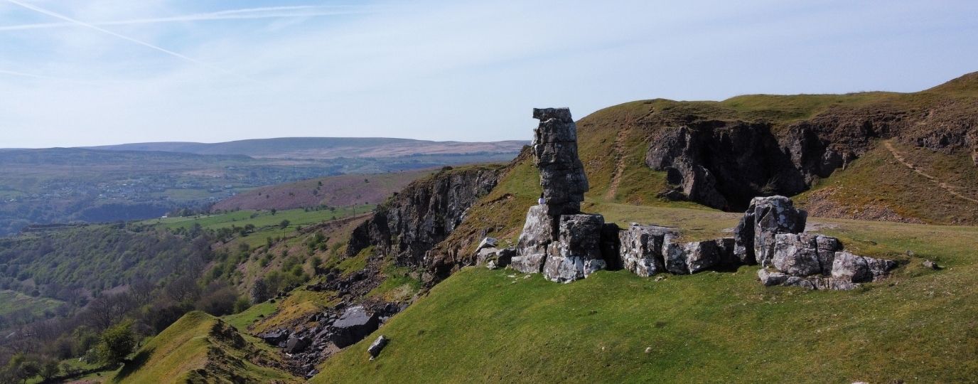
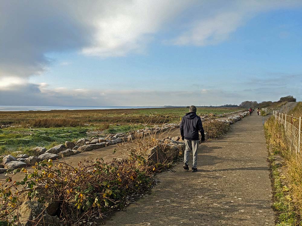
A useful path leaves the centre of Caldicot and avoids roads for most of the way to the railway station. The Wales Coast Path is joined and followed, crossing a footbridge over the busy M4 motorway, passing saltmarsh beside the Severn estuary before going beneath the Prince of Wales Bridge. The path goes through an Iron Age fort to reach Sudbrook, where the little Tunnel Centre explains all about the construction of the Severn Tunnel. The Wales Coast Path leads to a lovely little park at Black Rock, then paths are followed inland through fields.
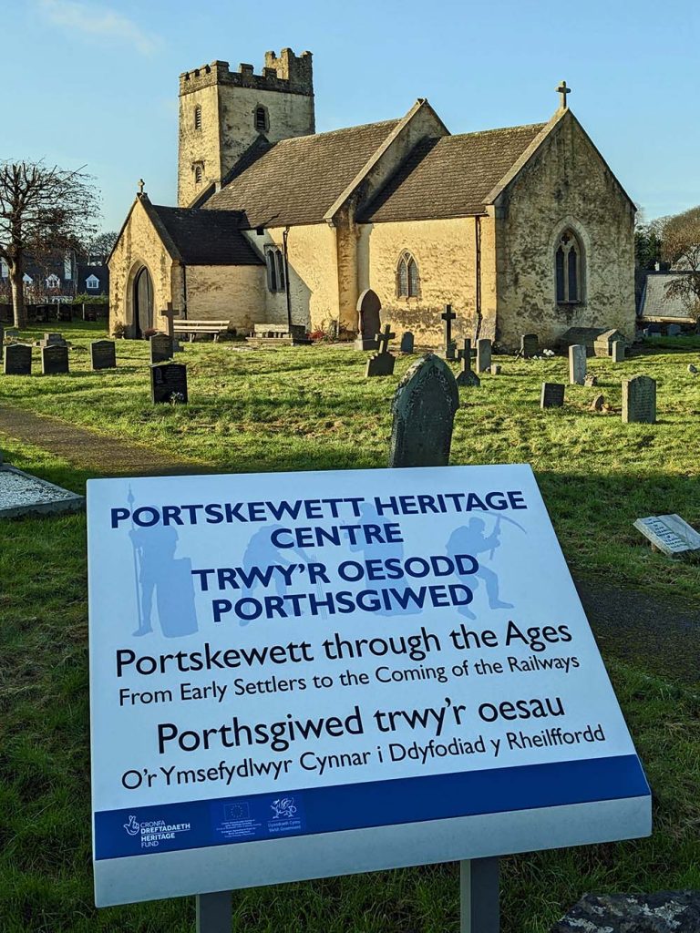
The route threads its way through urban areas and farmland, then Portskewett Heritage Centre sits beside St Mary’s Church. The green spaces of Harold’s Park and the community-run Cornfield Project are found on the outskirts of Caldicot. The final part of the walk passes Caldicot Castle, which dates from 1100 and was restored in the 19th century. It sits at the heart of an extensive country park only a short walk from Caldicot.
Top Tip
The Tunnel Centre at Sudbrook, the Portskewett Heritage Centre and Caldicot Castle should all be visited if they are open.
Chepstow and Sedbury
Chepstow marks the end of the 870 mile / 1400km Wales Coast Path, while nearby Sedbury marks the beginning of the 177 mile / 285km Offa’s Dyke Path, which could be followed northwards to reach Prestatyn, linking back to the Wales Coast Path!
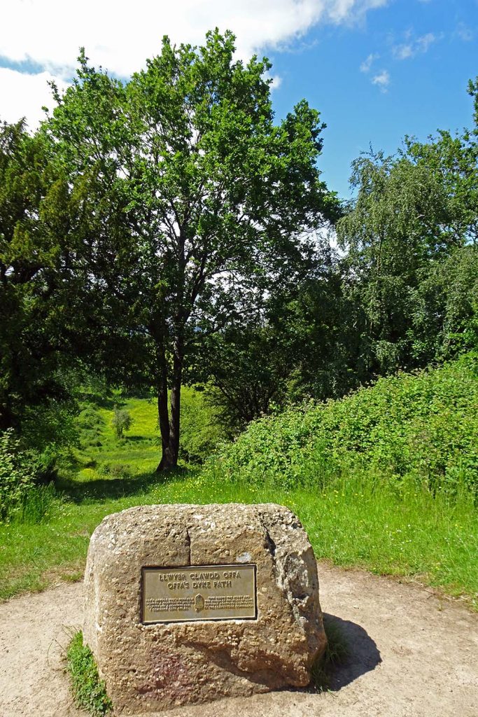
For a short, easy and interesting 5.3 mile / 8.6km walk, visit the terminal points of both trails. This end of the Wales Coast Path features plenty of splendid artworks, while the start of the Offa’s Dyke Path is marked by a huge boulder on Sedbury Cliff.
Start at Chepstow Railway Station, or the bus stands on Thomas Street.
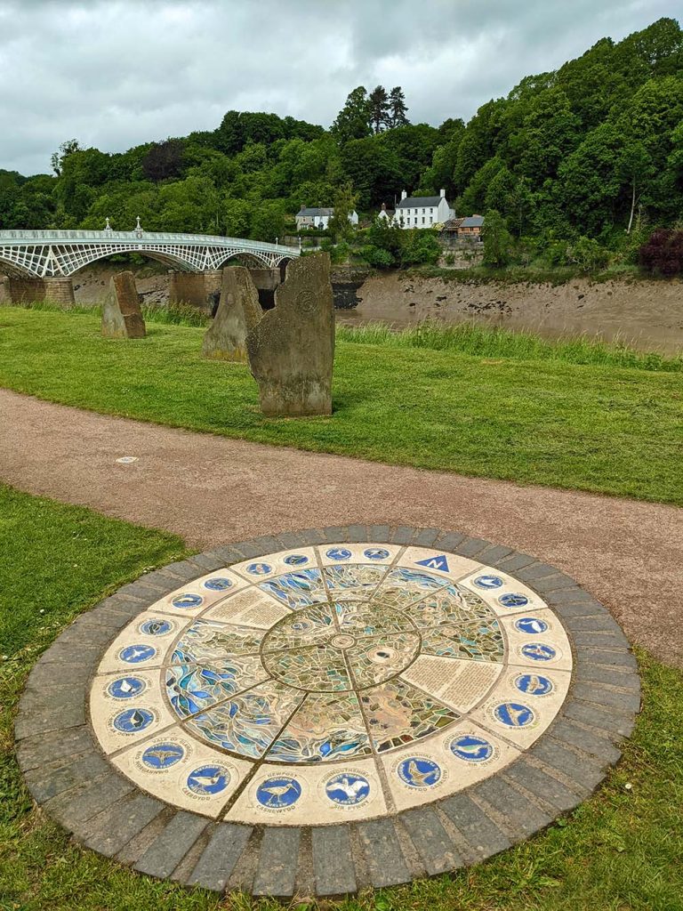
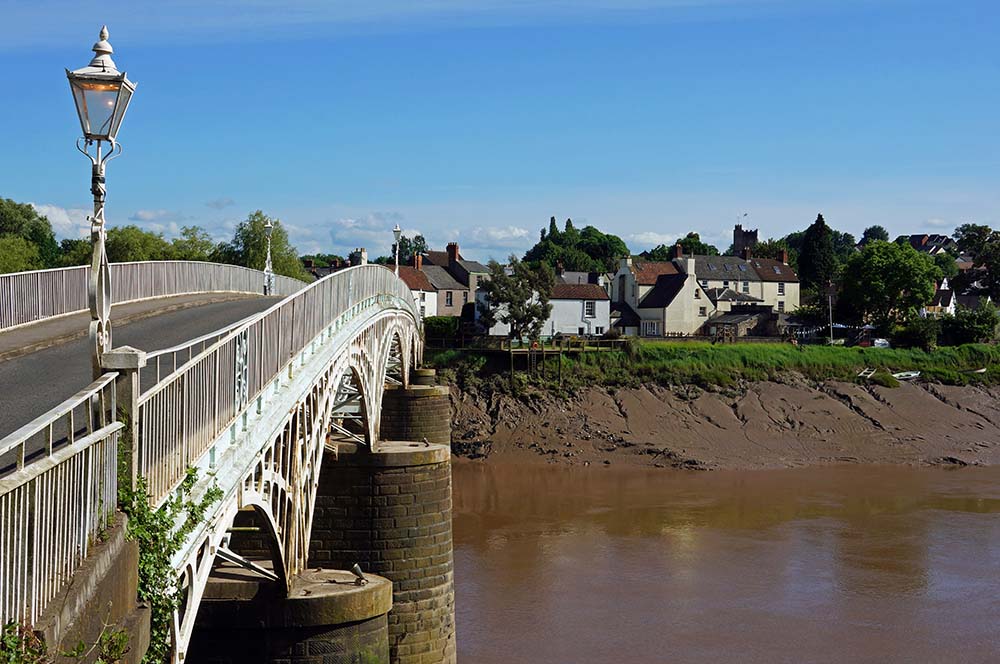
Either way, pick up and follow the Wales Coast Path through the streets, passing the Priory Church of St Mary, founded by the Benedictines in 1072. Continue down to the tidal River Wye and turn left to pass several features that mark the end of the coast path, and the familiar ‘dragonshell’ logo is repeated many times. Cross the ornate Old Wye Bridge and follow a path uphill, turning right as marked for the Offa’s Dyke Path, featuring an ‘acorn’ logo. Squeeze between houses, alternately following paths and roads through built-up areas and farmland.
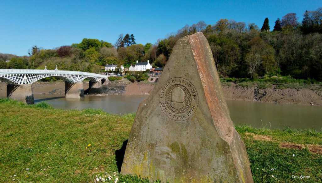
There is no trace of the 8th century earthwork of Offa’s Dyke until all of a sudden it crosses a valley and rises onto Sedbury Cliff. Stand beside a commemorative boulder, face northwards and imagine following the Offa’s Dyke Path all the way to Prestatyn on the north coast of Wales. Even if you’re not going to go that far, you’ll have to retrace steps at least back to Chepstow. Don’t leave without visiting Chepstow Castle, and take the time to wander the streets looking for other heritage features.
Top Tip
Ensure that you have enough time to wander round Chepstow and visit its castle, which abounds in history and heritage.
We hope you have enjoyed these Monmouthshire Circular Walking Routes, it’s great to have a list of routes that are available to those travelling by rail, a fun way to explore the countryside.
There are many more exciting walking routes available to visit across Wales including all of the fabulous Welsh Coast Path Circular Routes.
If you’re planning to explore what Wales has to offer, take a look at our guide to the origin of Welsh place names. This guide will help you with understanding Welsh names, how to pronounce them and meaning behind them, adding a little more context and interest to your adventures.