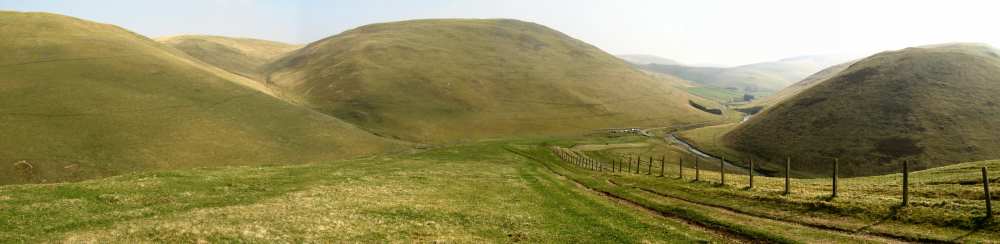
Did you know? There are quite a few hills and mountains in the British Isles that are rather cheekily named after boobs! Have you got a hill in your local area that’s earned a nickname because of its beautiful breast-shaped appearance – we’d love to add it to our list!
October is Breast Cancer Awareness Month!
In honour of #BreastCancerAwarenessMonth, let’s take a moment to appreciate the unique beauty of our natural landscapes and have a little light-hearted giggle while raising awareness for something much more serious. Hills and mountains have been reminding people of boobs since time immemorial. They are symbols of fertility and femininity and lets not forget we are all mammals, a term that comes directly from mammary glands. So, of course our ancestors looked at these shapely hills and thought of… boobs!
This October why not set your sights on hiking up one of these uniquely named or shaped hills with your friends or family? Snap a pic at the top and share it with the hashtag #BreastCancerAwarenessMonth. Raising awareness about breast cancer and how to check for symptoms is crucial for early diagnosis and treatment. We want to encourage more women to regularly check their humps for lumps!
A list of mountains and hills named after boobs
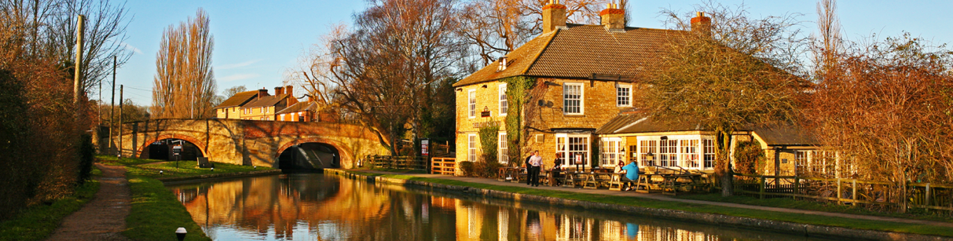
We’ve put together a list of hills and mountains named after boobs in England, Scotland and Wales, as well as a few that are just famously breast-shaped. We’ve added a link to an OS Maps Route you could try if you’re looking for a challenge to help raise awareness of Breast Cancer.
England
Mam Tor, Peak District
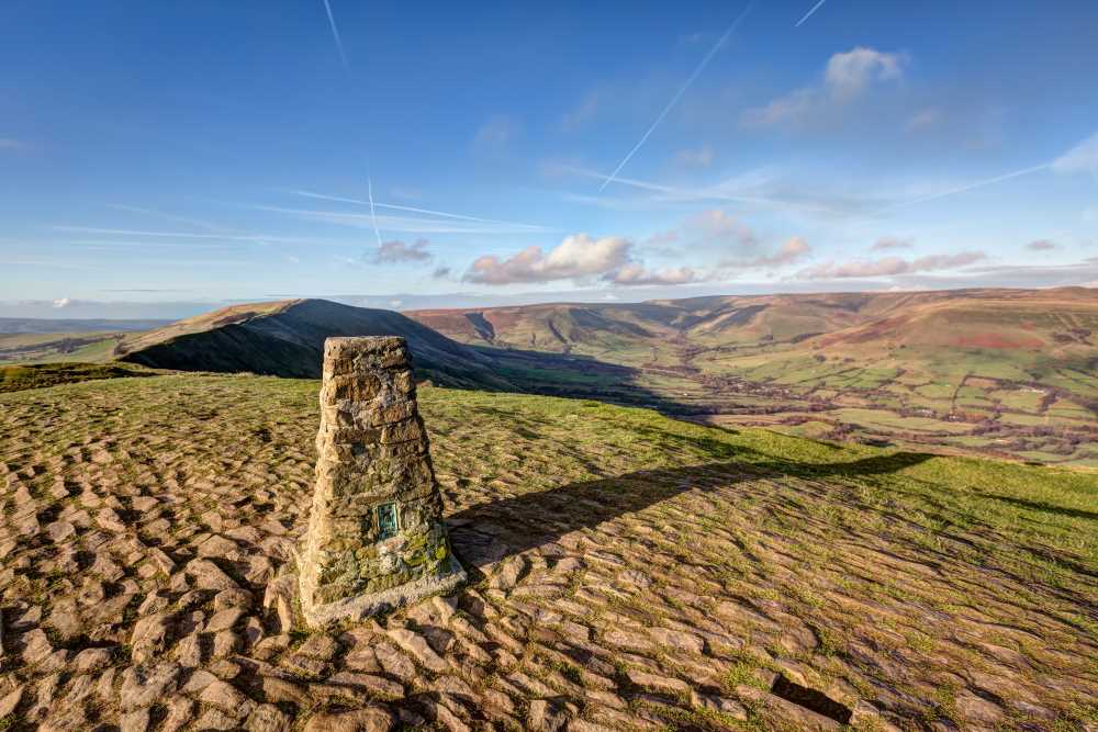
In the Peak District, “Mam” is an old English word for mother, and this hill is often associated with a breast-like shape. It reaches 517 meters (1,696 feet) and with a car park very close to the summit, it’s a favourite in the area for families and dog walkers. There’s a lovely Trig at the top with fabulous views.
Tunstall Hills, Northern Pennines
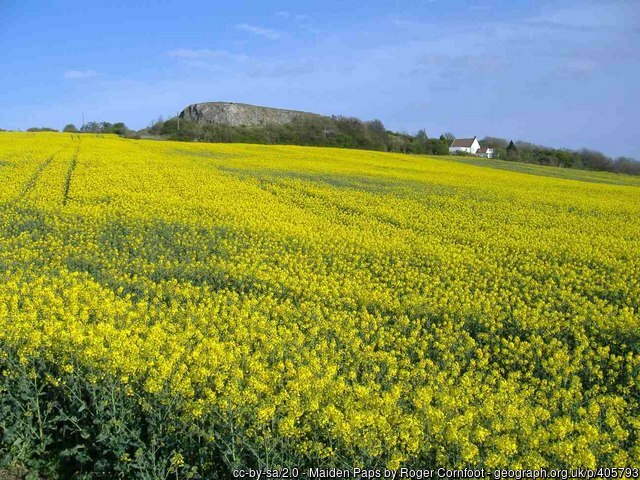
Historically nicknamed the “Maidens Paps” because their shape resembles that of breasts, the Gaelic word for breast is pap. The hills are 112 meters (367 feet) high. In the 1860’s, people protested when there were plans to limit access to the hills and more recently campaigners continue to protect the hills from development.
The Wrekin, Shropshire
The Wrekin is sometimes called “The Breast of the Maiden” because of its unique shape. It rises to 407 meters (1,335 feet). It’s a beloved spot for locals, with breathtaking views from its ancient hilltop fortress. As you hike up this hill, you’ll be walking among some of the oldest rocks in the world.
Mount Judd, Nuneaton
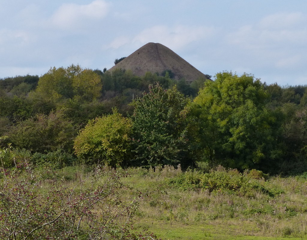
A man-made hill created from the spoil from the Judkins Quarry and also known locally as The Nuneaton Nipple. It is 158 meters (518 feet). The hill is on private land, so rather than walk up this one, perhaps just snap a pic as you pass!
Wittenham Clumps, Oxfordshire
Properly referred to as the Sinodun Hills, it has been suggested that the name is an old pun on the Latin ‘sinus’ (bosom). We also like Wittenham Clumps’ other names, The Berkshire Bubs and Mother Dunch’s Buttocks.
Titty Hill, West Sussex
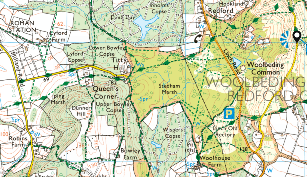
Not really a hill, but a hamlet in the civil parish of Milland in the Chichester district. It stands at 65 meters (212 feet) above sea level and you can find some lovely woodland footpaths to walk around here.
Wales
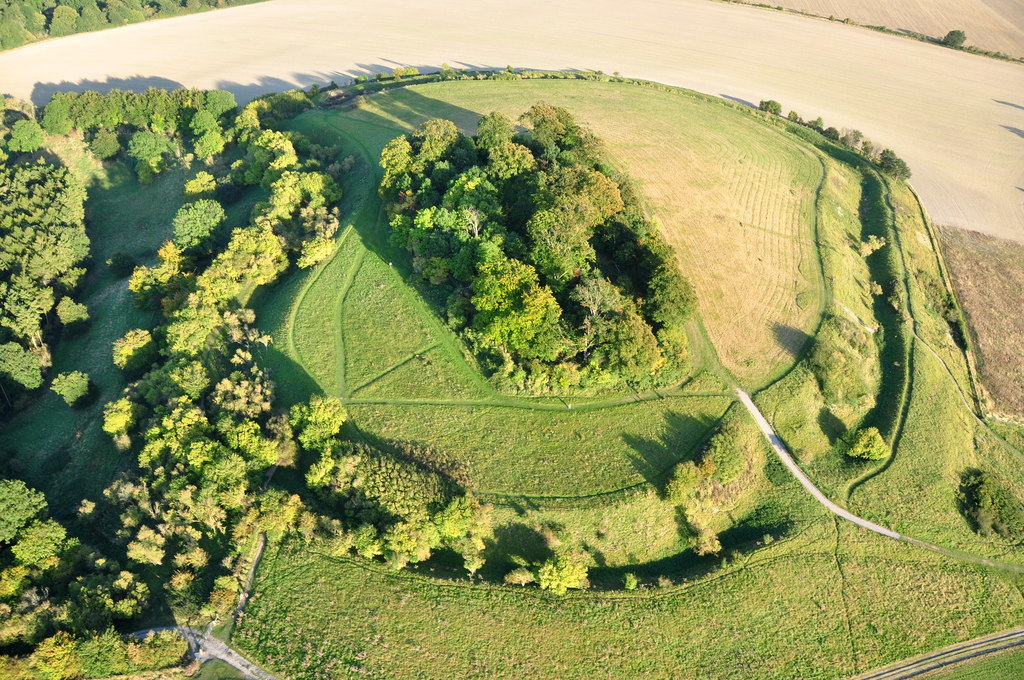
Twmbarlwm, Risca, South Wales
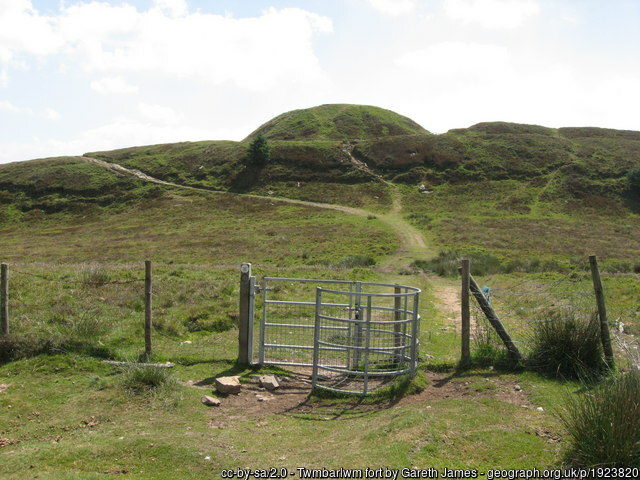
Also known as Twm Barlwm, Twyn Barlwm is known locally as The Nipple as it has a little hump on the top. It is 419 meters (1,375 feet) high. Home to the cuckoo, the skylark and even red kites, Twmbarlwm was once a motte and bailey castle and, before that, an iron age hillfort. It is said to be the first ‘mountain’ seen on the horizon from the Severn Bridge
Mumbles Hill, South Wales
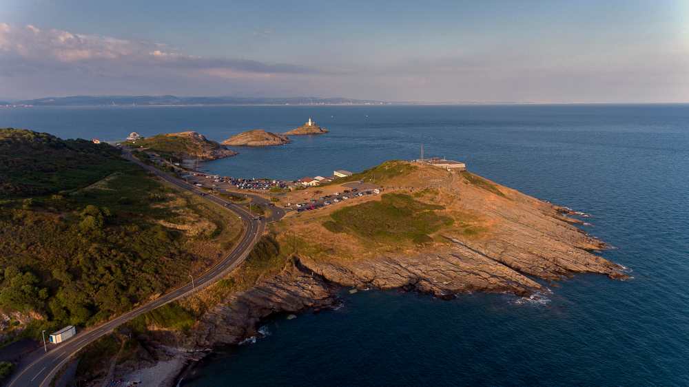
Located near the southeastern tip of the Gower Peninsula. According to one popular theory, French sailors named the headland “Mumbles” because the shape reminded them of breasts. The name is thought to be derived from the French word “les mamelles,” which translates to “the breasts”.
Moel Famau, Clwydian Range, North Wales
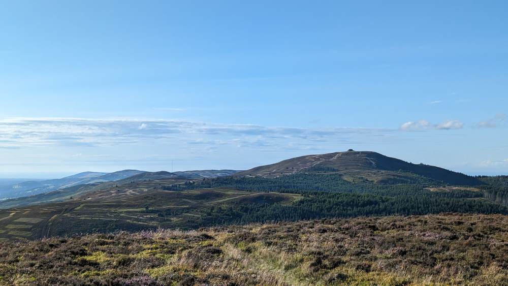
This peak, whose name means “Mother Mountain” in Welsh, is the highest summit in the Clwydian Range at 555 meters (1,820 feet). It offers stunning views across the Vale of Clwyd to Snowdonia and the North Wales coast. It’s a fairly easy going path which makes it a very popular weekend wonder.
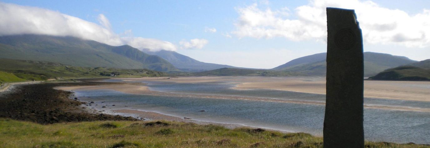
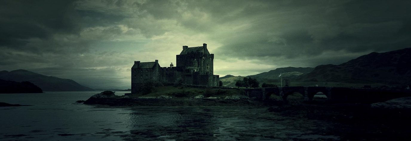
Scotland
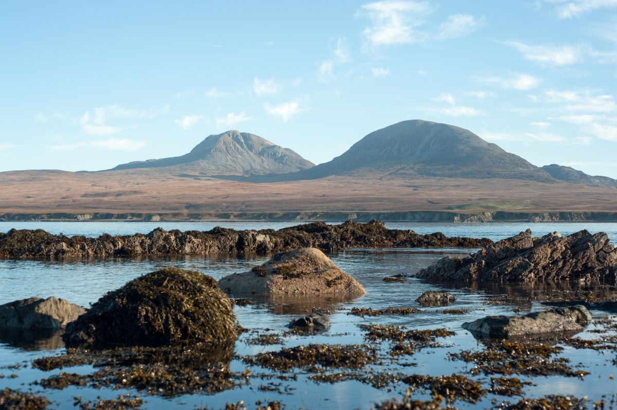
The Paps of Jura, Isle of Jura

These beautiful twin peaks are famously named after the Gaelic word for breasts ‘pap’. The highest peak, Beinn an Òir, stands at 785 meters (2,575 feet). There are three peaks to hike and if you get a clear day this will be an unforgettable hike.
The Pap of Glencoe, Highlands
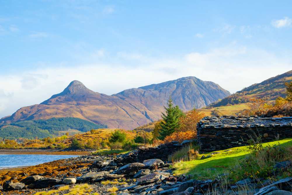
Known in Gaelic as “Sgorr na Cìche,” which translates to “Peak of the Breast” due to its distinctive conical shape. Standing at 742 meters (2,434 feet), this striking mountain is located on the northern side of Glen Coe.
Schiehallion, Perth and Kinross
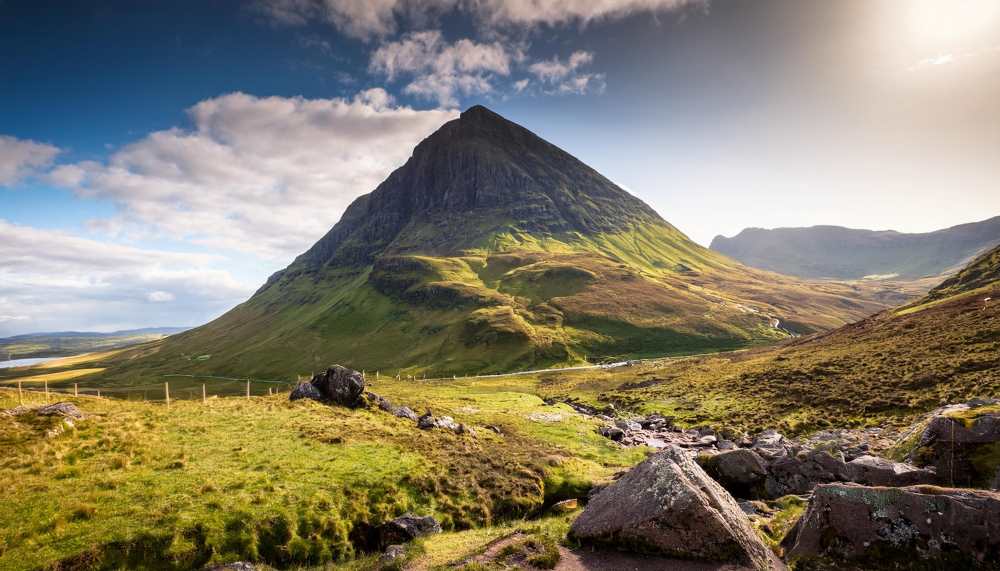
A prominent mountain known for its distinctive conical shape and significant height of 1,083 meters (3,553 feet), making it one of Scotland’s Munros (mountains over 3,000 feet). Some say the name comes from ‘Maiden’s Pap’ and by now you should know exactly what that means. It’s a fairly easy walk in good conditions so this could be the first of many Munros you tick off.
FUN MAP FACT
In 1774 Schiehallion was selected for a ground-breaking experiment which would prove the density of the planet – by comparing how much the mass of the mountain deflected a pendulum hung on its two sides. The experiment, popularly said to have ‘weighed the world’ for the first time, did so with remarkable accuracy, and its design led to the first use of contours, so familiar from maps to this day.
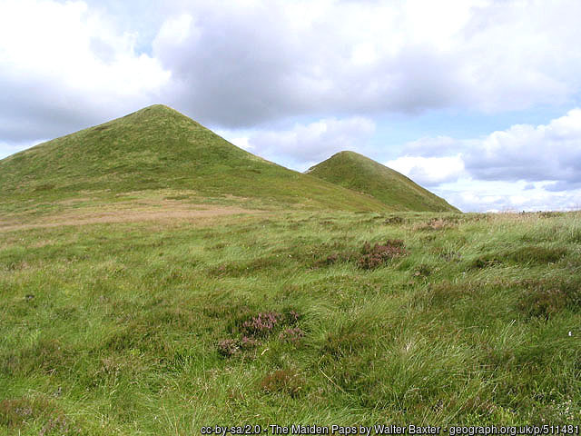
The Maiden Paps, Scottish Borders
These twin hills are named for their resemblance to breasts (quite Madonna-esque!) The higher pap is 510 meters (1,670 feet).
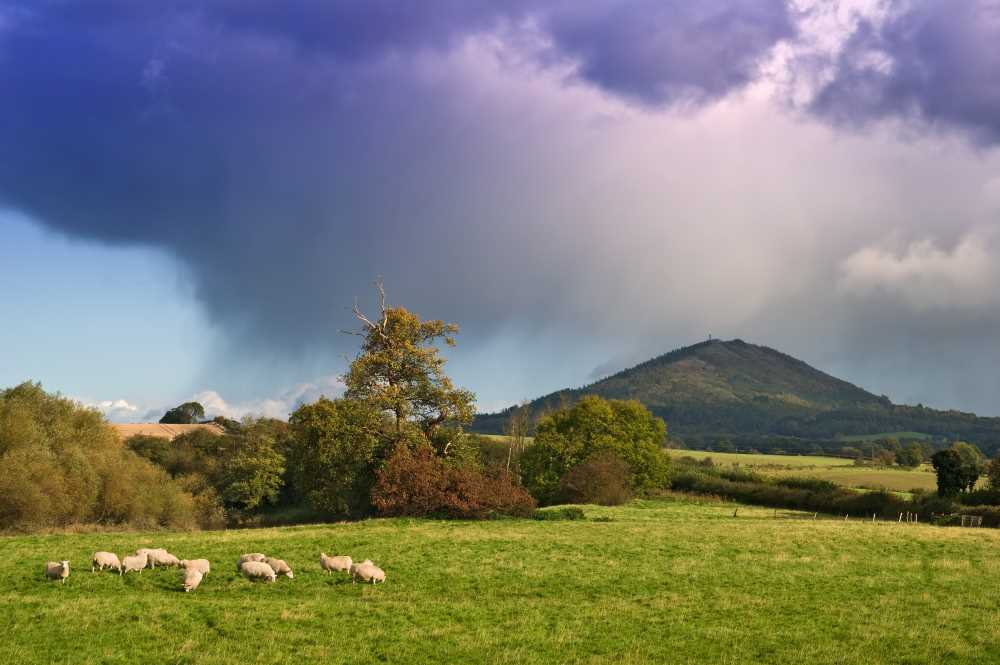
The Cheviot Hills, Northumberland and the Scottish Borders
While not specifically named after breasts, some of the rounded hills in this range have been noted to have a breast-like appearance. The highest peak, The Cheviot, is 815 meters (2,674 feet).
Fun Fact
If you don’t fancy walking up a hill in October, why not visit Manchester for a little city break instead? The name “Manchester” has an interesting origin that dates back to Roman times. Mancunium is believed to be derived from a Celtic word “mamm,” meaning “breast,” referring to a breast-shaped hill on which the original Roman fort was built. You can’t really see the hill now due to development, but it’s a fun fact to share whenever you bump into any Mancunians.
Whatever you do to help raise awareness of breast cancer, whether it’s sharing a post with the hashtag #breastcancerawarenessmonth or mentioning it to a friend, it makes a difference. Early diagnosis is vital, and encouraging more people to check their humps for lumps means more happy survivors. Let’s spread the word and support each other in this crucial fight.
Join our Get Outside Community on Facebook if you’d like to share more breast shaped hills that you think we should add to the list, especially if they have a cheeky local nick name!
By Hilary Pullen
Meet Hilary, Editor of Get Outside – the Ordnance Survey Blog. Hilary is based in North Wales and loves hiking with her dogs in the mountains of Eryri and Bryniau Clwyd, you can find her on Instagram @nearlyuphill and read her guides to walking in North Wales on her blog. Drop her an email hilary.pullen@os.uk if you are interested in posting an article on Get Outside.